Block
From the record
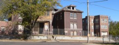
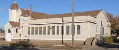
64 National Register listings published here, 3 of them National Historic Landmarks.
Sources: the National Register database, National Park Service
56 topographic sheets cover 31 settlements here, and 64 properties are on the National Register of Historic Places.
64 National Register listings published here, 3 of them National Historic Landmarks.
Sources: the National Register database, National Park Service
Every property in this county listed on the National Register of Historic Places, with the year it was listed and the federal nomination document.
Every wildfire the federal occurrence database records inside this county: 146 of them, burning about 2,010 acres. None started naturally and 1 was recorded as arson. Each settlement page carries the fires within five miles of it.
| Reported cause | Fires |
|---|---|
| Missing data/not specified/undetermined | 64 |
| Debris and open burning | 62 |
| Smoking | 10 |
| Equipment and vehicle use | 9 |
| Arson/incendiarism | 1 |
The five largest, by the area the report gives. None of them was recorded as arson.
| Date | Cause | Size | Reported by | Name on the report |
|---|---|---|---|---|
| 19 May 2008 | Missing data/not specified/undetermined | 200 acres | Iowa Department of Natural Resources | not named |
| 19 April 2014 | Debris and open burning | 160 acres | Iowa Department of Natural Resources | not named |
| 7 October 2011 | Missing data/not specified/undetermined | 120 acres | Iowa Department of Natural Resources | 2876 JASPER AVE SMITHLAND, IA, IA |
| 11 April 2015 | Missing data/not specified/undetermined | 110 acres | Iowa Department of Natural Resources | not named |
| 25 March 2014 | Debris and open burning | 100 acres | Iowa Department of Natural Resources | not named |
| 2 April 2011 | Missing data/not specified/undetermined | 95 acres | Iowa Department of Natural Resources | 1637 170TH ST., SGT. BLUFF, IA |
| 3 April 2009 | Missing data/not specified/undetermined | 80 acres | Iowa Department of Natural Resources | not named |
| 3 March 2019 | Debris and open burning | 80 acres | Iowa Department of Natural Resources | not named |
Every settlement page carries the fires within five miles of it - see the settlement index below.
The NOAA Storm Events Database holds 856 reports for this county, causing 2 deaths, 65 injuries and about $297,116,580 in recorded property damage. Each settlement page carries the reports that name it.
| Kind of event | Reports |
|---|---|
| Hail | 369 |
| Thunderstorm Wind | 339 |
| Tornado | 57 |
| Flood | 41 |
| Flash Flood | 39 |
| Heavy Rain | 6 |
| Lightning | 4 |
| Funnel Cloud | 1 |
The most serious of them, by death, then injury, then recorded damage. The accounts are quoted exactly as the forecast office filed them.
| When | Event | Place named | Harm | What the report says |
|---|---|---|---|---|
| June 1973 | Tornado (F2) | not stated | 2 killed, 10 hurt, $250,000 | no account filed |
| July 1986 | Thunderstorm Wind | not stated | 16 hurt | no account filed |
| May 1964 | Tornado (F3) | not stated | 7 hurt, $2,500,000 | no account filed |
| June 1973 | Tornado (F2) | not stated | 5 hurt, $250,000 | no account filed |
| May 1979 | Tornado (F3) | not stated | 4 hurt, $25,000 | no account filed |
| June 1984 | Thunderstorm Wind | not stated | 4 hurt | no account filed |
| May 1979 | Tornado | not stated | 3 hurt, $25,000 | no account filed |
| June 1971 | Tornado (F0) | not stated | 3 hurt, $25,000 | no account filed |
| July 1999 | Flash Flood | Sioux City | 2 hurt, $8,000,000 | no account filed |
| June 1977 | Tornado | not stated | 2 hurt, $250,000 | no account filed |
| June 2011 | Thunderstorm Wind | Moville | 2 hurt, $150,000 | Thunderstorm winds tore roofs off 3 homes and damaged the roofs of at least 40 other homes. The winds also caused widespread tree damage and overturned four campers. There were 2 people injured in the overturned campers. |
| March 1953 | Tornado (F1) | not stated | 2 hurt, $2,500 | no account filed |
| July 1986 | Tornado (F4) | not stated | 1 hurt, $250,000,000 | no account filed |
| July 2008 | Thunderstorm Wind | Sioux City | 1 hurt, $5,000,000 | Thunderstorm winds caused widespread damage in and near Sioux City. Tree damage included large trees blown down, blocking several roads. A few vehicles were destroyed and numerous vehicles damaged by falling trees and tree debris. Falling trees also damaged several residences and garages, causing one known injury. The winds lifted a three car garage off its foundation, and overturned it onto a nearby pasture. One large tree split an occupied trailer in the middle, missing residents who were sleeping at both ends. Numerous power lines and poles were blown down or broken, leaving an estimated 19,000 customers without power, several thousand of which were still without power 24 hours later. Numerous buildings, especially residences, sustained roof damage, especially to shingles. The winds damaged or blew down several signs, damaged fences, and blew down a large awning that sheltered gasoline pumps at a convenience store. The winds flattened crops near the city, but the amount of crop damage was not known, especially since crops were expected to partially recover. |
| July 1996 | Thunderstorm Wind | Salix | 1 hurt, $200,000 | no account filed |
| April 1958 | Tornado (F1) | not stated | 1 hurt, $25,000 | no account filed |
| June 1990 | Thunderstorm Wind | not stated | 1 hurt | no account filed |
| March 2019 | Flood | Sloan | $6,790,000 | Water inundated western areas of Moville during the evening of March 13, and continued through early on March 15. Iowa Highway 140 was closed north of Highway 20 at Moville due to flooding. At the height of the flooding, 29 sections of roadway were closed in Woodbury County, including two sections requiring long term repairs (Highway 982 near Holly Springs and County road L37 near Danbury). Other flooding resulted in extensive damage to public infrastructure. Gravel roads were hit especially hard as ice-plugged culverts resulted in large sections of roadway washing away. |
| August 2001 | Thunderstorm Wind | Sioux City | $5,000,000 | Downburst thunderstorm winds caused extensive tree damage in Sioux City. Large trees were uprooted, snapped, and stripped. A few vehicles were completely destroyed by the falling trees. Houses and other buildings, including a nursing home, were also damaged by trees and debris. Many streets were blocked. Power lines and poles were also blown down, resulting in power outages affecting at least forty thousand people. Traffic lights were blown down. Roofs were damaged, including the roof blown off a medical office building, and sheet metal ducting blown off a roof. A 95 foot radio tower was also blown down, damaging a car and small building. |
| June 2024 | Flood | Sloan | $4,130,000 | Rainfall amounts across Woodbury County from June 20-22 were generally 1.0 inch or less. Farther north and upstream, 6 to 10 inches fell across portions of northwest Iowa and southeast South Dakota. This rainfall resulted in record flooding along the Big Sioux, Little Sioux, and Floyd Rivers, and extensive overland flooding along the adjoining flood plains. ||Multiple communities were impacted by flood waters. At peak flooding, numerous swift water rescues were conducted. Approximately 1,000 people were evacuated from the Riverside Neighborhood of Sioux City, 500 people were evacuated from Correctionville, and 10 people were evacuated from Smithland. County-wide, there were approximately 300 homes that were damaged and 10 that were destroyed. ||Public infrastructure was also severely impacted. Approximately 50 roads and bridges were closed due to flood waters. The railroad bridge across the Big Sioux River to South Dakota collapsed. The Correctionville energy transfer station and sewage lift station failed, while the fire station and city hall flooded. The Smithland sewage lift station failed and the Sioux City Wastewater Treatment Plant was damaged. Preliminary damage assessments estimate the loss to public infrastructure to be 4.13 million dollars. |
| October 2013 | Tornado (EF4) | Climbing Hill | $2,000,000 | A tornado severely damaged or destroyed about 10 houses, collapsing most walls on a few of the houses, tearing most of the roofs off other houses, and shifting what was left of some houses off their foundations. The tornado caused significant damage to roofs, windows, and siding of additional houses. Numerous farm outbuildings, storage buildings, and a few silos were destroyed or severely damaged. The tornado also destroyed or damaged several pieces of farm equipment, caused significant tree damage, including numerous trunks snapped or uprooted and other trees stripped, and blew down power poles and lines. The tornado then crossed into Cherokee County. |
| May 1998 | Hail | Climbing Hill | $1,400,000 | no account filed |
| June 2014 | Flood | Correctionville | $1,000,000 | Persistent heavy rains caused major flooding of the Little Sioux River. Much farmland, other lowlands, and roads near the river were flooded. The flooded roads included several in and near Correctionville. A trail bridge was washed out near Oto. Several homes and businesses were flooded, especially in basements. The river crested at 5.45 feet above flood stage at Correctionville on June 20th. |
| July 1996 | Flash Flood | Sioux City | $1,000,000 | no account filed |
| December 2021 | Tornado (EF2) | Bronson | $500,000 | The tornado spun up two miles northeast of Bronson along 190th Street, around one mile west of the intersection with Emmett Ave, where it ripped a portion of the roof off a single family home and damaged an outbuilding, with debris sent 100 yards to the north into a field. The tornado continued northeast across open fields until it hit two large metal utility transmission towers, and deposited the electric lines across U.S. Highway 20, resulting in the closure of U.S. Highway 20 east of Lawton for two days. The tornado crossed U.S. Highway 20 less than a mile east of Lawton, then made a more northward turn. As the tornado approached Fayette Avenue, it impacted multiple farmsteads with damage to a few barns and sheds, as well as broken and snapped tree limbs. A machine shed at one farmstead was completely destroyed along with a concrete silo and lean-to shed. Multiple power poles were snapped along 140th Street. Minor damage was also noted to shingles on a couple single family homes.|The tornado eventually lifted near the intersection of 110th Street and Fayette Avenue. The average path width was 75 yards and the maximum estimated wind speed was 130 mph. Property damage costs are a rough estimate. |
| July 2008 | Thunderstorm Wind | Moville | $500,000 | Thunderstorm winds caused widespread tree damage, including several trees blown down. The winds also destroyed two machine sheds, damaged roofs and siding on homes, blew down power lines, and damaged equipment at a construction project. The winds flattened some crops in the area, but the amount of crop damage was not known. |
| June 2004 | Flash Flood | Sioux City | $500,000 | Heavy rain caused flooding of numerous roads, stranding several vehicles. Several basements were flooded, damaging furniture and other contents, and at least one basement wall collapsed. |
| June 2001 | Thunderstorm Wind | Pierson | $500,000 | Thunderstorm winds damaged power lines and trees. The winds also damaged buildings, including roofs, siding, and windows. A barn and grain bin were destroyed. |
| July 1999 | Hail | Bronson | $500,000 | no account filed |
| May 1998 | Hail | Sioux City | $500,000 | no account filed |
| June 1994 | Thunderstorm Wind | Sioux City | $500,000 | no account filed |
| July 1994 | Tornado (F3) | Salix to | $500,000 | no account filed |
| October 2013 | Tornado (EF2) | Sloan | $400,000 | A tornado, crossing into Woodbury County from Monona County Iowa, severely damaged at least two houses, collapsing two walls and blowing the roof off one of the houses. The tornado also destroyed or damaged numerous farm outbuildings and storage buildings, including several structures at a hog farm, and a large metal storage building. The tornado also destroyed open air buildings at a dairy farm. The tornado blew down power lines and poles, and caused considerable tree damage, including trees snapped off at their trunks. Corn crops were flattened in a few areas. |
| December 2021 | Tornado (EF1) | Salix | $250,000 | The tornado touched down near Buchanan Avenue between 230th and 240th streets and moved north northeast, impacting four farmsteads. One machine shed was completely destroyed with debris deposited about 1 mile downstream in an open field. Several other outbuildings were damaged along the track along with a few trees. The tornado lifted just east of the intersection of Old Highway 141 and County Home Road. The average path width was 50 yards and the maximum estimated wind speed was 105 mph. Property damage costs are a rough estimate. |
| June 1984 | Tornado (F1) | not stated | $250,000 | no account filed |
| September 1983 | Tornado (F2) | not stated | $250,000 | no account filed |
| July 1972 | Tornado (F1) | not stated | $250,000 | no account filed |
| December 2021 | Tornado (EF1) | Moville | $200,000 | This tornado formed around 4 miles east-northeast of Moville, one-quarter mile east of the intersection of Jasper Avenue and 140th Street. The tornado traveled north-northeast for slightly over 4 and one quarter miles before exiting Woodbury County two miles south of Kingsley, just east of the intersection of Knox Avenue and 100th Street. The tornado continued in Plymouth County for somewhat less than 4 miles before dissipating at 1642CST. In Woodbury County near the touchdown point, a barn roof was collapsed. The tornado continued northeast for around a mile and a half before removing most roof panels from another barn. Near the Plymouth County line, the tornado encountered another farmstead which suffered total destruction of a garage and outbuilding. Numerous larger trees were snapped, and debris from damaged buildings was deposited in the trees. The tornado was rated EF1 while in both Woodbury and Plymouth Counties. The average path width in Woodbury County was 50 yards and the maximum estimated wind speed was 110 mph. Property damage costs are a rough estimate. |
| July 2003 | Hail | Climbing Hill | $200,000 | Large hail severely damaged crops over a 2 to 4 mile wide area from Climbing Hill southeast to Smithland, with the area reaching north to near Oto. Vehicles, siding, and windows were also damaged. The amount of crop damage was not known. |
| July 1999 | Thunderstorm Wind | Sloan | $200,000 | no account filed |
| June 1996 | Hail | Cushing | $200,000 | no account filed |
| August 2014 | Thunderstorm Wind | Sergeant Bluff | $100,000 | Thunderstorm winds overturned semi trucks on Interstate 29. The winds also caused tree damage, including large trees blown down. A few homes were damaged by falling trees or tree debris. |
| March 2006 | Tornado (F0) | Sioux City | $100,000 | A tornado blew the roof from a house, moved the house off its foundation, and heavily damaged a garage. |
| June 2003 | Thunderstorm Wind | Sergeant Bluff | $100,000 | Thunderstorm winds caused tree damage, with branches and other tree debris littering streets. The winds also blew down power lines and caused power outages. |
| June 2003 | Flash Flood | Sioux City | $100,000 | Very heavy rain caused severe and widespread flooding of streets and low areas. Water around two feet deep was reported at numerous locations, with one police officer reporting chest deep water as he assisted occupants of a stalled van. Numerous other vehicles were also stranded. |
| June 2003 | Thunderstorm Wind | Sioux City | $100,000 | Thunderstorm winds caused widespread tree damage, especially in the northern part of Sioux City. Several trees were blown down, and numerous limbs and smaller tree debris were blown down and littered streets and yards. Power lines were blown down, and resulting power outages affected an estimated 2,500 customers. The roof of a commercial building housing multiple businesses was blown off. Several homes sustained roof damage, and the porch of a home was damaged. |
| June 2003 | Thunderstorm Wind | Sioux City | $100,000 | Thunderstorm winds blew over a semi, caused roof damage to several buildings, and caused tree damage, including several trees blown down. |
| May 2002 | Thunderstorm Wind | Sloan | $100,000 | Thunderstorm winds blew over a barn and several sheds, and blew off or damaged the roofs of several buildings. The winds also caused tree and power line damage, with resulting power outages. |
| June 2001 | Thunderstorm Wind | Sioux City | $100,000 | Thunderstorm winds blew down trees and power lines. Some vehicles were damaged by debris. |
| June 2000 | Thunderstorm Wind | Salix | $100,000 | Thunderstorm winds destroyed a barn and caused other scattered damage to structures, as well as tree damage. |
| May 1998 | Hail | Sioux City | $100,000 | no account filed |
| December 2021 | Thunderstorm Wind | Anthon | $75,000 | Thunderstorm winds destroyed a garage and cattle barn. Property damage costs are a rough estimate. |
| May 2013 | Flood | Correctionville | $50,000 | Heavy rain caused moderate to major flooding of the Little Sioux River. Farmland, parkland, and the basements or lower levels of some homes and several businesses were flooded. Numerous roads were flooded by the river, and the flooding caused an interruption of the water supply in Correctionville. The river crested at 6.3 feet above flood stage at Correctionville on May 28th. |
| August 2010 | Thunderstorm Wind | Springdale | $50,000 | Thunderstorm winds caused widespread tree damage, including several large trees and numerous branches blown down. Some of the tree debris blocked roads and caused minor damage to homes. The winds also blew down power lines, causing a power outage, and blew part of a freight train off its tracks. |
| June 2003 | Hail | Sioux City | $50,000 | Large hail caused damage to vehicles and windows. |
| August 2003 | Thunderstorm Wind | Sloan | $50,000 | Thunderstorm winds caused tree damage, including large trees down. Power lines were also blown down, causing a power outage. A semi truck was blown over and damaged near Sloan. |
| May 2002 | Thunderstorm Wind | Danbury | $50,000 | Thunderstorm winds caused widespread tree damage. Numerous trees were blown down, including a 3 inch diameter tree snapped off at its base. |
| May 2002 | Thunderstorm Wind | Sloan | $50,000 | Thunderstorm winds caused widespread tree damage, and tree limbs falling on power lines caused a power outage that lasted for several hours. |
| April 2002 | Thunderstorm Wind | Sioux City | $50,000 | Thunderstorm winds blew a tree onto a garage, heavily damaging the garage and a restored vehicle inside. |
| July 2002 | Thunderstorm Wind | Correctionville | $50,000 | Thunderstorm winds blew down power lines and caused tree damage. |
The Survey's mineral resources record lists 34 workings inside this county. 5 still produce and 29 are closed or unrecorded. Each settlement page carries the workings within five miles of it.
| Commodity | Workings |
|---|---|
| Sand and Gravel, Construction | 27 |
| Clay | 6 |
| Salt | 1 |
The least common of them first, because a county's hundredth gravel pit says nothing its first ten did not.
| Where | Site | Commodity | Status | Recorded |
|---|---|---|---|---|
| Cargill Salt Terminal | Salt | Producer | ||
| Ballou Pit and Plant | Clay | Producer | ||
| Unknown | Clay | Unknown | ||
| Unknown | Clay | Past Producer | ||
| Unknown | Clay | Past Producer | ||
| Unknown | Clay | Unknown | ||
| Unknown | Clay | Past Producer | ||
| Anthon Pit | Sand and Gravel, Construction | Past Producer | ||
| Cockburn Pit | Sand and Gravel, Construction | Producer | ||
| Correctionville | Sand and Gravel, Construction | Past Producer | ||
| Correctionville Pit | Sand and Gravel, Construction | Past Producer | ||
| Correctionville Pit | Sand and Gravel, Construction | Past Producer | ||
| Heming Pit | Sand and Gravel, Construction | Past Producer | ||
| Mitchell-Steinhoff Pit | Sand and Gravel, Construction | Past Producer | ||
| Morville | Sand and Gravel, Construction | Unknown | ||
| Moville Pit | Sand and Gravel, Construction | Past Producer | ||
| Persinger Pit and Plant | Sand and Gravel, Construction | Producer | ||
| Rundal Pit | Sand and Gravel, Construction | Past Producer | ||
| Steinhoff | Sand and Gravel, Construction | Past Producer | ||
| Tom Flewelling Pit and Plant | Sand and Gravel, Construction | Producer | ||
| Unknown | Sand and Gravel, Construction | Past Producer | ||
| Unknown | Sand and Gravel, Construction | Past Producer | ||
| Unknown | Sand and Gravel, Construction | Past Producer | ||
| Unknown | Sand and Gravel, Construction | Unknown | ||
| Unknown | Sand and Gravel, Construction | Past Producer | ||
| Unknown | Sand and Gravel, Construction | Past Producer | ||
| Unknown | Sand and Gravel, Construction | Past Producer | ||
| Unknown | Sand and Gravel, Construction | Past Producer | ||
| Unknown | Sand and Gravel, Construction | Past Producer | ||
| Unknown | Sand and Gravel, Construction | Past Producer | ||
| Unknown | Sand and Gravel, Construction | Past Producer | ||
| Unknown | Sand and Gravel, Construction | Past Producer | ||
| Woodbury County Pits | Sand and Gravel, Construction | Past Producer | ||
| Wright Pit | Sand and Gravel, Construction | Past Producer |
Named settlements recorded in the Geographic Names Information System, each with the topographic sheets covering it. Villages, hamlets and abandoned places alike. Each is shown with the nearest named watercourse or landform and the survey quadrangle it falls on.
Union township · 51016 · On Bacon Creek · Correctionville quadrangle
8 sheets, 1954 to 1985
Woodbury township · 51054 · By Sergeant Bluff · Sergeant Bluff quadrangle
12 sheets, 1955 to 1993
Woodbury township · 51054 · On Dead Man Creek · Sergeant Bluff quadrangle
12 sheets, 1955 to 1993
Willow township · 51026 · On Lum Hollow Creek · Climbing Hill quadrangle
9 sheets, 1955 to 1986
Grant township · 51004 · Correctionville NW quadrangle
8 sheets, 1954 to 1985
No longer a settlement
Sioux City city · 51106 · By Floyds Bluff · Sergeant Bluff quadrangle
12 sheets, 1955 to 1993
Sioux City city · 51103 · On Mount Lucia · Sioux City North quadrangle
12 sheets, 1955 to 1994
Woodbury township · 51054 · By Sergeant Bluff · Sergeant Bluff quadrangle
12 sheets, 1955 to 1993
Sioux City city · 51105 · On Perry Creek · Sioux City South quadrangle
13 sheets, 1955 to 1993
Little Sioux township · 51056 · Near Smoky Hollow · Smithland quadrangle
8 sheets, 1954 to 1985
The vanished settlements of Woodbury County: the places named above that are no longer on the map.