 Block
Sioux City, Iowa
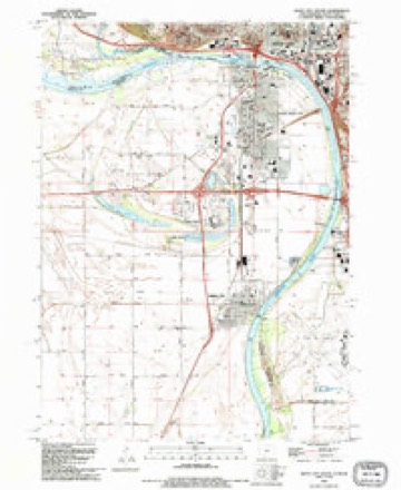
13 topographic sheets cover this place, the earliest surveyed in 1955 and the latest in 1993. It stands in Sioux City City. It lies in ZIP code area 51105. It stands on Perry Creek. The Survey maps it on the Sioux City South quadrangle. 85,797 people lived here at the 2020 count. It stands 1,201 feet above sea level.
Research this city
On record in Sioux City
Buildings and businesses the archive holds for this place. Each opens its own page, with the source record it came from.
On the National Register 12 of 60 shown
 SERGEANT FLOYDNational Historic Landmark · listed 1989
 Sergeant Floyd MonumentNational Historic Landmark · listed 1966
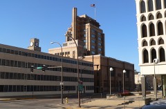 Woodbury County CourthouseNational Historic Landmark · listed 1973
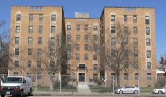 Alhambra Apartmentslisted 2001
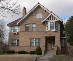 Atchison A. Ashby Houselisted 1998
 Badgerow Buildinglisted 1982
 Boston Blocklisted 1985
 Theophile Bruguier Cabinlisted 2000
 Elzy G. Burkam Houselisted 1998
 Charles City College Halllisted 1983
 Davidson Buildinglisted 1999
 Evans Blocklisted 1985
Population over time
2 figuresSioux City grew from 82,684 to 85,797 between 2010 and 2020. These are the recorded population figures Wikidata holds for this place, reached through the Geographic Names Information System number this page is keyed on rather than by name, so they belong to this place and not to another of the same name. Most are census counts, but not all are: an early figure may be a founding or settlement estimate, and an estimate published within five years of a census is left out. The change column is computed, and is left blank where more than 20 years separate a figure from the one before it, because a gap that long is not a change between two counts.
| Year | People | Change |
|---|---|---|
| 2010 | 82,684 | |
| 2020 | 85,797 | +3,113 (+4%) |
Topographic sheets covering this place
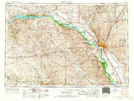
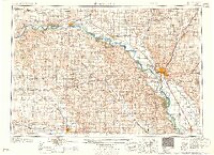
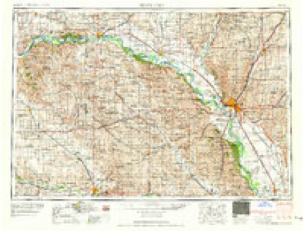
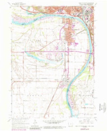
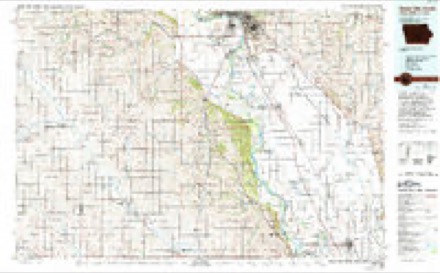
6 surveys from 13 printed sheetsMatched by testing this settlement's coordinate against the published boundary of every sheet in the United States Geological Survey's historical collection. Each opens the scanned sheet at the Survey.
- 1955 USGS Sioux City quadrangle1:250000, 4 printings
- 1958 USGS Sioux City quadrangle1:250000
- 1959 USGS Sioux City quadrangle1:250000
- 1963 USGS Sioux City South quadrangle1:24000, 4 printings
- 1986 USGS Sioux City South quadrangle1:100000, 2 printings
- 1993 USGS Sioux City South quadrangle1:24000
Fires near this place
16 since 2000Regional context, not property-specific evidence. The federal wildfire occurrence database lists 16 fires within 5 miles of Sioux City between 2000 and 2018, burning about 158 acres in total. None started naturally. 1 was recorded as arson. Distance is straight-line from the map coordinates, so a fire counted here may appear on a neighbouring settlement's page as well.
| Reported cause | Fires |
|---|---|
| Missing data/not specified/undetermined | 9 |
| Debris and open burning | 4 |
| Smoking | 2 |
| Arson/incendiarism | 1 |
The most recent of them, most recent first, with the day each was reported and the service that recorded it.
| Date | Cause | Size | Reported by | Name on the report |
|---|---|---|---|---|
| 9 September 2012 | Missing data/not specified/undetermined | 1.0 acres | Iowa Department of Natural Resources | not named |
| 30 August 2012 | Missing data/not specified/undetermined | 3.0 acres | Iowa Department of Natural Resources | not named |
| 27 August 2012 | Debris and open burning | under an acre | Iowa Department of Natural Resources | not named |
| 27 April 2018 | Debris and open burning | 5.0 acres | Iowa Department of Natural Resources | not named |
| 23 April 2008 | Missing data/not specified/undetermined | 10 acres | Iowa Department of Natural Resources | not named |
| 16 April 2016 | Missing data/not specified/undetermined | under an acre | South Dakota Wildland Fire Suppression | 1001 RIVER DRIVE |
| 11 April 2015 | Missing data/not specified/undetermined | 110 acres | Iowa Department of Natural Resources | not named |
| 11 April 2015 | Missing data/not specified/undetermined | 11 acres | Iowa Department of Natural Resources | not named |
Settlements close enough to share some of these fires:
Mines and quarries near this place
3 within 5 milesRegional context, not property-specific evidence. The federal mineral resources record lists 3 workings within 5 miles of Sioux City: 2 past producers, 1 unknown. None of them still produces. What was taken out: Clay. Distance is straight-line from the map coordinates, so a quarry counted here may appear on a neighbouring settlement's page as well.
Storms near this place
60 of 159 shownRegional context, not property-specific evidence. The National Weather Service names Sioux City in 159 storm reports between 1994 and 2025: 74 hail, 51 thunderstorm wind, 22 flash flood, 7 flood. The reports record 3 injuries. Each account below is quoted exactly as the forecast office filed it, from the NOAA Storm Events Database, and each date opens the federal record of that event.
| When | Event | Place named | Harm | What the report says |
|---|---|---|---|---|
| July 1999 | Flash Flood | Sioux City | 2 hurt, $8,000,000 | no account filed |
| July 2008 | Thunderstorm Wind | Sioux City | 1 hurt, $5,000,000 | Thunderstorm winds caused widespread damage in and near Sioux City. Tree damage included large trees blown down, blocking several roads. A few vehicles were destroyed and numerous vehicles damaged by falling trees and tree debris. Falling trees also damaged several residences and garages, causing one known injury. The winds lifted a three car garage off its foundation, and overturned it onto a nearby pasture. One large tree split an occupied trailer in the middle, missing residents who were sleeping at both ends. Numerous power lines and poles were blown down or broken, leaving an estimated 19,000 customers without power, several thousand of which were still without power 24 hours later. Numerous buildings, especially residences, sustained roof damage, especially to shingles. The winds damaged or blew down several signs, damaged fences, and blew down a large awning that sheltered gasoline pumps at a convenience store. The winds flattened crops near the city, but the amount of crop damage was not known, especially since crops were expected to partially recover. |
| August 2001 | Thunderstorm Wind | Sioux City | $5,000,000 | Downburst thunderstorm winds caused extensive tree damage in Sioux City. Large trees were uprooted, snapped, and stripped. A few vehicles were completely destroyed by the falling trees. Houses and other buildings, including a nursing home, were also damaged by trees and debris. Many streets were blocked. Power lines and poles were also blown down, resulting in power outages affecting at least forty thousand people. Traffic lights were blown down. Roofs were damaged, including the roof blown off a medical office building, and sheet metal ducting blown off a roof. A 95 foot radio tower was also blown down, damaging a car and small building. |
| July 1996 | Flash Flood | Sioux City | $1,000,000 | no account filed |
| June 2004 | Flash Flood | Sioux City | $500,000 | Heavy rain caused flooding of numerous roads, stranding several vehicles. Several basements were flooded, damaging furniture and other contents, and at least one basement wall collapsed. |
| May 1998 | Hail | Sioux City | $500,000 | no account filed |
| June 1994 | Thunderstorm Wind | Sioux City | $500,000 | no account filed |
| March 2006 | Tornado (F0) | Sioux City | $100,000 | A tornado blew the roof from a house, moved the house off its foundation, and heavily damaged a garage. |
| June 2003 | Flash Flood | Sioux City | $100,000 | Very heavy rain caused severe and widespread flooding of streets and low areas. Water around two feet deep was reported at numerous locations, with one police officer reporting chest deep water as he assisted occupants of a stalled van. Numerous other vehicles were also stranded. |
| June 2003 | Thunderstorm Wind | Sioux City | $100,000 | Thunderstorm winds caused widespread tree damage, especially in the northern part of Sioux City. Several trees were blown down, and numerous limbs and smaller tree debris were blown down and littered streets and yards. Power lines were blown down, and resulting power outages affected an estimated 2,500 customers. The roof of a commercial building housing multiple businesses was blown off. Several homes sustained roof damage, and the porch of a home was damaged. |
| June 2003 | Thunderstorm Wind | Sioux City | $100,000 | Thunderstorm winds blew over a semi, caused roof damage to several buildings, and caused tree damage, including several trees blown down. |
| June 2001 | Thunderstorm Wind | Sioux City | $100,000 | Thunderstorm winds blew down trees and power lines. Some vehicles were damaged by debris. |
| May 1998 | Hail | Sioux City | $100,000 | no account filed |
| June 2003 | Hail | Sioux City | $50,000 | Large hail caused damage to vehicles and windows. |
| April 2002 | Thunderstorm Wind | Sioux City | $50,000 | Thunderstorm winds blew a tree onto a garage, heavily damaging the garage and a restored vehicle inside. |
| April 2001 | Thunderstorm Wind | Sioux City | $50,000 | no account filed |
| July 1999 | Thunderstorm Wind | Sioux City | $50,000 | no account filed |
| March 2006 | Thunderstorm Wind | Sioux City | $40,000 | Thunderstorm winds destroyed a large storage building and a chicken coop. |
| August 2011 | Thunderstorm Wind | Sioux City | $25,000 | Thunderstorm winds blew down several trees, one of which landed on a house and caused roof damage. |
| June 2010 | Thunderstorm Wind | Sioux City | $20,000 | Thunderstorm winds caused widespread tree damage, including several trees blown down. The winds also blew down power lines. |
| June 2003 | Thunderstorm Wind | Sioux City | $20,000 | Thunderstorm winds blew two semis off a road. |
| December 2021 | Thunderstorm Wind | Sioux City | $10,000 | Several power poles were leaning after strong thunderstorm winds. Property damage costs are a rough estimate. |
| July 2019 | Flash Flood | Sioux City | $10,000 | Street flooding on 19th Street between Ross and Center Street. Multiple cars were stalled in flooding on Floyd Boulevard. |
| June 2000 | Thunderstorm Wind | Sioux City | $10,000 | Thunderstorm winds caused tree damage. |
| May 1999 | Thunderstorm Wind | Sioux City | $10,000 | no account filed |
| April 2004 | Lightning | Sioux City | $5,000 | Lightning struck a house, starting a small fire. |
| August 2002 | Lightning | Sioux City | $5,000 | Lightning struck a power pole and blew a transformer, causing a power outage. |
| September 1999 | Lightning | Sioux City | $5,000 | no account filed |
| August 1996 | Thunderstorm Wind | Sioux City | $5,000 | no account filed |
| August 2021 | Thunderstorm Wind | Sioux City | $2,000 | Thunderstorm winds brought down a few 4 to 6 inch diameter tree limbs in the Morningside neighborhood of Sioux City. Property damage costs are a rough estimate. |
| July 2025 | Thunderstorm Wind | Sioux City | - | Thunderstorm wind gusts were measured by a personal weather station. |
| September 2025 | Thunderstorm Wind | Sioux City | - | Thunderstorm wind gusts for about 1 or 2 minutes broke several 3 to 4 inch diameter tree limbs. |
| July 2024 | Flash Flood | Sioux City | - | Numerous manhole covers were displaced throughout the city from overwhelmed storm drain systems and the outpouring of water. |
| May 2024 | Thunderstorm Wind | Sioux City | - | Thunderstorm wind gusts were measured by a personal weather station, with damage to tree limbs also noted in the area. |
| July 2024 | Thunderstorm Wind | Sioux City | - | Thunderstorm wind gust up to 60 mph was measured by a personal weather station. |
| July 2024 | Thunderstorm Wind | Sioux City | - | Thunderstorm wind gusts up to 59 mph were measured by a personal weather station. |
| July 2024 | Thunderstorm Wind | Sioux City | - | Thunderstorm winds split a large tree near 18th and Myrtle Street. Numerous tree and branches down across the general Sioux City area. |
| June 2024 | Flood | Sioux City | - | The Missouri River at Sioux City rose above flood stage the evening of June 24th, cresting around 2.23 feet above flood stage (32.23 feet) on June 25th. The river then fell below flood stage on the morning of June 27th. For a more comprehensive description of flood damage, please see other entries for Woodbury County. |
| August 2024 | Flash Flood | Sioux City | - | Water was flowing 7 to 8 inches deep across roadways, disrupting travel. |
| April 2023 | Hail | Sioux City | - | Hail 1.0 inch in diameter fell 5 miles west-northwest of Sioux City. |
| July 2023 | Thunderstorm Wind | Sioux City | - | Thunderstorm winds took down numerous wires across the western portions of Sioux City. |
| October 2023 | Thunderstorm Wind | Sioux City | - | As a result of thunderstorm wind gusts, a tree fell onto a parked car. |
| May 2022 | Thunderstorm Wind | Sioux City | - | Thunderstorm winds downed large branches and powerlines. |
| May 2022 | Thunderstorm Wind | Sioux City | - | A large tree was taken down by thunderstorm winds. |
| July 2022 | Flash Flood | Sioux City | - | Multiple cars were stalled in deep standing water along west 19th Street in Sioux City. Several other low-lying roads were covered by water. |
| December 2021 | Thunderstorm Wind | Sioux City | - | A large tree was uprooted by thunderstorm winds. |
| June 2019 | Flood | Sioux City | - | A continuation of flooding from May, the Missouri River at Sioux City (gage site SSCN1) crested 0.27 feet above flood stage on June 1. Some minor flooding of Sioux City parks near the river occurred, along with water briefly onto portions of Hamilton Boulevard near Interstate 29. |
| May 2019 | Flood | Sioux City | - | Increased releases from upstream Gavins Point Dam along with runoff from heavy rainfall over the preceding week produced minor flooding on the Missouri River at Sioux City (gage site SSCN1). Hamilton Boulevard and a few park areas along the river near Interstate 29 were flooded as the river rose to 0.22 feet above flood stage on May 31. The river remained in minor flood stage at the end of the month. |
| June 2018 | Flash Flood | Sioux City | - | Heavy rainfall of 2 to 4 inches caused rapidly ponding water in lower urban areas of the Sioux City metro area. Manhole covers were blown off many roads in the downtown and Riverside areas, and water and debris flows covered many roadways. Several vehicles were disabled within the flood waters. |
| June 2018 | Flash Flood | Sioux City | - | A continuation of heavy rainfall in the Sioux City Metro area resulted in significant street flooding downtown. Water reached inside a gas station near downtown. Rainfall totals reached 4 to 6 inches in the flooded areas. |
| July 2015 | Thunderstorm Wind | Sioux City | - | Thunderstorm winds caused tree damage, including four inch diamater branches blown down. |
| July 2015 | Thunderstorm Wind | Sioux City | - | Thunderstorm winds caused tree damage, including a tree blown down on a house. |
| June 2014 | Hail | Sioux City | - | Hail covered the ground. |
| June 2014 | Flash Flood | Sioux City | - | Heavy rain of over 2 inches in a half hour caused flash flooding of streets in Sioux City. The flooding blew off manhole covers. |
| June 2014 | Thunderstorm Wind | Sioux City | - | Thunderstorm winds caused tree damage, including four inch diameter branches blown down. |
| June 2014 | Flood | Sioux City | - | Repeated heavy rains caused moderate flooding of the Big Sioux River, with lowlands including a few roads flooded. The river crested at 6.63 feet above flood stage on June 20th. |
| July 2013 | Thunderstorm Wind | Sioux City | - | Thunderstorm winds caused tree damage, including 6 inch diameter limbs blown down. |
| June 2011 | Thunderstorm Wind | Sioux City | - | Thunderstorm winds caused tree damage. |
| August 2011 | Thunderstorm Wind | Sioux City | - | Thunderstorm winds caused tree and power line damage. |
| August 2011 | Thunderstorm Wind | Sioux City | - | Thunderstorm winds caused tree and power line damage. |
Nearest settlements
The eight closest, with where each one stands in the county. Distances are straight-line, computed from the Geographic Names Information System coordinates.
| Map | Place | Distance | Sheets |
|---|---|---|---|
| Springdale | 2.3 miles | 12 | |
| Holiday Village | 2.6 miles | 12 | |
| Regency of Sioux City | 2.6 miles | 12 | |
| Morningside | 3.1 miles | 12 | |
| Leeds | 3.6 miles | 12 | |
| Mount Lucia | 4.4 miles | 12 | |
| Riverside | 4.5 miles | 12 | |
| Evergreen Village | 5.2 miles | 12 |
Elsewhere
Matched on this settlement's Geographic Names Information System number rather than its name, so it cannot be a different place of the same name in another state.
| Wikipedia article on Sioux City | An encyclopaedic summary. Its text is share-alike, so it is linked here rather than copied. |
| Wikidata item Q489255 | The structured record the population and elevation above come from. Public domain (CC0). |
Provenance
This settlement is recorded in the Geographic Names Information System as feature 461653. The sheet list is computed by point-in-boundary test against the United States Geological Survey's historical topographic inventory. Both are works of the United States government and carry no copyright under 17 U.S.C. 105.
Wildfire. Short, Karen C. 2022. Spatial wildfire occurrence data for the United States, 1992-2020 [FPA_FOD_20221014]. 6th Edition. Fort Collins, CO: Forest Service Research Data Archive. https://doi.org/10.2737/RDS-2013-0009.6 Collected with United States Government funding and usable without additional permissions or fees.
Mines and quarries. USGS Mineral Resources Data System (MRDS) https://mrdata.usgs.gov/mrds/ A work of the United States government, no copyright under 17 U.S.C. 105.
Storms. NOAA National Centers for Environmental Information, Storm Events Database https://www.ncei.noaa.gov/stormevents/ A work of the United States government, no copyright under 17 U.S.C. 105. Narratives are quoted verbatim from the National Weather Service report and are not edited or summarised.