 Block
Andrew, Iowa
17 topographic sheets cover this place, the earliest surveyed in 1891 and the latest in 1984. It stands in Perry Township. It lies in ZIP code area 52030. The Survey maps it on the Andrew quadrangle. 380 people lived here at the 2020 count. It stands 883 feet above sea level.
On record in Andrew
Buildings and businesses the archive holds for this place. Each opens its own page, with the source record it came from.
On the National Register 5 records
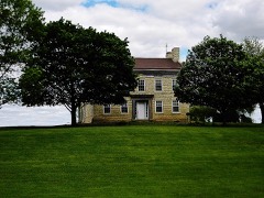 Nathaniel Butterworth Houselisted 1992
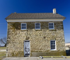 Insane Asylum at the County Poor Farmlisted 1992
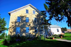 Jackson County Jaillisted 1978
- DeFries House, Barn and Carpenter Shoplisted 1992
- Thomas Slye Houselisted 1992
Population over time
2 figuresAndrew fell from 434 to 380 between 2010 and 2020. These are the recorded population figures Wikidata holds for this place, reached through the Geographic Names Information System number this page is keyed on rather than by name, so they belong to this place and not to another of the same name. Most are census counts, but not all are: an early figure may be a founding or settlement estimate, and an estimate published within five years of a census is left out. The change column is computed, and is left blank where more than 20 years separate a figure from the one before it, because a gap that long is not a change between two counts.
| Year | People | Change |
|---|---|---|
| 2010 | 434 | |
| 2020 | 380 | -54 (-12%) |
Topographic sheets covering this place
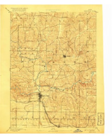
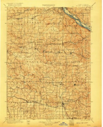
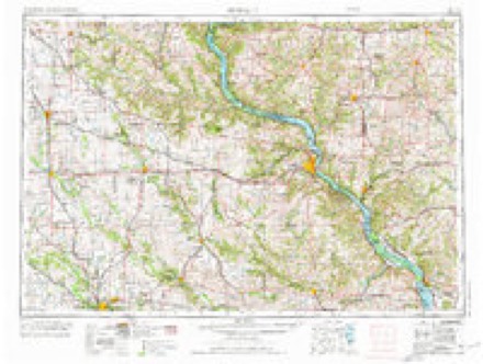
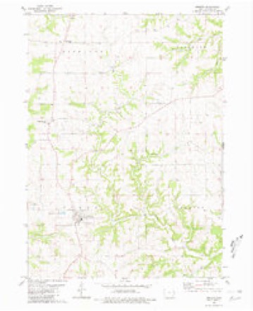
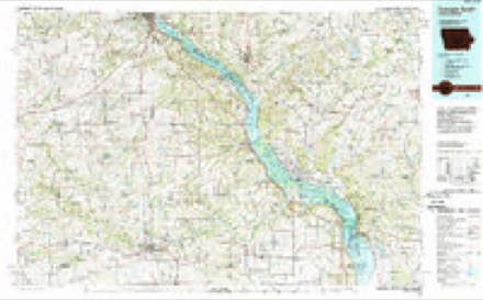
8 surveys from 17 printed sheetsMatched by testing this settlement's coordinate against the published boundary of every sheet in the United States Geological Survey's historical collection. Each opens the scanned sheet at the Survey.
- 1891 USGS Maquoketa quadrangle1:62500, 3 printings
- 1901 USGS Peosta quadrangle1:125000, 4 printings
- 1959 USGS Dubuque quadrangle1:250000
- 1961 USGS Dubuque quadrangle1:250000
- 1962 USGS Dubuque quadrangle1:250000, 2 printings
- 1976 USGS Dubuque quadrangle1:250000
- 1980 USGS Andrew quadrangle1:24000
- 1984 USGS Dubuque South quadrangle1:100000, 4 printings
Fires near this place
7 since 2006Regional context, not property-specific evidence. The federal wildfire occurrence database lists 7 fires within 5 miles of Andrew between 2006 and 2013, burning about 153 acres in total. None started naturally. None was recorded as arson. Distance is straight-line from the map coordinates, so a fire counted here may appear on a neighbouring settlement's page as well.
| Reported cause | Fires |
|---|---|
| Missing data/not specified/undetermined | 5 |
| Debris and open burning | 2 |
The most recent of them, most recent first, with the day each was reported and the service that recorded it.
| Date | Cause | Size | Reported by | Name on the report |
|---|---|---|---|---|
| 11 August 2012 | Missing data/not specified/undetermined | 2.0 acres | Iowa Department of Natural Resources | not named |
| 11 July 2012 | Debris and open burning | 6.0 acres | Iowa Department of Natural Resources | not named |
| 17 May 2013 | Debris and open burning | 80 acres | Iowa Department of Natural Resources | not named |
| 25 March 2010 | Missing data/not specified/undetermined | 1.0 acres | Iowa Department of Natural Resources | 32997 150TH STREET, IOWA |
| 21 March 2009 | Missing data/not specified/undetermined | 60 acres | Iowa Department of Natural Resources | not named |
| 15 March 2009 | Missing data/not specified/undetermined | 1.0 acres | Iowa Department of Natural Resources | not named |
| 14 February 2006 | Missing data/not specified/undetermined | 3.0 acres | Iowa Department of Natural Resources | not named |
Settlements close enough to share some of these fires:
Mines and quarries near this place
1 within 5 milesRegional context, not property-specific evidence. The federal mineral resources record lists 1 working within 5 miles of Andrew: 1 past producer. None of them still produces. What was taken out: Stone, Crushed/Broken. Distance is straight-line from the map coordinates, so a quarry counted here may appear on a neighbouring settlement's page as well.
| Where | Site | Commodity | Status | Recorded |
|---|---|---|---|---|
| Andrew Quarry | Stone, Crushed/Broken | Past Producer |
Storms near this place
14 since 1995Regional context, not property-specific evidence. The National Weather Service names Andrew in 14 storm reports between 1995 and 2023: 8 thunderstorm wind, 2 hail, 2 tornado, 1 flash flood. No death or injury is recorded in these reports. Each account below is quoted exactly as the forecast office filed it, from the NOAA Storm Events Database, and each date opens the federal record of that event.
| When | Event | Place named | Harm | What the report says |
|---|---|---|---|---|
| July 2016 | Tornado (EF1) | Andrew | $5,000,000 | A NWS storm survey team reported an EF-1 tornado crossed the southern parts of the town of Andrew. A building at the local coop was destroyed and numerous trees were snapped. |
| July 2016 | Thunderstorm Wind | Andrew | $5,000,000 | Local law enforcement reported significant damage to a building with nearby trees twisted and some farm equipment knocked over. |
| July 2003 | Thunderstorm Wind | Andrew | $60,000 | Limbs & power lines down |
| July 1995 | Thunderstorm Wind | Andrew | $50,000 | no account filed |
| July 1995 | Thunderstorm Wind | Andrew | $40,000 | Moisture streamed north over the central United States during the 24 hours prior to this event. Surface dew point temperatures were in the 65°-70° F. range. A strong southerly low level jet had also become established during the day with speeds at the 850 mb level in the 50 kt range. On the surface, two fronts were approaching Iowa. One was a warm front to the south of the state. A cold front was moving in from the west. An upper level low pressure area was over north central Kansas during the early afternoon hours. The air mass was quite unstable with lifted indices in the -5° to -7° C. range. The air was even more unstable to the south of Iowa. Convective available potential energy (CAPE) values were around 2800 J-kg-1 with helicity values around 400 m2-s-2 by mid afternoon. Surface mesoscale analysis during the afternoon revealed strong moisture convergence into northwest Missouri and southwest Iowa. That is where the thunderstorms formed. During the mid to late afternoon, a line of thunderstorms formed rapidly from southwest into central Iowa. These storms produced a few funnel clouds, but there was not real threat of them touching down. During the early stages of development, lightning from one of the storms struck a house in Atlantic. No fire was started, however electrical damage was reported. The freezing level on this day was quite high, in excess of 13,500 feet MSL. As a result, hail was not a dominant feature with the storms. Spotty reports of hail between three-quarters on an inch and nearly an inch in diameter were received, but most of the hail was marble-size or smaller. Wind became the major problem with the storms. Within two hours of the initial onset of convection, the thunderstorm complex assumed a bow echo configuration. This bow echo tracked across the entire state producing high winds and brief torrential rains. In Taylor County of southwest Iowa. high winds in the Sharpsburg area downed trees onto a house. The trees crashed through the house and even resulted in some foundation damage. Damage to the house was estimated between $50 thousand and $60 thousand. Near Bedford, high winds downed a tree onto a house. One man was seriously injured as he was unable to get to shelter before the tree fell through the house. He was still in the hospital the following day. Damage to the house was between $8 thousand and $9 thousand. Other damage around the state was mainly tree and power line damage. There were spotty reports of roof damage, such as in the Prairie City area of Jasper County and the Brooklyn area of Poweshiek County. A tractor-semitrailer was overturned by the high winds on Interstate 80 near Newton. For the most part winds were around 60 mph with many of the storms. A few of the storms produced brief stronger gusts in what appeared to be microburst activity. Considerable damage was done in the What Cheer area in Keokuk County. There was some increase in the wind strength over the eastern counties of the state as the storm system began to die out. Winds from the decaying storms reached 60 to 70 mph in several areas of east central Iowa. One of the collapsing storms produced high winds west of Andrew in Jackson County. The winds picked up a 2 x 4 and threw it through the side of a pick-up truck. Flooding was not a large problem except during the early stages of the storm systems development. Heavy rainfall was reported in Taylor County. Two inches fell in 55 minutes time in New Market, while .90 inches fell in 15 minutes in Bedford. The rainfall only resulted in bank full stages on the smaller streams. Minor flooding, mostly in urban areas, was reported in Union County as the heavy rainfall moved through. It did not last long, nor did it cause much damage. |
| July 2023 | Thunderstorm Wind | Andrew | - | Trees down along Highway 62, near Andrew. |
| May 2020 | Tornado (EFU) | Andrew | - | A trained spotter observed a brief tornado in a field. There was no observable damage to assign an EF-scale rating. |
| October 2018 | Flood | Andrew | - | Major flooding occurred on the Maquoketa River between the evening of October 10th and the morning of the 11th when the gage exceeded 28.5 feet. The Maquoketa River crested at 28.9 feet at 12 AM, October 11th. |
| June 2016 | Flash Flood | Andrew | - | Jackson county law enforcement reported several creeks in eastern Jackson county out of their banks. |
| June 2014 | Thunderstorm Wind | Andrew | - | A trained spotter reported a shed blown over and tree branches down. |
| June 1997 | Thunderstorm Wind | Andrew | - | Numerous trees downed. |
| April 2007 | Hail | Andrew | - | no account filed |
| April 2002 | Hail | Andrew | - | no account filed |
| August 1998 | Thunderstorm Wind | Andrew | - | no account filed |
Nearest settlements
The eight closest, with where each one stands in the county. Distances are straight-line, computed from the Geographic Names Information System coordinates.
| Map | Place | Distance | Sheets |
|---|---|---|---|
| Fulton | 4.5 miles | 17 | |
| Bridgeport | 4.8 miles | 17 | |
| Cottonville | 5.8 miles | 17 | |
| Hurstville | 6.2 miles | 17 | |
| Springbrook | 6.2 miles | 13 | |
| Maquoketa | 7.0 miles | 17 | |
| Otter Creek | 7.7 miles | 17 | |
| East Iron Hills | 7.7 miles | 17 |
Elsewhere
Matched on this settlement's Geographic Names Information System number rather than its name, so it cannot be a different place of the same name in another state.
| Wikipedia article on Andrew | An encyclopaedic summary. Its text is share-alike, so it is linked here rather than copied. |
| Wikidata item Q1947783 | The structured record the population and elevation above come from. Public domain (CC0). |
Provenance
This settlement is recorded in the Geographic Names Information System as feature 454187. The sheet list is computed by point-in-boundary test against the United States Geological Survey's historical topographic inventory. Both are works of the United States government and carry no copyright under 17 U.S.C. 105.
Wildfire. Short, Karen C. 2022. Spatial wildfire occurrence data for the United States, 1992-2020 [FPA_FOD_20221014]. 6th Edition. Fort Collins, CO: Forest Service Research Data Archive. https://doi.org/10.2737/RDS-2013-0009.6 Collected with United States Government funding and usable without additional permissions or fees.
Mines and quarries. USGS Mineral Resources Data System (MRDS) https://mrdata.usgs.gov/mrds/ A work of the United States government, no copyright under 17 U.S.C. 105.
Storms. NOAA National Centers for Environmental Information, Storm Events Database https://www.ncei.noaa.gov/stormevents/ A work of the United States government, no copyright under 17 U.S.C. 105. Narratives are quoted verbatim from the National Weather Service report and are not edited or summarised.