Block
From the record
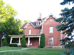
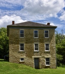
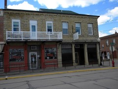
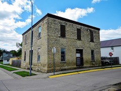
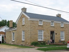
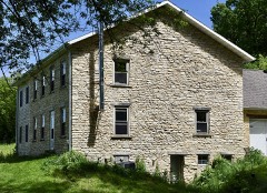
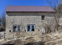
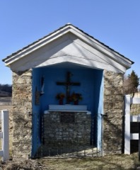
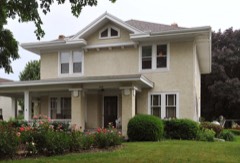
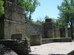
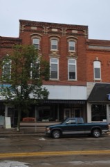
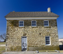
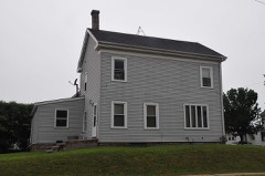
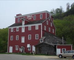
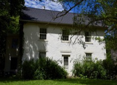
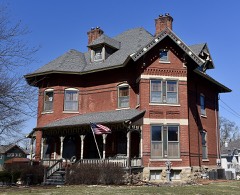
77 National Register listings published here.
Sources: the National Register database, National Park Service
70 topographic sheets cover 41 settlements here, and 77 properties are on the National Register of Historic Places.
77 National Register listings published here.
Sources: the National Register database, National Park Service
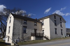
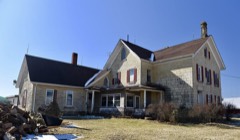
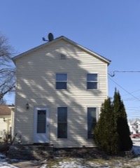
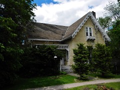
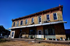
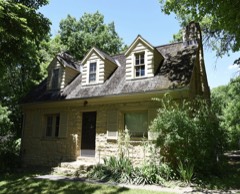
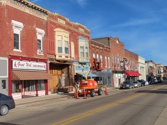
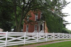
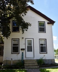
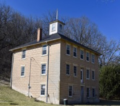
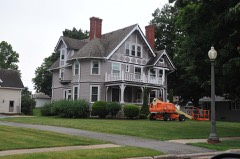
Every property in this county listed on the National Register of Historic Places, with the year it was listed and the federal nomination document.
Every wildfire the federal occurrence database records inside this county: 93 of them, burning about 1,099 acres. None started naturally and 1 was recorded as arson. Each settlement page carries the fires within five miles of it.
| Reported cause | Fires |
|---|---|
| Missing data/not specified/undetermined | 45 |
| Debris and open burning | 43 |
| Equipment and vehicle use | 3 |
| Arson/incendiarism | 1 |
| Smoking | 1 |
The five largest, by the area the report gives. None of them was recorded as arson.
| Date | Cause | Size | Reported by | Name on the report |
|---|---|---|---|---|
| 19 January 2006 | Missing data/not specified/undetermined | 200 acres | Iowa Department of Natural Resources | not named |
| 24 April 2009 | Missing data/not specified/undetermined | 100 acres | Iowa Department of Natural Resources | not named |
| 17 May 2013 | Debris and open burning | 80 acres | Iowa Department of Natural Resources | not named |
| 21 March 2009 | Missing data/not specified/undetermined | 60 acres | Iowa Department of Natural Resources | not named |
| 18 March 2006 | Missing data/not specified/undetermined | 50 acres | Iowa Department of Natural Resources | not named |
| 2 April 2011 | Missing data/not specified/undetermined | 35 acres | Iowa Department of Natural Resources | SE OF ELDORA 2.5 MILES, IA |
| 1 January 2003 | Missing data/not specified/undetermined | 35 acres | Iowa State Fire Marshal's Office | not named |
| 10 April 2009 | Missing data/not specified/undetermined | 35 acres | Iowa Department of Natural Resources | not named |
Every settlement page carries the fires within five miles of it - see the settlement index below.
The NOAA Storm Events Database holds 329 reports for this county, causing no deaths, 8 injuries and about $40,082,700 in recorded property damage. Each settlement page carries the reports that name it.
| Kind of event | Reports |
|---|---|
| Thunderstorm Wind | 178 |
| Hail | 80 |
| Tornado | 29 |
| Flash Flood | 21 |
| Flood | 16 |
| Heavy Rain | 3 |
| Funnel Cloud | 2 |
The most serious of them, by death, then injury, then recorded damage. The accounts are quoted exactly as the forecast office filed them.
| When | Event | Place named | Harm | What the report says |
|---|---|---|---|---|
| March 2023 | Tornado (EF1) | Bellevue | 3 hurt | A tornado touched down just south of Bellevue, and moved northeast over the Mississippi River before dissipating. This tornado impacted an RV park and some cabins located nearby. Some structural damage was noted, with some RVs that were flipped and damaged. Several trees within the area were also impacted, with some uprooted. Three injuries were noted with this tornado in the vicinity of the RV park. This tornado continued into Jo Daviess County, Illinois, but likely dissipated over the river as no damage was observed in a wooded area adjacent to the river. Peak winds were estimated around 105 mph. |
| November 1975 | Tornado (F2) | not stated | 2 hurt, $250,000 | no account filed |
| June 2010 | Tornado (EF1) | Maquoketa | 1 hurt, $250,000 | At approximately 740 pm June 5, an EF1 tornado moved across the northern edge of Maquoketa, IA. Wind speeds were estimated to be around 105 mph. Numerous trees were uprooted or snapped. Approximately 10 mobile homes and numerous vehicles were damaged by falling trees and tree limbs. A porch was torn from the front of a farm house and several outbuildings were damaged including an open-front garage that was completely destroyed. The sign at the elementary school school was destroyed and a rooftop air conditioner was moved, damaging the roof. |
| April 2007 | Thunderstorm Wind | Maquoketa | 1 hurt, $5,000 | A farm sustained damage to a machine shed and the residence as the storm moved through the area. Several tree limbs were blown down, one of which broke a bedroom window of the residence. The home owner was cut by the flying glass. Elsewhere in the vicinity, several tree limbs were downed and shingles were blown off some roofs. |
| May 1965 | Tornado | not stated | 1 hurt, $2,500 | no account filed |
| September 2002 | Hail | Maquoketa | $20,000,000 | no account filed |
| July 2016 | Tornado (EF1) | Andrew | $5,000,000 | A NWS storm survey team reported an EF-1 tornado crossed the southern parts of the town of Andrew. A building at the local coop was destroyed and numerous trees were snapped. |
| July 2016 | Thunderstorm Wind | Andrew | $5,000,000 | Local law enforcement reported significant damage to a building with nearby trees twisted and some farm equipment knocked over. |
| June 2007 | Tornado (EF2) | Springbrook | $3,250,000 | A tornado touched down about 3.5 miles south of Bellevue, IA. It moved north to county road Z15 and then northeast crossing the Mississippi River just south of Lock and Dam 12 into Jo Daviess County Illinois. Along the path, damage consisted of snapped and uprooted trees, farm out buildings, and roofs. The most significant damage occurred near the junction of county highway Z15 and 407th Avenue. A mobile home was rolled over and destroyed. The residents of the mobile home had taken shelter in the farm house about 100 feet away. The farm house only had damaged gutters. |
| July 2011 | Flash Flood | Garry Owen | $1,500,000 | Torrential downpours of rain fell across much of northeastern Jackson County during the evening of July 27 and early morning hours of July 28 resulting in flash flooding of much of the area. Rainfall totals of 7 to 15 inches were common across the area, with most of the rain falling in under 12 hours.||Several bridges were closed and roads washed out in northern Jackson County, including the bridge on 308th Street between Sieverding Ridge Road and U.S. 52, a wooden bridge in Tete De Morts Township on High Bridge Road, and a bridge on 248th Avenue. Some culverts on 370th Street were destroyed. Spruce Creek Park was evacuated. Some basements in Bellevue were also flooded. Annie's Acres along Mill Creek Road was also flooded. |
| July 2010 | Flood | Canton | $1,000,000 | Three mobile homes and a business in Canton on the western edge of Jackson County were flooded with up to 3 feet of water by the Maquoketa River. Numerous roads and bridges across the county suffered damage as a result of the record flooding. Near Maquoketa, three homes in the Hurstville Road area were flooded. ||Near Spragueville, a welding business was inundated by several feet of water as flood waters from the Maquoketa River backed up along nearby Deep Creek. ||The majority of flood damage in Jackson County was to crops, as most soybean fields affected by the floods were expected to be a total loss. |
| July 2003 | Thunderstorm Wind | Maquoketa | $600,000 | Numerous trees down citywide |
| June 2008 | Flood | Canton | $599,000 | no account filed |
| September 2018 | Tornado (EF1) | Springbrook | $250,000 | An EF-1 tornado damaged and uprooted trees, snapped a power pole, and caused roof damage. Maximum wind speed was estimated around 100 mph. The tornado was on the ground less than 1 minute and travelled a little more than a quarter mile. |
| July 2009 | Flash Flood | La Motte | $250,000 | Heavy rains resulted in some flash flooding in and around Bellevue, IA during the evening hours of July 27 and early morning hours of July 28. The flood waters were flowing over Highway 52 near Pleasant Creek, where the water was 5 feet deep for a time. In addition, four cars stalled out in waist-deep flood waters near Second Avenue and Park Street in Bellevue, IA around 945 pm. Several Bellevue residence sustained flooded basements. Mill Creek Road experienced significant flash flooding which washed trees, mud, and other debris onto the road and eroded portions of the road. Several area roads were closed for a time. A berm was breached at 31766 Mill Creek Road flooding the residence in through the windows. Annie's Acres, a strawberry patch, was flooded with machinery washed into a nearby cornfield. Several fences were washed out and fields were flattened by the flood waters. Law enforcement officials and newspaper media also contributed to this report. |
| April 2011 | Flood | St Donatus | $250,000 | no account filed |
| March 1991 | Tornado (F2) | not stated | $250,000 | no account filed |
| August 1998 | Thunderstorm Wind | Countywide | $120,000 | no account filed |
| June 2011 | Thunderstorm Wind | Buckhorn | $100,000 | Wind gusts estimated to be 70 to 80 mph caused extensive tree damage, destroyed a barn, and downed power poles along a path from just east of Nashville, IA to just southeast of the Maquoketa Municipal Airport around 830 am CDT June 8. |
| June 2010 | Thunderstorm Wind | Fulton | $100,000 | Wind gusts estimated to be 65 mph blew a semi over at mile marker 164 on Highway 61 about 6 miles north of Maquoketa, IA at 131 pm June 18. |
| June 1998 | Thunderstorm Wind | La Motte | $100,000 | Strong thunderstorm winds destroyed a dairy barn and ripped the roof off another barn in Northeastern Jackson county. One home was destroyed as strong winds drove barn beams through the walls, shattered glass and spread dirt and debris inside the home. |
| April 1995 | Thunderstorm Wind | Maquoketa | $100,000 | As the storm mentioned above tracked across the state, a dry slot moved out just ahead of it. Thunderstorms fired along and just ahead of the dry slot. The winds aloft were quite strong at the time as were the gradient winds. As a result, the thunderstorms became severe in terms of high winds. A downbust wind caused damage on a farmstead in Benton County for the first report of the morning. There was one sighting of a funnel cloud in Muscatine County. Several tractor-semitrailer trucks were overturned in Cedar County as the gusty winds blew them off the roads. One driver received minor injuries as he was pinned inside his truck west of Clarence. The storms and gusty winds continued to track northeast. A roof was removed off a business in Stanwood, impaling boards into the ground. Another roof was taken off by high winds at Mayville. There were several reports of barns being blown down by the wind gusts. Several trees were down, as were power lines as well throughout east-central Iowa. A significant amount of damage was reported in Maquoketa by high winds. There were reports of several buildings sustaining structural damage caused by the winds. The event was a short event as the storms tracked rapidly northeast into Illinois and Wisconsin. |
| July 2003 | Thunderstorm Wind | Andrew | $60,000 | Limbs & power lines down |
| July 2003 | Thunderstorm Wind | Green Is | $60,000 | Limbs & power lines down |
| July 2011 | Thunderstorm Wind | Bellevue | $50,000 | Wind gusts estimated to be up to 85 mph snapped several large pine trees off about 10 feet off the ground, downed power lines, and destroyed a machine shed in Bellevue, IA around 1015 am CDT July 28. The debris from the machine shed blew across the street onto the DNR Building and broke the windshield of a DNR vehicle. A power outage was observed on the south side of town. |
| June 2009 | Thunderstorm Wind | Sabula | $50,000 | Wind gusts estimated to be 60 mph blew a pontoon boat onto a car in Sabula, IA around 522 pm June 27. |
| June 2009 | Flash Flood | Maquoketa | $50,000 | Heavy rains resulted in flash flooding of many streets in Maquoketa, IA during the evening of June 19. |
| May 1999 | Thunderstorm Wind | Miles | $50,000 | Severe thunderstorm winds caused major damage at a farm 3.5 miles southeast of Miles. The wind completely destroyed a 54'x144' machine shed, a corn crib, and extensive fencing. Numerous pieces of farm machinery were damaged. The garage was moved off its foundation, damaging the car and truck that were inside. Siding was also torn off and windows were broken at a house. |
| July 1995 | Thunderstorm Wind | Andrew | $50,000 | no account filed |
| August 1994 | Hail | Bellevue | $50,000 | no account filed |
| August 1994 | Thunderstorm Wind | Bellevue | $50,000 | no account filed |
| August 1994 | Hail | Green Island | $50,000 | no account filed |
| July 1995 | Thunderstorm Wind | Andrew | $40,000 | Moisture streamed north over the central United States during the 24 hours prior to this event. Surface dew point temperatures were in the 65°-70° F. range. A strong southerly low level jet had also become established during the day with speeds at the 850 mb level in the 50 kt range. On the surface, two fronts were approaching Iowa. One was a warm front to the south of the state. A cold front was moving in from the west. An upper level low pressure area was over north central Kansas during the early afternoon hours. The air mass was quite unstable with lifted indices in the -5° to -7° C. range. The air was even more unstable to the south of Iowa. Convective available potential energy (CAPE) values were around 2800 J-kg-1 with helicity values around 400 m2-s-2 by mid afternoon. Surface mesoscale analysis during the afternoon revealed strong moisture convergence into northwest Missouri and southwest Iowa. That is where the thunderstorms formed. During the mid to late afternoon, a line of thunderstorms formed rapidly from southwest into central Iowa. These storms produced a few funnel clouds, but there was not real threat of them touching down. During the early stages of development, lightning from one of the storms struck a house in Atlantic. No fire was started, however electrical damage was reported. The freezing level on this day was quite high, in excess of 13,500 feet MSL. As a result, hail was not a dominant feature with the storms. Spotty reports of hail between three-quarters on an inch and nearly an inch in diameter were received, but most of the hail was marble-size or smaller. Wind became the major problem with the storms. Within two hours of the initial onset of convection, the thunderstorm complex assumed a bow echo configuration. This bow echo tracked across the entire state producing high winds and brief torrential rains. In Taylor County of southwest Iowa. high winds in the Sharpsburg area downed trees onto a house. The trees crashed through the house and even resulted in some foundation damage. Damage to the house was estimated between $50 thousand and $60 thousand. Near Bedford, high winds downed a tree onto a house. One man was seriously injured as he was unable to get to shelter before the tree fell through the house. He was still in the hospital the following day. Damage to the house was between $8 thousand and $9 thousand. Other damage around the state was mainly tree and power line damage. There were spotty reports of roof damage, such as in the Prairie City area of Jasper County and the Brooklyn area of Poweshiek County. A tractor-semitrailer was overturned by the high winds on Interstate 80 near Newton. For the most part winds were around 60 mph with many of the storms. A few of the storms produced brief stronger gusts in what appeared to be microburst activity. Considerable damage was done in the What Cheer area in Keokuk County. There was some increase in the wind strength over the eastern counties of the state as the storm system began to die out. Winds from the decaying storms reached 60 to 70 mph in several areas of east central Iowa. One of the collapsing storms produced high winds west of Andrew in Jackson County. The winds picked up a 2 x 4 and threw it through the side of a pick-up truck. Flooding was not a large problem except during the early stages of the storm systems development. Heavy rainfall was reported in Taylor County. Two inches fell in 55 minutes time in New Market, while .90 inches fell in 15 minutes in Bedford. The rainfall only resulted in bank full stages on the smaller streams. Minor flooding, mostly in urban areas, was reported in Union County as the heavy rainfall moved through. It did not last long, nor did it cause much damage. |
| April 2010 | Thunderstorm Wind | La Motte | $35,000 | Wind gusts estimated to be 65 mph ripped the roof off of a machine shed and blew a post through the side of a mobile home just east of the Dubuque-Jackson county line on 230th Avenue or about 3 miles north of La Motte, IA at 1107 pm April 5. |
| June 2008 | Thunderstorm Wind | Green Is | $25,000 | Winds estimated to be 75 mph caused substantial damage to a farm on 435th Avenue about 7 miles north of Preston, IA around 6:30 am June 5. A barn was blown over damaging some equipment inside and the porch on the house was heavily damaged. |
| June 2008 | Thunderstorm Wind | Springbrook | $25,000 | Wind gusts estimated to be 70 mph blew a grain bin over about two miles west of Springbrook, IA at 7:40 pm June 8. |
| July 2007 | Flash Flood | Maquoketa | $25,000 | Three to six inches of rain fell in a short amount of time during the early morning hours of July 4th in Maquoketa, IA resulting in flash flooding. After receiving over 2 inches of rain in an hour, streets began to flood in Maquoketa around 1 AM. An additional 2 to 4 inches of rain had fallen by 3 AM. Flood waters 3 feet deep forced the closure of Highway 64 on the east side of town. The water was over the hoods of police squad cars. Several streets were flooded and or closed throughout the town including the intersections of South Fifth and Washington streets, Eddy and South Vermont streets, and 200th Avenue and Family Dollar parkway. A car was stalled in flood waters near the Eagle's Club. Prairie Creek overflowed its banks prompting the evacuation of campers in the Horseshoe Pond Park. A bridge was washed out at Lakehurst Dam near Maquoketa. A campground just south of Maquoketa also flooded rapidly forcing camping trailers to higher ground. In addition, the Maquoketa Caves State Park also had flooding, which damaged the lighting system in the park as well as washed debris into some caves prompting the closure of parts of the park for several days. Law enforcement, cooperative observers, and media sources also contributed to this report. |
| August 2007 | Thunderstorm Wind | Green Is | $25,000 | Winds estimated to be 70 mph blew down several branches and five to ten trees near Green Island, IA. One tree landed on a house. Delayed report. |
| April 1995 | Thunderstorm Wind | Maquoketa | $25,000 | no account filed |
| June 1990 | Tornado (F1) | not stated | $25,000 | no account filed |
| March 1988 | Tornado (F0) | not stated | $25,000 | no account filed |
| December 1975 | Tornado (F1) | not stated | $25,000 | no account filed |
| June 1969 | Tornado (F1) | not stated | $25,000 | no account filed |
| February 2014 | Thunderstorm Wind | Maquoketa Muni Arpt | $15,000 | Wind gusts estimated to be 65 mph ripped half of the shingles off of the house. |
| June 2008 | Thunderstorm Wind | La Motte | $15,000 | Wind gusts estimated to be 65 mph blew down 5 utility poles along 230th Avenue just north of La Motte, IA around 6:10 am June 5 resulting in a power outage. |
| August 2003 | Thunderstorm Wind | Maquoketa | $15,000 | Trees and Power lines down. |
| May 1999 | Thunderstorm Wind | Baldwin | $15,000 | Severe thunderstorm winds destroyed a machine shed, one grain bin, and one silo. Two other silos and a loading chute were also damaged. |
| July 2011 | Thunderstorm Wind | Smiths Ferry | $10,000 | Wind gusts estimated to be 70 mph blew a semi-tractor trailer over just north of Bellevue, IA around 610 am CDT July 11. |
| August 2003 | Thunderstorm Wind | Preston | $10,000 | Trees down;lasted 15 minutes |
| July 2003 | Hail | Maquoketa | $10,000 | no account filed |
| July 2003 | Hail | Maquoketa | $10,000 | no account filed |
| July 2003 | Hail | Maquoketa | $10,000 | no account filed |
| June 2000 | Thunderstorm Wind | Preston | $10,000 | no account filed |
| June 2000 | Thunderstorm Wind | Countywide | $10,000 | no account filed |
| April 1996 | Tornado (F0) | Preston | $10,000 | no account filed |
| August 2006 | Thunderstorm Wind | Maquoketa | $8,000 | Co-operative observer reported 3 foot diameter trees down and two power poles snapped south of his farm. A considerable amount of corn was flattened with damage to some buildings. Time estimated based on radar. |
| August 2004 | Thunderstorm Wind | Maquoketa | $8,000 | Numerous streets closed due to downed trees and power lines. A 15 inch diameter tree down on a house.Only two severe reports were received in Jackson County. KDVN 88D reflectivity and velocity data suggests that damage may be more widespread across the southern part of the county during 1820-1930 CST (0020-0130 UTC). This would be consistent with the passage of the bookend vorticity as it moved across Jackson County. |
| August 2003 | Thunderstorm Wind | Fulton | $6,000 | Tree down on house |
| July 2013 | Thunderstorm Wind | Maquoketa | $5,000 | Wind gusts estimated to be 75 mph blew down several large trees and a large billboard sign in Maquoketa, IA around 840 pm CDT July 22. Some trees fell onto power lines. This report was made on a media Facebook page. |
| July 2011 | Thunderstorm Wind | Maquoketa | $5,000 | Wind gusts estimated to be 60 mph blew down some branches in Maquoketa, IA around 630 am CDT July 11. Some streets were blocked by the branches. A power outage was also observed. |
The Survey's mineral resources record lists 55 workings inside this county. 17 still produce and 38 are closed or unrecorded. Each settlement page carries the workings within five miles of it.
| Commodity | Workings |
|---|---|
| Stone, Crushed/Broken | 34 |
| Lead | 10 |
| Sand and Gravel, Construction | 8 |
| Phosphorus-Phosphates | 1 |
| Clay | 1 |
| Flagstone | 1 |
The least common of them first, because a county's hundredth gravel pit says nothing its first ten did not.
| Where | Site | Commodity | Status | Recorded |
|---|---|---|---|---|
| Bellevue Clay Products Co. Pit | Clay | Past Producer | ||
| Outcrop | Phosphorus-Phosphates | Past Producer | ||
| Unknown | Flagstone | Past Producer | ||
| Bellevue Pit & Plant | Sand and Gravel, Construction | Producer | ||
| Kueter Pit | Sand and Gravel, Construction | Past Producer | ||
| Little Gem Pit & Plant | Sand and Gravel, Construction | Producer | ||
| Maquoketa Pit | Sand and Gravel, Construction | Past Producer | ||
| Rockdale Pit | Sand and Gravel, Construction | Past Producer | ||
| Trenkamp Pit | Sand and Gravel, Construction | Past Producer | ||
| Turner Sand Pit | Sand and Gravel, Construction | Producer | ||
| Unknown | Sand and Gravel, Construction | Past Producer | ||
| Baldwin Mines | Lead | Past Producer | Galena | |
| Gillespie Farm Diggings | Lead | Past Producer | Galena | |
| Indian Mines | Lead | Past Producer | Galena | |
| Lytle Creek Diggings | Lead | Occurrence | Galena | |
| Lytle Creek Diggings | Lead | Past Producer | ||
| Main Baldwin Diggings | Lead | Past Producer | Galena | |
| Mineral Creek Diggings | Lead | Past Producer | Galena | |
| Tete Des Morts Diggings | Lead | Past Producer | ||
| Unknown | Lead | Past Producer | ||
| Unknown | Lead | Past Producer | ||
| Andrew Quarry | Stone, Crushed/Broken | Past Producer | ||
| Beckley Quarry | Stone, Crushed/Broken | Past Producer | ||
| Bellevue Quarry | Stone, Crushed/Broken | Producer | ||
| Bellevue Sand and Gravel Co. Quarry | Stone, Crushed/Broken | Past Producer | ||
| Crabtown Quarry | Stone, Crushed/Broken | Past Producer | ||
| Franks Quarry | Stone, Crushed/Broken | Producer | ||
| Frost Quarry | Stone, Crushed/Broken | Past Producer | ||
| Holtz Quarry | Stone, Crushed/Broken | Past Producer | ||
| Joinerville Quarry | Stone, Crushed/Broken | Producer | ||
| La Motte Quarry | Stone, Crushed/Broken | Producer | ||
| Maquoketa Quarry | Stone, Crushed/Broken | Producer | ||
| Marshall Quarry | Stone, Crushed/Broken | Past Producer | ||
| Marvin Quarry | Stone, Crushed/Broken | Past Producer | ||
| Miles Quarry | Stone, Crushed/Broken | Producer | ||
| Mo-Keta Stone Quarry | Stone, Crushed/Broken | Producer | ||
| Otter Creek Quarry | Stone, Crushed/Broken | Producer | ||
| Pataska Quarry | Stone, Crushed/Broken | Producer | ||
| Preston Quarry | Stone, Crushed/Broken | Producer | ||
| Rowan Quarry | Stone, Crushed/Broken | Producer | ||
| Schwenker Quarry | Stone, Crushed/Broken | Past Producer | ||
| Schwenker Quarry | Stone, Crushed/Broken | Past Producer | ||
| Springbrook Quarry | Stone, Crushed/Broken | Producer | ||
| Springbrook-Lundin Quarry | Stone, Crushed/Broken | Producer | ||
| St Donatus Quarry | Stone, Crushed/Broken | Past Producer | ||
| Unknown | Stone, Crushed/Broken | Past Producer | ||
| Unknown | Stone, Crushed/Broken | Past Producer | ||
| Unknown | Stone, Crushed/Broken | Past Producer | ||
| Unknown | Stone, Crushed/Broken | Unknown | ||
| Unknown | Stone, Crushed/Broken | Past Producer | ||
| Unknown | Stone, Crushed/Broken | Past Producer | ||
| Unknown | Stone, Crushed/Broken | Past Producer | ||
| Unknown | Stone, Crushed/Broken | Past Producer | ||
| Unknown | Stone, Crushed/Broken | Past Producer | ||
| Weis Quarry | Stone, Crushed/Broken | Producer |
Named settlements recorded in the Geographic Names Information System, each with the topographic sheets covering it. Villages, hamlets and abandoned places alike. Each is shown with the nearest named watercourse or landform and the survey quadrangle it falls on.
Maquoketa township · 52060 · On Prairie Creek · Maquoketa quadrangle
17 sheets, 1891 to 1984
Brandon township · 52309 · On Black Hawk Creek · Canton quadrangle
17 sheets, 1891 to 1984
Farmers Creek township · 52060 · On Farmers Creek · Fulton quadrangle
17 sheets, 1891 to 1984
Washington township · 52064 · Near Mooney Hollow · Green Island quadrangle
15 sheets, 1935 to 1984
South Fork township · 52060 · On Hurstville Branch · Maquoketa quadrangle
17 sheets, 1891 to 1984
South Fork township · 52060 · On North Fork Maquoketa River · Maquoketa quadrangle
17 sheets, 1891 to 1984
Bellevue township · 52031 · On Bellevue Slough · Bellevue quadrangle
18 sheets, 1911 to 1984
Brandon township · 52309 · Near Goose Rock · Leisure Lake quadrangle
17 sheets, 1891 to 1984
No longer a settlement
Washington township · 52031 · Near Bowman Island · Springbrook quadrangle
13 sheets, 1935 to 1984
Van Buren township · 52069 · On South Copper Creek · Preston quadrangle
13 sheets, 1935 to 1984
Washington township · 52064 · Near Muskrat Hollow · Green Island quadrangle
15 sheets, 1935 to 1984
Van Buren township · 52069 · Preston quadrangle
13 sheets, 1935 to 1984
No longer a settlement
Tete Des Morts township · 52071 · On Lux Creek · La Motte quadrangle
19 sheets, 1901 to 1984
Tete Des Morts township · 52031 · Near Scott Island · Bellevue quadrangle
18 sheets, 1911 to 1984
Fairfield township · 52074 · On Copper Creek · Preston quadrangle
13 sheets, 1935 to 1984
Iowa township · 52064 · Near Muskrat Hollow · Green Island quadrangle
15 sheets, 1935 to 1984
The vanished settlements of Jackson County: the places named above that are no longer on the map.