 Block
Bettendorf, Iowa
20 topographic sheets cover this place, the earliest surveyed in 1891 and the latest in 1993. It stands in Pleasant Valley Township. It lies in ZIP code area 52722. It stands on Stafford Creek. The Survey maps it on the Davenport East quadrangle. 39,102 people lived here at the 2020 count. It stands 571 feet above sea level.
On record in Bettendorf
Buildings and businesses the archive holds for this place. Each opens its own page, with the source record it came from.
On the National Register 4 records
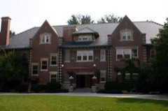 Joseph F. Bettendorf Houselisted 1983
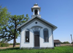 Forest Grove School No. 5listed 2013
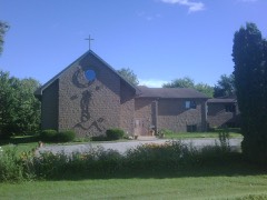 Regina Coeli Monasterylisted 1994
- Bettendorf-Washington Schoollisted 1984
Population over time
2 figuresBettendorf grew from 33,217 to 39,102 between 2010 and 2020. These are the recorded population figures Wikidata holds for this place, reached through the Geographic Names Information System number this page is keyed on rather than by name, so they belong to this place and not to another of the same name. Most are census counts, but not all are: an early figure may be a founding or settlement estimate, and an estimate published within five years of a census is left out. The change column is computed, and is left blank where more than 20 years separate a figure from the one before it, because a gap that long is not a change between two counts.
| Year | People | Change |
|---|---|---|
| 2010 | 33,217 | |
| 2020 | 39,102 | +5,885 (+18%) |
Topographic sheets covering this place
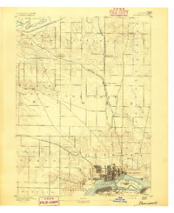
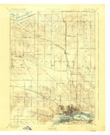
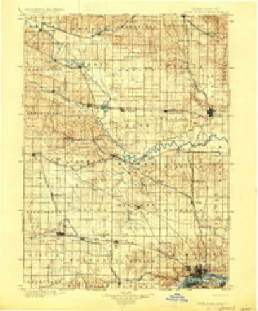
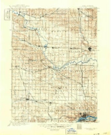
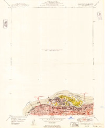
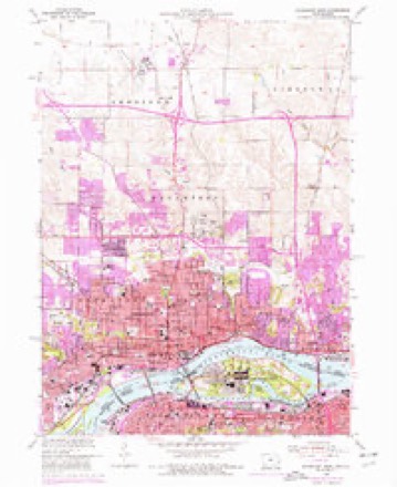
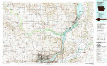
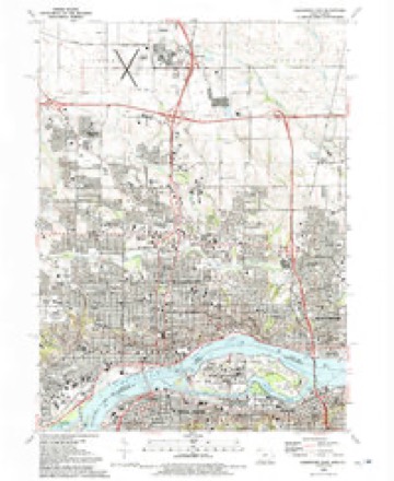
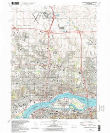
12 surveys from 20 printed sheetsMatched by testing this settlement's coordinate against the published boundary of every sheet in the United States Geological Survey's historical collection. Each opens the scanned sheet at the Survey.
- 1891 USGS Davenport quadrangle1:62500
- 1894 USGS Davenport quadrangle1:62500, 4 printings
- 1901 USGS Rock Island quadrangle1:125000, 2 printings
- 1910 USGS Rock Island quadrangle1:125000
- 1949 USGS Davenport quadrangle1:24000
- 1953 USGS Davenport East quadrangle1:24000, 3 printings
- 1958 USGS Davenport quadrangle1:250000, 2 printings
- 1961 USGS Davenport quadrangle1:250000
- 1962 USGS Davenport quadrangle1:250000
- 1984 USGS Davenport quadrangle1:100000, 2 printings
- 1991 USGS Davenport East quadrangle1:24000
- 1993 USGS Davenport East quadrangle1:24000
Fires near this place
7 since 2006Regional context, not property-specific evidence. The federal wildfire occurrence database lists 7 fires within 5 miles of Bettendorf between 2006 and 2019, burning about 15 acres in total. None started naturally. None was recorded as arson. Distance is straight-line from the map coordinates, so a fire counted here may appear on a neighbouring settlement's page as well.
| Reported cause | Fires |
|---|---|
| Missing data/not specified/undetermined | 5 |
| Debris and open burning | 2 |
The most recent of them, most recent first, with the day each was reported and the service that recorded it.
| Date | Cause | Size | Reported by | Name on the report |
|---|---|---|---|---|
| 11 September 2009 | Debris and open burning | under an acre | Illinois Division of Forestry Resources | IDNR |
| 16 August 2008 | Missing data/not specified/undetermined | 2.0 acres | Illinois Division of Forestry Resources | MM15 |
| 22 July 2008 | Missing data/not specified/undetermined | under an acre | Illinois Division of Forestry Resources | POLE |
| 9 April 2019 | Debris and open burning | 2.0 acres | Iowa Department of Natural Resources | not named |
| 3 April 2011 | Missing data/not specified/undetermined | 10 acres | Iowa Department of Natural Resources | H AVE AND E 49, IA |
| 22 March 2007 | Missing data/not specified/undetermined | under an acre | Iowa Department of Natural Resources | not named |
| 6 February 2006 | Missing data/not specified/undetermined | under an acre | Iowa Department of Natural Resources | not named |
Settlements close enough to share some of these fires:
Mines and quarries near this place
5 within 5 milesRegional context, not property-specific evidence. The federal mineral resources record lists 5 workings within 5 miles of Bettendorf: 4 past producers, 1 producer. 1 still produces. What was taken out: Stone, Crushed/Broken, Sand and Gravel, Construction. Distance is straight-line from the map coordinates, so a quarry counted here may appear on a neighbouring settlement's page as well.
| Where | Site | Commodity | Status | Recorded |
|---|---|---|---|---|
| Builders Sand and Gravel Co. Dredge | Sand and Gravel, Construction | Producer | ||
| Bettendorf Stone Co. Quarry | Stone, Crushed/Broken | Past Producer | ||
| Rock Island City Eng. | Stone, Crushed/Broken | Past Producer | ||
| U. S. Army Engineers | Stone, Crushed/Broken | Past Producer | ||
| Unknown | Stone, Crushed/Broken | Past Producer |
Storms near this place
60 of 66 shownRegional context, not property-specific evidence. The National Weather Service names Bettendorf in 66 storm reports between 1995 and 2025: 32 thunderstorm wind, 21 hail, 7 flash flood, 2 tornado. The reports record 1 injury. Each account below is quoted exactly as the forecast office filed it, from the NOAA Storm Events Database, and each date opens the federal record of that event.
| When | Event | Place named | Harm | What the report says |
|---|---|---|---|---|
| August 1997 | Thunderstorm Wind | Bettendorf | 1 hurt | Winds were strong enough to snap cables which held a Bettendorf, Iowa casino riverboat to the Dock. The Casino boat and 1,076 patrons then took an unexpected cruse in the MIssissippi River for 90 minutes before they could be re-docked. One Casino employee was injured by flying glass, no other injuries were reported. |
| March 2006 | Flash Flood | Bettendorf | $400,000 | Thunderstorms trained across the Quad City Metro area and produced rainfall rates exceeding 1 inch per 30 minutes. At 2000 CST an off duty NWS employee reported 2 feet of water over the roads in his neighborhood along the Bettendorf/Davenport city limits. By 2134 CST media and law enforcement were reporting water 4 inches deep was flowing into the Davenport Police Station on Harrision street. Numerous streets were closed due to high water; Harrision by the police station and River Drive in several spots. The media was reporting sinkholes developing on some streets in Davenport with some residences flooded. Although unknown at the time, the Federal Building in downtown Davenport had its basement partially flooded. Near the Oscar Mayer/Kraft plant, 2-3 feet of water was on second street while River Drive and 3rd street by the Quad City Times Newspaper had thigh deep water. The flash flooding in Davenport was exacerbated from winter debris blocking storm drains and therefore preventing or restricting the amount of water getting into storm sewers.By 2230 CST, spotters and the media were reporting that flooding in downtown Davenport was beginning to recede. It is unknown how many buildings received water inside them but it is probably safe to say it was a few dozen. The flooding of the police station was caused by a police car blocking a storm sewer drain. A city engineer with Davenport concluded that this level of flooding was typical for a 15 to 20 year event.KMLI ASOS reported 1.78 inches of rain for 12 March 2006 of which 1.66 inches fell during the 1800-2400 CST time period. At the same time, the KDVN ASOS reported 1.05 inches of rain for 12 March 2006. The heaviest rain occurred during the 1900-2300 CST time period in a narrow band in between the two ASOS sites. The highest know rainfall amount occurred in central Davenport where 3.50 inches of rain fell. The closeness of the heavy rainband to the KDVN 88D resulted in a severe underestimation of the rainfall. Rainfall estimates from the distant KILX and KLOT 88D sites indicate 3-4 inches of rain fell. |
| May 2003 | Heavy Rain | Bettendorf | $50,000 | Street flooding |
| September 2000 | Thunderstorm Wind | Bettendorf | $35,000 | Large tree fell on a home and vehicle parked in the driveway on Sunset Circle. |
| June 2004 | Thunderstorm Wind | Bettendorf | $8,000 | Near Bettendorf High School. A downburst took some shingles off a house, downed several ornamental trees, and knocked a fence over. |
| August 2006 | Thunderstorm Wind | Bettendorf | $5,000 | A new gazebo was destroyed with several 10 to 12 inch diameter limbs down. Time estimated based on radar. |
| July 2003 | Hail | Bettendorf | $5,000 | 6 minute duration |
| September 2000 | Thunderstorm Wind | Bettendorf | $5,000 | no account filed |
| July 1995 | Hail | Bettendorf | $1,000 | no account filed |
| July 2025 | Thunderstorm Wind | Bettendorf | - | An NWS Employee reported numerous tree branches down, some 4-6 inches in diameter, along Duck Creek Parkway between Brady Street and Eastern Street. Tree also snapped off near the base. The time of the event was estimated using radar. |
| May 2024 | Thunderstorm Wind | Bettendorf | - | Six inch diameter tree branches down. |
| May 2024 | Thunderstorm Wind | Bettendorf | - | Eight to ten inch diameter tree branch down. The time was estimated by radar data. |
| March 2024 | Hail | Bettendorf | - | Dime to quarter sized hail. |
| July 2024 | Thunderstorm Wind | Bettendorf | - | A trained spotter reported that a tree was snapped in half. |
| July 2024 | Thunderstorm Wind | Bettendorf | - | Broadcast Media reported that numerous trees were blown down on Locust Street. The time of event was estimated using radar. |
| July 2024 | Thunderstorm Wind | Bettendorf | - | A public report of 2 to 4 inch tree limbs down in Meir Park by park staff. |
| July 2024 | Thunderstorm Wind | Bettendorf | - | A trained spotter reported a snapped tree. |
| June 2024 | Thunderstorm Wind | Bettendorf | - | Large tree branches fell and downed powerlines on the road. |
| April 2023 | Hail | Bettendorf | - | A public report of 1.50 inch hail. |
| March 2022 | Thunderstorm Wind | Bettendorf | - | An off duty NWS employee reported that siding was removed from a house due to high winds. |
| September 2022 | Thunderstorm Wind | Bettendorf | - | Three inch diameter branch down due to the wind. The time was estimated from radar. |
| September 2022 | Thunderstorm Wind | Bettendorf | - | Delayed report of trees down on Linden Lane and along Spruce Hill Drive. Time estimated from radar and previous report. |
| April 2020 | Hail | Bettendorf | - | Hail ranged from 1.5 to 2.0 inches. |
| July 2020 | Thunderstorm Wind | Bettendorf | - | A three inch diameter tree branch blown down. |
| July 2020 | Thunderstorm Wind | Bettendorf | - | A large tree was snapped off near the corner of Mississippi Blvd and 16th Street in Bettendorf. |
| June 2019 | Thunderstorm Wind | Bettendorf | - | LARGE 4 TO 6 inch diameter tree limbs blown down. |
| May 2019 | Thunderstorm Wind | Bettendorf | - | A large 6 inch diameter tree branch was reported down near the intersection of Kimberly Road and Jersey Ridge Road. |
| April 2019 | Hail | Bettendorf | - | The public reported a number of hailstones measuring 7/8 inch in diameter after some melting. |
| August 2018 | Thunderstorm Wind | Bettendorf | - | A NWS Employee reported numerous 3 to 5 inch diameter branches down between Interstate 74 and Bridge Avenue on Locust Street. The time of the event was estimated using radar. |
| July 2016 | Thunderstorm Wind | Bettendorf | - | A NWS employee reported a tree was uprooted and the crown of a tree was snapped along with several 6 inch diameter branches down. Time was estimated by the radar. |
| July 2016 | Thunderstorm Wind | Bettendorf | - | A NWS employee reported several tree branches were down with the largest a foot in diameter near the village of East Davenport. |
| May 2011 | Thunderstorm Wind | Bettendorf | - | A 64 mph wind gust was measured 2 miles west of Riverdale, IA or in Bettendorf, IA around 845 pm CDT May 22. |
| May 2011 | Thunderstorm Wind | Bettendorf | - | Winds estimated to be 60 mph blew some shopping carts around at the Target store near 53rd St and Elmore Ave in Davenport, IA around 845 pm CDT May 22. |
| June 2011 | Thunderstorm Wind | Bettendorf | - | A 71 mph wind gust was recorded by the RWIS (Roadway Weather Information System) on the Interstate 74 bridge over the Mississippi River about 1 mile south southeast of Bettendorf, IA at 522 am CDT June 9. |
| June 2011 | Thunderstorm Wind | Bettendorf | - | Wind gusts estimated to be 65 mph blew down several 8 inch diameter tree limbs near the intersection of 8th Street and State Street in Bettendorf, IA at 525 am CDT June 9. |
| June 2011 | Thunderstorm Wind | Bettendorf | - | A 61 mph wind gust was recorded by the RWIS (Roadway Weather Information System) on the Interstate 74 bridge over the Mississippi River about 1 mile south southeast of Bettendorf, IA at 532 am CDT June 9. |
| June 2009 | Thunderstorm Wind | Bettendorf | - | A 60 mph wind gust was measured by the IDOT RWIS site RQCI4 on the Interstate 74 bridge going over the Mississippi River at 540 pm June 27. |
| April 2006 | Heavy Rain | Bettendorf | - | Wife of an NWS employee reported minor street flooding. |
| May 2006 | Hail | Bettendorf | - | Reported by WFO MIC |
| April 2003 | Hail | Bettendorf | - | Davenport/Bettendorf line |
| June 2002 | Flash Flood | Bettendorf | - | A driver was rescued from a stranded van before the van was swept away by flood waters. |
| June 2002 | Flash Flood | Bettendorf | - | River Drive and Middle Road at 53rd Street closed due to flooding. |
| June 2001 | Flood | Bettendorf | - | Street flooding reported by trained spotter. |
| June 2001 | Flash Flood | Bettendorf | - | Major street flooding reported in the city, especially on State Street. Reported by media. |
| June 2001 | Flash Flood | Bettendorf | - | Flash flooding contributed to a five-car accident on the Interstate 74 bridge approach to the Mississippi River. There were no injuries. Reported by media. |
| June 2001 | Flash Flood | Bettendorf | - | Spencer Creek bridge under water at 249th Avenue. Road impassable. Reported by law enforcement. |
| June 2001 | Thunderstorm Wind | Bettendorf | - | 70 mph thunderstorm gust blew trees and traffic signals down near the intersection of Grant St. and Interstate 74. Reported by media. |
| June 2001 | Flash Flood | Bettendorf | - | Major flooding reported on Spencer Creek near Bettendorf. Reported by emergency management. |
| September 2000 | Thunderstorm Wind | Bettendorf | - | Winds were sustained at 60 mph for a period of 5 minutes, with gusts estimated at near 80 mph. |
| August 1997 | Thunderstorm Wind | Bettendorf | - | Numerous trees downed. |
| May 1997 | Tornado (F0) | Bettendorf | - | Brief tornado touchdown near 18th and Middle Road. |
| May 2024 | Hail | Bettendorf | - | no account filed |
| March 2024 | Hail | Bettendorf | - | no account filed |
| March 2023 | Hail | Bettendorf | - | no account filed |
| April 2020 | Hail | Bettendorf | - | no account filed |
| April 2020 | Hail | Bettendorf | - | no account filed |
| April 2020 | Hail | Bettendorf | - | no account filed |
| April 2020 | Hail | Bettendorf | - | no account filed |
| May 2013 | Hail | Bettendorf | - | no account filed |
| May 2013 | Hail | Bettendorf | - | no account filed |
Nearest settlements
The eight closest, with where each one stands in the county. Distances are straight-line, computed from the Geographic Names Information System coordinates.
| Map | Place | Distance | Sheets |
|---|---|---|---|
| Davenport | 3.3 miles | 20 | |
| Riverdale | 3.3 miles | 21 | |
| Panorama Park | 3.9 miles | 21 | |
| Pleasant Valley | 5.8 miles | 21 | |
| Green Acres | 5.9 miles | 20 | |
| Black Hawk | 6.5 miles | 18 | |
| Carriage Place | 6.6 miles | 21 | |
| Sherton Heights | 6.7 miles | 21 |
Elsewhere
Matched on this settlement's Geographic Names Information System number rather than its name, so it cannot be a different place of the same name in another state.
| Wikipedia article on Bettendorf | An encyclopaedic summary. Its text is share-alike, so it is linked here rather than copied. |
| Wikidata item Q832387 | The structured record the population and elevation above come from. Public domain (CC0). |
Provenance
This settlement is recorded in the Geographic Names Information System as feature 454588. The sheet list is computed by point-in-boundary test against the United States Geological Survey's historical topographic inventory. Both are works of the United States government and carry no copyright under 17 U.S.C. 105.
Wildfire. Short, Karen C. 2022. Spatial wildfire occurrence data for the United States, 1992-2020 [FPA_FOD_20221014]. 6th Edition. Fort Collins, CO: Forest Service Research Data Archive. https://doi.org/10.2737/RDS-2013-0009.6 Collected with United States Government funding and usable without additional permissions or fees.
Mines and quarries. USGS Mineral Resources Data System (MRDS) https://mrdata.usgs.gov/mrds/ A work of the United States government, no copyright under 17 U.S.C. 105.
Storms. NOAA National Centers for Environmental Information, Storm Events Database https://www.ncei.noaa.gov/stormevents/ A work of the United States government, no copyright under 17 U.S.C. 105. Narratives are quoted verbatim from the National Weather Service report and are not edited or summarised.