 Block
Center Grove, Iowa
20 topographic sheets cover this place, the earliest surveyed in 1901 and the latest in 1984. It stands in Dubuque City. It lies in ZIP code area 52003. It stands on North Fork Catfish Creek. The Survey maps it on the Dubuque South quadrangle.
Topographic sheets covering this place
9 surveys from 20 printed sheetsMatched by testing this settlement's coordinate against the published boundary of every sheet in the United States Geological Survey's historical collection. Each opens the scanned sheet at the Survey.
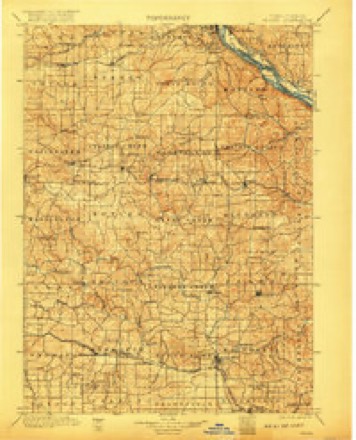
- 1901 USGS Peosta quadrangle1:125000, 4 printings
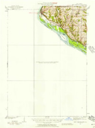
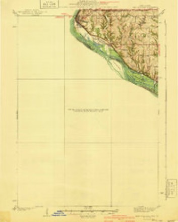
- 1935 USGS East Dubuque quadrangle1:62500
- 1940 USGS East Dubuque quadrangle1:62500, 3 printings
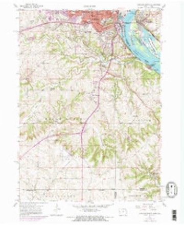
- 1955 USGS Dubuque South quadrangle1:24000, 3 printings
- 1959 USGS Dubuque quadrangle1:250000
- 1961 USGS Dubuque quadrangle1:250000
- 1962 USGS Dubuque quadrangle1:250000, 2 printings
- 1976 USGS Dubuque quadrangle1:250000
- 1984 USGS Dubuque South quadrangle1:100000, 4 printings
Fires near this place
13 since 2007Regional context, not property-specific evidence. The federal wildfire occurrence database lists 13 fires within 5 miles of Center Grove between 2007 and 2018, burning about 48 acres in total. None started naturally. None was recorded as arson. Distance is straight-line from the map coordinates, so a fire counted here may appear on a neighbouring settlement's page as well.
| Reported cause | Fires |
|---|---|
| Missing data/not specified/undetermined | 7 |
| Debris and open burning | 4 |
| Smoking | 1 |
| Recreation and ceremony | 1 |
The most recent of them, most recent first, with the day each was reported and the service that recorded it.
| Date | Cause | Size | Reported by | Name on the report |
|---|---|---|---|---|
| 30 September 2012 | Recreation and ceremony | 1.0 acres | Iowa Department of Natural Resources | not named |
| 9 April 2014 | Debris and open burning | under an acre | Iowa Department of Natural Resources | not named |
| 1 April 2007 | Missing data/not specified/undetermined | under an acre | Iowa Department of Natural Resources | not named |
| 30 March 2018 | Debris and open burning | 1.0 acres | Iowa Department of Natural Resources | not named |
| 30 March 2011 | Missing data/not specified/undetermined | under an acre | Iowa Department of Natural Resources | 12250 SWILL VALLEY RD PEOSTA, IA 52068, IA |
| 28 March 2015 | Missing data/not specified/undetermined | 1.0 acres | Iowa Department of Natural Resources | not named |
| 22 March 2018 | Debris and open burning | 1.0 acres | Iowa Department of Natural Resources | not named |
| 21 March 2009 | Missing data/not specified/undetermined | 1.0 acres | Iowa Department of Natural Resources | not named |
Settlements close enough to share some of these fires:
Mines and quarries near this place
10 of 36 shownRegional context, not property-specific evidence. The federal mineral resources record lists 36 workings within 5 miles of Center Grove: 24 past producers, 9 unknowns, 3 producers. 3 still produce. What was taken out: Lead, Stone, Crushed/Broken, Zinc, Phosphorus-Phosphates. Distance is straight-line from the map coordinates, so a quarry counted here may appear on a neighbouring settlement's page as well.
| Where | Site | Commodity | Status | Recorded |
|---|---|---|---|---|
| Becker Quarry | Stone, Crushed/Broken, Limestone, Dimension | Past Producer | ||
| Bonson Mine | Zinc, Lead, Iron | Past Producer | Galena, Limonite, Sphalerite | |
| Brugh and Amsden Mine | Zinc, Lead | Past Producer | Galena, Sphalerite | |
| Unknown | Sand and Gravel, Construction | Past Producer | ||
| Beadle Mine, Dubuque and L Superior Mine | Lead, Zinc | Past Producer | Galena, Sphalerite | |
| Fourteenth Street Mine | Lead, Zinc | Past Producer | Galena, Sphalerite | |
| Levens Mine North Langworthy Mine | Lead, Zinc | Past Producer | Galena, Sphalerite | |
| Composite Section | Phosphorus-Phosphates | Past Producer | ||
| Creek Bank | Phosphorus-Phosphates | Past Producer | ||
| Creek Bank | Phosphorus-Phosphates | Past Producer |
Storms near this place
54 since 2007Regional context, not property-specific evidence. The National Weather Service names Center Grove in 54 storm reports between 2007 and 2025: 28 thunderstorm wind, 18 hail, 6 flash flood, 2 heavy rain. No death or injury is recorded in these reports. Each account below is quoted exactly as the forecast office filed it, from the NOAA Storm Events Database, and each date opens the federal record of that event.
| When | Event | Place named | Harm | What the report says |
|---|---|---|---|---|
| July 2007 | Flash Flood | Center Grove | $500,000 | Rainfall totals of 2 to 6 inches over a 7 hour period resulted in numerous flooded roads, creeks, streams, and rivers throughout Dubuque County. The following locations reported flooding during this event: Rupp Hollow Rd, W Locust St and 22nd St, 17th St and Locust St, all along Locust St, Downtown Dubuque, Highway 52 on the north side of town, Highway 52 and Clayhill Rd, 22nd St and White St, many roads north of Highway 20, English Mill Rd and N Cascade Rd, Paradise Valley Rd and Highway 52, and several areas along Highway 52 from Sageville, IA to Holy Cross, IA. It was also reported that portions of the Maquoketa River was well out of its banks and the river level was rising rapidly. |
| June 2009 | Thunderstorm Wind | Center Grove | $25,000 | Wind gusts estimated to be 65 mph blew some power lines down in Dubuque, IA around 845 am June 19. |
| March 2025 | Thunderstorm Wind | Center Grove | - | A large business sign blown down, just south of Pennsylvania Ave and JFK Road intersection. The time was estimated from radar information. |
| July 2025 | Thunderstorm Wind | Center Grove | - | A public report of damage to a swing set. |
| May 2024 | Hail | Center Grove | - | Reported at Amazon Facility in Dubuque. |
| July 2024 | Thunderstorm Wind | Center Grove | - | A trained spotter reported a 58 MPH thunderstorm wind gust. |
| July 2024 | Thunderstorm Wind | Center Grove | - | A trained spotter estimated a thunderstorm wind gust of 70 MPH. |
| June 2024 | Thunderstorm Wind | Center Grove | - | Large tree downed by the thunderstorm winds. |
| June 2024 | Thunderstorm Wind | Center Grove | - | Several trees down throughout the neighborhood, with one down on a house. |
| June 2024 | Flash Flood | Center Grove | - | Reports of basement flooding in the neighborhood. |
| June 2024 | Heavy Rain | Center Grove | - | Rainfall from the last two hours. |
| June 2022 | Thunderstorm Wind | Center Grove | - | A tree was blown down onto power lines. |
| July 2020 | Flash Flood | Center Grove | - | All intersections on Highway 20 from University Ave through downtown Dubuque are closed due to water over the roads. |
| August 2018 | Thunderstorm Wind | Center Grove | - | A State Official reported that at least two trees were uprooted in the city of Dubuque. |
| August 2018 | Thunderstorm Wind | Center Grove | - | A trained spotter reported down power lines. |
| July 2017 | Thunderstorm Wind | Center Grove | - | Local law enforcement reported multiple trees were down throughout the city of Dubuque from high winds. |
| July 2017 | Thunderstorm Wind | Center Grove | - | The county emergency manager reported numerous trees were down in the city of Dubuque. Also, many roads were impassable due to a combination of trees down and flash flooding occurring. |
| July 2017 | Thunderstorm Wind | Center Grove | - | The county emergency manager received numerous reports of branches and a few trees down in the city of Dubuque. |
| July 2017 | Thunderstorm Wind | Center Grove | - | A trained spotter reported a 10 inch in diameter ash tree was blown over along with several 2 to 4 inch in diameter tree limbs. |
| June 2017 | Hail | Center Grove | - | The hail lasted for 5 minutes. |
| July 2017 | Hail | Center Grove | - | Local law enforcement reported multiple occurrences of nickel to quarter sized hail throughout the city. |
| July 2017 | Thunderstorm Wind | Center Grove | - | Local law enforcement had received multiple reports of winds estimated at 50 to 60 mph. |
| June 2017 | Hail | Center Grove | - | Trained spotters reported numerous hail reports of 1 to 1.75 inch diameter hail across central and eastern Dubuque County, including the city of Dubuque. |
| July 2017 | Thunderstorm Wind | Center Grove | - | Local law enforcement reported trees down in the city of Dubuque, along with some power lines. |
| August 2016 | Thunderstorm Wind | Center Grove | - | A state official reported numerous tree limbs down where Highway 52 comes into Dubuque. Some of the limbs were down homes. |
| May 2016 | Thunderstorm Wind | Center Grove | - | Received via social media reports of power lines down and roof damage on the northwest side of Dubuque. |
| September 2015 | Hail | Center Grove | - | Pea to penny sized hail fell along with torrential rain. |
| June 2014 | Thunderstorm Wind | Center Grove | - | A trained spotter reported trees down at the Dubuque county fairgrounds. |
| June 2014 | Flash Flood | Center Grove | - | Law enforcement reported the intersection of 22nd and Central was closed due to flooding. |
| June 2014 | Flash Flood | Center Grove | - | Law enforcement 22nd street from central to elm closed due to street flooding. |
| June 2014 | Hail | Center Grove | - | The public reported hail the size of quarters. |
| June 2013 | Hail | Center Grove | - | Golf ball sized hail was reported on the north side of town. |
| April 2013 | Hail | Center Grove | - | Quarter sized hail fell about 2 miles west northwest of Dubuque, IA at 1210 pm CDT April 29. |
| April 2011 | Hail | Center Grove | - | Golf ball sized hail fell at Clarke University in Dubuque, IA at 823 pm CDT April 3. |
| April 2011 | Hail | Center Grove | - | Quarter sized hail fell 1 mile north of Dubuque, IA at 824 pm CDT April 3. |
| April 2011 | Hail | Center Grove | - | Golf ball sized hail fell on the south side of Dubuque, IA at 819 pm CDT April 3. |
| July 2011 | Hail | Center Grove | - | Half dollar sized hail fell in Dubuque, IA at 720 pm CDT July 27. |
| April 2010 | Hail | Center Grove | - | Half dollar sized hail fell in Dubuque, IA at 1050 pm April 5. This report was relayed by WREX TV. |
| June 2010 | Thunderstorm Wind | Center Grove | - | Wind gusts estimated to be 65 mph were observed in Dubuque, IA around 400 am June 23. |
| July 2010 | Thunderstorm Wind | Center Grove | - | Wind gusts estimated to be 65 mph blew down some large trees on the west side of Dubuque, IA at 909 pm CDT July 22. |
| July 2009 | Thunderstorm Wind | Center Grove | - | Wind gusts were estimated to be 60 mph in Dubuque, IA around 636 pm July 24. |
| July 2009 | Thunderstorm Wind | Center Grove | - | Wind gusts were estimated to be 65 mph at the Kennedy Mall in Dubuque, IA around 638 pm July 24. |
| April 2008 | Flash Flood | Center Grove | - | Numerous roads were closed due to high water. |
| May 2008 | Hail | Center Grove | - | A trained spotter reported hail the size of quarters near Center Grove. |
| June 2008 | Thunderstorm Wind | Center Grove | - | Wind gusts estimated to be 70 to 80 mph were observed in Dubuque, IA at 7:02 pm June 8. Winds of this magnitude were also reported across much of Dubuque County. |
| July 2007 | Thunderstorm Wind | Center Grove | - | Winds estimated to be 70 mph blew down some trees in the vicinity of 52nd Street North(Route 52) and Clay Hill Rd. |
| July 2007 | Thunderstorm Wind | Center Grove | - | Winds estimated to be 70 mph blew down some trees in the vicinity of Hales Mill Rd. and Derby Grange Rd. |
| July 2007 | Thunderstorm Wind | Center Grove | - | Winds estimated to be 70 mph blew down some trees on N Grandview Ave near Bunker Hill Golf Course. |
| August 2007 | Thunderstorm Wind | Center Grove | - | Winds estimated to be 65 mph blew down a tree on Highway 52 just north of Dubuque, IA. |
| June 2024 | Heavy Rain | Center Grove | - | no account filed |
| April 2023 | Hail | Center Grove | - | no account filed |
| June 2017 | Hail | Center Grove | - | no account filed |
| June 2017 | Hail | Center Grove | - | no account filed |
| June 2017 | Hail | Center Grove | - | no account filed |
Nearest settlements
The eight closest, with where each one stands in the county. Distances are straight-line, computed from the Geographic Names Information System coordinates.
| Map | Place | Distance | Sheets |
|---|---|---|---|
| Cathedral Square | 2.1 miles | 20 | |
| Asbury | 2.5 miles | 16 | |
| Rockdale | 2.7 miles | 20 | |
| Dubuque | 2.8 miles | 19 | |
| Key West | 3.4 miles | 20 | |
| Julien | 3.5 miles | 15 | |
| South Switch Junction | 3.7 miles | 20 | |
| Frith Spur | 4.1 miles | 19 |
Provenance
This settlement is recorded in the Geographic Names Information System as feature 455285. The sheet list is computed by point-in-boundary test against the United States Geological Survey's historical topographic inventory. Both are works of the United States government and carry no copyright under 17 U.S.C. 105.
Wildfire. Short, Karen C. 2022. Spatial wildfire occurrence data for the United States, 1992-2020 [FPA_FOD_20221014]. 6th Edition. Fort Collins, CO: Forest Service Research Data Archive. https://doi.org/10.2737/RDS-2013-0009.6 Collected with United States Government funding and usable without additional permissions or fees.
Mines and quarries. USGS Mineral Resources Data System (MRDS) https://mrdata.usgs.gov/mrds/ A work of the United States government, no copyright under 17 U.S.C. 105.
Storms. NOAA National Centers for Environmental Information, Storm Events Database https://www.ncei.noaa.gov/stormevents/ A work of the United States government, no copyright under 17 U.S.C. 105. Narratives are quoted verbatim from the National Weather Service report and are not edited or summarised.