Block
From the record
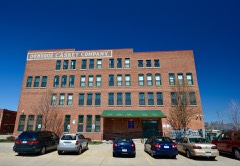
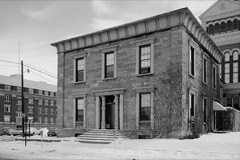
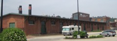
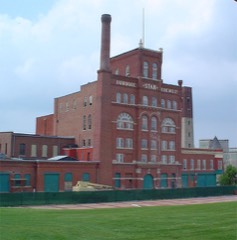
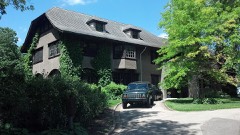
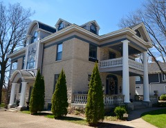
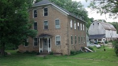
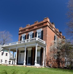
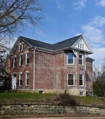
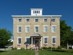
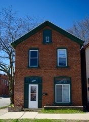
84 National Register listings published here, 3 of them National Historic Landmarks.
Sources: the National Register database, National Park Service
68 topographic sheets cover 55 settlements here, and 84 properties are on the National Register of Historic Places.
84 National Register listings published here, 3 of them National Historic Landmarks.
Sources: the National Register database, National Park Service
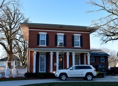
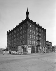
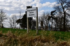
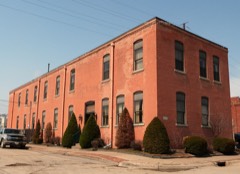
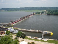
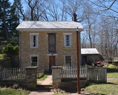
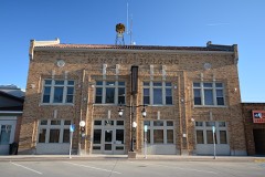
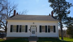
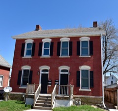
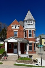
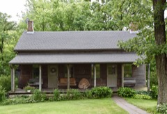
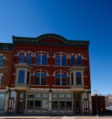
Every property in this county listed on the National Register of Historic Places, with the year it was listed and the federal nomination document.
Every wildfire the federal occurrence database records inside this county: 59 of them, burning about 318 acres. None started naturally and none was recorded as arson. Each settlement page carries the fires within five miles of it.
| Reported cause | Fires |
|---|---|
| Missing data/not specified/undetermined | 32 |
| Debris and open burning | 21 |
| Smoking | 4 |
| Recreation and ceremony | 1 |
| Railroad operations and maintenance | 1 |
The five largest, by the area the report gives. None of them was recorded as arson.
| Date | Cause | Size | Reported by | Name on the report |
|---|---|---|---|---|
| 20 March 2009 | Missing data/not specified/undetermined | 50 acres | Iowa Department of Natural Resources | not named |
| 10 April 2015 | Debris and open burning | 35 acres | Iowa Department of Natural Resources | not named |
| 23 March 2010 | Missing data/not specified/undetermined | 35 acres | Iowa Department of Natural Resources | 19598 COLONY RD., IOWA |
| 8 October 2012 | Debris and open burning | 30 acres | Iowa Department of Natural Resources | not named |
| 21 March 2015 | Debris and open burning | 22 acres | Iowa Department of Natural Resources | not named |
| 3 April 2019 | Missing data/not specified/undetermined | 20 acres | Iowa Department of Natural Resources | not named |
| 7 October 2011 | Missing data/not specified/undetermined | 20 acres | Iowa Department of Natural Resources | 24317 OLD HIGHWAY RD. EPWORTH, IA, IA |
| 6 October 2011 | Missing data/not specified/undetermined | 10 acres | Iowa Department of Natural Resources | 1/2 SOUTH OF HWY 3, IA |
Every settlement page carries the fires within five miles of it - see the settlement index below.
The NOAA Storm Events Database holds 700 reports for this county, causing no deaths, 16 injuries and about $77,479,800 in recorded property damage. Each settlement page carries the reports that name it.
| Kind of event | Reports |
|---|---|
| Thunderstorm Wind | 340 |
| Hail | 200 |
| Flash Flood | 68 |
| Heavy Rain | 35 |
| Tornado | 33 |
| Flood | 14 |
| Funnel Cloud | 8 |
| Lightning | 2 |
The most serious of them, by death, then injury, then recorded damage. The accounts are quoted exactly as the forecast office filed them.
| When | Event | Place named | Harm | What the report says |
|---|---|---|---|---|
| August 1994 | Hail | Durango | 4 hurt, $50,000 | no account filed |
| August 1994 | Thunderstorm Wind | Durango | 4 hurt, $50,000 | no account filed |
| June 2019 | Thunderstorm Wind | Fillmore | 2 hurt | An anchored mobile home was destroyed 4 S of Epworth with 2 injuries. Further southeast along the Epworth to Fillmore track, a home lost its roof. Another injury occurred near Bernard at 14029 Ryan Rd, where a barn was partially destroyed and trees snapped off. All injuries were not life threatening. |
| March 1991 | Tornado (F2) | not stated | 1 hurt, $250,000 | no account filed |
| April 2010 | Thunderstorm Wind | Bernard | 1 hurt, $25,000 | Wind gusts estimated to be 60 mph blew a semi truck off the road at the intersection of Highway 151 and Sundown Rd or about 9 miles west southwest of the Dubuque, IA Regional Airport at 1052 pm April 5. |
| October 1996 | Thunderstorm Wind | Epworth | 1 hurt, $20,000 | no account filed |
| October 1996 | Thunderstorm Wind | Epworth | 1 hurt, $20,000 | no account filed |
| June 2019 | Thunderstorm Wind | (Dbq)Dubuque Muni Ar | 1 hurt | Barn partially destroyed and trees snapped off. |
| June 2019 | Thunderstorm Wind | (Dbq)Dubuque Muni Ar | 1 hurt | Barn reported destroyed. One possible injury. |
| March 1990 | Tornado (F4) | not stated | $25,000,000 | no account filed |
| May 1999 | Flash Flood | Dubuque | $16,000,000 | Five to six feet of water flooded city streets in downtown. Major road damage resulted, including buckled roads and pavement washed away. Approximately 25 residential blocks were affected. Basements in over 60 houses were flooded with water from 2 feet deep up to the rafters. Flooding was reported between 20th and 28th Streets and between between Washington and Jackson streets. State damage estimates were set at $17 million in Dubuque. |
| July 2011 | Flash Flood | White Pine Hollow Sp | $7,000,000 | Torrential downpours of rain fell across much of Dubuque County during the evening of July 27 and early morning hours of July 28 resulting in flash flooding of much of the county, especially in Dubuque, IA. Rainfall totals of 7 to 15 inches were common across the area, with most of the rain falling in under 12 hours.||Numerous roads and bridges were washed out and many others closed, causing Dubuque County to run out of barricades. Several neighborhoods were evacuated, including the Valley Hill trailer park where the water was 6 feet deep. Many creeks in the area raged out of their banks, including Catfish Creek. Very early estimates of damage to infrastructure alone exceeded $3 Million. Numerous roads and streets were flooded, with some eroded or washed away completely. Among the hardest hit areas was the vicinities of St. Mary's Catholic Church, Elm Street and the Millwork District. The Dubuque water treatment plant was heavily damaged, with estimates between $1.5 Million and $2 Million. A basement wall caved in at 1790 Chaney Road on Dubuque's West End. |
| June 2008 | Flood | Balltown | $6,400,000 | no account filed |
| May 1999 | Flash Flood | Dyersville | $5,000,000 | Flash flooding along the The North Fork of the Maquoketa River caused extensive damage in Dyersville. Numerous businesses across town sustained major damage. The costliest damage occurred at Scale Models, which sustained an estimated $150,000 in damage. Other businesses reported flooding to depths of 7 feet in their basements. About 100 people were evacuated from 60 homes. State officials set the preliminary damage estimates from Dyersville at $3 to $5 million. |
| August 1994 | Hail | Dubuque | $5,000,000 | no account filed |
| May 1988 | Tornado (F1) | not stated | $2,500,000 | no account filed |
| April 2011 | Hail | Worthington | $1,000,000 | Golf ball sized hail fell 1 mile north of Worthington, IA around 722 pm CDT April 3. |
| July 2011 | Flash Flood | Zwingle | $1,000,000 | Torrential downpours of rain fell across much of Dubuque County during the evening of July 27 and early morning hours of July 28 resulting in flash flooding of much of the county, especially in Dubuque, IA. Rainfall totals of 7 to 15 inches were common across the area, with most of the rain falling in under 12 hours. Significant street flooding began between 7 and 8 pm and escalated as the night continued. |
| July 2003 | Thunderstorm Wind | Dubuque | $1,000,000 | Numerous trees down |
| July 2016 | Flash Flood | Sageville | $500,000 | Amateur radio report received of water over several roads in downtown Dubuque including Central Avenue and Jackson Streets which were closed. |
| April 2010 | Thunderstorm Wind | (Dbq)Dubuque Muni Ar | $500,000 | Wind gusts estimated to be 70 mph destroyed a hanger at the Dubuque, IA Regional Airport at 225 pm April 30. Parts of the hanger were lofted into two other hanger buildings damaging them. In addition, several airplanes inside the hangers were also heavily damaged. An airport official also contributed to this report. |
| July 2010 | Flash Flood | White Pine Hollow Sp | $500,000 | Heavy rains of 4 to 8 inches which fell in about 12 hours resulted in flash flooding of much of Dubuque County during the morning of July 23. At 1245 am CDT, about 15 inches of water was flowing in some streets in Dubuque as torrential rains continued. At 122 am CDT, the baseball field near the junction of Coffee Creek and the North Fork Maquoketa River in New Vienna was flooded with 4 feet of water. In addition, the North Fork of the Maquoketa River flooded and flood waters started to reach the edges of some residences in town. By 539 am CDT, Highway 52 north of Dubuque was closed due to flooding.||In Dyersville, both Bear Creek and the North Fork Maquoketa River overtopped, flooding various streets around town including a 3-block section of downtown near the historic basilica. One neighborhood was surrounded by water, forcing emergency crews to stage personnell in the isolated area. About 50 homes in Dyersvile were affected either by flooded basements or by loss of access. |
| July 2007 | Flash Flood | Center Grove | $500,000 | Rainfall totals of 2 to 6 inches over a 7 hour period resulted in numerous flooded roads, creeks, streams, and rivers throughout Dubuque County. The following locations reported flooding during this event: Rupp Hollow Rd, W Locust St and 22nd St, 17th St and Locust St, all along Locust St, Downtown Dubuque, Highway 52 on the north side of town, Highway 52 and Clayhill Rd, 22nd St and White St, many roads north of Highway 20, English Mill Rd and N Cascade Rd, Paradise Valley Rd and Highway 52, and several areas along Highway 52 from Sageville, IA to Holy Cross, IA. It was also reported that portions of the Maquoketa River was well out of its banks and the river level was rising rapidly. |
| July 1994 | Thunderstorm Wind | Dubuque | $500,000 | no account filed |
| August 1994 | Hail | Sageville | $500,000 | no account filed |
| August 1994 | Thunderstorm Wind | Dubuque | $500,000 | no account filed |
| August 2010 | Lightning | Luxemburg | $250,000 | A lightning strike was the likely cause of an early morning fire August 9 that caused significant damage to the Holy Trinity Catholic Church in Luxemburg, IA. Authorities were notified at 236 am CDT that flames were coming out of the church steeple. |
| June 2009 | Thunderstorm Wind | Farley | $250,000 | Wind gusts estimated to be 75 mph blew down numerous trees and damaged several buildings from about 2 miles southeast of Farley, IA through the Epworth and Peosta vicinities, to Dubuque, IA between 8 am and 9 am June 19. A 300 foot cattle shed near Peosta, IA was displaced from its foundation. |
| May 2008 | Tornado (EF1) | New Vienna | $250,000 | Tornado moved from Delaware County into Dubuque County. The tornado moved southeast across New Wine Park, damaging over 1,000 trees. It also damaged a barn and hay shelter before lifting near the intersection of Highway 136 and Floyd Road. |
| April 2011 | Flood | White Pine Hollow Sp | $250,000 | no account filed |
| June 1980 | Tornado (F1) | not stated | $250,000 | no account filed |
| September 1970 | Tornado (F2) | not stated | $250,000 | no account filed |
| April 1967 | Tornado (F2) | not stated | $250,000 | no account filed |
| April 2010 | Thunderstorm Wind | (Dbq)Dubuque Muni Ar | $150,000 | Wind gusts estimated to be 70 mph ripped the roof off of a house near the intersection of Buncombe Rd and Bennettville Rd or about 3 miles south southwest of the Dubuque, IA Regional Airport at 1050 pm April 5. |
| July 2011 | Lightning | Dubuque | $100,000 | Lightning struck a spire on Bishop's Block Building at the intersection of 1st and Main Streets in Dubuque, IA during the evening of July 27 causing bricks to shoot out over the street below. Some cars were damaged and a portion of the street was blocked. |
| July 2011 | Thunderstorm Wind | Key West | $100,000 | Wind gust between 65 and 75 mph caused two anaerobic digesters under construction at the Dubuque Water Pollution Control Plant to collapse around 610 am CDT July 11. |
| July 2010 | Thunderstorm Wind | Holy Cross | $100,000 | On US Highway 52 between Holy Cross and Rickardsville, numerous trees were uprooted and some farm outbuildings were damaged. The roof and doors were torn from an implement dealer. Three trees at a residence across the street were also blown down, with one of the trees landing on the house. |
| September 2010 | Thunderstorm Wind | Peosta | $100,000 | Wind gusts estimated to be 75 mph blew a semi-truck over on Highway 20 about 2 miles east of Peosta, IA around 515 pm CDT September 12. |
| June 1998 | Thunderstorm Wind | Countywide | $100,000 | Strong thunderstorm winds downed trees and power lines across the tri-state area of Northeast Iowa, Northern Illinois, and Southwest Wisconsin. Approximately 2000 customers of Alliant Utilities lost power during the storm.In the city of Dubuque numerous trees blocked streets with one tree falling on a pickup truck. At Sacred Heart Church the wind broke the face of the steeple clock, and at Loras College damage was sustained when lightning struck the boiler smokestack in the maintenance building. There was some basement flooding in the Loras College fieldhouse. Also in Dubuque, the roof was ripped off the Harbor Place Mall leaving 2 to 3 inches of standing water in the building, and another $5000 worth of damage was reported at the airport when strong gusts peeled panels off a hanger roof. Near Worthington a roof was blown off a large barn and seven other farm buildings were damaged by strong winds. Northeast of Luxemburg a farm received substantial damage when thunderstorm winds damaged a hog building, cattle shed, and several other farmsheds. One shed, used for storing vehicles and farm equipment, was ripped apart resulting in major damage to the vehicles inside the shed. The family home also sustained minor damage. |
| May 2016 | Thunderstorm Wind | Sageville | $90,000 | The emergency manager reported a roof was partially ripped off of a school. |
| June 2005 | Thunderstorm Wind | Balltown | $70,000 | A downburst/microburst occurred on a farm south of Balltown, Iowa. Part of a barn was destroyed and 30 trees on the property were downed. An additional 30 trees were downed in an area of timber just off the property. |
| April 2010 | Thunderstorm Wind | Fillmore | $50,000 | Wind gusts estimated to be 65 mph destroyed a barn about 6 miles northeast of Cascade, IA around 1038 pm April 5. |
| April 2010 | Thunderstorm Wind | (Dbq)Dubuque Muni Ar | $50,000 | Wind gusts estimated to be 70 mph blew some farm machinery over and downed some power lines about 2 miles southeast of the Dubuque, IA Regional Airport at 1050 pm April 5. |
| August 2009 | Thunderstorm Wind | Epworth | $50,000 | Wind gusts estimated to be 70 mph overturned a mobile home and uprooted several large trees in Epworth, IA around 100 pm August 9. |
| July 2003 | Thunderstorm Wind | Epworth | $50,000 | Tree down blocking Old Highway Rd |
| April 2004 | Thunderstorm Wind | Dubuque | $50,000 | no account filed |
| April 1994 | Hail | not stated | $50,000 | no account filed |
| April 1994 | Hail | New Vienna | $50,000 | no account filed |
| July 1994 | Thunderstorm Wind | Dubuque | $50,000 | no account filed |
| August 1994 | Thunderstorm Wind | Dubuque | $50,000 | no account filed |
| August 1994 | Thunderstorm Wind | Sageville | $50,000 | no account filed |
| June 2004 | Flash Flood | North Portion | $40,000 | Water over numerous roads in north part of county; Highway 52 closed at Rickardsville and Sageville |
| July 2011 | Thunderstorm Wind | Asbury | $25,000 | Wind gusts estimated to be 70 mph blew down some 12 inch diameter trees onto an outbuilding about 4 miles west northwest of Dubuque, IA at 602 am CDT July 11. |
| June 2009 | Thunderstorm Wind | Center Grove | $25,000 | Wind gusts estimated to be 65 mph blew some power lines down in Dubuque, IA around 845 am June 19. |
| June 2009 | Thunderstorm Wind | Dyersville | $25,000 | Wind gusts estimated to be 70 to 80 mph damaged numerous outbuildings south of Dyersville, IA around 830 am June 19. |
| June 2008 | Flash Flood | Dyersville | $25,000 | Heavy rains caused rapid rises in river levels along the North Fork Maquoketa River resulting in some flash flooding in Dyersville, IA around 2:00 pm June 8. Some Dyersville residences along the river were evacuated. |
| June 2008 | Flash Flood | Durango | $25,000 | Heavy rains caused the Little Maquoketa River to rise rapidly resulting in some flash flooding of Highway 52 near Durango, IA around 2:00 pm June 8.|The highway was closed until the flood waters receded. Some Durango residences along the river were evacuated. |
| July 1995 | Hail | Rickardsville | $25,000 | no account filed |
| March 1990 | Tornado (F1) | not stated | $25,000 | no account filed |
| May 1988 | Tornado (F0) | not stated | $25,000 | no account filed |
The Survey's mineral resources record lists 94 workings inside this county. 12 still produce and 82 are closed or unrecorded. Each settlement page carries the workings within five miles of it.
| Commodity | Workings |
|---|---|
| Stone, Crushed/Broken | 45 |
| Lead | 17 |
| Phosphorus-Phosphates | 12 |
| Zinc | 11 |
| Sand and Gravel, Construction | 11 |
| Lead, Zinc | 5 |
| Zinc, Lead | 2 |
| Zinc, Lead, Iron | 1 |
| Stone, Crushed/Broken, Limestone, Dimension | 1 |
The least common of them first, because a county's hundredth gravel pit says nothing its first ten did not.
| Where | Site | Commodity | Status | Recorded |
|---|---|---|---|---|
| Becker Quarry | Stone, Crushed/Broken, Limestone, Dimension | Past Producer | ||
| Bonson Mine | Zinc, Lead, Iron | Past Producer | Galena, Limonite, Sphalerite | |
| Brugh and Amsden Mine | Zinc, Lead | Past Producer | Galena, Sphalerite | |
| Fitzpatrick Mine | Zinc, Lead | Past Producer | ||
| Beadle Mine, Dubuque and L Superior Mine | Lead, Zinc | Past Producer | Galena, Sphalerite | |
| Durango Drybone Mine Ewing Diggings | Lead, Zinc | Past Producer | Galena, Smithsonite | |
| Fitzpatrick Mine | Lead, Zinc | Past Producer | Galena, Sphalerite | |
| Fourteenth Street Mine | Lead, Zinc | Past Producer | Galena, Sphalerite | |
| Levens Mine North Langworthy Mine | Lead, Zinc | Past Producer | Galena, Sphalerite | |
| Beadle Mine | Lead, Zinc | Unknown | Galena | |
| Beecher Sand Ltd. | Sand and Gravel, Construction | Producer | ||
| Bonson Mine | Zinc, Lead | Unknown | Sphalerite | |
| Brugh and Amsden Mine | Lead, Zinc | Unknown | Galena | |
| Dubuque Sand and Gravel Dredge | Sand and Gravel, Construction | Producer | ||
| Durango Drybone Mine | Zinc, Lead | Unknown | Sphalerite | |
| Fitzpatrick Mine | Zinc, Lead | Unknown | Sphalerite | |
| Fourteenth Street Mine | Zinc, Lead | Unknown | Sphalerite | |
| Kilbourne Mine | Lead, Zinc | Unknown | Galena | |
| Koopman Pit | Sand and Gravel, Construction | Past Producer | ||
| Level Mine | Lead, Zinc | Unknown | Galena | |
| Levens Mine | Lead, Zinc | Unknown | Galena | |
| Sauser Sand Pit | Sand and Gravel, Construction | Producer | ||
| Stewart and Bartlett Mine | Lead, Zinc | Unknown | Galena | |
| Stewarts Cave Mine | Lead, Zinc | Unknown | Galena | |
| Unknown | Sand and Gravel, Construction | Past Producer | ||
| Unknown | Sand and Gravel, Construction | Past Producer | ||
| Unknown | Sand and Gravel, Construction | Past Producer | ||
| Unknown | Sand and Gravel, Construction | Past Producer | ||
| Unknown | Sand and Gravel, Construction | Past Producer | ||
| Unknown | Sand and Gravel, Construction | Past Producer | ||
| Unknown | Sand and Gravel, Construction | Past Producer | ||
| Composite Section | Phosphorus-Phosphates | Past Producer | ||
| Creek Bank | Phosphorus-Phosphates | Past Producer | ||
| Creek Bank | Phosphorus-Phosphates | Past Producer | ||
| Creek Bank | Phosphorus-Phosphates | Past Producer | ||
| Excavation | Phosphorus-Phosphates | Past Producer | ||
| Occurrence | Phosphorus-Phosphates | Past Producer | ||
| Occurrence | Phosphorus-Phosphates | Past Producer | ||
| Roadcut | Phosphorus-Phosphates | Past Producer | ||
| Roadcut | Phosphorus-Phosphates | Past Producer | ||
| Roadcut | Phosphorus-Phosphates | Past Producer | ||
| Stream Bank | Phosphorus-Phosphates | Past Producer | ||
| Twin Springs Quarry | Phosphorus-Phosphates | Past Producer | ||
| Kilbourne Mine | Lead | Past Producer | Galena | |
| Level Mine | Lead | Past Producer | Galena | |
| Prospect | Lead | Occurrence | Galena | |
| Sherrills Mound Mines | Lead | Past Producer | ||
| Stewart and Bartlett Mine | Lead | Past Producer | Galena | |
| Stewarts Cave Mine | Lead | Past Producer | Galena | |
| Arnsdorf | Stone, Crushed/Broken | Past Producer | ||
| Beecher West Dubuque Quarry | Stone, Crushed/Broken | Past Producer | ||
| Bernard Quarry | Stone, Crushed/Broken | Past Producer | ||
| Bertling Quarry | Stone, Crushed/Broken | Past Producer | ||
| Browns Bottom Wash Plant Plant | Stone, Crushed/Broken | Producer | ||
| Dyersville Quarry | Stone, Crushed/Broken | Producer | ||
| Dzaboff Quarry | Stone, Crushed/Broken | Past Producer | ||
| Eagle Point Lime Works | Stone, Crushed/Broken | Past Producer | ||
| Hanten Quarry | Stone, Crushed/Broken | Past Producer | ||
| Hermsen Quarry | Stone, Crushed/Broken | Producer | ||
| Johns Creek Quarry | Stone, Crushed/Broken | Past Producer | ||
| Kemp Quarry | Stone, Crushed/Broken | Producer | ||
| Klein Quarry | Stone, Crushed/Broken | Past Producer | ||
| Koos Quarry | Stone, Crushed/Broken | Past Producer | ||
| Kurt Quarry | Stone, Crushed/Broken | Past Producer | ||
| Kutsch Quarry | Stone, Crushed/Broken | Past Producer | ||
| Lansing Quarry | Stone, Crushed/Broken | Past Producer | ||
| Lot 340 Quarry | Stone, Crushed/Broken | Producer | ||
| Mar Jo Hills Quarry | Stone, Crushed/Broken | Producer | ||
| Mattloch Quarry | Stone, Crushed/Broken | Past Producer | ||
| Mauser Farm | Stone, Crushed/Broken | Past Producer | ||
| Reiter Quarry | Stone, Crushed/Broken | Producer | ||
| Rose Spur Quarry & Mill | Stone, Crushed/Broken | Producer | ||
| Schlitche Quarry | Stone, Crushed/Broken | Past Producer | ||
| Thole Quarry | Stone, Crushed/Broken | Producer | ||
| Trappist Quarry | Stone, Crushed/Broken | Past Producer | ||
| Treester Quarry | Stone, Crushed/Broken | Past Producer | ||
| Unknown | Stone, Crushed/Broken | Past Producer | ||
| Unknown | Stone, Crushed/Broken | Past Producer | ||
| Unknown | Stone, Crushed/Broken | Past Producer | ||
| Unknown | Stone, Crushed/Broken | Past Producer | ||
| Unknown | Stone, Crushed/Broken | Past Producer | ||
| Unknown | Stone, Crushed/Broken | Past Producer | ||
| Unknown | Stone, Crushed/Broken | Past Producer | ||
| Unknown | Stone, Crushed/Broken | Past Producer | ||
| Unknown | Stone, Crushed/Broken | Past Producer | ||
| Unknown | Stone, Crushed/Broken | Past Producer | ||
| Unknown | Stone, Crushed/Broken | Past Producer | ||
| Unknown | Stone, Crushed/Broken | Past Producer | ||
| Unknown | Stone, Crushed/Broken | Past Producer | ||
| Unknown | Stone, Crushed/Broken | Past Producer | ||
| Unknown | Stone, Crushed/Broken | Past Producer | ||
| Unknown | Stone, Crushed/Broken | Past Producer | ||
| Unknown | Stone, Crushed/Broken | Past Producer | ||
| Wpa Quarry | Stone, Crushed/Broken | Past Producer |
Named settlements recorded in the Geographic Names Information System, each with the topographic sheets covering it. Villages, hamlets and abandoned places alike. Each is shown with the nearest named watercourse or landform and the survey quadrangle it falls on.
Table Mound township · Near Swiss Valley · Dubuque South quadrangle
20 sheets, 1901 to 1984
Washington township · 52079 · Zwingle quadrangle
19 sheets, 1901 to 1984
No longer a settlement
Dubuque city · 52001 · By Kellys Bluff · Dubuque South quadrangle
20 sheets, 1901 to 1984
Mosalem township · 52003 · By Horseshoe Bluff · Dubuque South quadrangle
20 sheets, 1901 to 1984
Dubuque city · 52003 · On North Fork Catfish Creek · Dubuque South quadrangle
20 sheets, 1901 to 1984
Peru township · 52039 · On North Fork Little Maquoketa River · Sherrill quadrangle
16 sheets, 1900 to 1984
New Wine township · 52040 · On Hewitt Creek · Dyersville East quadrangle
12 sheets, 1900 to 1984
Dubuque city · 52001 · Near Hamm Island · Dubuque North quadrangle
19 sheets, 1900 to 1984
Jefferson township · 52039 · Near Mangold Hollow · Sherrill quadrangle
16 sheets, 1900 to 1984
Dubuque city · 52001 · Near Union Park Hollow · Dubuque North quadrangle
19 sheets, 1900 to 1984
Dubuque township · 52001 · Near Union Park Hollow · Dubuque North quadrangle
19 sheets, 1900 to 1984
Table Mound township · 52003 · On South Fork Catfish Creek · Dubuque South quadrangle
20 sheets, 1901 to 1984
Mosalem township · 52003 · Near Ninemile Island · Menominee quadrangle
20 sheets, 1901 to 1984
New Wine township · 52065 · On Coffee Creek · New Vienna quadrangle
12 sheets, 1902 to 1984
Jefferson township · 52073 · Near Stegar Hollow · Holy Cross quadrangle
15 sheets, 1900 to 1984
Dubuque city · 52003 · On Middle Fork Catfish Creek · Dubuque South quadrangle
20 sheets, 1901 to 1984
Peru township · 52001 · On Little Maquoketa River · Dubuque North quadrangle
19 sheets, 1900 to 1984
Dubuque township · 52001 · Near Couler Valley · Dubuque North quadrangle
19 sheets, 1900 to 1984
Mosalem township · 52003 · Near Ninemile Island · Menominee quadrangle
20 sheets, 1901 to 1984
Jefferson township · 52073 · On Sherrill Mound · Sherrill quadrangle
16 sheets, 1900 to 1984
Dubuque city · 52003 · On Catfish Creek · Dubuque South quadrangle
20 sheets, 1901 to 1984
New Wine township · 52040 · On Hewitt Creek · Dyersville East quadrangle
12 sheets, 1900 to 1984
Jefferson township · 52073 · On Bunker Chute · Cassville quadrangle
16 sheets, 1900 to 1984
The vanished settlements of Dubuque County: the places named above that are no longer on the map.