 Block
Clarksville, Iowa
9 topographic sheets cover this place, the earliest surveyed in 1954 and the latest in 1984. It stands in Butler Township. It lies in ZIP code area 50619. It stands on Dry Creek. The Survey maps it on the Clarksville quadrangle. 1,264 people lived here at the 2020 count. It stands 942 feet above sea level.
Research this city
Population over time
2 figuresClarksville fell from 1,439 to 1,264 between 2010 and 2020. These are the recorded population figures Wikidata holds for this place, reached through the Geographic Names Information System number this page is keyed on rather than by name, so they belong to this place and not to another of the same name. Most are census counts, but not all are: an early figure may be a founding or settlement estimate, and an estimate published within five years of a census is left out. The change column is computed, and is left blank where more than 20 years separate a figure from the one before it, because a gap that long is not a change between two counts.
| Year | People | Change |
|---|---|---|
| 2010 | 1,439 | |
| 2020 | 1,264 | -175 (-12%) |
Topographic sheets covering this place
4 surveys from 9 printed sheetsMatched by testing this settlement's coordinate against the published boundary of every sheet in the United States Geological Survey's historical collection. Each opens the scanned sheet at the Survey.
- 1954 USGS Waterloo quadrangle1:250000, 4 printings
- 1955 USGS Waterloo quadrangle1:250000, 2 printings
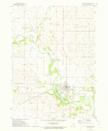
- 1971 USGS Clarksville quadrangle1:24000
- 1984 USGS Waverly quadrangle1:100000, 2 printings
Mines and quarries near this place
9 within 5 milesRegional context, not property-specific evidence. The federal mineral resources record lists 9 workings within 5 miles of Clarksville: 7 past producers, 2 producers. 2 still produce. What was taken out: Sand and Gravel, Construction, Stone, Crushed/Broken. Distance is straight-line from the map coordinates, so a quarry counted here may appear on a neighbouring settlement's page as well.
| Where | Site | Commodity | Status | Recorded |
|---|---|---|---|---|
| Engle-Clarksville Quarry | Stone, Crushed/Broken | Past Producer | ||
| Rattlesnake Quarry | Stone, Crushed/Broken | Past Producer | ||
| Unknown | Stone, Crushed/Broken | Past Producer | ||
| Clarksville Pit | Sand and Gravel, Construction | Past Producer | ||
| Hurd Pit | Sand and Gravel, Construction | Producer | ||
| Knocks Sand and Gravel | Sand and Gravel, Construction | Producer | ||
| Unknown | Sand and Gravel, Construction | Past Producer | ||
| Unknown | Sand and Gravel, Construction | Past Producer | ||
| Unknown | Sand and Gravel, Construction | Past Producer |
Storms near this place
56 since 1994Regional context, not property-specific evidence. The National Weather Service names Clarksville in 56 storm reports between 1994 and 2025: 19 thunderstorm wind, 19 hail, 8 heavy rain, 4 flash flood. No death or injury is recorded in these reports. Each account below is quoted exactly as the forecast office filed it, from the NOAA Storm Events Database, and each date opens the federal record of that event.
| When | Event | Place named | Harm | What the report says |
|---|---|---|---|---|
| July 1999 | Flash Flood | Clarksville | $500,000 | no account filed |
| September 2016 | Flood | Clarksville | $300,000 | Emergency Manager reported levee on the west side of Clarksville along the Shell Rock river failed and the southwest side of town is flooding. Residents being evacuated. |
| June 2014 | Thunderstorm Wind | Clarksville | $250,000 | Numerous trees and power lines down throughout town. Worst trees damage was on the southern and western side of town. Most trees in this region sustained limb damage or were snapped. Winds lasted six minutes based on spotter account. The falling trees damaged several houses, buildings, and power lines. |
| June 2014 | Tornado (EF1) | Clarksville | $200,000 | This short-lived tornado formed east of Clarksville and caused damage to multiple shelter belts. It strengthened to an EF1 as it passed over a house and removed part of its roof. The tornado damaged another house a mile further east before dissipating shortly thereafter. |
| June 2014 | Thunderstorm Wind | Clarksville | $70,000 | Swath of RFD winds south of the two tornadoes. Large tree snapped on farmstead. Empty grain bin rolled 75 yards to the ENE. Many tree limbs downed for a mile north and several miles E and W of this point. |
| September 2016 | Flood | Clarksville | $50,000 | Iowa DOT reported Highway 188 closed in both directions due to flooding. Detour in place. |
| September 2016 | Flood | Clarksville | $50,000 | Public reported water over the road on Highway 188 just south of Clarksville. |
| May 1998 | Thunderstorm Wind | Clarksville | $50,000 | no account filed |
| July 1994 | Thunderstorm Wind | Clarksville | $50,000 | no account filed |
| August 1997 | Thunderstorm Wind | Clarksville | $35,000 | no account filed |
| August 2007 | Thunderstorm Wind | Clarksville | $25,000 | Numerous trees were blown down, some up to one to two feet in diameter. One large tree fell on a home causing damage to the home. Power lines were down on roadways along with the trees. |
| August 2007 | Thunderstorm Wind | Clarksville | $15,000 | A NWS Employee estimated wind gusts of 65 to 70 mph in the town of Clarksville. |
| July 1995 | Hail | Clarksville | $15,000 | no account filed |
| September 2019 | Thunderstorm Wind | Clarksville | $10,000 | Law enforcement reported a large tree limb down on a home in Clarksville. Time estimated from radar. |
| April 2017 | Thunderstorm Wind | Clarksville | $10,000 | Public reported large tree down along with partial roof removed from a Morton building. Relayed by NWS employee. Time radar estimated. |
| July 2008 | Thunderstorm Wind | Clarksville | $10,000 | Four large trees were downed. |
| August 1995 | Thunderstorm Wind | Clarksville | $10,000 | The same front mentioned above remained stationary over Iowa during the night. A weak impulse moved along the front and resulted in the development of a mesoscale convective system. The thunderstorms were widespread, however most were not severe. One storm did produce high winds in Webster City. Numerous reports of downed trees and power lines were received. The high winds extended up to the Woolstock area in extreme southern Wright County. Farther east, the storms downed trees in the city of Clarksville. |
| April 2014 | Hail | Clarksville | $10,000 | no account filed |
| June 2009 | Thunderstorm Wind | Clarksville | $10,000 | no account filed |
| July 2007 | Hail | Clarksville | $10,000 | no account filed |
| July 2007 | Hail | Clarksville | $10,000 | no account filed |
| March 2006 | Thunderstorm Wind | Clarksville | $10,000 | no account filed |
| April 2017 | Thunderstorm Wind | Clarksville | $5,000 | Public reported estimated 60 plus mph winds and trees down. Report relayed by NWS employee. Time radar estimated. |
| June 2014 | Hail | Clarksville | $5,000 | Emergency Manager reported 1 inch diameter hail and winds of 50 to 60 MPH. |
| May 2010 | Flash Flood | Clarksville | $5,000 | Water running through fields and ditches and also ponding of water near Clarksville. |
| July 2008 | Thunderstorm Wind | Clarksville | $5,000 | Trees and power lines down in the city. |
| April 2014 | Hail | Clarksville | $5,000 | no account filed |
| June 2008 | Hail | Clarksville | $5,000 | no account filed |
| September 2005 | Thunderstorm Wind | Clarksville | $5,000 | no account filed |
| July 2003 | Thunderstorm Wind | Clarksville | $5,000 | no account filed |
| April 2009 | Hail | Clarksville | $3,000 | Report received from a KIMT spotter. |
| September 2005 | Hail | Clarksville | $2,000 | no account filed |
| July 2003 | Thunderstorm Wind | Clarksville | $2,000 | no account filed |
| April 2008 | Hail | Clarksville | $1,000 | no account filed |
| September 2001 | Hail | Clarksville | $1,000 | no account filed |
| May 2025 | Funnel Cloud | Clarksville | - | Report via social media. |
| August 2025 | Thunderstorm Wind | Clarksville | - | Trained spotter report of a tree down in town. |
| September 2025 | Hail | Clarksville | - | Clarksville fire department reported half inch to three quarter inch sized hail. |
| July 2020 | Hail | Clarksville | - | NWS employee reported quarter sized hail southwest of Clarksville. |
| June 2020 | Hail | Clarksville | - | Fire Department reported quarter sized hail mixed with smaller hail lasting approximately ten minutes. |
| June 2018 | Hail | Clarksville | - | KWWL relayed a public report of quarter sized hail. |
| June 2017 | Hail | Clarksville | - | Local fire department reported penny sized hail. |
| September 2017 | Heavy Rain | Clarksville | - | Public reported storm total heavy rainfall of 2.84 inches. |
| September 2016 | Flash Flood | Clarksville | - | Law enforcement reported water up to the wheel wells of a pickup truck along 220th st near Terrace Ave. |
| September 2016 | Heavy Rain | Clarksville | - | CoCoRaHS observer recorded heavy rainfall of 2.30 inches over the last 24 hours. |
| September 2016 | Heavy Rain | Clarksville | - | Trained spotter reported heavy rainfall of 2.9 inches roughly over the last two hours. |
| September 2016 | Flash Flood | Clarksville | - | Public reported several rural roads north of Clarksville impassable due to water flowing over them. Time radar estimated. |
| September 2016 | Heavy Rain | Clarksville | - | Trained spotter reported heavy rainfall of 3.25 inches. This is an updated rainfall total from an earlier report as rain has now stopped. |
| September 2016 | Heavy Rain | Clarksville | - | Trained spotter reported heavy rainfall of 4.17 inches storm total on the north end of town. |
| September 2016 | Heavy Rain | Clarksville | - | Clarksville fire department reported heavy rainfall on the day of 4.6 inches. |
| August 2016 | Heavy Rain | Clarksville | - | KWWL recorded heavy rainfall of 2.77 inches. Came in two waves, morning storm followed by evening storms. |
| July 2008 | Heavy Rain | Clarksville | - | Rainfall in the past hour and one half was 2.44 inches. |
| July 2021 | Hail | Clarksville | - | no account filed |
| June 2012 | Hail | Clarksville | - | no account filed |
| March 2007 | Funnel Cloud | Clarksville | - | no account filed |
| May 2003 | Hail | Clarksville | - | no account filed |
Nearest settlements
The eight closest, with where each one stands in the county. Distances are straight-line, computed from the Geographic Names Information System coordinates.
| Map | Place | Distance | Sheets |
|---|---|---|---|
| Packard | 5.7 miles | 9 | |
| Shell Rock | 6.8 miles | 9 | |
| Allison | 7.1 miles | 9 | |
| Coster | 8.1 miles | 9 | |
| Butler Center | 8.6 miles | 9 | |
| Wilmar | 8.9 miles | 9 | |
| Pilot Rock | 9.7 miles | 9 | |
| New Albion | 10.4 miles | 9 |
Elsewhere
Matched on this settlement's Geographic Names Information System number rather than its name, so it cannot be a different place of the same name in another state.
| Wikipedia article on Clarksville | An encyclopaedic summary. Its text is share-alike, so it is linked here rather than copied. |
| Wikidata item Q1947716 | The structured record the population and elevation above come from. Public domain (CC0). |
Provenance
This settlement is recorded in the Geographic Names Information System as feature 455441. The sheet list is computed by point-in-boundary test against the United States Geological Survey's historical topographic inventory. Both are works of the United States government and carry no copyright under 17 U.S.C. 105.
Mines and quarries. USGS Mineral Resources Data System (MRDS) https://mrdata.usgs.gov/mrds/ A work of the United States government, no copyright under 17 U.S.C. 105.
Storms. NOAA National Centers for Environmental Information, Storm Events Database https://www.ncei.noaa.gov/stormevents/ A work of the United States government, no copyright under 17 U.S.C. 105. Narratives are quoted verbatim from the National Weather Service report and are not edited or summarised.