 Block
Council Bluffs, Iowa
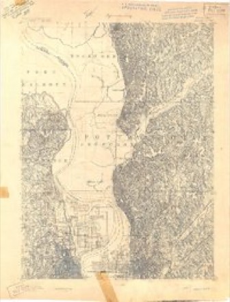
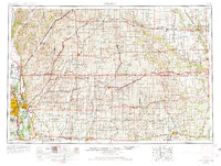
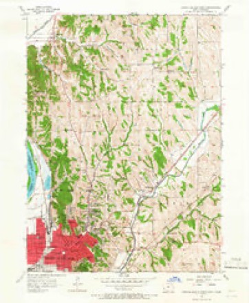
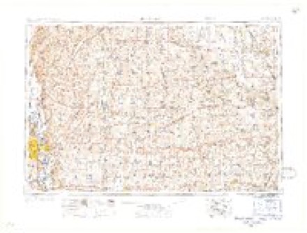
14 topographic sheets cover this place, the earliest surveyed in 1893 and the latest in 1994. It stands in Kane Township. It lies in ZIP code area 51501. The Survey maps it on the Council Bluffs North quadrangle. 62,799 people lived here at the 2020 count. It stands 1,089 feet above sea level.
Research this city
On record in Council Bluffs
Buildings and businesses the archive holds for this place. Each opens its own page, with the source record it came from.
On the National Register 12 of 34 shown
 Grenville M. Dodge HouseNational Historic Landmark · listed 1966
 Pottawattamie County JailNational Historic Landmark · listed 1972
 100 Block of West Broadway Historic Districtlisted 2002
 Bennett Buildinglisted 2001
 August Beresheim Houselisted 1976
 Jean and Inez Bregant Houselisted 2013
 Thomas E. Cavin Houselisted 1984
 Chevra B'nai Yisroel Synagoguelisted 2007
 Chicago, Rock Island & Pacific Railroad Passenger Depotlisted 1995
 Council Bluffs Free Public Librarylisted 1999
 Ruth Anne Dodge Memoriallisted 1980
 Shepard and Emma Farnsworth Houselisted 2018
Population over time
3 figuresCouncil Bluffs grew from 58,268 to 62,799 between 2000 and 2020. These are the recorded population figures Wikidata holds for this place, reached through the Geographic Names Information System number this page is keyed on rather than by name, so they belong to this place and not to another of the same name. Most are census counts, but not all are: an early figure may be a founding or settlement estimate, and an estimate published within five years of a census is left out. The change column is computed, and is left blank where more than 20 years separate a figure from the one before it, because a gap that long is not a change between two counts.
| Year | People | Change |
|---|---|---|
| 2000 | 58,268 | |
| 2010 | 62,230 | +3,962 (+7%) |
| 2020 | 62,799 | +569 (+1%) |
Topographic sheets covering this place
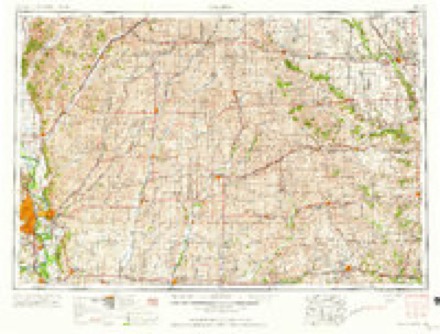
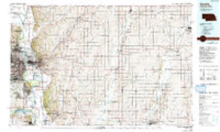
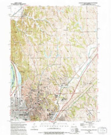
7 surveys from 14 printed sheetsMatched by testing this settlement's coordinate against the published boundary of every sheet in the United States Geological Survey's historical collection. Each opens the scanned sheet at the Survey.
- 1893 USGS Omaha quadrangle1:62500
- 1954 USGS Omaha quadrangle1:250000, 3 printings
- 1956 USGS Council Bluffs North quadrangle1:24000, 4 printings
- 1957 USGS Omaha quadrangle1:250000
- 1958 USGS Omaha quadrangle1:250000, 2 printings
- 1985 USGS Omaha quadrangle1:100000, 2 printings
- 1994 USGS Council Bluffs North quadrangle1:24000
Fires near this place
14 since 2007Regional context, not property-specific evidence. The federal wildfire occurrence database lists 14 fires within 5 miles of Council Bluffs between 2007 and 2020, burning about 322 acres in total. 1 started naturally. 1 was recorded as arson. Distance is straight-line from the map coordinates, so a fire counted here may appear on a neighbouring settlement's page as well.
| Reported cause | Fires |
|---|---|
| Missing data/not specified/undetermined | 8 |
| Debris and open burning | 3 |
| Natural | 1 |
| Smoking | 1 |
| Arson/incendiarism | 1 |
The most recent of them, most recent first, with the day each was reported and the service that recorded it.
| Date | Cause | Size | Reported by | Name on the report |
|---|---|---|---|---|
| 3 September 2020 | Missing data/not specified/undetermined | 1.0 acres | Iowa Department of Natural Resources | not named |
| 27 September 2020 | Missing data/not specified/undetermined | 1.0 acres | Iowa Department of Natural Resources | not named |
| 22 April 2018 | Natural | 300 acres | Iowa Department of Natural Resources | not named |
| 21 April 2018 | Missing data/not specified/undetermined | 1.0 acres | Iowa Department of Natural Resources | not named |
| 20 April 2018 | Debris and open burning | 3.0 acres | Iowa Department of Natural Resources | not named |
| 19 April 2018 | Arson/incendiarism | 1.0 acres | Iowa Department of Natural Resources | not named |
| 17 April 2018 | Missing data/not specified/undetermined | 5.0 acres | Iowa Department of Natural Resources | not named |
| 15 April 2007 | Missing data/not specified/undetermined | under an acre | Iowa Department of Natural Resources | not named |
Settlements close enough to share some of these fires:
Mines and quarries near this place
7 within 5 milesRegional context, not property-specific evidence. The federal mineral resources record lists 7 workings within 5 miles of Council Bluffs: 7 past producers. None of them still produces. What was taken out: Sand and Gravel, Construction, Lead, Smelter, Clay. Distance is straight-line from the map coordinates, so a quarry counted here may appear on a neighbouring settlement's page as well.
| Where | Site | Commodity | Status | Recorded |
|---|---|---|---|---|
| Asarco (Omaha) Refinery | Lead, Smelter | Past Producer | ||
| Unknown | Clay | Past Producer | ||
| Hively Pit | Sand and Gravel, Construction | Past Producer | ||
| Unknown | Sand and Gravel, Construction | Past Producer | ||
| Unknown | Sand and Gravel, Construction | Past Producer | ||
| Unknown | Sand and Gravel, Construction | Past Producer | ||
| Wickham Pit | Sand and Gravel, Construction | Past Producer |
Storms near this place
60 of 67 shownRegional context, not property-specific evidence. The National Weather Service names Council Bluffs in 67 storm reports between 1994 and 2026: 35 hail, 21 thunderstorm wind, 6 flash flood, 2 funnel cloud. The reports record 1 death and 2 injuries. Each account below is quoted exactly as the forecast office filed it, from the NOAA Storm Events Database, and each date opens the federal record of that event.
| When | Event | Place named | Harm | What the report says |
|---|---|---|---|---|
| April 2001 | Thunderstorm Wind | Council Bluffs | 1 killed, 1 hurt, $20,000 | Two men working alone atop a new meatpacking building were blown off the 40-foot-high roof by the thunderstorm that rolled through the area and produced the widespread hail reports. The winds were measured at 35 to 40 mph at the Council Bluffs airport and at Omaha Eppley Airfield, but could have been locally stronger. One of the men died later that day as a result of the fall. The sudden wind gust blew a section of roof and the men off the building. |
| August 2004 | Lightning | Council Bluffs | 1 hurt | Lightning stuck a home and critically injured a 15 year-old boy who was shocked while on a computer. |
| August 1999 | Flash Flood | Council Bluffs | $4,000,000 | Very heavy rain fell across eastern Nebraska and western Iowa from Friday 8/6/99 into Saturday morning 8/7/99. Over 10 inches of rain fell at Omaha Eppley Airfield, just across the Missouri River to the west of Council Bluffs Iowa. An unofficial 24 hour rainfall total of 13 inches was reported at Treynor, 10 miles east of Council Bluffs. The heavy rain caused significant damage to around 3000 homes in Council Bluffs with over 3 million dollars damage. Severe street and basement flooding was also observed in Council Bluffs and other homes throughout the county. |
| April 1994 | Thunderstorm Wind | Council Bluffs | $50,000 | no account filed |
| August 1994 | Thunderstorm Wind | Council Bluffs | $5,000 | Warm, humid, and very unstable air moved over Iowa during the afternoon of the 7th. A warm front moved northeast across the state during the day. During the late afternoon hours a cold front approached the northwest corner of the state. Very humid air was drawn north just ahead of the cold front. Dew point temperatures were in the lower to middle 70s over most of the state by evening. Northwest flow in the middle and upper levels brought in relatively cool air aloft over the area. As a result the lifted indices were in the -10 to -12. range. By early evening, convective available potential energy values reached 4000-6000 J-Kg-1 over much of the west half of Iowa. Thunderstorms fired in two areas initially. The first was over southern Minnesota. The second was over north central Nebraska. The two areas propagated south and grew toward each other with time. Though the storms were tornadic over Minnesota, the main severe weather event for Iowa was hail and high winds. The Minnesota convection dropped into north central and northeast Iowa. Dime-size hail was the result. There were sporadic reports of marble to dime-size hail for about 45 minutes over Winnebago County. Dime-size hail also fell over northwest Hancock County as the storms entered the Woden area. After this time, they weakened as they continued to move south-southeast. As the mesoscale convective system over Nebraska built into southeast South Dakota and northwest Iowa, high winds and hail resulted. Hail ranged in size from three quarter inch to golf ball in size. In Cherokee County, hail damage was reported to many cars in the city of Cherokee by hail 2 inches in diameter. Reports showed at least 150 cars and 100 homes were damaged by the hail. A tornado touched down northwest of Sibley, in Osceola County. One farmstead was hit with damage reported to several buildings, one was destroyed. A woman received minor injuries when she was cut on the hand by flying glass. Five hogs were killed when a concrete block building was collapsed. The building housed 300 hogs. A silo was destroyed on the farm and carried a mile to the south. At the same time one of the cars was lifted and thrown 50 feet. At about the same time, a farmhouse in rural Sibley was struck by lightning. The house was set on fire and was totally lost. Also in Osceola County, north of Sibley, a farmstead was hit by high winds in advance of the tornado. A concrete was destroyed and the end of the barn was completely removed. Woodbury and Monona Counties were hard hit by high winds. The first reports came from Danbury, where 60 to 65 MPH winds were reported. Numerous reports of trees and power lines being downed by high winds were received from Woodbury County. In Monona County, Mapleton and the area around it were hard hit. In the town of Mapleton, the roof was blown off of a car dealership, and the roof was caved in on one apartment building. In the downtown area, winds blew out a three quarter inch thick plate glass window. Several farmsteads were damaged by the winds as well. Two farms had significant structural damage. Another reported one grain bin blown off its foundation, and six others had the sides collapsed and bent over. Twelve hogs were killed when a quonset building was destroyed. One man was injured in Crawford County when high winds downed a large tree limb in front of the car that he was driving. The storms continued south, though they had weakened with winds around 50 MPH. Spotty damage occurred. High winds downed trees and limbs in Harrison County at Dunlap and Pottawattamie County at Council Bluffs. Several tents were blown down by the wind at the County Fair in Dunlap as well. There were also several lightning strikes. Lightning set a house on fire southwest of Sibley, destroying it. A barn was a total loss to fire northeast of Mapleton when lightning struck it. Another storm moved across Shelby County. Lightning struck two house in Harlan. Damage occurred to each, but actual dollar amount was not available. |
| April 2026 | Hail | Council Bluffs | - | Public report of hail estimated up to 1 inch in diameter near Carter Lake, IA. |
| April 2026 | Hail | Council Bluffs | - | Delayed public report of hail estimated up to 1 inch in diameter in Council Bluffs, IA. Time estimated with radar. |
| April 2025 | Hail | Council Bluffs | - | Trained spotter measured hail up to 1 inch in diameter. |
| April 2025 | Hail | Council Bluffs | - | Public estimated hail up to 1.25 inch in diameter, from mPING report. |
| April 2025 | Hail | Council Bluffs | - | Public estimated hail up to 1.25 inch in diameter from social media images. Time estimated with radar. |
| May 2024 | Hail | Council Bluffs | - | Amateur Radio reported golf ball sized hail falling in Council Bluffs. |
| April 2024 | Tornado (EF1) | Council Bluffs | - | The ground-level tornado circulation developed near 35th and Broadway in Council Bluffs, producing an intermittent track as it progressed north-northeast through a neighborhood, damaging trees, roofs, and apartment buildings. Peak winds were estimated to be at 110 miles per hour, with a peak width in this segment of the track of 75 yards, and an estimated average width of 50 yards. This tornado continued into Douglas County where it caused EF-2 damage at Eppley Airfield, then moved back into Pottawattamie County shortly after. |
| July 2024 | Hail | Council Bluffs | - | Emergency management reported quarter to ping-pong ball sized hail on the northeast side of Council Bluffs. Severe hail lasted for just under ten minutes at this location. |
| June 2024 | Hail | Council Bluffs | - | A very slow moving supercell thunderstorm developed over downtown Omaha. After remaining stationary for about 30 minutes, it slowly started moving to the south. This storm began producing severe hail in a swath from Council Bluffs to eastern Sarpy County. Multiple reports of hail ranging from quarter to tennis ball sized were received by the office via social media and phone calls from the public and trained spotters. |
| June 2024 | Hail | Council Bluffs | - | The office received a public report of quarter sized hail from mPING. |
| April 2023 | Flash Flood | Council Bluffs | - | Emergency manager reported water over the intersection of 33rd Street and 3rd Avenue. |
| June 2022 | Hail | Council Bluffs | - | Emergency management reported 1 inch hail. |
| August 2021 | Flash Flood | Council Bluffs | - | Trained spotter reported 2-4 feet of water over roads. |
| August 2021 | Flash Flood | Council Bluffs | - | Public reported flooded basements. |
| August 2021 | Flash Flood | Council Bluffs | - | Emergency manager reported several flooded roads in the city. A couple of cars have been stranded. |
| June 2018 | Thunderstorm Wind | Council Bluffs | - | Large tree limbs were blown down, partially blocking a street in Council Bluffs. |
| August 2018 | Flash Flood | Council Bluffs | - | The road was closed due to flooding. |
| June 2017 | Hail | Council Bluffs | - | A storm chaser reported quarter size to ping pong ball size hail. |
| August 2016 | Thunderstorm Wind | Council Bluffs | - | Tree limbs up to 4 inches in diameter were blown down. |
| May 2014 | Thunderstorm Wind | Council Bluffs | - | Tree damage, which knocked down some power lines, was mainly reported on the northwest side of Council Bluffs. At the peak there were 3168 customers around Council Bluffs without power. |
| June 2013 | Thunderstorm Wind | Council Bluffs | - | A bowing thunderstorm complex that brought fairly widespread tree damage to a large part of Omaha moved into the Council Bluffs area and then eventually through much of Pottawattamie and southern Shelby counties. Many trees were split or uprooted in Council Bluffs which caused damage to vehicles and homes and brought scattered power outages to town. A wind gust of 60 mph was measured by thw Awos at the Council Bluffs airport at 1010 am CDT. |
| August 2011 | Thunderstorm Wind | Council Bluffs | - | Thunderstorm wind gusts estimated at around 60 mph accompanied hail that reached up to baseball-size in the Council Bluffs area. The wind driven hail caused extensive damage to homes, vehicles and trees around town. |
| August 2011 | Hail | Council Bluffs | - | Hail up to baseball-size which was accompanied by thunderstorm wind gusts estimated at around 60 mph caused extensive damage to homes and vehicles in the Council Bluffs area. Iowa Western Community College had at least a million dollars worth of damage to buildings, mainly to roofs, windows and siding, according to the college's vice president of marketing and public relations. |
| June 2011 | Thunderstorm Wind | Council Bluffs | - | Thunderstorm wind gusts estimated at over 60 mph caused tree damage across parts of Council Bluffs which in turned downed power lines knocking out power to around 4,000 people in town. |
| July 2010 | Thunderstorm Wind | Council Bluffs | - | Thunderstorm wind gusts of around 60 mph downed large tree limbs from Council Bluffs to southeast of town. One limb caught a power line going into a house pulling the mast off exposing live wires which started an attic fire. |
| October 2007 | Hail | Council Bluffs | - | One inch hail was reported near Interstate 29 in Council Bluffs. |
| August 2007 | Funnel Cloud | Council Bluffs | - | A funnel cloud was reported by a spotter moving up and down near 29th Street and Avenue G. The funnel was caught on video and played later on a local tv station. |
| August 2007 | Thunderstorm Wind | Council Bluffs | - | A local media meteorologist measured a wind gust of 74 mph in Council Bluffs. The strong winds caused scattered tree damage in town including downed power lines. |
| March 2006 | Thunderstorm Wind | Council Bluffs | - | Thunderstorm wind gusts estimated at 60 mph broke off some 6 inch diameter tree limbs in town. The winds were from the same cluster of cells that produced the weak tornado in the Papillion, Nebraska area. |
| July 2006 | Thunderstorm Wind | Council Bluffs | - | Thunderstorm winds estimated at 60 mph downed large tree limbs which fell onto power lines near 35th and West Broadway Streets. |
| June 2005 | Hail | Council Bluffs | - | The hail was accompanied by 50 to 55 mph winds. |
| June 2005 | Thunderstorm Wind | Council Bluffs | - | Thunderstorm wind gusts estimated at 60 mph blew a tree down on a golf course east of Council Bluffs, knocked several other tree branches down and also blew over some lawn furniture and caused some shingle damage. |
| June 2004 | Thunderstorm Wind | Council Bluffs | - | Thunderstorm wind gusts estimated at over 60 mph blew down a tree 16 inches in diameter in Council Bluffs. The winds also caused an unoccupied house that was being refurbished to collapse. |
| August 2004 | Thunderstorm Wind | Council Bluffs | - | Thunderstorm wind gusts estimated at 60 mph broke large tree limbs from Council Bluffs to 6 miles east of town. |
| July 2004 | Thunderstorm Wind | Council Bluffs | - | Thunderstorm wind gusts estimated at 70 mph downed numerous tree limbs in the northern and eastern sections of Council Bluffs. Power was knocked out for several hours for 150-175 homes. |
| May 2003 | Thunderstorm Wind | Council Bluffs | - | A thunderstorm wind gust was estimated at 60 mph just east of Council Bluffs. This was from the same thunderstorm that produced 1 inch hail. |
| June 2003 | Thunderstorm Wind | Council Bluffs | - | A thunderstorm wind gust estimated at 60 mph downed a large tree in Council Bluffs. |
| June 2003 | Tornado (F0) | Council Bluffs | - | A trained spotter reported a brief touchdown of a tornado in an open field around 10 miles east of Council Bluffs. The tornado was also spotted by air traffic controllers at Omaha Eppley Airfield. |
| May 2002 | Thunderstorm Wind | Council Bluffs | - | A storm spotter estimated thunderstorm wind gusts of around 60 mph. |
| April 2001 | Hail | Council Bluffs | - | See the narrative for Douglas county, Nebraska, for the event that began at 1040 CST. |
| May 2001 | Hail | Council Bluffs | - | See the narrative for Douglas county Nebraska. |
| May 1998 | Hail | Council Bluffs | - | At the Lewis and Clark monument |
| June 2014 | Hail | Council Bluffs | - | no account filed |
| May 2007 | Hail | Council Bluffs | - | no account filed |
| October 2007 | Hail | Council Bluffs | - | no account filed |
| June 2005 | Hail | Council Bluffs | - | no account filed |
| June 2005 | Hail | Council Bluffs | - | no account filed |
| May 2004 | Hail | Council Bluffs | - | no account filed |
| May 2004 | Hail | Council Bluffs | - | no account filed |
| May 2003 | Hail | Council Bluffs | - | no account filed |
| May 2003 | Hail | Council Bluffs | - | no account filed |
| May 2002 | Hail | Council Bluffs | - | no account filed |
| May 2002 | Hail | Council Bluffs | - | no account filed |
| July 2002 | Hail | Council Bluffs | - | no account filed |
| June 2001 | Hail | Council Bluffs | - | no account filed |
Nearest settlements
The eight closest, with where each one stands in the county. Distances are straight-line, computed from the Geographic Names Information System coordinates.
| Map | Place | Distance | Sheets |
|---|---|---|---|
| Carter Lake | 3.6 miles | 15 | |
| Chautauqua | 4.1 miles | 14 | |
| Gilliatt | 5.8 miles | 14 | |
| Clara | 6.6 miles | 15 | |
| Crescent | 7.1 miles | 14 | |
| Dumfries | 8.3 miles | 11 | |
| Weston | 8.4 miles | 12 | |
| Quick | 10.3 miles | 12 |
Elsewhere
Matched on this settlement's Geographic Names Information System number rather than its name, so it cannot be a different place of the same name in another state.
| Wikipedia article on Council Bluffs | An encyclopaedic summary. Its text is share-alike, so it is linked here rather than copied. |
| Wikidata item Q695565 | The structured record the population and elevation above come from. Public domain (CC0). |
Provenance
This settlement is recorded in the Geographic Names Information System as feature 455672. The sheet list is computed by point-in-boundary test against the United States Geological Survey's historical topographic inventory. Both are works of the United States government and carry no copyright under 17 U.S.C. 105.
Wildfire. Short, Karen C. 2022. Spatial wildfire occurrence data for the United States, 1992-2020 [FPA_FOD_20221014]. 6th Edition. Fort Collins, CO: Forest Service Research Data Archive. https://doi.org/10.2737/RDS-2013-0009.6 Collected with United States Government funding and usable without additional permissions or fees.
Mines and quarries. USGS Mineral Resources Data System (MRDS) https://mrdata.usgs.gov/mrds/ A work of the United States government, no copyright under 17 U.S.C. 105.
Storms. NOAA National Centers for Environmental Information, Storm Events Database https://www.ncei.noaa.gov/stormevents/ A work of the United States government, no copyright under 17 U.S.C. 105. Narratives are quoted verbatim from the National Weather Service report and are not edited or summarised.