Block
From the record
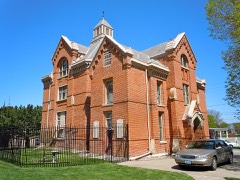
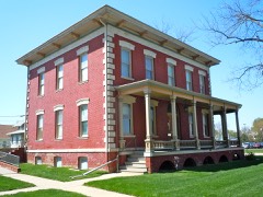
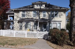
43 National Register listings published here, 2 of them National Historic Landmarks.
Sources: the National Register database, National Park Service
49 topographic sheets cover 33 settlements here, and 43 properties are on the National Register of Historic Places.
43 National Register listings published here, 2 of them National Historic Landmarks.
Sources: the National Register database, National Park Service
Every property in this county listed on the National Register of Historic Places, with the year it was listed and the federal nomination document.
Every wildfire the federal occurrence database records inside this county: 75 of them, burning about 5,183 acres. 2 started naturally and 5 were recorded as arson. Each settlement page carries the fires within five miles of it.
| Reported cause | Fires |
|---|---|
| Debris and open burning | 34 |
| Missing data/not specified/undetermined | 24 |
| Smoking | 5 |
| Arson/incendiarism | 5 |
| Equipment and vehicle use | 3 |
| Natural | 2 |
| Railroad operations and maintenance | 1 |
| Recreation and ceremony | 1 |
The five largest, by the area the report gives. Three of them were set deliberately.
| Date | Cause | Size | Reported by | Name on the report |
|---|---|---|---|---|
| 6 March 2005 | Missing data/not specified/undetermined | 4,000 acres | Iowa Department of Natural Resources | not named |
| 22 April 2018 | Natural | 300 acres | Iowa Department of Natural Resources | not named |
| 15 January 2014 | Debris and open burning | 120 acres | Iowa Department of Natural Resources | not named |
| 30 April 2018 | Equipment and vehicle use | 100 acres | Iowa Department of Natural Resources | not named |
| 17 March 2015 | Arson/incendiarism | 90 acres | Iowa Department of Natural Resources | not named |
| 26 March 2015 | Arson/incendiarism | 80 acres | Iowa Department of Natural Resources | not named |
| 31 March 2015 | Arson/incendiarism | 70 acres | Iowa Department of Natural Resources | not named |
| 18 March 2015 | Missing data/not specified/undetermined | 56 acres | DeSoto National Wildlife Refuge | SUBURBAN |
Every settlement page carries the fires within five miles of it - see the settlement index below.
The NOAA Storm Events Database holds 564 reports for this county, causing 5 deaths, 106 injuries and about $116,244,280 in recorded property damage. Each settlement page carries the reports that name it.
| Kind of event | Reports |
|---|---|
| Hail | 259 |
| Thunderstorm Wind | 195 |
| Tornado | 57 |
| Flood | 24 |
| Flash Flood | 19 |
| Funnel Cloud | 5 |
| Heavy Rain | 3 |
| Lightning | 2 |
The most serious of them, by death, then injury, then recorded damage. The accounts are quoted exactly as the forecast office filed them.
| When | Event | Place named | Harm | What the report says |
|---|---|---|---|---|
| June 2008 | Thunderstorm Wind | Lake Manawa | 2 killed, 1 hurt, $11,000,000 | This is a continuation of a 5 to 7 mile wide damage path that a bow-echo thunderstorm caused across eastern Nebraska and southwest Iowa. In Pottawattamie county Iowa it was estimated by a NWS storm survey that winds reached 70 to 90 mph in an area from Council Bluffs to southwest of Treynor and north of Mineola. There was a concentration of tree damage across this area, which also caused house and vehicle damage. Two adults were killed and one young female adult was injured in Council Bluffs when a tree crushed the parked car they were sitting in. Two Semis were blown off the Interstate near Council Bluffs and grain storage units near Treynor sustained serious damage. In Council Bluffs damage was also noted at the City's Recreation Center, the Public Library, the traffic building and a restaurant and golf course. Damage to trees alone in the northwest part of the city amounted to $275,000. From Council Bluffs the damage swath persisted to areas south and southeast of Macedonia, though wind speeds were estimated to have weakened to 60 to 70 mph. MidAmerican Energy reported that 13,000 customers lost power from the storm in southwest Iowa, including around 11,000 in the Council Bluffs area. According to FEMA and local emergency management damage across the county came to at least $13 million. |
| April 2024 | Tornado (EF3) | Mc Clelland | 1 killed, 3 hurt | A tornado developed approximately 3 miles east of McClelland, and developed prior to the dissipation of the EF-3 tornado that tracked near Treynor. This was confirmed by photo and video evidence of storm spotters. This tornado moved toward the north-northeast, damaging mainly trees, outbuildings and barns as it tracked towards Sumac Road and 330th Street. At this point, according to radar and storm damage indicators, the tornado rapidly intensified. An outbuilding was totally destroyed near Sycamore Road, and the tornado caused extensive tree damage east of 330th Road, south of Minden. The tornado intensified further, and widened to approximately 1200 yards as it impacted the town of Minden. Video and spotter reports indicate that there were multiple vortices within the tornado near Minden and points northeast, and there was evidence of narrow zones of the most intense damage which lines up very well with the multiple vortex tornado concept. In fact, there were damage indicators of EF-1 damage and high-end EF-3 damage within only 100 yards of each other. The most intense damage was on the far east side of Minden. Numerous homes were uninhabitable and several homes were completely destroyed. There were also several sizeable metal buildings southeast of Main Street that were completely destroyed. The construction of these metal structures and the homes that were most impacted, in conjunction with the tree damage and damage to cars with few if any cars being lofted and thrown indicated that this was a very strong EF-3 tornado, near the top of the damage range for an EF-3. The damage to the town of Minden was extensive, with three injuries. A fourth person succumbed to their injuries after the event, resulting in the only direct fatality of this tornado outbreak in the OAX area. The tornado continued northeast of Minden where it produced EF-3 damage at two homes along 345th Street. One of the homes was somewhat intact but was removed from its foundation and slid approximately 10 yards to the northeast. The other home had only small interior rooms remaining. It is worth noting that these two homes were 700 yards apart along the north-south street. EF-2 damage occurred along Whippoorwill Road. The tornado crossed Interstate 80 near 355th Street, flipping a semi, and produced damage of a mile wide along York Road just north of Interstate 80. This tornado continued briefly into Harrison County and then into Shelby County. EF-1 damage was noted in Harrison County and EF-3 damage was found in Shelby County 2 miles west of Harlan, Iowa. Peak estimated winds in Pottawattamie County from this tornado were estimated at 160 miles per hour. Maximum width was estimated at 1900 yards, with an average width of 850 yards. |
| April 2001 | Thunderstorm Wind | Council Bluffs | 1 killed, 1 hurt, $20,000 | Two men working alone atop a new meatpacking building were blown off the 40-foot-high roof by the thunderstorm that rolled through the area and produced the widespread hail reports. The winds were measured at 35 to 40 mph at the Council Bluffs airport and at Omaha Eppley Airfield, but could have been locally stronger. One of the men died later that day as a result of the fall. The sudden wind gust blew a section of roof and the men off the building. |
| May 1996 | Lightning | Lake Manawa | 1 killed, 1 hurt | no account filed |
| July 1988 | Tornado (F2) | not stated | 42 hurt, $25,000,000 | no account filed |
| July 1988 | Tornado (F3) | not stated | 34 hurt, $25,000,000 | no account filed |
| July 1988 | Tornado (F1) | not stated | 12 hurt, $25,000,000 | no account filed |
| June 1976 | Tornado (F4) | not stated | 6 hurt, $2,500,000 | no account filed |
| May 2012 | Thunderstorm Wind | Lake Manawa | 3 hurt | Three people were injured, including a 3-year-old boy, when thunderstorm wind gusts estimated at over 60 mph downed a large tree that fell on their tent at the Lake Manawa State Park. |
| April 1989 | Tornado (F0) | not stated | 2 hurt, $250,000 | no account filed |
| August 2004 | Lightning | Council Bluffs | 1 hurt | Lightning stuck a home and critically injured a 15 year-old boy who was shocked while on a computer. |
| September 2015 | Flash Flood | Chautauqua | $5,000,000 | Numerous reports of flash flooding were received from broadcast media, spotters, and social media. Very heavy rainfall occurred during the overnight and into the early morning hours on the 23rd with the Council Bluffs area seeing over 7 inches of rainfall. This lead to significant flash flooding of streets and small streams. This had a large impact on the morning rush hour with numerous cars stalled with several water rescues taking place. Basement flooding also occurred throughout the city during the morning hours. |
| August 2011 | Flood | Grable | $5,000,000 | Flooding along the Missouri River gradually worsened over western Pottawattamie county during June and July and persisted into August as record releases from Gavins Point Dam brought widespread flooding along the River. The river near Omaha climbed to a little under 36 feet by the end of June, flood stage is 29 feet, before falling slightly in July and a little more by early August. By the end of the month decreased releases from Gavins Point Dam had allowed the river to fall to around 31 feet. The flooding in Pottawattamie county closed roads along the river including 16 miles of Interstate 29 north of Council Bluffs and Interstate 680 east of north Omaha. Several parks and recreation areas were flooded along with parking lots and parts of the parking garages of 2 riverboat casinos. At least 100 homes in Council Bluffs were evacuated and about 10 businesses were closed. Tens of thousands of sandbags were filled and deployed to help shore up weak spots in the federal levee in the Council Bluffs area which came close to failing in July. Some homes near the river experienced seepage into basements from high ground water levels. Although river levels had dropped by the end of August, minor flooding persisted into September. The U.S. Army Corps of Engineers stated that a little over $6 million was spent on levee repair/work in Pottawattamie county. As the river fell by the end of August it became apparent that Interstate 680 had been undercut by the current completely destroying the pavement from the river to its junction with I29 near Crescent. The Iowa Farm Bureau Federation estimated that the flood event caused total crop and economic losses of $ 31.2 million in Pottawattamie county. |
| August 1999 | Flash Flood | Council Bluffs | $4,000,000 | Very heavy rain fell across eastern Nebraska and western Iowa from Friday 8/6/99 into Saturday morning 8/7/99. Over 10 inches of rain fell at Omaha Eppley Airfield, just across the Missouri River to the west of Council Bluffs Iowa. An unofficial 24 hour rainfall total of 13 inches was reported at Treynor, 10 miles east of Council Bluffs. The heavy rain caused significant damage to around 3000 homes in Council Bluffs with over 3 million dollars damage. Severe street and basement flooding was also observed in Council Bluffs and other homes throughout the county. |
| July 2011 | Flood | Grable | $3,000,000 | Flooding along the Missouri River gradually worsened over Pottawattamie county during June and persisted into July as record releases from Gavins Point Dam brought widespread flooding along the River. The river near Omaha climbed to a little under 36 feet by the end of June before falling slightly early in July before reaching a second peak around 36 feet in late July before falling slightly by early August. The flooding in Pottawattamie county closed 16 miles of Interstate 29 north of Council Bluffs and also closed I680 from the Mormon Bridge to its junction with I29 near Crescent. Several parks and recreation areas were also flooded along with the parking lots and parts of the parking garage of 2 riverboat casinos. Other county roads and farm land near the river were also flooded. At least 100 homes in Council Bluffs were evacuated and about 10 businesses were closed. Tens of thousands of sandbags were filled and deployed to help shore up weak spots in the federal levee in the Council Bluffs area. Some homes near the river experienced seepage into basements from high ground water levels. The flooding continued into August. As of early July the city of Council Bluffs had spent or committed over 5.5 million dollars for flood relief/prevention. |
| May 1988 | Tornado (F2) | not stated | $2,500,000 | no account filed |
| May 1987 | Tornado (F1) | not stated | $2,500,000 | no account filed |
| May 2007 | Flood | Avoca | $1,560,000 | Heavy rainfall over the weekend of May 4th through the 6th, caused the West Nishnabotna River to flood across Pottawattamie county. The West Nishnabotna River at Hancock crested around 20.5 feet between 1130 pm and midnight May 6th. Flood stage is 14 feet. The river at Hancock first crossed flood stage around 6 am cdt May 6th and didn't drop below flood stage until around 1 pm cdt on the 7th. The flooding affected farmland and many county roads in the area from around Avoca through Hancock. Some homes were also damaged. |
| May 1999 | Tornado (F2) | Treynor | $690,000 | Destroyed mostly farm buildings and equipment, did damage a few homes. |
| June 2024 | Flood | Loveland | $550,000 | Excessive rainfall across much of eastern South Dakota resulted in river flooding along the Missouri River at the end of June. Moderate flood stage was observed along the Missouri, with two Omaha river gauges cresting between 32.5 and 33.0 feet. Flood stage for this stretch of the Missouri ranges from 27.0 to 27.5 feet. At 3 pm, emergency management closed down Gifford Road in Council Bluffs as flood waters had reached the edge of the travel portion of the roadway. At 5:52 pm CDT on 6/25, Iowa Department of Transportation closed the I-680 Exit 1 westbound off-ramp as it became impassible due to flooding. By noon on 6/26, water was observed flowing over portions of the interstate and over lowlands into nearby farm fields. Later into the evening of the 26th, Iowa Department of Transportation reported numerous agricultural and local levee breaches west of Interstate 29 and north of Interstate 680 resulting in the rapid submerging of roads in this area. By 10:00 pm CDT, emergency management reported water to the shoulder of Interstate 29. By the morning of the 27th, water was observed on traffic cameras as covering segments of Interstate 29, primarily around mile marker 67.2 and north of Honey Creek. At 7:47 am CDT on the 29th, emergency management sent drone photos of I-29 completely submerged at and north of the I-680 interchange. Multiple ramps at the interchange were also submerged. At 3:30 pm CDT on the 29th, emergency management reported the waters had begun to recede, partially uncovering previously flooded stretches of Interstate 29. Damage in this county from the flood was estimated to be $637,250.00. |
| November 2015 | Tornado (EF1) | Avoca | $250,000 | The tornado started just south of the County Road 18 to the west of the city of Avoca, Iowa. The tornado tracked to the north northeast through open fields initially. Due to the recent harvest the tornado was easily tracked through the fields due to ground scouring of the left-over corn stocks. The tornado narrowly missed a farmstead along 420th street but did destroy one empty grain bin located across the street from the farm. The tornado continued to track across open fields until it crossed the busy Interstate 80 where a semi was lofted and tossed into a ditch on the north side of the interstate. At this location there were also large hardwood trees that were uprooted. The tornado continued to the northeast into Shelby County. |
| June 1992 | Tornado (F2) | not stated | $250,000 | no account filed |
| April 1991 | Tornado (F1) | not stated | $250,000 | no account filed |
| March 1990 | Tornado (F1) | not stated | $250,000 | no account filed |
| May 1970 | Tornado (F2) | not stated | $250,000 | no account filed |
| June 2011 | Flood | Grable | $200,000 | Flooding along the Missouri River gradually worsened over the area during June as record releases from Gavins Point Dam brought widespread flooding along the River. The river near Omaha climbed to around its 29 foot flood stage late in May, and then continued rising to a little under 36 feet by the end of June. The flooding in Pottawattamie county closed several parks and recreation areas and flooded parking lots and parts of the parking garage of 2 riverboat casinos. Some roads along the river also flooded including 16 miles of Interstate 29 north of Council Bluffs. At least 100 homes in Council Bluffs were evacuated and about 10 businesses were closed. Tens of thousands of sandbags were filled and deployed to help shore up weak spots in the federal levee in the Council Bluffs area. The flooding persisted into July. |
| June 2014 | Flash Flood | Lake Manawa | $150,000 | Heavy rainfall from a significant supercell caused widespread flooding across the city of Council Bluffs. Street flooding with water up to 3.5 feet deep occurred. This led to numerous cars becoming stranded and some water into homes and businesses. |
| April 2001 | Tornado (F1) | Carson | $110,000 | This tornado was caught on film by a storm chaser. Two large barns and an outbuilding were destroyed, and a roof was taken off of a house. From the same mini-supercell that first produced a tornado near Emerson, Iowa. |
| August 2011 | Flood | Lake Manawa | $100,000 | Rainfall of 1 to 3 inches that fell across the eastern sections of Council Bluffs caused areas of flash flooding, especially around the Playland Park neighbor hood. However, other streets flooded due to the unusually high water table because of the high water of the Missouri River which was in flood, including one westbound lane of Interstate 80 west of South 24th Street. Although the flash flooding subsided, general flooding of low areas persisted well into the afternoon and evening of August 22. The flooding caused at least 2 houses to partially collapse, although their foundation was likely weakened due to high ground water in the region and poor drainage. |
| July 1996 | Tornado (F1) | Shelby | $100,000 | no account filed |
| May 2024 | Flash Flood | Minden | $75,000 | The Pottawattamie Emergency Manager reported street flooding throughout the town of Minden. Sewer systems in the city were completely inundated with water flowing over roads at 340th Street between southeast Minden and the Keg Creek Bridge. |
| September 2011 | Flood | Loveland | $50,000 | Flooding along the Missouri River, which had gradually worsened over western Pottawattamie county during June and July, improved during August and basically ended by Sept. 11 as the river level at Omaha fell below its 29 foot flood stage. However, at it's peak the river near Omaha climbed to nearly 36 feet toward the end of June and remained very high into mid August. This caused extensive damage to Interstates 29 and 680 along with other roads and farm land in that area. Other properties near the river sustained flood damage and persistently high ground water also caused damage much of the summer. |
| August 2011 | Flash Flood | Lake Manawa | $50,000 | Rainfall of 1 to 3 inches that fell across the eastern sections of Council Bluffs caused areas of flash flooding, especially around the Playland Park neighborhood. However, other streets flooded due to the unusually high water table because of the high water of the Missouri River which was in flood. Twenty-four students had to be rescued by National Guard personnel when their school bus stalled out in 4 feet of water. Although the flash flooding subsided, general flooding of low areas persisted well into the afternoon and evening. |
| April 1994 | Hail | Oakland | $50,000 | no account filed |
| April 1994 | Thunderstorm Wind | Council Bluffs | $50,000 | no account filed |
| April 1994 | Thunderstorm Wind | Oakland | $50,000 | no account filed |
| July 1994 | Thunderstorm Wind | Avoca | $50,000 | no account filed |
| August 1993 | Thunderstorm Wind | Macedonia | $50,000 | no account filed |
| August 1993 | Tornado (F0) | Macedonia | $50,000 | no account filed |
| August 1993 | Thunderstorm Wind | Ankeny | $50,000 | no account filed |
| June 1990 | Tornado (F0) | not stated | $25,000 | no account filed |
| May 1987 | Tornado (F1) | not stated | $25,000 | no account filed |
| May 1987 | Tornado (F1) | not stated | $25,000 | no account filed |
| May 1975 | Tornado (F2) | not stated | $25,000 | no account filed |
| May 1975 | Tornado (F2) | not stated | $25,000 | no account filed |
| June 2010 | Flash Flood | Underwood | $20,000 | Heavy rain of around 2 inches fell in about an hours time in the Underwood area. The rain caused a lot of lowland flooding around the Underwood area with several roads under water for a time. Some water damage was also noted around town either by it entering basements or collecting on flat rooftops. |
| May 2011 | Flood | Island Park | $10,000 | High releases from upstream reservoirs brought steadily increasing flows along the Missouri River. The river near Omaha climbed to around its 29 foot flood stage late on May 27th, and then continued rising into June while the river near Blair began flooding a few days earlier. The flooding in Pottawattamie county closed at least several parks and recreation areas and began flooding the parking lots of 2 riverboat casinos. Some roads along the river also flooded. The flooding got worse in June. |
| March 2010 | Flood | Grable | $10,000 | The combination of melting snow and several rain episodes caused the Missouri River to flood southwest of Missouri Valley. The river flooded a few roads near the river and also the Wilson Island SRA where most of the 135-140 campsites were flooded. Damage likely occurred to the SRA's septic system and expenses were incurred after the event to pump the water out of low areas. |
| July 2010 | Flood | Grable | $10,000 | Lowland flooding from heavy rain over much of eastern Nebraska and western Iowa during most of June carried over through much of July into August along the Missouri River in the Omaha area. The high waters frequently flooded Wilson Island Park which remained closed from when it first flooded on June 18th through July and August. A few roads by the river also flooded. Rising water also periodically flooded a riverboat casino's parking lot and lower level of a parking garage. |
| July 2000 | Thunderstorm Wind | Oakland | $10,000 | Thunderstorm winds downed trees and a machine shed east of Oakland. |
| May 1999 | Tornado (F0) | Treynor | $10,000 | Stayed mostly in open fields, did destroy a hog shed. |
| June 1996 | Hail | Treynor | $10,000 | no account filed |
| September 2014 | Flood | Hancock | $5,000 | Heavy rainfall at the end of August allowed the West Nishnabotna River to rise above flood stage on the early morning on the 1st, crest during the early afternoon, and fall below flood stage during the early evening. The flooding was minor and confined to low-lying areas along the river. |
| June 2010 | Flood | Grable | $5,000 | Heavy rain over much of eastern Nebraska and western Iowa during most of June caused a prolonged period of flooding along the Missouri River, especially downstream of Omaha through Rulo. In addition, increased flows from the Platte River caused the Missouri River to back up a bit increasing levels in the Council Bluffs area and just upstream. The high waters flooded Wilson Island Park for over a week and also crossed a few roads by the river and approached the parking lots of riverboat casinos. |
| August 1994 | Thunderstorm Wind | Council Bluffs | $5,000 | Warm, humid, and very unstable air moved over Iowa during the afternoon of the 7th. A warm front moved northeast across the state during the day. During the late afternoon hours a cold front approached the northwest corner of the state. Very humid air was drawn north just ahead of the cold front. Dew point temperatures were in the lower to middle 70s over most of the state by evening. Northwest flow in the middle and upper levels brought in relatively cool air aloft over the area. As a result the lifted indices were in the -10 to -12. range. By early evening, convective available potential energy values reached 4000-6000 J-Kg-1 over much of the west half of Iowa. Thunderstorms fired in two areas initially. The first was over southern Minnesota. The second was over north central Nebraska. The two areas propagated south and grew toward each other with time. Though the storms were tornadic over Minnesota, the main severe weather event for Iowa was hail and high winds. The Minnesota convection dropped into north central and northeast Iowa. Dime-size hail was the result. There were sporadic reports of marble to dime-size hail for about 45 minutes over Winnebago County. Dime-size hail also fell over northwest Hancock County as the storms entered the Woden area. After this time, they weakened as they continued to move south-southeast. As the mesoscale convective system over Nebraska built into southeast South Dakota and northwest Iowa, high winds and hail resulted. Hail ranged in size from three quarter inch to golf ball in size. In Cherokee County, hail damage was reported to many cars in the city of Cherokee by hail 2 inches in diameter. Reports showed at least 150 cars and 100 homes were damaged by the hail. A tornado touched down northwest of Sibley, in Osceola County. One farmstead was hit with damage reported to several buildings, one was destroyed. A woman received minor injuries when she was cut on the hand by flying glass. Five hogs were killed when a concrete block building was collapsed. The building housed 300 hogs. A silo was destroyed on the farm and carried a mile to the south. At the same time one of the cars was lifted and thrown 50 feet. At about the same time, a farmhouse in rural Sibley was struck by lightning. The house was set on fire and was totally lost. Also in Osceola County, north of Sibley, a farmstead was hit by high winds in advance of the tornado. A concrete was destroyed and the end of the barn was completely removed. Woodbury and Monona Counties were hard hit by high winds. The first reports came from Danbury, where 60 to 65 MPH winds were reported. Numerous reports of trees and power lines being downed by high winds were received from Woodbury County. In Monona County, Mapleton and the area around it were hard hit. In the town of Mapleton, the roof was blown off of a car dealership, and the roof was caved in on one apartment building. In the downtown area, winds blew out a three quarter inch thick plate glass window. Several farmsteads were damaged by the winds as well. Two farms had significant structural damage. Another reported one grain bin blown off its foundation, and six others had the sides collapsed and bent over. Twelve hogs were killed when a quonset building was destroyed. One man was injured in Crawford County when high winds downed a large tree limb in front of the car that he was driving. The storms continued south, though they had weakened with winds around 50 MPH. Spotty damage occurred. High winds downed trees and limbs in Harrison County at Dunlap and Pottawattamie County at Council Bluffs. Several tents were blown down by the wind at the County Fair in Dunlap as well. There were also several lightning strikes. Lightning set a house on fire southwest of Sibley, destroying it. A barn was a total loss to fire northeast of Mapleton when lightning struck it. Another storm moved across Shelby County. Lightning struck two house in Harlan. Damage occurred to each, but actual dollar amount was not available. |
| September 1994 | Hail | Neola | $5,000 | no account filed |
| August 1993 | Thunderstorm Wind | Macedonia | $5,000 | no account filed |
| April 1991 | Tornado (F0) | not stated | $2,500 | no account filed |
| May 1987 | Tornado (F1) | not stated | $2,500 | no account filed |
| June 2011 | Flash Flood | Lake Manawa | $1,000 | Torrential rain caused relatively brief flash flooding of numerous streets in the Council Bluffs area. |
The Survey's mineral resources record lists 21 workings inside this county. 4 still produce and 17 are closed or unrecorded. Each settlement page carries the workings within five miles of it.
| Commodity | Workings |
|---|---|
| Sand and Gravel, Construction | 11 |
| Stone, Crushed/Broken | 8 |
| Clay | 1 |
| Sand and Gravel, Construction, Stone, Crushed/Broken | 1 |
The least common of them first, because a county's hundredth gravel pit says nothing its first ten did not.
| Where | Site | Commodity | Status | Recorded |
|---|---|---|---|---|
| Crescent Quarry | Sand and Gravel, Construction, Stone, Crushed/Broken | Producer | ||
| Unknown | Clay | Past Producer | ||
| K and S Qurry | Stone, Crushed/Broken | Producer | ||
| Macedonia | Stone, Crushed/Broken | Past Producer | ||
| North Macedonia | Stone, Crushed/Broken | Past Producer | ||
| Silver City Quarry | Stone, Crushed/Broken | Producer | ||
| South Macedonia | Stone, Crushed/Broken | Past Producer | ||
| Unknown | Stone, Crushed/Broken | Unknown | ||
| Unknown | Stone, Crushed/Broken | Past Producer | ||
| Unknown | Stone, Crushed/Broken | Past Producer | ||
| Avoca Plant | Sand and Gravel, Construction | Producer | ||
| Hively Pit | Sand and Gravel, Construction | Past Producer | ||
| Loveland Sand Pit | Sand and Gravel, Construction | Past Producer | ||
| Oakland Pit and Plant | Sand and Gravel, Construction | Past Producer | ||
| Unknown | Sand and Gravel, Construction | Past Producer | ||
| Unknown | Sand and Gravel, Construction | Unknown | ||
| Unknown | Sand and Gravel, Construction | Unknown | ||
| Unknown | Sand and Gravel, Construction | Past Producer | ||
| Unknown | Sand and Gravel, Construction | Past Producer | ||
| Unknown | Sand and Gravel, Construction | Past Producer | ||
| Wickham Pit | Sand and Gravel, Construction | Past Producer |
Named settlements recorded in the Geographic Names Information System, each with the topographic sheets covering it. Villages, hamlets and abandoned places alike. Each is shown with the nearest named watercourse or landform and the survey quadrangle it falls on.
Crescent township · 51526 · On Lapworth Creek · Omaha North quadrangle
15 sheets, 1893 to 1994
Crescent township · 51526 · On Crescent Creek · Council Bluffs North quadrangle
14 sheets, 1893 to 1994
Knox township · 51521 · Avoca quadrangle
10 sheets, 1954 to 1994
No longer a settlement
Knox township · 51521 · On East Branch West Nishnabotna River · Avoca quadrangle
10 sheets, 1954 to 1994
No longer a settlement
Keg Creek township · 51575 · On Little Silver Creek · Treynor quadrangle
10 sheets, 1954 to 1985
Hazel Dell township · 51576 · On Henchal Creek · McClelland quadrangle
12 sheets, 1954 to 1994
The vanished settlements of Pottawattamie County: the places named above that are no longer on the map.