 Block
Des Moines, Iowa
16 topographic sheets cover this place, the earliest surveyed in 1905 and the latest in 1984. It stands in Lee Township. It lies in ZIP code area 50316. It lies near Boatman Island. The Survey maps it on the Des Moines SE quadrangle. 214,133 people lived here at the 2020 count. It stands 955 feet above sea level.
Research this city
On record in Des Moines
Buildings and businesses the archive holds for this place. Each opens its own page, with the source record it came from.
On the National Register 12 of 191 shown
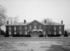 Fort Des Moines Provisional Army Officer Training SchoolNational Historic Landmark · listed 1974
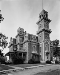 Terrace HillNational Historic Landmark · listed 1972
- Terrace HillNational Historic Landmark · listed 2003
 Abraham Lincoln High Schoollisted 2002
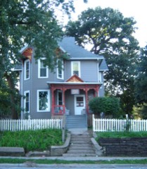 William W. and Elizabeth J. Ainsworth Houselisted 1998
 American Republic Insurance Company Headquarters Buildinglisted 2015
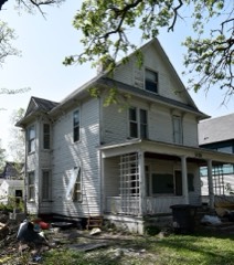 Josiah Andrews Houselisted 1988
 Apperson-Iowa Motor Car Company Buildinglisted 2016
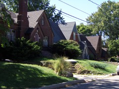 Ashby Manor Historic Districtlisted 1992
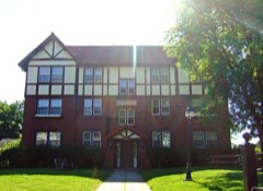 Ayrshire Apartmentslisted 1996
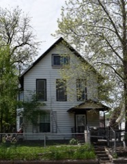 William H. and Alice Bailey Houselisted 1996
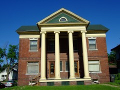 C. H. Baker Double Houselisted 1996
Population over time
2 figuresDes Moines grew from 203,433 to 214,133 between 2010 and 2020. These are the recorded population figures Wikidata holds for this place, reached through the Geographic Names Information System number this page is keyed on rather than by name, so they belong to this place and not to another of the same name. Most are census counts, but not all are: an early figure may be a founding or settlement estimate, and an estimate published within five years of a census is left out. The change column is computed, and is left blank where more than 20 years separate a figure from the one before it, because a gap that long is not a change between two counts.
| Year | People | Change |
|---|---|---|
| 2010 | 203,433 | |
| 2020 | 214,133 | +10,700 (+5%) |
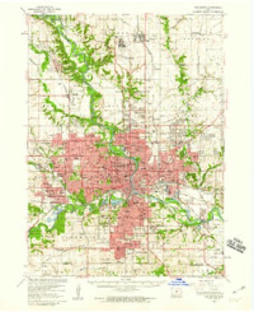
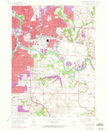
Topographic sheets covering this place
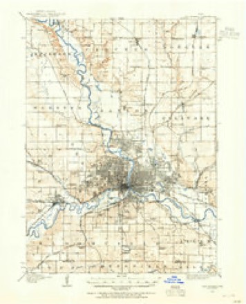
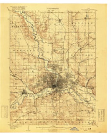
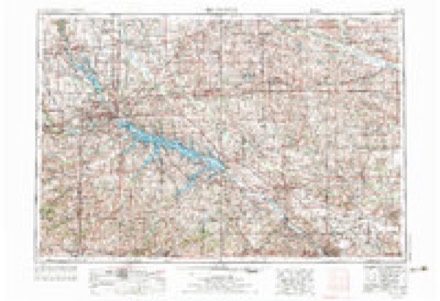
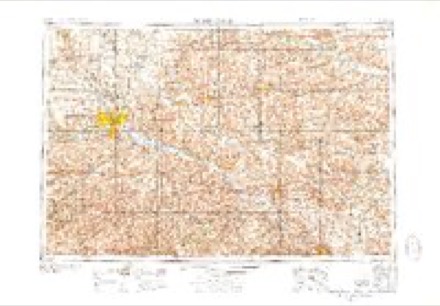
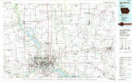
9 surveys from 16 printed sheetsMatched by testing this settlement's coordinate against the published boundary of every sheet in the United States Geological Survey's historical collection. Each opens the scanned sheet at the Survey.
- 1905 USGS Des Moines quadrangle1:62500
- 1907 USGS Des Moines quadrangle1:62500, 3 printings
- 1954 USGS Des Moines quadrangle1:250000, 2 printings
- 1956 USGS Des Moines quadrangle1:250000
- 1956 USGS Des Moines quadrangle1:62500
- 1956 USGS Des Moines SE quadrangle1:24000, 4 printings
- 1957 USGS Des Moines quadrangle1:250000
- 1969 USGS Des Moines quadrangle1:250000
- 1984 USGS Des Moines quadrangle1:100000, 2 printings
Fires near this place
6 since 2006Regional context, not property-specific evidence. The federal wildfire occurrence database lists 6 fires within 5 miles of Des Moines between 2006 and 2015, burning about 26 acres in total. None started naturally. None was recorded as arson. Distance is straight-line from the map coordinates, so a fire counted here may appear on a neighbouring settlement's page as well.
| Reported cause | Fires |
|---|---|
| Missing data/not specified/undetermined | 6 |
The most recent of them, most recent first, with the day each was reported and the service that recorded it.
| Date | Cause | Size | Reported by | Name on the report |
|---|---|---|---|---|
| 2 July 2011 | Missing data/not specified/undetermined | under an acre | Iowa Department of Natural Resources | U.S 20 @ N-57, IA |
| 4 April 2015 | Missing data/not specified/undetermined | under an acre | Iowa Department of Natural Resources | not named |
| 16 April 2009 | Missing data/not specified/undetermined | 5.0 acres | Iowa Department of Natural Resources | not named |
| 20 February 2009 | Missing data/not specified/undetermined | 20 acres | Iowa Department of Natural Resources | not named |
| 1 February 2006 | Missing data/not specified/undetermined | under an acre | Iowa Department of Natural Resources | not named |
| 13 January 2006 | Missing data/not specified/undetermined | under an acre | Iowa Department of Natural Resources | not named |
Settlements close enough to share some of these fires:
Mines and quarries near this place
9 within 5 milesRegional context, not property-specific evidence. The federal mineral resources record lists 9 workings within 5 miles of Des Moines: 6 past producers, 3 producers. 3 still produce. What was taken out: Sand and Gravel, Construction, Clay, Flagstone, Stone, Crushed/Broken. Distance is straight-line from the map coordinates, so a quarry counted here may appear on a neighbouring settlement's page as well.
| Where | Site | Commodity | Status | Recorded |
|---|---|---|---|---|
| Capitol Hill Sandstone Quarry | Flagstone | Past Producer | ||
| West Des Moines Plant #8 | Stone, Crushed/Broken | Producer | ||
| Can-Tex Industries West Pit | Clay | Producer | ||
| Goodwin Brick and Tile Co. Clay Pit | Clay | Past Producer | ||
| Iowa Clay Pipe Co. Pit | Clay | Past Producer | ||
| Bowser Pit | Sand and Gravel, Construction | Past Producer | ||
| Se 22nd St. Pit | Sand and Gravel, Construction | Past Producer | ||
| Unknown | Sand and Gravel, Construction | Past Producer | ||
| White Pit and Plant | Sand and Gravel, Construction | Producer |
Storms near this place
60 of 348 shownRegional context, not property-specific evidence. The National Weather Service names Des Moines in 348 storm reports between 1994 and 2025: 131 hail, 101 thunderstorm wind, 52 flood, 30 flash flood. The reports record 2 deaths and 48 injuries. Each account below is quoted exactly as the forecast office filed it, from the NOAA Storm Events Database, and each date opens the federal record of that event.
| When | Event | Place named | Harm | What the report says |
|---|---|---|---|---|
| February 1997 | Flash Flood | Des Moines | 1 killed, $30,000 | no account filed |
| June 2014 | Thunderstorm Wind | Des Moines | 1 killed, $1,000 | Thunderstorm winds blew down a large tree branch. A homeless individual died when a the branch fell on him at a homeless settlement along the banks of the Raccoon River east of Fluer Blvd. |
| June 1998 | Thunderstorm Wind | Des Moines | 40 hurt, $40,000,000 | no account filed |
| May 2004 | Dust Devil | Des Moines | 5 hurt | no account filed |
| September 2001 | Tornado (F1) | West Des Moines | 1 hurt, $500,000 | Tornado touched down on southwest edge of West Des Moines at the Glen Oaks Golf Club and swept into an apartment complex. Track was intermittent following the destruction of a garage unit there. |
| March 2007 | Lightning | Des Moines | 1 hurt | no account filed |
| August 2004 | Lightning | West Des Moines | 1 hurt | no account filed |
| June 2001 | Hail | West Des Moines | $9,500,000 | no account filed |
| June 2008 | Flash Flood | Des Moines | $7,000,000 | no account filed |
| June 1998 | Thunderstorm Wind | Des Moines | $4,000,000 | no account filed |
| August 2002 | Thunderstorm Wind | Des Moines | $2,500,000 | no account filed |
| June 1998 | Thunderstorm Wind | West Des Moines | $2,000,000 | no account filed |
| June 1998 | Flash Flood | Des Moines | $1,000,000 | no account filed |
| July 2010 | Flood | Des Moines | $500,000 | no account filed |
| June 1998 | Thunderstorm Wind | Des Moines | $500,000 | no account filed |
| May 2022 | Lightning | Des Moines | $400,000 | At 201 Grand Avenue, three condos suffered major damage and a fourth had minor damage from a fire believed to have been started by lightning according to firefighters. Time estimated using lightning data. |
| May 1996 | Flash Flood | Des Moines | $300,000 | no account filed |
| October 2019 | Hail | Des Moines | $250,000 | Public reported baseball sized hail via picture from social media. |
| June 2015 | Flood | Des Moines | $250,000 | The river crested at 16.21 feet at 3:30 PM CST on 16 June. |
| June 2015 | Flood | Des Moines | $250,000 | The Raccoon River at Des Moines Fleur Drive crested at 21.54 feet at 3:30 PM CST on 26 June. |
| July 2015 | Flood | Des Moines | $250,000 | The Raccoon River at Fleur Drive Des Moines crested at 12.83 feet at 5:15 PM CDT on 29 July. |
| June 2010 | Flood | Des Moines | $250,000 | no account filed |
| April 2007 | Flood | Des Moines | $250,000 | no account filed |
| June 2001 | Hail | West Des Moines | $250,000 | no account filed |
| June 2008 | Flood | Des Moines | $200,000 | One foot of water at Northwest 6th Drive between 49th and 51st. |
| June 2001 | Hail | West Des Moines | $200,000 | no account filed |
| July 1997 | Flash Flood | Des Moines | $200,000 | no account filed |
| May 1996 | Flood | Des Moines | $200,000 | no account filed |
| September 2014 | Flood | Des Moines | $150,000 | no account filed |
| May 2013 | Flood | Des Moines | $150,000 | no account filed |
| July 1998 | Flash Flood | Des Moines | $150,000 | no account filed |
| May 2019 | Flood | Des Moines | $100,000 | The Raccoon River at Des Moines Fleur Drive crested twice at 16.86 feet on 25 May 2019 at 06:30 UTC and at 17.42 feet on 29 May 2019 at 15:00 UTC. |
| June 2018 | Flash Flood | West Des Moines | $100,000 | Public reported that 63rd and Grand near West Des Moines was underwater. Water rescues were performed at this location as well. |
| December 2015 | Flood | Des Moines | $100,000 | The Raccoon River crested at 17.72 feet on 15 December 2015 at 23:30 UTC. |
| September 2013 | Thunderstorm Wind | Des Moines | $100,000 | Winds estimated at 65 MPH. |
| April 2012 | Thunderstorm Wind | West Des Moines | $100,000 | Most of the roof torn away on a commercial building. |
| April 2012 | Thunderstorm Wind | Des Moines | $100,000 | Large trees down near 18th and Woodland in the Sherman Hoyt area. Significant tree damage. |
| August 2010 | Flash Flood | Des Moines | $100,000 | Evacuations taking place from 3325 Hubble Ave at an apartment complex to 3560 Douglas Ave near a trailer Park in east Des Moines. |
| May 2000 | Tornado (F1) | Des Moines | $100,000 | Intermittent path |
| September 2014 | Flood | Des Moines | $100,000 | no account filed |
| March 2010 | Flood | Des Moines | $100,000 | no account filed |
| August 2010 | Flood | Des Moines | $100,000 | no account filed |
| May 2004 | Flash Flood | Des Moines | $100,000 | no account filed |
| August 2002 | Thunderstorm Wind | Des Moines | $100,000 | no account filed |
| August 2002 | Thunderstorm Wind | Des Moines | $100,000 | no account filed |
| August 2002 | Thunderstorm Wind | West Des Moines | $100,000 | no account filed |
| February 1997 | Flash Flood | Des Moines | $100,000 | no account filed |
| June 2019 | Flash Flood | Des Moines | $75,000 | Law enforcement reported 5 vehicles stranded and assistance needed to get people out of the water. |
| August 2010 | Flash Flood | West Des Moines | $75,000 | Public Works Department in Des Moines and West Des Moines reports water over the road at Grand and 61st. |
| July 2009 | Hail | Des Moines | $75,000 | Hail reported at the intersection of 2nd Ave and Euclid in the Highland Park area. |
| October 2007 | Tornado (EF1) | Des Moines | $75,000 | A tornado took down power lines and power poles were snapped at 13th Street and Mulberry. The public reported a flipped car at SW 6th Street and Mulberry. |
| May 2014 | Hail | West Des Moines | $75,000 | no account filed |
| May 2004 | Flash Flood | West Des Moines | $75,000 | no account filed |
| May 2004 | Flash Flood | Des Moines | $75,000 | no account filed |
| June 1998 | Flood | Des Moines | $75,000 | no account filed |
| June 1998 | Thunderstorm Wind | West Des Moines | $75,000 | no account filed |
| October 2018 | Flood | Des Moines | $50,000 | The Raccoon River at Des Moines at Fleur Drive crested twice, the first crest at 15.13 ft on 11 October 2018 at 02:30 UTC, the second crest at 15.06 ft on 13 October 2018 at 09:45 UTC. |
| May 2016 | Flood | Des Moines | $50,000 | The Raccoon River at Fleur Drive in Des Moines crested at 4:30 pm CDT on 1 May 2016 at 13.67 feet. |
| September 2015 | Flood | Des Moines | $50,000 | The Raccoon River at Des Moines Fleur Drive crested at 13.08 feet on 9 September 2015 at 10:45 pm CDT. |
| April 2012 | Thunderstorm Wind | Des Moines | $50,000 | South wind of 65 MPH was measured at the Blank Park Zoo. |
Nearest settlements
The eight closest, with where each one stands in the county. Distances are straight-line, computed from the Geographic Names Information System coordinates.
| Map | Place | Distance | Sheets |
|---|---|---|---|
| Easton Place | 2.4 miles | 16 | |
| Country Estate Village | 3.5 miles | 16 | |
| East Des Moines | 3.6 miles | 16 | |
| Swanwood | 3.6 miles | 16 | |
| Marquisville | 3.9 miles | 16 | |
| Norwoodville | 3.9 miles | 16 | |
| Bowsher | 4.4 miles | 16 | |
| Saylor | 4.6 miles | 16 |
Elsewhere
Matched on this settlement's Geographic Names Information System number rather than its name, so it cannot be a different place of the same name in another state.
| Wikipedia article on Des Moines | An encyclopaedic summary. Its text is share-alike, so it is linked here rather than copied. |
| Wikidata item Q39709 | The structured record the population and elevation above come from. Public domain (CC0). |
Provenance
This settlement is recorded in the Geographic Names Information System as feature 465961. The sheet list is computed by point-in-boundary test against the United States Geological Survey's historical topographic inventory. Both are works of the United States government and carry no copyright under 17 U.S.C. 105.
Wildfire. Short, Karen C. 2022. Spatial wildfire occurrence data for the United States, 1992-2020 [FPA_FOD_20221014]. 6th Edition. Fort Collins, CO: Forest Service Research Data Archive. https://doi.org/10.2737/RDS-2013-0009.6 Collected with United States Government funding and usable without additional permissions or fees.
Mines and quarries. USGS Mineral Resources Data System (MRDS) https://mrdata.usgs.gov/mrds/ A work of the United States government, no copyright under 17 U.S.C. 105.
Storms. NOAA National Centers for Environmental Information, Storm Events Database https://www.ncei.noaa.gov/stormevents/ A work of the United States government, no copyright under 17 U.S.C. 105. Narratives are quoted verbatim from the National Weather Service report and are not edited or summarised.