 Block
Dows, Iowa
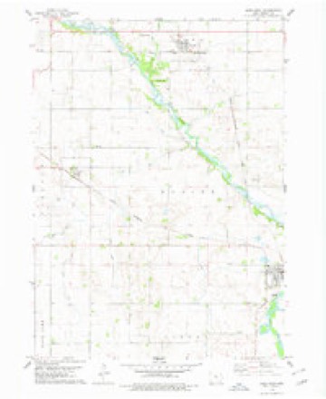
9 topographic sheets cover this place, the earliest surveyed in 1954 and the latest in 1984. It stands in Blaine Township. It lies in ZIP code area 50071. The Survey maps it on the Dows West quadrangle.
On record in Dows
Buildings and businesses the archive holds for this place. Each opens its own page, with the source record it came from.
On the National Register 3 records
 Burlington, Cedar Rapids & Northern Passenger Depot-Dowslisted 1993
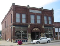 Fillmore Blocklisted 1998
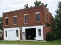 Quasdorf Blacksmith and Wagon Shoplisted 1994
Topographic sheets covering this place
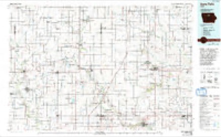
4 surveys from 9 printed sheetsMatched by testing this settlement's coordinate against the published boundary of every sheet in the United States Geological Survey's historical collection. Each opens the scanned sheet at the Survey.
- 1954 USGS Waterloo quadrangle1:250000, 4 printings
- 1955 USGS Waterloo quadrangle1:250000, 2 printings
- 1978 USGS Dows West quadrangle1:24000
- 1984 USGS Iowa Falls quadrangle1:100000, 2 printings
Mines and quarries near this place
10 within 5 milesRegional context, not property-specific evidence. The federal mineral resources record lists 10 workings within 5 miles of Dows: 8 past producers, 2 producers. 2 still produce. What was taken out: Sand and Gravel, Construction, Stone, Crushed/Broken. Distance is straight-line from the map coordinates, so a quarry counted here may appear on a neighbouring settlement's page as well.
| Where | Site | Commodity | Status | Recorded |
|---|---|---|---|---|
| Dows Quarry | Stone, Crushed/Broken | Producer | ||
| Denger Pit | Sand and Gravel, Construction | Past Producer | ||
| Dows Pit | Sand and Gravel, Construction | Past Producer | ||
| Marlowe Oakland Pit | Sand and Gravel, Construction | Past Producer | ||
| Meineke Pit | Sand and Gravel, Construction | Past Producer | ||
| Patterson Pit | Sand and Gravel, Construction | Past Producer | ||
| Stuck Pit | Sand and Gravel, Construction | Producer | ||
| Unknown | Sand and Gravel, Construction | Past Producer | ||
| Unknown | Sand and Gravel, Construction | Past Producer | ||
| Unknown | Sand and Gravel, Construction | Past Producer |
Storms near this place
27 since 1995Regional context, not property-specific evidence. The National Weather Service names Dows in 27 storm reports between 1995 and 2025: 15 thunderstorm wind, 7 hail, 2 tornado, 2 funnel cloud. No death or injury is recorded in these reports. Each account below is quoted exactly as the forecast office filed it, from the NOAA Storm Events Database, and each date opens the federal record of that event.
| When | Event | Place named | Harm | What the report says |
|---|---|---|---|---|
| May 1995 | Hail | Dows | $75,000 | no account filed |
| June 1997 | Thunderstorm Wind | Dows | $50,000 | no account filed |
| June 2025 | Thunderstorm Wind | Dows | $45,000 | Significant damage to an outbuilding on a farm near Dows. Images found via social media. |
| March 2005 | Tornado (F1) | Dows | $30,000 | Tornado destroyed a garage and ripped the roof off of a barn northwest of Dows. |
| April 2024 | Tornado (EF1) | Dows | $20,000 | This tornado entered into Wright County from Hamilton County. The tornado immediately impacted a hog confinement building upon entering the county producing severe damage to the back third of one of the buildings with EF1 damage. The tornado continued northward before a more northwest movement occurred and dissipated shortly thereafter. |
| June 2010 | Thunderstorm Wind | Dows | $20,000 | Semi blown over at mile post 154 on I-35. |
| June 2010 | Thunderstorm Wind | Dows | $10,000 | Trained spotter reports wind gusts in excess of 60 MPH. Power out in Dows. |
| April 2008 | Hail | Dows | $10,000 | no account filed |
| March 2006 | Thunderstorm Wind | Dows | $10,000 | no account filed |
| May 2004 | Thunderstorm Wind | Dows | $10,000 | no account filed |
| July 2013 | Thunderstorm Wind | Dows | $5,000 | A large tree branch was downed. It took out a power line and blocked a road. |
| July 2003 | Thunderstorm Wind | Dows | $5,000 | no account filed |
| July 2000 | Thunderstorm Wind | Dows | $5,000 | no account filed |
| April 2014 | Hail | Dows | $3,000 | no account filed |
| May 2008 | Hail | Dows | $2,000 | Report was received from a KCCI TV viewer. Time was estimated. |
| June 2005 | Thunderstorm Wind | Dows | $2,000 | no account filed |
| May 2004 | Hail | Dows | $2,000 | no account filed |
| August 2004 | Hail | Dows | $2,000 | no account filed |
| June 2025 | Thunderstorm Wind | Dows | - | Wind gust measured by an RWIS from the Iowa DOT. |
| June 2020 | Thunderstorm Wind | Dows | - | Williams RWIS report of 50 knot wind. |
| July 2018 | Thunderstorm Wind | Dows | - | Fire department reported large limbs down in town of around 6 to 8 inches in diameter. |
| September 2018 | Heavy Rain | Dows | - | Public reported heavy rainfall of 3.25 inches and still raining as of time of the report. |
| June 2017 | Funnel Cloud | Dows | - | Public reported a funnel cloud looking north of the truck stop near I-35 and Highway 20 interchange. |
| June 2017 | Thunderstorm Wind | Dows | - | Iowa DOT RWIS station measured a 60 mph wind gust. |
| July 2010 | Funnel Cloud | Dows | - | Small short-lived funnels extending less than half way down from the base of the cloud. |
| May 2010 | Hail | Dows | - | no account filed |
| June 2010 | Thunderstorm Wind | Dows | - | no account filed |
Nearest settlements
The eight closest, with where each one stands in the county. Distances are straight-line, computed from the Geographic Names Information System coordinates.
Provenance
This settlement is recorded in the Geographic Names Information System as feature 455978. The sheet list is computed by point-in-boundary test against the United States Geological Survey's historical topographic inventory. Both are works of the United States government and carry no copyright under 17 U.S.C. 105.
Mines and quarries. USGS Mineral Resources Data System (MRDS) https://mrdata.usgs.gov/mrds/ A work of the United States government, no copyright under 17 U.S.C. 105.
Storms. NOAA National Centers for Environmental Information, Storm Events Database https://www.ncei.noaa.gov/stormevents/ A work of the United States government, no copyright under 17 U.S.C. 105. Narratives are quoted verbatim from the National Weather Service report and are not edited or summarised.