 Block
Hiawatha, Iowa
18 topographic sheets cover this place, the earliest surveyed in 1888 and the latest in 1994. It stands in Monroe Township. It lies in ZIP code area 52233. The Survey maps it on the Cedar Rapids North quadrangle. 7,183 people lived here at the 2020 count. It stands 853 feet above sea level.
Research this city
On record in Hiawatha
Buildings and businesses the archive holds for this place. Each opens its own page, with the source record it came from.
On the National Register 1 record
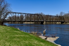 Chain Lakes Bridgelisted 1998
Population over time
2 figuresHiawatha grew from 7,024 to 7,183 between 2010 and 2020. These are the recorded population figures Wikidata holds for this place, reached through the Geographic Names Information System number this page is keyed on rather than by name, so they belong to this place and not to another of the same name. Most are census counts, but not all are: an early figure may be a founding or settlement estimate, and an estimate published within five years of a census is left out. The change column is computed, and is left blank where more than 20 years separate a figure from the one before it, because a gap that long is not a change between two counts.
| Year | People | Change |
|---|---|---|
| 2010 | 7,024 | |
| 2020 | 7,183 | +159 (+2%) |
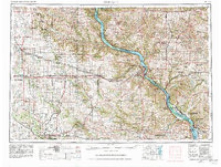
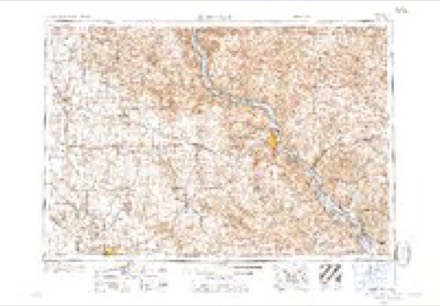
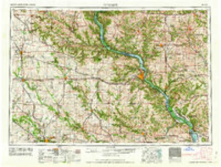
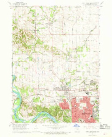
Topographic sheets covering this place
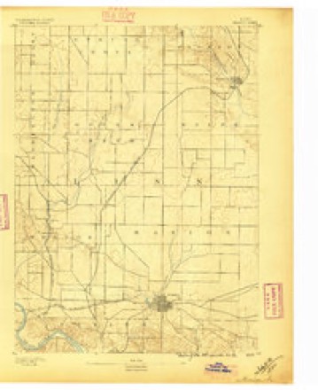
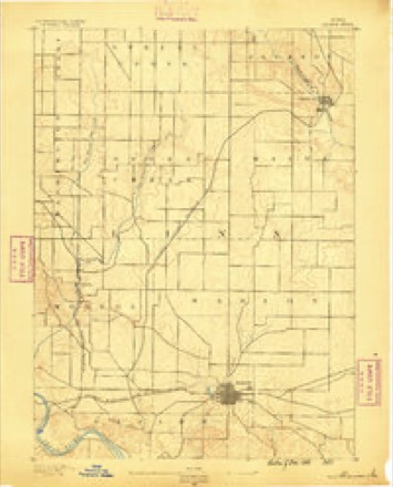
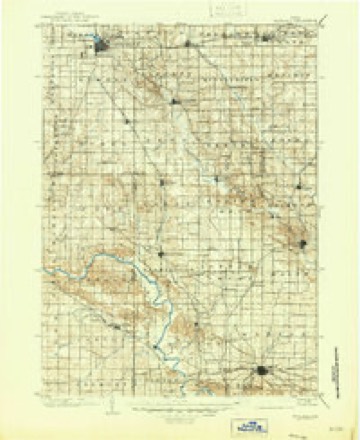
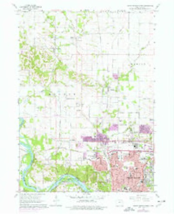
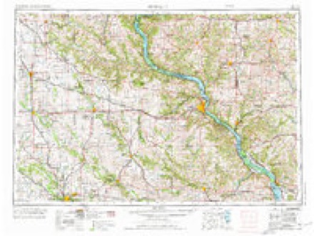
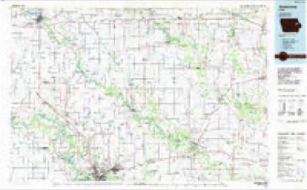
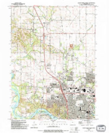
11 surveys from 18 printed sheetsMatched by testing this settlement's coordinate against the published boundary of every sheet in the United States Geological Survey's historical collection. Each opens the scanned sheet at the Survey.
- 1888 USGS Marion quadrangle1:62500
- 1889 USGS Marion quadrangle1:62500, 3 printings
- 1903 USGS Winthrop quadrangle1:125000, 2 printings
- 1959 USGS Dubuque quadrangle1:250000
- 1961 USGS Dubuque quadrangle1:250000
- 1962 USGS Dubuque quadrangle1:250000, 2 printings
- 1967 USGS Cedar Rapids North quadrangle1:24000, 2 printings
- 1975 USGS Cedar Rapids North quadrangle1:24000
- 1976 USGS Dubuque quadrangle1:250000
- 1984 USGS Anamosa quadrangle1:100000, 2 printings
- 1994 USGS Cedar Rapids North quadrangle1:24000, 2 printings
Fires near this place
18 since 1996Regional context, not property-specific evidence. The federal wildfire occurrence database lists 18 fires within 5 miles of Hiawatha between 1996 and 2017, burning about 59 acres in total. 1 started naturally. 1 was recorded as arson. Distance is straight-line from the map coordinates, so a fire counted here may appear on a neighbouring settlement's page as well.
| Reported cause | Fires |
|---|---|
| Missing data/not specified/undetermined | 9 |
| Recreation and ceremony | 5 |
| Equipment and vehicle use | 2 |
| Natural | 1 |
| Arson/incendiarism | 1 |
The most recent of them, most recent first, with the day each was reported and the service that recorded it.
| Date | Cause | Size | Reported by | Name on the report |
|---|---|---|---|---|
| 30 September 2004 | Recreation and ceremony | 3.0 acres | Iowa State Fire Marshal's Office | not named |
| 15 July 2012 | Missing data/not specified/undetermined | 1.0 acres | Iowa Department of Natural Resources | not named |
| 9 June 2003 | Missing data/not specified/undetermined | under an acre | Iowa State Fire Marshal's Office | not named |
| 23 June 2012 | Natural | under an acre | Iowa Department of Natural Resources | not named |
| 4 May 2004 | Missing data/not specified/undetermined | 6.0 acres | Iowa State Fire Marshal's Office | not named |
| 3 April 2004 | Recreation and ceremony | 1.0 acres | Iowa State Fire Marshal's Office | not named |
| 27 April 1996 | Missing data/not specified/undetermined | 25 acres | Sac and Fox Agency | MONTOUR |
| 23 April 2017 | Missing data/not specified/undetermined | 1.0 acres | Iowa Department of Natural Resources | not named |
Settlements close enough to share some of these fires:
Mines and quarries near this place
10 of 15 shownRegional context, not property-specific evidence. The federal mineral resources record lists 15 workings within 5 miles of Hiawatha: 11 past producers, 4 producers. 4 still produce. What was taken out: Sand and Gravel, Construction, Stone, Crushed/Broken. Distance is straight-line from the map coordinates, so a quarry counted here may appear on a neighbouring settlement's page as well.
| Where | Site | Commodity | Status | Recorded |
|---|---|---|---|---|
| Lee Crawford Quarry & Mill | Stone, Crushed/Broken | Producer | ||
| Robins Quarry | Stone, Crushed/Broken | Producer | ||
| Shaefer Quarry | Stone, Crushed/Broken | Past Producer | ||
| Unknown | Stone, Crushed/Broken | Past Producer | ||
| Unknown | Stone, Crushed/Broken | Past Producer | ||
| Aggregates Inc. Site No. 1 | Sand and Gravel, Construction | Producer | ||
| Cedar Rapids Sand Pit | Sand and Gravel, Construction | Producer | ||
| Francik Pit | Sand and Gravel, Construction | Past Producer | ||
| Freese Pit | Sand and Gravel, Construction | Past Producer | ||
| Unknown | Sand and Gravel, Construction | Past Producer |
Storms near this place
60 of 71 shownRegional context, not property-specific evidence. The National Weather Service names Hiawatha in 71 storm reports between 1994 and 2026: 34 thunderstorm wind, 28 hail, 5 flash flood, 3 flood. The reports record 1 injury. Each account below is quoted exactly as the forecast office filed it, from the NOAA Storm Events Database, and each date opens the federal record of that event.
| When | Event | Place named | Harm | What the report says |
|---|---|---|---|---|
| August 2004 | Thunderstorm Wind | Hiawatha | 1 hurt, $20,000 | A mile long swath of straight line winds estimated at 70 mph occurred along Boyson Road in the northern part of Hiawatha. Damage was sustained to the local Farm Bureau office, the Hiawatha Care Center, a gas station, a banking center, and a sign company. A 91 year old female resident of the Care Center was injured when part of the wall was knocked out with damage to the roof. |
| May 1994 | Thunderstorm Wind | Hiawatha | $50,000 | no account filed |
| July 2019 | Lightning | Hiawatha | $20,000 | Local broadcast media relayed a report that a lightning strike totaled a vehicle at Apple Kids Childcare. |
| April 2006 | Hail | Hiawatha | $4,000 | Total hail duration 5 minutes with most of it just under penny size. |
| August 2000 | Thunderstorm Wind | Hiawatha | $2,000 | Large tree limbs knocked down. |
| September 2016 | Flash Flood | Hiawatha | $1,000 | Local law enforcement reports high water caused a driver to abandon his car. Ellis Boulevard was barricaded at 4 locations due to high water. The time of the event was estimated. |
| April 2026 | Hail | Hiawatha | - | Relayed by emergency management. |
| April 2025 | Flash Flood | Hiawatha | - | A trained spotter reported that a creek was flowing out of its banks along Center Point road near Interstate 380. They also submitted photos of the flooded creek. Rainfall reports around the area ranged from 2 to 3 inches. |
| July 2025 | Thunderstorm Wind | Hiawatha | - | A trained spotter reported that a very large tree was snapped off 10 feet above the ground, and was blocking the road. |
| May 2024 | Thunderstorm Wind | Hiawatha | - | Eight to ten inch diameter tree snapped. The time was based on radar data. |
| May 2024 | Thunderstorm Wind | Hiawatha | - | Spotter estimated severe wind gusts. |
| July 2024 | Thunderstorm Wind | Hiawatha | - | A trained spotter reported a large tree limb down and powerlines down. The time of the event was estimated using radar. |
| March 2023 | Thunderstorm Wind | Hiawatha | - | Pea sized hail also fell with the strong winds. |
| July 2023 | Thunderstorm Wind | Hiawatha | - | Trained spotter reported a 90 mph wind gust along the leading edge of the thunderstorm. |
| July 2023 | Thunderstorm Wind | Hiawatha | - | Trained spotter reporting 90 mph wind gusts for at least 6 minutes, with zero visibility. |
| July 2022 | Thunderstorm Wind | Hiawatha | - | A trained spotter reported large tree limbs down. |
| July 2022 | Thunderstorm Wind | Hiawatha | - | A public report of estimated winds with a thunderstorm gust front ased on a brief power outage. |
| July 2022 | Thunderstorm Wind | Hiawatha | - | A trained spotter reported power lines down. Estimated winds to be sustained at 55 MPH. |
| July 2022 | Thunderstorm Wind | Hiawatha | - | A trained spotter reported thunderstorm wind gusts began around 905 PM and lasted about 10 to 15 minutes. |
| July 2022 | Thunderstorm Wind | Hiawatha | - | A member of the public reported a tree down. |
| July 2022 | Thunderstorm Wind | Hiawatha | - | Thunderstorm outflow winds knocked out power. |
| April 2020 | Hail | Hiawatha | - | Measured by KGAN studios. |
| April 2020 | Hail | Hiawatha | - | Report from KGAN studios, where at least one wind shield was broken. |
| April 2020 | Hail | Hiawatha | - | Considerable damage was reported to nearby vehicles. |
| July 2020 | Thunderstorm Wind | Hiawatha | - | A large tree limb was broken off outside of the TV news station. |
| July 2020 | Thunderstorm Wind | Hiawatha | - | A large tree was blown down, falling through a garage. |
| July 2020 | Thunderstorm Wind | Hiawatha | - | A spotter estimated high winds. |
| July 2018 | Thunderstorm Wind | Hiawatha | - | A trained spotter reported maximum wind gusts around 60 mph. |
| May 2018 | Thunderstorm Wind | Hiawatha | - | A trained spotter estimated a wind gust of 60 MPH. |
| September 2018 | Thunderstorm Wind | Hiawatha | - | A trained spotter estimated max wind gusts of 60 mph. |
| August 2016 | Flash Flood | Hiawatha | - | Law Enforcement reported a road closure in town due to water over the road. |
| June 2015 | Flash Flood | Hiawatha | - | Urban flash flooding resulted in water up to 4 feet deep in place. A spotter reported water over the hood of a small car near Blairs Ferry Road and C Avenue. |
| July 2014 | Flood | Hiawatha | - | Heavy rain across the Upper Midwest and eastern Iowa during the last two weeks of June caused the Cedar River at Cedar Rapids to rise above the major flood stage of 16 feet during the first week in July. The first occurred between 100 PM on July 1 and 600 AM on July 2 with a crest of 16.4 feet at 600 PM on July 1. The second rise above the major flood stage occurred between noon on July 3 and 745 PM on July 4 with a crest of around 16.5 feet around 600 AM on July 3. |
| May 2013 | Flood | Hiawatha | - | Heavy rains the last week in May caused a rapid rise on the Cedar River in Cedar Rapids. The river rose above the major flood stage of 16 feet at midday and remained above the major flood stage through the end of the month. |
| September 2013 | Thunderstorm Wind | Hiawatha | - | A trained spotter from Minnesota reported a 5 inch branch down. They estimated the winds to be 50 to 60 MPH. Time of the event was estimated using radar. |
| June 2012 | Thunderstorm Wind | Hiawatha | - | Wind gusts estimated to be 70 mph snapped a 10 inch diameter tree limb near the spotters residence about 5 miles north of Cedar Rapids, IA around 540 pm CDT June 29. Numerous power outages were also observed. |
| March 2012 | Hail | Hiawatha | - | Nickel sized hail fell 5 miles north northeast of Cedar Rapids at 901 pm CDT March 31. |
| March 2012 | Hail | Hiawatha | - | Pea to quarter sized hail fell near Blairs Ferry Road and 10th between Cedar Rapids and Hiawatha at 925 pm CDT March 31. The hail covered the ground. |
| March 2012 | Hail | Hiawatha | - | Nickel to quarter sized hail fell on the northeast side of Cedar Rapids at 928 pm CDT March 31. |
| August 2012 | Thunderstorm Wind | Hiawatha | - | A trained spotter estimated thunderstorm wind speeds of 60 to 65 mph. |
| June 2011 | Thunderstorm Wind | Hiawatha | - | Wind gusts estimated to be 70 mph were observed 5 miles north of Cedar Rapids, IA at 735 pm CDT June 8. A power outage was also observed on the northeast side of Cedar Rapids. |
| June 2011 | Thunderstorm Wind | Hiawatha | - | Wind gusts estimated to be 70 to 80 mph were observed 5 miles north of Cedar Rapids, IA at 745 pm CDT June 8. Large tree branches were blown down in the middle of the street. |
| July 2011 | Thunderstorm Wind | Hiawatha | - | A 70 mph wind gust was recorded 5 miles north northeast of Cedar Rapids, IA at 943 pm CDT July 22. |
| July 2011 | Thunderstorm Wind | Hiawatha | - | Wind gusts estimated to be 60 mph were observed 5 miles north northeast of Cedar Rapids, IA at 1055 am CDT July 24. |
| July 2011 | Thunderstorm Wind | Hiawatha | - | Wind gusts estimated to be 70 mph blew down some tree branches about 5 miles north of Cedar Rapids, IA at 1102 am CDT July 24. |
| August 2011 | Hail | Hiawatha | - | Quarter-sized hail lasted 3 to 4 minutes. |
| August 2011 | Thunderstorm Wind | Hiawatha | - | A fence was blown down, and a 12-inch diameter tree was down. Six-inch limbs were also down in the area. |
| August 2011 | Hail | Hiawatha | - | Quarter-sized hail was accompanied by heavy rain. |
| April 2011 | Hail | Hiawatha | - | Quarter sized hail fell in Hiawatha, IA at 645 pm CDT April 3. |
| September 2010 | Hail | Hiawatha | - | Quarter-sized hail fell in Hiawatha, IA at 118 pm CDT September 21. |
| September 2010 | Hail | Hiawatha | - | Quarter-sized hail fell about 5 miles north northeast of Cedar Rapids, IA at 119 pm CDT September 21. |
| June 2010 | Thunderstorm Wind | Hiawatha | - | Wind gusts estimated to be 65 mph were observed about 3 miles north of Cedar Rapids, IA at 615 pm June 18. |
| June 2010 | Thunderstorm Wind | Hiawatha | - | Wind gusts measured to be 70 mph were observed about 5 miles north northeast of Cedar Rapids, IA at 608 pm June 18. |
| August 2009 | Flash Flood | Hiawatha | - | Heavy rains resulted in flash flooding of the Hiawatha Road in Hiawatha, IA during the early morning hours of August 26. Six to eight inches of water was covering the road. |
| June 2005 | Hail | Hiawatha | - | Dime to nickel sized hail |
| May 2004 | Hail | Hiawatha | - | Covered the ground. |
| July 2001 | Thunderstorm Wind | Hiawatha | - | Large trees and power poles snapped. Reported by emergency management. |
| June 1999 | Flood | Hiawatha | - | Heavy rain of just over 2 inches in an hour flooded several streets. Cars were stranded in standing water onNorth Center Point Road and Robins Road. |
| April 2023 | Hail | Hiawatha | - | no account filed |
| April 2023 | Hail | Hiawatha | - | no account filed |
Nearest settlements
The eight closest, with where each one stands in the county. Distances are straight-line, computed from the Geographic Names Information System coordinates.
| Map | Place | Distance | Sheets |
|---|---|---|---|
| Hiawatha Oak Brook Court | 0.6 miles | 18 | |
| Sunset Village | 0.8 miles | 18 | |
| Louisa | 0.8 miles | 18 | |
| New Buffalo | 1.2 miles | 18 | |
| Linn Junction | 2.4 miles | 18 | |
| Robins | 2.6 miles | 18 | |
| Cedar Rapids | 2.8 miles | 18 | |
| Lindale Manor | 3.0 miles | 18 |
Elsewhere
Matched on this settlement's Geographic Names Information System number rather than its name, so it cannot be a different place of the same name in another state.
| Wikipedia article on Hiawatha | An encyclopaedic summary. Its text is share-alike, so it is linked here rather than copied. |
| Wikidata item Q1922650 | The structured record the population and elevation above come from. Public domain (CC0). |
Provenance
This settlement is recorded in the Geographic Names Information System as feature 457418. The sheet list is computed by point-in-boundary test against the United States Geological Survey's historical topographic inventory. Both are works of the United States government and carry no copyright under 17 U.S.C. 105.
Wildfire. Short, Karen C. 2022. Spatial wildfire occurrence data for the United States, 1992-2020 [FPA_FOD_20221014]. 6th Edition. Fort Collins, CO: Forest Service Research Data Archive. https://doi.org/10.2737/RDS-2013-0009.6 Collected with United States Government funding and usable without additional permissions or fees.
Mines and quarries. USGS Mineral Resources Data System (MRDS) https://mrdata.usgs.gov/mrds/ A work of the United States government, no copyright under 17 U.S.C. 105.
Storms. NOAA National Centers for Environmental Information, Storm Events Database https://www.ncei.noaa.gov/stormevents/ A work of the United States government, no copyright under 17 U.S.C. 105. Narratives are quoted verbatim from the National Weather Service report and are not edited or summarised.