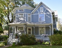
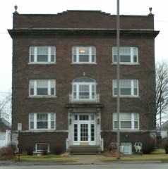
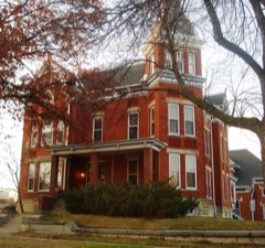
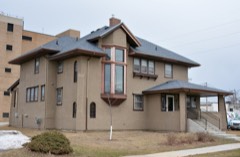
Block
From the record
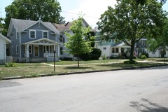
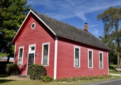
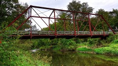
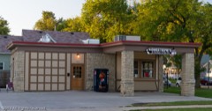
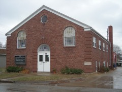
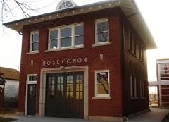
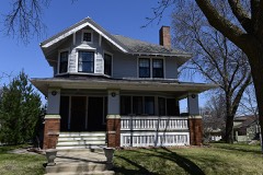
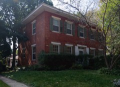
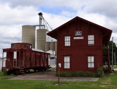
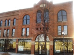
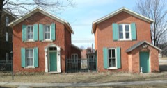
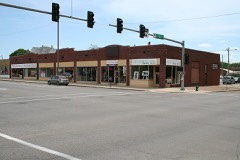
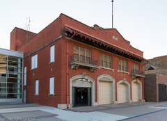
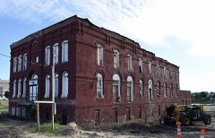
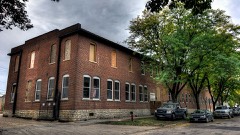
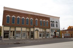
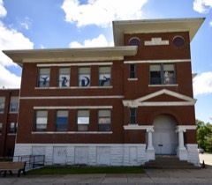
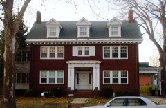
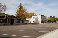
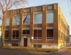
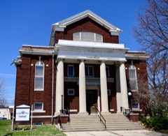
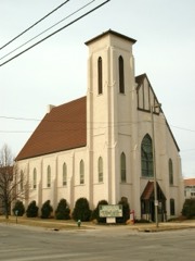
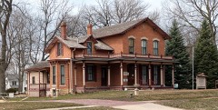
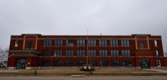
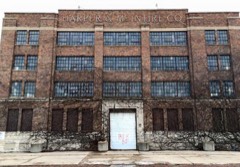
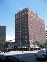
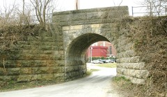
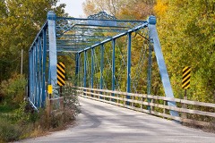
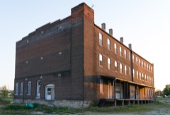
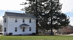
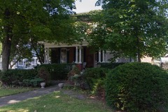
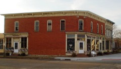
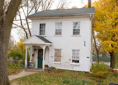
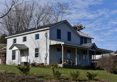
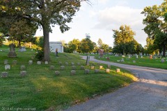
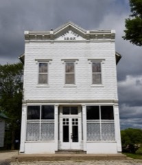
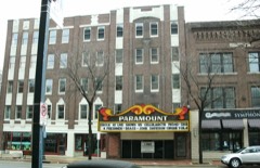
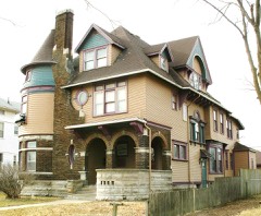
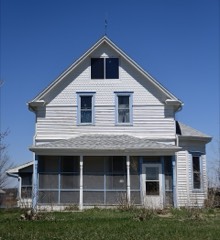
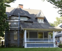
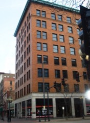
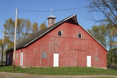
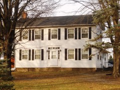
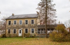
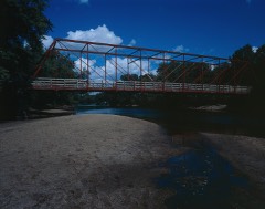
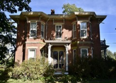
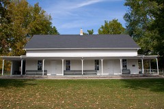
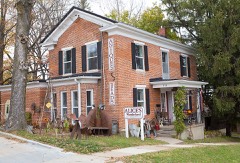
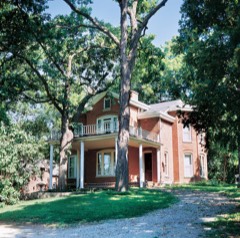
121 National Register listings published here.
Sources: the National Register database, National Park Service
90 topographic sheets cover 52 settlements here, and 121 properties are on the National Register of Historic Places.
121 National Register listings published here.
Sources: the National Register database, National Park Service
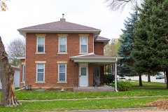
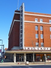
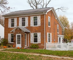
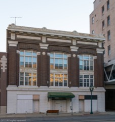
Every property in this county listed on the National Register of Historic Places, with the year it was listed and the federal nomination document.
Every wildfire the federal occurrence database records inside this county: 40 of them, burning about 348 acres. 2 started naturally and 1 was recorded as arson. Each settlement page carries the fires within five miles of it.
| Reported cause | Fires |
|---|---|
| Missing data/not specified/undetermined | 20 |
| Recreation and ceremony | 8 |
| Debris and open burning | 5 |
| Equipment and vehicle use | 3 |
| Natural | 2 |
| Smoking | 1 |
| Arson/incendiarism | 1 |
The five largest, by the area the report gives. None of them was recorded as arson.
| Date | Cause | Size | Reported by | Name on the report |
|---|---|---|---|---|
| 12 April 2014 | Debris and open burning | 120 acres | Iowa Department of Natural Resources | not named |
| 5 April 2013 | Debris and open burning | 60 acres | Iowa Department of Natural Resources | not named |
| 15 April 2006 | Missing data/not specified/undetermined | 40 acres | Iowa Department of Natural Resources | not named |
| 5 April 2014 | Debris and open burning | 30 acres | Iowa Department of Natural Resources | not named |
| 27 April 1996 | Missing data/not specified/undetermined | 25 acres | Sac and Fox Agency | MONTOUR |
| 20 March 2015 | Debris and open burning | 10 acres | Iowa Department of Natural Resources | not named |
| 12 April 2009 | Missing data/not specified/undetermined | 10 acres | Iowa Department of Natural Resources | not named |
| 11 April 2009 | Missing data/not specified/undetermined | 10 acres | Iowa Department of Natural Resources | not named |
Every settlement page carries the fires within five miles of it - see the settlement index below.
The NOAA Storm Events Database holds 1,170 reports for this county, causing 6 deaths, 148 injuries and about $803,524,530 in recorded property damage. Each settlement page carries the reports that name it.
| Kind of event | Reports |
|---|---|
| Thunderstorm Wind | 574 |
| Hail | 389 |
| Tornado | 64 |
| Flash Flood | 58 |
| Heavy Rain | 31 |
| Flood | 20 |
| Funnel Cloud | 19 |
| Lightning | 15 |
The most serious of them, by death, then injury, then recorded damage. The accounts are quoted exactly as the forecast office filed them.
| When | Event | Place named | Harm | What the report says |
|---|---|---|---|---|
| August 2020 | Thunderstorm Wind | Covington | 1 killed, 100 hurt | Widespread straight-line winds that produced extensive damage were reported throughout Linn County, associated with a derecho. These winds lasted around an hour in total at any one location, even though the initial line of storms moved out quickly. Damaging straight-line winds continued and were associated with the rear inflow jet. Maximum wind speeds were estimated to be 80 to 100 MPH for much of the county, with areas in central Linn County that had wind speed estimates that were 120 MPH or higher. The highest estimated wind speed were in the Cedar Rapids area where extensive damage to an apartment complex occurred with damage indicating winds about 140 MPH. A radio transmission tower also collapsed with wind speed estimated at 130 MPH. These estimates were determined based off damage reports and photos submitted through social media as well as a damage survey. The peak thunderstorm wind gust measured at the Cedar Rapids airport ASOS before it lost power was 68 MPH. The duration of strong winds caused extensive damaged most if not all trees, crops, and structures in their path. Due to the widespread damage, long duration power outages occurred. One fatality occurred here when a 63 year old man riding a bicycle was struck and killed by a tree that was knocked down due to the winds. There were also numerous injuries reported in the Cedar Rapids area. |
| July 1992 | Thunderstorm Wind | not stated | 1 killed, 2 hurt | no account filed |
| June 2014 | Thunderstorm Wind | Fairfax | 1 killed, 1 hurt | Law enforcement reported a business building destroyed by high winds from a severe thunderstorm. One person was killed and another injured due to the collapsed structure. A NWS survey found the roof had been blown off which caused the walls to collapse inward and the body was found underneath the rubble. |
| June 2014 | Flash Flood | Cedar Rapids | 1 killed, 1 hurt | One teenager drowned and another was injured when they were swept into a large storm sewer during heavy rains. Three 17-year-olds were playing Frisbee near Arthur Elementary School when one of the boys was swept into the storm sewer and another boy went to try rescue him but was also swept in. The first boy drowned but the second boy came out of the sewer drain more than a mile away in Cedar Lake. |
| September 2005 | Lightning | (Cid)Cedar Rapids Ar | 1 killed, 1 hurt | Lightning struck two golfers at the Airport National Public Golf Course 5 miles east of Cedar Rapids Airport. Both golfers were rushed to a nearby hospital where one (a 38 year old male) was pronounced dead. The other golfer, male, age 37, was treated and released. |
| June 2015 | Lightning | Palo | 1 killed | A 42 year old female was struck and killed by lightning while camping at the Pleasant Creek State Recreation Area near Palo. |
| May 1965 | Tornado (F2) | not stated | 14 hurt, $250,000 | no account filed |
| July 2016 | Tornado (EF2) | Fairfax | 4 hurt, $250,000 | A tornado from Benton County continued southeast through southeastern portions of Walford. The tornado damaged the roofs of numerous homes. One home was completely destroyed when it collapsed on itself, apparently aided by wind blown debris. |
| June 2014 | Thunderstorm Wind | Cedar Rapids | 4 hurt | A severe thunderstorm packing 80 mph winds blew a tarp on top of several people trying to cover the infield at Veterans Memorial Stadium in Cedar Rapids. This occurred toward the end of the Cedar Rapids Kernels minor league baseball game. Three people suffered concussions while another person dislocated his shoulder. |
| May 1953 | Tornado (F3) | not stated | 4 hurt | no account filed |
| September 1972 | Tornado (F2) | not stated | 3 hurt, $2,500,000 | no account filed |
| May 1999 | Thunderstorm Wind | Cedar Rapids | 2 hurt, $500,000 | Severe thunderstorm winds blew most of the roof off the MidAmerica Housing partnership building in northeast Cedar Rapids. Debris from the roof was blown into other buildings and interior beams were pulled away from the structure. Severe winds also blew two 18-wheel tractor-trailer trucks off Highway 380 near Center Point, causing minor injuries. In addition, at least 20 power lines were downed in the Cedar Rapids area alone. |
| June 1986 | Thunderstorm Wind | not stated | 2 hurt | no account filed |
| May 1964 | Tornado (F2) | not stated | 1 hurt, $250,000 | no account filed |
| May 2000 | Tornado (F1) | Alburnett | 1 hurt, $50,000 | A tornado touched down at Alburnett causing damage. The center section of the horse barn roof at Strand Arabian Stables was torn off. Sheet metal from the horse barn roof littered surrounding yards, and one woman was cut by the sheet metal. She was taken to St. Luke's Hospital where she was treated and released. There were about 45 horses on the grounds of the stables when the tornado hit, but incredibly none were hurt. A barn also collapsed along Lafayette Road. Ten cows were inside the barn, and one was killed. Damage was also found along East Otter Road. A house had it's roof damaged and siding taken off, and a small shed was destroyed. A minivan was pushed off of a driveway and had it's windows broken out. A garage door was also pushed in on a garage. |
| August 2004 | Thunderstorm Wind | Hiawatha | 1 hurt, $20,000 | A mile long swath of straight line winds estimated at 70 mph occurred along Boyson Road in the northern part of Hiawatha. Damage was sustained to the local Farm Bureau office, the Hiawatha Care Center, a gas station, a banking center, and a sign company. A 91 year old female resident of the Care Center was injured when part of the wall was knocked out with damage to the roof. |
| April 2021 | Tornado (EF0) | Beverly | 1 hurt | A brief tornado caused damage to several manufactured homes and a garage in the southwest part of Cedar Rapids Wednesday evening. One home sustained significant roof damage, with additional siding damage to nearby homes. One person sustained minor injuries from glass after their bedroom window blew in. The tornado lofted debris into a nearby field. Maximum sustained winds were around 85 mph and the tornado was rated EF-0. |
| June 2017 | Tornado (EF2) | Central City | 1 hurt | The tornado touched down south of Central City in the county fairgrounds outfield area, and tracked about 12 miles northeast through Prairieburg before lifting in rural Jones County. The most intense damage occurred near and in Prairieburg. At a farmstead just southwest of town, a woman was injured when her garage collapsed on her. In Prairieburg, the grain elevator sustained severe damage, one mobile home was lofted and destroyed, and another mobile home severely damaged. On the east edge of town, a horse barn was destroyed. One horse was killed and two others sustained injuries. Northeast of town, a hog building was destroyed, killing several young hogs. This EF2 tornado continued into Jones County, Iowa. |
| June 2009 | Thunderstorm Wind | Cedar Rapids | 1 hurt | Wind gusts estimated to be 75 mph blew a tree down striking a woman at 625 42nd St. NE in Cedar Rapids, IA at 517 pm June 23. |
| July 2001 | Lightning | Fairfax | 1 hurt | Reported by law enforcement. |
| June 1998 | Thunderstorm Wind | Cedar Rapids | 1 hurt | A line of fast moving thunderstorms downed numerous tree limbs and power lines across Cedar Rapids leaving 12,000 customers of Alliant-IES Utilities without power. Wind peeled the outer membrane from a roof of a business allowing water to soak the suspended-ceiling tiles. The waterlogged tiles then gave way damaging portions of the carpet, but missing showcases and merchandise. One man was injured when strong winds lifted then flattened the large beer tent he was in at Hiawatha's Hog Wild Days. |
| July 1997 | Lightning | Cedar Rapids | 1 hurt | Man injured seriously when lightning struck a nearby tree. |
| April 1991 | Thunderstorm Wind | not stated | 1 hurt | no account filed |
| June 2008 | Flood | Center Pt | $750,000,000 | The record crest on the Cedar River at Cedar Rapids occurred on June 13, 2008 at 31.12 feet. Flood stage is 12 feet. The previous record crest was 20.00 feet set on June 1, 1851. Damage estimates just in Cedar Rapids was at least $750 million. |
| March 1990 | Tornado (F4) | not stated | $25,000,000 | no account filed |
| July 2003 | Thunderstorm Wind | Cedar Rapids | $5,000,000 | no account filed |
| May 2003 | Hail | Fairfax | $3,000,000 | no account filed |
| September 2016 | Flood | Covington | $2,200,000 | Heavy rainfall of 4 to over 10 inches over significant areas from 21 to 23 September in extreme North Central and Northeast Iowa moved downstream causing the Cedar River to rise above major flood stage levels. ||Cedar Rapids rose above its major flood stage level of 16.0 feet on September 25th, 2016 at approximately 10 PM CST. It crested around 22.0 feet at approximately 8 AM CST on September 26th, 2016. It fell below major flood stage on September 30th around 6 AM CST.||Over 100 buildings and homes were impacted by the flooding. Dozens of blocks were closed of due to temporary barriers related to the flooding for a few to several days. ||Local agencies reported 27 roads were closed across the county.||Roughly 100 homes were evacuated in Palo, a community near Cedar Rapids along the Cedar River.||All the bridges except for the I-380 were closed. All schools in Cedar Rapids were closed for 3 days.||This was the second highest crest on record, surpassed only by the crest of 31.12 feet in 2008. |
| May 2003 | Hail | Cedar Rapids | $2,000,000 | Far west side of city |
| July 2003 | Tornado (F2) | Cedar Rapids | $2,000,000 | Strong F2...winds estimated at 140 mph. |
| May 2003 | Thunderstorm Wind | Cedar Rapids | $1,000,000 | 18 inch limb on house |
| September 2010 | Hail | Marion | $500,000 | Golf ball-sized hail fell in Marion, IA at 125 pm CDT September 21. This report was relayed by KCRG. |
| April 2009 | Tornado (EF1) | Lafayette | $500,000 | An EF1 tornado with estimated wind speeds of up to 100 mph touched down near Lafayette, IA around 452 pm and proceeded to track northeast crossing the Linn-Delaware County line around 510 pm, finally lifting just north of Buck Creek, IA around 530 pm. Several farms sustained structural and equipment damage, trees were uprooted or snapped off, some camping trailers were destroyed, and several power lines were blown down. |
| August 2009 | Flash Flood | Coggon | $500,000 | Heavy rains of 5 to 9 inches resulted in flash flooding of much of Linn County on August 27. Several streets and county roads were closed due to the flood waters. Some areas particularly hard hit were Cedar Rapids, Bertram, Central City, and Coggon. Some vehicles were stranded in the flood waters. Several residences experienced flooding in their basements. Numerous streams and creeks flooded out of their banks. Trained spotters and broadcast media also contributed to this report. |
| July 2003 | Tornado (F2) | Covington | $500,000 | no account filed |
| June 1994 | Thunderstorm Wind | Fairfax | $500,000 | no account filed |
| July 1994 | Thunderstorm Wind | Swrn Cedar Rapids | $500,000 | no account filed |
| August 1993 | Thunderstorm Wind | Cedar Rapids | $500,000 | no account filed |
| August 1993 | Thunderstorm Wind | Mt. Vernon | $500,000 | no account filed |
| April 2013 | Flash Flood | Walker | $250,000 | Several rounds of heavy rain resulted in flash flooding across much of Linn County from the mid evening of April 17 through the early morning of April 18. |
| June 2009 | Thunderstorm Wind | Walker | $250,000 | Wind gusts estimated to be around 80 mph caused widespread tree damage with tree limbs over 8 inches in diameter and trees over 3 feet in diameter blown down along a path from 2 miles south of Quasqueton, IA in Buchanan County, to Walker, IA in Linn County, along Highway W35 and Highway W6E to Center Point, IA in Linn County between 745 am and 830 am June 19. Some houses and many out buildings were damaged by falling trees. Power lines were also knocked down across much of the area. The end time of the damage was around 830 am. |
| May 2004 | Tornado (F3) | Palo | $250,000 | Rated F3 with winds estimated at 175 mph. |
| May 2003 | Hail | Cedar Rapids | $250,000 | Duration 5 minutes |
| July 2003 | Thunderstorm Wind | Palo | $250,000 | no account filed |
| July 2003 | Thunderstorm Wind | Center Pt | $250,000 | no account filed |
| June 1983 | Tornado (F1) | not stated | $250,000 | no account filed |
| July 1979 | Tornado (F1) | not stated | $250,000 | no account filed |
| October 1966 | Tornado (F2) | not stated | $250,000 | no account filed |
| June 2014 | Thunderstorm Wind | Marion Evans Arpt | $200,000 | The top half of a barn was blown off and a house was severely damaged. At the house, the front porch blew off and the garage doors blew in, unroofing the garage and front half of the roof of the house. Radar showed a strong downburst occurring at the time of the damage. |
| July 2003 | Hail | Coggon | $200,000 | Numerous reports of nickel to 1.25 inch hail |
| June 2011 | Thunderstorm Wind | Marion | $150,000 | Wind gust estimated to be 70 mph blew a tree onto a building at 790 22nd Street in Marion, IA around 830 pm CDT June 13. |
| August 2003 | Thunderstorm Wind | Cedar Rapids | $150,000 | Numerous trees down on vehicles and buildings. |
| July 1995 | Thunderstorm Wind | Marion | $125,000 | no account filed |
| July 2003 | Thunderstorm Wind | Cedar Rapids | $100,000 | 5 inch limbs and power lines down |
| May 1995 | Thunderstorm Wind | Springville | $75,000 | no account filed |
| April 2006 | Tornado (F0) | Marion | $70,000 | Rated high F0 |
| September 2012 | Lightning | Mt Vernon | $50,000 | Lightning struck the bell tower atop the College Hall building at Cornell College in Mount Vernon, IA around 4 am CDT September 7. Damage was confined to the bell tower and part of the attic. |
| July 2011 | Thunderstorm Wind | Walker | $50,000 | Wind gusts estimated to be 70 mph blew down several trees in Walker, IA at 530 am CDT July 11. Some cars were damaged. |
| June 2011 | Lightning | Covington | $50,000 | Lightning struck a home at 505 Rockhurst Dr. SW in Cedar Rapids, IA at 230 am CDT June 10. The strike caused some damage to the homes wiring and minor fire damage. |
| July 2007 | Tornado (EF1) | Paris | $50,000 | A tornado briefly touched down just west of Paris, IA, or about 14.5 miles north of Cedar Rapids, IA around 7:15 PM on July 18th. It destroyed a farm shed completely, ripped part of a roof off of another farm shed, and damaged several trees and crops in the area. |
The Survey's mineral resources record lists 73 workings inside this county. 13 still produce and 60 are closed or unrecorded. Each settlement page carries the workings within five miles of it.
| Commodity | Workings |
|---|---|
| Stone, Crushed/Broken | 40 |
| Sand and Gravel, Construction | 30 |
| Sand and Gravel, Construction, Stone, Crushed/Broken | 2 |
| Zinc, Iron | 1 |
The least common of them first, because a county's hundredth gravel pit says nothing its first ten did not.
| Where | Site | Commodity | Status | Recorded |
|---|---|---|---|---|
| Martin Marietta Quarry | Zinc, Iron | Past Producer | Pyrite, Sphalerite | |
| Sweeting Quarry | Sand and Gravel, Construction, Stone, Crushed/Broken | Producer | ||
| Troy Mills Quarry and Sand Pit | Sand and Gravel, Construction, Stone, Crushed/Broken | Past Producer | ||
| Aggregates Inc. Site No. 1 | Sand and Gravel, Construction | Producer | ||
| Baird Pit | Sand and Gravel, Construction | Past Producer | ||
| Cedar Rapids Sand Pit | Sand and Gravel, Construction | Producer | ||
| Cedar Rapids Sand Plant | Sand and Gravel, Construction | Producer | ||
| Central City Pit | Sand and Gravel, Construction | Past Producer | ||
| Coggon Pit | Sand and Gravel, Construction | Past Producer | ||
| East Marion Sand Pit | Sand and Gravel, Construction | Prospect | ||
| Equitable Life Pit | Sand and Gravel, Construction | Past Producer | ||
| Foy Estate | Sand and Gravel, Construction | Past Producer | ||
| Francik Pit | Sand and Gravel, Construction | Past Producer | ||
| Freese Pit | Sand and Gravel, Construction | Past Producer | ||
| Hampton Pit | Sand and Gravel, Construction | Past Producer | ||
| Ivanhoe Sand Pit | Sand and Gravel, Construction | Producer | ||
| Oliphant Pit | Sand and Gravel, Construction | Past Producer | ||
| Park Pit | Sand and Gravel, Construction | Past Producer | ||
| Pearson Pit | Sand and Gravel, Construction | Past Producer | ||
| Schultz Pit | Sand and Gravel, Construction | Past Producer | ||
| Unknown | Sand and Gravel, Construction | Past Producer | ||
| Unknown | Sand and Gravel, Construction | Past Producer | ||
| Unknown | Sand and Gravel, Construction | Past Producer | ||
| Unknown | Sand and Gravel, Construction | Past Producer | ||
| Unknown | Sand and Gravel, Construction | Past Producer | ||
| Unknown | Sand and Gravel, Construction | Past Producer | ||
| Unknown | Sand and Gravel, Construction | Past Producer | ||
| Unknown | Sand and Gravel, Construction | Past Producer | ||
| Unknown | Sand and Gravel, Construction | Past Producer | ||
| Unknown | Sand and Gravel, Construction | Past Producer | ||
| Unknown | Sand and Gravel, Construction | Past Producer | ||
| Unknown | Sand and Gravel, Construction | Past Producer | ||
| Zinger Pit | Sand and Gravel, Construction | Past Producer | ||
| Alice Quarry | Stone, Crushed/Broken | Past Producer | ||
| Bettenbender Quarry | Stone, Crushed/Broken | Producer | ||
| Boddicker-Murray Quarry | Stone, Crushed/Broken | Past Producer | ||
| Bowser Quarry | Stone, Crushed/Broken | Producer | ||
| Cedar Rapids Quarry | Stone, Crushed/Broken | Producer | ||
| Cook Quarry | Stone, Crushed/Broken | Past Producer | ||
| Decious Quarry | Stone, Crushed/Broken | Past Producer | ||
| Edgerly Quarry | Stone, Crushed/Broken | Past Producer | ||
| Emmonds Quarry | Stone, Crushed/Broken | Past Producer | ||
| Finn Quarry | Stone, Crushed/Broken | Past Producer | ||
| Hartl Quarry | Stone, Crushed/Broken | Past Producer | ||
| Knickerbacher Quarry | Stone, Crushed/Broken | Past Producer | ||
| Lee Crawford Quarry & Mill | Stone, Crushed/Broken | Producer | ||
| Lisbon Quarry | Stone, Crushed/Broken | Producer | ||
| Modsley Quarry | Stone, Crushed/Broken | Past Producer | ||
| Morgan Creek Quarry | Stone, Crushed/Broken | Producer | ||
| Otis Quarry | Stone, Crushed/Broken | Past Producer | ||
| Owens Quarry | Stone, Crushed/Broken | Past Producer | ||
| Palo Quarry | Stone, Crushed/Broken | Past Producer | ||
| Paralta Quarry | Stone, Crushed/Broken | Past Producer | ||
| Plower Quarry | Stone, Crushed/Broken | Producer | ||
| River Road Quarry | Stone, Crushed/Broken | Past Producer | ||
| Robins Quarry | Stone, Crushed/Broken | Producer | ||
| Shaefer Quarry | Stone, Crushed/Broken | Past Producer | ||
| Thompson Quarry | Stone, Crushed/Broken | Past Producer | ||
| Unknown | Stone, Crushed/Broken | Past Producer | ||
| Unknown | Stone, Crushed/Broken | Past Producer | ||
| Unknown | Stone, Crushed/Broken | Past Producer | ||
| Unknown | Stone, Crushed/Broken | Past Producer | ||
| Unknown | Stone, Crushed/Broken | Past Producer | ||
| Unknown | Stone, Crushed/Broken | Past Producer | ||
| Unknown | Stone, Crushed/Broken | Past Producer | ||
| Unknown | Stone, Crushed/Broken | Past Producer | ||
| Unknown | Stone, Crushed/Broken | Past Producer | ||
| Unknown | Stone, Crushed/Broken | Past Producer | ||
| Unknown | Stone, Crushed/Broken | Past Producer | ||
| Unknown | Stone, Crushed/Broken | Past Producer | ||
| Unknown | Stone, Crushed/Broken | Past Producer | ||
| Unknown | Stone, Crushed/Broken | Past Producer | ||
| Unknown | Stone, Crushed/Broken | Past Producer |
Named settlements recorded in the Geographic Names Information System, each with the topographic sheets covering it. Villages, hamlets and abandoned places alike. Each is shown with the nearest named watercourse or landform and the survey quadrangle it falls on.
Fairfax township · 52404 · Near Tissel Hollow · Cedar Rapids South quadrangle
16 sheets, 1887 to 1994
No longer a settlement
Washington township · 52213 · On Apple Creek · Center Point quadrangle
14 sheets, 1888 to 1984
Clinton township · 52324 · On Silver Creek · Shellsburg quadrangle
16 sheets, 1888 to 1993
Cedar Rapids city · 52403 · On Prairie Creek · Cedar Rapids South quadrangle
16 sheets, 1887 to 1994
Cedar Rapids city · 52404 · Cedar Rapids South quadrangle
16 sheets, 1887 to 1994
Monroe township · 52233 · Cedar Rapids North quadrangle
18 sheets, 1888 to 1994
Cedar Rapids city · 52404 · Cedar Rapids South quadrangle
16 sheets, 1887 to 1994
Cedar Rapids city · 52404 · On Willow Creek · Cedar Rapids South quadrangle
16 sheets, 1887 to 1994
Marion township · 52302 · On Coopers Creek · Cedar Rapids North quadrangle
18 sheets, 1888 to 1994
Monroe township · 52302 · On East Otter Creek · Cedar Rapids North quadrangle
18 sheets, 1888 to 1994
Boulder township · 52214 · On Boulder Creek · Prairieburg quadrangle
14 sheets, 1890 to 1984
No longer a settlement
Cedar Rapids city · 52404 · On Willow Creek · Cedar Rapids South quadrangle
16 sheets, 1887 to 1994
Brown township · 52336 · On East Big Creek · Springville quadrangle
14 sheets, 1890 to 1984
Monroe township · 52341 · On West Otter Creek · Cedar Rapids North quadrangle
18 sheets, 1888 to 1994
Bertram township · 52403 · On Wanatee Creek · Bertram quadrangle
15 sheets, 1887 to 1993
Cedar Rapids city · 52404 · Near Municipal Island · Cedar Rapids South quadrangle
16 sheets, 1887 to 1994
Cedar Rapids city · 52404 · On Prairie Creek · Cedar Rapids South quadrangle
16 sheets, 1887 to 1994
The vanished settlements of Linn County: the places named above that are no longer on the map.