 Block
Okoboji, Iowa
8 topographic sheets cover this place, the earliest surveyed in 1954 and the latest in 1985. It stands in Center Grove Township. It lies in ZIP code area 51355. The Survey maps it on the Okoboji quadrangle. 768 people lived here at the 2020 count. It stands 1,421 feet above sea level.
Population over time
2 figuresOkoboji fell from 807 to 768 between 2010 and 2020. These are the recorded population figures Wikidata holds for this place, reached through the Geographic Names Information System number this page is keyed on rather than by name, so they belong to this place and not to another of the same name. Most are census counts, but not all are: an early figure may be a founding or settlement estimate, and an estimate published within five years of a census is left out. The change column is computed, and is left blank where more than 20 years separate a figure from the one before it, because a gap that long is not a change between two counts.
| Year | People | Change |
|---|---|---|
| 2010 | 807 | |
| 2020 | 768 | -39 (-5%) |
Topographic sheets covering this place
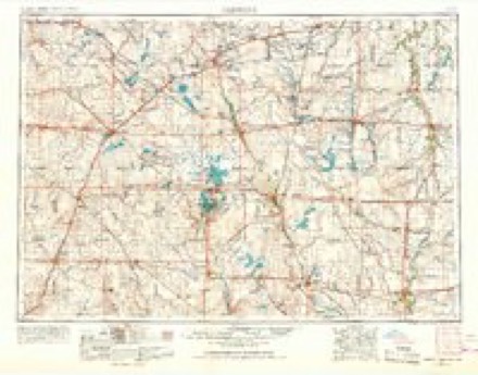
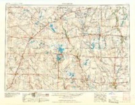
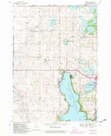
4 surveys from 8 printed sheetsMatched by testing this settlement's coordinate against the published boundary of every sheet in the United States Geological Survey's historical collection. Each opens the scanned sheet at the Survey.
- 1954 USGS Fairmont quadrangle1:250000, 3 printings
- 1958 USGS Fairmont quadrangle1:250000
- 1970 USGS Okoboji quadrangle1:24000, 2 printings
- 1985 USGS Iowa Great Lakes quadrangle1:100000, 2 printings
Fires near this place
29 since 2006Regional context, not property-specific evidence. The federal wildfire occurrence database lists 29 fires within 5 miles of Okoboji between 2006 and 2017, burning about 646 acres in total. None started naturally. None was recorded as arson. Distance is straight-line from the map coordinates, so a fire counted here may appear on a neighbouring settlement's page as well.
| Reported cause | Fires |
|---|---|
| Missing data/not specified/undetermined | 23 |
| Debris and open burning | 5 |
| Misuse of fire by a minor | 1 |
The most recent of them, most recent first, with the day each was reported and the service that recorded it.
| Date | Cause | Size | Reported by | Name on the report |
|---|---|---|---|---|
| 31 July 2017 | Missing data/not specified/undetermined | under an acre | Iowa Department of Natural Resources | not named |
| 27 June 2017 | Missing data/not specified/undetermined | under an acre | Iowa Department of Natural Resources | not named |
| 9 April 2011 | Missing data/not specified/undetermined | 60 acres | Iowa Department of Natural Resources | A34, 2235 193RD AVE., OKOBOJI TWP, BY LITTLE SIOUX |
| 9 April 2009 | Missing data/not specified/undetermined | 1.0 acres | Iowa Department of Natural Resources | not named |
| 7 April 2011 | Missing data/not specified/undetermined | 1.0 acres | Iowa Department of Natural Resources | 25271 182ND ST., CENTER GROVE TWP, SPIRIT LAKE, IA |
| 6 April 2011 | Missing data/not specified/undetermined | under an acre | Iowa Department of Natural Resources | 2305 225TH ST., MILFORD TWP, MILFORD, IA, IA |
| 30 April 2015 | Missing data/not specified/undetermined | under an acre | Iowa Department of Natural Resources | not named |
| 3 April 2009 | Missing data/not specified/undetermined | 10 acres | Iowa Department of Natural Resources | not named |
Settlements close enough to share some of these fires:
Mines and quarries near this place
10 of 27 shownRegional context, not property-specific evidence. The federal mineral resources record lists 27 workings within 5 miles of Okoboji: 19 past producers, 7 producers, 1 unknown. 7 still produce. What was taken out: Sand and Gravel, Construction. Distance is straight-line from the map coordinates, so a quarry counted here may appear on a neighbouring settlement's page as well.
| Where | Site | Commodity | Status | Recorded |
|---|---|---|---|---|
| Dickinson County Pits | Sand and Gravel, Construction | Producer | ||
| Frey Pit | Sand and Gravel, Construction | Producer | ||
| Herman Wedking | Sand and Gravel, Construction | Past Producer | ||
| Leith Pit | Sand and Gravel, Construction | Past Producer | ||
| Milford Pit | Sand and Gravel, Construction | Past Producer | ||
| Milford Pit | Sand and Gravel, Construction | Past Producer | ||
| Rohlin Pit | Sand and Gravel, Construction | Producer | ||
| Roth Pit | Sand and Gravel, Construction | Past Producer | ||
| Unknown | Sand and Gravel, Construction | Past Producer | ||
| Unknown | Sand and Gravel, Construction | Past Producer |
Storms near this place
36 since 1994Regional context, not property-specific evidence. The National Weather Service names Okoboji in 36 storm reports between 1994 and 2024: 17 hail, 10 thunderstorm wind, 4 flash flood, 4 flood. The reports record 2 injuries. Each account below is quoted exactly as the forecast office filed it, from the NOAA Storm Events Database, and each date opens the federal record of that event.
| When | Event | Place named | Harm | What the report says |
|---|---|---|---|---|
| June 2001 | Hail | Okoboji | 2 hurt, $100,000 | Large hail injured 2 people, and caused damage to vehicles and buildings. |
| June 2024 | Flood | West Okoboji | $1,900,000 | Rainfall amounts across Dickinson County from June 20-22 ranged from 5 to 10 inches. Widespread overland flooding ensued with additional major to record flooding along the West Fork Little Sioux and Little Sioux Rivers. Lakeshore flooding was also observed across the Iowa Great Lakes. ||There were over 550 locations across the county where water crossed the road or there was severe gravel wash. Three bridges were also damaged and closed. Preliminary damage assessments estimate loss to public infrastructure to be 1.9 million dollars. ||County-wide, hundreds of homes reported flood damage with water or sewage in their basements. There were approximately 25 lakeshore homes with water onto the first floor, which required the temporary relocation of some residents. There were also flood damages to area businesses. Dozens of bank collapses were reported along East Okoboji, West Okoboji, Big Spirit, and Silver Lakes with nearly 3,000 ft of shoreline lost. West Okoboji Lake crested about six inches below the record set in 1993. ||The majority of overland flooding subsided by June 25, but river flooding continued through the end of the month. For additional information on river flooding, please see other flood entries for Dickinson County. |
| August 2019 | Thunderstorm Wind | Okoboji | $250,000 | A widespread swath of wind damage occurred from the eastern shores of West Okoboji Lake to the eastern shore of East Okoboji Lake. Areas near West Lake Okoboji featured limb and minor building damage with wind speeds of 65 to 75 mph. However, more significant damage occurred east of Highway 71 where large trees were snapped and an office building severely damaged with wind gusts from 75 to 93 mph. |
| March 2019 | Flood | West Okoboji | $190,000 | Water was over County Road A34 in multiple locations west of Milford, as well as over roads in other nearby areas. Other flooding resulted in damage to public infrastructure including county roads and culverts. |
| July 2010 | Thunderstorm Wind | West Okoboji | $75,000 | Thunderstorm winds damaged several boats and docks at Terrace Park Beach. The winds also blew down trees and power lines, resulting in power outages. |
| July 2010 | Thunderstorm Wind | Okoboji | $50,000 | Thunderstorm winds caused widespread tree and power line damage. Several large trees were blown down, blocking some roads, and downed power lines resulted in power outages. A few buildings and vehicles were damaged by falling trees or tree debris. |
| June 1994 | Hail | West Okoboji | $50,000 | no account filed |
| June 2014 | Thunderstorm Wind | Okoboji | $10,000 | Thunderstorm winds snapped off 8 power poles. |
| June 2016 | Tornado (EF0) | West Okoboji | $1,000 | A brief tornado damaged a small shed. |
| December 2021 | Thunderstorm Wind | West Okoboji | - | Several tree limbs were broken by thunderstorm winds. |
| June 2019 | Flood | West Okoboji | - | During crop planting season, prolonged flooding led to the loss of or inability to plant crops across the area. Crop loss estimates provided by the United States Department of Agriculture. |
| July 2018 | Flood | Okoboji | - | A no-wake rule was implemented on Lake Okoboji as well as all other lakes in Dickinson County as levels approached minor flood stage on July 4. Lake levels crested at minor flood stage at the east/west Okoboji Channel (gage site EWOI4) on July 5. The no-wake rule was relaxed on July 11. |
| June 2018 | Flash Flood | West Okoboji | - | Repeated bursts of heavy rain over a two hour period brought 4 to 6 inches of rainfall. Water inundated State Highway 86, resulting in several stalled vehicles. |
| June 2018 | Flash Flood | West Okoboji | - | An estimated 5 inches of rainfall resulted in water across the road 7 miles west of Milford. |
| June 2018 | Thunderstorm Wind | West Okoboji | - | Strong winds uprooted a mature tree which blocked the road in front of Taco House Restaurant. |
| June 2016 | Flash Flood | Okoboji | - | Heavy rain caused flash flooding of streets in Spirit Lake. |
| July 2009 | Flash Flood | Okoboji | - | Heavy rain caused flash flooding of Streets in the town of Spirit Lake, stalling several vehicles. |
| July 2009 | Thunderstorm Wind | West Okoboji | - | Thunderstorm winds caused an unknown amount of tree damage. |
| July 2009 | Thunderstorm Wind | West Okoboji | - | Thunderstorm winds caused damage to corn crops. The amount of crop damage was not known. |
| June 2001 | Hail | Okoboji | - | Large hail accumulated two and a half inches. |
| April 2022 | Hail | West Okoboji | - | no account filed |
| June 2020 | Hail | Okoboji | - | no account filed |
| June 2018 | Hail | West Okoboji | - | no account filed |
| June 2018 | Hail | West Okoboji | - | no account filed |
| June 2017 | Hail | West Okoboji | - | no account filed |
| June 2016 | Hail | West Okoboji | - | no account filed |
| June 2014 | Hail | Okoboji | - | no account filed |
| September 2012 | Thunderstorm Wind | Okoboji | - | no account filed |
| August 2008 | Hail | West Okoboji | - | no account filed |
| May 2005 | Hail | Okoboji | - | no account filed |
| April 2004 | Hail | Okoboji | - | no account filed |
| May 2002 | Hail | Okoboji | - | no account filed |
| May 2002 | Hail | Okoboji | - | no account filed |
| May 1999 | Hail | Okoboji | - | no account filed |
| June 1998 | Hail | West Okoboji | - | no account filed |
| July 1998 | Thunderstorm Wind | West Okoboji | - | no account filed |
Nearest settlements
The eight closest, with where each one stands in the county. Distances are straight-line, computed from the Geographic Names Information System coordinates.
| Map | Place | Distance | Sheets |
|---|---|---|---|
| Village East Resort | 1.1 miles | 8 | |
| Manhattan Beach Resort | 1.1 miles | 8 | |
| Arnolds Park | 1.6 miles | 7 | |
| Crows Nest Resort | 1.6 miles | 7 | |
| Egralharve | 1.7 miles | 8 | |
| Crescent Beach Resort | 1.8 miles | 8 | |
| Wahpeton | 1.9 miles | 8 | |
| West Okoboji | 2.4 miles | 8 |
Elsewhere
Matched on this settlement's Geographic Names Information System number rather than its name, so it cannot be a different place of the same name in another state.
| Wikipedia article on Okoboji | An encyclopaedic summary. Its text is share-alike, so it is linked here rather than copied. |
| Wikidata item Q1926483 | The structured record the population and elevation above come from. Public domain (CC0). |
Provenance
This settlement is recorded in the Geographic Names Information System as feature 459815. The sheet list is computed by point-in-boundary test against the United States Geological Survey's historical topographic inventory. Both are works of the United States government and carry no copyright under 17 U.S.C. 105.
Wildfire. Short, Karen C. 2022. Spatial wildfire occurrence data for the United States, 1992-2020 [FPA_FOD_20221014]. 6th Edition. Fort Collins, CO: Forest Service Research Data Archive. https://doi.org/10.2737/RDS-2013-0009.6 Collected with United States Government funding and usable without additional permissions or fees.
Mines and quarries. USGS Mineral Resources Data System (MRDS) https://mrdata.usgs.gov/mrds/ A work of the United States government, no copyright under 17 U.S.C. 105.
Storms. NOAA National Centers for Environmental Information, Storm Events Database https://www.ncei.noaa.gov/stormevents/ A work of the United States government, no copyright under 17 U.S.C. 105. Narratives are quoted verbatim from the National Weather Service report and are not edited or summarised.