 Block
Payne, Iowa
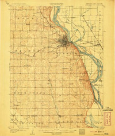
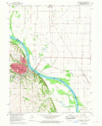
12 topographic sheets cover this place, the earliest surveyed in 1907 and the latest in 1993. It stands in Washington Township. It lies in ZIP code area 51640. The Survey maps it on the Nebraska City quadrangle.
Topographic sheets covering this place
7 surveys from 12 printed sheetsMatched by testing this settlement's coordinate against the published boundary of every sheet in the United States Geological Survey's historical collection. Each opens the scanned sheet at the Survey.
- 1907 USGS Nebraska City quadrangle1:62500, 3 printings
- 1955 USGS Nebraska City quadrangle1:250000, 3 printings
- 1957 USGS Nebraska City quadrangle1:250000
- 1958 USGS Nebraska City quadrangle1:250000
- 1966 USGS Nebraska City quadrangle1:24000, 2 printings
- 1985 USGS Nebraska City quadrangle1:100000
- 1993 USGS Nebraska City quadrangle1:100000
Fires near this place
18 since 2006Regional context, not property-specific evidence. The federal wildfire occurrence database lists 18 fires within 5 miles of Payne between 2006 and 2018, burning about 26 acres in total. 1 started naturally. 1 was recorded as arson. Distance is straight-line from the map coordinates, so a fire counted here may appear on a neighbouring settlement's page as well.
| Reported cause | Fires |
|---|---|
| Missing data/not specified/undetermined | 7 |
| Debris and open burning | 6 |
| Smoking | 3 |
| Natural | 1 |
| Arson/incendiarism | 1 |
The most recent of them, most recent first, with the day each was reported and the service that recorded it.
| Date | Cause | Size | Reported by | Name on the report |
|---|---|---|---|---|
| 8 August 2007 | Natural | under an acre | Nebraska Forest Service | not named |
| 27 June 2008 | Missing data/not specified/undetermined | under an acre | Nebraska Forest Service | not named |
| 18 May 2006 | Missing data/not specified/undetermined | under an acre | Iowa Department of Natural Resources | not named |
| 4 April 2014 | Missing data/not specified/undetermined | 1.1 acres | Iowa Department of Natural Resources | not named |
| 3 April 2018 | Debris and open burning | under an acre | Nebraska Forest Service | not named |
| 16 April 2008 | Debris and open burning | 10 acres | Nebraska Forest Service | not named |
| 12 April 2018 | Missing data/not specified/undetermined | under an acre | Nebraska Forest Service | not named |
| 9 March 2017 | Smoking | 1.0 acres | Nebraska Forest Service | not named |
Settlements close enough to share some of these fires:
Mines and quarries near this place
2 within 5 milesRegional context, not property-specific evidence. The federal mineral resources record lists 2 workings within 5 miles of Payne: 2 past producers. None of them still produces. What was taken out: Sand and Gravel, Construction. Distance is straight-line from the map coordinates, so a quarry counted here may appear on a neighbouring settlement's page as well.
| Where | Site | Commodity | Status | Recorded |
|---|---|---|---|---|
| Payne Junction Pit | Sand and Gravel, Construction | Past Producer | ||
| Unknown | Sand and Gravel, Construction | Past Producer |
Storms near this place
18 since 2008Regional context, not property-specific evidence. The National Weather Service names Payne in 18 storm reports between 2008 and 2024: 7 thunderstorm wind, 4 flood, 3 tornado, 3 hail. No death or injury is recorded in these reports. Each account below is quoted exactly as the forecast office filed it, from the NOAA Storm Events Database, and each date opens the federal record of that event.
| When | Event | Place named | Harm | What the report says |
|---|---|---|---|---|
| June 2011 | Flash Flood | Payne | $100,000 | A federal levee along the Missouri River failed causing flash flooding of several farmsteads southwest of Hamburg. The flood waters also flooded across a local highway and eventually reached Interstate 29 and a levee surrounding Hamburg. |
| May 2011 | Flood | Payne | $5,000 | This flooding carried over from April when several episodes of heavy rain combined with snow melt and heavy rain upstream caused a prolonged period of high flows along the Missouri River. At Nebraska City the river first climbed over its 18 foot flood stage in mid April and had a several week crest around 19.5 feet from late April into mid May then steadily rose into June ending May around 23 feet. Although the flooding mainly affected marshes and farmland along the river, a few roads and recreational areas were also flooded. The flooding got progressively worse in June. |
| August 2010 | Flood | Payne | $3,000 | This flooding carried over from June and July when heavy rain over much of eastern Nebraska and western Iowa during those months caused a prolonged period of flooding along the Missouri River, especially downstream of Omaha through Rulo. The river near Nebraska City climbed above flood stage early in the afternoon on June 11th and remained above flood stage for most of July and into August. River levels were held up by additional rains and increased releases from upstream reservoirs. The river at Nebraska City crested around or a little over 25 feet during the afternoon of June 16th and June 21st. During July the river at Nebraska City peaked around 22 feet during the evening of July 1 and in August a crest of around 21.5 feet was seen on the 5th. Flood stage is 18 feet. In western Iowa most of the flooding was confined to farmland along the river with most of the significant flooding occurring during June and July. |
| June 2011 | Flood | Payne | $2,000 | Rainfall of 1 to 3 inches in less than a 12 hour time period brought lowland flooding along the Nishnabotna River in southwest Iowa. The river near Hamburg crested a little over its 23 foot flood stage during the afternoon of 6/27. The river flooded mainly farm land along the river but significant flooding from the Missouri River was ongoing in the area already. |
| June 2024 | Flood | Payne | - | Excessive rainfall across much of eastern South Dakota resulted in river flooding along the Missouri River at the end of June. Moderate flood stage was observed along the Missouri, with the river gauge in Nebraska City cresting at 24.35 feet on 6/30. Flood stage at this river gauge is 18.0 feet. The county did not report any damages to the State of Iowa, so have left damages at zero. |
| May 2023 | Tornado (EFU) | Payne | - | Public sent a video of a brief tornado kicking up a bit of dust resulting in no damage. |
| April 2023 | Thunderstorm Wind | Payne | - | A public personal weather station recorded a peak wind gust of 58 mph. |
| April 2023 | Tornado (EFU) | Payne | - | Multiple photographs and reports from storm chasers and public confirm a brief tornado near this location. No damage was reported or surveyed. |
| July 2021 | Thunderstorm Wind | Payne | - | Iowa mesonet station measured a peak wind gust of 80 mph. |
| October 2020 | Thunderstorm Wind | Payne | - | Iowa DOT site measured a peak wind gust of 67 mph. |
| September 2016 | Thunderstorm Wind | Payne | - | Measured by a Iowa State department of transportation road weather sensor. |
| June 2016 | Thunderstorm Wind | Payne | - | Along with the quarter size hail that fell at the residence, the public estimated that winds were around 60 mph. |
| September 2015 | Thunderstorm Wind | Payne | - | Where is the damage. |
| May 2013 | Thunderstorm Wind | Payne | - | A department of roads sensor along I29 measured a thunderstorm wind gust of 61 mph. |
| June 2008 | Tornado (EF0) | Payne | - | A brief tornado touchdown was reported near I-29 and mile marker 10. The tornado was only on the ground a minute or two and caused no apparent damage. |
| March 2016 | Hail | Payne | - | no account filed |
| June 2016 | Hail | Payne | - | no account filed |
| June 2011 | Hail | Payne | - | no account filed |
Nearest settlements
The eight closest, with where each one stands in the county. Distances are straight-line, computed from the Geographic Names Information System coordinates.
| Map | Place | Distance | Sheets |
|---|---|---|---|
| East Port (historical) | 4.0 miles | 12 | |
| Percival | 6.2 miles | 12 | |
| Hamburg | 7.1 miles | 13 | |
| Eureka (historical) | 7.8 miles | 15 | |
| Sidney | 8.1 miles | 12 | |
| Riverton | 10.2 miles | 12 | |
| Thurman | 10.4 miles | 9 | |
| McPaul | 10.7 miles | 15 |
Provenance
This settlement is recorded in the Geographic Names Information System as feature 460047. The sheet list is computed by point-in-boundary test against the United States Geological Survey's historical topographic inventory. Both are works of the United States government and carry no copyright under 17 U.S.C. 105.
Wildfire. Short, Karen C. 2022. Spatial wildfire occurrence data for the United States, 1992-2020 [FPA_FOD_20221014]. 6th Edition. Fort Collins, CO: Forest Service Research Data Archive. https://doi.org/10.2737/RDS-2013-0009.6 Collected with United States Government funding and usable without additional permissions or fees.
Mines and quarries. USGS Mineral Resources Data System (MRDS) https://mrdata.usgs.gov/mrds/ A work of the United States government, no copyright under 17 U.S.C. 105.
Storms. NOAA National Centers for Environmental Information, Storm Events Database https://www.ncei.noaa.gov/stormevents/ A work of the United States government, no copyright under 17 U.S.C. 105. Narratives are quoted verbatim from the National Weather Service report and are not edited or summarised.