 Block
From the record
9 National Register listings published here.
Sources: the National Register database, National Park Service
43 topographic sheets cover 17 settlements here, and 9 properties are on the National Register of Historic Places.
9 National Register listings published here.
Sources: the National Register database, National Park Service
Every property in this county listed on the National Register of Historic Places, with the year it was listed and the federal nomination document.
| Photograph | Property | Type | Listed | Reference |
|---|---|---|---|---|
 | Chautauqua Pavilion | structure | 1976 | 76000773 |
 | Fremont County Courthouse | building | 1981 | 81000238 |
 | Hamburg Public Library | building | 1983 | 83000359 |
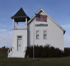 | Hunter School | building | 2007 | 06001220 |
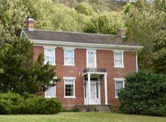 | Jason and Elizabeth Baylor Rector House | building | 2002 | 01001542 |
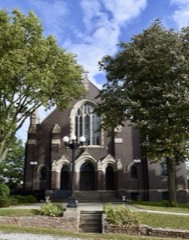 | St. Patrick Church | building | 1983 | 83000360 |
| Tabor Antislavery Historic District | district | 2007 | 07001117 | |
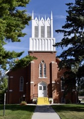 | Tabor Congregational Church | building | 2011 | 11000720 |
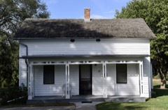 | Todd House | building | 1975 | 75000689 |
Every wildfire the federal occurrence database records inside this county: 48 of them, burning about 387 acres. None started naturally and none was recorded as arson. Each settlement page carries the fires within five miles of it.
| Reported cause | Fires |
|---|---|
| Missing data/not specified/undetermined | 41 |
| Debris and open burning | 4 |
| Smoking | 2 |
| Equipment and vehicle use | 1 |
The five largest, by the area the report gives. None of them was recorded as arson.
| Date | Cause | Size | Reported by | Name on the report |
|---|---|---|---|---|
| 6 March 2020 | Smoking | 80 acres | Iowa Department of Natural Resources | not named |
| 5 March 2020 | Smoking | 43 acres | Iowa Department of Natural Resources | not named |
| 20 February 2006 | Missing data/not specified/undetermined | 40 acres | Iowa Department of Natural Resources | not named |
| 20 February 2006 | Missing data/not specified/undetermined | 30 acres | Iowa Department of Natural Resources | not named |
| 21 March 2009 | Missing data/not specified/undetermined | 30 acres | Iowa Department of Natural Resources | not named |
| 8 April 2006 | Missing data/not specified/undetermined | 30 acres | Iowa Department of Natural Resources | not named |
| 21 February 2013 | Missing data/not specified/undetermined | 20 acres | Iowa Department of Natural Resources | not named |
| 19 January 2006 | Missing data/not specified/undetermined | 15 acres | Iowa Department of Natural Resources | not named |
Every settlement page carries the fires within five miles of it - see the settlement index below.
The NOAA Storm Events Database holds 361 reports for this county, causing 3 deaths, 29 injuries and about $56,997,630 in recorded property damage. Each settlement page carries the reports that name it.
| Kind of event | Reports |
|---|---|
| Hail | 138 |
| Thunderstorm Wind | 111 |
| Flood | 64 |
| Tornado | 38 |
| Flash Flood | 6 |
| Funnel Cloud | 3 |
| Lightning | 1 |
The most serious of them, by death, then injury, then recorded damage. The accounts are quoted exactly as the forecast office filed them.
| When | Event | Place named | Harm | What the report says |
|---|---|---|---|---|
| August 1979 | Tornado (F3) | not stated | 2 killed, 14 hurt, $2,500,000 | no account filed |
| March 2019 | Flood | Farragut | 1 killed, 2 hurt, $22,000,000 | Flooding along the Nishnabotna River. The river gage above Hamburg, operated by the USGS, peaked at 31.07 feet at 11 am on March 16th. Moderate flood stage is 27.5 feet while major flood stage is 33 feet. Preliminary informations shows this peak is the 3rd highest on record. Flooding also occurred along the Missouri River. The river gage at Nebraska City, operated by the USGS, peaked at 30.15 feet at 6 pm on March 16th. Minor flood stage is 18 feet, moderate flood stage is 23 feet while major flood stage is 27 feet. Preliminary data shows this to be a record crest. Flooding continued into the next month. Levees 601, 594 and 575 failed flooding Bartlett, Percival, Hamburg, and the truck stop area near Interstate 29. Dollar estimate is from the Army Corps of Engineers Omaha District. Hospitals and businesses were impacted by the flood. Floods devastated livestock, grain storage, and fields that had yet to be planted.Water systems in Hamburg were incapacitated and overcome with high water. Three men were driving in Hamburg and drove around a road closed barrieron the evening of the 15th. They continued driving until they hit flood water, where the current swept their vehicle away. The men tried to swim to safety. Two of the men were found holding onto trees in the floodwaters. The third was found in a ditch near a residence trying to get warm. One of the men died. |
| April 2012 | Tornado (EF2) | Percival | 4 hurt | A tornado touched down near Percival, Iowa and began a 12 mile long track that went through Thurman causing extensive home, vehicle and tree damage to that town. It was estimated that at least 70 percent of the buildings in Thurman sustained damage, including 14 homes that were destroyed. The tornado was rated at EF2. Only minor injuries were reported in Thurman. However, as the tornado crossed Interstate 29, four semi trucks were overturned requiring the hospitalization of four truckers, the most serious with a punctured lung. |
| May 1983 | Tornado (F2) | not stated | 3 hurt, $2,500,000 | no account filed |
| September 1989 | Tornado (F1) | not stated | 3 hurt, $250,000 | no account filed |
| June 2018 | Thunderstorm Wind | Mc Paul | 2 hurt | A total of 9 semi-trucks were overturned on Interstate 29 west of Thurman. Two drivers were injured and taken by ambulance to a hospital. Interstate 29 was closed in both directions after the damaging wind gust overturned the trucks. Numerous trees and power lines were down west of Thurman. In Thurman, there were a lot of trees uprooted along with damage to roofs of homes. |
| July 1992 | Thunderstorm Wind | not stated | 1 hurt | no account filed |
| March 2019 | Flash Flood | Bartlett | $14,000,000 | Thurman was evacuated due to a levee break on the Missouri River. |
| August 2011 | Flood | Bartlett | $10,000,000 | Flooding along the Missouri River gradually worsened over the area during June into July as record inflows into the Missouri River above Sioux City in June and much above normal inflows during July prompted record releases from Gavins Point Dam. The river at Nebraska City reached a record crest of a little over 28 feet by the end of the June before falling through early July as levees in the area were breached and widened by flood waters. Although moderate flooding still persisted into August, river values started falling by the end of the month and minor flooding continued into September as outflows from Gavins Point were reduced. River values at Nebraska City started August a little over 23 feet and ended the month a little over 20.5 feet. Flood stage at Nebraska City is 18 feet. The levee west and southwest of Hamburg failed in June as did the levee near Percival causing extensive flooding of farmland, roads and a few highways near Hamburg, including 24 miles of Interstate 29. Highway 2 that led into Nebraska City also closed by the middle of June due to flood waters and remained closed through September. By the middle of June just under 1,000 people had been evacuated along the river in the Hamburg area and at least 10 businesses had closed. Sandbagging and development of a second levee near Hamburg kept much of the flood waters out of that town during July and August, and the mandatory evacuation was changed to a voluntary one by late August as the river level dropped and pressure on the levee near town was reduced. Around 600 people in Percival, Bartlett and Paul were evacuated toward the end of June after the levee near Percival failed. By the middle of August, as the water had receded slightly, it was learned that erosion had impacted the integrity of some of Interstate 29, especially near bridges and overpasses. The Iowa Farm Bureau Federation estimated that the flood event caused total crop and economic losses of $52.2 million in Fremont county. |
| September 2011 | Flood | Hamburg | $3,000,000 | Flooding along the Missouri River gradually improved over the area during September as releases from Gavins Point Dam were reduced. The river at Nebraska City, which reached a record crest of a little over 28 feet by the end of the June, had fallen to around 20.5 feet by the first of September and finally below its 18 foot flood stage during the evening of Sept. 28th. However, extensive flooding of farm fields, roads and highways that had occurred over the summer as levees near Hamburg and Percival failed persisted into September. The flooding caused the closure of 24 miles of Interstate 29 and Highway 2 into Nebraska City as well as other local roads and highways. After the flood waters receded, it was learned that Highway 2 near I29 had several areas of extensive damage, included a sink hole of 15 feet deep. Bridge approaches along I29 were damaged just north of the Missouri border. These roads remained closed in September. |
| June 2011 | Flood | Bartlett | $500,000 | Flooding along the Missouri River gradually worsened over the area during June as record releases from Gavins Point Dam and periodic heavy rain brought widespread flooding along the River. The river at Nebraska City, which climbed above its 18 foot flood stage in mid April, started June around 23 feet and then began rising by the 10th eventually reaching a record crest a little over 28 feet by the end of the month. The river stayed well above flood stage into July. A levee west and southwest of Hamburg experienced seepage in several areas prompting partial evacuation of Hamburg on the 5th. The levee eventually failed by the middle of June causing extensive flooding of farmland, roads and a few highways near Hamburg, including 10 miles of Interstate 29. Highway 2 that led into Nebraska City was also closed by the middle of June due to flood waters. By the middle of June just under 1,000 people had been evacuated along the river in the Hamburg area, and at least 10 businesses had closed. Sandbagging and development of a second levee near town kept much of the flood waters out of Hamburg during June. Around 600 people in Percival, Bartlett and Paul were evacuated toward the end of the month and on June 30th the levee near Percival failed causing additional flooding and closing of more of Interstate 29. |
| May 2007 | Flood | Riverton | $500,000 | Heavy rainfall over the weekend of May 4th through the 6th, caused the Nishnabotna River to flood across Fremont county. The Nishnabotna River at Hamburg reached a prolonged crest of around 32.4 feet between 715 pm and 1145 pm on May 8th. Flood stage is 23 feet. The river at Hamburg first crossed flood stage around 6 am CDT on May 6th and didn't drop below flood stage until around 7 am on May 15th.|The flooding closed Interstate 29 for a while and an agricultural levee broke south of town sending significant amounts of water across agricultural bottom lands and county roads in the region early May 7th.|Flooding was also observed along the East Nishnabotna River northeast of Riverton to it's merger with the West Nishnabotna near Riverton where it forms the Nishnabotna that passes near Hamburg. Some home damage and county roads closures were reported in the area due to flood waters. |
| June 1990 | Tornado (F2) | not stated | $250,000 | no account filed |
| June 1964 | Tornado (F3) | not stated | $250,000 | no account filed |
| June 1964 | Tornado (F4) | not stated | $250,000 | no account filed |
| July 2011 | Flood | Bartlett | $150,000 | Flooding along the Missouri River gradually worsened over the area during June as record releases from Gavins Point Dam and periodic heavy rain brought widespread flooding along the River. The river at Nebraska City reached a record crest a little over 28 feet by the end of the June before falling through early July as levees in the area were breached and widened by flood waters. However, significant flooding persisted through much of July and August. A levee west and southwest of Hamburg failed by the middle of June causing extensive flooding of farmland, roads and a few roads or highways near Hamburg, including 10 miles of Interstate 29. By mid July around 24 miles of Interstate 29 was closed, from around Bartlett to the Missouri border. Highway 2 that led into Nebraska City also closed by the middle of June due to flood waters and remained closed in July. By the middle of June just under 1,000 people had been evacuated along the river in the Hamburg area and at least 10 businesses had closed. Sandbagging and development of a second levee near Hamburg kept much of the flood waters out of that town during July. Around 600 people in Percival, Bartlett and Paul were evacuated toward the end of June and on June 30th the levee near Percival failed causing additional flooding and closing of more of Interstate 29. By the end of July the levee breach near Percival expanded from 200 feet in late June to around 1,000 feet by the end of July. |
| June 2011 | Flash Flood | Payne | $100,000 | A federal levee along the Missouri River failed causing flash flooding of several farmsteads southwest of Hamburg. The flood waters also flooded across a local highway and eventually reached Interstate 29 and a levee surrounding Hamburg. |
| June 2008 | Lightning | Farragut | $100,000 | Lightning apparently struck a house causing a fire that totally destroyed it. |
| June 1994 | Hail | Tabor | $50,000 | Warm, moist, and unstable air poured into Iowa during the day. By the early evening hours thunderstorms erupted over eastern Nebraska and southwest Iowa where convection broke through the capping layer. The storms produced hail over the far southwest corner of the state. The hail ranged from dime-size to golf ball-size. Considerable damage was reported to the crops in the area. |
| June 1994 | Hail | Thurman | $50,000 | Warm, moist, and unstable air poured into Iowa during the day. By the early evening hours thunderstorms erupted over eastern Nebraska and southwest Iowa where convection broke through the capping layer. The storms produced hail over the far southwest corner of the state. The hail ranged from dime-size to golf ball-size. Considerable damage was reported to the crops in the area. |
| June 1994 | Hail | Farragut | $50,000 | no account filed |
| June 1994 | Hail | Randolph | $50,000 | no account filed |
| June 1994 | Hail | Randolph | $50,000 | no account filed |
| August 1993 | Hail | Sidney | $50,000 | no account filed |
| August 1993 | Thunderstorm Wind | not stated | $50,000 | no account filed |
| December 2015 | Flood | Riverton | $25,000 | Heavy rainfall during mid December led to river flooding along both the East and West Nishnabotna Rivers. The West Nishnabotna River crested during the late afternoon on the 14th, while the East Nishnabotna crested late on the 15th. The river flooding was generally confined to low agricultural land along the rivers, but State Highway J46 was closed due to flooding. |
| May 1988 | Tornado (F0) | not stated | $25,000 | no account filed |
| June 1978 | Tornado (F1) | not stated | $25,000 | no account filed |
| May 1976 | Tornado (F1) | not stated | $25,000 | no account filed |
| June 1972 | Tornado (F1) | not stated | $25,000 | no account filed |
| April 1968 | Tornado (F2) | not stated | $25,000 | no account filed |
| April 1964 | Tornado (F2) | not stated | $25,000 | no account filed |
| May 1959 | Tornado (F2) | not stated | $25,000 | no account filed |
| June 2010 | Flood | Hamburg | $10,000 | Heavy rain over much of eastern Nebraska and western Iowa during most of June caused a prolonged period of flooding along the Missouri River, especially downstream of Omaha through Rulo. The river near Nebraska City climbed above flood stage early in the afternoon on June 11th and remained above flood stage into July. The river at Nebraska City crested around or a little over 25 feet during the afternoon of June 16th and June 21st. Flood stage is 18 feet. Some roads near the river were flooded along with some cabins, boat ramps and recreation areas. |
| September 2014 | Flood | Hamburg | $5,000 | A slow moving thunderstorm complex lead to heavy rainfall on the 9th causing the West Nishnabotna River to rise above flood stage around the Hamburg area. The river rose above flood stage during the afternoon on the 10th, crested later that morning, and fell below flood stage during the afternoon on the 11th. The flooding was minor and confined to low-lying areas. |
| October 2014 | Flood | Riverton | $5,000 | Heavy rainfall in late September led to river flooding into early October along the West Nishnabotna River. The river rose to flood stage in the afternoon on the 1st, crested in the early morning on the 2nd, and fell below flood stage later that evening. The flooding was minor and confined to low-lying areas along the river. |
| September 2014 | Flood | Riverton | $5,000 | A slow moving thunderstorm complex lead to heavy rainfall on the 9th causing the East Nishnabotna River to rise above flood stage around the Riverton area. The river rose above flood stage during the afternoon on the 10th, crested during the morning on the 11th, and fell below flood stage later that afternoon. The flooding was minor and confined to low-lying areas. |
| August 2014 | Flood | Randolph | $5,000 | Repeated thunderstorms on the 27th and 28th of August caused heavy rainfall and the West Nishnabotna River to go into flood. The river rose above flood stage on the afternoon of the 28th, the river created and fell below flood stage that evening. The flooding was generally minor and confined to low-lying areas along the river. |
| August 2014 | Flood | Riverton | $5,000 | Repeated thunderstorms on the 27th and 28th of August caused heavy rainfall and the West Nishnabotna River to go into flood. The river rose above flood stage on the afternoon of the 28th, crested that late evening, and fell below flood stage in the early morning on the 29th. The flooding was generally minor and confined to low-lying areas along the river. |
| September 2014 | Flood | Riverton | $5,000 | Heavy rainfall at the end of August allowed the West Nishnabotna River to rise above flood stage on the early morning on the 2st, crest during the late morning, and fall below flood stage during the afternoon. The flooding was minor and confined to low-lying areas along the river. |
| April 2011 | Flood | Bartlett | $5,000 | Several periods of moderate to heavy rain combined with upstream inflows due to snow melt and rain caused the Missouri River to flood from around Nebraska City downstream through Rulo. The flooding began a little after the middle of the month and persisted into May. In Fremont county the flooding mainly affected marshy lowlands and low-lying farm fields along the river although a few recreational areas were flooded as well. The river at Nebraska City climbed above its 18 foot flood stage in the evening of 4/19 and continued above flood stage into May. The river had a prolonged crest of around and just under 19.5 feet over the last week or so of April. The flooding and this crest carried into May. |
| May 2011 | Flood | Payne | $5,000 | This flooding carried over from April when several episodes of heavy rain combined with snow melt and heavy rain upstream caused a prolonged period of high flows along the Missouri River. At Nebraska City the river first climbed over its 18 foot flood stage in mid April and had a several week crest around 19.5 feet from late April into mid May then steadily rose into June ending May around 23 feet. Although the flooding mainly affected marshes and farmland along the river, a few roads and recreational areas were also flooded. The flooding got progressively worse in June. |
| June 2010 | Flood | Hamburg | $5,000 | Heavy rain prior to and after June 11 caused flooding of the Nishnabotna River in southwest Iowa. The river near Hamburg crested at almost 27 feet around midnight CDT on June 15. Flood stage is 23 feet. The river near Hamburg was above flood stage from the early afternoon of June 11 until the late morning of June 16th. Levees near town protected significant damage, but some agricultural lowlands near the river were flooded as were some other places near town. |
| March 2010 | Flood | Bartlett | $5,000 | Melting snow and several periods of rain brought a prolonged period of flooding along the Missouri River. The river stage near Nebraska City (on the Nebraska side) crested around 21.5 feet late on March 22nd (flood stage is 18 feet). The high water flooded some county roads near the river and also approached Highway 2 east of Nebraska City. A few recreational areas were also flooded. |
| July 2010 | Flood | Bartlett | $5,000 | This flooding carried over from June when heavy rain over much of eastern Nebraska and western Iowa during most of that month caused a prolonged period of flooding along the Missouri River, especially downstream of Omaha through Rulo. The river near Nebraska City climbed above flood stage early in the afternoon on June 11th and remained above flood stage for most of July and into August. River levels were held up by additional rains and increased releases from upstream reservoirs. The river at Nebraska City crested around or a little over 25 feet during the afternoon of June 16th and June 21st. During July the river at Nebraska City peaked around 22 feet during the evening of July 1. Flood stage is 18 feet. In western Iowa most of the flooding was confined to farmland along the river. |
| August 1997 | Thunderstorm Wind | Tabor | $5,000 | Roof shingles ripped off of a home. |
| June 2010 | Flood | Hamburg | $4,000 | Heavy rain on June 22nd and 23rd caused flooding of the Nishnabotna River in southwest Iowa. The river near Hamburg crested at almost 27 feet during the morning of June 24th. Flood stage is 23 feet. The river near Hamburg was above flood stage from the morning of June 22 until the morning of June 25th. Levees near town protected significant damage, but some agricultural lowlands near the river were flooded. |
| June 2010 | Flood | Hamburg | $3,000 | Heavy rain producing thunderstorms that moved into western Iowa on June 27 caused another round of flooding along the Nishnabotna River, especially near Hamburg. The river near Hamburg crested a little over 26 feet in the evening of June 28, flood stage is 23 feet. The river near town was above flood stage from late in the evening of the 27th until the afternoon of the 29th. A federal levee near town protected the area from significant damage, but some agricultural lowlands near the river were flooded. |
| August 2010 | Flood | Payne | $3,000 | This flooding carried over from June and July when heavy rain over much of eastern Nebraska and western Iowa during those months caused a prolonged period of flooding along the Missouri River, especially downstream of Omaha through Rulo. The river near Nebraska City climbed above flood stage early in the afternoon on June 11th and remained above flood stage for most of July and into August. River levels were held up by additional rains and increased releases from upstream reservoirs. The river at Nebraska City crested around or a little over 25 feet during the afternoon of June 16th and June 21st. During July the river at Nebraska City peaked around 22 feet during the evening of July 1 and in August a crest of around 21.5 feet was seen on the 5th. Flood stage is 18 feet. In western Iowa most of the flooding was confined to farmland along the river with most of the significant flooding occurring during June and July. |
| May 1983 | Tornado (F1) | not stated | $2,500 | no account filed |
| April 1968 | Tornado (F2) | not stated | $2,500 | no account filed |
| July 1965 | Tornado (F2) | not stated | $2,500 | no account filed |
| June 2014 | Flood | Randolph | $2,000 | Heavy rain caused the West Nishnabotna River to flood from near Randolph downstream to near Riverton. The river near Randolph reached nearly 22.5 feet during the morning of June 4th, flood stage is 19 feet. Meanwhile, the river crested at around 26.36 feet near Riverton around noon on June 4. Flood stage at Riverton is 21.5 feet. The flooding mainly impacted agricultural land along the River. |
| June 2014 | Flood | Riverton | $2,000 | Heavy rain caused the Nishnabotna River to flood around the Hamburg area on June 4th. The river near Hamburg crested a little over 26.5 feet during the mid afternoon of June 4, flood stage is 25 feet. The flooding mainly impacted farmland along the river. |
| June 2011 | Flood | Payne | $2,000 | Rainfall of 1 to 3 inches in less than a 12 hour time period brought lowland flooding along the Nishnabotna River in southwest Iowa. The river near Hamburg crested a little over its 23 foot flood stage during the afternoon of 6/27. The river flooded mainly farm land along the river but significant flooding from the Missouri River was ongoing in the area already. |
| May 1998 | Thunderstorm Wind | Shenandoah | $2,000 | Tree branches downed onto power lines. |
| June 2010 | Flood | Randolph | $1,000 | Heavy rain over a 3 or 4 day period caused the West Nishnabotna River to briefly surpass its 19 foot flood stage near Randolph. The river crested at almost 19.5 feet around noon on the 14th. Some rural lowlands near the river were flooded. |
| May 1995 | Thunderstorm Wind | Riverton | $1,000 | no account filed |
| August 1993 | Tornado (F0) | Sidney | $50 | no account filed |
| August 1993 | Tornado (F0) | Shenandoah | $50 | no account filed |
The Survey's mineral resources record lists 7 workings inside this county. 1 still produces and 6 are closed or unrecorded. Each settlement page carries the workings within five miles of it.
| Commodity | Workings |
|---|---|
| Sand and Gravel, Construction | 4 |
| Stone, Crushed/Broken | 3 |
The least common of them first, because a county's hundredth gravel pit says nothing its first ten did not.
| Where | Site | Commodity | Status | Recorded |
|---|---|---|---|---|
| Tabor Quarry | Stone, Crushed/Broken | Past Producer | ||
| Thurman Quarry | Stone, Crushed/Broken | Producer | ||
| Unknown | Stone, Crushed/Broken | Past Producer | ||
| Bartlett Pit | Sand and Gravel, Construction | Past Producer | ||
| Payne Junction Pit | Sand and Gravel, Construction | Past Producer | ||
| Unknown | Sand and Gravel, Construction | Past Producer | ||
| Welchons Pit | Sand and Gravel, Construction | Past Producer |
Named settlements recorded in the Geographic Names Information System, each with the topographic sheets covering it. Villages, hamlets and abandoned places alike. Each is shown with the nearest named watercourse or landform and the survey quadrangle it falls on.
Scott township · 51654 · On Waubonsie Creek · Rock Bluff quadrangle
15 sheets, 1935 to 1993
Benton township · 51648 · On Horse Creek · Nebraska City quadrangle
12 sheets, 1907 to 1993
No longer a settlement
Riverton township · 51650 · On Ledgewood Creek · Riverton quadrangle
12 sheets, 1939 to 1993
The vanished settlements of Fremont County: the places named above that are no longer on the map.