 Block
Red Oak, Iowa
9 topographic sheets cover this place, the earliest surveyed in 1954 and the latest in 1985. It stands in Red Oak Township. It lies in ZIP code area 51566. It stands on Red Oak Creek. The Survey maps it on the Red Oak North quadrangle. 5,596 people lived here at the 2020 count. It stands 1,050 feet above sea level.
Research this city
On record in Red Oak
Buildings and businesses the archive holds for this place. Each opens its own page, with the source record it came from.
On the National Register 11 records
 Chautauqua Parklisted 1972
 Chicago, Burlington Northern and Quincy Depotlisted 1999
 Alfred Hebard Houselisted 1984
 Montgomery County Courthouselisted 1981
 Murphy, Thos. D. Co. Factory And Power Plantlisted 2008
 Edmund B. Osborne Houselisted 1997
 Red Oak Downtown Historic Districtlisted 2016
 Red Oak Firehouse and City Jaillisted 2006
 Red Oak Public Librarylisted 1983
- Montgomery County Jaillisted 1992
- Red Oak High Schoollisted 2020
Population over time
2 figuresRed Oak fell from 5,742 to 5,596 between 2010 and 2020. These are the recorded population figures Wikidata holds for this place, reached through the Geographic Names Information System number this page is keyed on rather than by name, so they belong to this place and not to another of the same name. Most are census counts, but not all are: an early figure may be a founding or settlement estimate, and an estimate published within five years of a census is left out. The change column is computed, and is left blank where more than 20 years separate a figure from the one before it, because a gap that long is not a change between two counts.
| Year | People | Change |
|---|---|---|
| 2010 | 5,742 | |
| 2020 | 5,596 | -146 (-3%) |
Topographic sheets covering this place
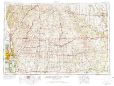
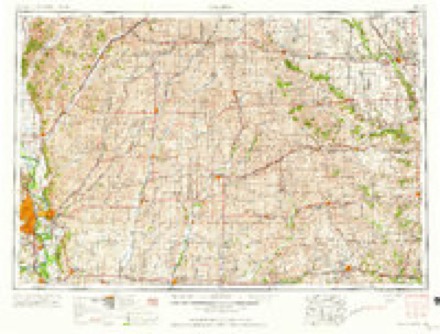
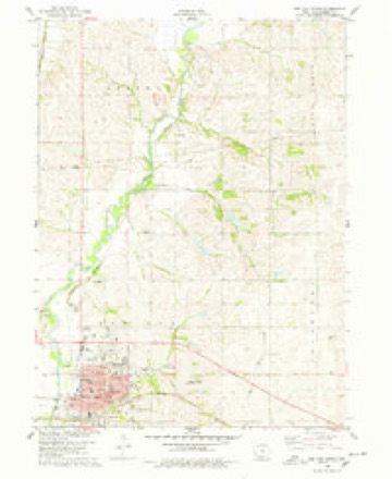
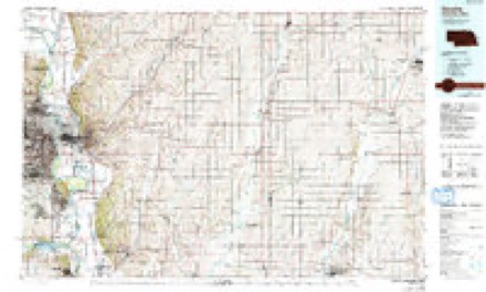
5 surveys from 9 printed sheetsMatched by testing this settlement's coordinate against the published boundary of every sheet in the United States Geological Survey's historical collection. Each opens the scanned sheet at the Survey.
- 1954 USGS Omaha quadrangle1:250000, 3 printings
- 1957 USGS Omaha quadrangle1:250000
- 1958 USGS Omaha quadrangle1:250000, 2 printings
- 1978 USGS Red Oak North quadrangle1:24000
- 1985 USGS Omaha quadrangle1:100000, 2 printings

Mines and quarries near this place
4 within 5 milesRegional context, not property-specific evidence. The federal mineral resources record lists 4 workings within 5 miles of Red Oak: 4 past producers. None of them still produces. What was taken out: Sand and Gravel, Construction, Stone, Crushed/Broken. Distance is straight-line from the map coordinates, so a quarry counted here may appear on a neighbouring settlement's page as well.
| Where | Site | Commodity | Status | Recorded |
|---|---|---|---|---|
| Red Oak Quarry | Stone, Crushed/Broken | Past Producer | ||
| Coburg Pit | Sand and Gravel, Construction | Past Producer | ||
| Red Oak Pit | Sand and Gravel, Construction | Past Producer | ||
| Unknown | Sand and Gravel, Construction | Past Producer |
Storms near this place
60 of 70 shownRegional context, not property-specific evidence. The National Weather Service names Red Oak in 70 storm reports between 1993 and 2024: 29 hail, 26 thunderstorm wind, 5 heavy rain, 4 flash flood. No death or injury is recorded in these reports. Each account below is quoted exactly as the forecast office filed it, from the NOAA Storm Events Database, and each date opens the federal record of that event.
| When | Event | Place named | Harm | What the report says |
|---|---|---|---|---|
| May 2007 | Flash Flood | Red Oak | $1,130,000 | Heavy rain for the second consecutive night caused flash flooding along Red Oak Creek in Red Oak as the creek backed up because of high flows on the East Nishnabotna River. Authorities attempted to evacuate nearly 1,600 people, beginning around 300 am local time, although not every attempt was successful. The water caused extensive damage to many basements in town, but no serious injuries were reported. In total an estimated 50 homes were damaged by flooding. |
| June 1994 | Hail | Red Oak | $50,000 | no account filed |
| April 1999 | Tornado (F1) | Red Oak | $45,000 | This tornado appeared to have been spawned by the same storm that produced the f0 tornado to its south. This storm damaged a pig farm where several metal buildings were destroyed. An RV was overturned and pushed into a small A frame house destroying it. |
| July 1994 | Thunderstorm Wind | Red Oak | $5,000 | A very unstable airmass was over the central plains during the late afternoon hours. Lifted indices were in the -10 to -12 °C. range with convective available potential energy values around 5000 J-Kg-1. During the day, a weak cold front sank slowly south across Iowa. By the late afternoon hours it had become stationary along the southern Iowa border, extending into southern Nebraska. A fairly strong southerly flow of moist air impinged on the front during the late afternoon and evening hours. This aided in the formation of a mesoscale convective complex. Iowa was on the far northeast edge of the complex and thus severe weather was somewhat limited. There were reports of hail and high winds over the southwest quarter of Iowa. Much of the severe weather was over the extreme southwest counties. Hail was under an inch in diameter, while wind gusts were generally around 60 MPH with the stronger storms. During the middle evening hours, gusty winds developed over the northwest and west central counties of the state. It is believed these winds were the result of a rear inflow jet on the back side of the mesoscale convective complex. Winds profiler data tended to support this idea and fit with literature written on the subject. The winds blew from the east to southeast at 40 to 50 MPH at Sioux City and Little Sioux for about 2 hours. Winds returned to normal by midnight. |
| June 1994 | Hail | Red Oak | $5,000 | no account filed |
| April 1993 | Hail | Red Oak | $5,000 | no account filed |
| June 2010 | Flood | Red Oak | $2,000 | Heavy rain during the morning of June 27th caused flooding of the East Nishnabotna River near Red Oak. The river near Red Oak crested at around 22 feet during the late evening of June 27th, flood stage is 18 feet. The river was above flood stage near Red Oak from the afternoon of the 27th until the morning of the 28th. Minor flooding of agricultural lowlands was noted. |
| May 2024 | Hail | Red Oak | - | Half-dollar sized hail was reported via mPING. |
| March 2022 | Thunderstorm Wind | Red Oak | - | Public reported minor roof damage and a 6-inch tree limb down. |
| August 2022 | Thunderstorm Wind | Red Oak | - | Public reported via social media of a tree downed by a severe storm wind gust. The Red Oak AWOS reported a peak wind gust of 55 mph. |
| September 2022 | Hail | Red Oak | - | Public reported 1-inch hail. |
| June 2020 | Thunderstorm Wind | Red Oak | - | Public called in that a large tree limb was down. |
| October 2020 | Thunderstorm Wind | Red Oak | - | Emergency manager reported multiple trees and tree branches down on power lines. |
| March 2020 | Hail | Red Oak | - | Emergency Manager. reported 2 inch hail southeast of Red Oak. |
| March 2020 | Hail | Red Oak | - | Public reported 1.25 inch hail just north of Red Oak. |
| May 2019 | Heavy Rain | Red Oak | - | The Emergency Manager reported 8.75 inches of rain south of Red Oak. |
| October 2019 | Tornado (EFU) | Red Oak | - | A very short lived tornado was reported by emergency management. |
| May 2019 | Heavy Rain | Red Oak | - | The Emergency Manager reported 5.5 to 7 inches of rain in Red Oak. |
| September 2018 | Thunderstorm Wind | Red Oak | - | A lot of tree damage was reported in the city. |
| March 2017 | Thunderstorm Wind | Red Oak | - | Trees were blown down in the Red Oak Cemetery. |
| May 2016 | Flood | Red Oak | - | Minor agricultural lowland flooding was observed along the east bank of the river. |
| July 2016 | Thunderstorm Wind | Red Oak | - | The emergency manager reported significant tree damage in the city of Red Oak. |
| November 2015 | Thunderstorm Wind | Red Oak | - | The wind gust was measured at the local Red Oak airport. The emergency manager reported power poles downed from this storm. |
| December 2015 | Flood | Red Oak | - | Heavy rainfall over a two-day period in mid December brough the East Nishnabotna River above flood stage with a crest to just below moderate stage. The crest reached 21.02 feet in the early afternoon hours of December 14th. This was 3.02 feet above flood stage. |
| July 2014 | Flash Flood | Red Oak | - | Heavy rainfall to near 5 inches resulted in localized flash flooding in Red Oak. The flooding resulted in the closing of U.S. Highway 34 for a short time during the morning. |
| May 2014 | Hail | Red Oak | - | Golf ball-size hail was reported by emergency management a little south of Red Oak. |
| June 2014 | Thunderstorm Wind | Red Oak | - | Local law enforcement reported several trees downed in the city of Red Oak. |
| April 2014 | Hail | Red Oak | - | The city of Red Oak was hit with a second hail storm on the same night. Another supercell thunderstorm move from southwest to northeast across the southern half of Red Oak with ping pong ball to golf ball size hail. The hail covered the ground in some spots. |
| April 2014 | Hail | Red Oak | - | The local newspaper, The Red Oak Express, reported hail as large as 3 inches in diameter fell in the city of Red Oak. The 2 to 3 inch hail was responsible for damage to roofs, broken windows in homes and cars. |
| October 2013 | Thunderstorm Wind | Red Oak | - | Reports from Red Oak of a couple of trees and branches down due to the strong winds. The Red Oak AWOS, located near 1 mile west of town recorded a wind gusts to 55 mph. |
| May 2013 | Flash Flood | Red Oak | - | Heavy thunderstorm rainfall of 1 to 2 inches fell quickly across Red Oak leading to flash flooding in the city with numerous streets flooded. |
| May 2013 | Flash Flood | Red Oak | - | Street flooding was one to two feet deep in places. |
| April 2012 | Heavy Rain | Red Oak | - | Rainfall of 2 to 3 inches fell in about an hours time with some reports of a storm total of 5.5 inches in about 4 hours. The heavy rain caused street flooding in the Red Oak area, especially on the east side of town and also flooded some parks and ball fields. |
| June 2012 | Heavy Rain | Red Oak | - | Rainfall of a little over 3 inches fell in several hours in the Red Oak area. The storms produced some street flooding in town. |
| March 2011 | Hail | Red Oak | - | Hail up to golf ball-size was reported in and near Red Oak. |
| August 2011 | Thunderstorm Wind | Red Oak | - | A thunderstorm wind gust of 64 mph was measured at the Red Oak Awos. The strong winds severely damaged a hanger at the Red Oak airport and dropped some trees onto homes in the region. |
| June 2011 | Heavy Rain | Red Oak | - | Rainfall of 2.8 inches fell from thunderstorms at the Red Oak Awos in a several hour period. The storm total was a little over 3 inches. The heavy rain produced some minor street flooding in town. |
| June 2010 | Thunderstorm Wind | Red Oak | - | The Awos in Red Oak measured a thunderstorm wind gust of 59 mph. |
| June 2009 | Thunderstorm Wind | Red Oak | - | A thunderstorm wind gust of 64 mph was measured by the Awos at Red Oak. |
| April 2009 | Thunderstorm Wind | Red Oak | - | Thunderstorm wind gusts estimated at over 60 mph downed a tree, the trunk of which was 18 inches in diameter. Several large branches were also downed. |
| June 2008 | Thunderstorm Wind | Red Oak | - | Emergency management estimated thunderstorm wind gusts in excess of 60 mph. |
| May 2007 | Hail | Red Oak | - | Hail up to 1 inch in diameter fell for several minutes in the Red Oak area. |
| August 2007 | Thunderstorm Wind | Red Oak | - | Thunderstorm winds estimated at 60 mph blew a power pole over on a car. The car was occupied at the time and the power was live, but the occupants escaped unharmed. The winds also brought down tree limbs and power lines in the area. |
| May 2007 | Tornado (EF2) | Red Oak | - | This tornado tore the roof off of a house, destroyed a barn, downed trees and power poles and tossed cars into a field. Most of the damage was in Montgomery county, east of Henderson (which is in Mills county). The tornado crossed into Pottawattamie county about 4 miles southeast of Macedonia. The total path length was around 11.5 miles. |
| August 2007 | Thunderstorm Wind | Red Oak | - | A thunderstorm wind gust was measured at 61 mph by the AWOS in Red Oak. The strong winds caused significant tree damage in town. Fallen trees damaged roofs, vehicles and blocked a few roads. Other building damage was noted included a crumpled grain bin near town.| |
| March 2006 | Hail | Red Oak | - | Hail around penny size was reported for about 10 to 15 minutes near Red Oak. |
| July 2006 | Thunderstorm Wind | Red Oak | - | Thunderstorm winds estimated at 60 mph downed some large tree limbs in town. |
| August 2004 | Thunderstorm Wind | Red Oak | - | Thunderstorm winds of over 60 mph downed large trees near Red Oak. |
| August 2004 | Thunderstorm Wind | Red Oak | - | Thunderstorm wind gusts were estimated at 60 mph west of Red Oak. This was from the second severe thunderstorm to hit town within an hour. |
| May 2003 | Hail | Red Oak | - | Hail up to 3/4 inch covered the greens at the Red Oak Country Club golf course. |
| October 2002 | Thunderstorm Wind | Red Oak | - | Thunderstorm winds downed a tree which caused vehicle damage. |
| June 2001 | Thunderstorm Wind | Red Oak | - | Thunderstorm winds downed power lines and trees around the Red Oak area. |
| June 2018 | Thunderstorm Wind | Red Oak | - | no account filed |
| July 2014 | Hail | Red Oak | - | no account filed |
| July 2012 | Hail | Red Oak | - | no account filed |
| June 2008 | Hail | Red Oak | - | no account filed |
| June 2008 | Hail | Red Oak | - | no account filed |
| April 2005 | Hail | Red Oak | - | no account filed |
| September 2005 | Hail | Red Oak | - | no account filed |
| May 2004 | Hail | Red Oak | - | no account filed |
Nearest settlements
The eight closest, with where each one stands in the county. Distances are straight-line, computed from the Geographic Names Information System coordinates.
| Map | Place | Distance | Sheets |
|---|---|---|---|
| Frankfort (historical) | 5.1 miles | 9 | |
| Stennett | 5.8 miles | 9 | |
| McPherson | 5.9 miles | 9 | |
| Hawthorne | 5.9 miles | 9 | |
| Coburg | 6.7 miles | 8 | |
| Stanton | 6.7 miles | 8 | |
| Biddick (historical) | 9.1 miles | 9 | |
| Wales | 9.2 miles | 9 |
Elsewhere
Matched on this settlement's Geographic Names Information System number rather than its name, so it cannot be a different place of the same name in another state.
| Wikipedia article on Red Oak | An encyclopaedic summary. Its text is share-alike, so it is linked here rather than copied. |
| Wikidata item Q986189 | The structured record the population and elevation above come from. Public domain (CC0). |
Provenance
This settlement is recorded in the Geographic Names Information System as feature 460554. The sheet list is computed by point-in-boundary test against the United States Geological Survey's historical topographic inventory. Both are works of the United States government and carry no copyright under 17 U.S.C. 105.
Mines and quarries. USGS Mineral Resources Data System (MRDS) https://mrdata.usgs.gov/mrds/ A work of the United States government, no copyright under 17 U.S.C. 105.
Storms. NOAA National Centers for Environmental Information, Storm Events Database https://www.ncei.noaa.gov/stormevents/ A work of the United States government, no copyright under 17 U.S.C. 105. Narratives are quoted verbatim from the National Weather Service report and are not edited or summarised.