 Block
From the record
One of 84 National Register listings published here for Dubuque County · listed in 2020 · category: District.
Sources: the National Register database, National Park Service
Listed on the National Register of Historic Places in 2020.
One of 84 National Register listings published here for Dubuque County · listed in 2020 · category: District.
Sources: the National Register database, National Park Service
Regional context, not property-specific evidence. The federal wildfire occurrence database lists 9 fires within 5 miles of Loras College Historic District between 1996 and 2015, burning about 52 acres in total. None started naturally. None was recorded as arson. Distance is straight-line from the map coordinates, so a fire counted here may appear on a neighbouring settlement's page as well.
| Reported cause | Fires |
|---|---|
| Missing data/not specified/undetermined | 5 |
| Debris and open burning | 2 |
| Smoking | 1 |
| Recreation and ceremony | 1 |
The most recent of them, most recent first, with the day each was reported and the service that recorded it.
| Date | Cause | Size | Reported by | Name on the report |
|---|---|---|---|---|
| 30 September 2012 | Recreation and ceremony | 1.0 acres | Iowa Department of Natural Resources | not named |
| 24 April 1996 | Missing data/not specified/undetermined | 4.0 acres | Wisconsin Department of Natural Resources | not named |
| 20 April 2010 | Missing data/not specified/undetermined | under an acre | Iowa Department of Natural Resources | MINES OF SPAIN REC AREA, IOWA |
| 1 April 2007 | Missing data/not specified/undetermined | under an acre | Iowa Department of Natural Resources | not named |
| 18 March 2009 | Missing data/not specified/undetermined | under an acre | Iowa Department of Natural Resources | not named |
| 17 March 2000 | Debris and open burning | 5.8 acres | Wisconsin Department of Natural Resources | not named |
| 8 October 2012 | Debris and open burning | 30 acres | Iowa Department of Natural Resources | not named |
| 6 October 2011 | Missing data/not specified/undetermined | 10 acres | Iowa Department of Natural Resources | 1/2 SOUTH OF HWY 3, IA |
Regional context, not property-specific evidence. The federal mineral resources record lists 32 workings within 5 miles of Loras College Historic District: 21 past producers, 8 unknowns, 3 producers. 3 still produce. What was taken out: Lead, Zinc, Phosphorus-Phosphates, Stone, Crushed/Broken. Distance is straight-line from the map coordinates, so a quarry counted here may appear on a neighbouring settlement's page as well.
| Where | Site | Commodity | Status | Recorded |
|---|---|---|---|---|
| Becker Quarry | Stone, Crushed/Broken, Limestone, Dimension | Past Producer | ||
| Brugh and Amsden Mine | Zinc, Lead | Past Producer | Galena, Sphalerite | |
| Unknown | Sand and Gravel, Construction | Past Producer | ||
| Beadle Mine, Dubuque and L Superior Mine | Lead, Zinc | Past Producer | Galena, Sphalerite | |
| Fourteenth Street Mine | Lead, Zinc | Past Producer | Galena, Sphalerite | |
| Levens Mine North Langworthy Mine | Lead, Zinc | Past Producer | Galena, Sphalerite | |
| Bob Richards Quarry | Stone, Crushed/Broken | Past Producer | ||
| Browns Bottom Wash Plant Plant | Stone, Crushed/Broken | Producer | ||
| Composite Section | Phosphorus-Phosphates | Past Producer | ||
| Creek Bank | Phosphorus-Phosphates | Past Producer |
Regional context, not property-specific evidence. The National Weather Service names Dubuque, the town this property stands in, in 96 storm reports between 1994 and 2025: 32 hail, 28 thunderstorm wind, 15 flash flood, 13 heavy rain. No death or injury is recorded in these reports. Each account below is quoted exactly as the forecast office filed it, from the NOAA Storm Events Database, and each date opens the federal record of that event.
| When | Event | Place named | Harm | What the report says |
|---|---|---|---|---|
| May 1999 | Flash Flood | Dubuque | $16,000,000 | Five to six feet of water flooded city streets in downtown. Major road damage resulted, including buckled roads and pavement washed away. Approximately 25 residential blocks were affected. Basements in over 60 houses were flooded with water from 2 feet deep up to the rafters. Flooding was reported between 20th and 28th Streets and between between Washington and Jackson streets. State damage estimates were set at $17 million in Dubuque. |
| August 1994 | Hail | Dubuque | $5,000,000 | no account filed |
| July 2003 | Thunderstorm Wind | Dubuque | $1,000,000 | Numerous trees down |
| July 1994 | Thunderstorm Wind | Dubuque | $500,000 | no account filed |
| August 1994 | Thunderstorm Wind | Dubuque | $500,000 | no account filed |
| July 2011 | Lightning | Dubuque | $100,000 | Lightning struck a spire on Bishop's Block Building at the intersection of 1st and Main Streets in Dubuque, IA during the evening of July 27 causing bricks to shoot out over the street below. Some cars were damaged and a portion of the street was blocked. |
| April 2004 | Thunderstorm Wind | Dubuque | $50,000 | no account filed |
| July 1994 | Thunderstorm Wind | Dubuque | $50,000 | no account filed |
| August 1994 | Thunderstorm Wind | Dubuque | $50,000 | no account filed |
| September 2000 | Thunderstorm Wind | Dubuque | $6,000 | no account filed |
| July 2006 | Thunderstorm Wind | Dubuque | $5,000 | Trees and limbs down across the city. One tree fell on a house causing minor damage. Several trees were downed in Miller-Riverview Park and the arboretum. |
| August 1994 | Hail | Dubuque | $5,000 | Thunderstorms erupted in an unstable airmass over Iowa. The first storms developed near an old outflow boundary formed from the previous nights convection. The storms produced gusty winds and heavy rainfall for the most part. Three quarter inch diameter hail fell in Jackson and Dubuque Counties. Property damage was minor, however the hail did cause quite a bit of crop damage. |
| July 1994 | Thunderstorm Wind | Dubuque | $5,000 | no account filed |
| July 1994 | Thunderstorm Wind | Dubuque | $5,000 | no account filed |
| June 2006 | Thunderstorm Wind | Dubuque | $4,000 | Trees and power lines down on Broadway near 24th Street. |
| July 2003 | Heavy Rain | Dubuque | $2,000 | Street flooding |
| May 2004 | Thunderstorm Wind | Dubuque | $1,000 | Shingles off roof on Universal Drive |
| May 1998 | Tornado (F0) | Dubuque | $200 | no account filed |
| July 2025 | Flash Flood | Dubuque | - | The Emergency Manager reports street flooding through parts of the downtown area, with a car stranded in water near the 17th and Locust Street interchange. Creeks in the area are also near bankful. Waters are slowly starting to recede as the rain ended. |
| July 2025 | Flash Flood | Dubuque | - | Water up to the bumpers on cars at the intersection of 17th and Locus streets. |
| July 2025 | Flash Flood | Dubuque | - | Law Enforcement Officers reported that flash flooding made roads impassable near Linwood Cemetery. |
| September 2025 | Hail | Dubuque | - | Hail ranging from pea size to penny size embedded in torrential rainfall downpours was reported. |
| July 2024 | Flood | Dubuque | - | The Mississippi River at the Dubuque Railroad Bridge rose above its major flood stage of 21.5 feet around 1 AM on July 3 and crested at 22.30 feet on the 6th. The river fell back below flood stage around 6 PM on July 10. |
| June 2024 | Flash Flood | Dubuque | - | Report gathered from mping indicating street flooding, with road closures and vehicles stranded in the water. |
| March 2023 | Thunderstorm Wind | Dubuque | - | A trained spotter reported that large trees were blown down. |
| March 2023 | Thunderstorm Wind | Dubuque | - | A trained spotter reported power lines and trees down at 32nd Street and Peru Road. |
| June 2023 | Thunderstorm Wind | Dubuque | - | Sheriffs office reported trees and powerlines down. |
| June 2023 | Thunderstorm Wind | Dubuque | - | Sheriffs office reported trees and powerlines down throughout Dubuque Iowa. |
| July 2021 | Thunderstorm Wind | Dubuque | - | Law enforcement reported 2 trees were blown down by thunderstorm outflow winds. The trees are about 2 feet in diameter. |
| July 2019 | Thunderstorm Wind | Dubuque | - | A trained spotter reported that several 1 to 2 inch tree branches were down near their residence. They also noted that some shingles were blown off their shed. The time of the event was estimated using radar. |
| September 2019 | Flash Flood | Dubuque | - | A widespread and significant flash flood was reported in the city of Dubuque and some surrounding areas, including Catfish Creek near Swiss Valley Park. Reports of significant street flooding and stalled cars were common, and some video showing rapidly water flowing through city streets was seen on social media. |
| April 2019 | Flood | Dubuque | - | River levels continued to run high during the month of April. Heavy rain across the area causing the Mississippi River to rise above its major flood stage of 20.5 feet early in the morning on the 25th, and it remained above its major flood stage into the month of May. During this second crest, the river crested at 21.77 feet. on April 27th. Preliminarily, this is the 4th highest crest on record at Dubuque Lock and Dam 11. |
| July 2018 | Thunderstorm Wind | Dubuque | - | A trained spotter reported estimated wind gusts around 65 mph. Some large tree limbs were down. |
| May 2018 | Thunderstorm Wind | Dubuque | - | A trained spotter reported a tree 1 foot in diameter snapped in the woods. |
| September 2018 | Thunderstorm Wind | Dubuque | - | The county emergency manager reported several trees down on the north side of Dubuque. The time of the event was estimated using radar. |
| June 2014 | Flash Flood | Dubuque | - | A trained spotter reported water 2 to 3 feet deep on 17th street and Kaufmann avenue. |
| May 2013 | Hail | Dubuque | - | Pea to nickel size reported by a spotter. |
| April 2011 | Hail | Dubuque | - | Two inch diameter hail fell 1 mile east northeast of Dubuque, IA at 821 pm CDT April 3. |
| April 2011 | Hail | Dubuque | - | Golf ball sized hail fell 1 mile south southeast of Dubuque, IA at 821 pm CDT April 3. |
| April 2011 | Hail | Dubuque | - | Grapefruit sized hail fell 1 mile east northeast of Dubuque, IA at 830 pm CDT April 3 filling the streets with hail. |
| April 2011 | Hail | Dubuque | - | Golf ball sized hail fell 7 miles southwest of Dubuque, IA in Swiss Valley at 816 pm CDT April 3. |
| July 2011 | Heavy Rain | Dubuque | - | As of 729 pm CDT July 27, the rainfall total 2 miles northeast of Dubuque, IA was 3.50 inches. |
| July 2011 | Hail | Dubuque | - | Quarter sized hail fell 2 miles northeast of Dubuque, IA at 729 pm CDT July 27. |
| July 2011 | Hail | Dubuque | - | Quarter sized hail fell 1 mile northeast of Dubuque, IA at 717 pm CDT July 27. |
| July 2011 | Hail | Dubuque | - | Quarter sized hail fell 1 mile south southeast of Dubuque, IA at 720 pm CDT July 27. |
| July 2011 | Heavy Rain | Dubuque | - | At 523 am CDT July 28, the rainfall total 1 mile northeast of Dubuque, IA was 7.50 inches. |
| July 2011 | Heavy Rain | Dubuque | - | At 718 pm CDT July 27, the 1 hour rainfall total 1 mile northeast of Dubuque, IA was estimated to be 3.00 inches. |
| July 2011 | Heavy Rain | Dubuque | - | At 6 am CDT July 28, the 24 hour rainfall total at the COOP site at Lock and Dam 11 in Dubuque, IA was 8.80 inches. |
| July 2011 | Heavy Rain | Dubuque | - | Just before 7 pm CDT, typical street flooding began in Dubuque with some sewer covers being blown off. |
| April 2011 | Hail | Dubuque | - | Hockey puck sized hail fell 1 mile northeast of Dubuque, IA at 829 pm CDT April 3. |
| October 2010 | Flood | Dubuque | - | The river rose above flood stage at Dubuque LD11 on September 30 at 1140 am cst and fell below flood stage on October 9 at 348 am cst. Moderate flooding occurred with the crest reaching 18.36 feet on October 3 at 300 pm cst. Flood stage is 16 feet. |
| October 2010 | Flood | Dubuque | - | The river rose above flood stage at Dubuque on September 29 at 740 pm cst and fell below flood stage on October 11 at 715 pm cst. Moderate flooding occurred with the crest reaching 20.17 feet on October 3 at 530 pm cst. Flood stage is 17 feet. |
| July 2009 | Hail | Dubuque | - | Hail the size of a quarter fell 2 miles northeast of Dubuque, IA at 646 pm July 24. |
| July 2009 | Hail | Dubuque | - | Hail the size of a golf ball fell on the Highway 151 bridge into Wisconsin at 638 pm July 24. |
| May 2008 | Hail | Dubuque | - | A cocorahs observer measured golf ball size hail at Clarke College in Dubuque. The hail fell for 5 minutes which shredded leaves and dented some cars. |
| May 2008 | Flash Flood | Dubuque | - | Heavy rains of 3 to 5 inches closed the right lane in both directions on Highway 52 on the north side of Dubuque. |
| June 2008 | Thunderstorm Wind | Dubuque | - | Wind gusts estimated to be 80 mph blew down some three to four inch diameter branches just northeast of Dubuque, IA at 7:21 pm June 8. Very heavy rain was also reported. |
| June 2006 | Heavy Rain | Dubuque | - | roadside ditches full with water ponding on U.S. 52 |
| June 2006 | Heavy Rain | Dubuque | - | Heavy rain occurred in the city of Dubuque along with winds estimated at 43 knots (50 mph). At the time the spotter called in, rain was falling at a rate of 2.40 inches per hour. |
| June 2005 | Heavy Rain | Dubuque | - | Street flooding on the west side of Dubuque. |
No historic map-sheet match is published for this property yet. That does not mean no map exists. This record needs a coordinate-quality review before it can be joined to a sheet boundary. Browse the county's mapped places while that work is pending.
Other National Register properties close enough to walk or drive between, ordered by distance from this one. Both positions come from the same geocoding pass that matched these properties to their map sheets.
| Photograph | Property | Distance | Listed |
|---|---|---|---|
 | West Eleventh Street Historic District | 0.3 miles | 2004 |
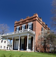 | Ora Holland House | 0.4 miles | 1986 |
 | Andrew-Ryan House | 0.4 miles | 1985 |
 | Charles T. Hancock House | 0.4 miles | 1986 |
 | Jackson Park Historic District | 0.4 miles | 1986 |
 | Carnegie-Stout Public Library | 0.5 miles | 1975 |
| National Archives record | The nomination case file for reference 100005277 in Record Group 79. |
| Dubuque County | All 84 listed properties in this county. |