 Block
From the record
One of 48 National Register listings published here for Lee County · listed in 2022 · category: Building.
Sources: the National Register database, National Park Service
Listed on the National Register of Historic Places in 2022.
One of 48 National Register listings published here for Lee County · listed in 2022 · category: Building.
Sources: the National Register database, National Park Service
Regional context, not property-specific evidence. The federal wildfire occurrence database lists 12 fires within 5 miles of Hosea S. and Elizabeth Case House between 2018 and 2020, burning about 112 acres in total. None started naturally. None was recorded as arson. Distance is straight-line from the map coordinates, so a fire counted here may appear on a neighbouring settlement's page as well.
| Reported cause | Fires |
|---|---|
| Debris and open burning | 10 |
| Smoking | 1 |
| Equipment and vehicle use | 1 |
The most recent of them, most recent first, with the day each was reported and the service that recorded it.
| Date | Cause | Size | Reported by | Name on the report |
|---|---|---|---|---|
| 6 May 2019 | Debris and open burning | under an acre | Iowa Department of Natural Resources | not named |
| 1 April 2020 | Debris and open burning | under an acre | Iowa Department of Natural Resources | not named |
| 1 April 2020 | Debris and open burning | 2.0 acres | Iowa Department of Natural Resources | not named |
| 7 March 2020 | Equipment and vehicle use | 5.0 acres | Iowa Department of Natural Resources | not named |
| 6 March 2020 | Debris and open burning | 60 acres | Iowa Department of Natural Resources | not named |
| 6 March 2020 | Smoking | under an acre | Iowa Department of Natural Resources | not named |
| 31 March 2020 | Debris and open burning | 40 acres | Iowa Department of Natural Resources | not named |
| 22 March 2018 | Debris and open burning | under an acre | Iowa Department of Natural Resources | not named |
Regional context, not property-specific evidence. The federal mineral resources record lists 3 workings within 5 miles of Hosea S. and Elizabeth Case House: 2 past producers, 1 producer. 1 still produces. What was taken out: Stone, Crushed/Broken, Limestone, Dimension, Stone, Crushed/Broken. Distance is straight-line from the map coordinates, so a quarry counted here may appear on a neighbouring settlement's page as well.
| Where | Site | Commodity | Status | Recorded |
|---|---|---|---|---|
| Schroeder Quarry | Limestone, Dimension, Stone, Crushed/Broken | Past Producer | ||
| Heinold Quarry | Stone, Crushed/Broken | Producer | ||
| Ward Quarry | Stone, Crushed/Broken | Past Producer |
Regional context, not property-specific evidence. The National Weather Service names Denmark, the town this property stands in, in 26 storm reports between 1999 and 2026: 16 hail, 7 thunderstorm wind, 1 flash flood, 1 flood. No death or injury is recorded in these reports. Each account below is quoted exactly as the forecast office filed it, from the NOAA Storm Events Database, and each date opens the federal record of that event.
| When | Event | Place named | Harm | What the report says |
|---|---|---|---|---|
| September 2005 | Thunderstorm Wind | Denmark | $12,000 | 6-10 inch diameter trees down with numerous large branches down. |
| April 2006 | Hail | Denmark | $5,000 | The first report of severe hail came from spotters 2 miles west of Denmark during the 1134-1135 CST time period with penny sized hail observed. Law enforcement reported a total hail duration of 10 minutes in Denmark with severe hail of 1 inch occurring in the 1138-1140 CST time period. |
| March 2026 | Tornado (EF1) | Denmark | - | This survey was completed with the help of the Denmark Fire Department. This EF-1 tornado caused damage to a large section of shingles that it tore off a roof and the soffit blew in on multiple sides of a house. About 10-15 snapped trees, with most snapped halfway up. There were also 5-8 trees that were uprooted. In addition, a power pole was snapped. Damage largely confined to along and just west of 330th Avenue. This EF-1 tornado had peak estimated winds of 100 MPH along its 1.16 mile path with a peak width of 50 yards. |
| March 2024 | Hail | Denmark | - | Public report of ping pong ball sized hail on Facebook. |
| April 2020 | Hail | Denmark | - | Fire department reported softball sized hail. |
| June 2019 | Flood | Denmark | - | The Skunk River at Augusta Iowa, remained above major flood stage of 20.0 feet from the end of May through June 2nd, when it fell below 20 feet in the evening. |
| June 2018 | Thunderstorm Wind | Denmark | - | Power lines were blown down. |
| June 2015 | Thunderstorm Wind | Denmark | - | A camping trailer was blown off of support jacks. |
| June 2015 | Thunderstorm Wind | Denmark | - | A spotter reported numerous trees damaged, camper blown onto side, and a telephone pole down. |
| June 2010 | Hail | Denmark | - | Quarter-sized hail fell 10 miles north of Fort Madison, IA at 517 pm June 21. |
| June 2010 | Hail | Denmark | - | Quarter-sized hail fell in Denmark, IA at 511 pm June 21. |
| August 2009 | Thunderstorm Wind | Denmark | - | Wind gusts estimated to be 60 mph were observed about 4 miles west of Wever, IA around 724 am August 4. |
| April 2008 | Hail | Denmark | - | A trained spotter measured nickel size hail and estimated winds to near 50 mph near Denmark. |
| June 2002 | Flash Flood | Denmark | - | Two to three inches of rain fell in an hour triggering widespread lowland flooding. Also, water up to a foot deep covered several streets. |
| April 2000 | Hail | Denmark | - | 1 inch hail reported by law enforcement official. |
| May 2023 | Hail | Denmark | - | no account filed |
| May 2023 | Hail | Denmark | - | no account filed |
| May 2023 | Hail | Denmark | - | no account filed |
| May 2014 | Hail | Denmark | - | no account filed |
| May 2014 | Hail | Denmark | - | no account filed |
| June 2010 | Hail | Denmark | - | no account filed |
| March 2009 | Hail | Denmark | - | no account filed |
| March 2009 | Hail | Denmark | - | no account filed |
| June 2002 | Hail | Denmark | - | no account filed |
| June 2002 | Thunderstorm Wind | Denmark | - | no account filed |
| June 1999 | Thunderstorm Wind | Denmark | - | no account filed |
No historic map-sheet match is published for this property yet. That does not mean no map exists. This record needs a coordinate-quality review before it can be joined to a sheet boundary. Browse the county's mapped places while that work is pending.
Other National Register properties close enough to walk or drive between, ordered by distance from this one. Both positions come from the same geocoding pass that matched these properties to their map sheets.
| Photograph | Property | Distance | Listed |
|---|---|---|---|
| Denmark Congregational Church | 1.9 miles | 1977 | |
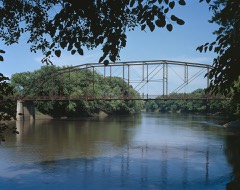 | Bridgeport Bridge | 3.0 miles | 1998 |
| Presbyterian Church | 5.0 miles | 2022 |
| National Archives record | The nomination case file for reference 100008390 in Record Group 79. |
| Lee County | All 48 listed properties in this county. |