 Block
From the record
One of 121 National Register listings published here for Linn County · listed in 2023 · category: Building.
Sources: the National Register database, National Park Service
Listed on the National Register of Historic Places in 2023.
One of 121 National Register listings published here for Linn County · listed in 2023 · category: Building.
Sources: the National Register database, National Park Service
Regional context, not property-specific evidence. The federal wildfire occurrence database lists 3 fires within 5 miles of Hickman-Nietert-Odd Fellows Building between 2003 and 2006, burning about 42 acres in total. None started naturally. None was recorded as arson. Distance is straight-line from the map coordinates, so a fire counted here may appear on a neighbouring settlement's page as well.
| Reported cause | Fires |
|---|---|
| Missing data/not specified/undetermined | 2 |
| Recreation and ceremony | 1 |
The most recent of them, most recent first, with the day each was reported and the service that recorded it.
| Date | Cause | Size | Reported by | Name on the report |
|---|---|---|---|---|
| 15 April 2006 | Missing data/not specified/undetermined | 40 acres | Iowa Department of Natural Resources | not named |
| 23 March 2004 | Recreation and ceremony | under an acre | Iowa State Fire Marshal's Office | not named |
| 29 November 2003 | Missing data/not specified/undetermined | 2.0 acres | Iowa State Fire Marshal's Office | not named |
Regional context, not property-specific evidence. The federal mineral resources record lists 5 workings within 5 miles of Hickman-Nietert-Odd Fellows Building: 5 past producers. None of them still produces. What was taken out: Stone, Crushed/Broken, Sand and Gravel, Construction. Distance is straight-line from the map coordinates, so a quarry counted here may appear on a neighbouring settlement's page as well.
| Where | Site | Commodity | Status | Recorded |
|---|---|---|---|---|
| Park Pit | Sand and Gravel, Construction | Past Producer | ||
| Unknown | Sand and Gravel, Construction | Past Producer | ||
| Fishel Quarry | Stone, Crushed/Broken | Past Producer | ||
| Unknown | Stone, Crushed/Broken | Past Producer | ||
| Unknown | Stone, Crushed/Broken | Past Producer |
Regional context, not property-specific evidence. The National Weather Service names Alburnett, the town this property stands in, in 20 storm reports between 1997 and 2024: 10 thunderstorm wind, 7 hail, 2 tornado, 1 funnel cloud. The reports record 1 injury. Each account below is quoted exactly as the forecast office filed it, from the NOAA Storm Events Database, and each date opens the federal record of that event.
| When | Event | Place named | Harm | What the report says |
|---|---|---|---|---|
| May 2000 | Tornado (F1) | Alburnett | 1 hurt, $50,000 | A tornado touched down at Alburnett causing damage. The center section of the horse barn roof at Strand Arabian Stables was torn off. Sheet metal from the horse barn roof littered surrounding yards, and one woman was cut by the sheet metal. She was taken to St. Luke's Hospital where she was treated and released. There were about 45 horses on the grounds of the stables when the tornado hit, but incredibly none were hurt. A barn also collapsed along Lafayette Road. Ten cows were inside the barn, and one was killed. Damage was also found along East Otter Road. A house had it's roof damaged and siding taken off, and a small shed was destroyed. A minivan was pushed off of a driveway and had it's windows broken out. A garage door was also pushed in on a garage. |
| July 2011 | Thunderstorm Wind | Alburnett | $25,000 | Wind gusts estimated to be 70 mph resulted in a power outage in Alburnett, IA at 525 am CDT July 11. |
| July 2007 | Thunderstorm Wind | Alburnett | $25,000 | Winds estimated to be 70 mph blew down several large trees damaging some homes. Time estimated. |
| April 2006 | Hail | Alburnett | $8,000 | no account filed |
| September 2018 | Tornado (EF1) | Alburnett | $1,000 | A NWS Survey Team determined a brief high end EF1 tornado, with estimated maximum wind speeds around 110 mph, snapped and uprooted hardwood trees at a farmstead. The tornado was embedded in a roughly quarter mile wide swath of straight line wind damage with estimated speeds of 80 to 90 mph. |
| April 2010 | Thunderstorm Wind | Alburnett | $1,000 | Wind gusts estimated to be 65 mph blew some branches down and ripped some shingles and siding off a home in Alburnett, IA around 640 pm April 5. |
| April 2024 | Funnel Cloud | Alburnett | - | The Fire Department reported a funnel cloud just west of Alburnett. |
| July 2020 | Thunderstorm Wind | Alburnett | - | A citizen reported estimated high winds. |
| September 2018 | Thunderstorm Wind | Alburnett | - | A trained spotter reported several healthy large tree branches down, the time was estimated by radar. |
| June 2017 | Hail | Alburnett | - | This report was received through social media. |
| June 2015 | Thunderstorm Wind | Alburnett | - | Tree limbs larger than 2 inches in diameter were blown down. |
| May 2014 | Hail | Alburnett | - | Quarter sized hail fell about 6 miles west of Central City, IA around 500 pm CDT May 20. |
| May 2014 | Hail | Alburnett | - | Quarter sized hail fell about 3 miles north of Alburnett, IA around 732 pm CDT May 20. |
| June 2013 | Thunderstorm Wind | Alburnett | - | Local broadcast media estimated wind speeds of 55 to 60 mph. |
| June 2011 | Thunderstorm Wind | Alburnett | - | Wind gusts estimated to be 70 mph blew down several trees in Alburnett, IA at 813 pm CDT June 8. |
| April 2006 | Hail | Alburnett | - | Golf ball sized hail. |
| May 2001 | Hail | Alburnett | - | Quarter sized hail reported by trained storm spotter. |
| September 1997 | Thunderstorm Wind | Alburnett | - | Trees and large limbs downed. |
| May 2024 | Thunderstorm Wind | Alburnett | - | no account filed |
| May 2002 | Hail | Alburnett | - | no account filed |
No historic map-sheet match is published for this property yet. That does not mean no map exists. This record needs a coordinate-quality review before it can be joined to a sheet boundary. Browse the county's mapped places while that work is pending.
Other National Register properties close enough to walk or drive between, ordered by distance from this one. Both positions come from the same geocoding pass that matched these properties to their map sheets.
| Photograph | Property | Distance | Listed |
|---|---|---|---|
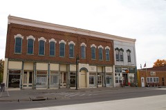 | Central City Commercial Historic District | 6.2 miles | 2003 |
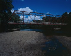 | Upper Paris Bridge | 6.9 miles | 1998 |
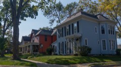 | Terrace Park Historic District | 7.7 miles | 2006 |
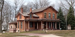 | Granger House | 7.8 miles | 1976 |
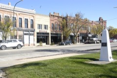 | Marion Commercial Historic District | 7.9 miles | 2009 |
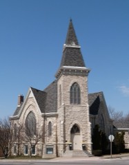 | First Presbyterian Church of Marion, Iowa | 7.9 miles | 1992 |
| National Archives record | The nomination case file for reference 100009434 in Record Group 79. |
| Linn County | All 121 listed properties in this county. |