 Block
From the record
One of 40 National Register listings published here for Muscatine County · listed in 2023 · category: District.
Sources: the National Register database, National Park Service
Listed on the National Register of Historic Places in 2023.
One of 40 National Register listings published here for Muscatine County · listed in 2023 · category: District.
Sources: the National Register database, National Park Service
Regional context, not property-specific evidence. The federal wildfire occurrence database lists 3 fires within 5 miles of Fairport Biological Station Historic District between 2011 and 2013, burning about 52 acres in total. None started naturally. None was recorded as arson. Distance is straight-line from the map coordinates, so a fire counted here may appear on a neighbouring settlement's page as well.
| Reported cause | Fires |
|---|---|
| Debris and open burning | 2 |
| Missing data/not specified/undetermined | 1 |
The most recent of them, most recent first, with the day each was reported and the service that recorded it.
| Date | Cause | Size | Reported by | Name on the report |
|---|---|---|---|---|
| 3 April 2013 | Debris and open burning | 1.0 acres | Iowa Department of Natural Resources | not named |
| 28 April 2013 | Debris and open burning | 50 acres | Iowa Department of Natural Resources | not named |
| 9 October 2011 | Missing data/not specified/undetermined | 1.0 acres | Iowa Department of Natural Resources | 1687 HWY J-22, IA |
Regional context, not property-specific evidence. The federal mineral resources record lists 4 workings within 5 miles of Fairport Biological Station Historic District: 4 past producers. None of them still produces. What was taken out: Stone, Crushed/Broken, Flagstone. Distance is straight-line from the map coordinates, so a quarry counted here may appear on a neighbouring settlement's page as well.
| Where | Site | Commodity | Status | Recorded |
|---|---|---|---|---|
| Alteneder Quarry | Flagstone | Past Producer | ||
| Hintermeister Quarry | Stone, Crushed/Broken | Past Producer | ||
| Lindburg Quarry | Stone, Crushed/Broken | Past Producer | ||
| Smokey Hollow Quarry | Stone, Crushed/Broken | Past Producer |
Regional context, not property-specific evidence. The National Weather Service names Fairport, the town this property stands in, in 8 storm reports between 1995 and 2024: 3 thunderstorm wind, 2 hail, 1 flood, 1 flash flood. No death or injury is recorded in these reports. Each account below is quoted exactly as the forecast office filed it, from the NOAA Storm Events Database, and each date opens the federal record of that event.
| When | Event | Place named | Harm | What the report says |
|---|---|---|---|---|
| July 1995 | Thunderstorm Wind | Fairport | $110,000 | A fairly strong cold front sank south across Iowa during the day. The frontal system had significant moisture to work with as the remnants of tropical storm Dean had already reach the state. The air mass ahead of the front was very unstable as afternoon temperatures rose into the lower 90s with dew point temperatures in the middle 70s. CAPE values by late afternoon were around 3000 J-kg-1 with lifted indices around -9° C. Thunderstorm erupted on the cold side of the front. The initial windshift was very shallow. The storms quickly became multicellular with very little in the way of severe weather associated with them. They did produce copious amounts of rainfall with two to four inch amounts reported in some areas. No significant flooding occurred as the soil was extremely dry. One storm was severe as it moved across Boone County. Winds of at least 60 MPH nearly blew a car off of a highway northwest of Boone. High winds also moved into the city of Boone. Another severe thunderstorms moved into Muscatine County. High winds blew the roof off of a building east of Fairport and downed several trees and power lines. A house also sustained considerable roof damage. Due to the unique construction, damage was placed at between $60 thousand and $70 thousand to the house. As thunderstorms moved through Kossuth County, lightning struck a tree outside a house in Whittemore. The tree was downed and nails popped out of the drywall in the house. |
| July 2024 | Tornado (EFU) | Fairport | - | A tornado was captured on video near the shore of the Mississippi River in Muscatine County Iowa. The tornado crossed the Mississippi River and moved onshore in Rock Island County Illinois, just west of the Loud Thunder Forest Preserve, where it uprooted trees and downed large branches. No rating is assigned for the path of the tornado over the Mississippi River. Once onshore, the tornado was rated EF-0 with maximum winds around 75 mph. |
| June 2020 | Hail | Fairport | - | A trained spotter reported that pea to dime sized hail was falling intermittently. |
| May 2019 | Flash Flood | Fairport | - | Highway 22 closed due to water over the road. |
| February 2017 | Hail | Fairport | - | Trained spotters reported pea to dime size hail. |
| October 2016 | Thunderstorm Wind | Fairport | - | A storm survey team found uprooted hardwood trees due to straight line winds. |
| October 2016 | Thunderstorm Wind | Fairport | - | A storm survey team found broken off hardwood tree branches between 1 and 3 inches in diameter due to straight line winds. |
| July 2014 | Flood | Fairport | - | Heavy rains that fell across the Upper Midwest during the last two weeks of June brought the Mississippi River at Muscatine above its major flood stage of 20 feet at approximately 400 AM on July 1 and fell below the major flood stage around 600 PM on July 11.. The Mississippi River crested at 23.7 feet between 1145 on July 4 and 6PM on July 5. |
No historic map-sheet match is published for this property yet. That does not mean no map exists. This record needs a coordinate-quality review before it can be joined to a sheet boundary. Browse the county's mapped places while that work is pending.
Other National Register properties close enough to walk or drive between, ordered by distance from this one. Both positions come from the same geocoding pass that matched these properties to their map sheets.
| Photograph | Property | Distance | Listed |
|---|---|---|---|
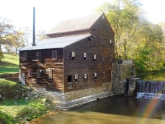 | Pine Creek Gristmill | 2.5 miles | 1979 |
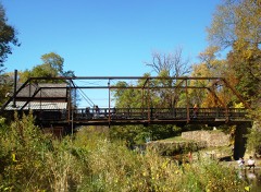 | Pine Mill Bridge | 2.7 miles | 1998 |
 | Pine Mills German Methodist Episcopal Church | 3.0 miles | 2003 |
 | Lock and Dam No. 16 Historic District | 5.9 miles | 2004 |
 | Fair Oaks Historic District | 6.8 miles | 2020 |
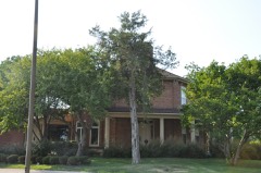 | Sinnett Octagon House | 7.0 miles | 1974 |
| National Archives record | The nomination case file for reference 100009488 in Record Group 79. |
| Muscatine County | All 40 listed properties in this county. |