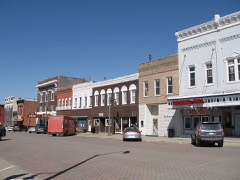
Block
From the record
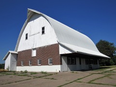
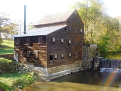
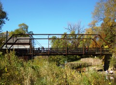
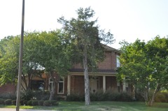
40 National Register listings published here.
Sources: the National Register database, National Park Service
57 topographic sheets cover 24 settlements here, and 40 properties are on the National Register of Historic Places.
40 National Register listings published here.
Sources: the National Register database, National Park Service
Every property in this county listed on the National Register of Historic Places, with the year it was listed and the federal nomination document.
Every wildfire the federal occurrence database records inside this county: 23 of them, burning about 193 acres. None started naturally and none was recorded as arson. Each settlement page carries the fires within five miles of it.
| Reported cause | Fires |
|---|---|
| Debris and open burning | 20 |
| Missing data/not specified/undetermined | 2 |
| Smoking | 1 |
The five largest, by the area the report gives. None of them was recorded as arson.
| Date | Cause | Size | Reported by | Name on the report |
|---|---|---|---|---|
| 28 April 2013 | Debris and open burning | 50 acres | Iowa Department of Natural Resources | not named |
| 5 April 2020 | Debris and open burning | 40 acres | Iowa Department of Natural Resources | not named |
| 21 October 2014 | Debris and open burning | 30 acres | Iowa Department of Natural Resources | not named |
| 29 March 2013 | Debris and open burning | 20 acres | Iowa Department of Natural Resources | not named |
| 9 September 2013 | Debris and open burning | 11 acres | Iowa Department of Natural Resources | not named |
| 6 October 2020 | Missing data/not specified/undetermined | 11 acres | Iowa Department of Natural Resources | not named |
| 7 March 2020 | Debris and open burning | 8.0 acres | Iowa Department of Natural Resources | not named |
| 6 April 2014 | Debris and open burning | 5.0 acres | Iowa Department of Natural Resources | not named |
Every settlement page carries the fires within five miles of it - see the settlement index below.
The NOAA Storm Events Database holds 492 reports for this county, causing 3 deaths, 23 injuries and about $32,420,200 in recorded property damage. Each settlement page carries the reports that name it.
| Kind of event | Reports |
|---|---|
| Thunderstorm Wind | 211 |
| Hail | 160 |
| Tornado | 41 |
| Flood | 34 |
| Flash Flood | 31 |
| Funnel Cloud | 6 |
| Heavy Rain | 5 |
| Lightning | 4 |
The most serious of them, by death, then injury, then recorded damage. The accounts are quoted exactly as the forecast office filed them.
| When | Event | Place named | Harm | What the report says |
|---|---|---|---|---|
| April 2006 | Tornado (F1) | Nichols | 1 killed, 1 hurt, $120,000 | Entered from Johnson County |
| May 2015 | Lightning | Muscatine | 1 killed, 1 hurt | The Muscatine County Emergency Manager reported a male, age 36, was struck by lightning and killed while riding a horse. Another male, age 25, was injured. The horse was also killed. |
| June 2013 | Tornado (EF1) | Muscatine | 1 killed, $500,000 | There was a narrow damage track with trees snapped and uprooted. The most intense damage occurred in the business district along Highway 61. There was damage to a church, car dealership, hotel, and several other business. The damage continued down New Era road where several farmsteads sustained damage. The fatality occurred at the car dealership. There were 5 semi trailers overturned along Highway 61. |
| June 1998 | Thunderstorm Wind | Countywide | 10 hurt, $1,500,000 | no account filed |
| June 2007 | Tornado (EF3) | Fruitland | 6 hurt, $15,000,000 | A tornado entered into Muscatine County from Louisa County just south of Fruitland, IA. It progressed to the northeast through the center of Fruitland destroying the post office and city hall building, numerous homes, and overturning some railroad cars. The tornado weakened as it approached the southwest portions of Muscatine. In Muscatine, the western sections of town had varying degrees of damage, which was mainly confined to roof damage. At a car dealership, some cars were displaced. The tornado eventually lifted on the northeast side of Muscatine near the junction of highways 22 and 61. Debris from Muscatine and Fruitland fell in Lowden, IA. Some personal papers were found 1 to 4 miles northwest of Lowden. Lowden is approximately 30 miles NNE of Muscatine.| |
| March 2017 | Tornado (EF2) | Muscatine | 3 hurt, $100,000 | Tornado was rated EF-2 with peak winds of 115 MPH, a path length of 1.78 miles and max width of 200 yards. Estimated time was 10:05 PM to 10:10 PM. Tornado tracked through Muscatine, touching down in Kent Stein Park, traveling through neighborhoods, and damaging homes and businesses. At least 2 homes lost their roofs. Up to 80 more homes sustained minor damage. |
| August 1977 | Tornado | not stated | 1 hurt, $250,000 | no account filed |
| June 1997 | Thunderstorm Wind | West Liberty | 1 hurt, $15,000 | An eleven year old girl was injured by flying glass when a tree struck her home. The tree struck the house and smashed a window as the girl and her parents were running to the basement for shelter. The family also lost numerous trees and one grain bin. |
| June 2008 | Flood | Montpelier | $9,100,000 | The record crest on the Cedar River at Conesville occurred on June 15, 2008 at 23.40 feet. Flood stage is 13 feet. |
| May 1995 | Tornado (F3) | Stockton to | $650,000 | no account filed |
| August 2009 | Flood | West Liberty | $500,000 | no account filed |
| July 2003 | Thunderstorm Wind | Wilton | $350,000 | On Trail Avenue |
| April 2011 | Flood | Muscatine | $250,000 | no account filed |
| May 2000 | Hail | Muscatine | $250,000 | no account filed |
| May 1991 | Tornado (F1) | not stated | $250,000 | no account filed |
| May 1988 | Tornado (F1) | not stated | $250,000 | no account filed |
| May 1987 | Tornado (F1) | not stated | $250,000 | no account filed |
| August 1987 | Tornado (F1) | not stated | $250,000 | no account filed |
| April 1981 | Tornado (F0) | not stated | $250,000 | no account filed |
| July 1979 | Tornado (F1) | not stated | $250,000 | no account filed |
| May 1966 | Tornado (F2) | not stated | $250,000 | no account filed |
| April 2008 | Tornado (EF2) | West Liberty | $200,000 | This tornado touched down 5.2 miles northeast of Nichols and tracked to the northeast before lifting 2 miles west of Moscow. The EF2 tornado was on the ground for 6.5 miles, had maximum winds to 115 mph and was 150 yards wide. There were 5 farmsteads that were hit by the tornado, but no injuries were reported. Siding and shingles of two homes were peeled off. Outbuildings were damaged, a machine shed and grain bin destroyed, and a wooden swingset toppled. Utility poles were snapped or blown down, while several trees were snapped or uprooted. |
| September 2016 | Flood | Atalissa | $150,000 | Heavy rainfall of 4 to over 10 inches over significant areas from 21 to 23 September in extreme North Central and Northeast Iowa moved downstream causing the Cedar River to rise above major flood stage levels. ||Conesville rose above its major flood stage level of 16.5 feet on September 28th, 2016 at approximately 5 AM CST. It crested around 18.2 feet at approximately 9 AM CST on September 29th, 2016. It fell below major flood stage on October 1st around 11 pm CST.||Major flooding continued into October. |
| July 2010 | Flood | Moscow | $125,000 | no account filed |
| July 1995 | Thunderstorm Wind | Fairport | $110,000 | A fairly strong cold front sank south across Iowa during the day. The frontal system had significant moisture to work with as the remnants of tropical storm Dean had already reach the state. The air mass ahead of the front was very unstable as afternoon temperatures rose into the lower 90s with dew point temperatures in the middle 70s. CAPE values by late afternoon were around 3000 J-kg-1 with lifted indices around -9° C. Thunderstorm erupted on the cold side of the front. The initial windshift was very shallow. The storms quickly became multicellular with very little in the way of severe weather associated with them. They did produce copious amounts of rainfall with two to four inch amounts reported in some areas. No significant flooding occurred as the soil was extremely dry. One storm was severe as it moved across Boone County. Winds of at least 60 MPH nearly blew a car off of a highway northwest of Boone. High winds also moved into the city of Boone. Another severe thunderstorms moved into Muscatine County. High winds blew the roof off of a building east of Fairport and downed several trees and power lines. A house also sustained considerable roof damage. Due to the unique construction, damage was placed at between $60 thousand and $70 thousand to the house. As thunderstorms moved through Kossuth County, lightning struck a tree outside a house in Whittemore. The tree was downed and nails popped out of the drywall in the house. |
| May 2003 | Hail | Atalissa | $100,000 | no account filed |
| April 2006 | Tornado (F1) | Nichols | $80,000 | Entered from Johnson County |
| July 2003 | Thunderstorm Wind | Wilton | $60,000 | no account filed |
| April 2010 | Hail | Muscatine | $50,000 | Half dollar sized hail fell on the west side of Muscatine, IA at 801 pm April 4. The hail dented some cars. |
| May 2004 | Thunderstorm Wind | Sweetland Center | $50,000 | Grain bin blown over with trees into houses. |
| May 2003 | Heavy Rain | Muscatine | $50,000 | Water 2 inches deep on streets |
| July 2003 | Thunderstorm Wind | Atalissa | $50,000 | Tree down on a 35 foot camper |
| July 2003 | Hail | Muscatine | $50,000 | Lasted 10 minutes |
| May 2000 | Thunderstorm Wind | Muscatine | $50,000 | A barn suffered significant damage due to high winds. The roof caved in and pieces of the wood structure were spread across the farmland. |
| June 1994 | Thunderstorm Wind | Muscatine | $50,000 | no account filed |
| June 1997 | Thunderstorm Wind | Pleasant Prairie | $40,000 | Wind damage was reported to have damaged or destroyed one third of a house. |
| July 2003 | Thunderstorm Wind | Atalissa | $40,000 | no account filed |
| April 2006 | Hail | Muscatine | $30,000 | Numerous reports of quarter to tennis ball size hail across city and at the community college; this was the second hail core to hit the city. |
| May 1996 | Thunderstorm Wind | Muscatine | $30,000 | no account filed |
| May 1995 | Hail | Muscatine Airport | $30,000 | no account filed |
| May 2013 | Tornado (EF1) | Conesville | $25,000 | Large trees were snapped and uprooted along the path. The roof of a mobile home was partially blown off. The wind speed with this tornado were estimated to be around 95 mph. |
| May 2011 | Thunderstorm Wind | West Liberty | $25,000 | Wind gusts estimated to be 70 mph destroyed a garage and caused extensive tree damage at a home near Highway 70 and 130th Street just southeast of West Liberty, IA around 520 pm CDT May 22. |
| May 2011 | Thunderstorm Wind | West Liberty | $25,000 | Wind gusts estimated to be 70 mph blew a roof off of a barn near West Liberty, IA at 530 pm CDT May 24. |
| June 2010 | Flash Flood | Nichols | $25,000 | Heavy rains resulted in flash flooding in Muscatine, IA and Nichols, IA during the late afternoon and evening of June 23. Some vehicles were stalled out in over a foot of flood water in downtown Muscatine. In Nichols, some streets were temporarily closed due to flooding. |
| June 2009 | Thunderstorm Wind | Pleasant Prairie | $25,000 | Wind gusts estimated to be 65 mph damaged some outbuildings and trees about 3 miles south of Stockton, IA around 530 pm June 19. |
| July 2008 | Thunderstorm Wind | Montpelier | $25,000 | Wind gusts estimated to be 70 mph blew several large tree branches down and ripped some siding off a residence in Montpelier, IA at 555 am July 21. A power outage was also observed. |
| July 2008 | Thunderstorm Wind | Muscatine | $25,000 | Wind gusts estimated to be 70 mph blew down several trees and branches across Muscatine, IA around 545 am July 21. Some of the trees fell across Mulberry Avenue. Some homes were also damaged and a power outage was observed. |
| May 2004 | Thunderstorm Wind | Muscatine | $25,000 | 8 power lines down with 2 semi trucks blown over. |
| July 2003 | Thunderstorm Wind | Atalissa | $25,000 | Trees and power lines down |
| June 1980 | Tornado (F1) | not stated | $25,000 | no account filed |
| May 1967 | Tornado (F2) | not stated | $25,000 | no account filed |
| June 1964 | Tornado (F0) | not stated | $25,000 | no account filed |
| April 2006 | Thunderstorm Wind | Muscatine Muni Arpt | $20,000 | AWOS measured 57 kts. Buildings were damaged at the airport. |
| May 2004 | Thunderstorm Wind | Atalissa | $20,000 | 2 semi trucks blown over with significant power lines down |
| July 2003 | Thunderstorm Wind | Muscatine | $20,000 | Tree down on a trailer |
| July 2003 | Thunderstorm Wind | Muscatine Muni Arpt | $20,000 | KMUT AWOS |
| July 2003 | Thunderstorm Wind | Muscatine | $20,000 | Trees down on U.S. 61 |
| February 1999 | Thunderstorm Wind | Muscatine | $20,000 | no account filed |
| May 1995 | Hail | Muscatine | $20,000 | no account filed |
| May 1995 | Tornado (F0) | Muscatine | $20,000 | no account filed |
The Survey's mineral resources record lists 19 workings inside this county. 5 still produce and 14 are closed or unrecorded. Each settlement page carries the workings within five miles of it.
| Commodity | Workings |
|---|---|
| Sand and Gravel, Construction | 12 |
| Stone, Crushed/Broken | 6 |
| Flagstone | 1 |
The least common of them first, because a county's hundredth gravel pit says nothing its first ten did not.
| Where | Site | Commodity | Status | Recorded |
|---|---|---|---|---|
| Alteneder Quarry | Flagstone | Past Producer | ||
| Atalissa Quarry | Stone, Crushed/Broken | Producer | ||
| Hintermeister Quarry | Stone, Crushed/Broken | Past Producer | ||
| Lindburg Quarry | Stone, Crushed/Broken | Past Producer | ||
| Melpine Quarry | Stone, Crushed/Broken | Past Producer | ||
| Smokey Hollow Quarry | Stone, Crushed/Broken | Past Producer | ||
| Unknown | Stone, Crushed/Broken | Past Producer | ||
| Acme Fuel and Material Co. Pit | Sand and Gravel, Construction | Producer | ||
| Atalissa Pit | Sand and Gravel, Construction | Past Producer | ||
| Atalissa Pit | Sand and Gravel, Construction | Past Producer | ||
| Blue Ribbon Pit | Sand and Gravel, Construction | Past Producer | ||
| Hahn Ready Mix Co. Pit | Sand and Gravel, Construction | Producer | ||
| Mc Killip Farm Pit | Sand and Gravel, Construction | Past Producer | ||
| Mc Killip Sand Dredge and Plant | Sand and Gravel, Construction | Producer | ||
| Northern Gravel Dredge & Plant | Sand and Gravel, Construction | Producer | ||
| Richter Property | Sand and Gravel, Construction | Past Producer | ||
| Salisbury Pit | Sand and Gravel, Construction | Past Producer | ||
| Thorpe Pit | Sand and Gravel, Construction | Past Producer | ||
| Unknown | Sand and Gravel, Construction | Past Producer |
Named settlements recorded in the Geographic Names Information System, each with the topographic sheets covering it. Villages, hamlets and abandoned places alike. Each is shown with the nearest named watercourse or landform and the survey quadrangle it falls on.
Lake township · 52761 · Muscatine NW quadrangle
9 sheets, 1948 to 1984
No longer a settlement
Sweetland township · 52761 · Near Goose Island · Illinois City quadrangle
15 sheets, 1916 to 1991
Bloomington township · 52761 · On Mad Creek · Muscatine quadrangle
12 sheets, 1948 to 1991
Montpelier township · 52761 · On Pine Creek · Montpelier quadrangle
15 sheets, 1916 to 1991
No longer a settlement
Orono township · 52739 · On Pike Creek · Columbus Junction quadrangle
7 sheets, 1958 to 1984
No longer a settlement
Wapsinonoc township · 52776 · On Middle Branch Wapsinonoc Creek · West Liberty quadrangle
11 sheets, 1894 to 1984
The vanished settlements of Muscatine County: the places named above that are no longer on the map.