 Block
From the record
One of 32 National Register listings published here for Wapello County · listed in 2013 · category: Building.
Sources: the National Register database, National Park Service
Listed on the National Register of Historic Places in 2013.
One of 32 National Register listings published here for Wapello County · listed in 2013 · category: Building.
Sources: the National Register database, National Park Service
Regional context, not property-specific evidence. The federal wildfire occurrence database lists 6 fires within 5 miles of Administration Building, U.S. Naval Air Station Ottumwa between 2009 and 2018, burning about 24 acres in total. None started naturally. None was recorded as arson. Distance is straight-line from the map coordinates, so a fire counted here may appear on a neighbouring settlement's page as well.
| Reported cause | Fires |
|---|---|
| Debris and open burning | 3 |
| Missing data/not specified/undetermined | 2 |
| Railroad operations and maintenance | 1 |
The most recent of them, most recent first, with the day each was reported and the service that recorded it.
| Date | Cause | Size | Reported by | Name on the report |
|---|---|---|---|---|
| 11 July 2018 | Missing data/not specified/undetermined | 1.0 acres | Iowa Department of Natural Resources | not named |
| 27 May 2018 | Railroad operations and maintenance | 1.0 acres | Iowa Department of Natural Resources | not named |
| 20 May 2009 | Missing data/not specified/undetermined | 1.0 acres | Iowa Department of Natural Resources | not named |
| 28 April 2018 | Debris and open burning | 15 acres | Iowa Department of Natural Resources | not named |
| 11 April 2018 | Debris and open burning | 4.0 acres | Iowa Department of Natural Resources | not named |
| 2 March 2018 | Debris and open burning | 2.0 acres | Iowa Department of Natural Resources | not named |
Regional context, not property-specific evidence. The federal mineral resources record lists 6 workings within 5 miles of Administration Building, U.S. Naval Air Station Ottumwa: 4 past producers, 2 producers. 2 still produce. What was taken out: Clay, Sand and Gravel, Construction, Stone, Crushed/Broken. Distance is straight-line from the map coordinates, so a quarry counted here may appear on a neighbouring settlement's page as well.
| Where | Site | Commodity | Status | Recorded |
|---|---|---|---|---|
| B and M Quarry | Stone, Crushed/Broken | Past Producer | ||
| Can-Tex Industries Ottumwa Pit | Clay | Producer | ||
| Ottumwa Brick and Tile Co. | Clay | Past Producer | ||
| Unknown | Sand and Gravel, Construction | Past Producer | ||
| W. Ottumwa Sand | Sand and Gravel, Construction | Producer | ||
| Wapello Quarry | Stone, Crushed/Broken | Past Producer |
Regional context, not property-specific evidence. The National Weather Service names Ottumwa, the town this property stands in, in 165 storm reports between 1995 and 2023: 81 thunderstorm wind, 44 hail, 16 flash flood, 16 heavy rain. The reports record 10 injuries. Each account below is quoted exactly as the forecast office filed it, from the NOAA Storm Events Database, and each date opens the federal record of that event.
| When | Event | Place named | Harm | What the report says |
|---|---|---|---|---|
| April 2014 | Thunderstorm Wind | Ottumwa | 10 hurt, $100,000 | Thunderstorm wind damage was reported in the 1000 block of west Mary St. in Ottumwa. Two foot diameter trees blown over, flag poles were bent in half and a grain bin roof was removed and blown 200 yards. |
| March 2019 | Flash Flood | Ottumwa | $300,000 | Flash flooding occurred on the north side of Ottumwa due to an ice jam on the Des Moines River. Water rapidly rose several feet flooding a campground and a few local residences. Some cars and campers were flooded. |
| June 2011 | Flash Flood | Ottumwa | $300,000 | Harrows Creek was out of its bank and flowing across West Second Street. Cars were stranded on North Jefferson Street. A portion of the 1600 block of East Main Street was washed out by flood waters. Law enforcement closed the roads. |
| June 2000 | Flash Flood | Ottumwa | $300,000 | no account filed |
| May 2013 | Flash Flood | Ottumwa | $250,000 | Trained spotter reported flash flooding along 140th Ave on the north side of Ottumwa. Water moving down the road 1 to 2 feet deep. |
| April 2013 | Flash Flood | Ottumwa | $200,000 | Ottumwa Police reported several roads and intersections in the city as impassible to cars. |
| May 2013 | Flash Flood | Ottumwa | $200,000 | Spotter reports that flash flooding with water 2 to 5 feet deep swept down the street carrying logs and debris with it. At the bottom of the street there was a car in the water with a depth of 5 feet. |
| June 2010 | Flash Flood | Ottumwa | $100,000 | Eight to 10 inches of water on several roadways. |
| August 2010 | Flash Flood | Ottumwa | $100,000 | A trained spotter in Ottumwa reported water flowing through the streets deep enough to stall multiple vehicles. He also estimated 2 inches of rain in the last hour. |
| June 2008 | Flash Flood | Ottumwa | $100,000 | Water from 6 inches to 3 feet deep was flooding about half of the south side of Ottumwa. |
| June 2008 | Flash Flood | Ottumwa | $100,000 | Flash flooding was reported by the Ottumwa police and city management. Numerous cars stalled. |
| July 2015 | Thunderstorm Wind | Ottumwa | $50,000 | Trained spotter reported numerous tree limbs down on houses and powerlines. Time estimated from radar. An estimated 14 inch diameter tree was snapped near the base. Power was out in portions of town. |
| May 2013 | Flash Flood | Ottumwa | $50,000 | Culvert washed out on Rock Bluff Road near 155th Ave. |
| September 2013 | Thunderstorm Wind | Ottumwa | $50,000 | Trees and power lines down in town. |
| October 2002 | Thunderstorm Wind | Ottumwa | $50,000 | no account filed |
| May 1998 | Flood | Ottumwa | $50,000 | no account filed |
| June 1998 | Flood | Ottumwa | $50,000 | no account filed |
| June 1997 | Thunderstorm Wind | Ottumwa | $35,000 | no account filed |
| March 2017 | Thunderstorm Wind | Ottumwa | $30,000 | Law enforcement reported several trees down throughout town along with a roof off of a house on S. Madison Ave and a metal shed destroyed on 50th Street. This is a delayed report and time estimated from radar. |
| September 2007 | Heavy Rain | Ottumwa | $30,000 | Heavy rainfall was reported overnight from KBIZ radio. |
| May 1998 | Thunderstorm Wind | Ottumwa | $30,000 | no account filed |
| June 2015 | Thunderstorm Wind | Ottumwa | $25,000 | Chaser reported large trees down across roads just north of Ottumwa. |
| June 2012 | Thunderstorm Wind | Ottumwa | $25,000 | Larger than one foot diameter trees down. A light pole was also blown down. One large tree was snapped off on the trunk near the school. |
| June 2010 | Flash Flood | Ottumwa | $25,000 | Highway 149 and Highland Park Road had water partially covering the roadway. |
| August 2010 | Flash Flood | Ottumwa | $25,000 | Trained spotter reports water flowing over the road and blocking traffic near the intersection of Pennsylvania Ave and Jefferson Street. |
| August 2010 | Flash Flood | Ottumwa | $25,000 | Six inches of flowing water across Eddyville Road. Cars stalled. |
| April 2007 | Flood | Ottumwa | $25,000 | no account filed |
| May 2007 | Flood | Ottumwa | $25,000 | no account filed |
| June 1999 | Thunderstorm Wind | Ottumwa | $25,000 | no account filed |
| July 1998 | Flood | Ottumwa | $25,000 | no account filed |
| June 2015 | Thunderstorm Wind | Ottumwa | $20,000 | Public/Chaser report of trees down and debris 2 miles E of Ottumwa. |
| June 2015 | Thunderstorm Wind | Ottumwa | $20,000 | Spotter estimated wind gusts of 80 mph with reports of large tree limbs down in town. |
| April 1997 | Thunderstorm Wind | Ottumwa | $20,000 | no account filed |
| April 1996 | Hail | Ottumwa | $20,000 | no account filed |
| September 2018 | Thunderstorm Wind | Ottumwa | $15,000 | Public reported a tree down on a camper, with the roof buckled. This is a delayed report and time estimated from radar. |
| July 2016 | Thunderstorm Wind | Ottumwa | $15,000 | Law Enforcement reported power lines down in town. |
| July 2015 | Thunderstorm Wind | Ottumwa | $15,000 | Trained spotter reported telephone pole knocked over at intersection of Clay and Gateway. Wind gusts estimated at 60-65 mph. |
| November 2015 | Thunderstorm Wind | Ottumwa | $15,000 | Public reported multiple areas with power lines down. Photo posted on facebook. |
| June 2008 | Heavy Rain | Ottumwa | $15,000 | Street flooding was reported in Ottumwa. A number of intersections and low lying areas were under water, including the intersection of Jefferson and Main. |
| June 2009 | Thunderstorm Wind | Ottumwa | $15,000 | no account filed |
| May 2003 | Thunderstorm Wind | Ottumwa | $15,000 | no account filed |
| June 2000 | Thunderstorm Wind | Ottumwa | $15,000 | no account filed |
| June 2018 | Thunderstorm Wind | Ottumwa | $10,000 | Public reported a large tree down over power lines. |
| August 2011 | Thunderstorm Wind | Ottumwa | $10,000 | Large trees down. |
| June 2010 | Flash Flood | Ottumwa | $10,000 | West snd St in Ottumwa was closed from the 1100 to 1500 block. Up to 2 feet of water was reported on Harrows Branch Road. |
| June 2010 | Thunderstorm Wind | Ottumwa | $10,000 | House debris on Rutledge Rd and 120th. |
| May 2008 | Thunderstorm Wind | Ottumwa | $10,000 | Some damage was reported in downtown Ottumwa, along with half inch diameter hail. |
| June 2008 | Thunderstorm Wind | Ottumwa | $10,000 | Winds were estimated at 60 to 65 MPH in Ottumwa. |
| June 2008 | Thunderstorm Wind | Ottumwa | $10,000 | Power outages reported in Ottumwa. |
| April 2010 | Lightning | Ottumwa | $10,000 | no account filed |
| April 2010 | Hail | Ottumwa | $10,000 | no account filed |
| July 2008 | Thunderstorm Wind | Ottumwa | $10,000 | no account filed |
| August 2006 | Flash Flood | Ottumwa | $10,000 | no account filed |
| June 2005 | Thunderstorm Wind | Ottumwa | $10,000 | no account filed |
| June 2005 | Thunderstorm Wind | Ottumwa | $10,000 | no account filed |
| August 2003 | Thunderstorm Wind | Ottumwa | $10,000 | no account filed |
| May 2002 | Hail | Ottumwa | $10,000 | no account filed |
| May 2001 | Hail | Ottumwa | $10,000 | no account filed |
| June 2001 | Thunderstorm Wind | Ottumwa | $10,000 | no account filed |
| October 2001 | Hail | Ottumwa | $10,000 | no account filed |
No historic map-sheet match is published for this property yet. That does not mean no map exists. This record needs a coordinate-quality review before it can be joined to a sheet boundary. Browse the county's mapped places while that work is pending.
Other National Register properties close enough to walk or drive between, ordered by distance from this one. Both positions come from the same geocoding pass that matched these properties to their map sheets.
| Photograph | Property | Distance | Listed |
|---|---|---|---|
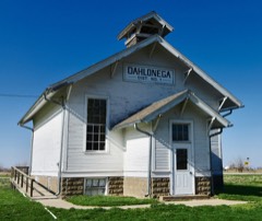 | Dahlonega School #1 | 5.0 miles | 2000 |
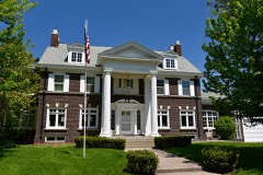 | Vogel Place Historic District | 5.3 miles | 1995 |
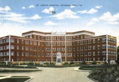 | St. Joseph Hospital Historic District | 5.4 miles | 2015 |
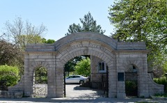 | Ottumwa Cemetery Historic District | 5.5 miles | 1995 |
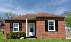 | North Fellows Historic District | 6.0 miles | 2010 |
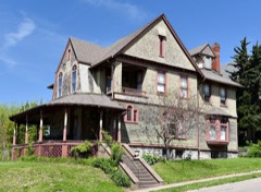 | Court Hill Historic District | 6.0 miles | 1998 |
| National Archives record | The nomination case file for reference 13000273 in Record Group 79. |
| Wapello County | All 32 listed properties in this county. |