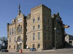
Block
From the record
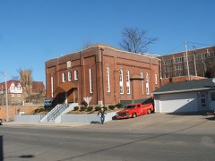
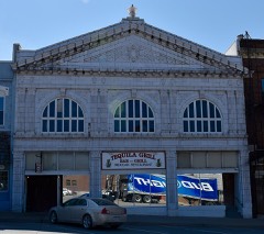
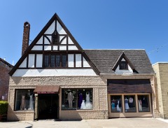
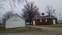
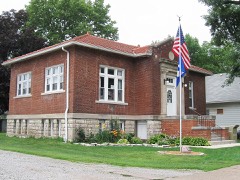
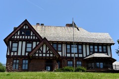
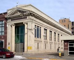
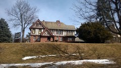
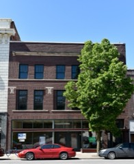
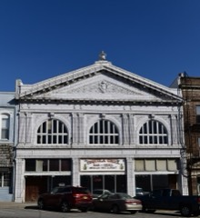
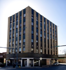
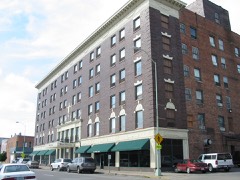
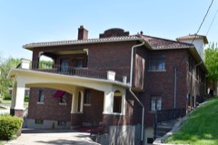
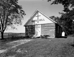
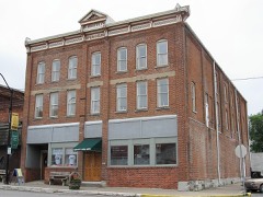
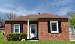
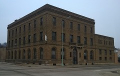
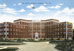
32 National Register listings published here.
Sources: the National Register database, National Park Service
31 topographic sheets cover 27 settlements here, and 32 properties are on the National Register of Historic Places.
32 National Register listings published here.
Sources: the National Register database, National Park Service
Every property in this county listed on the National Register of Historic Places, with the year it was listed and the federal nomination document.
Every wildfire the federal occurrence database records inside this county: 49 of them, burning about 283 acres. None started naturally and 1 was recorded as arson. Each settlement page carries the fires within five miles of it.
| Reported cause | Fires |
|---|---|
| Debris and open burning | 23 |
| Missing data/not specified/undetermined | 20 |
| Recreation and ceremony | 2 |
| Smoking | 1 |
| Arson/incendiarism | 1 |
| Railroad operations and maintenance | 1 |
| Equipment and vehicle use | 1 |
The five largest, by the area the report gives. None of them was recorded as arson.
| Date | Cause | Size | Reported by | Name on the report |
|---|---|---|---|---|
| 6 March 2020 | Debris and open burning | 80 acres | Iowa Department of Natural Resources | not named |
| 13 April 2006 | Missing data/not specified/undetermined | 60 acres | Iowa Department of Natural Resources | not named |
| 27 April 2018 | Debris and open burning | 15 acres | Iowa Department of Natural Resources | not named |
| 15 December 2002 | Missing data/not specified/undetermined | 15 acres | Iowa State Fire Marshal's Office | not named |
| 28 April 2018 | Debris and open burning | 15 acres | Iowa Department of Natural Resources | not named |
| 27 April 2018 | Debris and open burning | 10 acres | Iowa Department of Natural Resources | not named |
| 9 May 2017 | Equipment and vehicle use | 8.0 acres | Iowa Department of Natural Resources | not named |
| 22 April 2018 | Missing data/not specified/undetermined | 5.0 acres | Iowa Department of Natural Resources | not named |
Every settlement page carries the fires within five miles of it - see the settlement index below.
The NOAA Storm Events Database holds 596 reports for this county, causing 2 deaths, 64 injuries and about $44,679,030 in recorded property damage. Each settlement page carries the reports that name it.
| Kind of event | Reports |
|---|---|
| Thunderstorm Wind | 263 |
| Hail | 125 |
| Heavy Rain | 76 |
| Flood | 60 |
| Flash Flood | 37 |
| Tornado | 27 |
| Funnel Cloud | 6 |
| Lightning | 2 |
The most serious of them, by death, then injury, then recorded damage. The accounts are quoted exactly as the forecast office filed them.
| When | Event | Place named | Harm | What the report says |
|---|---|---|---|---|
| April 2001 | Tornado (F2) | Agency | 2 killed, 3 hurt, $400,000 | Quick moving tornado, touchdown with strongest part in Agency. Nine buildings with major damage, 43 with minor. Two buildings destroyed. Two dead, three injured. |
| September 2010 | Flood | Eddyville | 50 hurt, $10,000 | no account filed |
| April 2014 | Thunderstorm Wind | Ottumwa | 10 hurt, $100,000 | Thunderstorm wind damage was reported in the 1000 block of west Mary St. in Ottumwa. Two foot diameter trees blown over, flag poles were bent in half and a grain bin roof was removed and blown 200 yards. |
| July 2025 | Thunderstorm Wind | Eldon | 1 hurt, $15,000 | Wapello County EM and City of Eldon reported tree damage and power outages due to thunderstorm winds in the town of Eldon. Downed trees were reported to be blocking roadways and the City of Eldon spent the next few days cleaning up tree damage. One tree fell on and injured a motorcyclist driving through town. |
| May 1988 | Tornado (F2) | not stated | $25,000,000 | no account filed |
| September 1982 | Tornado (F2) | not stated | $2,500,000 | no account filed |
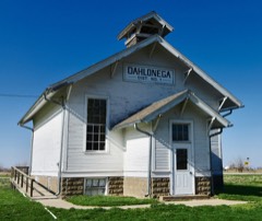
| March 2023 | Tornado (EF2) | Dahlonega | $2,000,000 | Long track tornado began in Wapello County northeast |of Ottumwa then tracked northeast into Keokuk County. |The primary damage in Wapello County consisted of three |homes and one hog confinement facility. The first home |lost the entire roof and one external wall. The first failure |point was likely the wind entering and lifting the garage |which then led to failure of the roof. The home only had |straight nailed connections to the external walls spaced|every 18 inches and less to the roof. An unoccupied |mobile home on the property was not well anchored and |rolled to total destruction. This location was rated 110 mph |and EF-1. Two well anchored hog confinement buildings |were totally destroyed and were rated EF-2. The tornado |then impacted a location with a well built 2 story brick |house. The house suffered some roof and window damage |and a loss of a garage door but sustained little other |damage. Other damage indicators at the site suggested |EF-1 winds. Total destruction of a house occurred just |prior to the tornado exiting the county. This older house |sat unanchored to the concrete block basement. The house |was pushed off the foundation and crumbled. Some trees |near the house and a propane tank were mostly left with |little damage. A larger tree directly next to the house on |the wind side had several large limbs removed. Due to |all of these reasons, the wind at this location has been |rated at 135 mph, or high end EF-2. |
| August 2010 | Flood | Eddyville | $2,000,000 | no account filed |
| June 2008 | Flood | Eddyville | $1,000,000 | no account filed |
| July 2010 | Flood | Eddyville | $500,000 | no account filed |
| June 2000 | Flash Flood | Countywide | $500,000 | no account filed |
| April 2007 | Flood | Kirkville | $350,000 | no account filed |
| March 2019 | Flash Flood | Ottumwa | $300,000 | Flash flooding occurred on the north side of Ottumwa due to an ice jam on the Des Moines River. Water rapidly rose several feet flooding a campground and a few local residences. Some cars and campers were flooded. |
| June 2011 | Flash Flood | Ottumwa | $300,000 | Harrows Creek was out of its bank and flowing across West Second Street. Cars were stranded on North Jefferson Street. A portion of the 1600 block of East Main Street was washed out by flood waters. Law enforcement closed the roads. |
| June 2011 | Flood | Eddyville | $300,000 | no account filed |
| June 2000 | Flash Flood | Ottumwa | $300,000 | no account filed |
| May 2013 | Flash Flood | Ottumwa | $250,000 | Trained spotter reported flash flooding along 140th Ave on the north side of Ottumwa. Water moving down the road 1 to 2 feet deep. |
| August 2010 | Flash Flood | Dahlonega | $250,000 | Local law enforcement and trained spotters report water flowing over Highway 149 and North Court Road in the 2600 to 2700 block on the north side of Ottumwa. Water was up to the windows of cars with vehicles stalling and traffic backing up. |
| June 1990 | Tornado (F0) | not stated | $250,000 | no account filed |
| June 1990 | Tornado (F2) | not stated | $250,000 | no account filed |
| May 1988 | Tornado (F2) | not stated | $250,000 | no account filed |
| November 1988 | Tornado (F2) | not stated | $250,000 | no account filed |
| April 2013 | Flash Flood | Ottumwa | $200,000 | Ottumwa Police reported several roads and intersections in the city as impassible to cars. |
| May 2013 | Flash Flood | (Otm)Ottumwa Indstrl | $200,000 | Large propane tank washed away along Keb Lane just north of Ottumwa. |
| May 2013 | Flash Flood | Ottumwa | $200,000 | Spotter reports that flash flooding with water 2 to 5 feet deep swept down the street carrying logs and debris with it. At the bottom of the street there was a car in the water with a depth of 5 feet. |
| June 2010 | Flood | Eddyville | $200,000 | no account filed |
| May 2013 | Flash Flood | Chillicothe | $150,000 | Flood damage to the railroad tracks near the 12000 block on Rock Bluff Road due to the South Avery Creek. |
| May 2013 | Flood | Eddyville | $150,000 | no account filed |
| August 2001 | Flash Flood | Countywide | $150,000 | no account filed |
| June 2019 | Thunderstorm Wind | Eddyville | $100,000 | Emergency manager reported several trees down across the city of Eddyville, a utility pole snapped, and two houses that had trees that fell on top of them. Degree of damage to the homes was unknown at the time. This is a delayed report and time estimated form radar. |
| August 2018 | Thunderstorm Wind | Blakesburg | $100,000 | Trained spotter reported that the small town of Blakesburg had a lot of tree damage, including several trees falling on houses. Extent of damage was unknown at the time. Report came via social media. |
| June 2015 | Thunderstorm Wind | Dudley | $100,000 | Media report of narrow swath of wind damage going from NW to SE from Monroe-Wapello Road to 140th street. Multiple farm silos and outbuildings damaged or destroyed. Large wooden power lines leaning or snapped. Time radar estimated. |
| June 2015 | Thunderstorm Wind | Chillicothe | $100,000 | Law enforcement report of a roof off of a house and numerous trees down in town. |
| June 2015 | Flood | Eldon | $100,000 | The Des Moines River at Ottumwa crested at 13.74 feet at 8:10 PM CST on 26 June. |
| April 2014 | Thunderstorm Wind | Bidwell | $100,000 | Major structural damage to at least one farmstead. Roofs were blown off of outbuildings, damage to homestead roof and porch as well. Many 12-18 inch diameter trees were snapped. |
| May 2013 | Flash Flood | Bidwell | $100,000 | Flood damage to the railroad tracks near 87th St and Highway 34. |
| June 2010 | Flash Flood | Ottumwa | $100,000 | Eight to 10 inches of water on several roadways. |
| August 2010 | Flash Flood | Ottumwa | $100,000 | A trained spotter in Ottumwa reported water flowing through the streets deep enough to stall multiple vehicles. He also estimated 2 inches of rain in the last hour. |
| August 2010 | Flash Flood | (Otm)Ottumwa Indstrl | $100,000 | Trained spotter reports water flowing over the road near the intersection of Angle Road and Highway 149 in north Ottumwa. |
| July 2010 | Flash Flood | Blakesburg Arpt | $100,000 | More than a foot of running water over 215th Ave between Highway 34 and Bluegrass Road. |
| March 2008 | Flash Flood | Chillicothe | $100,000 | At least 3 inches of water was reported in the spotters basement, along with several other homes in Ottumwa neighborhood taking on water in basements. |
| March 2008 | Flash Flood | Chillicothe | $100,000 | Wildwood Road in Ottumwa was closed from high water. Numerous other gravel roads in the county were closed due to water running over them. Some washouts were also reported. |
| June 2008 | Flash Flood | Ottumwa | $100,000 | Water from 6 inches to 3 feet deep was flooding about half of the south side of Ottumwa. |
| June 2008 | Flash Flood | Ottumwa | $100,000 | Flash flooding was reported by the Ottumwa police and city management. Numerous cars stalled. |
| August 2007 | Flash Flood | Farson | $100,000 | Several small streams were in flood with water over county roads in that area. |
| September 2014 | Flood | Eldon | $100,000 | no account filed |
| October 2014 | Flood | Eldon | $100,000 | no account filed |
| June 2010 | Flood | Chillicothe | $100,000 | no account filed |
| June 2010 | Flood | Eddyville | $100,000 | no account filed |
| March 2008 | Flood | Eddyville | $100,000 | no account filed |
| April 1999 | Tornado (F2) | Agency | $100,000 | no account filed |
| May 1998 | Hail | Eddyville | $100,000 | no account filed |
| June 1997 | Thunderstorm Wind | Eddyville | $100,000 | no account filed |
| April 1996 | Hail | Eldon | $100,000 | no account filed |
| June 2015 | Tornado (EF1) | Dudley | $75,000 | This tornado moved from Monroe into Wapello county. This is the Wapello county portion. The circulation for this short-lived tornado originated on the northern flank of a small squall line bow segment. This circulation rapidly tightened south of Eddyville and broke off the line, where it became tornadic. Damage included multiple farmsteads that lost silos and outbuildings, bent power lines, snapped trees, and a house that lost its roof and east wall. Downburst damage also occurred upstream and downstream of the tornado track. |
| June 2008 | Tornado (EF1) | Highland Center | $75,000 | A tornado touched down north of Ottumwa. A home lost the roof and the wall of one room was partially collapsed. Several trees were down around the home as well. |
| August 2007 | Flash Flood | Agency | $75,000 | Rural roads were flooded near Eldon. |
| June 2011 | Flood | Eddyville | $75,000 | no account filed |
| April 2019 | Flood | Eldon | $50,000 | The Des Moines River at Ottumwa crested at 12.35 feet on 29 April 2019 at 19:45 UTC. |
| April 2019 | Flood | Eldon | $50,000 | The Des Moines River at Ottumwa crested at 11.54 feet on 30 April 2019 at 20:30 UTC. |
The Survey's mineral resources record lists 32 workings inside this county. 2 still produce and 30 are closed or unrecorded. Each settlement page carries the workings within five miles of it.
| Commodity | Workings |
|---|---|
| Sand and Gravel, Construction | 10 |
| Stone, Crushed/Broken | 8 |
| Zinc | 7 |
| Limestone, Dimension | 5 |
| Clay | 2 |
The least common of them first, because a county's hundredth gravel pit says nothing its first ten did not.
| Where | Site | Commodity | Status | Recorded |
|---|---|---|---|---|
| Can-Tex Industries Ottumwa Pit | Clay | Producer | ||
| Ottumwa Brick and Tile Co. | Clay | Past Producer | ||
| Bear Creek Quarries | Limestone, Dimension | Past Producer | ||
| Harrows Branch Quarries | Limestone, Dimension | Past Producer | ||
| South Avery Creek Quarry | Limestone, Dimension | Past Producer | ||
| Unknown | Limestone, Dimension | Past Producer | ||
| Unknown | Limestone, Dimension | Past Producer | ||
| Drill Hole | Zinc | Past Producer | Sphalerite | |
| Drill Hole | Zinc | Past Producer | Sphalerite | |
| Drill Hole | Zinc | Past Producer | Sphalerite | |
| Drill Hole | Zinc | Past Producer | Sphalerite | |
| Drill Hole | Zinc | Past Producer | Sphalerite | |
| Drill Hole | Zinc | Past Producer | Sphalerite | |
| Drill Hole | Zinc | Past Producer | Sphalerite | |
| B and M Quarry | Stone, Crushed/Broken | Past Producer | ||
| Dudley Quarry | Stone, Crushed/Broken | Past Producer | ||
| Halverson Quarry | Stone, Crushed/Broken | Past Producer | ||
| Kirkville Quarry | Stone, Crushed/Broken | Past Producer | ||
| Old City Quarry | Stone, Crushed/Broken | Past Producer | ||
| Stewart Quarry | Stone, Crushed/Broken | Past Producer | ||
| Wagner Quarry | Stone, Crushed/Broken | Past Producer | ||
| Wapello Quarry | Stone, Crushed/Broken | Past Producer | ||
| Hargis Bar | Sand and Gravel, Construction | Past Producer | ||
| Materials Service Pit | Sand and Gravel, Construction | Past Producer | ||
| Ottumwa Pit | Sand and Gravel, Construction | Past Producer | ||
| Rowell Farm Pit | Sand and Gravel, Construction | Past Producer | ||
| Ulmer Pit | Sand and Gravel, Construction | Past Producer | ||
| Unknown | Sand and Gravel, Construction | Past Producer | ||
| Unknown | Sand and Gravel, Construction | Past Producer | ||
| Unknown | Sand and Gravel, Construction | Past Producer | ||
| Unknown | Sand and Gravel, Construction | Past Producer | ||
| W. Ottumwa Sand | Sand and Gravel, Construction | Producer |
Named settlements recorded in the Geographic Names Information System, each with the topographic sheets covering it. Villages, hamlets and abandoned places alike. Each is shown with the nearest named watercourse or landform and the survey quadrangle it falls on.
Cass township · 52548 · On South Avery Creek · Chillicothe quadrangle
7 sheets, 1954 to 1982
Columbia township · 52501 · On North Avery Creek · Chillicothe quadrangle
7 sheets, 1954 to 1982
Center township · 52501 · On Sugar Creek · Ottumwa North quadrangle
9 sheets, 1954 to 1982
Highland township · 52501 · On Spring Creek · Hedrick quadrangle
8 sheets, 1954 to 1982
Richland township · 52501 · Ottumwa North quadrangle
9 sheets, 1954 to 1982
No longer a settlement
Center township · 52501 · On Sand Creek · Ottumwa North quadrangle
9 sheets, 1954 to 1982
Center township · 52501 · On Kettle Creek · Ottumwa North quadrangle
9 sheets, 1954 to 1982
The vanished settlements of Wapello County: the places named above that are no longer on the map.