BlockBefore

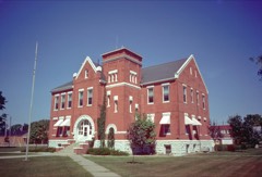
Old Worth County Courthouse

Listed on the National Register of Historic Places in 1981.

From the record

“The Old Worth County Courthouse in Northwood, Iowa, United States, was built in 1880. It was listed on the National Register of Historic Places in 1981 as a part of the County Courthouses in Iowa Thematic Resource.”

Wikipedia article Old Worth County Courthouse (Iowa), CC BY-SA 4.0.

One of 6 National Register listings published here for Worth County · listed in 1981 · category: Building.

Sources: the Wikipedia article · the case file at the National Archives · the National Register database, National Park Service

The listing

  • What is counted as historic. The nomination lists 1 building as contributing to the listing.
  • Address. 921 Central Ave., Northwood, 50459
  • When was it listed? July 1981
  • Category. building
  • Also known as. County Courthouses in Iowa TR
  • Township. Grove township
  • Architectural style. Renaissance Revival architecture
  • National Register reference number. 81000276 - the number the National Park Service assigned this property when it was listed, and the key its nomination file is catalogued under at the National Archives.

Fires near this property

3 since 2006

Regional context, not property-specific evidence. The federal wildfire occurrence database lists 3 fires within 5 miles of Old Worth County Courthouse between 2006 and 2014, burning about 124 acres in total. None started naturally. None was recorded as arson. Distance is straight-line from the map coordinates, so a fire counted here may appear on a neighbouring settlement's page as well.

Reported cause Fires
Missing data/not specified/undetermined2
Debris and open burning1

The most recent of them, most recent first, with the day each was reported and the service that recorded it.

DateCause SizeReported by Name on the report
7 May 2011Missing data/not specified/undetermined1.0 acresIowa Department of Natural Resources4969 NIGHTINGALE NORTHWOOD, IA, IA
12 May 2006Missing data/not specified/undetermined120 acresIowa Department of Natural Resourcesnot named
18 April 2014Debris and open burning3.0 acresIowa Department of Natural Resourcesnot named

Every fire recorded in Worth County

Mines and quarries near this property

10 of 13 shown

Regional context, not property-specific evidence. The federal mineral resources record lists 13 workings within 5 miles of Old Worth County Courthouse: 8 producers, 3 past producers, 2 unknowns. 8 still produce. What was taken out: Sand and Gravel, Construction, Stone, Crushed/Broken. Distance is straight-line from the map coordinates, so a quarry counted here may appear on a neighbouring settlement's page as well.

Where SiteCommodity StatusRecorded
HansonStone, Crushed/BrokenProducer
Harris QuarryStone, Crushed/BrokenProducer
Kensett QuarryStone, Crushed/BrokenUnknown
Kuennen QuarryStone, Crushed/BrokenProducer
Northwood QuarryStone, Crushed/BrokenProducer
Aase Pit and PlantSand and Gravel, ConstructionProducer
Knutson PitSand and Gravel, ConstructionProducer
Lucken PitSand and Gravel, ConstructionProducer
UnknownSand and Gravel, ConstructionUnknown
UnknownSand and Gravel, ConstructionPast Producer

Every working recorded in Worth County

Storms near this property

60 of 63 shown

Regional context, not property-specific evidence. The National Weather Service names Northwood, the town this property stands in, in 63 storm reports between 1993 and 2024: 24 hail, 20 thunderstorm wind, 10 heavy rain, 5 flash flood. The reports record 2 injuries. Each account below is quoted exactly as the forecast office filed it, from the NOAA Storm Events Database, and each date opens the federal record of that event.

WhenEvent Place namedHarm What the report says
May 2006HailNorthwood2 hurtno account filed
June 2013Flash FloodNorthwood$200,000Worth County Sheriff's office reported road closures at Ulmus Road between 420th and 400th Rd. Water was flowing over the road from a culvert and 430th between Zinnia Rd west to Yarrow Rd is closed.
June 1998FloodNorthwood$75,000no account filed
May 1998Thunderstorm WindNorthwood$50,000no account filed
July 1994Thunderstorm WindNorthwood$50,000no account filed
July 1994HailNorthwood$50,000no account filed
May 1994HailNorthwood$50,000no account filed
July 2016Thunderstorm WindNorthwood$30,000Iowa DOT reported Highway 65 blocked in both directions due to downed power lines. Time radar estimated.
July 2017Thunderstorm WindNorthwood$25,000County dispatch reported a transformer blown, power lines and power poles down, and tree damage. This is a delayed report and time estimated from radar.
July 2011Thunderstorm WindNorthwood$25,000Numerous trees down on power lines.
June 2008Flash FloodNorthwood$25,000Street flooding was reported in the area.
September 2001HailNorthwood$20,000no account filed
October 2006HailNorthwood$15,000no account filed
April 2004Thunderstorm WindNorthwood$15,000no account filed
July 2011Flash FloodNorthwood$10,000Lark Ave between 430th and 440th closed due to high water.
August 2007Flash FloodNorthwood$10,000The creek in town was reported out of its banks and flooding.
April 2010HailNorthwood$10,000no account filed
October 2006Thunderstorm WindNorthwood$10,000no account filed
October 2006HailNorthwood$10,000no account filed
April 2004HailNorthwood$10,000no account filed
June 2001Thunderstorm WindNorthwood$10,000no account filed
September 2001HailNorthwood$10,000no account filed
June 1995Thunderstorm WindNorthwood$10,000no account filed
June 2008Tornado (EF0)Northwood$5,000A small debris cloud was noted by a storm chaser.
May 2006HailNorthwood$5,000no account filed
July 2006Thunderstorm WindNorthwood$5,000no account filed
October 2006HailNorthwood$5,000no account filed
April 2004HailNorthwood$5,000no account filed
June 2004Thunderstorm WindNorthwood$5,000no account filed
September 2001HailNorthwood$5,000no account filed
June 1999Thunderstorm WindNorthwood$5,000no account filed
July 1998Thunderstorm WindNorthwood$5,000no account filed
July 1995HailNorthwood$5,000no account filed
May 2004HailNorthwood$3,000no account filed
June 1998Thunderstorm WindNorthwood$3,000no account filed
June 2020LightningNorthwood$2,000Coop observer reported that lightning hit a walnut tree 100 ft. from the house and fried the well pump.
June 1995HailNorthwood$2,000The air mass over Iowa became very unstable during the late afternoon hours. Dew point temperatures soared into the lower 70s F. with surface temperatures reaching the middle 80s to lower 90s F. CAPE values reached 3500 J-kg-1 by the latter part of the afternoon. A small cluster of thunderstorms developed over north-central Iowa. One of them became severe and produced inch diameter hail west of Northwood.
June 2006HailNorthwood$2,000no account filed
July 2003Thunderstorm WindNorthwood$2,000no account filed
March 1995Thunderstorm WindNorthwood$1,000An intense low pressure moved from western Kansas into northwest Iowa during the say. Strong southeast winds drew moisture north from the Gulf of Mexico. Surface dew point temperatures reached the lower 50s ahead of a dry line rotating around the south side of the low. Dew point temperatures were in the 10-12° C range at 850 mb. Thunderstorms erupted during the late afternoon and early evening hours just ahead of the dry line. They became severe over south central Iowa and moved/developed north into the north central counties of the state. Helicity values were quite high in spite of the relatively low cape values. Helicity was in the 550 m2-s-2, while CAPE values were around 500 J-kg-1. Initially, the thunderstorms produced hail. There were several reports of hail in the three-quarter to one inch diameter range from Osceola to just south of Des Moines. WSR-88D VIL values were in the 45-50 kg-m-2 range. One of the stronger cells produced a funnel cloud over Warren County. Spotters were able to watch a rotating wall cloud form just before the funnel formed. As the storms worked north, hail nearly an inch in diameter was reported in Hancock County. Gusty winds became a problem. Wind gusts of 60-65 MPH were reported in Winnebago, Cerro Gordo, and Worth Counties. The storms were quite quick moving, however a series of cells moved across the Des Moines area. They produced heavy rainfall with three inches falling in a short period of time over the eastern sections of Des Moines. This resulted in urban flooding in the area with water over the roads. Soil conditions were quite saturated prior to the rainfall.
May 2006HailNorthwood$1,000no account filed
July 1999Thunderstorm WindNorthwood$1,000no account filed
August 1993HailNorthwood$500no account filed
May 2024Thunderstorm WindNorthwood-Trained spotter reported downed trees along Highway 105, 1 mile west of Northwood.
June 2024Thunderstorm WindNorthwood-Reports of trees and powerlines down in Northwood. Time of occurrence estimated from radar.
September 2024Thunderstorm WindNorthwood-Several trees down. Time estimate by radar.
August 2021Flash FloodNorthwood-Water was several inches deep and completely covering 13th Street South in Northwood.
June 2018Heavy RainNorthwood-Coop observer recorded heavy rainfall of 2.17 inches over the last 24 hours.
July 2016Heavy RainNorthwood-Coop observer measured heavy rainfall of 3.15 inches over the last 24 hours.
September 2016Heavy RainNorthwood-Coop observer recorded heavy rainfall of 4.13 inches over the last 24 hours.
August 2016Heavy RainNorthwood-Coop observer reported storm total heavy rainfall of 4.55 inches. End time radar estimated.
July 2015Heavy RainNorthwood-Coop observer reported heavy rainfall of 2.82 inches over the last 24 hours.
December 2015Heavy RainNorthwood-Coop observer reported heavy rainfall of 1.55 inches over the last 48 hours/storm total so far.
June 2013Heavy RainNorthwood-A Co-op observer measured 1.97 inches of rain between 1700 and 1730 CST.
July 2011Heavy RainNorthwood-Rainfall of 4.50 inches.
July 2011Heavy RainNorthwood-Heavy rainfall of 4.64 inches from 1430 to 1800 CST.

Every storm recorded in Worth County

Map coverage status

No historic map-sheet match is published for this property yet. That does not mean no map exists. This record needs a coordinate-quality review before it can be joined to a sheet boundary. Browse the county's mapped places while that work is pending.

Listed places nearby

3 within 8 miles

Other National Register properties close enough to walk or drive between, ordered by distance from this one. Both positions come from the same geocoding pass that matched these properties to their map sheets.

Photograph PropertyDistance Listed
Worth County Courthouseunder 500 feet1981
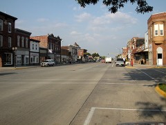
Northwood Central Avenue Historic District0.2 miles2006
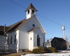
First Methodist Episcopal Church6.4 miles2000

Sources for this property

National Archives recordThe nomination case file for reference 81000276 in Record Group 79.
Wikipedia articleCommunity-written account of this property, licensed CC BY-SA.
Worth CountyAll 6 listed properties in this county.

Provenance

  • Listing record. National Park Service National Register of Historic Places, listed-properties dataset, current to 2026-05-22.
  • Map join. Address geocoded through the United States Census geocoder, then tested against the published boundary of every sheet in the USGS Historical Topographic Map Collection.
  • How this page is made. Listing fields come from federal records; map-sheet coverage is a labelled coordinate-to-boundary calculation, not a source-field claim.
  • Wildfire. Short, Karen C. 2022. Spatial wildfire occurrence data for the United States, 1992-2020 [FPA_FOD_20221014]. 6th Edition. Fort Collins, CO: Forest Service Research Data Archive. https://doi.org/10.2737/RDS-2013-0009.6 Collected with United States Government funding and usable without additional permissions or fees.
  • Mines and quarries. USGS Mineral Resources Data System (MRDS) https://mrdata.usgs.gov/mrds/ A work of the United States government, no copyright under 17 U.S.C. 105.
  • Storms. NOAA National Centers for Environmental Information, Storm Events Database https://www.ncei.noaa.gov/stormevents/ A work of the United States government, no copyright under 17 U.S.C. 105. Narratives are quoted verbatim from the National Weather Service report and are not edited or summarised.