 Block
From the record
One of 8 National Register listings published here for Howard County · listed in 1982 · category: Building.
Sources: the National Register database, National Park Service
Listed on the National Register of Historic Places in 1982.
One of 8 National Register listings published here for Howard County · listed in 1982 · category: Building.
Sources: the National Register database, National Park Service
Regional context, not property-specific evidence. The federal wildfire occurrence database lists 15 fires within 5 miles of South Ward School between 2007 and 2020, burning about 214 acres in total. None started naturally. None was recorded as arson. Distance is straight-line from the map coordinates, so a fire counted here may appear on a neighbouring settlement's page as well.
| Reported cause | Fires |
|---|---|
| Debris and open burning | 9 |
| Missing data/not specified/undetermined | 5 |
| Equipment and vehicle use | 1 |
The most recent of them, most recent first, with the day each was reported and the service that recorded it.
| Date | Cause | Size | Reported by | Name on the report |
|---|---|---|---|---|
| 3 May 2020 | Debris and open burning | 20 acres | Iowa Department of Natural Resources | not named |
| 9 April 2019 | Debris and open burning | 6.0 acres | Iowa Department of Natural Resources | not named |
| 5 April 2015 | Debris and open burning | 20 acres | Iowa Department of Natural Resources | not named |
| 4 April 2009 | Missing data/not specified/undetermined | 1.0 acres | Iowa Department of Natural Resources | not named |
| 4 April 2009 | Missing data/not specified/undetermined | 3.0 acres | Iowa Department of Natural Resources | not named |
| 20 April 2019 | Debris and open burning | 2.0 acres | Iowa Department of Natural Resources | not named |
| 18 April 2014 | Debris and open burning | 10 acres | Iowa Department of Natural Resources | not named |
| 18 April 2014 | Debris and open burning | 39 acres | Iowa Department of Natural Resources | not named |
Regional context, not property-specific evidence. The federal mineral resources record lists 13 workings within 5 miles of South Ward School: 6 past producers, 6 producers, 1 unknown. 6 still produce. What was taken out: Stone, Crushed/Broken, Sand and Gravel, Construction. Distance is straight-line from the map coordinates, so a quarry counted here may appear on a neighbouring settlement's page as well.
| Where | Site | Commodity | Status | Recorded |
|---|---|---|---|---|
| Unknown | Sand and Gravel, Construction | Past Producer | ||
| Unknown | Sand and Gravel, Construction | Past Producer | ||
| Unknown | Sand and Gravel, Construction | Past Producer | ||
| Albertson | Stone, Crushed/Broken | Producer | ||
| Balk | Stone, Crushed/Broken | Producer | ||
| Bauer Quarry | Stone, Crushed/Broken | Past Producer | ||
| Daley Quarry | Stone, Crushed/Broken | Producer | ||
| E Roberts | Stone, Crushed/Broken | Producer | ||
| Earl Roberts Quarry | Stone, Crushed/Broken | Producer | ||
| Stinger Quarry | Stone, Crushed/Broken | Producer |
Regional context, not property-specific evidence. The National Weather Service names Cresco, the town this property stands in, in 43 storm reports between 1994 and 2020: 15 thunderstorm wind, 14 hail, 3 funnel cloud, 3 flood. No death or injury is recorded in these reports. Each account below is quoted exactly as the forecast office filed it, from the NOAA Storm Events Database, and each date opens the federal record of that event.
| When | Event | Place named | Harm | What the report says |
|---|---|---|---|---|
| July 1994 | Thunderstorm Wind | Cresco | $500,000 | no account filed |
| June 1998 | Thunderstorm Wind | Cresco | $85,000 | no account filed |
| September 2018 | Lightning | Cresco | $50,000 | A fire at an assisted living facility in Cresco was started by a lightning strike. A portion of the building sustained heavy damage but all the residents were safely evacuated. |
| July 1997 | Tornado (F0) | Cresco | $35,000 | no account filed |
| July 2000 | Thunderstorm Wind | Cresco | $30,000 | no account filed |
| June 1998 | Thunderstorm Wind | Cresco | $10,000 | no account filed |
| June 1998 | Flash Flood | Cresco | $10,000 | no account filed |
| April 1997 | Thunderstorm Wind | Cresco | $10,000 | no account filed |
| July 2002 | Thunderstorm Wind | Cresco | $7,500 | no account filed |
| August 2014 | Thunderstorm Wind | Cresco | $5,000 | Farm buildings north of Cresco were damaged by high winds. |
| October 2012 | Lightning | Cresco | $5,000 | A oak tree in Cresco, estimated to be at least 150 years old, had to be cut down after a lightning strike seriously damaged the tree. The lightning strike also took out the controller card to some nearby stoplights. |
| August 2007 | Flash Flood | Cresco | $5,000 | Sheriff deputy reported that gravel roads had washouts throughout the county. Time estimated. |
| September 1995 | Hail | Cresco | $5,000 | Two frontal systems were moving southeast across the central United States. The first cold front was Pacific in origin and was quite weak. A much stronger cold front dropped southeast from Canada and entered Iowa during the afternoon. The air mass was capped in the mid levels. CAPE values were in the 2000-3000 J-kg-1 range ahead of the Canadian cold front. Surface dew point temperatures in the lower 70s F. Strong thunderstorms developed over north central Iowa and moved into the northeast counties. The produced brief heavy rainfall and gusty winds for the most part. A few storms produced hail during the early evening hours as colder air moved in aloft. Three-quarter-inch diameter hail fell in several locations over northeast Iowa. Golf ball-size hail fell in a few locations. Both Applington, in Butler County, and New Haven, in Mitchell County, reported golf ball-size hail. |
| April 1995 | Thunderstorm Wind | Cresco | $3,000 | Scattered thunderstorms moved across northern Iowa during the evening hours. There were numerous reports of pea- to marble-size hail with them, covering the ground in some locations. The gradient winds were quite strong during the evening. Minor damage occurred in Cresco as one storm produced winds of 58 mph. |
| June 1998 | Thunderstorm Wind | Cresco | $3,000 | no account filed |
| August 2000 | Thunderstorm Wind | Cresco | $2,500 | no account filed |
| July 2006 | Thunderstorm Wind | Cresco | $2,000 | no account filed |
| July 2003 | Thunderstorm Wind | Cresco | $2,000 | no account filed |
| May 1996 | Hail | Cresco | $2,000 | no account filed |
| July 2003 | Hail | Cresco | $1,000 | no account filed |
| July 1995 | Hail | Cresco | $1,000 | no account filed |
| July 2003 | Hail | Cresco | $800 | no account filed |
| April 2001 | Thunderstorm Wind | Cresco | $500 | no account filed |
| June 1998 | Thunderstorm Wind | Cresco | $200 | no account filed |
| June 2020 | Funnel Cloud | Cresco | - | A funnel cloud was sighted near Cresco. |
| June 2018 | Heavy Rain | Cresco | - | The COOP observer near Cresco measured 3.37 inches of rain. |
| August 2016 | Heavy Rain | Cresco | - | The COOP observer near Cresco measured 6.04 inches of rain. |
| June 2015 | Hail | Cresco | - | Half dollar sized hail was reported near Cresco. |
| June 2015 | Flood | Cresco | - | Locally heavy rain caused street flooding to occur in Cresco, temporarily causing law enforcement to close off some streets. |
| June 2014 | Flood | Cresco | - | Runoff from heavy rains caused street flooding to occur in Cresco. |
| July 2012 | Flood | Cresco | - | Numerous streets were flooded in Cresco and the water was deep enough in the downtown area to go over the curbs and threatened to go into some businesses. The flooding was produced by 2.65 inches of rain that fell in an hour and a half. |
| July 2009 | Hail | Cresco | - | Hail was accompanied with wind gusts of 40 to 50 mph, which damaged crops. |
| July 2009 | Hail | Cresco | - | Dime size hail combined with strong winds damaged corn fields. |
| May 2012 | Hail | Cresco | - | no account filed |
| June 2009 | Hail | Cresco | - | no account filed |
| June 2007 | Hail | Cresco | - | no account filed |
| July 2005 | Funnel Cloud | Cresco | - | no account filed |
| June 2003 | Hail | Cresco | - | no account filed |
| July 2003 | Hail | Cresco | - | no account filed |
| July 2003 | Hail | Cresco | - | no account filed |
| June 1998 | Thunderstorm Wind | Cresco | - | no account filed |
| June 1998 | Tornado (F0) | Cresco | - | no account filed |
| July 1997 | Funnel Cloud | Cresco | - | no account filed |
No historic map-sheet match is published for this property yet. That does not mean no map exists. This record needs a coordinate-quality review before it can be joined to a sheet boundary. Browse the county's mapped places while that work is pending.
Other National Register properties close enough to walk or drive between, ordered by distance from this one. Both positions come from the same geocoding pass that matched these properties to their map sheets.
| Photograph | Property | Distance | Listed |
|---|---|---|---|
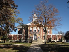 | Howard County Courthouse | 0.4 miles | 1981 |
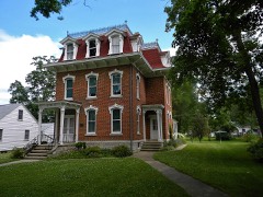 | Kellow House | 0.6 miles | 1977 |
 | Cresco Opera House | 1.3 miles | 1981 |
| National Archives record | The nomination case file for reference 82000408 in Record Group 79. |
| Howard County | All 8 listed properties in this county. |