 Block
From the record
8 National Register listings published here.
Sources: the National Register database, National Park Service
15 topographic sheets cover 17 settlements here, and 8 properties are on the National Register of Historic Places.
8 National Register listings published here.
Sources: the National Register database, National Park Service
Every property in this county listed on the National Register of Historic Places, with the year it was listed and the federal nomination document.
| Photograph | Property | Type | Listed | Reference |
|---|---|---|---|---|
 | Bohemian Savings Bank | building | 1990 | 88002806 |
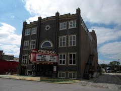 | Cresco Opera House | building | 1981 | 81000245 |
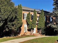 | James C. Fellows House | building | 1982 | 82002621 |
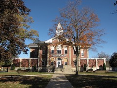 | Howard County Courthouse | building | 1981 | 81000246 |
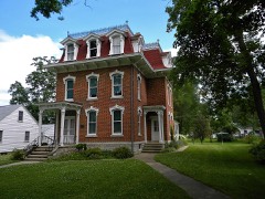 | Kellow House | building | 1977 | 77000517 |
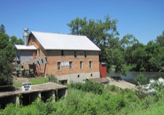 | Lime Springs Mill Complex | building | 1977 | 77000518 |
| Polygonal Barn, New Oregon Township | building | 1986 | 86001437 | |
| South Ward School | building | 1982 | 82000408 |
Every wildfire the federal occurrence database records inside this county: 39 of them, burning about 583 acres. None started naturally and none was recorded as arson. Each settlement page carries the fires within five miles of it.
| Reported cause | Fires |
|---|---|
| Missing data/not specified/undetermined | 19 |
| Debris and open burning | 18 |
| Equipment and vehicle use | 2 |
The five largest, by the area the report gives. None of them was recorded as arson.
| Date | Cause | Size | Reported by | Name on the report |
|---|---|---|---|---|
| 18 April 2020 | Equipment and vehicle use | 65 acres | Iowa Department of Natural Resources | not named |
| 26 March 2008 | Missing data/not specified/undetermined | 60 acres | Iowa Department of Natural Resources | not named |
| 14 April 2009 | Missing data/not specified/undetermined | 50 acres | Iowa Department of Natural Resources | not named |
| 8 May 2018 | Debris and open burning | 45 acres | Iowa Department of Natural Resources | not named |
| 1 February 2011 | Missing data/not specified/undetermined | 40 acres | Iowa Department of Natural Resources | 2594 190TH ST. AFTON, IA, IA |
| 14 April 2009 | Missing data/not specified/undetermined | 40 acres | Iowa Department of Natural Resources | not named |
| 29 October 2006 | Missing data/not specified/undetermined | 40 acres | Iowa Department of Natural Resources | not named |
| 18 April 2014 | Debris and open burning | 39 acres | Iowa Department of Natural Resources | not named |
Every settlement page carries the fires within five miles of it - see the settlement index below.
The NOAA Storm Events Database holds 309 reports for this county, causing no deaths, 30 injuries and about $13,293,950 in recorded property damage. Each settlement page carries the reports that name it.
| Kind of event | Reports |
|---|---|
| Thunderstorm Wind | 111 |
| Hail | 97 |
| Tornado | 44 |
| Flash Flood | 20 |
| Flood | 13 |
| Heavy Rain | 10 |
| Funnel Cloud | 9 |
| Lightning | 5 |
The most serious of them, by death, then injury, then recorded damage. The accounts are quoted exactly as the forecast office filed them.
| When | Event | Place named | Harm | What the report says |
|---|---|---|---|---|
| May 1968 | Tornado (F5) | not stated | 12 hurt, $2,500 | no account filed |
| May 1965 | Tornado (F4) | not stated | 5 hurt, $25,000 | no account filed |
| July 1971 | Tornado (F4) | not stated | 4 hurt, $2,500,000 | no account filed |
| May 2011 | Tornado (EF2) | Riceville | 3 hurt, $525,000 | This tornado first caused some damage about 3 miles north of State Highway 9 north of Riceville. The tornado almost immediately strengthen to EF1 as it moved northeast. Several farms had outbuildings destroyed, widespread tree damage occurred and several homes had partial or complete roof damage. As the tornado passed south of Chester, it increased to its maximum width and strength. The tornado remained at EF2 strength as it crossed the state line into Fillmore County Minnesota. The tornado passed through rural portions of the county affecting around a dozen farms with only three minor injuries occurring. Around 850 customers were loss power as a result of the storms. Damages were estimated to be around $500 thousand. |
| August 2012 | Lightning | Riceville | 2 hurt | Two young boys were injured when lightning struck a tree they were taking shelter under while fishing at the Lake Hendricks park and campground near Riceville. One boy was listed in critical condition after being transferred to St. Marys hospital in Rochester, Minnesota. The second boy only received minor injuries and was treated and released from a local hospital. |
| May 1953 | Tornado (F4) | not stated | 2 hurt | no account filed |
| April 2026 | Tornado (EF0) | Saratoga | 1 hurt, $55,000 | This tornado developed northwest of Saratoga and was witnessed by multiple individuals as it tracked northeast, damaging one outbuilding. The tornado also rolled a truck with the driver sustaining minor injuries. The tornado then dissipated southeast of the intersection of 70th street and Kent Avenue. |
| July 2009 | Thunderstorm Wind | Cresco Muni Arpt | 1 hurt, $10,000 | Trees were down all of over town and there were power outages. A woman was reportedly injured when a tree may have fallen on her in a park. Heavy rain and street flooding was also reported. |
| May 2019 | Tornado (EF1) | Maple Leaf | $1,300,000 | A tornado formed over rural Howard County south of Saratoga and then traveled north-northeast before dissipating just before entering Lime Springs. The tornado struck and destroyed a wind turbine north of State Highway 9 and also destroyed a large farm building along Lilac Avenue. |
| June 2008 | Flood | Protivin | $750,000 | Flash flooding led to aerial flooding across much of the county. Numerous roads and bridges remained closed, mainly in the northern part of the county.||In the Lime Springs area, the road to Lidtke park was damaged and water approached the top of the Lidtke Mill bridge.||Parts of Protivin was evacuated due to flood waters and ponding. Crops were also hit hard with too much standing water. |
| September 2011 | Thunderstorm Wind | Saratoga | $740,000 | A building roof and several grain bins were damaged, a shed destroyed and 70 power poles blown down along Jade Avenue five miles west of Lime Springs. |
| December 2021 | Tornado (EF0) | Schley | $600,000 | This was the third tornado of the night in Howard County. This EF0 tornado formed west of Schley and move northeast before dissipating east of Davis Corners. This tornado removed the roof from a hog farm building, drove lumber through the side of a metal building and also damaged other outbuildings and trees. One house had broken windows and some damage from tree branches downed on it. |
| July 1994 | Tornado (F3) | not stated | $500,000 | Intermittent track, mostly F1 damage |
| July 1994 | Tornado (F1) | Elma | $500,000 | no account filed |
| July 1994 | Thunderstorm Wind | Cresco | $500,000 | no account filed |
| August 2016 | Flood | Riceville | $470,000 | State Highway 9 was closed west of Cresco due to flood waters from the North Branch of the Turkey River. The flood waters from the North Branch of the Turkey River also washed out Robin Avenue. Lidtke County Park just north of Lime Springs was flooded by the Upper Iowa River. A small mudslide occurred along Watsons Creek in Lake Hendricks Park in Riceville. The county engineer estimated there were over 450 locations where water was over roads with only minor damage reported. In Cresco, several houses had water in the basements. School was canceled in the Howard-Winneshiek and Riceville school districts. |
| April 2022 | Tornado (EF0) | Saratoga | $340,000 | An EF0 tornado developed southwest of Saratoga and tracked to the northeast before dissipating southeast of town. The tornado damaged trees and some farm outbuildings along its path. |
| June 2000 | Flash Flood | Countywide | $300,000 | no account filed |
| July 1999 | Flash Flood | Countywide | $275,000 | no account filed |
| April 2026 | Hail | Elma | $250,000 | The public reported three and a half inch diameter hail near Elma. |
| December 2021 | Tornado (EF0) | Schley | $250,000 | This was the fourth tornado of the night across Howard County. This EF0 tornado formed northeast of Schley and moved northeast before dissipating west of Cresco. This tornado caused damage to one farm where a house was effectively destroyed by large trees blown down on it. At another farm, the home sustained roof damage from a large tree downed on it along with broken windows and two metal outbuildings were destroyed with a third damaged. |
| June 2004 | Tornado (F3) | Riceville | $190,000 | no account filed |
| May 2008 | Thunderstorm Wind | Davis Corners | $185,000 | An apparent downburst hit the parking lot of Featherlite Trailers damaging 36 trailers. Many of them were tossed into the air or into other trailers. The damage occurred after security had left the facility and was found the next morning. Although not impossible, there was not ample evidence to document this as a brief tornado touchdown. |
| June 2010 | Flood | Chester | $150,000 | Rainfall of 2.5 to 4 inches during the evening of June 22 caused major damage to secondary roads across Howard County with 120 spots noting damage. |
| July 2010 | Thunderstorm Wind | Elma | $150,000 | Four steel grain bins, a barn, well house and two machine sheds were destroyed by thunderstorms winds. |
| June 2004 | Tornado (F0) | Riceville | $100,000 | no account filed |
| December 2021 | Tornado (EF0) | Elma | $90,000 | This tornado formed in Chickasaw County and moved into Howard County south of Elma along County Line Road just east of the Little Wapsipinicon River. The tornado moved rapidly northeast before dissipating south of Elma. Damage from this EF0 tornado was limited to trees and one farm. |
| December 2021 | Tornado (EF0) | Elma | $90,000 | This was the second tornado of the night in Howard County. This EF0 tornado formed northeast of Elma and moved northeast before dissipating east of Saratoga. Damage along the path was limited to trees and weak farm outbuildings. |
| June 1998 | Thunderstorm Wind | Cresco | $85,000 | no account filed |
| June 2008 | Flash Flood | Chester | $80,000 | Flash flooding led to numerous road closures, mainly in the northern part of the county. Some bridges near the Iowa-Minnesota border were also damaged and closed. |
| April 2026 | Hail | Saratoga | $75,000 | The public reported baseball sized hail in Saratoga. |
| December 2021 | Thunderstorm Wind | Vernon Spgs | $75,000 | A metal machine building was destroyed west of Cresco. |
| September 2011 | Thunderstorm Wind | Saratoga | $75,000 | Several large grain bins were buckled by the high winds. |
| September 2007 | Thunderstorm Wind | Elma | $75,000 | Two silos were damaged, a grain bin was caved in, and one end of a machine shed was lost. |
| July 2010 | Thunderstorm Wind | Cresco Muni Arpt | $70,000 | Storms blew the roof off a car dealership with debris blown several blocks. At a nearby restaurant, picnic tables were lifted, windows busted and trees blown down. Signs for area businesses were also destroyed. A wholesale greenhouse had most of the glass panels on the roof of one building destroyed where the winds may have been locally higher. Another business close to the greenhouse also had the roof destroyed. |
| June 2000 | Flash Flood | Countywide | $70,000 | no account filed |
| March 2017 | Thunderstorm Wind | Davis Corners | $65,000 | In Davis Corners, trees were blown down, a shed was demolished, an outbuilding had the front overhead door blown in along with a wall and backdoor blown out. The roof on a house was totaled by the winds. Another business had a metal building with several puncture holes from flying debris and had an outbuilding blown down. |
| August 2024 | Thunderstorm Wind | Lime Spgs | $60,000 | Law enforcement reported power poles down in Lime Springs as well as many other instances of wind damage in Howard County. |
| June 1999 | Thunderstorm Wind | Chester | $60,000 | no account filed |
| July 2000 | Flash Flood | Countywide | $55,000 | no account filed |
| December 2021 | Thunderstorm Wind | Cresco Muni Arpt | $50,000 | A metal pole shed was blown off its foundation just west of Cresco. |
| May 2019 | Thunderstorm Wind | Lime Spgs | $50,000 | After a tornado dissipated just outside of Lime Springs, the remaining winds from the storm blew down several trees and powerlines and cause some roof damage to homes in town. Around 900 residents were without power after the storm. |
| September 2018 | Lightning | Cresco | $50,000 | A fire at an assisted living facility in Cresco was started by a lightning strike. A portion of the building sustained heavy damage but all the residents were safely evacuated. |
| August 2007 | Flood | Protivin | $50,000 | Runoff from heavy rainfall continued to cause flooding on streams and creeks, with sand bagging on Bohemian Creek in Protivin. |
| October 2006 | Hail | Protivin | $50,000 | no account filed |
| May 2004 | Flash Flood | Countywide | $50,000 | no account filed |
| May 1996 | Thunderstorm Wind | Schley | $50,000 | no account filed |
| July 1994 | Tornado (F2) | Elma to | $50,000 | no account filed |
| June 2024 | Flood | Lime Spgs | $40,000 | Significant rainfall later into June pushed the Upper Iowa River at Lime Springs into flood stage on June 27th. The river stage crested during the early morning on June 23rd in major flood stage at 16.40 ft. This was a new record high river stage for the site. |
| March 2017 | Thunderstorm Wind | Davis Corners | $40,000 | Two outbuildings were blown apart and a branch was forced through the wall of a home northeast of Davis Corners. |
| May 1998 | Thunderstorm Wind | Florenceville | $40,000 | no account filed |
| May 2019 | Tornado (EF0) | Elma | $35,000 | A tornado entered into Howard County southwest of Elma as it moved north-northeast and then dissipated after crossing Dale Avenue. Farm buildings were damaged just north of the Chickasaw County line. This was witnessed by area fire departments serving as spotters. |
| May 2000 | Flash Flood | Countywide | $35,000 | no account filed |
| July 1997 | Tornado (F0) | Cresco | $35,000 | no account filed |
| December 2021 | Thunderstorm Wind | Davis Corners | $30,000 | Trees were uprooted, power poles snapped and a metal barn roof was partially blown off west of Davis Corners. |
| December 2021 | Thunderstorm Wind | Schley | $30,000 | An outbuilding and structures on a hog farm southwest of Cresco were damaged. |
| July 2008 | Thunderstorm Wind | Protivin | $30,000 | A business building was destroyed by a storm in the Protivin area. A gustnado likely caused the damage, but local officials suspected a tornado may have struck in a 100-foot area and destroyed the building. |
| July 2000 | Thunderstorm Wind | Cresco | $30,000 | no account filed |
| July 1998 | Hail | Lime Spgs | $30,000 | no account filed |
| April 2022 | Tornado (EF1) | Riceville | $25,000 | This EF1 tornado moved into Howard County south of Riceville and moved to the northeast before dissipating southeast of Riceville. Damage was mainly limited to trees. |
The Survey's mineral resources record lists 51 workings inside this county. 16 still produce and 35 are closed or unrecorded. Each settlement page carries the workings within five miles of it.
| Commodity | Workings |
|---|---|
| Stone, Crushed/Broken | 29 |
| Sand and Gravel, Construction | 22 |
The least common of them first, because a county's hundredth gravel pit says nothing its first ten did not.
| Where | Site | Commodity | Status | Recorded |
|---|---|---|---|---|
| Cannon Pit #2 | Sand and Gravel, Construction | Past Producer | ||
| Chester Pit #1 | Sand and Gravel, Construction | Past Producer | ||
| Eastman Pit | Sand and Gravel, Construction | Producer | ||
| Eckerman Pit | Sand and Gravel, Construction | Past Producer | ||
| Frederick Pit | Sand and Gravel, Construction | Producer | ||
| Kruse Pit | Sand and Gravel, Construction | Producer | ||
| Lourdes Pit | Sand and Gravel, Construction | Past Producer | ||
| Schley Pit and Plant | Sand and Gravel, Construction | Producer | ||
| Unknown | Sand and Gravel, Construction | Past Producer | ||
| Unknown | Sand and Gravel, Construction | Past Producer | ||
| Unknown | Sand and Gravel, Construction | Past Producer | ||
| Unknown | Sand and Gravel, Construction | Past Producer | ||
| Unknown | Sand and Gravel, Construction | Past Producer | ||
| Unknown | Sand and Gravel, Construction | Past Producer | ||
| Unknown | Sand and Gravel, Construction | Past Producer | ||
| Unknown | Sand and Gravel, Construction | Past Producer | ||
| Unknown | Sand and Gravel, Construction | Past Producer | ||
| Unknown | Sand and Gravel, Construction | Past Producer | ||
| Unknown | Sand and Gravel, Construction | Past Producer | ||
| Unknown | Sand and Gravel, Construction | Unknown | ||
| Unknown | Sand and Gravel, Construction | Past Producer | ||
| Unknown | Sand and Gravel, Construction | Past Producer | ||
| Albertson | Stone, Crushed/Broken | Producer | ||
| Balk | Stone, Crushed/Broken | Producer | ||
| Bauer Quarry | Stone, Crushed/Broken | Past Producer | ||
| Burger Quarry | Stone, Crushed/Broken | Past Producer | ||
| Cecelia Quarry | Stone, Crushed/Broken | Past Producer | ||
| Daley Quarry | Stone, Crushed/Broken | Producer | ||
| Davis Corners Quarry | Stone, Crushed/Broken | Past Producer | ||
| Dotzler Quarry | Stone, Crushed/Broken | Producer | ||
| E Roberts | Stone, Crushed/Broken | Producer | ||
| Eckerman Quarry | Stone, Crushed/Broken | Past Producer | ||
| Gansen | Stone, Crushed/Broken | Past Producer | ||
| Le Roy Quarry | Stone, Crushed/Broken | Past Producer | ||
| Maple Leaf Quarry | Stone, Crushed/Broken | Producer | ||
| Mauer Quarry | Stone, Crushed/Broken | Producer | ||
| Nelson Quarry | Stone, Crushed/Broken | Producer | ||
| Odonnell Quarry | Stone, Crushed/Broken | Producer | ||
| Reicks Quarry | Stone, Crushed/Broken | Producer | ||
| Souhrada Quarry | Stone, Crushed/Broken | Past Producer | ||
| Stinger Quarry | Stone, Crushed/Broken | Producer | ||
| Tank Lime Quarry | Stone, Crushed/Broken | Producer | ||
| Unknown | Stone, Crushed/Broken | Past Producer | ||
| Unknown | Stone, Crushed/Broken | Past Producer | ||
| Unknown | Stone, Crushed/Broken | Past Producer | ||
| Unknown | Stone, Crushed/Broken | Unknown | ||
| Unknown | Stone, Crushed/Broken | Past Producer | ||
| Unknown | Stone, Crushed/Broken | Past Producer | ||
| Unknown | Stone, Crushed/Broken | Unknown | ||
| Unknown | Stone, Crushed/Broken | Past Producer | ||
| Winekoff Quarry | Stone, Crushed/Broken | Past Producer |
Named settlements recorded in the Geographic Names Information System, each with the topographic sheets covering it. Villages, hamlets and abandoned places alike. Each is shown with the nearest named watercourse or landform and the survey quadrangle it falls on.
Forest City township · 52155 · Cresco NW quadrangle
7 sheets, 1954 to 1985
No longer a settlement
Forest City township · 52155 · On Beaver Creek · Lime Springs quadrangle
7 sheets, 1954 to 1985
Afton township · 50466 · Riceville quadrangle
7 sheets, 1954 to 1985
No longer a settlement
Jamestown township · 50466 · On Watsons Creek · Riceville quadrangle
7 sheets, 1954 to 1985
The vanished settlements of Howard County: the places named above that are no longer on the map.