 Block
From the record
One of 14 National Register listings published here for Delaware County · listed in 1990 · category: District.
Sources: the case file at the National Archives · the National Register database, National Park Service
Listed on the National Register of Historic Places in 1990.
One of 14 National Register listings published here for Delaware County · listed in 1990 · category: District.
Sources: the case file at the National Archives · the National Register database, National Park Service
Regional context, not property-specific evidence. The federal wildfire occurrence database lists 3 fires within 5 miles of Backbone State Park, Picnicking, Hiking & Camping Area (Area B) between 2011 and 2015, burning about 66 acres in total. None started naturally. None was recorded as arson. Distance is straight-line from the map coordinates, so a fire counted here may appear on a neighbouring settlement's page as well.
| Reported cause | Fires |
|---|---|
| Missing data/not specified/undetermined | 2 |
| Debris and open burning | 1 |
The most recent of them, most recent first, with the day each was reported and the service that recorded it.
| Date | Cause | Size | Reported by | Name on the report |
|---|---|---|---|---|
| 1 April 2015 | Debris and open burning | 25 acres | Iowa Department of Natural Resources | not named |
| 31 March 2011 | Missing data/not specified/undetermined | under an acre | Iowa Department of Natural Resources | 205 CONCORD ST. LAMONT, IA 50650, IA |
| 27 March 2011 | Missing data/not specified/undetermined | 40 acres | Iowa Department of Natural Resources | 37383 ACORN RD., STRAWBERRY POINT, IA 52076, IA |
Regional context, not property-specific evidence. The federal mineral resources record lists 16 workings within 5 miles of Backbone State Park, Picnicking, Hiking & Camping Area (Area B): 10 past producers, 5 producers, 1 unknown. 5 still produce. What was taken out: Stone, Crushed/Broken, Sand and Gravel, Construction. Distance is straight-line from the map coordinates, so a quarry counted here may appear on a neighbouring settlement's page as well.
| Where | Site | Commodity | Status | Recorded |
|---|---|---|---|---|
| Hollerman Pit | Sand and Gravel, Construction | Past Producer | ||
| Hoth Pit | Sand and Gravel, Construction | Past Producer | ||
| Joy Springs Pit | Sand and Gravel, Construction | Past Producer | ||
| Unknown | Sand and Gravel, Construction | Past Producer | ||
| Unknown | Sand and Gravel, Construction | Past Producer | ||
| Unknown | Sand and Gravel, Construction | Past Producer | ||
| Ward Farm Pit | Sand and Gravel, Construction | Past Producer | ||
| Burrack Quarry | Stone, Crushed/Broken | Producer | ||
| Forrestville Quarry | Stone, Crushed/Broken | Past Producer | ||
| Harold Hartman Quarry | Stone, Crushed/Broken | Producer |
Regional context, not property-specific evidence. The National Weather Service names Dundee, the town this property stands in, in 31 storm reports between 1998 and 2025: 10 thunderstorm wind, 9 hail, 5 flash flood, 3 tornado. No death or injury is recorded in these reports. Each account below is quoted exactly as the forecast office filed it, from the NOAA Storm Events Database, and each date opens the federal record of that event.
| When | Event | Place named | Harm | What the report says |
|---|---|---|---|---|
| September 2016 | Flood | Dundee | $150,000 | Heavy rainfall of 4 to over 10 inches over significant areas from 21 to 23 September in extreme North Central and Northeast Iowa moved downstream causing the Maquoketa River to rise above major flood stage levels. ||Manchester rose above its major flood stage level of 20.0 feet on September 23rd, 2016 at approximately 12 PM CST. It crested around 20.3 feet at approximately 3 PM CST on September 23rd, 2016. It fell below major flood stage on September 23rd around 4 PM CST. |
| June 2014 | Tornado (EF1) | Dundee | $100,000 | A tornado formed 4 miles south of Lamont, IA in Buchanan County, tracked about 1 mile to the northeast before crossing into Delaware County. In Delaware County the tornado continued for about 13 miles to the northeast to Edgewood, IA. ||This entry is for the Delaware County portion of the tornado track (second and final segment).||Most of the damage was south and east of Dundee into south Edgewood. Several grain bins collapsed or were destroyed. Two old hog confinements were seriously damaged along with an aluminum roof being torn off. Numerous trees were snapped along the path. |
| May 2008 | Tornado (EF1) | Dundee | $100,000 | Tornado moved from Buchanan County into Delaware County. It was on the ground for about 11 miles before it lifted near Oneida. Some farmsteads, trees, and power lines were damaged. |
| June 2008 | Flash Flood | Dundee | $25,000 | Heavy rains resulted in some flash flooding of numerous county roads in the vicinity of Dundee, IA during the evening of June 8. The roads were either washed out or covered with flood waters. Additional county roads across Delaware County were also experiencing flash flooding. |
| May 2004 | Thunderstorm Wind | Dundee | $15,000 | Roof off a hog building with slight damage to a machine shed and the farm house |
| May 2004 | Flash Flood | Dundee | $3,000 | 6 to 12 inches of moving water across gravel road |
| June 1998 | Thunderstorm Wind | Dundee | $2,500 | Strong thunderstorm winds uprooted, shattered and splintered nearly two acres of trees at Backbone State Park. Between 50 and 100 oaks, maples, and basswood trees were destroyed. Campgrounds were also damaged by the high winds and one tent was flattened by a falling tree. No injuries were reported to the occupants of the tent. They sought shelter in a campground shower house before the tree fell. |
| June 2025 | Thunderstorm Wind | Dundee | - | Large branches down in town. Time estimated using radar. |
| July 2024 | Thunderstorm Wind | Dundee | - | The Emergency Manager reported a 10 inch tree limbs down. |
| June 2022 | Hail | Dundee | - | Winds to 40 mph also reported. |
| June 2019 | Thunderstorm Wind | Dundee | - | Numerous trees blown down. |
| July 2017 | Hail | Dundee | - | A public report was received of hail between 0.50 up to 1.0 inch in diameter. This report was relayed by the county emergency manager. |
| May 2016 | Thunderstorm Wind | Dundee | - | The local coop observer reported a 2 foot diameter tree was snapped about 4 to 5 feet above the ground at 1435 165th street. This is roughly 2 miles South Southeast of Dundee. |
| June 2014 | Flash Flood | Dundee | - | Law enforcement reported county road washouts and water over the road on Highway 13 and Highway 3. |
| February 2009 | Hail | Dundee | - | The emergency manager reported nickel size hail northeast of Dundee. |
| May 2008 | Flood | Dundee | - | The Maquoketa River at Manchester was over its major flood stage level from 2:30 pm to 3:45 pm on May 30. |
| May 2008 | Hail | Dundee | - | Nickel to quarter-sized hail fell in Dundee at 655 pm. |
| May 2008 | Flood | Dundee | - | The Maquoketa River at Manchester was over its major flood stage level from 7:00 am to 4:00 pm on May 26. |
| May 2008 | Flash Flood | Dundee | - | Heavy rains of 3 to 8 inches has resulted in water covering some roads in the vicinity of Dundee, IA. |
| August 2007 | Hail | Dundee | - | Hail the size of a quarter fell in Dundee, IA.| |
| September 2007 | Thunderstorm Wind | Dundee | - | Winds estimated to be 65 mph blew down some trees in Dundee, IA. |
| May 2001 | Tornado (F0) | Dundee | - | A tornado touched down briefly just west of Backbone State Park. No damage was reported. |
| September 2001 | Thunderstorm Wind | Dundee | - | Thunderstorm winds estimated at 60 mph downed trees at Backbone State Park. Reported by law enforcement. |
| August 1999 | Thunderstorm Wind | Dundee | - | A tree 24 inches in diameter and 40 feet tall was downed. |
| May 1999 | Flash Flood | Dundee | - | Flash flooding caused the boat ramp to collapse and flooded bridges at Backbone State Park. |
| April 2013 | Hail | Dundee | - | no account filed |
| December 2002 | Funnel Cloud | Dundee | - | no account filed |
| June 2002 | Hail | Dundee | - | no account filed |
| May 2000 | Hail | Dundee | - | no account filed |
| May 2000 | Hail | Dundee | - | no account filed |
| August 2000 | Thunderstorm Wind | Dundee | - | no account filed |
No historic map-sheet match is published for this property yet. That does not mean no map exists. This record needs a coordinate-quality review before it can be joined to a sheet boundary. Browse the county's mapped places while that work is pending.
Other National Register properties close enough to walk or drive between, ordered by distance from this one. Both positions come from the same geocoding pass that matched these properties to their map sheets.
| Photograph | Property | Distance | Listed |
|---|---|---|---|
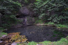 | Backbone State Park Historic District | 0.7 miles | 1991 |
| Backbone State Park, Cabin-Bathing Area (Area A) | 1.4 miles | 1990 | |
| Backbone State Park, Richmond Springs (Area C) | 1.7 miles | 1990 | |
| Coffin's Grove Stagecoach House | 7.9 miles | 1975 |
| National Archives record | The nomination case file for reference 90001682 in Record Group 79. |
| Delaware County | All 14 listed properties in this county. |