Block
From the record
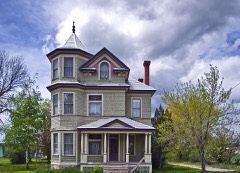
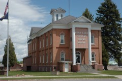
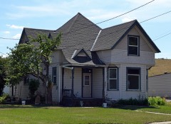
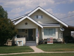
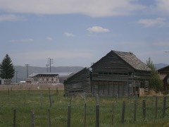
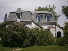
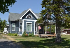
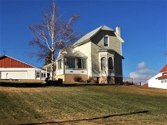
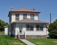
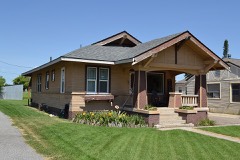
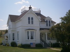
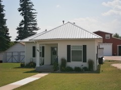
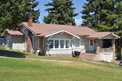
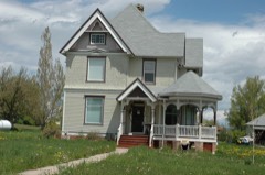
92 National Register listings published here.
Sources: the National Register database, National Park Service
40 topographic sheets cover 32 settlements here, and 92 properties are on the National Register of Historic Places.
92 National Register listings published here.
Sources: the National Register database, National Park Service
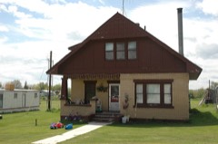
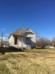
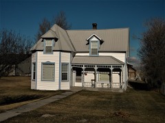
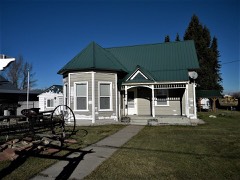
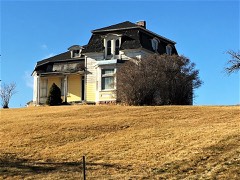
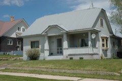
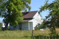
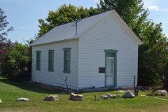
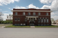
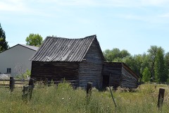
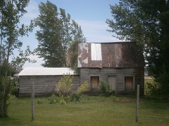
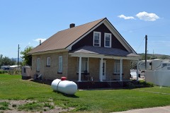
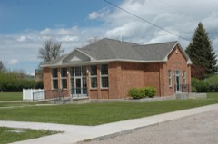
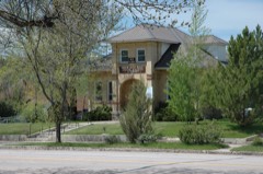
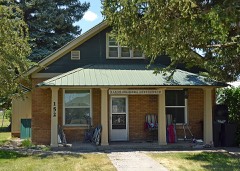
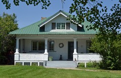
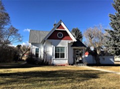
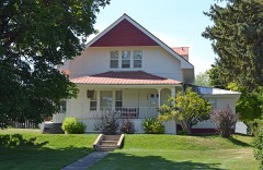
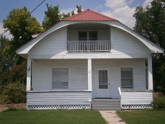
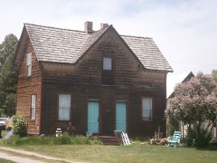
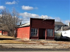
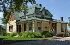
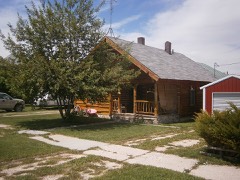
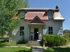
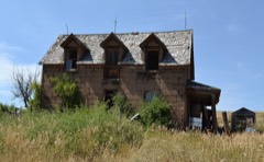
Every property in this county listed on the National Register of Historic Places, with the year it was listed and the federal nomination document.
Every wildfire the federal occurrence database records inside this county: 224 of them, burning about 15,750 acres. 82 started naturally and 4 were recorded as arson. Each settlement page carries the fires within five miles of it.
| Reported cause | Fires |
|---|---|
| Recreation and ceremony | 89 |
| Natural | 82 |
| Missing data/not specified/undetermined | 22 |
| Debris and open burning | 8 |
| Smoking | 6 |
| Equipment and vehicle use | 6 |
| Arson/incendiarism | 4 |
| Power generation/transmission/distribution | 3 |
| Fireworks | 2 |
| Other causes | 1 |
| Misuse of fire by a minor | 1 |
The five largest, by the area the report gives. Two of them were set deliberately.
| Date | Cause | Size | Reported by | Name on the report |
|---|---|---|---|---|
| 26 August 2010 | Natural | 3,536 acres | Caribou-Targhee National Forest | GIRAFFE CREEK |
| 2 September 2007 | Natural | 2,945 acres | Idaho Falls District | SWEETWATER |
| 11 July 1994 | Arson/incendiarism | 2,190 acres | Idaho Falls District | MERKLEY |
| 9 October 1999 | Debris and open burning | 1,672 acres | Idaho Falls District | BOUNDARY 1 |
| 22 September 2018 | Equipment and vehicle use | 1,016 acres | Caribou-Targhee National Forest | 8 MILE |
| 2 August 1996 | Arson/incendiarism | 600 acres | Idaho Falls District | MERKLEY |
| 26 July 1994 | Natural | 460 acres | Idaho Falls District | GENEVA |
| 28 August 2012 | Power generation/transmission/distribution | 419 acres | Caribou-Targhee National Forest | NORTH CANYON |
Every settlement page carries the fires within five miles of it - see the settlement index below.
The NOAA Storm Events Database holds 80 reports for this county, causing 4 deaths, 3 injuries and about $1,161,900 in recorded property damage. Each settlement page carries the reports that name it.
| Kind of event | Reports |
|---|---|
| Thunderstorm Wind | 56 |
| Hail | 12 |
| Flood | 8 |
| Tornado | 2 |
| Flash Flood | 1 |
| Debris Flow | 1 |
The most serious of them, by death, then injury, then recorded damage. The accounts are quoted exactly as the forecast office filed them.
| When | Event | Place named | Harm | What the report says |
|---|---|---|---|---|
| June 2015 | Thunderstorm Wind | St Charles | 4 killed, 3 hurt, $3,000 | Winds from a severe thunderstorm of 70 mph or greater caused large waves and capsized a ski boat with 7 people on board on Bear Lake on the Idaho portion of the lake. There were 4 fatalities with 3 survivors from the accident. |
| February 2017 | Flood | Nounan | $808,000 | An extensive warmup combined with record snows in December and January caused minor flooding and roof collapses as the weight of heavy snow mixed with rain caused multiple rood collapses. The Geneva School roof collapsed. |
| March 2017 | Flood | Nounan | $135,000 | Continued extensive snow melt created continued sheet flooding throughout the month with water as much as 3 feet deep in fields near Ovid. Damage estimates continued to increase from roads to property damage. |
| August 1997 | Thunderstorm Wind | Montpelier | $70,000 | no account filed |
| May 2017 | Flood | Nounan | $55,000 | The Bear River near the Wyoming border remained at flood stage for much of the month and minor field flooding mainly continued through May. Reports of some basement flooding in the county along with road and bridge damage continued. |
| March 2006 | Thunderstorm Wind | Countywide | $25,000 | no account filed |
| June 2010 | Thunderstorm Wind | Ovid | $20,000 | Thunderstorm winds demolished a new hay barn. |
| June 1998 | Tornado (F0) | Montpelier | $20,000 | no account filed |
| June 2017 | Flood | Nounan | $10,000 | The Bear River near the Wyoming border receded below flood stage and the flooding situation improved throughout the month. Repair to damaged roads continued along with west nile mosquito control. |
| August 2024 | Thunderstorm Wind | Nounan | $6,000 | Six trees blown down in Skinner Canyon. |
| April 2023 | Debris Flow | Ovid | $5,000 | At approximately 6:30 pm MDT on the 11th a mud slide necessitated the closure of SH-36 between Ovid and Preston. Continued warming temperatures resulted in two more slides in the area. As of 2:30 pm MDT on the 12th the highway remainedclosed north of Mink Creek. |
| July 2011 | Flood | Montpelier | $2,000 | Extensive lowland and field flooding continued through much of July along the Bear River upstream of Stewart Dam. Water continued to surround a couple homes in the dingle area and water continued to impact a portion of Pegram Road near the town of Pegram. Water levels on the river receded considerably beginning July 24th. |
| June 2010 | Thunderstorm Wind | Paris | $1,200 | Power pole snapped by thunderstorm wind causing power outage. |
| September 2007 | Thunderstorm Wind | Montpelier | $1,000 | Trees reported down in Montpelier on Eastshore Road and Highway 89 with carport roof blown off as well in the town. |
| July 2016 | Thunderstorm Wind | Montpelier | $400 | A large tree snapped due to a strong thunderstorm wind on July 4th. |
| May 1998 | Thunderstorm Wind | Montpelier | $300 | no account filed |
| April 2026 | Thunderstorm Wind | Montpelier | - | The Sheep Creek Hills mesonet site recorded a 59 mph thunderstorm outflow wind gust. |
| May 2025 | Thunderstorm Wind | Montpelier | - | The Sheep Creek Hills mesonet station PC506 recorded a 63 mph wind gust. |
| May 2025 | Thunderstorm Wind | Montpelier | - | The Sheep Creek Hills mesonet site recorded a 58 mph wind gust. |
| August 2025 | Thunderstorm Wind | Alton | - | The mesonet station PC624 Alton East recorded a 60 mph thunderstorm outflow wind gust. |
| August 2025 | Thunderstorm Wind | Geneva | - | A 61 mph thunderstorm outflow wind recorded at the Geneva Summit mesonet station on US Highway 89. |
| July 2025 | Thunderstorm Wind | Ovid | - | The Bear Lake County AWOS station K1U7 recorded a 60 mph thunderstorm outflow wind. |
| July 2025 | Thunderstorm Wind | Montpelier | - | A 64 mph wind gust was measured at the Sheep Creek Hills PACIFICORP mesonet site. |
| December 2025 | Thunderstorm Wind | Bloomington | - | A 58 mph wind gust measured at the Paris Peak mesonet site. |
| December 2025 | Thunderstorm Wind | Montpelier | - | A 66 mph wind gust was measured at the mesonet station PC506 Sheep Hills Creek. |
| December 2025 | Thunderstorm Wind | Pegram | - | Mesonet station PC587 North Willow recorded a 59 mph wind gust. |
| December 2025 | Thunderstorm Wind | Alton | - | A 75 mph wind gust measured at the Rocky Point ITD mesonet site. |
| December 2025 | Thunderstorm Wind | Alton | - | A 64 mph wind gust measured at the PC624 Alpon East mesonet site. |
| May 2024 | Thunderstorm Wind | Lindsayville | - | A 61 mph gust measured at Bartlett Lake mesonet site. |
| May 2024 | Thunderstorm Wind | Dingle | - | A 58 mph wind gust measured at Rocky Point ITD platform. |
| May 2024 | Thunderstorm Wind | St Charles | - | Private weather station recorded 58 mph gust east/southeast of St Charles. |
| July 2024 | Thunderstorm Wind | Lindsayville | - | Mesonet station Bartlett Lake measured a 60 mph wind gust. |
| July 2024 | Thunderstorm Wind | Montpelier | - | Sheep Creek Hills mesonet site recorded a 62 mph wind gust. |
| August 2024 | Thunderstorm Wind | Bloomington | - | Rocky Mountain Power reported over 200 customers without power due to thunderstorm winds. |
| August 2024 | Thunderstorm Wind | Montpelier | - | A 59 mph thunderstorm outflow wind measured at Sheep Creek Hills Pacificorp mesonet site. |
| July 2022 | Thunderstorm Wind | Bern | - | The COOP observer in Bern estimated a 60 mph thunderstorm outflow wind. |
| June 2020 | Thunderstorm Wind | Dingle | - | Thunderstorm winds removed a sheet metal roof from an outbuilding and dropped it onto another building nearby. |
| June 2019 | Thunderstorm Wind | Bern | - | The trained spotter in Bern recorded a 64 mph thunderstorm wind gust. |
| June 2019 | Thunderstorm Wind | Alton | - | The mesonet station ITD37 at Rocky Point on Highway 30 recorded a wind gust of 62 mph. |
| June 2018 | Flash Flood | Montpelier | - | A strong thunderstorm dumped heavy rain and hail on Montpelier. Washington Street, one of the main streets in the city, had several inches of water running on it. Extensive hail fell as well with some small branches and limbs downed from trees and minor crop damage reported. |
| August 2018 | Thunderstorm Wind | Bern | - | A 62 mph wind gust was recorded by COOP Observer in Bern. |
| April 2017 | Flood | Nounan | - | There continued to be mainly minor flooding of the Bear River. There remained extensive field flooding with much of it between Dingle and Pegram. |
| July 2017 | Hail | Bloomington | - | Hail fell in Bear Lake county. One inch hail was measured 1 mile south of Bloomington with Highway 89 covered with hail. |
| July 2017 | Hail | Bloomington | - | One inch hail fell 1 mile south of Bloomington on Highway 89 in Bear Lake County. |
| May 2016 | Thunderstorm Wind | Montpelier | - | Spotter measured a 65 mph wind gust west of Montpelier. |
| May 2016 | Hail | Montpelier | - | One inch hail in Montpelier with small branches stripped off trees. |
| May 2016 | Hail | Geneva | - | One inch hail in Geneva. |
| June 2015 | Thunderstorm Wind | Bern | - | A COOP observer recorded a 76 mph wind gust in Bern. Aspen tree felled by the wind. |
| September 2014 | Hail | Dingle | - | One inch hail measured in Dingle. |
| August 2013 | Thunderstorm Wind | Bern | - | A COOP observer in Bern measured a 72 mph wind gust in a thunderstorm. |
| July 2013 | Tornado (EF0) | Wardboro | - | Tornado spotted by public who took photograph of tornado 3 miles west southwest of Wardboro in between Paris and Dingle. No damage reported as tornado occurred in open area. Tornado was on the ground at approximately 7:30 pm MDT. |
| July 2013 | Thunderstorm Wind | Bern | - | Spotter in Bern with wind equipment measured 65 mph thunderstorm wind gust. |
| June 2011 | Hail | Ovid | - | One inch hail reported in Ovid. |
| June 2011 | Hail | Montpelier | - | A trained spotter reported 2 inch hail in Montpelier. |
| June 2011 | Hail | Montpelier | - | One inch hail reported by spotter 1 mile north of Montpelier. |
| June 2011 | Thunderstorm Wind | St Charles | - | Sixty mph wind near St Charles. |
| June 2011 | Thunderstorm Wind | Bern | - | Sixty-two mph wind gust at Bern measured by trained spotter. |
| June 2011 | Thunderstorm Wind | St Charles | - | Large tree was downed 1 mile south southeast of St Charles. |
| June 2011 | Flood | Montpelier | - | Extensive lowland and field flooding occurred along the Bear River upstream of Stewart Dam. Two homes in the dingle area were surrounded by water. Waterh encroached on some outbuildings and agricultural supp0lies were flooded in low lying areas. Water covered a portion of Pegram Road near the town of Pegram. The Bear border river gauge was inundated with water. Extensive flooding of fields occurred along the lower end of teh Thomas Fork near the confluence with the Bear River. |
| May 2011 | Flood | Montpelier | - | Extensive lowland and field flooding occurred along the Bear River upstream of Stewart Dam. Two homes in the dingle area surrounded by water. Water covered a portion of Pegram Road near the town of Pegram. Water flowed across Poverty Flat Road near the intersection with Pegram Road. Extensive lowland flooding also occurred along the Thomas Fork near the Wyoming Border. Water flowed across county roads and some livestock corrals were inundated with water. Humerous small creeks draining east into Bear River and Bear Lake exceeded their banks and caused damage and washouts along back country roads. Montpelier Creek caused flooding of some prpoerties in the canyon east of the town of Montpelier. |
The Survey's mineral resources record lists 82 workings inside this county. 4 still produce and 78 are closed or unrecorded. Each settlement page carries the workings within five miles of it.
| Commodity | Workings |
|---|---|
| Phosphorus-Phosphates | 29 |
| Copper | 11 |
| Sand and Gravel, Construction | 11 |
| Manganese | 6 |
| Lead | 6 |
| Silver | 5 |
| Limestone, General | 4 |
| Gypsum-Anhydrite | 3 |
| Vanadium | 2 |
| Gold | 2 |
| Sulfur | 2 |
| Magnesite | 2 |
| Stone, Dimension | 1 |
| Gold, Silver, Molybdenum, Zinc | 1 |
The least common of them first, because a county's hundredth gravel pit says nothing its first ten did not.
| Where | Site | Commodity | Status | Recorded |
|---|---|---|---|---|
| Bear Lake Hot Spring | Geothermal | Occurrence | ||
| Blackstone Mine | Lead, Gold, Silver, Molybdenum, Zinc | Past Producer | 1896 | |
| Clark Mine | Silver, Lead, Gold, Copper, Zinc | Past Producer | ||
| Dingle Sandstone Quarry | Stone, Dimension | Past Producer | Sandstone | |
| Evening Star Group | Uranium, Copper | Occurrence | Replacement | |
| Humming Bird Group | Lead, Copper, Gold, Silver | Past Producer | 1897 | |
| Idaho Gem Group | Lead, Molybdenum | Prospect | Replacement | |
| Paris-Bloomington | Phosphorus-Phosphates, Vanadium, Uranium, Zinc, Thallium, Silver, Selenium, REE, Cadmium, Fluorine-Fluorite | Past Producer | 1917 | |
| Tiptop Prospect | Lead, Silver, Gold | Occurrence | Replacement | |
| Unnamed Location | Rhenium | Occurrence | ||
| Waterloo Mine | Phosphorus-Phosphates, Oil Shale, Fluorine-Fluorite, REE, Uranium, Vanadium | Past Producer | 1907 | |
| Worm Creek Prospect | Manganese, Lead, Silver | Unknown | ||
| Bear Lake Mine | Phosphorus-Phosphates, Vanadium | Past Producer | ||
| Blacksmith Dolomite | Magnesite | Occurrence | ||
| Cambrian Dolomite | Magnesite | Occurrence | ||
| Colorado - Idaho Mine | Gold, Silver | Past Producer | Replacement | |
| Sulfur Occurrence | Sulfur | Occurrence | ||
| Unnamed Location | Gold, Silver | Unknown | ||
| Unnamed Sulfur Occurrence | Sulfur | Occurrence | ||
| Crow Creek Gypsum Occurrence | Gypsum-Anhydrite | Unknown | ||
| Montpelier Canyon Gypsum Deposit | Gypsum-Anhydrite | Past Producer | Sedimentary | |
| Unnamed Gypsum Deposit | Gypsum-Anhydrite | Prospect | ||
| Georgetown Area Limestone | Limestone, General | Unknown | ||
| Montpelier Limestone Quarry | Limestone, General | Past Producer | 1908 | |
| Owen Quarry | Limestone, General | Producer | ||
| Paris Peak | Limestone, General | Producer | ||
| Bonanza Shaft | Copper, Silver | Past Producer | Replacement | |
| Boulder - Bonanza Group | Lead, Silver | Past Producer | 1913 | |
| Berrett and Ricks Prospect | Lead, Copper | Occurrence | Cerussite, Galena | |
| Manganese Deposit | Manganese | Occurrence | ||
| Pine Gap No.1 | Manganese | Unknown | ||
| Spence Group | Lead | Occurrence | Replacement | |
| Unnamed Location | Lead | Past Producer | ||
| Unnamed Manganese Occurrence | Manganese | Occurrence | ||
| Welker Prospect | Manganese | Prospect | ||
| Worm Creek Prospect | Manganese | Occurrence | Sedimentary | |
| Bear Lake Concrete | Sand and Gravel, Construction | Producer | ||
| Bear Lake Pit | Sand and Gravel, Construction | Producer | ||
| Bonneville Group | Copper | Past Producer | Replacement | |
| Claire Mining Co | Copper | Past Producer | ||
| Co-op Creek Prospects | Copper | Prospect | Vein | |
| Copper Prospect | Copper | Occurrence | ||
| Department of Highways, Pit No 011a | Sand and Gravel, Construction | Prospect | ||
| Duke Mine | Copper | Past Producer | 1905 | |
| Evening Star | Copper | Prospect | ||
| Gravel Pit | Sand and Gravel, Construction | Past Producer | ||
| Gravel Pits | Sand and Gravel, Construction | Past Producer | ||
| Nounan Group | Copper | Occurrence | Replacement | |
| Unnamed Location | Sand and Gravel, Construction | Occurrence | ||
| Unnamed Location | Sand and Gravel, Construction | Occurrence | ||
| Unnamed Location | Sand and Gravel, Construction | Occurrence | ||
| Unnamed Location | Sand and Gravel, Construction | Occurrence | ||
| Unnamed Location | Copper | Prospect | ||
| Unnamed Location | Sand and Gravel, Construction | Occurrence | ||
| Unnamed Location | Sand and Gravel, Construction | Occurrence | ||
| Unnamed Prospect | Copper | Occurrence | ||
| Bear River Area | Phosphorus-Phosphates | Unknown | ||
| Bennington Canyon Mine | Phosphorus-Phosphates | Past Producer | 1941 | |
| Georgetown Canyon Mine | Phosphorus-Phosphates | Past Producer | 1958 | |
| Home Canyon Mine | Phosphorus-Phosphates | Past Producer | Bedded - Phosphate | |
| Hot Springs Deposits | Phosphorus-Phosphates | Prospect | Bedded - Phosphate | |
| Hots Springs Phosphate Deposit | Phosphorus-Phosphates | Occurrence | Underground | |
| McIlwee Mine | Phosphorus-Phosphates | Unknown | ||
| Merriman Potash Company | Phosphorus-Phosphates | Past Producer | ||
| Phosphate Deposit | Phosphorus-Phosphates | Occurrence | Underground | |
| Phosphate Deposit | Phosphorus-Phosphates | Occurrence | ||
| Phosphate Deposit | Phosphorus-Phosphates | Occurrence | ||
| Phosphate Deposit | Phosphorus-Phosphates | Occurrence | ||
| Phosphate Deposit | Phosphorus-Phosphates | Occurrence | ||
| Phosphate Deposit | Phosphorus-Phosphates | Occurrence | ||
| Phosphate Occurrence | Phosphorus-Phosphates | Unknown | ||
| San Francisco Chemical Company | Phosphorus-Phosphates | Prospect | ||
| Unnamed Location | Phosphorus-Phosphates | Occurrence | ||
| Unnamed Location | Phosphorus-Phosphates | Occurrence | ||
| Unnamed Location | Phosphorus-Phosphates | Occurrence | ||
| Unnamed Location | Phosphorus-Phosphates | Occurrence | ||
| Unnamed Location | Phosphorus-Phosphates | Occurrence | ||
| Unnamed Location | Phosphorus-Phosphates | Occurrence | ||
| Unnamed Location | Phosphorus-Phosphates | Unknown | ||
| Unnamed Location | Phosphorus-Phosphates | Occurrence | ||
| Utah Fertilizer & Chemical Mfg. Co. | Phosphorus-Phosphates | Past Producer | ||
| Utah Fertilizer & Chemical Mfg. Co. | Phosphorus-Phosphates | Past Producer |
Named settlements recorded in the Geographic Names Information System, each with the topographic sheets covering it. Villages, hamlets and abandoned places alike. Each is shown with the nearest named watercourse or landform and the survey quadrangle it falls on.
Montpelier census division · 83272 · On Indian Creek · Bear Lake North quadrangle
13 sheets, 1909 to 1983
Montpelier census division · 83272 · Near Cooley Canyon · Bear Lake North quadrangle
13 sheets, 1909 to 1983
Paris census division · 83287 · In Fish Haven Canyon · Saint Charles quadrangle
14 sheets, 1909 to 2005
Montpelier census division · 83238 · Near Surnge Canyon · Geneva quadrangle
12 sheets, 1909 to 1983
Georgetown census division · 83239 · On Georgetown Creek · Georgetown quadrangle
13 sheets, 1909 to 1983
Montpelier census division · 83238 · Near Shale Point · Meade Peak quadrangle
12 sheets, 1909 to 1983
Paris census division · 83287 · Near Williamson Hollow · Saint Charles quadrangle
14 sheets, 1909 to 2005
Montpelier census division · 83254 · On Sheep Creek · Pegram quadrangle
12 sheets, 1909 to 1983
Georgetown census division · 83254 · On Spring Creek · Nounan quadrangle
14 sheets, 1909 to 2005
Georgetown census division · 83276 · On Trail Creek · Fossil Canyon quadrangle
10 sheets, 1911 to 1982
Montpelier census division · 83254 · In Montpelier Canyon · Montpelier quadrangle
13 sheets, 1909 to 1983
Georgetown census division · 83239 · On Stauffer Creek · Nounan quadrangle
14 sheets, 1909 to 2005
Montpelier census division · 83254 · On Pegram Creek · Pegram quadrangle
12 sheets, 1909 to 1983
Montpelier census division · 83238 · On Raymond Creek · Geneva quadrangle
12 sheets, 1909 to 1983
Paris census division · 83272 · On Saint Charles Creek · Saint Charles quadrangle
14 sheets, 1909 to 2005
Montpelier census division · 83233 · On Indian Creek · Bear Lake North quadrangle
13 sheets, 1909 to 1983
Georgetown census division · 83254 · On Georgetown Creek · Nounan quadrangle
14 sheets, 1909 to 2005