 Block
From the record
8 National Register listings published here.
Sources: the National Register database, National Park Service
36 topographic sheets cover 24 settlements here, and 8 properties are on the National Register of Historic Places.
8 National Register listings published here.
Sources: the National Register database, National Park Service
Every property in this county listed on the National Register of Historic Places, with the year it was listed and the federal nomination document.
| Photograph | Property | Type | Listed | Reference |
|---|---|---|---|---|
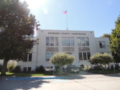 | Boundary County Courthouse | building | 1987 | 87001581 |
| Fry's Trading Post | building | 1984 | 84001104 | |
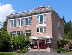 | North Side School | building | 1992 | 92000417 |
| Snyder Guard Station Historical District | district | 1983 | 83000283 | |
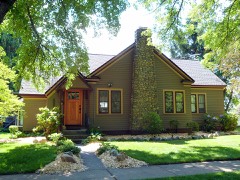 | Russell and Pearl Soderling House | building | 1998 | 97001650 |
| Spokane & International Railroad Construction Camp | site | 1994 | 94000630 | |
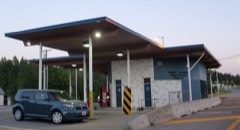 | U.S. Inspection Station-Porthill, Idaho | building | 2014 | 14000252 |
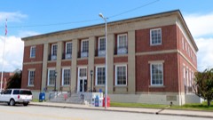 | US Post Office-Bonners Ferry Main | building | 1989 | 89000129 |
Every wildfire the federal occurrence database records inside this county: 1,220 of them, burning about 18,858 acres. 706 started naturally and 27 were recorded as arson. Each settlement page carries the fires within five miles of it.
| Reported cause | Fires |
|---|---|
| Natural | 706 |
| Debris and open burning | 150 |
| Missing data/not specified/undetermined | 138 |
| Recreation and ceremony | 73 |
| Equipment and vehicle use | 34 |
| Smoking | 32 |
| Arson/incendiarism | 27 |
| Misuse of fire by a minor | 21 |
| Railroad operations and maintenance | 16 |
| Power generation/transmission/distribution | 11 |
| Fireworks | 10 |
| Other causes | 1 |
| Firearms and explosives use | 1 |
The five largest, by the area the report gives. None of them was recorded as arson.
| Date | Cause | Size | Reported by | Name on the report |
|---|---|---|---|---|
| 29 July 2015 | Natural | 6,675 acres | Idaho Panhandle National Forest | PARKER RIDGE |
| 2 September 2003 | Missing data/not specified/undetermined | 3,449 acres | Idaho Panhandle National Forest | MYRTLE CREEK |
| 22 August 2006 | Natural | 2,959 acres | Idaho Panhandle National Forest | HUGHES EAST |
| 28 July 2018 | Natural | 1,115 acres | Idaho Panhandle National Forest | SMITH CREEK |
| 5 September 2011 | Natural | 802 acres | Idaho Panhandle National Forest | BIRTHDAY |
| 25 July 2003 | Equipment and vehicle use | 590 acres | Idaho Department of Lands | HUNT CREEK |
| 2 August 2018 | Natural | 473 acres | Idaho Panhandle National Forest | COPPER MOUNTAIN |
| 13 August 2001 | Natural | 440 acres | Idaho Department of Lands | LOOKOUT MOUNTAIN |
Every settlement page carries the fires within five miles of it - see the settlement index below.
The NOAA Storm Events Database holds 66 reports for this county, causing no deaths, 2 injuries and about $6,544,500 in recorded property damage. Each settlement page carries the reports that name it.
| Kind of event | Reports |
|---|---|
| Thunderstorm Wind | 24 |
| Hail | 14 |
| Flood | 13 |
| Debris Flow | 9 |
| Flash Flood | 3 |
| Heavy Rain | 2 |
| Funnel Cloud | 1 |
The most serious of them, by death, then injury, then recorded damage. The accounts are quoted exactly as the forecast office filed them.
| When | Event | Place named | Harm | What the report says |
|---|---|---|---|---|
| July 2019 | Thunderstorm Wind | Bonners Ferry | 1 hurt, $20,000 | Thunderstorm winds swept through Boundary County. One man was injured while pinned down by a fallen tree near Bonners Ferry. Fire and utility crews cleared over 20 downed trees from numerous roads in Bonner County. |
| August 1989 | Thunderstorm Wind | not stated | 1 hurt | no account filed |
| March 2017 | Debris Flow | Mc Arthur | $2,500,000 | Periodic heavy rain and spring snow melt during the second half of March promoted numerous debris flows and landslides through out Boundary County. On March 15th vibrations from a train caused a saturated ground landslide which undermined the tracks and caused 12 rail cars full of grain to derail and slide into a ravine near Moyie Springs. Debris flows cut numerous roads in the county during the next two weeks. Boundary County was included in a Presidential Disaster Declaration as a result of damage created by this episode. |
| January 2020 | Debris Flow | Moyie Spgs | $2,000,000 | A BNSF train derailed when a rock slide cut the rail line along the Kootenai River east of Bonners Ferry. Three locomotives were pushed off of the tracks along with 6 rail cars, with one locomotive completely submerged in the Kootenai River. |
| March 2016 | Debris Flow | Bonners Ferry | $500,000 | Emergency management reported a significant slow slide more than one quarter mile long, timbered and somewhat steep near Cemetery road in Bonners Ferry, Idaho. City engineers and road and bridge workers were out surveying the situation. |
| April 2011 | Flood | Moravia | $500,000 | Deep Creek flooded portions of Deep Creek Loop, also listed as Old Highway 95 causing sloughing of the roadway and embankment. Pavement damage was 500 feet by nine feet wide. The route is a major county through route from Naples to Bonners Ferry. |
| May 1998 | Flash Flood | Bonners Ferry | $500,000 | Mudslides from heavy rain. |
| April 1998 | Hail | Bonners Ferry | $100,000 | 1 3/4 inch hail 3 miles north of Bonners Ferry. COnsiderable damage to cars in the area |
| June 2007 | Thunderstorm Wind | Bonners Ferry | $76,500 | no account filed |
| June 2007 | Thunderstorm Wind | Moyie Spgs | $55,000 | no account filed |
| April 2017 | Debris Flow | Moravia | $50,000 | A second debris flow cut Highway 95, which is a primary route through Boundary County, between Naples and Bonners Ferry. |
| April 2017 | Debris Flow | Naples | $50,000 | A debris flow cut Highway 95, which is a primary route through Boundary County, near the town of Naples. |
| March 2012 | Flood | Eileen | $50,000 | Water was reported over Moyie River Road. There were also some reports of a few culverts being blocked and minor damage to the shoulder of roadways. Damage was estimated. |
| April 1998 | Thunderstorm Wind | Bonners Ferry | $50,000 | wind damage power lines blown down near Kootenai river |
| March 2014 | Flood | Boundry Co Arpt | $25,000 | Fleming Creek came out of its banks and flooded a single home. Damage costs were estimated. |
| July 2014 | Thunderstorm Wind | Mc Arthur | $20,000 | Thunderstorm winds ranging between 55 and 65 miles per hour knocked down numerous trees across central and eastern sections of Boundary County. At least ten trees were knocked down in and around the city of Bonner Ferry. |
| May 2006 | Thunderstorm Wind | Naples | $15,000 | no account filed |
| May 1998 | Heavy Rain | Moyie Spgs | $10,000 | 3 inches of rain overnight |
| January 2014 | Flood | Boundry Co Arpt | $5,000 | Fleming Creek Road washed out in two locations and was closed off. Little damage was reported along the side of the road and was reopened the next day. Sandbags were placed around a house on Moon Shadow Road due to some basement flooding. Damage to the home was estimated. |
| July 1998 | Thunderstorm Wind | Copeland | $5,000 | 60 mph wind gust with small trees down. |
| December 2025 | Flood | Mc Arthur | $2,000 | Forest Service Road 293 washed out and a landslide covered Forest Service Road 231 below it. Damage cost is estimated. |
| May 2018 | Flood | Addie | $2,000 | The USGS River Gage on the Moyie River at Eastport recorded a rise above the Flood Stage of 9.0 feet at 9:00 PM PST on May 7th. The river crested at 9.5 feet at 9:30 PM PST on May 8th. The river receded below Flood Stage at 5:45 PM on May 11th. The river rose again on May 16th and crested at 9.1 feet at 9:15 PM before receding below Flood Stage on May 17th at 7:30 AM. |
| April 2017 | Debris Flow | Moravia | $2,000 | A debris flow on Myrtle Creek Road exposed two cases of vintage dynamite apparently buried and abandoned after road work in the 1970s. The dynamite was rendered safe and removed but the road remained closed due to unstable surface conditions through April 13th. |
| September 2024 | Thunderstorm Wind | Boundry Co Arpt | $1,000 | Downed trees and powerlines closed Fleming Creek Road from Highway 95 to Hagen Road. A gust of 46 MPH was recorded in the area. |
| September 2024 | Thunderstorm Wind | Eileen | $1,000 | Downed trees and powerlines closed Perkins Lake Road from Perkins Lake to Solomon Lake Road. A gust of 46 MPH was recorded in the area. |
| September 2024 | Thunderstorm Wind | Moravia | $1,000 | Roof was torn off a large barn. A 57 MPH gust was recorded North of Naples. |
| May 2023 | Debris Flow | Bonners Ferry | $1,000 | Debris flow from the Russell Mountain burn scar due to rain and snowmelt at the higher elevations. Mud, logs and rocks moved downslope and covered parts of Ball Creek Rd. |
| September 2024 | Thunderstorm Wind | Moravia | $500 | Trees uprooted or snapped off along Deep Creek Road toward Bonners Ferry. Hail up to pea size. A 57 MPH gust was recorded North of Naples. |
| September 2024 | Thunderstorm Wind | Bonners Ferry | $500 | Observer reported downed trees in Bonners Ferry. A gust of 46 MPH was recorded in Bonners Ferry. |
| September 2024 | Thunderstorm Wind | Bonners Ferry | $500 | Media reported several trees down at the fairgrounds. A gust of 46 MPH was recorded in the area. |
| September 2024 | Thunderstorm Wind | Moyie Spgs | $500 | Large fir tree downed in Moyie Springs across from the mill. A gust of 46 MPH was recorded in the area. |
| September 2024 | Thunderstorm Wind | Naples | $500 | Davis wx station recorded 57 mph gust. One large Pine down and some Aspen trees. |
| May 2023 | Flash Flood | Copeland | $500 | Heavy rain and snow melt led to road washout along the Ball Creek Road. Rain fall amounts were from area observations ranged from 0.3-0.6. It is in the area of the Russell Mountain Burn Scar. |
| January 2020 | Debris Flow | Moyie Spgs | - | The Boundary County Sheriff reported a rock slide near Bonners Ferry along the Kootenai River. The Rock slide derailed a BNSF train into the Kootenai River. |
| May 2017 | Funnel Cloud | Eileen | - | A funnel cloud was observed for approximately 10 minutes over the mountains west of Moyie Springs. |
| September 2016 | Hail | Bonners Ferry | - | A trained weather spotter reported 0.75 inch hail one mile northwest of Bonners Ferry, Idaho. |
| September 2016 | Hail | Bonners Ferry | - | A member of the public reported 0.88 inch hail 3 miles north northwest of Bonners Ferry, Idaho. |
| June 2015 | Thunderstorm Wind | Bonners Ferry | - | An emergency manager reported that a couple of trees fell due to thunderstorm wind gusts. One car was struck and a low voltage line knocked down by the fallen trees. The time of report was based off radar data. |
| June 2015 | Thunderstorm Wind | Bonners Ferry | - | An emergency manager reported a tree top blew down between two homes at the Kootenai Tribal Mission. The time of the report was based off of radar data. |
| February 2015 | Flood | Bonners Ferry | - | The Boundary County Emergency Manager reported water ponding on or flowing across numerous roads due to heavy rain and melting snow. Ruby Creek and Deep Creek went over their banks into the flood plain. Water was over Highland Flats Road. |
| February 2015 | Debris Flow | Copeland | - | An Emergency Manager reported the debris flow on Highway 95 east of Mount Hall Elementary School 1 mile East Southeast of Copeland, Idaho. |
| December 2015 | Flood | Moravia | - | A trained spotter reported flooding along Deep Creek at Lions Den Road 6 miles north of Naples, Idaho. |
| July 2013 | Thunderstorm Wind | Eastport | - | A large tree was blown over onto Highway 95 at milepost 533. |
| July 2013 | Hail | Copeland | - | Most of the hail stones were the size of quarters and largest hail stone was the size of a ping pong ball. |
| July 2012 | Flood | Porthill | - | High flows out of Libby Dam in northwest Montana resulted in widespread flooding along the Kootenai River in and around Bonners Ferry and downstream to the Canadian Border. Flooding along the river began on June 25th and carried over through the beginning of July. Damage occurred along the city dikes in Bonners Ferry. Volunteers had to shore up 500 feet of levy behind the Kootenai River Inn to prevent water from spilling in. Water filled sub-surface storage areas of the General Feed and Grain located near the river in Bonners Ferry. Sloughing of dikes downstream of Bonners Ferry was observed as well. This resulted in an extensive amount of water seepage into farm lands throughout the Kootenai River valley. Over 5,000 acres of farm land was damaged resulting in four million dollars in crop damage. |
| March 2012 | Flood | Crossport | - | Kootenai Trail Road was inundated with water from Cow Creek. |
| March 2012 | Flood | Naples | - | Portions of Old Highway 95, north of Naples, were flooded when heavy spring runoff flooded caused Deep Creek to flow out of its banks. |
| July 2010 | Thunderstorm Wind | Bonners Ferry | - | A severe thunderstorm brought high wind gusts that blew over several trees. Pea size hail and heavy rain was also observed with the thunderstorm. |
| June 1998 | Flash Flood | Porthill | - | 2.02 inches of rain at bonners ferry and 1.98 inches at porthill. Parker Creek had some flooding |
| April 1998 | Hail | Naples | - | 3/4 ich hail |
| April 1998 | Hail | Bonners Ferry | - | 1 inch hail from sheriffs office and spotters |
| June 1998 | Heavy Rain | Bonners Ferry | - | 1 inch of rain in 15 minutes |
| May 1997 | Thunderstorm Wind | Bonners Ferry | - | 60 mph gust and 1/2 inch hail |
| June 2012 | Hail | Moyie Spgs | - | no account filed |
| June 2012 | Hail | Moyie Spgs | - | no account filed |
| July 2012 | Hail | Leonia | - | no account filed |
| May 2008 | Flood | Eastport | - | no account filed |
| June 2006 | Flood | Bonners Ferry | - | no account filed |
| July 2006 | Hail | Bonners Ferry | - | no account filed |
| July 2006 | Hail | Bonners Ferry | - | no account filed |
The Survey's mineral resources record lists 134 workings inside this county. 15 still produce and 119 are closed or unrecorded. Each settlement page carries the workings within five miles of it.
| Commodity | Workings |
|---|---|
| Sand and Gravel, Construction | 51 |
| Lead | 23 |
| Gold | 13 |
| Copper | 10 |
| Uranium | 8 |
| Thorium | 6 |
| Silver | 6 |
| Silver, Lead | 4 |
| Tungsten | 3 |
| Lead, Copper | 3 |
| Lead, Silver | 3 |
| Nickel, Copper | 2 |
| Silver, Zinc | 2 |
| Zinc | 2 |
The least common of them first, because a county's hundredth gravel pit says nothing its first ten did not.
| Where | Site | Commodity | Status | Recorded |
|---|---|---|---|---|
| Alice Group | Lead, Gold, Silver | Prospect | Vein | |
| American Girl Mine | Silver, Lead, Copper, Molybdenum, Gold, Zinc | Past Producer | Anglesite, Chalcopyrite, Molybdenite, Sphalerite | |
| Arsenopyrite Vein | Arsenic, Iron, Sulfides | Occurrence | ||
| Bald Eagle | Bismuth, Gold | Unknown | ||
| Bethlehem Mine | Lead, Copper, Zinc, Gold, Silver, Tungsten, Sulfur | Past Producer | Chalcopyrite, Galena, Sphalerite | |
| Big T Prospect | Silver, Copper, Zinc, Lead | Prospect | ||
| Blue Grouse Prospect | Sulfides | Occurrence | Vein | |
| Boundary County Deposit | Molybdenum, Lead, Cobalt | Producer | Molybdenite, Molybdite | |
| Bruce Berringer Prospect | Thorium, Uranium, Copper | Occurrence | Copper | |
| Continental | Silver, Lead, Gold, Copper, Zinc | Past Producer | 1900, 1915 | |
| Cynide Gold Mining Property Mine | Silver, Lead, Gold, Zinc, Copper | Past Producer | Galena, Gold, Silver | |
| Downey Prospect | Silver, Lead, Copper, Zinc | Prospect | ||
| Eileen Mining Company Prospect | Lead, Copper, Silver | Past Producer | Copper, Galena | |
| Fox & Brandt Property | Copper, Cobalt | Unknown | ||
| Gold Shaft Group Prospect | Lead, Silver, Copper, Uranium | Prospect | Galena | |
| Golden Hope Claims Prospect | Lead, Silver, Copper | Prospect | Chalcopyrite, Galena | |
| Golden Sceptre Mine | Thorium, Lead, Gold, Copper, Silver | Prospect | 1955 | |
| Hall Mountain | Thorium, Copper, REE, Uranium | Past Producer | 1939 | |
| Idamont Property | Gold, Lead, Silver, Zinc | Past Producer | Placer | |
| International Molybdenum Mine | Molybdenum, Cobalt, Nickel, Platinum | Past Producer | 1938 | |
| Klondike Prospect | Lead, Silver, Zinc, Gold, Nickel | Prospect | Vein | |
| Lion Head Prospect | Mica | Prospect | 1928 | |
| Mc Ginty Claim | Copper, Lead | Occurrence | Vein | |
| Miller Brothers Mine | Lead, Silver, Zinc, Nickel, Copper, Gold, Sulfides | Past Producer | 1937 | |
| Montgomery Prospect | Nickel, Copper, Zinc, Cobalt, Gold, Lead | Prospect | Chalcopyrite, Gersdorffite, Pentlandite, Sphalerite | |
| Moyie Yaak District | Tungsten, Gold, Molybdenum, Lead, Silver | Producer | QUARTZ VEINS/SHEAR ZONE, PLACER | |
| N. W. Prospecting & Development Prospect | REE, Thorium | Occurrence | 1955 | |
| Oscar Claim | Lead, Silver, Zinc, Copper | Occurrence | Vein | |
| Perkins Lake Pit | Limestone, Dimension | Producer | ||
| Pit No 1 Dist No 15 Cow Creek | Sand and Gravel, Construction, Stone | Producer | ||
| Queen Mine | Copper, Gold, Lead, Zinc, Silver | Past Producer | Chalcopyrite, Sphalerite, Tetrahedrite | |
| Regal Mine | Gold, Silver, Lead, Zinc, Copper | Past Producer | 1937 | |
| Scheller Prospect | Thorium, REE, Uranium | Prospect | 1955 | |
| Silver Spoon Prospect | Lead, Copper, Gold, Silver | Prospect | Vein | |
| Skin Creek Occurrence | Lead, Copper, Silver, Zinc | Prospect | ||
| Tilley Mine | Lead, Copper, Gold, Nickel, Silver, Zinc | Prospect | 1952 | |
| Tommy Moran Prospect | Gold, Silver, Lead, Zinc, Copper | Occurrence | Chalcopyrite, Galena, Gold, Silver, Sphalerite | |
| Trust Mining Company Prospect | Gold, Copper, Silver, Nickel | Prospect | Copper | |
| Tungsten Hill Mine | Tungsten, Lead, Copper, Silver, Gold | Past Producer | Chalcopyrite, Scheelite | |
| Unnamed Location | Tellurium | Prospect | ||
| Unnamed prospect | Copper, Molybdenum, Lead, Zinc | Occurrence | Chalcopyrite, Molybdenite | |
| Wawa Claims | Thorium, REE | Occurrence | Vein | |
| Buckskin Group | Lead, Silver, Gold | Prospect | Vein | |
| Fern Cliff Prospect | Copper, Silver, Gold, Lead | Prospect | Vein | |
| Hall Mountain Nickel Deposit-1 | Nickel, Copper | Occurrence | ||
| Idamont Mine | Lead, Zinc | Unknown | ||
| Iron Ridge Claim | Lead, Zinc, Silver | Unknown | ||
| Kent Prospect | Lead, Zinc | Prospect | Galena, Sphalerite | |
| Name Unknown | Lead, Zinc, Silver | Occurrence | ||
| Northern Star Prospect | Molybdenum | Prospect | Molybdenite | |
| Peters and Mitchum Property Prospect | Lead, Silver, Zinc | Prospect | Underground | |
| Cow Creek | Tungsten | Occurrence | ||
| Ebba Claim | Lead, Copper | Occurrence | Vein | |
| Eureka Prospect | Copper, Lead, Silver | Past Producer | Vein | |
| Kate Fry Claim Group Prospect | Lead, Copper | Occurrence | Chalcopyrite, Galena, Malachite | |
| Queen Mountain Deposit | Tungsten, Lead, Copper | Past Producer | Chalcopyrite, Galena, Pyrite, Pyrrhotite, Scheelite | |
| Damon Group Prospect | Gold, Silver, Lead | Prospect | Galena | |
| Porthill District | Silver, Lead | Occurrence | REPLACEMENT VEIN | |
| Barringer Prospect | Thorium | Occurrence | 1955 | |
| Hall Mountain No. 1 Prospect | Thorium | Occurrence | ||
| Jane Mine | Lead, Silver | Past Producer | Anglesite | |
| Priest Lake Mining Co. | Lead, Silver | Prospect | Galena | |
| Railroad Prospect | Copper, Silver | Past Producer | ||
| Dehlbom Property | Uranium | Prospect | ||
| E. Priest Lake Prospect | Uranium | Prospect | Uraninite | |
| Leonia | Uranium, Gold | Past Producer | ||
| Naples Prospect | Uranium | Prospect | 1953 | |
| Nelson Claim | Uranium | Unknown | ||
| U Group | Uranium | Unknown | ||
| Unnamed Location | Uranium | Prospect | ||
| Clancy Mine | Lead, Copper | Prospect | Vein | |
| Geneva Claims | Lead, Copper | Prospect | ||
| Homestake Claim | Copper | Occurrence | Vein | |
| Keno and Glory Claims Prospect | Copper | Prospect | ||
| Parker Mine | Gold, Copper | Prospect | ||
| Unnamed Location | Copper | Prospect | ||
| Boulder Gold Mining Company Prospect | Gold | Prospect | ||
| Copper Creek | Gold | Prospect | ||
| Golden Triplet Prospect | Lead, Gold | Prospect | Galena | |
| Lolo Group | Gold | Occurrence | ||
| Point Bar Placer | Gold | Prospect | ||
| Copper Falls Prospect | Lead | Occurrence | Vein | |
| Silver Bell No. 1 Prospect | Lead | Prospect | Vein | |
| Unamed Lead Prospect | Lead | Occurrence | Galena | |
| Borrow Pit | Sand and Gravel, Construction | Unknown | ||
| Borrow Pit | Sand and Gravel, Construction | Unknown | ||
| Borrow Pit | Sand and Gravel, Construction | Unknown | ||
| Borrow Pit | Sand and Gravel, Construction | Unknown | ||
| Borrow Pit | Sand and Gravel, Construction | Unknown | ||
| Borrow Pit | Sand and Gravel, Construction | Unknown | ||
| Borrow Pit | Sand and Gravel, Construction | Unknown | ||
| Borrow Pit | Sand and Gravel, Construction | Unknown | ||
| Borrow Pit | Sand and Gravel, Construction | Unknown | ||
| Borrow Pit | Sand and Gravel, Construction | Unknown | ||
| Borrow Pit | Sand and Gravel, Construction | Unknown | ||
| Borrow Pit | Sand and Gravel, Construction | Unknown | ||
| Borrow Pit | Sand and Gravel, Construction | Unknown | ||
| Borrow Pit | Sand and Gravel, Construction | Unknown | ||
| Borrow Pit | Sand and Gravel, Construction | Unknown | ||
| Borrow Pit | Sand and Gravel, Construction | Unknown | ||
| Borrow Pit | Sand and Gravel, Construction | Unknown | ||
| Borrow Pit | Sand and Gravel, Construction | Unknown | ||
| Borrow Pit | Sand and Gravel, Construction | Unknown | ||
| Borrow Pit | Sand and Gravel, Construction | Unknown | ||
| Borrow Pit | Sand and Gravel, Construction | Unknown | ||
| Borrow Pit | Sand and Gravel, Construction | Unknown | ||
| Borrow Pit | Sand and Gravel, Construction | Unknown | ||
| Borrow Pit | Sand and Gravel, Construction | Unknown | ||
| Brannon Pit Br-5 | Sand and Gravel, Construction | Past Producer | ||
| Gravel Pit | Sand and Gravel, Construction | Unknown | ||
| Gravel Pit | Sand and Gravel, Construction | Producer | ||
| Gravel Pit | Sand and Gravel, Construction | Producer | ||
| Gravel Pit | Sand and Gravel, Construction | Producer | ||
| Gravel Pit | Sand and Gravel, Construction | Producer | ||
| Gravel Pit | Sand and Gravel, Construction | Producer | ||
| Gravel Pit | Sand and Gravel, Construction | Producer | ||
| Gravel Pit | Sand and Gravel, Construction | Producer | ||
| Gravel Pit | Sand and Gravel, Construction | Producer | ||
| Gravel Pits | Sand and Gravel, Construction | Unknown | ||
| Homestake Mine | Sand and Gravel, Construction | Unknown | ||
| Mountain Chief Mine | Sand and Gravel, Construction | Unknown | ||
| Moyie Springs Dump Site | Sand and Gravel, Construction | Past Producer | ||
| Navagation Mine | Sand and Gravel, Construction | Unknown | ||
| Plowboy Mine | Sand and Gravel, Construction | Unknown | ||
| Portrey Pit | Sand and Gravel, Construction | Producer | ||
| Quarry | Sand and Gravel, Construction | Unknown | ||
| Sandpit | Sand and Gravel, Construction | Unknown | ||
| Sandpit | Sand and Gravel, Construction | Unknown | ||
| Sandpit | Sand and Gravel, Construction | Unknown | ||
| Snow Creek Pit | Sand and Gravel, Construction | Producer | ||
| Unnamed Mine | Sand and Gravel, Construction | Unknown | ||
| Unnamed Mine | Sand and Gravel, Construction | Unknown | ||
| Unnamed Mine | Sand and Gravel, Construction | Unknown | ||
| Zimmerman Pit | Sand and Gravel, Construction | Producer |
Named settlements recorded in the Geographic Names Information System, each with the topographic sheets covering it. Villages, hamlets and abandoned places alike. Each is shown with the nearest named watercourse or landform and the survey quadrangle it falls on.
Moyie Springs census division · 83826 · On Spruce Creek · Eastport quadrangle
11 sheets, 1911 to 1996
Bonners Ferry census division · 83805 · Bonners Ferry quadrangle
12 sheets, 1911 to 1996
Bonners Ferry census division · 83805 · Near O'Callaghans Island · Bonners Ferry quadrangle
12 sheets, 1911 to 1996
South and West Boundary census division · On Gable Creek · Leonia quadrangle
11 sheets, 1911 to 1983
No longer a settlement
South and West Boundary census division · 83805 · On Brown Creek · Moravia quadrangle
12 sheets, 1911 to 1996
Bonners Ferry census division · 83805 · On Brush Creek · Copeland quadrangle
13 sheets, 1911 to 1996
South and West Boundary census division · 83805 · On Dobson Creek · Moyie Springs quadrangle
12 sheets, 1911 to 1996
Bonners Ferry census division · 83805 · On Brown Creek · Naples quadrangle
12 sheets, 1911 to 1996
Moyie Springs census division · 83826 · On Line Creek · Eastport quadrangle
11 sheets, 1911 to 1996
Moyie Springs census division · 83845 · On Skin Creek · Meadow Creek quadrangle
12 sheets, 1911 to 1996
Moyie Springs census division · On Spruce Creek · Eastport quadrangle
11 sheets, 1911 to 1996
South and West Boundary census division · 83805 · On Katka Creek · Moyie Springs quadrangle
12 sheets, 1911 to 1996
South and West Boundary census division · On Boulder Creek · Leonia quadrangle
11 sheets, 1911 to 1983
South and West Boundary census division · 83847 · On Dodge Creek · Naples quadrangle
12 sheets, 1911 to 1996
Moyie Springs census division · 83805 · On Meadow Creek · Meadow Creek quadrangle
12 sheets, 1911 to 1996
Bonners Ferry census division · 83805 · On Snow Creek · Moravia quadrangle
12 sheets, 1911 to 1996
Moyie Springs census division · 83845 · On Moyie River · Moyie Springs quadrangle
12 sheets, 1911 to 1996
Bonners Ferry census division · 83847 · On Trail Creek · Naples quadrangle
12 sheets, 1911 to 1996
Bonners Ferry census division · 83805 · On Boundary Creek · Copeland quadrangle
13 sheets, 1911 to 1996
Bonners Ferry census division · 83805 · On Bane Creek · Ritz quadrangle
13 sheets, 1911 to 1996
Moyie Springs census division · 83805 · On Round Prairie Creek · Eastport quadrangle
11 sheets, 1911 to 1996
Bonners Ferry census division · 83805 · Bonners Ferry quadrangle
12 sheets, 1911 to 1996
The vanished settlements of Boundary County: the places named above that are no longer on the map.