 Block
From the record
One of 8 National Register listings published here for Boundary County · listed in 1984 · category: Building.
Sources: the case file at the National Archives · the National Register database, National Park Service
Listed on the National Register of Historic Places in 1984.
One of 8 National Register listings published here for Boundary County · listed in 1984 · category: Building.
Sources: the case file at the National Archives · the National Register database, National Park Service
Regional context, not property-specific evidence. The federal wildfire occurrence database lists 157 fires within 5 miles of Fry's Trading Post between 1992 and 2020, burning about 204 acres in total. 37 started naturally. 10 were recorded as arson. Distance is straight-line from the map coordinates, so a fire counted here may appear on a neighbouring settlement's page as well.
| Reported cause | Fires |
|---|---|
| Debris and open burning | 44 |
| Natural | 37 |
| Missing data/not specified/undetermined | 28 |
| Equipment and vehicle use | 10 |
| Arson/incendiarism | 10 |
| Recreation and ceremony | 8 |
| Misuse of fire by a minor | 7 |
| Fireworks | 5 |
| Railroad operations and maintenance | 4 |
| Smoking | 4 |
The most recent of them, most recent first, with the day each was reported and the service that recorded it.
| Date | Cause | Size | Reported by | Name on the report |
|---|---|---|---|---|
| 9 September 2006 | Debris and open burning | under an acre | Idaho Department of Lands | RIVERSIDE |
| 9 September 1992 | Debris and open burning | under an acre | Idaho Department of Lands | FRENCH CONNECTION |
| 7 September 2008 | Equipment and vehicle use | under an acre | Idaho Department of Lands | WAGON WHEEL RD |
| 5 September 2003 | Missing data/not specified/undetermined | 20 acres | Kootenai National Wildlife Refuge | MYRTLE CREEK |
| 30 September 2011 | Equipment and vehicle use | under an acre | Idaho Department of Lands | PETERSON |
| 30 September 2011 | Missing data/not specified/undetermined | under an acre | Idaho Department of Lands | MOONSHADOW |
| 3 September 2006 | Arson/incendiarism | under an acre | Idaho Department of Lands | CRAWFISH |
| 25 September 2009 | Recreation and ceremony | under an acre | Idaho Panhandle National Forest | SNOW RIP |
Regional context, not property-specific evidence. The federal mineral resources record lists 12 workings within 5 miles of Fry's Trading Post: 6 unknowns, 5 producers, 1 occurrence. 5 still produce. What was taken out: Sand and Gravel, Construction, Arsenic, Iron, Sulfides, Stone. Distance is straight-line from the map coordinates, so a quarry counted here may appear on a neighbouring settlement's page as well.
| Where | Site | Commodity | Status | Recorded |
|---|---|---|---|---|
| Arsenopyrite Vein | Arsenic, Iron, Sulfides | Occurrence | ||
| Pit No 1 Dist No 15 Cow Creek | Sand and Gravel, Construction, Stone | Producer | ||
| Borrow Pit | Sand and Gravel, Construction | Unknown | ||
| Borrow Pit | Sand and Gravel, Construction | Unknown | ||
| Borrow Pit | Sand and Gravel, Construction | Unknown | ||
| Gravel Pit | Sand and Gravel, Construction | Producer | ||
| Gravel Pit | Sand and Gravel, Construction | Producer | ||
| Gravel Pit | Sand and Gravel, Construction | Producer | ||
| Gravel Pits | Sand and Gravel, Construction | Unknown | ||
| Sandpit | Sand and Gravel, Construction | Unknown |
Regional context, not property-specific evidence. The National Weather Service names Bonners Ferry, the town this property stands in, in 22 storm reports between 1997 and 2024: 10 thunderstorm wind, 6 hail, 2 flood, 2 debris flow. The reports record 1 injury. Each account below is quoted exactly as the forecast office filed it, from the NOAA Storm Events Database, and each date opens the federal record of that event.
| When | Event | Place named | Harm | What the report says |
|---|---|---|---|---|
| July 2019 | Thunderstorm Wind | Bonners Ferry | 1 hurt, $20,000 | Thunderstorm winds swept through Boundary County. One man was injured while pinned down by a fallen tree near Bonners Ferry. Fire and utility crews cleared over 20 downed trees from numerous roads in Bonner County. |
| March 2016 | Debris Flow | Bonners Ferry | $500,000 | Emergency management reported a significant slow slide more than one quarter mile long, timbered and somewhat steep near Cemetery road in Bonners Ferry, Idaho. City engineers and road and bridge workers were out surveying the situation. |
| May 1998 | Flash Flood | Bonners Ferry | $500,000 | Mudslides from heavy rain. |
| April 1998 | Hail | Bonners Ferry | $100,000 | 1 3/4 inch hail 3 miles north of Bonners Ferry. COnsiderable damage to cars in the area |
| June 2007 | Thunderstorm Wind | Bonners Ferry | $76,500 | no account filed |
| April 1998 | Thunderstorm Wind | Bonners Ferry | $50,000 | wind damage power lines blown down near Kootenai river |
| May 2023 | Debris Flow | Bonners Ferry | $1,000 | Debris flow from the Russell Mountain burn scar due to rain and snowmelt at the higher elevations. Mud, logs and rocks moved downslope and covered parts of Ball Creek Rd. |
| September 2024 | Thunderstorm Wind | Bonners Ferry | $500 | Observer reported downed trees in Bonners Ferry. A gust of 46 MPH was recorded in Bonners Ferry. |
| September 2024 | Thunderstorm Wind | Bonners Ferry | $500 | Media reported several trees down at the fairgrounds. A gust of 46 MPH was recorded in the area. |
| September 2016 | Hail | Bonners Ferry | - | A trained weather spotter reported 0.75 inch hail one mile northwest of Bonners Ferry, Idaho. |
| September 2016 | Hail | Bonners Ferry | - | A member of the public reported 0.88 inch hail 3 miles north northwest of Bonners Ferry, Idaho. |
| June 2015 | Thunderstorm Wind | Bonners Ferry | - | An emergency manager reported that a couple of trees fell due to thunderstorm wind gusts. One car was struck and a low voltage line knocked down by the fallen trees. The time of report was based off radar data. |
| June 2015 | Thunderstorm Wind | Bonners Ferry | - | An emergency manager reported a tree top blew down between two homes at the Kootenai Tribal Mission. The time of the report was based off of radar data. |
| February 2015 | Flood | Bonners Ferry | - | The Boundary County Emergency Manager reported water ponding on or flowing across numerous roads due to heavy rain and melting snow. Ruby Creek and Deep Creek went over their banks into the flood plain. Water was over Highland Flats Road. |
| July 2010 | Thunderstorm Wind | Bonners Ferry | - | A severe thunderstorm brought high wind gusts that blew over several trees. Pea size hail and heavy rain was also observed with the thunderstorm. |
| April 1998 | Hail | Bonners Ferry | - | 1 inch hail from sheriffs office and spotters |
| June 1998 | Heavy Rain | Bonners Ferry | - | 1 inch of rain in 15 minutes |
| May 1997 | Thunderstorm Wind | Bonners Ferry | - | 60 mph gust and 1/2 inch hail |
| June 2006 | Flood | Bonners Ferry | - | no account filed |
| July 2006 | Hail | Bonners Ferry | - | no account filed |
| July 2006 | Hail | Bonners Ferry | - | no account filed |
| August 2006 | Thunderstorm Wind | Bonners Ferry | - | no account filed |
No historic map-sheet match is published for this property yet. That does not mean no map exists. This record needs a coordinate-quality review before it can be joined to a sheet boundary. Browse the county's mapped places while that work is pending.
Other National Register properties close enough to walk or drive between, ordered by distance from this one. Both positions come from the same geocoding pass that matched these properties to their map sheets.
| Photograph | Property | Distance | Listed |
|---|---|---|---|
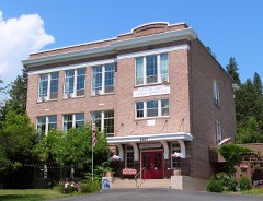 | North Side School | 0.2 miles | 1992 |
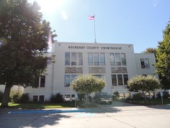 | Boundary County Courthouse | 0.3 miles | 1987 |
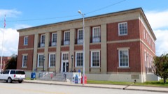 | US Post Office-Bonners Ferry Main | 0.3 miles | 1989 |
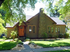 | Russell and Pearl Soderling House | 0.6 miles | 1998 |
| National Archives record | The nomination case file for reference 84001104 in Record Group 79. |
| Boundary County | All 8 listed properties in this county. |