 Block
From the record
8 National Register listings published here, 2 of them National Historic Landmarks.
Sources: the National Register database, National Park Service
100 topographic sheets cover 47 settlements here, and 8 properties are on the National Register of Historic Places.
8 National Register listings published here, 2 of them National Historic Landmarks.
Sources: the National Register database, National Park Service
Every property in this county listed on the National Register of Historic Places, with the year it was listed and the federal nomination document.
| Photograph | Property | Type | Listed | Reference |
|---|---|---|---|---|
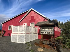 | Brown's Creek CCC Camp Barracks | building | 1984 | 84001114 |
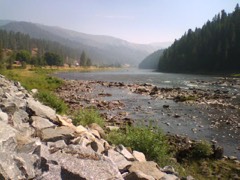 | Lolo Trail | site | 1966 | 66000309 |
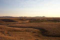 | Nez Perce National Historical Park | district | 1966 | 66000310 |
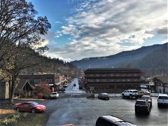 | Orofino Historic District | district | 1982 | 82000384 |
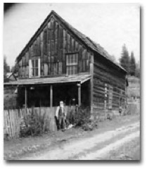 | Pierce Courthouse | building | 1972 | 72000100 |
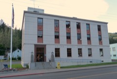 | US Post Office-Orofino Main | building | 1989 | 89000133 |
| Weippe Community Hall | building | 2025 | 100012272 | |
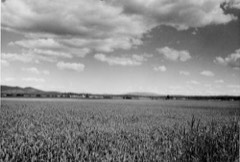 | Weippe Prairie | site | 1966 | 66000311 |
Every wildfire the federal occurrence database records inside this county: 2,805 of them, burning about 71,946 acres. 2,241 started naturally and 38 were recorded as arson. Each settlement page carries the fires within five miles of it.
| Reported cause | Fires |
|---|---|
| Natural | 2241 |
| Missing data/not specified/undetermined | 187 |
| Debris and open burning | 105 |
| Recreation and ceremony | 85 |
| Equipment and vehicle use | 76 |
| Arson/incendiarism | 38 |
| Smoking | 21 |
| Misuse of fire by a minor | 19 |
| Fireworks | 19 |
| Power generation/transmission/distribution | 9 |
| Railroad operations and maintenance | 2 |
| Other causes | 2 |
| Firearms and explosives use | 1 |
The five largest, by the area the report gives. None of them was recorded as arson.
| Date | Cause | Size | Reported by | Name on the report |
|---|---|---|---|---|
| 11 August 2015 | Natural | 6,200 acres | Cottonwood Field Office | LOLO 2 |
| 11 August 2015 | Natural | 4,779 acres | Nez Perce - Clearwater National Forests | BOULDER |
| 8 August 2003 | Natural | 3,509 acres | Nez Perce - Clearwater National Forests | HOPEFUL 2 |
| 14 August 2015 | Natural | 3,309 acres | Nez Perce - Clearwater National Forests | SNOW CREEK |
| 4 August 2000 | Natural | 3,258 acres | Nez Perce - Clearwater National Forests | ELIZABETH |
| 9 August 2003 | Natural | 2,601 acres | Nez Perce - Clearwater National Forests | CAYUSE LAKE |
| 6 July 2006 | Natural | 2,467 acres | Nez Perce - Clearwater National Forests | POT MOUNTAIN WFU COMPLEX |
| 12 August 2015 | Natural | 2,200 acres | Nez Perce - Clearwater National Forests | HEATHER |
Every settlement page carries the fires within five miles of it - see the settlement index below.
The NOAA Storm Events Database holds 94 reports for this county, causing no deaths, no injuries and about $5,298,000 in recorded property damage. Each settlement page carries the reports that name it.
| Kind of event | Reports |
|---|---|
| Thunderstorm Wind | 39 |
| Hail | 33 |
| Heavy Rain | 9 |
| Flood | 6 |
| Funnel Cloud | 4 |
| Flash Flood | 1 |
| Tornado | 1 |
| Debris Flow | 1 |
The most serious of them, by death, then injury, then recorded damage. The accounts are quoted exactly as the forecast office filed them.
| When | Event | Place named | Harm | What the report says |
|---|---|---|---|---|
| March 2017 | Flood | Ahsahka | $3,000,000 | Abundant rain and low elevation snow melt in the upper portions of Orofino Creek near Pierce led to high stream flows on the 15th, followed by minor flooding on the 16th. Multiple homes and property were sandbagged to prevent flooding across southwest portions of the county. Jim Ford Creek flooded multiple properties in the Weippe area. Clearwater County declared a state of emergency because of all the mudslide, debris and river issues. Although the most severe flooding occurred on or near the 16th, another culvert gave way and caused Grangemont Road to shut down mile-marker 22 on March 25th lasting until April 5th. Total estimated cost of road repairs was 3 million dollars due to landslide failures. |
| February 2018 | Heavy Rain | Greer | $1,500,000 | Heavy rain lead to a fallen tree across U.S. Highway 12 near milepost 52 and subsequent car accident at 4:08 am on the 5th. One person was injured in the incident and the highway was blocked for one and a half hours. |
| March 2026 | Flood | Ahsahka | $500,000 | The most significant impact occurred south of Orofino, where a large landslide blocked US-12 between mile markers 44 and 45. The initial slide occurred around 1539MST on Friday, March 13. While crews worked to clear the route, a second slide occurred at the same location at 0920MST on Saturday, March 14. The highway remained closed in both directions until Saturday afternoon. Additional landslides and rockslides were reported on Lower Fords Creek Road, Grangemont Road, Sunnyside, and Bobbitt Bench. Heavy traffic diverted to Sunnyside Road caused that secondary route to begin failing under the saturated conditions.||In Orofino, the urban drainage system reached maximum capacity and overflowed, flooding residential areas. In the Riverside area (115th Street), rushing water surrounded homes and filled basements. Significant damage occurred at the Joint School District 171 bus garage when a nearby creek (likely Flume Creek) blew out, flooding the facility. While officials successfully moved most of the fleet, one school bus and a neighboring food pantry were inundated and suffered major damage.||Small streams and creeks, including Jim Fords Creek and Freeman Creek, crested their banks, threatening homes and washing out culverts. Near Weippe, a creek overflowed onto the roadway, causing significant rutting. The Clearwater River at Orofino saw a dramatic rise of over 8 feet, increasing from 5.78 feet on Thursday to a crest of 13.96 feet on Saturday nightstaying just below the 16-foot flood stage, though the high water contributed to the drainage backup in the city. Total rainfall between March 10 and 15 included 3.57 in Orofino, 4.00 in Peck, and 4.50 at the Pierce SNOTEL. |
| August 2014 | Hail | Weippe | $104,000 | A farmer reported major property and crop damage due to both large hail and wind. The property damage included 5 rental home roofs, siding from 3 homes, several windows, and 12 garage doors that either were dented or destroyed. Approximately 75% of his spring wheat crop, approximately 450 acres, was decimated by the wind and hail. In the 67 years that he has lived there, there was only one other storm that was comparable to this one. Back in 1963, a similar storm decimated his dad's crops. |
| May 2009 | Thunderstorm Wind | Orofino Arpt | $60,000 | A severe weather spotter reported hearing on a scanner that trees were blown down onto Highway 12 west of Orofino from gusty winds. A newspaper article confirmed that trees and power lines were blown down onto the highway near the Riverside Motel and Stoddard Electric. Traffic was backed up from the Orofino bridge to the the intersection of 118 Street and Highway 12. |
| June 1994 | Thunderstorm Wind | not stated | $50,000 | A Local Cooperative Observer at Headquarters, 60 miles northeast of Lewiston, reported that strong winds blew the roof off a house. The winds also blew over trees in the area. |
| August 2008 | Thunderstorm Wind | Orofino | $20,000 | A trained spotter reported damage to a boat dock and several boats at the Dworshak Reservoir. Numerous trees were also reported blown down, causing a power outage in Orofino with fire starts. |
| August 2014 | Thunderstorm Wind | Weippe | $17,000 | A farmer reported around 12 trees (pine and red fir) broke between 6 and 16 feet above the ground. A bull pine near 3 feet in diameter at the base, broke off around 6 feet from the ground and destroyed a trailer house. |
| December 2005 | Flash Flood | Orofino | $15,000 | no account filed |
| November 2010 | Thunderstorm Wind | Orofino | $10,000 | Widespread power outages in the Orofino area. Trees Down near the prison, hospital and hidden valley areas. Storage building blown out on Highway 12 west of Orofino. |
| November 2010 | Thunderstorm Wind | Greer | $10,000 | Several trees down across highways 11 and 3, blocking traffic. One trailer park was being evacuated due to tree damage on residences. |
| April 2018 | Flood | Weippe | $5,000 | Very heavy rainfall with amounts ranging from 1 to 3 inches combined with snow melt over a several day period led to overland flooding with rock, mud and water along portions of Clear Creek Road, Sally Ann Road, and on State Highway 13 along the South Fork Clearwater River halfway between Stites and Harpster. Plugged culverts were common. |
| March 2013 | Thunderstorm Wind | Orofino | $4,000 | Numerous pine and cedar trees were blown down by the wind in the Orofino area. The largest tree diameter was 28 inches. Many trees fell onto power lines causing highway 12 and other roads to close for up to 4 hours. Thirty percent of roof shingles were blown off. |
| August 2008 | Hail | Orofino | $2,000 | A trained spotter reported penny size hail and numerous trees and branches blown down from downtown Orofino to 5 miles northwest of Orofino. |
| August 2014 | Thunderstorm Wind | Greer | $1,000 | One tree, possibly a yellow pine, twisted off 20 to 30 feet above the ground. A 2nd yellow pine smashed into a vacant trailer house while a 3rd yellow pine was uprooted from the high winds. The severe winds combined with large hail also peppered the sides of a few farming structures. |
| August 2022 | Thunderstorm Wind | Weippe | - | Strong winds downed trees, leading to an extended power outage in the Glenwood area. |
| June 2022 | Hail | Weippe | - | A person on Facebook reported large hail south of Weippe. |
| July 2021 | Debris Flow | Greer | - | By 7:10 pm PDT, the Idaho Department of Transport began to receive reports of water, rocks, and mud on US-95 between mile marker 196-204, centered on MM200. This slide briefly closed both directions of the highway. |
| July 2019 | Hail | Weippe | - | Nickel to quarter-sized hail was reported in the town of Harpster, Idaho. |
| July 2019 | Hail | Pierce | - | The Spot Mountain Lookout in the Bitterroot National Forest reported quarter-size hail during the morning hours of July 3rd, as a line of thunderstorms moved through the area. |
| June 2016 | Hail | Greer | - | Spotter estimated the hailstones were up to 2.00 inches in diameter. |
| June 2016 | Hail | Greer | - | Public estimated 1.25 inch hail with wind gusts to 25 mph. |
| May 2015 | Hail | Headquarters | - | The public reported half dollar sized (1.25 in) hail that fell in the woods near Headquarters, ID. Pictures confirmed the size of hail. |
| August 2014 | Hail | Greer | - | A law enforcement office reported mostly 1 hail but a few were up to half-dollar size. The hail accumulated up to 12 inches in places. |
| August 2014 | Heavy Rain | Greer | - | A law enforcement officer estimated that between 1 and 2 inches of rain fell and caused a nearby creek to swell to 3 feet in width and a couple feet in depth. |
| August 2014 | Heavy Rain | Headquarters | - | The COOP observer measured 1.66 inches of rainfall for the 24 hours ending at 7 am Aug. 15. Most likely this rainfall amount was associated with the supercell thunderstorm that tracked over the area. |
| August 2014 | Hail | Weippe | - | The USDA reported that at least 400 acres of hard red spring wheat were destroyed and 700 acres were damaged. They also reported that 183.6 acres of soft wheat were destroyed and 189.2 acres were damaged. All in all, the total crop damage tallied at $425,000. |
| April 2012 | Hail | Orofino | - | A spotter estimated 1.00 inch hail 3 miles NE of Orofino. |
| April 2012 | Hail | Orofino | - | A spotter estimated 1.25 inch hail 5 miles NE of Orofino. |
| April 2012 | Hail | Orofino | - | Spotter estimated quarter sized hail 2 miles NW of Orofino. |
| April 2012 | Hail | Pierce | - | A trained spotter estimated 1.25 inch diameter hail. |
| June 2012 | Hail | Weippe | - | A spotter measured hail of 1.75 inch diameter. |
| June 2012 | Hail | Weippe | - | A spotter estimated hail at 1.75 inches. In addition 1.25 inches of rain fell in 1.5 hours. |
| April 2012 | Hail | Orofino | - | A trained spotter estimated golf ball sized hail in Orofino. |
| June 2011 | Hail | Hdqtrs Cptpa Arpt | - | Hail was estimated at 0.75 inch diameter. |
| October 2011 | Heavy Rain | Pierce | - | The equipment at Pierce reported 0.84 inches of rain in 24 hours. |
| October 2011 | Heavy Rain | Hdqtrs Cptpa Arpt | - | The equipment at Cool Creek reported a 24 hour rainfall total of 0.90 inches. |
| October 2011 | Heavy Rain | Cardiff | - | The equipment reported a 24 hour rainfall total of 0.90 inches. |
| October 2011 | Heavy Rain | Headquarters | - | The spotter at Headquarters reported a 24 hour rainfall total of 0.80 inches. |
| October 2011 | Heavy Rain | Cardiff | - | The observation equipment at Shanghi Summit reported 1.00 inch of rainfall. |
| October 2011 | Heavy Rain | Pierce | - | Equipment at Pierce reported 0.81 inches of rainfall and Pierce USFS ranger station reported 0.70 inch. |
| September 2010 | Thunderstorm Wind | Greer | - | Numerous blow downs throughout Clearwater County. Spotter reported 18 and 20 inch diameter trees broken at the base and mid-section respectively. Power and phone service was knocked out. A 26 foot airstream trailer was moved off its jack. Fire starts from lightning were also reported from this storm. |
| July 2010 | Thunderstorm Wind | Greer | - | A trained spotter reported several pine trees bent down/over with branches estimated at six inches in diameter broken off of trees from reported thunderstorm winds. |
| November 2010 | Thunderstorm Wind | Greer | - | Damage to tree due to estimated 60 mph wind gust. Also heard on scanner about other damage around the area. Including trees on cars, roads and structures. |
| July 2008 | Hail | Dent | - | Elk River recreation district reported penny sized hail. |
| August 2008 | Hail | Orofino | - | A trained spotter reported penny size hail. The Dent, ID RAWAS observation station recorded a wind gust of 54 MPH. |
| August 2008 | Thunderstorm Wind | Orofino | - | A trained spotter reported an estimated wind gust to 60 mph from a passing thunderstorm. |
| June 2007 | Funnel Cloud | Cardiff | - | Media reported a funnel cloud over Cardiff. |
| June 2007 | Hail | Orofino | - | Trained spotters reported nickel and penny sized hail. |
| June 2007 | Funnel Cloud | Orofino | - | Emergency manager relayed a live report of a funnel cloud near Orofino with thunderstorm winds up to 60 mph. |
| June 2007 | Thunderstorm Wind | Orofino | - | Emergency manager, USFS personnel and storm spotters reported numerous large trees and limbs blown down (intermittantly) along the storm track. |
| June 2007 | Hail | Orofino | - | Weather spotters reported penny sized hail 11 miles east of Orofino and golf ball sized hail over Cardiff. |
| June 2007 | Tornado (EF0) | Orofino | - | Weather spotter 15 miles east of Orofino reported a brief tornado touchdown with nickel sized hail. No significant damage was observed. |
| June 2007 | Hail | Orofino | - | Penny sized hail observed by spotter. |
| June 2007 | Funnel Cloud | Orofino | - | Spotter reported funnel cloud with 0.75 inch diameter hail. |
| June 2007 | Thunderstorm Wind | Orofino | - | Spotter reported numerous trees down across Highway 11 and Grangmont Road, as well as onto power lines. |
| June 2006 | Thunderstorm Wind | Orofino | - | no account filed |
| June 2006 | Thunderstorm Wind | Ahsahka | - | no account filed |
| May 2006 | Hail | Weippe | - | no account filed |
| May 2006 | Hail | Ahsahka | - | no account filed |
The Survey's mineral resources record lists 210 workings inside this county. 17 still produce and 193 are closed or unrecorded. Each settlement page carries the workings within five miles of it.
| Commodity | Workings |
|---|---|
| Gold | 110 |
| Silica | 13 |
| Sand and Gravel, Construction | 12 |
| REE | 8 |
| Beryllium | 6 |
| Copper | 5 |
| Stone | 5 |
| Silver | 5 |
| Iron | 4 |
| Mica | 3 |
| Limestone, High Calcium | 3 |
| Asbestos | 3 |
| Limestone, General | 3 |
| Aggregate, Light Weight | 3 |
The least common of them first, because a county's hundredth gravel pit says nothing its first ten did not.
| Where | Site | Commodity | Status | Recorded |
|---|---|---|---|---|
| Black Diamond Graphite Prospect | Graphite | Occurrence | ||
| Black Dome Group | Iron, Manganese | Prospect | ||
| Boehls | Aluminum, Sodium, Silica, Calcium, Iron | Prospect | 1951 | |
| Bull Moose Placer | Gold, Silver, Copper, Lead, Zinc, Aluminum | Producer | ||
| Bungalow | Gold, Molybdenum, Tin, Tungsten | Occurrence | ||
| Cedar Creek Placer Deposit | Titanium, REE | Past Producer | 1956 | |
| Clearwater Lime Products Co. Quarry | Limestone, General, Limestone, Ultra Pure | Past Producer | Limestone | |
| Clearwater Lime Products Co. Quarry | Marble, Dimension, Limestone, General | Past Producer | Metamorphic | |
| Clearwater Lime Products Co. Quarry | Limestone, Ultra Pure, Limestone, General | Past Producer | Limestone | |
| Dead Wood Creek Placer | Gold, Lead, Silver | Past Producer | ||
| Doe Creek Prospect | Silver, Lead | Occurrence | Vein | |
| Driessel Property | Sulfur | Unknown | ||
| Elizabeth Creek | Cobalt, Copper | Occurrence | ||
| Gold Hunter Prospect | Lead, Gold, Zinc | Occurrence | ||
| Gueda Deposit | Sapphire | Prospect | ||
| Hemler Prospect | Tungsten | Occurrence | Scheelite | |
| Herb Olson Prospect | Titanium, Thorium, REE | Unknown | ||
| Hoodoo Pass Area | Gold, Copper, Lead, Silver, Zinc | Occurrence | ||
| Ida-Ski | Fluorine-Fluorite, Semiprecious Gemstone | Prospect | ||
| Lolo Copper Prospect | Gold, Copper, Molybdenum | Occurrence | Vein | |
| Lucky Bell Mining Group | REE, Titanium, Iron, Garnet, Zirconium | Unknown | ||
| Lucky Deadwood | REE, Iron, Garnet, Zirconium, Titanium | Prospect | ||
| Meadow Creek Placer | Gold, Nickel, Copper, Cobalt | Past Producer | Placer | |
| Molybdenum Prospects | Molybdenum | Prospect | ||
| Moose Creek Deposit # 1 | REE, Titanium, Iron, Gold, Garnet, Zirconium | Prospect | ||
| Musselshell Creek Placer | Gold, REE, Thorium, Titanium, Zirconium, Garnet | Past Producer | Placer | |
| Musselshell Pit | Phosphorus-Phosphates | Unknown | ||
| Myers Mica Mine | Mica, PGE, Molybdenum | Unknown | ||
| New Democrat Mine | Copper, Zinc, Silver, Lead, Gold | Unknown | ||
| North Fork Galena Occurrence | Lead | Occurrence | 1958 | |
| North Fork, Clearwater River | Gold, Platinum | Producer | Stream Placer | |
| Old Jackson Tunnel Prospect | Zinc | Occurrence | Vein | |
| Orofino | Calcium | Occurrence | ||
| Pierce City District | Gold, Mercury, Titanium, Iron, Platinum | Producer | 1860 | |
| R W Beck Deposit | Clay | Unknown | ||
| Sewell Lime Company Quarry | Limestone, General, Limestone, High Calcium | Past Producer | ||
| Snake Creek Placer | Gold, Kyanite, Garnet | Past Producer | Placer | |
| Southeast Blacklead Mountain Pros. | Gold, Copper, Tungsten, Mill Concentrate | Prospect | ||
| Teakean Butte Occurrence | Gold, Iron, REE, Titanium, Zirconium, Garnet | Occurrence | Placer | |
| Victoria Prospect | Zinc, Lead, Silver | Occurrence | Vein | |
| Weippe Iron Deposit | Iron, Gold | Occurrence | Sedimentary | |
| Blacklead Iron Prospect | Iron, Copper | Occurrence | Contact Metamorphic | |
| Blacklead Mountain Prospects | Gold, Iron, Copper | Prospect | ||
| Browns Placer | Thorium | Unknown | ||
| Cavendish Summit | REE, Zirconium, Titanium, Iron, Garnet | Occurrence | ||
| Cranberry Creek Pit | Stone, Crushed/Broken | Producer | ||
| Cw-69s Quarry | Stone, Dimension | Unknown | ||
| Elk River Clay Deposit | Kaolin | Occurrence | Clay, Kaolinite | |
| Ferry Creek Quarry | Cesium | Past Producer | ||
| Fords Creek Pit | Stone, Dimension | Unknown | ||
| Freeman Creek Pit | Stone, Crushed/Broken | Producer | ||
| Jim Brown Creek | REE, Zirconium, Titanium, Iron, Garnet | Unknown | ||
| Moose Mountain Prospect | Mercury | Occurrence | Cinnabar | |
| Musselshell Placer | Gold, REE, Thorium | Past Producer | Placer | |
| Musselshell Placers | Thorium, Gold | Prospect | ||
| Name Unknown | Mercury | Occurrence | Placer | |
| North Fork Kyanite Occurrence | Kyanite | Occurrence | 1958 | |
| Orogrande Quarry | Cesium | Past Producer | ||
| Ruby Creek Mine | Gold, Zinc, Lead, Copper | Past Producer | Anglesite, Chalcopyrite, Galena, Pyromorphite, Smithsonite, Sphalerite, Tetrahedrite | |
| Ruby Creek Prospect | Zinc, Lead, Copper | Occurrence | Vein | |
| Smith Ridge Clay | Kaolin | Unknown | ||
| Smith Ridge Kyanite Deposit | Kyanite | Occurrence | Contact Metamorphic | |
| Big Creek Limestone Occurrence | Limestone, General | Occurrence | Limestone | |
| Bobs Creek Mica Occurrence | Mica | Occurrence | ||
| Clearwater | Limestone, General | Past Producer | ||
| Olson Asbestos | Asbestos | Unknown | ||
| Orofino | Limestone, General | Past Producer | ||
| Orofino Creek Anthophyllite Occurrence | Asbestos | Occurrence | Metamorphic | |
| Orofino Quarries No. 1 and No. 2 | Limestone, High Calcium | Past Producer | Limestone | |
| Orofino Quarry No. 3 | Limestone, High Calcium | Past Producer | Limestone | |
| Partridge Creek Prospect | Mica | Occurrence | 1925 | |
| Rock Quarry Crooked Fork | Aggregate, Light Weight | Past Producer | ||
| Rock Quarry Kelly Forks Station | Aggregate, Light Weight | Past Producer | ||
| Rock Quarry Moodoo Pass | Aggregate, Light Weight | Past Producer | ||
| South Orofino Quarry | Limestone, High Calcium | Past Producer | Limestone | |
| Teakean Asbestos Prospect | Asbestos | Occurrence | Anthophyllite | |
| Bear Butte Iron Prospect | Iron | Occurrence | ||
| Bear Creek Placers | Gold, Iron | Occurrence | ||
| Ericksen Deposit | Iron | Unknown | ||
| American Placer | Gold, Silver | Past Producer | ||
| Cow Creek Quarry | Stone | Past Producer | ||
| Dewey | Gold, Silver | Past Producer | ||
| Dundas Prospect | Copper, Gold | Occurrence | Vein | |
| Dworshak Dam Stone | Stone | Past Producer | Metamorphic | |
| Headquarters Pit | Stone | Producer | ||
| Mayfield Claims | Gold, Copper | Occurrence | ||
| Moose City Vicinity | Gold, Silver | Occurrence | ||
| Old Camp-Y-Pit | Stone | Producer | ||
| Oxford Prospect | Copper | Occurrence | Vein | |
| Pit No. 1 | Stone | Past Producer | ||
| Santiago Group | Gold, Silver | Past Producer | ||
| Woodchuck Placer | Gold, Silver | Past Producer | ||
| Allgood Prospect | Beryllium | Occurrence | Aquamarine | |
| Heywood Creek Occurrence | Beryllium | Occurrence | Beryl | |
| New Occurrence | Beryllium | Unknown | ||
| Pierce Divide Occurrence | Beryllium | Occurrence | Beryl | |
| Placer Creek Beryl Occurrence | Beryllium | Occurrence | Vein | |
| Stocking Meadows Occurrence | Beryllium | Occurrence | Beryl | |
| B and B Prospect | Gold, REE | Occurrence | ||
| Craig Black Sands | REE | Unknown | ||
| Minnie Mae Claim | Gold, REE | Occurrence | ||
| Cavendish Quarry | Sand and Gravel, Construction | Past Producer | ||
| Cummings | Sand and Gravel, Construction | Past Producer | ||
| Gravel Pit | Sand and Gravel, Construction | Producer | ||
| Gravel Pit | Sand and Gravel, Construction | Producer | ||
| Gravel Pit | Sand and Gravel, Construction | Producer | ||
| Gravel Pit | Sand and Gravel, Construction | Producer | ||
| Gravel Pit | Sand and Gravel, Construction | Producer | ||
| Gravel Pit | Sand and Gravel, Construction | Producer | ||
| Gravel Pit | Sand and Gravel, Construction | Producer | ||
| Gravel Pit | Sand and Gravel, Construction | Producer | ||
| Gravel Pit | Sand and Gravel, Construction | Producer | ||
| Gravel Pit | Sand and Gravel, Construction | Producer | ||
| Birch Mountain Silica Occurrence | Silica | Occurrence | Quartz | |
| Cedar Camp Area | Silica | Unknown | ||
| Cedars - Kelly Creek Sand Occurrence | Silica | Occurrence | Sand | |
| Cedars - Kelly Creek Sand Occurrence | Silica | Occurrence | Sand | |
| Cedars - Kelly Creek Sandstone Occurrence | Silica | Occurrence | Sandstone | |
| Cedars - Kelly Creek Sandstone Occurrence | Silica | Occurrence | Sandstone | |
| Cedars - Kelly Creek Sandstone Occurrence | Silica | Occurrence | Sandstone | |
| Cedars - Kelly Creek Sandstone Occurrence | Silica | Occurrence | Sandstone | |
| Fly Hill Silica | Silica | Occurrence | ||
| Kelly Creek Sandstone Occurrence | Silica | Occurrence | Sandstone | |
| Luckyann/Lucky Jo Claims | Gold, Silica | Occurrence | ||
| Reeds Creek | Silica | Prospect | ||
| Whitelead Claims | Gold, Silica | Occurrence | ||
| Ables Placer | Gold | Past Producer | Placer | |
| Ann Dee Prospect | Gold | Occurrence | ||
| Armstrong Gulch Placer | Gold | Past Producer | Placer | |
| Bear Waller | Gold | Occurrence | ||
| Bedrock Creek | Gold | Occurrence | ||
| Boggs Gulch Placers | Gold | Unknown | ||
| Boise Quartz | Gold | Unknown | ||
| Bole Property Mine | Gold | Past Producer | Vein | |
| Bond Mine | Gold | Past Producer | Vein | |
| C.A.O. Claims | Gold | Occurrence | ||
| Canal Gulch Creek Placer | Gold | Past Producer | 1860 | |
| Cayuse Creek | Gold | Occurrence | ||
| Chamberlain Creek Placer | Gold | Past Producer | Placer | |
| Clearwater Gulch Placer | Gold | Past Producer | Placer | |
| Clearwater River N. Fk At Fix Creek Placer | Gold | Occurrence | Placer | |
| Clearwater River Placers N. Fk. | Gold | Past Producer | Placer | |
| Cow Creek Placer | Gold | Past Producer | Placer | |
| Crystal Creek Placer | Gold | Past Producer | Placer | |
| Dream Gulch | Gold | Unknown | ||
| Driessel Prospect | Gold | Occurrence | ||
| Dutchman Creek Placer | Gold | Past Producer | Placer | |
| East Saddle Claims | Gold | Occurrence | ||
| Elk Creek Placer | Gold | Past Producer | Placer | |
| Emma Claim | Gold | Occurrence | ||
| Fetch Claims | Gold | Occurrence | ||
| Fisher Quartz | Gold | Unknown | ||
| Fourth of July Creek | Gold | Occurrence | ||
| French Creek Placer | Gold | Past Producer | Placer | |
| Gaffney Placer | Gold | Occurrence | Placer | |
| Galena Claim | Gold | Occurrence | ||
| Gold Chasers | Gold | Unknown | ||
| Gold Creek Placer | Gold | Past Producer | Placer | |
| Hanson Ridge Structure | Gold | Occurrence | ||
| Harbison and Buob Placers | Gold | Unknown | ||
| Hemlock Creek | Gold | Occurrence | ||
| Hidden Creek Placer | Gold | Past Producer | Placer | |
| Howard Creek | Gold | Occurrence | ||
| Independence Creek Placer | Gold | Past Producer | Placer | |
| Irish Creek Placer | Gold | Past Producer | Placer | |
| Jericho Mine | Gold | Past Producer | 1899 | |
| Kelly Creek Lower | Gold | Prospect | ||
| Kelly Creek Upper | Gold | Occurrence | ||
| Last Show Placer | Gold | Unknown | ||
| Lilly Placer Patents | Gold | Occurrence | ||
| Little Beaver Creek Placer | Gold | Past Producer | Placer | |
| Little Moose Creek | Gold | Occurrence | ||
| Lolo Creek Placer | Gold | Past Producer | Placer | |
| Lolo Placer | Gold | Past Producer | ||
| Long Creek Placer | Gold | Past Producer | Placer | |
| Lost Cabin Claims | Gold | Prospect | ||
| Lunde/Toboggan Ridges | Gold | Occurrence | ||
| Magary Camp Area | Gold | Occurrence | ||
| Marten Hill Prospect | Gold | Occurrence | ||
| May Creek | Gold | Unknown | ||
| Meadows Creek Placer | Gold | Past Producer | Placer | |
| Mica Group | Gold | Occurrence | ||
| Mink Creek Prospect | Gold | Occurrence | ||
| Missouri Rost Placers | Gold | Unknown | ||
| Moose Creek Placer | Gold | Past Producer | Placer | |
| Moscor Bar Placer | Gold | Past Producer | ||
| Oro-Fino Placer | Gold | Past Producer | ||
| Orofino Creek Placer | Gold | Past Producer | 1857 | |
| Orogrande Creek | Gold | Occurrence | ||
| Osier Creek Placer | Gold | Past Producer | Placer | |
| Ozark Mine | Gold | Past Producer | Vein | |
| Pioneer Mine | Gold | Past Producer | Vein | |
| Poorman's Creek Placer | Gold | Past Producer | Placer | |
| Quartz Creek Placer | Gold | Past Producer | Placer | |
| Red Lead Claims | Gold | Occurrence | ||
| Reeds Creek Placer | Gold | Past Producer | Placer | |
| Rhodes Creek Placer | Gold | Past Producer | Placer | |
| Rhodes Peak Graben | Gold | Prospect | ||
| Ruby Creek | Gold | Occurrence | ||
| Sailor Gulch Patent | Gold | Past Producer | ||
| Shanghai Creek Placer | Gold | Past Producer | Placer | |
| Slide Creek Placer | Gold | Past Producer | Placer | |
| Sweet Mine | Gold | Unknown | ||
| Upper Osier Creek Placer | Gold | Past Producer | Placer | |
| Venus Quartz | Gold | Unknown | ||
| Vi-Vi Placers | Gold | Unknown | ||
| Weitas Area | Gold | Occurrence | ||
| White Bear Prospect | Gold | Occurrence | ||
| White Rock Claims | Gold | Occurrence | ||
| Wild Rose Mine | Gold | Past Producer | Vein |
Named settlements recorded in the Geographic Names Information System, each with the topographic sheets covering it. Villages, hamlets and abandoned places alike. Each is shown with the nearest named watercourse or landform and the survey quadrangle it falls on.
Nez Perce census division · 83544 · On North Fork Clearwater River · Ahsahka quadrangle
11 sheets, 1955 to 1994
Pierce-Headquarters census division · On Bingo Creek · Thompson Point quadrangle
10 sheets, 1923 to 1994
Pierce-Headquarters census division · 83544 · On Whiskey Creek · Orofino East quadrangle
10 sheets, 1924 to 1994
Elk River census division · On Breakfast Creek · Township Butte quadrangle
15 sheets, 1923 to 1994
Pierce-Headquarters census division · 83544 · Orofino East quadrangle
10 sheets, 1924 to 1994
Pierce-Headquarters census division · 83546 · On Little Beaver Creek · Jaype quadrangle
14 sheets, 1923 to 1994
Pierce-Headquarters census division · 83546 · Near Mutton Gulch · Pierce quadrangle
10 sheets, 1924 to 1994
Pierce-Headquarters census division · On Moss Creek · Cayuse Junction quadrangle
13 sheets, 1911 to 1994
Pierce-Headquarters census division · 83544 · On Meadow Creek · Rudo quadrangle
11 sheets, 1924 to 1994
Pierce-Headquarters census division · On Cow Creek · Weippe North quadrangle
10 sheets, 1924 to 1994
Pierce-Headquarters census division · 83544 · Whiskey Butte quadrangle
14 sheets, 1923 to 1994
Elk River census division · 83827 · On Partridge Creek · Elk River quadrangle
10 sheets, 1955 to 1994
Nez Perce census division · 83544 · On Big Creek · Orofino East quadrangle
10 sheets, 1924 to 1994
Pierce-Headquarters census division · On Olson Creek · Weippe North quadrangle
10 sheets, 1924 to 1994
Pierce-Headquarters census division · 83544 · On Falls Creek · Dent quadrangle
11 sheets, 1955 to 1994
Pierce-Headquarters census division · 83546 · On Fohl Creek · Headquarters quadrangle
14 sheets, 1923 to 1994
Pierce-Headquarters census division · 83546 · On Trail Creek · Jaype quadrangle
14 sheets, 1923 to 1994
Pierce-Headquarters census division · On Isabella Creek · Thompson Point quadrangle
10 sheets, 1923 to 1994
Weippe census division · 83553 · On Heywood Creek · Weippe South quadrangle
10 sheets, 1924 to 1994
Pierce-Headquarters census division · 83546 · On Trail Creek · Jaype quadrangle
14 sheets, 1923 to 1994
Pierce-Headquarters census division · 83553 · On Space Creek · Weippe North quadrangle
10 sheets, 1924 to 1994
Pierce-Headquarters census division · 83546 · On Hildebrand Creek · Pierce quadrangle
10 sheets, 1924 to 1994
Elk River census division · On Seastem Creek · McGary Butte quadrangle
11 sheets, 1955 to 1994
Nez Perce census division · 83544 · On Deer Creek · Orofino East quadrangle
10 sheets, 1924 to 1994
Pierce-Headquarters census division · Near Sailor Gulch · Osier Ridge quadrangle
12 sheets, 1911 to 1994
Pierce-Headquarters census division · 83553 · On Musselshell Meadows · Musselshell quadrangle
10 sheets, 1924 to 1994
Elk River census division · On West Fork Cameron Creek · McGary Butte quadrangle
11 sheets, 1955 to 1994
Pierce-Headquarters census division · On Olson Creek · Weippe North quadrangle
10 sheets, 1924 to 1994
Pierce-Headquarters census division · 83546 · On Hildebrand Creek · Pierce quadrangle
10 sheets, 1924 to 1994
No longer a settlement
Nez Perce census division · 83544 · On Orofino Creek · Orofino West quadrangle
10 sheets, 1924 to 1994
Pierce-Headquarters census division · 83553 · On Swede Creek · Pierce quadrangle
10 sheets, 1924 to 1994
Pierce-Headquarters census division · 83546 · Near Canal Gulch · Pierce quadrangle
10 sheets, 1924 to 1994
Pierce-Headquarters census division · On Poorman Creek · Whiskey Butte quadrangle
14 sheets, 1923 to 1994
Pierce-Headquarters census division · 83544 · On Rudo Creek · Rudo quadrangle
11 sheets, 1924 to 1994
Pierce-Headquarters census division · On Long Creek · Osier Ridge quadrangle
12 sheets, 1911 to 1994
Weippe census division · 83553 · On Grasshopper Creek · Weippe North quadrangle
10 sheets, 1924 to 1994
The vanished settlements of Clearwater County: the places named above that are no longer on the map.