Block
From the record
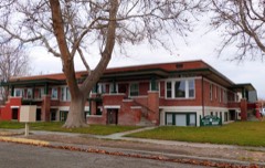
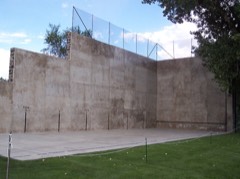
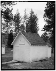
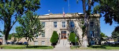
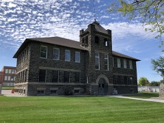
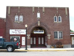
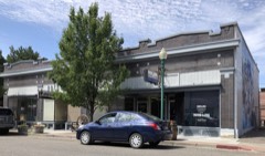
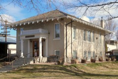
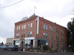
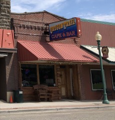
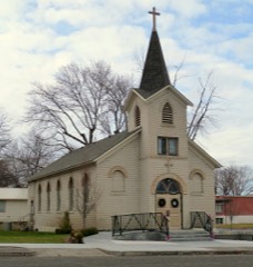
23 National Register listings published here.
Sources: the National Register database, National Park Service
87 topographic sheets cover 20 settlements here, and 23 properties are on the National Register of Historic Places.
23 National Register listings published here.
Sources: the National Register database, National Park Service
Every property in this county listed on the National Register of Historic Places, with the year it was listed and the federal nomination document.
Every wildfire the federal occurrence database records inside this county: 1,646 of them, burning about 1,257,240 acres. 740 started naturally and 17 were recorded as arson. Each settlement page carries the fires within five miles of it.
| Reported cause | Fires |
|---|---|
| Natural | 740 |
| Equipment and vehicle use | 266 |
| Missing data/not specified/undetermined | 223 |
| Recreation and ceremony | 98 |
| Railroad operations and maintenance | 81 |
| Power generation/transmission/distribution | 78 |
| Debris and open burning | 63 |
| Fireworks | 25 |
| Firearms and explosives use | 23 |
| Arson/incendiarism | 17 |
| Smoking | 15 |
| Other causes | 9 |
| Misuse of fire by a minor | 8 |
The five largest, by the area the report gives. None of them was recorded as arson.
| Date | Cause | Size | Reported by | Name on the report |
|---|---|---|---|---|
| 19 August 1992 | Natural | 177,544 acres | Boise National Forest | FOOTHILLS |
| 3 August 2012 | Equipment and vehicle use | 146,832 acres | Boise National Forest | TRINITY RIDGE |
| 8 August 2013 | Natural | 135,231 acres | Boise District | MUDD |
| 8 August 2013 | Natural | 129,730 acres | Boise National Forest | VILLAGE |
| 14 August 2011 | Natural | 39,577 acres | Boise District | BLAIR |
| 7 August 2008 | Natural | 37,725 acres | Sawtooth National Forest | SOUTH BARKER |
| 15 August 2000 | Natural | 35,238 acres | Boise National Forest | TRAIL CREEK |
| 30 August 1999 | Power generation/transmission/distribution | 35,041 acres | Boise District | EAST SLICK |
Every settlement page carries the fires within five miles of it - see the settlement index below.
The NOAA Storm Events Database holds 130 reports for this county, causing 3 deaths, 6 injuries and about $812,000 in recorded property damage. Each settlement page carries the reports that name it.
| Kind of event | Reports |
|---|---|
| Thunderstorm Wind | 56 |
| Heavy Rain | 27 |
| Hail | 18 |
| Flash Flood | 13 |
| Tornado | 5 |
| Flood | 5 |
| Wildfire | 3 |
| Funnel Cloud | 2 |
| Debris Flow | 1 |
The most serious of them, by death, then injury, then recorded damage. The accounts are quoted exactly as the forecast office filed them.
| When | Event | Place named | Harm | What the report says |
|---|---|---|---|---|
| May 2021 | Thunderstorm Wind | (Muo)Mountain Home A | 3 killed, 5 hurt | The AWOS at Mountain Home AFB measured a 58 MPH wind gust with several reports of damage received by the public. A dust storm from the gust front of a nearby thunderstorm reduced visibility to near zero, resulting in a 7 car accident with 3 fatalities. Idaho State Police officials reported the accident was on Highway 51, southeast of Mountain Home. ISP officials have determined the dust storm reduced visibility significantly and was the cause of the accident. |
| March 1995 | Thunderstorm Wind | not stated | 1 hurt, $500,000 | A severe thunderstorm damaged mobile homes and sheds. A tractor semitrailer overturned injuring the driver. |
| May 2017 | Flood | Anderson | $100,000 | The Boise River near Anderson reached minor food stage due to snow melt. A number of county and Forest Service roads were damaged. |
| July 2008 | Flash Flood | Atlanta Graham Arpt | $100,000 | Forest Service Roads were washed out with debris flows. The top end of Fall Creek road was washed out and the West Fork of James Creek near Atlanta road was also washed out. A new washout scar was seen in the wilderness area near Jackson Peak on the Upper North Fork of the Boise River. |
| June 1994 | Thunderstorm Wind | not stated | $50,000 | Strong winds, produced by thunderstorms, were observed across south central Idaho. A gust to 69 mph was recorded at the Hailey Airport. These winds blew over numerous trees and downed several power lines along the Wood River Valley near Hailey. Strong thunderstorm winds also caused damage in Elmore County near Mountain Home. Wind gusts up to 50 mph were recorded at Mountain Home Air Force Base, but the nature of the damage indicated that gusts reached severe criteria in the area. Nine powerline poles, as well as several large trees, were blown over. |
| January 2011 | Flood | Glenns Ferry | $25,000 | Minor flooding was reported in Glenns Ferry by the Elmore County Sheriff's Department dispatch. A portion of a railway line was washed out and four homes were evacuated. |
| August 1986 | Tornado (F1) | not stated | $25,000 | no account filed |
| May 1996 | Heavy Rain | 3 Island State Park | $5,000 | no account filed |
| July 1995 | Thunderstorm Wind | Nr. Arrowrock Dam | $5,000 | no account filed |
| February 2017 | Flood | Cleft | $2,000 | A road was washed out cutting access to Souls Rest Creek neighborhood. |
| July 2025 | Thunderstorm Wind | Cleft | - | At 6:30pm MDT, Idaho Power mesonet station 032ID recorded a wind gust of 68 mph. Later, at 6:36pm MDT, a RAWs (LLCI1) recorded a gust of 59 mph. These gusts were associated with a outflow boundary from a thunderstorm southwest of both locations. No damages were reported. |
| July 2025 | Thunderstorm Wind | King Hill | - | Deer Haven RAWS recorded a gust of 50 knots associated with a thunderstorm outflow. |
| July 2025 | Thunderstorm Wind | (Muo)Mountain Home A | - | Continuation of outflow boundary originating from Ada County. Mesonet station IDARNG3_D2 measured a wind gust of 58 mph. No damages reported. |
| December 2025 | Thunderstorm Wind | (Muo)Mountain Home A | - | The Mountain Home Air Force Base ASOS measured a thunderstorm wind gust of 60 mph at 8:07 AM MST as a line of showers with embedded thunderstorms passed. |
| January 2024 | Thunderstorm Wind | Glenns Ferry | - | Power outages were reported for nearly 33 customers near Mountain Home due to wind gusts bringing power poles. |
| January 2024 | Thunderstorm Wind | Reverse | - | South 18 street in Mountain Home from Beet Dump Road to Rockin Road was closed due to 20 plus power poles on the road. There were 100 plus homes affected and without 911 landline capabilities. This also affected the Mountain Home Air Force Base operations. |
| August 2024 | Thunderstorm Wind | Mountain Home | - | Strong winds brought a tree down and damaged an outdoor pool near downtown Mountain Home, ID. |
| August 2024 | Thunderstorm Wind | King Hill | - | The mesonet station at Deer Haven measured a strong wind gust from the thunderstorm outflow. |
| May 2024 | Thunderstorm Wind | Glenns Ferry Muni Ar | - | The mesonet station, GFRI, 6.7 miles southwest of Glenns Ferry measured strong wind gusts. |
| January 2024 | Thunderstorm Wind | (Muo)Mountain Home A | - | The mesonet station MTHI1, Mountain Home AFB RAWS, measured a 67 mph wind gust. |
| July 2024 | Thunderstorm Wind | King Hill | - | Large tree branches fell down, a motorhome was flipped, power poles were down, and outdoor structures were damaged from strong thunderstorm outflow winds. |
| July 2024 | Tornado (EF0) | Glenns Ferry | - | Broadcast media and social media provided videos show a weak EF-0 land spout tornado on the ground in Glenns Ferry, with a path along and just north of E. Harrison Ave. Elmore County Emergency Management and general public reports, along with photos of roof damage, several downed trees, downed branches, and damage to power lines are consistent with EF-0 wind speeds of 70 to 80 mph. The tornado had a path length of approximately 0.3 miles and a path width of approximately 30 yards. |
| September 2024 | Heavy Rain | Dixie | - | The mesonet station CCDI1 near Anderson Dam measured heavy rain from thunderstorms. |
| September 2024 | Thunderstorm Wind | King Hill | - | The Deer Haven RAWS measured very strong wind from a thunderstorm outflow boundary. |
| November 2024 | Heavy Rain | Featherville | - | The mesonet station WAGI1 at Wagontown RAWS measured 1.44 inches of rain. |
| November 2024 | Heavy Rain | Pine | - | The mesonet station LCRI1, at NRAWS 13, measured 1.17 inches of rain. |
| March 2023 | Heavy Rain | Dixie | - | The mesonet station CCDI1 8.3 miles southeast of Anderson Dam measured 0.60 inches of heavy rain. |
| March 2023 | Heavy Rain | Rocky Bar | - | The mesonet station TRMI1 8.7 miles west of Featherville, ID measured 0.95 inches of heavy rain. |
| March 2023 | Heavy Rain | Featherville | - | The mesonet station CW0406 at Pine, ID measured 0.79 inches of heavy rain. |
| March 2023 | Heavy Rain | Pine | - | The mesonet station LCRI1 near NRAWS 13 measured 0.95 inches of heavy rain. |
| June 2023 | Thunderstorm Wind | (Muo)Mountain Home A | - | The AWOS station at Mountain Home Air Force Base measured 52 knots of wind. |
| June 2023 | Thunderstorm Wind | (Muo)Mountain Home A | - | The AWOS Station at Mountain Home Air Force Base measured 52 knots of wind. |
| June 2023 | Thunderstorm Wind | (Muo)Mountain Home A | - | The mesonet station, TS962, 7 miles west northwest of Mountain Home Air Force Base. |
| June 2023 | Thunderstorm Wind | (Muo)Mountain Home A | - | The mesonet station, TS962, 7 miles west northwest of Mountain Home Air Force Base measured 51 knots of wind. |
| August 2023 | Flash Flood | Featherville | - | A trained spotter reported flash flooding over the road, stranding some motorcyclists on the main road in Featherville, ID. |
| August 2023 | Heavy Rain | Mountain Home | - | The CoCoRaHS station ID-EL-3 0.9 miles southwest of Mountain Home measured 1.32 inches of rain. |
| August 2023 | Heavy Rain | Prairie | - | The mesonet station PRAI1 0.6 miles northeast of Prairie measured 1.30 inches of rain. |
| August 2023 | Heavy Rain | Featherville | - | The mesonet station CW0406 in Pine, ID measured 0.96 inches of rain. |
| August 2023 | Heavy Rain | (Muo)Mountain Home A | - | The mesonet station MTHI1 on Mountain Home AFB measured 0.85 inches of rain. |
| August 2023 | Heavy Rain | Anderson | - | The mesonet station ARAI1 bear Anderson Dam measured 0.73 inches of rain. |
| August 2023 | Heavy Rain | Pine | - | The mesonet station LCRI1 at NRAWS 13 measured 0.72 inches of rain. |
| August 2023 | Heavy Rain | Rocky Bar | - | The mesonet station TRMI1 8.7 miles west of Featherville measured 0.90 inches of rain. |
| August 2023 | Heavy Rain | Pine Arpt | - | The mesonet station DEHI1, Deer Haven, measured 0.91 inches of rain. |
| August 2023 | Heavy Rain | Featherville | - | Spotter reported 2.15 inches of rain total near Featherville. |
| August 2023 | Heavy Rain | Featherville | - | The mesonet station CW0406 Pine measured 1.56 inches of heavy rain. |
| June 2023 | Heavy Rain | Featherville | - | The mesonet station, WAGI1, near Featherville, ID measured 0.56 inches of heavy rainfall. |
| June 2022 | Hail | Mayfield | - | A member of the public posted this photo on Facebook. |
| June 2022 | Hail | Mayfield | - | There was a layer of inch deep quarter size hail on Interstate 84. |
| June 2022 | Heavy Rain | Featherville | - | The Mesonet station, CW0406, near Pine, ID measured 1.43 inches of total rainfall. |
| June 2022 | Thunderstorm Wind | Mountain Home | - | A large tree partially was uprooted and fell on house near East Second Avenue in Mountain Home. Numerous small branches were down with diameters of 1 to 2 inches. A Porta Potty was blown over near Rosewood Park. Damage occurred during a thunderstorm with brief heavy rain which was described as wet downburst. |
| June 2022 | Heavy Rain | Featherville | - | The Mesonet station, CW0406, near Featherville, ID measured 2.96 inches of total rainfall. |
| June 2021 | Thunderstorm Wind | Glenns Ferry | - | The public reported a 62 MPH thunderstorm wind gust 9 miles south of Glenns Ferry using a Davis weather station. |
| August 2021 | Heavy Rain | (Muo)Mountain Home A | - | ASOS recorded 0.85 inches of rain in 34 minutes. |
| August 2021 | Flash Flood | Prairie Smith Arpt | - | Boise National Forest Officials reported that Trinity Ridge Road 129 is impassable at Burnt Creek due to a washout which occurred on Sunday. There were also other smaller washouts between Bear Hole and Burnt Creek. Photos indicated that logs and other debris were involved in the flood as well. |
| October 2021 | Heavy Rain | Featherville | - | The mesonet station WAGI1, 4.5 miles southwest of Featherville, ID, recorded 3.05 inches of rain. |
| October 2021 | Heavy Rain | Featherville | - | A mesonet station CW0406, 2 miles southeast of Featherville, ID, measured 4.83 inches of rain from this storm. |
| April 2020 | Thunderstorm Wind | Reverse | - | The ITD mesonet site at Hammett Hill recorded a wind gust of 63 MPH with reports of wind damage around the area. |
| July 2019 | Hail | Prairie | - | The COOP observer at Prairie reported large hail up to 1.25 inches. The hail shredded trees and damaged vehicles. |
| July 2019 | Thunderstorm Wind | Glenns Ferry Muni Ar | - | A 72 MPH thunderstorm wind gust was reported 1 mile west of Glenns Ferry by a resident with a home weather station. |
| October 2019 | Thunderstorm Wind | Glenns Ferry Muni Ar | - | A wind gust of 64 MPH was recorded 4 miles southwest of Glenns Ferry. |
The Survey's mineral resources record lists 256 workings inside this county. 15 still produce and 241 are closed or unrecorded. Each settlement page carries the workings within five miles of it.
| Commodity | Workings |
|---|---|
| Gold | 125 |
| Silver | 60 |
| Geothermal | 39 |
| Sand and Gravel, Construction | 26 |
| Gold, Silver | 10 |
| Molybdenum | 8 |
| Antimony | 7 |
| Beryllium | 7 |
| Lead | 6 |
| Diatomite | 5 |
| Lead, Zinc | 5 |
| Copper | 5 |
| Zinc, Lead | 4 |
| REE | 4 |
The least common of them first, because a county's hundredth gravel pit says nothing its first ten did not.
| Where | Site | Commodity | Status | Recorded |
|---|---|---|---|---|
| Ajax Mine | Gold, Copper, Silver, Lead | Past Producer | Chalcopyrite, Gold, Malachite, Sphalerite | |
| Alphabet Group Prospect | Silver, Lead, Beryllium, Molybdenum, Gold | Prospect | 1960 | |
| Basin Claims | Silver, Lead, Gold, Zinc, Tungsten, Molybdenum, Nickel, Mercury, Antimony, Tin, Bismuth | Prospect | Galena, Sphalerite | |
| Bayhorse Pass Prospect No. 2 | Silver, Copper, Tin | Occurrence | Malachite | |
| Big Eight | Tungsten, Vanadium | Occurrence | ||
| Boise - Rochester Mine | Silver, Gold, Sulfur | Past Producer | 1869 | |
| Burnt Sage | Stone, Dimension | Unknown | ||
| Cabin Creek | Molybdenum, Silver, Antimony | Occurrence | ||
| Corder Group Prospect | Silver, Gold, Copper, Bismuth, Molybdenum, Lead | Prospect | Vein | |
| Corder Group Prospect No. 2 | Lead, Copper, Silver, Tin, Molybdenum | Prospect | Vein | |
| Crooked Tree Group | Gold, Lead, Molybdenum, Silver, Zinc | Unknown | ||
| Crooked Tree Group Prospect | Zinc, Beryllium, Silver, Molybdenum, Lead, Bismuth | Occurrence | 1963 | |
| Decker-Hortenstine Prospect | Molybdenum, Gold, Silver, Beryllium, Copper, Zinc | Prospect | 1920 | |
| Diatomite Mine | Diatomite, Clay | Past Producer | Sedimentary | |
| Dismal Swamp Placer Mine | Niobium (Columbium), Titanium, Tantalum, Uranium | Past Producer | Placer | |
| Dog Creek Prospect | Silver, Bismuth | Prospect | ||
| Feather River | REE, Garnet, Iron, Titanium, Zirconium | Unknown | ||
| Feather River Placer | REE, Titanium, Iron, Silver, Garnet, Gold, Zirconium | Past Producer | Placer | |
| Golden Stinger | Gold, Silver, Lead, Copper, Zinc | Past Producer | ||
| Holly Mine | Copper, Silver, Lead, Gold, Zinc | Past Producer | Chalcopyrite, Gold, Malachite, Sphalerite | |
| Idaho Gold Chief Prospect | Gold, Zinc, Lead, Silver | Past Producer | Galena, Scheelite, Sphalerite | |
| Index Mine | Gold, Copper, Silver, Lead, Zinc | Past Producer | Chalcopyrite, Gold, Sphalerite | |
| Jacobs Mine | Copper, Gold, Silver, Lead | Past Producer | Chalcopyrite, Gold, Sphalerite | |
| Johnson Creek Prospect No. 2 | Silver, Gold, Copper, Lead, Zinc, Bismuth, Molybdenum | Occurrence | Vein | |
| Johnson Creek Prospect No. 3 | Silver, Copper, Molybdenum, Tin | Occurrence | ||
| Johnson Creek Prospects | Silver, Gold, Bismuth, Copper, Lead, Molybdenum, Tin, Zinc | Prospect | Vein | |
| Larimer Creek | Gold, Iron | Occurrence | Placer | |
| Lison Mine | Gold, Arsenic | Past Producer | Vein | |
| Little Queens Mine | Gold, Silver, Lead, Zinc, Copper | Past Producer | 1951 | |
| Lone Pine Mine | Lead, Zinc, Gold, Silver | Prospect | Vein | |
| Marsh Creek Property | Gold, Copper, Lead, Zinc, Silver | Prospect | Chalcopyrite, Galena, Sphalerite | |
| Minerva Mine | Gold, Silver, Silica, Antimony | Past Producer | Surface/Underground | |
| Monarch Mine | Gold, Silver, Tungsten | Past Producer | 1863, 1865 | |
| Money Quartz Prospect | Gold, Silver, Lead, Mercury | Occurrence | Vein | |
| Old Glory Mine | Zinc, Lead, Silver, Gold | Past Producer | Chalcopyrite, Galena, Gold, Sphalerite | |
| Ophir Mine | Gold, Silver, Lead, Zinc, Copper | Past Producer | Galena, Sphalerite | |
| Pumicite Occurrence | Pumice | Past Producer | ||
| Pyramid Placer Mine | Gold, Iron, Garnet, Mercury, Titanium | Past Producer | Placer | |
| Revenue Mine | Copper, Gold, Silver, Lead, Molybdenum | Past Producer | Chalcopyrite, Galena, Sphalerite | |
| Ridge Prospects | Gold, Silver, Lead, Bismuth, Molybdenum, Beryllium | Occurrence | Vein | |
| Rinebold Prospect | Molybdenum, Gold, Silver, Beryllium, Copper, Zinc | Prospect | 1904 | |
| Roaring River | Molybdenum, Silver, Gold | Occurrence | Chalcopyrite, Molybdenite, Pyrite, Specularite | |
| Rocky Bar | Gold, Platinum, Silver | Past Producer | 1862 | |
| Spanish Town Mine | Gold, Lead, Copper, Silver, Arsenic | Past Producer | Surface/Underground | |
| Stone Quarry | Stone | Producer | ||
| Swensson Prospect | Feldspar | Prospect | Feldspar | |
| This Is It Claim Prospect | Lead, Silver, Gold, Bismuth, Zinc | Prospect | 1946 | |
| Upper Billy Creek Mineral Occurrences | Molybdenum, Silver, Gold, Beryllium, Lead, Bismuth | Prospect | Beryl, Molybdenite | |
| Valley Chief Nos. 1-11 Claims | Silver, Copper, Lead, Zinc, Bismuth, Gold | Prospect | Chalcopyrite, Galena, Sphalerite | |
| Verdun Group | Gold, Silver, Zinc, Lead, Copper | Past Producer | Chalcopyrite, Galena, Sphalerite | |
| Bosie Rochester | Gold, Silver, Lead, Copper | Past Producer | ||
| Bowerman Mine | Gold, Silver, Lead, Copper | Past Producer | Chalcopyrite, Gold, Sphalerite | |
| Buffalo Mine | Silver, Gold | Past Producer | 1864 | |
| C. & E. Placer | Thorium | Past Producer | ||
| Commonwealth Mine | Gold, Lead, Zinc, Silver | Past Producer | Galena, Sphalerite | |
| Elmore | Gold, Silver, Lead, Zinc | Past Producer | ||
| Mud Flats | Thorium, REE | Occurrence | ||
| Passover Prospect | Gold, Lead, Silver | Past Producer | 1937 | |
| Pickett Mountain Prospect | Gold, Silver, Copper, Lead, Zinc | Occurrence | Vein | |
| Pilot Knob Prospect | Gold, Lead, Zinc, Silver | Occurrence | 1933 | |
| Snake River Placer | Gold, Titanium, Platinum | Past Producer | Stream Placer | |
| Tahoma Mine | Gold, Silver, Copper, Lead, Zinc | Past Producer | Miargyrite, Pyrargyrite | |
| Tyceska Gold Mining Co. | Gold, Titanium, Platinum | Past Producer | Stream Placer | |
| Volcano Mine | Gold, Copper, Silver, Lead, Zinc | Past Producer | Chalcopyrite, Gold, Sphalerite | |
| Atlanta District | Gold, Silver, Tungsten | Producer | GOLD - QUARTZ VEINS | |
| Talache | Silver, Tungsten | Past Producer | ||
| Alexander Flats | REE, Gold | Occurrence | ||
| Browns Creek Prospect | Gold, Silver, Zinc, Lead | Prospect | 1948 | |
| Franklin Mine | Gold, Silver, Zinc, Lead | Past Producer | Galena, Sphalerite | |
| Lone Cabin Nos. 1-8 Claims | Gold, Silver, Zinc, Lead | Past Producer | Vein | |
| Pittsburg Mine | Gold, Zinc, Lead | Unknown | ||
| Blackstone Mine | Copper, Silver | Past Producer | ||
| Diatomite Deposit | Diatomite | Occurrence | Sedimentary | |
| Diatomite Deposit | Diatomite | Occurrence | Sedimentary | |
| Diatomite Deposit | Diatomite | Occurrence | Sedimentary | |
| Diatomite Deposit | Diatomite | Occurrence | Sedimentary | |
| Grouse Creek - Black Warrior Creek Ridge Prospects | Silver, Gold, Lead, Zinc | Prospect | Vein | |
| Lucky Group | Molybdenum, Lead, Zinc | Prospect | 1963 | |
| Money Prospect | Gold, Silver, Lead, Zinc | Prospect | Vein | |
| Vishnu Mine | Gold, Lead, Zinc | Past Producer | 1863 | |
| Clark Lead Prospect | Lead | Unknown | ||
| La Moyne Creek Pb-Ag Outcrop | Lead, Silver | Occurrence | Vein | |
| Mule Creek Prospect No. 2 | Gold, Silver, Lead | Occurrence | Vein | |
| Overlook Mine | Silver, Gold, Lead | Past Producer | Vein | |
| Black Warrior Mine | Antimony | Prospect | ||
| Blue Cloud Claims | Beryllium, Molybdenum | Prospect | Vein | |
| Blue Crystal Prospect | Beryllium | Prospect | 1960 | |
| Blue Gem Claims Prospect | Beryllium | Occurrence | Aquamarine | |
| Blue Gem No. 2 | Beryllium | Prospect | ||
| Deer Park Group | Antimony, Gold | Prospect | ||
| Glens Peak Prospects | Beryllium | Prospect | Aquamarine, Beryl | |
| Hermada Antimony Mine | Antimony | Past Producer | 1947 | |
| Hope Claims Prospect | Antimony | Occurrence | Vein | |
| North Star Lake Occurrence | Beryllium | Occurrence | Aquamarine | |
| Public Domain Prospects | Beryllium | Unknown | ||
| Reno Claims Mine | Antimony | Past Producer | Vein | |
| W.K.R. Antimony Claims | Antimony | Prospect | ||
| West Fork Exchange Prospect | Antimony | Prospect | Vein | |
| Decker-Hortenstine No. 2 Prospect | Molybdenum | Prospect | 1920 | |
| Sheep Creek | Molybdenum | Occurrence | ||
| Atlanta Gold Mines Corporation | Gold, Silver | Past Producer | Surface/Underground | |
| Atlanta Lode | Gold, Silver | Past Producer | 1860, 1864 | |
| Atlanta, Yuba District | Gold, Silver | Producer | VEIN/DIKES, REPLACEMENT VEINS | |
| Big Lode Mine | Gold, Silver | Past Producer | ||
| Pine Grove District | Gold, Silver | Producer | QUARTZ VEINS/SHEAR ZONE, PLACER | |
| Dodge Pit | Sand and Gravel, Construction | Producer | ||
| Dodge Pit | Sand and Gravel, Construction | Unknown | ||
| Gravel Pit | Sand and Gravel, Construction | Past Producer | ||
| Gravel Pit | Sand and Gravel, Construction | Past Producer | ||
| Gravel Pit | Sand and Gravel, Construction | Past Producer | ||
| Gravel Pit | Sand and Gravel, Construction | Past Producer | ||
| Gravel Pit | Sand and Gravel, Construction | Past Producer | ||
| Gravel Pit | Sand and Gravel, Construction | Producer | ||
| Gravel Pit | Sand and Gravel, Construction | Past Producer | ||
| Gravel Pit | Sand and Gravel, Construction | Past Producer | ||
| Gravel Pit | Sand and Gravel, Construction | Past Producer | ||
| Gravel Pit | Sand and Gravel, Construction | Past Producer | ||
| Gravel Pit | Sand and Gravel, Construction | Past Producer | ||
| Gravel Pit | Sand and Gravel, Construction | Producer | ||
| Gravel Pit | Sand and Gravel, Construction | Past Producer | ||
| Gravel Pit | Sand and Gravel, Construction | Past Producer | ||
| Gravel Pit | Sand and Gravel, Construction | Producer | ||
| Gravel Pit | Sand and Gravel, Construction | Past Producer | ||
| Gravel Pit | Sand and Gravel, Construction | Past Producer | ||
| Gravel Pit | Sand and Gravel, Construction | Producer | ||
| Mountain Home Pit | Sand and Gravel, Construction | Producer | ||
| Obsidian Pit | Sand and Gravel, Construction | Producer | ||
| Sand Bank | Sand and Gravel, Construction | Past Producer | ||
| Sandpit | Sand and Gravel, Construction | Past Producer | ||
| St. Pit El8 | Sand and Gravel, Construction | Unknown | ||
| State Pit El 109 | Sand and Gravel, Construction | Producer | ||
| Basset Hot Springs | Geothermal | Occurrence | ||
| Bridge Hot Spring | Geothermal | Occurrence | ||
| Campinland | Geothermal | Prospect | ||
| Crevice Hot Spring | Geothermal | Occurrence | ||
| Dutch Frank S Sp. | Geothermal | Occurrence | ||
| El Paso Station | Geothermal | Prospect | ||
| Geothermal Location | Geothermal | Occurrence | ||
| Geothermal Location | Geothermal | Occurrence | ||
| Geothermal Location | Geothermal | Occurrence | ||
| Geothermal Location | Geothermal | Occurrence | ||
| Geothermal Location | Geothermal | Occurrence | ||
| Geothermal Location | Geothermal | Occurrence | ||
| Geothermal Location | Geothermal | Occurrence | ||
| Geothermal Location | Geothermal | Occurrence | ||
| Geothermal Location | Geothermal | Occurrence | ||
| Geothermal Location | Geothermal | Occurrence | ||
| Geothermal Location | Geothermal | Occurrence | ||
| Geothermal Location | Geothermal | Occurrence | ||
| Geothermal Location | Geothermal | Occurrence | ||
| Geothermal Location | Geothermal | Occurrence | ||
| Geothermal Location | Geothermal | Occurrence | ||
| Geothermal Location | Geothermal | Occurrence | ||
| Geothermal Location | Geothermal | Occurrence | ||
| Geothermal Location | Geothermal | Occurrence | ||
| Geothermal Location | Geothermal | Occurrence | ||
| Granite Creek | Geothermal | Occurrence | ||
| King Hill | Geothermal | Prospect | ||
| Latty Hot Springs | Geothermal | Occurrence | ||
| Neinmeyer Hot Spring | Geothermal | Occurrence | ||
| Nevin Spring | Geothermal | Occurrence | ||
| Old Resort | Geothermal | Prospect | ||
| Paradise Hot Spring | Geothermal | Occurrence | ||
| Pool Creek Hot Spring | Geothermal | Occurrence | ||
| Reed Hot Spring | Geothermal | Occurrence | ||
| Ross # 1 | Geothermal | Prospect | ||
| Ross # 2 | Geothermal | Prospect | ||
| Stevens | Geothermal | Prospect | ||
| Walker # 1 | Geothermal | Prospect | ||
| Weatherby Mill | Geothermal | Occurrence | ||
| Baltimore Mine | Gold, Silver | Past Producer | ||
| Big Water No. 17 Claim | Gold, Silver | Prospect | ||
| Boneparte | Gold, Silver | Past Producer | ||
| Bonnie Anna Mine | Gold, Silver | Past Producer | Vein | |
| Clifton Bell | Gold, Silver | Past Producer | ||
| Constant Hope Prospect | Gold, Silver | Prospect | Surface/Underground | |
| Daley Consolidated Mine | Gold, Silver | Past Producer | ||
| Empire Mine | Gold, Silver | Past Producer | Underground | |
| Fisher Property | Gold, Silver | Occurrence | ||
| Flint Gulch Prospect | Gold, Silver | Prospect | ||
| Ford Prospect | Silver, Gold | Prospect | ||
| Franklin Mine | Gold, Silver | Past Producer | ||
| Gold Bug Claim | Gold, Silver | Past Producer | ||
| Greenback Mine | Gold, Silver | Past Producer | Underground | |
| Hill and Davis Claim Prospect | Gold, Silver | Prospect | Surface/Underground | |
| Hy Country Exploration Mine | Gold, Silver | Occurrence | ||
| Idaho Gold Mine | Gold, Silver | Past Producer | Surface/Underground | |
| Independence Mine | Gold, Silver | Past Producer | ||
| Jessie Benton Mine | Gold, Silver | Past Producer | ||
| Keystone Mine | Gold, Silver | Past Producer | ||
| Last Chance Mine | Gold, Silver | Past Producer | Underground | |
| Little Water Gulch Prospect | Gold, Silver | Prospect | ||
| Lucky Strike Mine | Gold, Silver | Past Producer | ||
| Magnolia Creek Mine | Gold, Silver | Past Producer | Vein | |
| Mule Creek Prospect No. 1 | Silver, Gold | Prospect | Vein | |
| Pal Group Mine | Gold, Silver | Past Producer | Underground | |
| Paymaster Mine | Gold, Silver | Past Producer | Surface/Underground | |
| Rico Mine | Gold, Silver | Past Producer | ||
| Sample No. 1573 Occurrence | Gold, Silver | Occurrence | ||
| Silver Tide Vein Prospect | Gold, Silver | Prospect | ||
| Vibrator Prospect | Gold, Silver | Past Producer | ||
| Vre Non Placer | Gold, Silver | Past Producer | 1966 | |
| West Ophir Mine | Gold, Silver | Past Producer | Surface/Underground | |
| Wide West Mine | Gold, Silver | Past Producer | Underground | |
| Yuba Group Prospect | Gold, Silver | Prospect | ||
| Ada Elmore Lode | Gold | Past Producer | 1863 | |
| Anna | Gold | Occurrence | Vein | |
| Annette Prospect | Gold | Occurrence | ||
| Barger Group Prospect | Gold | Prospect | Vein | |
| Bird Claim Group | Gold | Past Producer | ||
| Bone Parte Mine | Gold | Past Producer | 1868 | |
| Canyon Group | Gold | Occurrence | Gold | |
| Champion | Gold | Occurrence | ||
| China Basin | Gold | Unknown | ||
| Confederate Star Mine | Gold | Past Producer | Underground | |
| Dona Prospect | Gold | Prospect | ||
| Doolittle Prospect | Gold | Prospect | ||
| Everrett Graves Placer | Gold | Prospect | Placer | |
| Glen Eden Prospect | Gold | Occurrence | ||
| Gloria Group | Gold | Occurrence | Gold | |
| Golden Bear Lode | Gold | Occurrence | ||
| Gordon | Gold | Occurrence | Gold | |
| Greenwalt Placer | Gold | Past Producer | 1925 | |
| Hercules Mine | Gold | Past Producer | ||
| Hill Billy | Gold | Occurrence | Placer | |
| Howard Mine | Gold | Prospect | Underground | |
| Idaho Bonanza | Gold | Producer | Placer | |
| Leonora No. 2 | Gold | Occurrence | Vein | |
| Lost Cavalos | Gold | Occurrence | Placer | |
| Manhattan | Gold | Occurrence | ||
| Mick | Gold | Occurrence | Gold | |
| Minnie | Gold | Occurrence | Vein | |
| Mountain Buck Mine | Gold | Past Producer | ||
| Mountain Goat Mine | Gold | Past Producer | Underground | |
| Neal District | Gold | Producer | QUARTZ LENS | |
| New York | Gold | Occurrence | ||
| Nugget | Gold | Past Producer | Placer | |
| Numerous Prospects | Gold | Prospect | ||
| Pioneer | Gold | Past Producer | Placer | |
| Ptla Mine | Gold | Past Producer | ||
| Quil Pig Prospect | Gold | Prospect | ||
| Rocky Bar West Minx Claims | Gold | Prospect | ||
| Snake River Placers | Gold | Past Producer | 1862 | |
| Snake River Placers | Gold | Past Producer | Placer | |
| Snake River Placers | Gold | Past Producer | 1862 | |
| Snake River Placers | Gold | Past Producer | Placer | |
| Snake River Placers | Gold | Past Producer | 1862 | |
| Snake River Placers | Gold | Past Producer | Placer | |
| Snake River Placers | Gold | Past Producer | 1862 | |
| South Fork Boise River Placers | Gold | Past Producer | ||
| South Park Dredging Co. | Gold | Past Producer | Placer | |
| Tip Top Prospect | Gold | Occurrence | ||
| Unnamed Prospect | Gold | Prospect | ||
| Upper Baker-Tally Creeks Locality | Gold | Plant | ||
| War Eagle Prospect | Gold | Prospect | Surface/Underground | |
| Wilson Group | Gold | Occurrence | Gold |
Named settlements recorded in the Geographic Names Information System, each with the topographic sheets covering it. Villages, hamlets and abandoned places alike. Each is shown with the nearest named watercourse or landform and the survey quadrangle it falls on.
Atlanta census division · 83716 · On Rabbit Creek · Atlanta West quadrangle
16 sheets, 1894 to 1982
No longer a settlement
Atlanta census division · 83716 · On Montezuma Creek · Atlanta West quadrangle
16 sheets, 1894 to 1982
Glenns Ferry census division · 83633 · Morrow Reservoir quadrangle
17 sheets, 1892 to 1990
Atlanta census division · 83647 · On Feather River · Featherville quadrangle
16 sheets, 1894 to 1982
Glenns Ferry census division · 83623 · Near Rosevear Gulch · Glenns Ferry quadrangle
13 sheets, 1947 to 1992
Glenns Ferry census division · 83633 · On Clover Creek · King Hill quadrangle
17 sheets, 1892 to 1990
Mountain Home census division · 83647 · Mountain Home North quadrangle
20 sheets, 1892 to 1992
Atlanta census division · 83647 · On Grouse Creek · Featherville quadrangle
16 sheets, 1894 to 1982
Atlanta census division · 83647 · On Louse Creek · Prairie quadrangle
17 sheets, 1894 to 1982
Atlanta census division · 83647 · On Dixie Creek · Anderson Ranch Dam quadrangle
16 sheets, 1892 to 1990
Atlanta census division · 83647 · On Steel Creek · Rocky Bar quadrangle
14 sheets, 1894 to 1982
Atlanta census division · 83647 · On East Fork Elk Creek · Rocky Bar quadrangle
14 sheets, 1894 to 1982
No longer a settlement
Glenns Ferry census division · 83623 · Near Goodman Flat · Goodman Flat quadrangle
17 sheets, 1892 to 1990
The vanished settlements of Elmore County: the places named above that are no longer on the map.