 Block
From the record
13 National Register listings published here.
Sources: the National Register database, National Park Service
32 topographic sheets cover 7 settlements here, and 13 properties are on the National Register of Historic Places.
13 National Register listings published here.
Sources: the National Register database, National Park Service
Every property in this county listed on the National Register of Historic Places, with the year it was listed and the federal nomination document.
| Photograph | Property | Type | Listed | Reference |
|---|---|---|---|---|
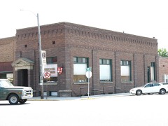 | Citizens State Bank | building | 1980 | 80001328 |
| Gooding College Campus | building | 1983 | 83000286 | |
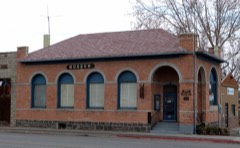 | Hagerman State Bank, Limited | building | 1989 | 89001000 |
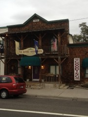 | Kelly's Hotel | building | 1985 | 85002155 |
| James Henry and Ida Owen Mays House | building | 1993 | 92001412 | |
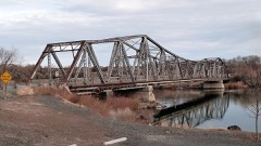 | Owsley Bridge | structure | 1998 | 98001172 |
| Priestly's Hydraulic Ram | structure | 1975 | 75000631 | |
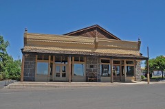 | Morris Roberts Store | building | 1978 | 78001062 |
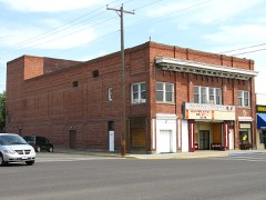 | Schubert Theatre | building | 2004 | 03001367 |
| Archie Teater Studio | building | 1984 | 84001132 | |
 | Thompson Mortuary Chapel | building | 1982 | 82000348 |
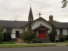 | Trinity Episcopal Church | building | 1982 | 82000349 |
| West Point Grade School | building | 1982 | 82000350 |
Every wildfire the federal occurrence database records inside this county: 281 of them, burning about 164,974 acres. 62 started naturally and 3 were recorded as arson. Each settlement page carries the fires within five miles of it.
| Reported cause | Fires |
|---|---|
| Equipment and vehicle use | 85 |
| Natural | 62 |
| Missing data/not specified/undetermined | 55 |
| Debris and open burning | 29 |
| Railroad operations and maintenance | 13 |
| Fireworks | 11 |
| Smoking | 6 |
| Firearms and explosives use | 6 |
| Power generation/transmission/distribution | 4 |
| Recreation and ceremony | 4 |
| Arson/incendiarism | 3 |
| Misuse of fire by a minor | 2 |
| Other causes | 1 |
The five largest, by the area the report gives. None of them was recorded as arson.
| Date | Cause | Size | Reported by | Name on the report |
|---|---|---|---|---|
| 5 August 2017 | Missing data/not specified/undetermined | 35,704 acres | Twin Falls District | SHOESTRING |
| 25 July 1996 | Equipment and vehicle use | 19,818 acres | Twin Falls District | DAVIS MTN |
| 17 July 2018 | Natural | 16,324 acres | Twin Falls District | DOG CREEK |
| 20 June 2006 | Equipment and vehicle use | 11,443 acres | Twin Falls District | HWY 46 MM 7 |
| 4 August 2011 | Natural | 6,963 acres | Twin Falls District | DEAD HORSE CAVE |
| 1 September 2011 | Equipment and vehicle use | 4,982 acres | Twin Falls District | HWY 46 MM 103 |
| 1 August 2008 | Smoking | 3,847 acres | Twin Falls District | SAND SHED |
| 10 August 2007 | Equipment and vehicle use | 3,835 acres | Twin Falls District | SHOESTRING |
Every settlement page carries the fires within five miles of it - see the settlement index below.
The NOAA Storm Events Database holds 46 reports for this county, causing no deaths, 23 injuries and about $1,907,030 in recorded property damage. Each settlement page carries the reports that name it.
| Kind of event | Reports |
|---|---|
| Thunderstorm Wind | 21 |
| Hail | 12 |
| Tornado | 6 |
| Flood | 4 |
| Heavy Rain | 2 |
| Wildfire | 1 |
The most serious of them, by death, then injury, then recorded damage. The accounts are quoted exactly as the forecast office filed them.
| When | Event | Place named | Harm | What the report says |
|---|---|---|---|---|
| June 1988 | Thunderstorm Wind | not stated | 23 hurt | no account filed |
| February 2017 | Flood | Hagerman | $1,500,000 | Rain and snowmelt on top of saturated and frozen soil led to widespread flooding. A report from social media indicated much of the town of Hagerman including the city park was flooded. Widespread flooding of agricultural lands occurred and some roads were damaged and closed due to flooding. |
| April 2017 | Flood | Gooding | $250,000 | The combination of rain and melting of near record snowpack in the Big Wood Basin led to significant flooding along the Big Wood River. Magic Reservoir filled to capacity sending large flows over the spillway and downriver through Gooding County. Extensive flooding of agricultural land occurred and several county roads were inundated with water. Just north of Gooding, portions of County Road 1700 South, 1800 East, and 1950 East were inundated with water and damaged. A few homes and businesses near the river were surrounded by water. Lowland flooding and damage to county roads occurred in the county well downstream from Gooding. |
| May 2017 | Flood | Gooding | $100,000 | Rapid snowmelt in the high elevations of the Big Wood Basin sent high flows over the spillway of Magic Reservoir causing flooding downstream in Gooding County. Agricultural land and low lying roads were impacted by the high water around the town of Gooding. |
| April 1988 | Tornado (F1) | not stated | $25,000 | no account filed |
| May 1985 | Tornado (F1) | not stated | $25,000 | no account filed |
| June 1990 | Tornado (F1) | not stated | $2,500 | no account filed |
| April 1988 | Tornado (F0) | not stated | $2,500 | no account filed |
| June 1998 | Hail | Gooding | $2,000 | no account filed |
| June 1956 | Tornado (F1) | not stated | $30 | no account filed |
| May 2024 | Thunderstorm Wind | (Gng)Gooding Muni Ar | - | A gust of 64 mph was measured at the Gooding airport. Multiple power lines were reported as down near the town, with outages affecting around 500 people. |
| June 2022 | Flood | Wendell | - | The driveway was flooded and marble size hail was spotted on the patio. |
| June 2022 | Hail | Hagerman | - | A member of the public posted this photo of hail on social media. |
| June 2022 | Hail | Hagerman | - | There were multiple reports on social media of hail around one inch in diameter. |
| June 2022 | Hail | Wendell | - | A trained spotter reported hail of 1.25 inches near Hagerman, ID. |
| April 2020 | Thunderstorm Wind | Gooding | - | The ITD mesonet site north of Gooding recorded a wind gust of 64 MPH with reports of wind damage around the area. |
| May 2020 | Thunderstorm Wind | Gooding | - | A 12 foot diameter Poplar tree was uprooted in Gooding. |
| October 2019 | Thunderstorm Wind | Wendell | - | Four power line poles were reported down on a county road. |
| June 2017 | Thunderstorm Wind | Wendell | - | Social and local media reported trees down and over 1000 without power. |
| June 2017 | Thunderstorm Wind | Gooding | - | The local newspaper reported several trees and power lines down around Gooding. |
| October 2016 | Hail | (Gng)Gooding Muni Ar | - | A trained spotter reported three quarter inch hail covering the ground with heavy rain and ponding. |
| August 2014 | Hail | Hagerman | - | Numerous reports on social media indicated quarter size, power outages and power poles down were observed from Hagerman to Bliss and Gooding. |
| August 2014 | Hail | Wendell | - | A trained spotter reported quarter sized hail. |
| August 2014 | Hail | Gooding | - | A trained spotter reported quarter sized hail, water running through his shop and downed branches in his yard measuring around 2,5 inches. |
| September 2013 | Thunderstorm Wind | Hagerman | - | Damage to buildings and power lines down was reported. |
| August 2013 | Hail | Wendell | - | Local media reported penny to nickel sized hail around the Wendell, Idaho area. |
| August 2009 | Hail | Gooding | - | A trained spotter near Gooding, Idaho reported golf ball sized hail. |
| April 2002 | Thunderstorm Wind | Gooding | - | A trained storm spotter reported that severe thunderstorm winds destroyed a 20-foot tall by 15-foot wide granary in Gooding. |
| May 1993 | Tornado (F0) | not stated | - | A short lived tornado touched down four miles west of and two and a half miles south of the town of Wendall, which is 20 miles northwest of Twin Falls. Two small trees were blown down. A calf shed was destroyed, while another shed's roof was torn off. |
| April 2006 | Hail | Gooding | - | no account filed |
| June 2002 | Thunderstorm Wind | Gooding | - | no account filed |
| May 1998 | Hail | Gooding | - | no account filed |
| August 1997 | Wildfire | Bliss | - | no account filed |
| June 1996 | Thunderstorm Wind | Bell Rapids | - | no account filed |
| May 1996 | Heavy Rain | Gooding | - | no account filed |
| May 1996 | Heavy Rain | Gooding | - | no account filed |
| June 1996 | Thunderstorm Wind | Gooding | - | no account filed |
| April 1992 | Thunderstorm Wind | not stated | - | no account filed |
| September 1991 | Thunderstorm Wind | not stated | - | no account filed |
| August 1990 | Thunderstorm Wind | not stated | - | no account filed |
| July 1985 | Thunderstorm Wind | not stated | - | no account filed |
| August 1977 | Thunderstorm Wind | not stated | - | no account filed |
| August 1977 | Thunderstorm Wind | not stated | - | no account filed |
| June 1970 | Thunderstorm Wind | not stated | - | no account filed |
| August 1965 | Thunderstorm Wind | not stated | - | no account filed |
| June 1956 | Thunderstorm Wind | not stated | - | no account filed |
The Survey's mineral resources record lists 31 workings inside this county. 6 still produce and 25 are closed or unrecorded. Each settlement page carries the workings within five miles of it.
| Commodity | Workings |
|---|---|
| Sand and Gravel, Construction | 15 |
| Geothermal | 8 |
| Gold | 4 |
| Diatomite | 2 |
| Volcanic Materials | 1 |
| Gemstone | 1 |
The least common of them first, because a county's hundredth gravel pit says nothing its first ten did not.
| Where | Site | Commodity | Status | Recorded |
|---|---|---|---|---|
| Cinder Deposit | Volcanic Materials | Occurrence | Cinders | |
| Gem Location Opal | Gemstone | Occurrence | ||
| Chalk Mine | Diatomite | Past Producer | ||
| Clover Creek Diatomite Deposit | Diatomite | Past Producer | ||
| Boulder Hill Placer | Gold | Past Producer | ||
| Brown Placer | Gold | Past Producer | ||
| Red Dot Mercury Claim | Gold | Occurrence | ||
| Snake River Placers | Gold | Past Producer | 1862 | |
| Geothermal Location | Geothermal | Occurrence | ||
| Geothermal Location | Geothermal | Occurrence | ||
| Geothermal Location | Geothermal | Occurrence | ||
| Geothermal Location | Geothermal | Occurrence | ||
| Geothermal Location | Geothermal | Occurrence | ||
| Hot Sulfur Lake | Geothermal | Occurrence | ||
| Tschannen Warm Spring | Geothermal | Occurrence | ||
| White Arrow Hot Spring | Geothermal | Occurrence | ||
| Cinder Pit | Sand and Gravel, Construction | Unknown | ||
| Gravel Pit | Sand and Gravel, Construction | Past Producer | ||
| Gravel Pit | Sand and Gravel, Construction | Past Producer | ||
| Gravel Pit | Sand and Gravel, Construction | Past Producer | ||
| Gravel Pit | Sand and Gravel, Construction | Past Producer | ||
| Gravel Pit | Sand and Gravel, Construction | Unknown | ||
| Gravel Pit | Sand and Gravel, Construction | Past Producer | ||
| Gravel Pit | Sand and Gravel, Construction | Producer | ||
| Smith S&G Pit | Sand and Gravel, Construction | Producer | ||
| Smith Sand and Gravel | Sand and Gravel, Construction | Producer | ||
| Snake River Sand and Gravel Pit | Sand and Gravel, Construction | Past Producer | ||
| State Pit Gd 56 | Sand and Gravel, Construction | Past Producer | ||
| State Pit Gd 58 | Sand and Gravel, Construction | Producer | ||
| Stricklan Pit | Sand and Gravel, Construction | Producer | ||
| Wendell Screening Plant | Sand and Gravel, Construction | Producer |
Named settlements recorded in the Geographic Names Information System, each with the topographic sheets covering it. Villages, hamlets and abandoned places alike. Each is shown with the nearest named watercourse or landform and the survey quadrangle it falls on.
Hagerman census division · 83332 · On Billingsley Creek · Hagerman quadrangle
10 sheets, 1949 to 1958