Block
From the record
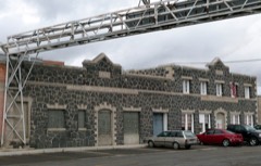
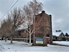
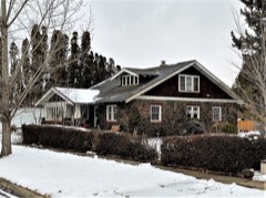
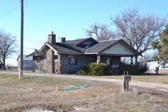
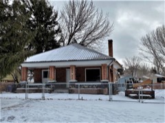
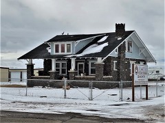
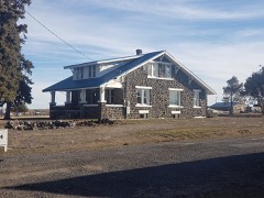
64 National Register listings published here.
Sources: the National Register database, National Park Service
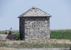
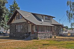
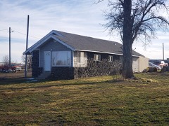
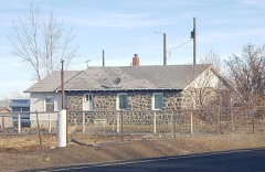
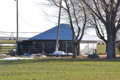
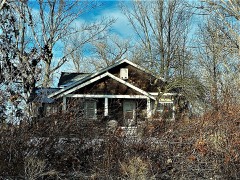
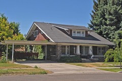
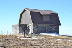
34 topographic sheets cover 15 settlements here, and 64 properties are on the National Register of Historic Places.
64 National Register listings published here.
Sources: the National Register database, National Park Service
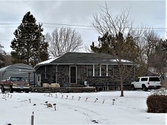
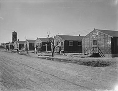
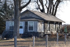
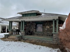
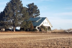
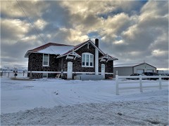
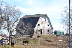
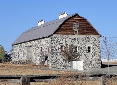
Every property in this county listed on the National Register of Historic Places, with the year it was listed and the federal nomination document.
Every wildfire the federal occurrence database records inside this county: 430 of them, burning about 145,768 acres. 59 started naturally and 18 were recorded as arson. Each settlement page carries the fires within five miles of it.
| Reported cause | Fires |
|---|---|
| Equipment and vehicle use | 112 |
| Missing data/not specified/undetermined | 79 |
| Natural | 59 |
| Debris and open burning | 42 |
| Power generation/transmission/distribution | 38 |
| Fireworks | 31 |
| Arson/incendiarism | 18 |
| Recreation and ceremony | 17 |
| Firearms and explosives use | 16 |
| Railroad operations and maintenance | 10 |
| Other causes | 4 |
| Misuse of fire by a minor | 2 |
| Smoking | 2 |
The five largest, by the area the report gives. None of them was recorded as arson.
| Date | Cause | Size | Reported by | Name on the report |
|---|---|---|---|---|
| 6 July 2007 | Power generation/transmission/distribution | 45,862 acres | Twin Falls District | RED BRIDGE |
| 10 August 2000 | Natural | 20,295 acres | Twin Falls District | HIGHPOINT |
| 24 June 2001 | Debris and open burning | 11,058 acres | Twin Falls District | BACONPOND |
| 31 July 2013 | Natural | 9,499 acres | Twin Falls District | SOUTHEAST RED BRIDGE |
| 1 August 2005 | Natural | 7,284 acres | Twin Falls District | ESTARLAKE |
| 2 July 2006 | Natural | 5,504 acres | Twin Falls District | 3 WELLS |
| 14 September 2005 | Equipment and vehicle use | 5,176 acres | Twin Falls District | WILSON |
| 31 July 2013 | Natural | 4,245 acres | Twin Falls District | CINDER ROAD |
Every settlement page carries the fires within five miles of it - see the settlement index below.
The NOAA Storm Events Database holds 51 reports for this county, causing no deaths, no injuries and about $2,780,500 in recorded property damage. Each settlement page carries the reports that name it.
| Kind of event | Reports |
|---|---|
| Thunderstorm Wind | 28 |
| Hail | 12 |
| Tornado | 6 |
| Flood | 4 |
| Lightning | 1 |
The most serious of them, by death, then injury, then recorded damage. The accounts are quoted exactly as the forecast office filed them.
| When | Event | Place named | Harm | What the report says |
|---|---|---|---|---|
| February 2017 | Flood | Jerome | $2,750,000 | Rainfall and rapid melting of low elevation snowpack on top of frozen and saturated soil led to widespread flooding. Many roads around Jerome were damaged and closed due to flood waters. Widespread flooding of agricultural lands occurred. |
| June 1990 | Tornado (F2) | not stated | $25,000 | no account filed |
| March 1988 | Tornado (F0) | not stated | $2,500 | no account filed |
| April 1988 | Tornado (F1) | not stated | $2,500 | no account filed |
| May 1993 | Tornado (F0) | not stated | $500 | A tornado touched down briefly near Milner Dam, 30 miles east of Twin Falls. A Jerome County Sheriff's Deputy reported a funnel cloud seven miles southeast of Jerome. |
| May 2025 | Thunderstorm Wind | Jerome | - | A tree branch with a width estimated to be 1.5 - 2 feet in diameter fell onto a parked car, causing significant damage to a parked car. Winds are estimated to be 65 MPH, given the size of the branch that fell while also taking into consideration that the branch appeared to be unhealthy in the image. |
| May 2025 | Thunderstorm Wind | Eden | - | Mesonet station 3251 D4 - Hansen Bridge recorded a wind gust of 79 MPH as a thunderstorm passed over. |
| December 2025 | Thunderstorm Wind | Jerome Co Arpt | - | The Idaho Transportation Department's Jerome Butte automated weather station observed a 62 mph wind gust coincident with the passage of a line of showers and embedded thunderstorms. Tree debris was strewn in the area. |
| December 2025 | Thunderstorm Wind | Jerome Co Arpt | - | A wind gust of 63 mph was measure at the KJER ASOS as a line of showers and embedded thunderstorms moved through. |
| August 2024 | Flood | Barrymore | - | Twin Falls County Sheriff dispatch office reported flooding near a construction zone on mile marker 70 on eastbound Interstate 84. This impacted construction activities and slowed traffic in the area. |
| January 2024 | Thunderstorm Wind | Mc Henry | - | Idaho Power reported 1,500 customers near Milner, Idaho were without power due to thunderstorm wind gusts. |
| May 2020 | Thunderstorm Wind | Hazelton Muni Arpt | - | The ITD21 weather station at mile post 190 on I-84 recorded a wind gust of 77 MPH. |
| October 2019 | Thunderstorm Wind | Jerome Co Arpt | - | Approximately 30 power line poles were reported down along U.S. Highway 93 between Twin Falls and Shoshone. |
| October 2019 | Thunderstorm Wind | Hazelton | - | A wind gust of 67 MPH was recorded at the ITD Valley interchange. |
| September 2019 | Hail | Eden | - | A trained spotter reported one inch hail near Eden. |
| September 2019 | Hail | Hazelton | - | One inch hail was reported at North Wilson, North of Hazelton, by a BLM fire crew. |
| June 2017 | Thunderstorm Wind | Barrymore | - | Social media reported trees down around Jerome and ITD21 measured a 60 MPH wind gust near Hazelton. |
| June 2017 | Thunderstorm Wind | Jerome | - | The local newspaper reported that a barn had collapsed and power poles were down just north of Jerome. |
| July 2017 | Thunderstorm Wind | Jerome | - | The Jerome Butte ITD station reported a wind gust of 64 MPH. |
| June 2016 | Thunderstorm Wind | Jerome Co Arpt | - | The ASOS at Jerome County Airport recorded a wind gust of 61 MPH at 1158 MDT. |
| June 2016 | Tornado (EF0) | Jerome Co Arpt | - | KMVT in Twin Falls relayed a video sent by a civilian of an EF0 tornado moving northwest to southeast along a gust front from a thunderstorm northeast of Jerome. The tornado began approximately 712 MDT and ended at 722 MDT. It was about 150 feet wide and moved through agricultural fields and no damage was reported. It is possible that the rotating column of air was a surface based gustnado since it was not clear if the updraft was connected to the parent thunderstorm. However, the rotating column had considerable height, strength and longevity. |
| July 2014 | Thunderstorm Wind | Jerome | - | One tree blown down and tin roofing removed from the roof of a barn in Jerome. Images forwarded by KMVT. |
| August 2014 | Flood | Barrymore | - | Most streets and roads were flooded around the county. Extensive crop damage was reported across most of the county. |
| August 2014 | Hail | Jerome | - | A trained spotter reported ping pong ball size hail covering most of the ground and damage to his corn crop. |
| July 2013 | Thunderstorm Wind | Jerome | - | A wind gust of 60 MPH was reported at the Jerome ASOS. |
| July 2013 | Hail | Mc Henry | - | The public reported at least golf ball sized hail between Kasota and Ridgeway roads near Hazelton. |
| May 2013 | Tornado (EF0) | Jerome | - | A Jerome County deputy reported a brief tornado touchdown. No damage was reported. |
| August 2013 | Hail | Jerome | - | Local media reported quarter sized hail around the Jerome, Idaho area. |
| August 2012 | Thunderstorm Wind | Jerome | - | KMVT television station reported a large tree was uprooted in Jerome, Idaho. |
| January 2011 | Flood | Jerome | - | The North Side Canal overflowed around the intersection of Tiger Drive and 16th Avenue East on Monday the 17th. City workers cleared mud and debris from streets and some homes and basements were flooded. |
| June 2010 | Thunderstorm Wind | Jerome Co Arpt | - | Jerome ASOS measure a 63 MPH wind gust from a thunderstorm. |
| August 2010 | Thunderstorm Wind | Jerome | - | Jerome County Sherrif dispatch reported trees and power lines down in the town of Jerome and the ASOS reported a wind gust of 67 MPH. |
| July 2008 | Thunderstorm Wind | Hazelton | - | Thunderstorm winds knocked down several trees and power lines and also damaged farm vehicles and irrigation pivots. |
| July 2008 | Hail | Hazelton | - | KMVT relayed a report of large hail up to 1.75 inches in Hazelton. |
| August 2003 | Thunderstorm Wind | Jerome | - | Wide spread thunderstorms moved into in Jerome County. These storms brought, heavy rain and strong winds that blew down trees and caused power outages in Jerome and Gooding counties. Blowing dust across Interstate 84 with visibilities as low as 10 feet caused several accidents. |
| May 1998 | Hail | Jerome | - | The Jerome County Sheriff reported 1.75 inch hailstones from a severe thunderstorm. |
| August 1997 | Hail | Jerome | - | A spotter in Jerome reported 7/8 inch hail with an evening thunderstorm. |
| June 2002 | Thunderstorm Wind | Jerome Co Arpt | - | no account filed |
| August 2000 | Thunderstorm Wind | Jerome | - | no account filed |
| July 1998 | Thunderstorm Wind | Jerome Co Arpt | - | no account filed |
| June 1998 | Hail | Jerome | - | no account filed |
| June 1996 | Lightning | Jerome County | - | no account filed |
| April 1992 | Thunderstorm Wind | not stated | - | no account filed |
| September 1989 | Thunderstorm Wind | not stated | - | no account filed |
| May 1984 | Thunderstorm Wind | not stated | - | no account filed |
| August 1979 | Hail | not stated | - | no account filed |
| July 1975 | Hail | not stated | - | no account filed |
| July 1970 | Thunderstorm Wind | not stated | - | no account filed |
| August 1968 | Thunderstorm Wind | not stated | - | no account filed |
| August 1965 | Thunderstorm Wind | not stated | - | no account filed |
| August 1963 | Hail | not stated | - | no account filed |
The Survey's mineral resources record lists 54 workings inside this county. 2 still produce and 52 are closed or unrecorded. Each settlement page carries the workings within five miles of it.
| Commodity | Workings |
|---|---|
| Sand and Gravel, Construction | 32 |
| Gold | 16 |
| Pumice | 3 |
| Pumice, Volcanic Materials | 1 |
| Geothermal | 1 |
| Clay | 1 |
The least common of them first, because a county's hundredth gravel pit says nothing its first ten did not.
| Where | Site | Commodity | Status | Recorded |
|---|---|---|---|---|
| Clay Caves | Clay | Unknown | ||
| Eden Butte Cinder Deposit | Pumice, Volcanic Materials | Producer | Cinders | |
| Unnamed Location | Geothermal | Occurrence | ||
| Cinder Pit | Pumice | Unknown | ||
| Cinder Pit | Pumice | Unknown | ||
| Cinder Pits | Pumice | Unknown | ||
| Murtaugh Placer Deposit | Gold | Past Producer | 1862 | |
| Snake River Placers | Gold | Past Producer | 1862 | |
| Snake River Placers | Gold | Past Producer | 1862 | |
| Snake River Placers | Gold | Past Producer | 1862 | |
| Snake River Placers | Gold | Past Producer | 1862 | |
| Snake River Placers | Gold | Past Producer | 1862 | |
| Snake River Placers | Gold | Past Producer | Placer | |
| Snake River Placers | Gold | Past Producer | 1862 | |
| Unnamed Location | Gold | Occurrence | ||
| Unnamed Location | Gold | Occurrence | ||
| Unnamed Location | Gold | Occurrence | ||
| Unnamed Location | Gold | Occurrence | ||
| Unnamed Location | Gold | Occurrence | ||
| Unnamed Location | Gold | Occurrence | ||
| Unnamed Location | Gold | Occurrence | ||
| Unnamed Location | Gold | Occurrence | ||
| Gravel Pit | Sand and Gravel, Construction | Unknown | ||
| Gravel Pit | Sand and Gravel, Construction | Past Producer | ||
| Gravel Pit | Sand and Gravel, Construction | Unknown | ||
| Gravel Pit | Sand and Gravel, Construction | Unknown | ||
| Gravel Pit | Sand and Gravel, Construction | Past Producer | ||
| Gravel Pit | Sand and Gravel, Construction | Unknown | ||
| Gravel Pit | Sand and Gravel, Construction | Unknown | ||
| Gravel Pit | Sand and Gravel, Construction | Past Producer | ||
| Gravel Pit | Sand and Gravel, Construction | Unknown | ||
| Gravel Pit | Sand and Gravel, Construction | Unknown | ||
| Gravel Pit | Sand and Gravel, Construction | Past Producer | ||
| Gravel Pit | Sand and Gravel, Construction | Unknown | ||
| Gravel Pit | Sand and Gravel, Construction | Unknown | ||
| Gravel Pit | Sand and Gravel, Construction | Unknown | ||
| Gravel Pit | Sand and Gravel, Construction | Unknown | ||
| Gravel Pit | Sand and Gravel, Construction | Unknown | ||
| Gravel Pit | Sand and Gravel, Construction | Past Producer | ||
| Gravel Pit | Sand and Gravel, Construction | Past Producer | ||
| Gravel Pit | Sand and Gravel, Construction | Past Producer | ||
| Gravel Pit | Sand and Gravel, Construction | Past Producer | ||
| Gravel Pit | Sand and Gravel, Construction | Unknown | ||
| Gravel Pit | Sand and Gravel, Construction | Unknown | ||
| Gravel Pit | Sand and Gravel, Construction | Unknown | ||
| Gravel Pit | Sand and Gravel, Construction | Unknown | ||
| Gravel Pit | Sand and Gravel, Construction | Unknown | ||
| Gravel Pit | Sand and Gravel, Construction | Unknown | ||
| Gravel Pit | Sand and Gravel, Construction | Past Producer | ||
| Gravel Pit | Sand and Gravel, Construction | Unknown | ||
| Gravel Pits | Sand and Gravel, Construction | Past Producer | ||
| Idaho Department of Higways | Sand and Gravel, Construction | Producer | ||
| Juchau Pit | Sand and Gravel, Construction | Unknown | ||
| Wendy Glenn Pit | Sand and Gravel, Construction | Unknown |
Named settlements recorded in the Geographic Names Information System, each with the topographic sheets covering it. Villages, hamlets and abandoned places alike. Each is shown with the nearest named watercourse or landform and the survey quadrangle it falls on.
Jerome census division · 83338 · Jerome quadrangle
11 sheets, 1950 to 1979
No longer a settlement
Eden-Hazelton census division · 83325 · Near Skeleton Butte · Eden quadrangle
8 sheets, 1955 to 1964
No longer a settlement
The vanished settlements of Jerome County: the places named above that are no longer on the map.