 Block
From the record
5 National Register listings published here.
Sources: the National Register database, National Park Service
17 topographic sheets cover 13 settlements here, and 5 properties are on the National Register of Historic Places.
5 National Register listings published here.
Sources: the National Register database, National Park Service
Every property in this county listed on the National Register of Historic Places, with the year it was listed and the federal nomination document.
| Photograph | Property | Type | Listed | Reference |
|---|---|---|---|---|
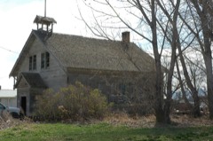 | Empire School | building | 2001 | 01000568 |
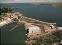 | Minidoka Dam and Power Plant | structure | 1974 | 74000746 |
| Rupert Town Square Historic District (Boundary Increase) | district | 2010 | 10000074 | |
| Rupert Town Square Historic District (Boundary Increase) | district | 2010 | 10000074 | |
| Wilson Theater | building | 2001 | 00001626 |
Every wildfire the federal occurrence database records inside this county: 83 of them, burning about 189,652 acres. 29 started naturally and 4 were recorded as arson. Each settlement page carries the fires within five miles of it.
| Reported cause | Fires |
|---|---|
| Natural | 29 |
| Equipment and vehicle use | 14 |
| Missing data/not specified/undetermined | 13 |
| Debris and open burning | 9 |
| Railroad operations and maintenance | 7 |
| Arson/incendiarism | 4 |
| Power generation/transmission/distribution | 4 |
| Fireworks | 1 |
| Other causes | 1 |
| Recreation and ceremony | 1 |
The five largest, by the area the report gives. None of them was recorded as arson.
| Date | Cause | Size | Reported by | Name on the report |
|---|---|---|---|---|
| 22 July 2005 | Natural | 47,592 acres | Idaho Falls District | RUPERT |
| 18 August 2008 | Equipment and vehicle use | 31,616 acres | Idaho Falls District | NORTH MINIDOKA |
| 16 August 2007 | Natural | 29,532 acres | Twin Falls District | BEAR DEN BUTTE |
| 7 August 1995 | Debris and open burning | 20,500 acres | Twin Falls District | BEARTRAP |
| 3 August 1992 | Natural | 9,819 acres | Twin Falls District | GREAT RIFT |
| 8 July 2012 | Natural | 7,935 acres | Twin Falls District | LAIDLAW |
| 6 August 2010 | Natural | 7,261 acres | Idaho Falls District | BEAR TRAP |
| 24 June 1999 | Natural | 7,187 acres | Twin Falls District | WHISKEYBT |
Every settlement page carries the fires within five miles of it - see the settlement index below.
The NOAA Storm Events Database holds 117 reports for this county, causing no deaths, no injuries and about $7,488,600 in recorded property damage. Each settlement page carries the reports that name it.
| Kind of event | Reports |
|---|---|
| Thunderstorm Wind | 82 |
| Hail | 19 |
| Tornado | 5 |
| Flood | 5 |
| Heavy Rain | 3 |
| Funnel Cloud | 3 |
The most serious of them, by death, then injury, then recorded damage. The accounts are quoted exactly as the forecast office filed them.
| When | Event | Place named | Harm | What the report says |
|---|---|---|---|---|
| February 2017 | Flood | Adelaide | $6,140,000 | A warmup very early in the month caused massive sheet flooding as the snow melt from extreme December and January snows began rapidly early in the month. Nearly all roads experienced major flooding with as much as 4 feet of water on some roadways. The county did not have enough signs to indicate all the road closures. By the 14th of the month the only main roadways north of Meridian Road that were open were 400 West Road and 600 West Road. Highway 24 from Rupert to Acequia was closed by the 12th. Many roads were lost due to the damage. A large number of homes received massive flooding damage. Rural home damage to wells and septic systems occurred contaminating water. The state declared Minidoka County a disaster with some of the most significant flood damage in the state occurring there. The city of Paul's main pump station became completely submerged under water. The month's damage in dollar amounts exceeded 6 million dollars. Over 50,000 sandbags were ordered. |
| March 2017 | Flood | Adelaide | $425,000 | Extensive flooding continued throughout Minidoka County in March although effects did diminish significantly from February. Road and property damage remained substantial however despite the improved conditions from February. |
| May 1991 | Tornado (F2) | not stated | $250,000 | no account filed |
| March 2006 | Thunderstorm Wind | Countywide | $240,000 | no account filed |
| July 1999 | Thunderstorm Wind | Rupert | $200,000 | Thunderstorm winds caused extensive damage to property in Rupert. Flying debris and downed trees damaged numerous vehicles and one home. The most extensive damage was a car dealership that lost part of its roof, which damaged or destoryed a number of vehicles. Power outages were widespread. |
| February 2000 | Thunderstorm Wind | Countywide | $80,000 | Near Rupert, a mesonet station recorded 96.3 mph wind gust, which is a new state wind speed record. Nearby, a home sustained roof damage and a its porch was torn off and destroyed. Three large signs were destroyed, one of which fell on a car. Several homes sustained minor roof damage. Several wheel line irrigation systems were damaged. |
| June 2005 | Thunderstorm Wind | Countywide | $30,000 | Southern Minidoka County was hit by severe thunderstorms. The Minidoka mesonet site recorded a wind gust of 72 mph. Several residents of Rupert were without power and two falling trees caused damage to a home on Third Street. Several downed trees were reported in Rupert. |
| June 2003 | Thunderstorm Wind | Paul | $20,000 | Thunderstorm wind overturned a trailer home in Paul. |
| December 2025 | Thunderstorm Wind | Rupert | $16,000 | Trees downed and 2 power poles snapped off along Idaho Highway 25 near Rupert. Power outages throughout the area. |
| May 2009 | Thunderstorm Wind | Paul | $15,000 | Microburst caused damage near Paul. Several large trees taken down, some on top of automobiles. Sheds were moved off foundations as well. |
| June 2015 | Thunderstorm Wind | Rupert | $10,000 | A tractor trailer was reported overturned on interstate 84 south of Rupert when strong thunderstorm winds passed through the region. |
| July 2012 | Thunderstorm Wind | Rupert | $10,000 | Minidoka County sherriff office reported power outages with trees taking down power lines. Roofs and buildings damaged and wheel lines blown into roads. Most of the damage reported in the city of Rupert. |
| December 2025 | Thunderstorm Wind | Minidoka | $8,000 | Multiple trees downed and power outage 12 miles west of Minidoka. |
| August 2022 | Thunderstorm Wind | Rupert | $7,000 | Seven large trees were blown down with some uprooted at the Rupert Country Club. Some were as large as two feet in diameter. |
| December 2025 | Thunderstorm Wind | Rupert | $6,000 | Trees and power lines downed in the area of the Idaho 25 Bridge over the Snake River. |
| June 1995 | Thunderstorm Wind | Malta | $5,000 | no account filed |
| December 2025 | Thunderstorm Wind | Rupert | $3,000 | Multiple large trees snapped off across Rupert, including a 2 to 3 foot diameter tree down on a house. Several roads were blocked. |
| May 2024 | Thunderstorm Wind | Rupert | $3,000 | Trees downed in Rupert. |
| August 2022 | Thunderstorm Wind | Rupert | $3,000 | A tree fell onto a Minivan near Rupert. |
| August 2022 | Thunderstorm Wind | Rupert | $3,000 | The public reported multiple trees downed in the city of Rupert. |
| December 2025 | Thunderstorm Wind | Paul | $2,500 | Large tree uprooted and power pole downed in Paul. |
| December 2025 | Thunderstorm Wind | Minidoka | $2,000 | A measured gust of 68 mph occurred southwest of Minidoka with an outhouse and chicken coop blown over. Wheel lines blown away as well. |
| May 2024 | Thunderstorm Wind | Paul | $2,000 | Two pine trees downed just north of Paul. |
| August 2022 | Thunderstorm Wind | Heyburn | $1,600 | A large tree was blown down near a wooden fence near the cozy coffee in Heyburn. Other large tree limbs reported down. |
| December 2025 | Thunderstorm Wind | Acequia | $1,000 | Tree downed in Acequia. |
| December 2025 | Thunderstorm Wind | Heyburn | $1,000 | Large pine tree uprooted near the intersection of W 300 S and Idaho Highway 27. |
| December 2025 | Thunderstorm Wind | Paul | $1,000 | Power pole snapped off along 600 W. |
| May 2024 | Thunderstorm Wind | Acequia | $1,000 | Pine tree uprooted north of Acequia. |
| May 2023 | Hail | Heyburn | $1,000 | Large hail did damage to awning in Heyburn. |
| August 2022 | Thunderstorm Wind | Rupert | $1,000 | Fence destroyed near intersection of S 300 W and W 50 Rd S near Rupert. |
| May 2018 | Thunderstorm Wind | Rupert | $500 | Severe thunderstorm winds damaged power lines in Rupert causing power outages for many Rupert residents. |
| May 2025 | Thunderstorm Wind | Minidoka | - | Thunderstorm wind gusts caused power outages northwest of Minidoka. |
| December 2025 | Thunderstorm Wind | Rupert | - | A 78 mph wind gust measured along E 300 N near N Meridian Road. |
| May 2024 | Thunderstorm Wind | Minidoka | - | The Minidoka ARL mesonet site recorded a 60 mph wind gust. |
| May 2024 | Thunderstorm Wind | Acequia | - | Idaho Power reported 1,100 customers without power across Minidoka, Hawley, Acequia, and Rupert. |
| May 2024 | Thunderstorm Wind | Paul | - | A 70 mph wind gust measured at site RPT1. |
| May 2024 | Thunderstorm Wind | Acequia | - | A private weather station recorded a 67 mph wind gust near intersection of 300 N and N 100 E. |
| May 2024 | Thunderstorm Wind | Burley | - | Idaho Power reported 550 customers without power from just west of Paul north to Idaho Highway 24. |
| June 2024 | Thunderstorm Wind | Minidoka | - | A 59 mph wind gust measured 6 miles northwest of Minidoka. |
| August 2024 | Thunderstorm Wind | Acequia | - | Idaho Power reported over 700 customers without power due to thunderstorm winds near Acequia. |
| May 2023 | Hail | Heyburn | - | Extensive wheat and beet crop damage near Heyburn due to shredding of vegetation by large hailstones. |
| May 2022 | Thunderstorm Wind | Minidoka | - | Mesonet site MIN recorded a 64 mph wind gust 6 miles northwest of Minidoka. |
| September 2022 | Thunderstorm Wind | Paul | - | The agrimet station RPTI1 recorded a 58 mph wind gust. |
| September 2021 | Thunderstorm Wind | Minidoka | - | Sixty mph 6 miles northwest of Minidoka. |
| October 2019 | Thunderstorm Wind | Paul | - | A tree was downed 5 miles west northwest of Paul. |
| October 2019 | Thunderstorm Wind | Minidoka | - | A 60 mph wind gust measured at the Minidoka mesonet station. |
| October 2019 | Thunderstorm Wind | Rupert | - | A large section of a tree down on 3rd st just east of H St in Rupert. Sheet metal debris strewn about the city. |
| October 2019 | Thunderstorm Wind | Acequia | - | The top half of a large pine tree snapped off just west of highway 24 near Acequia. Numerous other branches broken off nearby trees. |
| October 2019 | Thunderstorm Wind | Acequia | - | Tree reported by broadcast media in Jackson area. Near Cassia/Minidoka County border. |
| October 2019 | Thunderstorm Wind | Paul | - | The RPTI mesonet site recorded a 59 mph wind gust. |
| October 2019 | Thunderstorm Wind | Minidoka | - | A private weather station recorded a 66 mph wind gust near E 600 N and 700 Rd E. |
| October 2019 | Thunderstorm Wind | Acequia | - | A private weather station measured a 58 mph wind gust near the intersection of N 100 |E and E 300 N. |
| October 2019 | Thunderstorm Wind | Heyburn | - | Large evergreen tree snapped off near the base in Heyburn. |
| February 2019 | Flood | Rupert | - | Warm temperatures and rain associated with a long lasting atmospheric river led to extensive sheet flooding in Minidoka County. Several roads were closed in the Rupert and Paul areas with one gravel road washed away. |
| May 2018 | Hail | Heyburn | - | One inch hail reported in Heyburn. |
| May 2018 | Hail | Rupert | - | One inch hail reported in Rupert. |
| May 2018 | Hail | Rupert | - | One inch hail in Rupert. |
| January 2017 | Flood | Heyburn | - | A Couple of Cars needed to be removed from flood water at the intersection of 400S and 1150W west of Heyburn. Street flooding in Heyburn has resulted in the closure of some streets, particularly near the Snake River. |
| June 2017 | Thunderstorm Wind | Minidoka | - | The Minidoka ARL mesonet site measured a 59 mph thunderstorm wind gust. |
| June 2015 | Thunderstorm Wind | Heyburn | - | Strong thunderstorm winds blew over a wooden fence northeast of Heyburn. |
The Survey's mineral resources record lists 17 workings inside this county. 8 still produce and 9 are closed or unrecorded. Each settlement page carries the workings within five miles of it.
| Commodity | Workings |
|---|---|
| Sand and Gravel, Construction | 12 |
| Gold | 3 |
| Volcanic Materials | 1 |
| Clay | 1 |
The least common of them first, because a county's hundredth gravel pit says nothing its first ten did not.
| Where | Site | Commodity | Status | Recorded |
|---|---|---|---|---|
| Cinder Deposit | Volcanic Materials | Producer | ||
| Emerson Clay Pit | Clay | Producer | ||
| Rupert Placer | Gold | Past Producer | Placer | |
| Snake River Placers | Gold | Past Producer | Placer | |
| Snake River Placers | Gold | Past Producer | Placer | |
| Gravel Pit | Sand and Gravel, Construction | Past Producer | ||
| Gravel Pit | Sand and Gravel, Construction | Producer | ||
| Gravel Pit | Sand and Gravel, Construction | Unknown | ||
| Gravel Pit | Sand and Gravel, Construction | Producer | ||
| Gravel Pit | Sand and Gravel, Construction | Unknown | ||
| Gravel Pit | Sand and Gravel, Construction | Unknown | ||
| Gravel Pit | Sand and Gravel, Construction | Producer | ||
| Gravel Pit | Sand and Gravel, Construction | Past Producer | ||
| Gravel Pit | Sand and Gravel, Construction | Producer | ||
| Jackson Pit | Sand and Gravel, Construction | Producer | ||
| Kloepfer Crushing and Screening Plt | Sand and Gravel, Construction | Past Producer | ||
| Sand and Gravel Plant | Sand and Gravel, Construction | Producer |
Named settlements recorded in the Geographic Names Information System, each with the topographic sheets covering it. Villages, hamlets and abandoned places alike. Each is shown with the nearest named watercourse or landform and the survey quadrangle it falls on.