Block
From the record
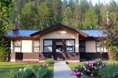
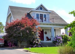
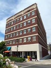
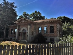
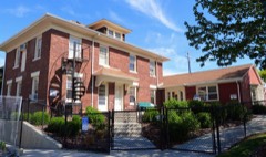
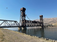
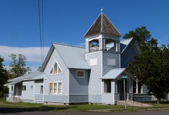
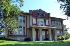
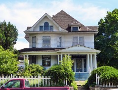
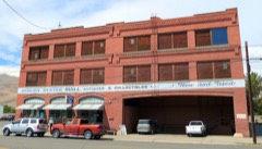
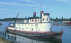
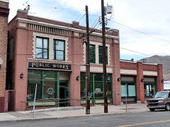
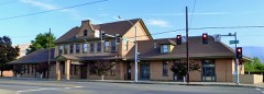
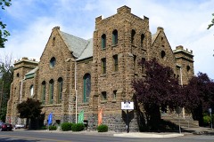
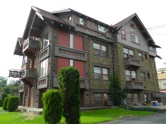
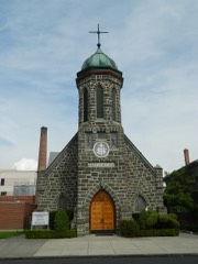
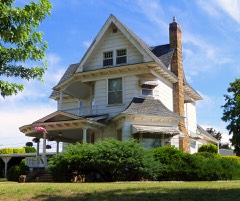
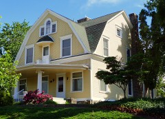
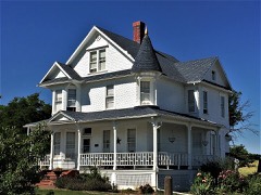
28 National Register listings published here.
Sources: the National Register database, National Park Service
55 topographic sheets cover 42 settlements here, and 28 properties are on the National Register of Historic Places.
28 National Register listings published here.
Sources: the National Register database, National Park Service
Every property in this county listed on the National Register of Historic Places, with the year it was listed and the federal nomination document.
Every wildfire the federal occurrence database records inside this county: 643 of them, burning about 192,963 acres. 134 started naturally and 15 were recorded as arson. Each settlement page carries the fires within five miles of it.
| Reported cause | Fires |
|---|---|
| Natural | 134 |
| Fireworks | 101 |
| Debris and open burning | 101 |
| Missing data/not specified/undetermined | 99 |
| Equipment and vehicle use | 95 |
| Smoking | 24 |
| Recreation and ceremony | 23 |
| Power generation/transmission/distribution | 19 |
| Arson/incendiarism | 15 |
| Misuse of fire by a minor | 12 |
| Other causes | 11 |
| Railroad operations and maintenance | 8 |
| Firearms and explosives use | 1 |
The five largest, by the area the report gives. None of them was recorded as arson.
| Date | Cause | Size | Reported by | Name on the report |
|---|---|---|---|---|
| 2 August 2014 | Natural | 65,200 acres | Cottonwood Field Office | BIG COUGAR |
| 13 July 2007 | Natural | 51,000 acres | Wallowa-Whitman National Forest | CHIMNEY COMPLEX |
| 15 July 2017 | Natural | 48,567 acres | Cottonwood Field Office | POWERLINE |
| 13 July 2007 | Equipment and vehicle use | 3,700 acres | Nez Perce Tribe | COYOTE CREEK |
| 18 August 2003 | Missing data/not specified/undetermined | 3,200 acres | Idaho Department of Lands | EAST OF ARROW |
| 15 July 2017 | Natural | 1,827 acres | Cottonwood Field Office | CORRAL CREEK |
| 26 July 2014 | Power generation/transmission/distribution | 1,630 acres | Nez Perce Tribe | CENTRAL GRADE |
| 30 September 2001 | Equipment and vehicle use | 1,595 acres | Idaho Department of Lands | CORRAL CREEK |
Every settlement page carries the fires within five miles of it - see the settlement index below.
The NOAA Storm Events Database holds 126 reports for this county, causing no deaths, 1 injury and about $8,870,500 in recorded property damage. Each settlement page carries the reports that name it.
| Kind of event | Reports |
|---|---|
| Thunderstorm Wind | 49 |
| Hail | 31 |
| Flash Flood | 14 |
| Flood | 14 |
| Funnel Cloud | 5 |
| Heavy Rain | 4 |
| Debris Flow | 4 |
| Tornado | 3 |
| Lightning | 2 |
The most serious of them, by death, then injury, then recorded damage. The accounts are quoted exactly as the forecast office filed them.
| When | Event | Place named | Harm | What the report says |
|---|---|---|---|---|
| July 1998 | Thunderstorm Wind | Lapwai | 1 hurt, $25,000 | power lines down and trees blown down. one tree blown down onto trailer house. 1 male injured. |
| May 2005 | Flash Flood | Lapwai | $4,000,000 | A slow moving thunderstorm moved 2 miles east of the town of Lapwai on the afternoon of the 8th of May. An estimated 2 to 3 inches fell across the headwaters of Garden Gulch Creek in about an hour. A flash flood then raced through Garden Gulch and flooded out structures, killed some livestock and washed out roads to the intersection of State Route 95 and Garden Gulch Road. An estimated 4 million dollars in property and roads was estimated in a five mile swath along Garden Gulch. |
| June 2023 | Flash Flood | East Lewiston | $1,000,000 | Flash flooding impacted several streets and avenues of Lewiston. It stalled vehicles and caused debris build up in the area. A local emergency was declared from damages sustained during the event. Half an inch of rain fell in 15 minutes from 1330LST to 1345LST. |
| June 2022 | Flood | Bundy | $1,000,000 | Us95 is down to one lane at milepost 296 due to flooding over roadway. time estimated based on dot report. |
| May 2005 | Flash Flood | Northeast Portion | $1,000,000 | no account filed |
| June 2022 | Flood | Bundy | $750,000 | Us95 is down to one lane at milepost 296 due to flooding over roadway. time estimated based on dot report. |
| April 2011 | Flood | North Lapwai | $600,000 | Flooding of several creeks and streams resulted in damage, closures, and evacuations along numerous roads along with minor flooding of six homes. Roads that were damaged include Webb Road, McCormack Ridge Road, Garden Gulch Road near Highway 95, Cottonwood Creek Road, Flatiron Road, and Mission Creek Road near Highway 95. Reservation Line Road and Webb Canal Road were also closed for a short time due to flooding. The worst of the flooding occurred along Webb Creek which flooded several low-lying areas, including the junction with Highway 95 and the junction with McCormick Ridge Road where reports stated water covered the bridge at the junction of McCormick Ridge Road. The Web Store Smoke Shop was inundated with approximately one foot of water. Around six homes along Webb Road experienced flooding up to the homes foundations. Mission Creek also spilled out of its banks with water reported to be flowing down Mission Creek Road, over the Mission Creek Bridge, and into nearby pastures and front yards. Sweetwater Creek, Lapwai Creek and Cottonwood Creek also had minor flooding with the Spalding church suffering the greatest damage. A culvert was plugged along Lapwai Creek near the intersection of Highway 95 and Garden Gulch Road causing road damage and a two day road closure. A plugged culvert along Sweetwater Creek led to approximately 30 feet of pavement erosion along Flatiron Road and 1500 feet of ditch and shoulder erosion. The Emergency Manager of Nez Perce County estimated flood damage to the roads was around $74,000 with most of the damage along Flatiron Road and Garden Gulch Road near Highway 95. On the Nez Perce Indian Reservation, at least one septic tank was compromised due to flooding. The flooding caused basement flooding in at least four homes throughout the reservation. Two private bridges were destroyed or compromised and classified as unsafe for use. |
| July 1998 | Flash Flood | Lewiston | $100,000 | an inch of rain in 30 minutes caused several streets to flood in downtown Lewiston. a couple of basements were flooded as up to a foot of water flowed in the streets. |
| May 2018 | Flood | East Lewiston | $50,000 | Heavy rain in and around Lewiston created numerous urban flooding problems during the morning of July 18th. A retention pond overflowed and caused a hillside washout with another hillside also suffering erosion damage. A number of roads and parking lots were flooded in the city and a block of apartments in low laying poor drainage areas suffered first floor and yard flooding. |
| September 1998 | Flash Flood | Lewiston | $40,000 | Over three quarters of an inch caused local flooding around the city of Lewiston. Flooding occurred on the interstate bridge, closing it for two hours. Several roads were covered by up to 2 feet of water. |
| July 1998 | Thunderstorm Wind | (Lws)Nez Perce Muni | $40,000 | 63 mph wind gust at the airport while 15 - 12 inch diameter trees blown down crushing a car. a roof of a shed was torn off. |
| September 1998 | Flash Flood | Lewiston | $30,000 | Rainfall amounts of up to 0.87" caused local flooding around the city of Lewiston, especially in parking lots and city streets. The heavy rain also caused several mudslides which closed roads. A lighting strike set a power pole on fire. |
| May 1962 | Tornado (F2) | not stated | $25,000 | no account filed |
| June 2022 | Flood | Sweetwater | $20,000 | Driveway washout reported to law enforcement for residence along us95. |
| June 2022 | Flood | Lapwai | $20,000 | The Lapwai church is flooded. it was unknown how deep the water was and extent of damage. |
| May 2018 | Flood | East Lewiston | $20,000 | Five main and 4 secondary roads in Latah County were washed out or otherwise damaged by heavy rains. |
| August 2005 | Thunderstorm Wind | Lewiston | $20,000 | A Canadian cold front moved across south central Idaho during the early evening hours of the 12th of August. A severe thunderstorm brought high wind gusts to the town of Lewiston and downed a few trees and caused damage to a few roofs. Damage estimates were on the order of twenty thousand dollars. |
| July 2014 | Thunderstorm Wind | East Lewiston | $10,000 | Weak thunderstorms passing through the area in the wake of two supercell thunderstorms brought strong winds along the Snake River Valley and Lewiston, Clarkston Area. Several small trees were blown down in Clarkston taking down power lines and damaging a residential fence. The storm also brought down scattered trees and limbs across Lewiston causing power outages and minor damage. |
| August 2008 | Thunderstorm Wind | Lewiston | $10,000 | no account filed |
| June 2022 | Flood | Lenore | $8,000 | Campground was flooded along school road. Report relayed via law enforcement. |
| July 2012 | Thunderstorm Wind | Webb | $8,000 | Thunderstorm winds knocked down several trees. There was also roof damage to an outbuilding. |
| August 2011 | Thunderstorm Wind | Lewiston Orchards | $7,000 | A highly localized microburst or possible gustnado resulted in minor damage of the Eagle Point subdivision approximately four miles east of downtown Lewiston. A section of a sheet metal roof was lifted off a two-story shop, a boat trailer was pushed into the outbuilding denting the sheet metal, three two-inch diameter trees were snapped, a travel trailer was knocked down, and lawn objects became airborne breaking one window of a house. |
| June 2015 | Debris Flow | East Lewiston | $5,000 | A member of the public reported rocks, mud, and debris covering US-95 road on the Lewiston, Grade not far from Lewiston, WA. |
| July 1998 | Thunderstorm Wind | Lewiston Orchards | $5,000 | power lines blown down. |
| June 1995 | Thunderstorm Wind | Lewiston | $5,000 | Strong winds in Lewiston knocked power lines down. |
| July 1995 | Thunderstorm Wind | Palouse Area | $5,000 | Winds gusted to 60 mph in the Palouse area. In Orofino trees were downed and at Peck over 70 trees at one farm were downed. |
| November 2010 | Thunderstorm Wind | Lewiston | $5,000 | no account filed |
| November 2010 | Thunderstorm Wind | Wana | $5,000 | no account filed |
| May 2006 | Thunderstorm Wind | Lewiston | $5,000 | no account filed |
| July 1995 | Thunderstorm Wind | Lewiston | $5,000 | no account filed |
| June 2015 | Flash Flood | East Lewiston | $4,500 | Public reported retaining walls washed out in port district of Lewiston, WA. The result was rocks, mud, and debris covering roadway. The report was through Facebook. |
| June 2015 | Flash Flood | Wana | $4,000 | A member of the public reported that heavy rain washed out road surface and damaged driveways on Waha Glenn Road in Waha, Idaho. They also reported one half inch hail covering the ground. |
| June 2008 | Thunderstorm Wind | Lewiston | $4,000 | no account filed |
| July 2012 | Thunderstorm Wind | Lewiston Orchards | $3,000 | A severe thunderstorm in the Blue Mountains over Columbia County in Washington produced a gust front that pushed through the Lewiston area. Lewiston Orchards seemed to feel the brunt of this outflow boundary with wind gusts up to 45 mph recorded at the Lewiston-Nez Perce County Airport. A few small trees were knocked over with trunks estimated at six to eight inches in diameter. Some small branches were broken off as well. |
| May 2006 | Flash Flood | Lewiston | $3,000 | no account filed |
| May 2023 | Flood | Wana | $2,000 | Bureau of Land Management of Idaho reported Eagle Creek Road in Nez Perce County had severe road damage from storms making travel impossible. Road is currently closed for repairs. |
| April 2019 | Flood | Lapwai | $2,000 | Lapwai Creek flooded bottom lands and flowed over Highway 95 in places between Lapwai and Culdesac causing the temporary closure of this primary route through the region. A few homes were threatened by the flood waters but no damage to any structures was reported. |
| June 2019 | Thunderstorm Wind | Lewiston | $2,000 | A member of the public reported large tree branches broken and power lines down in Lewiston. |
| June 2019 | Thunderstorm Wind | Lewiston | $2,000 | Law Enforcement reported power lines down at multiple locations in Lewiston. |
| July 2012 | Hail | Summit | $2,000 | Hail resulted in numerous dents to vehicles. |
| July 2012 | Hail | Summit | $2,000 | The hail caused major damage to a vehicle. |
| July 2012 | Hail | Myrtle | $2,000 | The hail caused numerous dents on vehicles. |
| June 2009 | Thunderstorm Wind | Lewiston | $2,000 | no account filed |
| June 2023 | Thunderstorm Wind | East Lewiston | $1,000 | Thunderstorm winds knocked down power lines and blew transformers. The report was along Snake River Avenue. |
| June 2022 | Flood | Lws Nez Perce Co Arp | $1,000 | Street closed due to urban flash flooding. Report received from Mping. |
| June 2022 | Flood | Webb | $1,000 | Webb road is closed due to flooding. time estimated. |
| June 2022 | Flood | Jacques | $1,000 | Mission creek road is closed due to flooding between Rock Creek and Terra View Dr. Approximately 1 foot of water is over the roadway. |
| December 2022 | Debris Flow | Lws Nez Perce Co Arp | $1,000 | Local media reported a small mudslide closing Vineyard Avenue for around 8 hours. Damage was minimal. |
| June 2019 | Thunderstorm Wind | Lapwai | $1,000 | The Nez Perce County Emergency Manager reported power lines blown down in the town of Lapwai. |
| June 2019 | Thunderstorm Wind | Culdesac | $1,000 | The Nez Perce County Emergency Manager reported a tree blown down in the town of Culdesac. |
| June 2015 | Flash Flood | East Lewiston | $1,000 | A Facebook post from the public noted that a retaining wall washed out along Nez Perce Drive which caused mud and rocks to spill out onto the roadway in Lewiston, WA. |
| August 2000 | Thunderstorm Wind | Lapwai | $1,000 | Thunderstorm winds blew down large tree branches southwest of Lapwai and blew down road signs near Culdesac. This thunderstorm also stirred up large amounts of blowing dust which reduced visibility to near zero at times. |
| May 2023 | Thunderstorm Wind | East Lewiston | $500 | Gusty outflow wind knocked down tree. Lewiston airport recorded a wind gust of 49 MPH at 1530 LST. |
| February 2020 | Debris Flow | Myrtle | $500 | A rock slide was reported to Law Enforcement blocking one lane of Highway 12 near Myrtle. |
| December 2017 | Debris Flow | Peck | $500 | Heavy rain and snow melt saturated the ground and caused a Debris Flow near Peck. The mudslide was reported to be 3 to 4 feet deep and about 30 feet wide across Sunnyside Bench Road. |
| June 2015 | Thunderstorm Wind | Culdesac | $500 | A member of law enforcement reported trees down on highway 395 at Mission Creek Road which is 3 miles west of Culdesac, ID. |
| June 2015 | Thunderstorm Wind | Culdesac | $500 | A member of law enforcement reported trees down on highway 395 around 2 miles east southeast of Culdesac, Idaho. |
| May 2015 | Thunderstorm Wind | Lewiston | $500 | Lewiston area utility company reported a number of tree limbs blown onto roads and into power-lines causing power outages between 8 PM and 1030 PM. |
| August 2014 | Lightning | East Lewiston | $500 | Trained Spotter measured thirty-two hundreths of rain in span of ten minutes under a heavy thunderstorm. Lightning hit and exploded a nearby telephone pole. Spotter was located two miles east of Lewiston. |
| June 2015 | Flash Flood | Lapwai | $100 | Law enforcement reported water over painted horse lane in Lapwai, Idaho. |
The Survey's mineral resources record lists 61 workings inside this county. 26 still produce and 35 are closed or unrecorded. Each settlement page carries the workings within five miles of it.
| Commodity | Workings |
|---|---|
| Sand and Gravel, Construction | 21 |
| Copper | 11 |
| Gold | 8 |
| Silver | 6 |
| Stone | 5 |
| Limestone, General | 4 |
| Silver, Copper | 3 |
| Pumice | 2 |
| Limestone, General, Stone, Crushed/Broken | 2 |
| Stone, Crushed/Broken | 2 |
| Marble, Dimension, Stone, Crushed/Broken | 1 |
| Granite | 1 |
| Silica | 1 |
| Clay | 1 |
The least common of them first, because a county's hundredth gravel pit says nothing its first ten did not.
| Where | Site | Commodity | Status | Recorded |
|---|---|---|---|---|
| Chimney Creek Marble Quarry | Marble, Dimension, Stone, Crushed/Broken | Past Producer | Metamorphic | |
| Copper Springs Prospect | Copper, Silver, Gold | Past Producer | ||
| Corral Creek Granite Quarry | Granite, Silica | Past Producer | Granite | |
| Cottonwood Creek Adit | Silver, Gold, Copper | Prospect | ||
| Deer Creek Mine | Gold, Copper, Silver, Molybdenum | Producer | Chalcopyrite, Sylvanite | |
| Horseman's Prospect | Copper, Silver, Gold, Molybdenum | Prospect | Chalcopyrite, Chrysocolla, Copper, Molybdenite | |
| Lime Point Limestone Deposit | Limestone, General, Stone, Crushed/Broken, Limestone, Dimension | Past Producer | 1875 | |
| Mason-Dixon Mine | Silica, Sand and Gravel, Construction | Producer | Unconsolidated Sediments | |
| Mill Creek Limestone Deposit | Limestone, General, Stone, Crushed/Broken, Marble, Dimension | Past Producer | Metamorphic | |
| Mission Creek Lime Quarry | Calcium | Past Producer | ||
| Tammany Creek Clay Occurrence No. 28 | Clay | Occurrence | Clay | |
| Bedrock Creek Limestone Mine | Limestone, General, Stone, Crushed/Broken, Copper | Past Producer | Limestone | |
| Billy Creek Pumicite Occurrence | Pumice | Occurrence | ||
| Captain John Creek Pumicite Occurrence | Pumice | Occurrence | ||
| McGregor Pit | Stone, Crushed/Broken | Producer | ||
| Peck Pit | Stone, Crushed/Broken | Producer | ||
| Cache Creek Rapids Adit | Gold, Silver, Copper | Prospect | ||
| Riggs Quarry | Gold, Silver, Copper | Prospect | ||
| Rosebud | Gold, Silver, Copper | Past Producer | ||
| Captain John Creek Limestone Deposit | Limestone, General | Past Producer | Limestone | |
| Madden Creek Limestone Deposit | Limestone, General | Past Producer | Limestone | |
| Peacock Copper | Limestone, General | Occurrence | ||
| Wooster Claim | Limestone, General | Occurrence | ||
| Barnes Pit | Stone | Producer | ||
| Buchanan Quarry | Stone | Producer | ||
| Kaufman Quarry | Stone | Producer | ||
| Northwest Aggregates | Stone | Past Producer | ||
| Spalding Pit | Stone | Producer | ||
| Gold Leaf | Gold, Silver | Occurrence | ||
| Gold Pan | Silver | Prospect | ||
| Hether Group | Gold, Silver | Prospect | ||
| Yellowboy Mine | Gold, Silver | Prospect | ||
| Sylvanite Gold-Copper Property | Gold, Copper | Occurrence | ||
| Empress No.1&2 | Copper | Prospect | ||
| Evening Star Lode | Copper | Prospect | ||
| Evergreen Mine | Copper | Prospect | ||
| Fadio | Copper | Unknown | ||
| Gold Ring | Copper | Prospect | ||
| Golden Crown Group | Copper | Unknown | ||
| Prospects No.15 | Copper | Unknown | ||
| Crystal Sand and Gravel | Sand and Gravel, Construction | Past Producer | ||
| Duthie Pit | Sand and Gravel, Construction | Producer | ||
| Gravel Pit | Sand and Gravel, Construction | Producer | ||
| Gravel Pit | Sand and Gravel, Construction | Producer | ||
| Gravel Pit | Sand and Gravel, Construction | Unknown | ||
| Gravel Pit | Sand and Gravel, Construction | Producer | ||
| Gravel Pit | Sand and Gravel, Construction | Producer | ||
| Gravel Pit | Sand and Gravel, Construction | Producer | ||
| Gravel Pit | Sand and Gravel, Construction | Producer | ||
| Gravel Pit | Sand and Gravel, Construction | Producer | ||
| Gravel Pit | Sand and Gravel, Construction | Producer | ||
| Gravel Pit | Sand and Gravel, Construction | Producer | ||
| Gravel Pit | Sand and Gravel, Construction | Producer | ||
| Gravel Pit | Sand and Gravel, Construction | Producer | ||
| Gravel Pit | Sand and Gravel, Construction | Producer | ||
| Gravel Pit | Sand and Gravel, Construction | Producer | ||
| Gravel Pit | Sand and Gravel, Construction | Producer | ||
| Lewiston Hill Grade Pit Np-11s | Sand and Gravel, Construction | Producer | ||
| Mission | Sand and Gravel, Construction | Producer | ||
| Paffile Pit | Sand and Gravel, Construction | Past Producer | ||
| Spalding Pit | Sand and Gravel, Construction | Producer |
Named settlements recorded in the Geographic Names Information System, each with the topographic sheets covering it. Villages, hamlets and abandoned places alike. Each is shown with the nearest named watercourse or landform and the survey quadrangle it falls on.
Nez Perce census division · 83541 · Near Rattlesnake Canyon · Lenore quadrangle
10 sheets, 1955 to 1990
Nez Perce census division · 83535 · On Potlatch River · Lapwai quadrangle
10 sheets, 1955 to 1981
Nez Perce census division · 83540 · Near Thiessen Gulch · Sweetwater quadrangle
9 sheets, 1955 to 1981
Nez Perce census division · 83535 · Near Fir Island · Juliaetta quadrangle
10 sheets, 1955 to 1990
Nez Perce census division · 83524 · Near Polly Ridge · Culdesac South quadrangle
9 sheets, 1955 to 1985
No longer a settlement
Lewiston census division · 83501 · Lewiston Orchards North quadrangle
9 sheets, 1955 to 1981
Nez Perce census division · 83524 · On Mission Creek · Culdesac South quadrangle
9 sheets, 1955 to 1985
Nez Perce census division · 83540 · On Lapwai Creek · Lapwai quadrangle
10 sheets, 1955 to 1981
Nez Perce census division · 83540 · Near Soldiers Canyon · Lapwai quadrangle
10 sheets, 1955 to 1981
Nez Perce census division · 83541 · On Jacks Creek · Lenore quadrangle
10 sheets, 1955 to 1990
Lewiston census division · 83501 · Near Holbrook Island · Clarkston quadrangle
12 sheets, 1945 to 1981
Lewiston census division · 83501 · Lewiston Orchards North quadrangle
9 sheets, 1955 to 1981
Nez Perce census division · 83535 · On Cottonwood Creek · Culdesac North quadrangle
9 sheets, 1955 to 1984
Nez Perce census division · 83540 · Near Coyote Gulch · Lapwai quadrangle
10 sheets, 1955 to 1981
Lewiston census division · 83501 · On Lindsay Creek · Clarkston quadrangle
12 sheets, 1945 to 1981
Nez Perce census division · 83545 · On Little Canyon Creek · Peck quadrangle
8 sheets, 1924 to 1981
Nez Perce census division · 83540 · Near McCormack Ridge · Sweetwater quadrangle
9 sheets, 1955 to 1981
No longer a settlement
Leland census division · 83537 · Near Potlatch Ridge · Southwick quadrangle
10 sheets, 1955 to 1990
Nez Perce census division · 83540 · Near Lapwai Valley · Lapwai quadrangle
10 sheets, 1955 to 1981
Nez Perce census division · 83540 · On Sweetwater Creek · Sweetwater quadrangle
9 sheets, 1955 to 1981
Leland census division · 83537 · Lenore quadrangle
10 sheets, 1955 to 1990
No longer a settlement
Lewiston census division · 83501 · On Captain John Creek · Captain John Rapids quadrangle
9 sheets, 1946 to 1981
Lewiston census division · 83501 · On Clearwater River · Clarkston quadrangle
12 sheets, 1945 to 1981
Lewiston census division · 83501 · On Lindsay Creek · Lewiston Orchards North quadrangle
9 sheets, 1955 to 1981
Nez Perce census division · 83540 · On Webb Creek · Sweetwater quadrangle
9 sheets, 1955 to 1981
Nez Perce census division · 83541 · Near Rattlesnake Canyon · Lenore quadrangle
10 sheets, 1955 to 1990
Lewiston census division · 83555 · Near Craig Mountain · Frye Point quadrangle
10 sheets, 1946 to 1981
The vanished settlements of Nez Perce County: the places named above that are no longer on the map.