 Block
From the record
One of 28 National Register listings published here for Nez Perce County · listed in 2018 · category: District.
Sources: the case file at the National Archives · the National Register database, National Park Service
Listed on the National Register of Historic Places in 2018.
One of 28 National Register listings published here for Nez Perce County · listed in 2018 · category: District.
Sources: the case file at the National Archives · the National Register database, National Park Service
Regional context, not property-specific evidence. The federal wildfire occurrence database lists 1 fire within 5 miles of Lewiston Historic District in 2018, burning about 283 acres in total. None started naturally. None was recorded as arson. Distance is straight-line from the map coordinates, so a fire counted here may appear on a neighbouring settlement's page as well.
| Reported cause | Fires |
|---|---|
| Equipment and vehicle use | 1 |
The most recent of them, most recent first, with the day each was reported and the service that recorded it.
| Date | Cause | Size | Reported by | Name on the report |
|---|---|---|---|---|
| 11 August 2018 | Equipment and vehicle use | 283 acres | Idaho Department of Lands | MILE MARKER 319 |
Regional context, not property-specific evidence. The federal mineral resources record lists 20 workings within 5 miles of Lewiston Historic District: 12 past producers, 8 producers. 8 still produce. What was taken out: Sand and Gravel, Construction, Stone, Crushed/Broken, Stone, Flagstone. Distance is straight-line from the map coordinates, so a quarry counted here may appear on a neighbouring settlement's page as well.
| Where | Site | Commodity | Status | Recorded |
|---|---|---|---|---|
| Clarkston Placer | Gold, Zirconium, Titanium, Iron | Past Producer | ||
| Clarkston Quarry | Flagstone | Past Producer | ||
| Barnes Pit | Stone | Producer | ||
| Borrow Pit | Stone, Crushed/Broken | Past Producer | ||
| Collins Quarry | Stone, Crushed/Broken | Past Producer | ||
| Kaufman Quarry | Stone | Producer | ||
| McGregor Pit | Stone, Crushed/Broken | Producer | ||
| Northwest Aggregates | Stone | Past Producer | ||
| Clarkston Pit | Sand and Gravel, Construction | Past Producer | ||
| Clarkston Pit | Sand and Gravel, Construction | Past Producer |
Regional context, not property-specific evidence. The National Weather Service names Lewiston, the town this property stands in, in 43 storm reports between 1995 and 2023: 19 thunderstorm wind, 9 flash flood, 3 heavy rain, 3 funnel cloud. No death or injury is recorded in these reports. Each account below is quoted exactly as the forecast office filed it, from the NOAA Storm Events Database, and each date opens the federal record of that event.
| When | Event | Place named | Harm | What the report says |
|---|---|---|---|---|
| June 2023 | Flash Flood | East Lewiston | $1,000,000 | Flash flooding impacted several streets and avenues of Lewiston. It stalled vehicles and caused debris build up in the area. A local emergency was declared from damages sustained during the event. Half an inch of rain fell in 15 minutes from 1330LST to 1345LST. |
| July 1998 | Flash Flood | Lewiston | $100,000 | an inch of rain in 30 minutes caused several streets to flood in downtown Lewiston. a couple of basements were flooded as up to a foot of water flowed in the streets. |
| May 2018 | Flood | East Lewiston | $50,000 | Heavy rain in and around Lewiston created numerous urban flooding problems during the morning of July 18th. A retention pond overflowed and caused a hillside washout with another hillside also suffering erosion damage. A number of roads and parking lots were flooded in the city and a block of apartments in low laying poor drainage areas suffered first floor and yard flooding. |
| September 1998 | Flash Flood | Lewiston | $40,000 | Over three quarters of an inch caused local flooding around the city of Lewiston. Flooding occurred on the interstate bridge, closing it for two hours. Several roads were covered by up to 2 feet of water. |
| September 1998 | Flash Flood | Lewiston | $30,000 | Rainfall amounts of up to 0.87" caused local flooding around the city of Lewiston, especially in parking lots and city streets. The heavy rain also caused several mudslides which closed roads. A lighting strike set a power pole on fire. |
| May 2018 | Flood | East Lewiston | $20,000 | Five main and 4 secondary roads in Latah County were washed out or otherwise damaged by heavy rains. |
| August 2005 | Thunderstorm Wind | Lewiston | $20,000 | A Canadian cold front moved across south central Idaho during the early evening hours of the 12th of August. A severe thunderstorm brought high wind gusts to the town of Lewiston and downed a few trees and caused damage to a few roofs. Damage estimates were on the order of twenty thousand dollars. |
| July 2014 | Thunderstorm Wind | East Lewiston | $10,000 | Weak thunderstorms passing through the area in the wake of two supercell thunderstorms brought strong winds along the Snake River Valley and Lewiston, Clarkston Area. Several small trees were blown down in Clarkston taking down power lines and damaging a residential fence. The storm also brought down scattered trees and limbs across Lewiston causing power outages and minor damage. |
| August 2008 | Thunderstorm Wind | Lewiston | $10,000 | no account filed |
| June 2015 | Debris Flow | East Lewiston | $5,000 | A member of the public reported rocks, mud, and debris covering US-95 road on the Lewiston, Grade not far from Lewiston, WA. |
| June 1995 | Thunderstorm Wind | Lewiston | $5,000 | Strong winds in Lewiston knocked power lines down. |
| November 2010 | Thunderstorm Wind | Lewiston | $5,000 | no account filed |
| May 2006 | Thunderstorm Wind | Lewiston | $5,000 | no account filed |
| July 1995 | Thunderstorm Wind | Lewiston | $5,000 | no account filed |
| June 2015 | Flash Flood | East Lewiston | $4,500 | Public reported retaining walls washed out in port district of Lewiston, WA. The result was rocks, mud, and debris covering roadway. The report was through Facebook. |
| June 2008 | Thunderstorm Wind | Lewiston | $4,000 | no account filed |
| May 2006 | Flash Flood | Lewiston | $3,000 | no account filed |
| June 2019 | Thunderstorm Wind | Lewiston | $2,000 | A member of the public reported large tree branches broken and power lines down in Lewiston. |
| June 2019 | Thunderstorm Wind | Lewiston | $2,000 | Law Enforcement reported power lines down at multiple locations in Lewiston. |
| June 2009 | Thunderstorm Wind | Lewiston | $2,000 | no account filed |
| June 2023 | Thunderstorm Wind | East Lewiston | $1,000 | Thunderstorm winds knocked down power lines and blew transformers. The report was along Snake River Avenue. |
| June 2015 | Flash Flood | East Lewiston | $1,000 | A Facebook post from the public noted that a retaining wall washed out along Nez Perce Drive which caused mud and rocks to spill out onto the roadway in Lewiston, WA. |
| May 2023 | Thunderstorm Wind | East Lewiston | $500 | Gusty outflow wind knocked down tree. Lewiston airport recorded a wind gust of 49 MPH at 1530 LST. |
| May 2015 | Thunderstorm Wind | Lewiston | $500 | Lewiston area utility company reported a number of tree limbs blown onto roads and into power-lines causing power outages between 8 PM and 1030 PM. |
| August 2014 | Lightning | East Lewiston | $500 | Trained Spotter measured thirty-two hundreths of rain in span of ten minutes under a heavy thunderstorm. Lightning hit and exploded a nearby telephone pole. Spotter was located two miles east of Lewiston. |
| June 2015 | Flash Flood | East Lewiston | $100 | A Facebook post from the public noted that water up to 6 inches deep pooled in the parking lot of the Red Lion Hotel in Lewiston, Idaho due to the heavy rain from thunderstorms. |
| March 2022 | Funnel Cloud | Lewiston | - | A cold core funnel was spotted near Lewiston Hill by several public sources. The location was estimated based on reports and pictures. It did not impact people or property. |
| July 2019 | Thunderstorm Wind | East Lewiston | - | A local newspaper reported a tree blown down in Lewiston due to a thunderstorm wind gust. No damage was reported. Time estimated from radar data. The local utility company reported 2400 customers without power in the Lewiston and Clarkston area as a result of thunderstorm winds bringing down power lines. |
| April 2017 | Thunderstorm Wind | East Lewiston | - | The Wheatland Fire Station near Lewiston measured a wind gust of 66 mph with estimated 50 mph sustained winds for a brief period. Scattered power outages were noted around Nez Perce County by the Emergency Manager. |
| April 2017 | Thunderstorm Wind | East Lewiston | - | The Shirrod Hill Mesonet station reported a wind gust of 62 mph as a thunderstorm gust front passed through the area. The ASOS station at the Lewiston Airport reported a wind gust of 56 mph. |
| June 2015 | Flash Flood | East Lewiston | - | A Facebook from the public noted that standing water several inches deep collected on Southway Avenue in Lewiston, Idaho. |
| June 2013 | Heavy Rain | East Lewiston | - | A CWOP mesonet site in Lewiston recorded 0.51 in twenty minutes. The intense rainfall overwhelmed the city's infrastructure leading to urban flooding and closed streets. Among the closures were G Street, Adams Lane, and Idaho Street. Nearly a foot of water was observed on sections of the blue bridge. The water receded within an hour and no injuries or damage was reported in this event. |
| March 1998 | Funnel Cloud | Lewiston | - | Spotter reported funnel cloud which did not touch down |
| July 1997 | Lightning | Lewiston | - | Local paper reported 300 acre grass fire started by lightning |
| May 1997 | Thunderstorm Wind | Lewiston | - | 57 mph thunderstorm gust |
| May 1997 | Tornado (F0) | Lewiston | - | eyewitness interviewed, concluded f0 tornado |
| June 2012 | Thunderstorm Wind | East Lewiston | - | no account filed |
| June 2012 | Hail | Lewiston | - | no account filed |
| June 2010 | Heavy Rain | East Lewiston | - | no account filed |
| April 2006 | Hail | Lewiston | - | no account filed |
| May 2000 | Hail | Lewiston | - | no account filed |
| May 2000 | Funnel Cloud | Lewiston | - | no account filed |
| May 1996 | Heavy Rain | Lewiston | - | no account filed |
No historic map-sheet match is published for this property yet. That does not mean no map exists. This record needs a coordinate-quality review before it can be joined to a sheet boundary. Browse the county's mapped places while that work is pending.
Other National Register properties close enough to walk or drive between, ordered by distance from this one. Both positions come from the same geocoding pass that matched these properties to their map sheets.
| Photograph | Property | Distance | Listed |
|---|---|---|---|
| Lewiston Historic District (Boundary Increase) | under 500 feet | 1984 | |
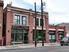 | Lewiston City Hall | under 500 feet | 1982 |
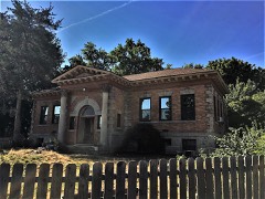 | Carnegie Library | 0.2 miles | 2018 |
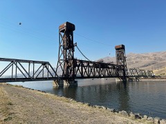 | Clearwater River Camas Prairie Railroad Bridge | 0.3 miles | 2025 |
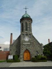 | St. Stanislaus Catholic Church | 0.5 miles | 1978 |
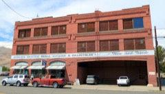 | Idaho Grocery Warehouse and Annex | 0.6 miles | 1982 |
| National Archives record | The nomination case file for reference 75000637 in Record Group 79. |
| Nez Perce County | All 28 listed properties in this county. |