 Block
From the record
15 National Register listings published here.
Sources: the National Register database, National Park Service
40 topographic sheets cover 17 settlements here, and 15 properties are on the National Register of Historic Places.
15 National Register listings published here.
Sources: the National Register database, National Park Service
Every property in this county listed on the National Register of Historic Places, with the year it was listed and the federal nomination document.
| Photograph | Property | Type | Listed | Reference |
|---|---|---|---|---|
 | David C. Chase House | building | 1978 | 78001091 |
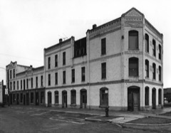 | Coughanour Apartment Block | building | 1978 | 78001092 |
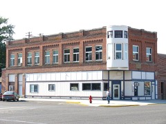 | N. A. Jacobsen Building | building | 1982 | 82000358 |
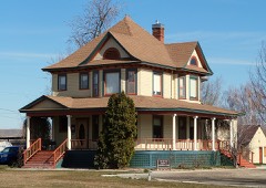 | N.A. Jacobsen House | building | 1998 | 97001610 |
| McCall District Administrative Site | building | 1991 | 91001892 | |
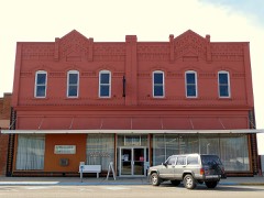 | A. B. Moss Building | building | 1978 | 78001093 |
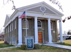 | New Plymouth Congregational Church | building | 1982 | 82000359 |
 | J. C. Palumbo Fruit Company Packing Warehouse Building | building | 1982 | 82000360 |
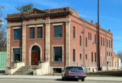 | Payette City Hall and Courthouse | building | 1979 | 79000808 |
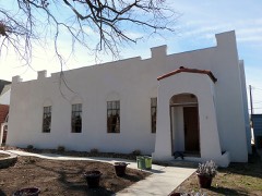 | Portia Club | building | 2010 | 10000159 |
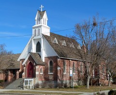 | St. James Episcopal Church | building | 1978 | 78001094 |
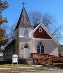 | St. John's Church | building | 2013 | 13000353 |
 | US Post Office-Payette Main | building | 1989 | 89000134 |
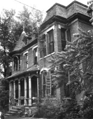 | Grant Whitney House | building | 1978 | 78001095 |
 | Woodward Building | building | 1978 | 78001096 |
Every wildfire the federal occurrence database records inside this county: 97 of them, burning about 33,335 acres. 17 started naturally and 6 were recorded as arson. Each settlement page carries the fires within five miles of it.
| Reported cause | Fires |
|---|---|
| Missing data/not specified/undetermined | 26 |
| Equipment and vehicle use | 22 |
| Natural | 17 |
| Firearms and explosives use | 8 |
| Arson/incendiarism | 6 |
| Recreation and ceremony | 5 |
| Debris and open burning | 5 |
| Power generation/transmission/distribution | 4 |
| Fireworks | 2 |
| Smoking | 1 |
| Other causes | 1 |
The five largest, by the area the report gives. None of them was recorded as arson.
| Date | Cause | Size | Reported by | Name on the report |
|---|---|---|---|---|
| 31 August 2007 | Natural | 10,238 acres | Boise District | SANDY |
| 11 August 1996 | Missing data/not specified/undetermined | 9,748 acres | Boise District | APPLEVALLE |
| 13 August 1996 | Natural | 2,960 acres | Boise District | INDIAN CK |
| 20 August 1992 | Missing data/not specified/undetermined | 1,545 acres | Boise District | BANISTER |
| 14 July 2019 | Natural | 1,529 acres | Boise District | HEART |
| 13 July 2007 | Natural | 958 acres | Boise District | ROCK |
| 3 September 2018 | Missing data/not specified/undetermined | 844 acres | Boise District | PEARLY |
| 23 July 2007 | Missing data/not specified/undetermined | 512 acres | Boise District | PEARLIE |
Every settlement page carries the fires within five miles of it - see the settlement index below.
The NOAA Storm Events Database holds 51 reports for this county, causing no deaths, 3 injuries and about $1,542,000 in recorded property damage. Each settlement page carries the reports that name it.
| Kind of event | Reports |
|---|---|
| Thunderstorm Wind | 31 |
| Hail | 10 |
| Flood | 3 |
| Heavy Rain | 3 |
| Tornado | 2 |
| Wildfire | 1 |
| Flash Flood | 1 |
The most serious of them, by death, then injury, then recorded damage. The accounts are quoted exactly as the forecast office filed them.
| When | Event | Place named | Harm | What the report says |
|---|---|---|---|---|
| June 2024 | Hail | New Plymouth | 3 hurt | Hail from a storm that was approximately one inch in diameter accumulated three inches deep on I-84 near Exit 9 and caused slick roads and 2 car accidents. |
| June 2010 | Flood | Payette | $1,000,000 | Moderate flooding occured in and around Payette along the Payette River. |
| April 1995 | Thunderstorm Wind | Payette | $500,000 | A large organized area of convection produced winds in excess of 60 mph from Rome, Oregon to Payette, Idaho, a storm path of over 130 miles with a width of up to 100 miles, from Baker City, Oregon to just northwest of Boise, with reports being received over a four hour period. The storm displayed characteristics of a large bow echo, which is not commonly observed west of the Continental Divide. Winds were measured over 60 mph at a number of locations, and trees were knocked over causing blackouts and damaging homes. |
| July 1983 | Tornado (F1) | not stated | $25,000 | no account filed |
| May 1996 | Thunderstorm Wind | New Plymouth | $5,000 | no account filed |
| May 1996 | Thunderstorm Wind | New Plymouth | $5,000 | no account filed |
| July 1995 | Hail | New Plymouth | $5,000 | no account filed |
| March 2017 | Flood | New Plymouth | $2,000 | Flooding occurred along the Payette River around the Payette, Idaho area and surrounding fields and roads. |
| May 2024 | Heavy Rain | Buckingham | - | The mesonet station, DW6467, in Fruitland measured 0.73 inches of rain. |
| June 2024 | Thunderstorm Wind | New Plymouth | - | A large diameter branch fell on a powerline and started a house fire, causing significant damage to the structure. |
| July 2024 | Thunderstorm Wind | New Plymouth | - | A metal roof was blown off a home in New Plymouth, ID. |
| July 2024 | Thunderstorm Wind | Fruitland | - | A tree with a diameter of twelve inches was snapped off. |
| March 2023 | Heavy Rain | New Plymouth | - | The mesonet station DW6457 near New Plymouth, ID measured 0.87 inches of heavy rain. |
| June 2022 | Hail | Payette | - | A spotter reported quarter size hail. |
| June 2022 | Hail | Payette | - | A member of the public posted a photo of this hail on Facebook. |
| June 2022 | Heavy Rain | New Plymouth | - | The Mesonet station, DW6457, near New Plymouth measured 1.11 inches of total rainfall. |
| August 2017 | Thunderstorm Wind | New Plymouth | - | Social media posted pictures of utility poles snapped in half near New Plymouth. National Weather Service radar indicated outflow thunderstorm winds were around 50 knots. |
| May 2014 | Thunderstorm Wind | Payette | - | The Emergency Manager command post reported wind damage and power outages across Payette County due to thunderstorm outflow winds out of the southeast. |
| April 2012 | Flood | Payette | - | A National Weather Service employee surveyed the Payette River near Payette and observed the river was out of bank and flooding fields and homes along State Highway 52. |
| August 2010 | Flash Flood | Fruitland | - | Payette County Sheriff's Office reported flash flooding that stalled cars in Fruitland and a mud slide across State Highway 52 east of Payette. |
| May 2009 | Hail | Payette | - | A trained spotter 1.5 miles west of Payette reported one inch hail. |
| August 2004 | Tornado (F0) | New Plymouth | - | Near Sand Hollow, Payette, Gem county line. No damaged reported. |
| July 2003 | Hail | New Plymouth | - | Wind gusts to 44 knots taking shingles off buildings. |
| May 1997 | Thunderstorm Wind | Payette | - | Winds generated by a severe thunderstorm ripped the roof off of a trailer home in Payette, Idaho. |
| July 1995 | Hail | Payette | - | Severe thunderstorms brought gusty winds to Boise causing some minor damage. Trees three-to four-feet in diameter were broken in two pieces. In Challis tree limbs were broken off while in Salmon and Arco sheds were mangled. In Soda Springs high winds toppled a tree and in Emmett fallen trees smashed a car. A house in Blackfoot was struck by lightning and a fire was started only causing minor damage. In McCall a man was struck and killed by lightning at a rodeo. Twelve others were injured by the strike. ILLINOIS, Northeast |
| June 2006 | Thunderstorm Wind | Countywide | - | no account filed |
| May 2003 | Hail | Fruitland | - | no account filed |
| June 2003 | Thunderstorm Wind | Fruitland | - | no account filed |
| July 2002 | Thunderstorm Wind | Fruitland | - | no account filed |
| July 2002 | Thunderstorm Wind | Payette | - | no account filed |
| July 2002 | Thunderstorm Wind | Fruitland | - | no account filed |
| July 2002 | Thunderstorm Wind | Fruitland | - | no account filed |
| July 1997 | Thunderstorm Wind | Payette | - | no account filed |
| June 1997 | Thunderstorm Wind | New Plymouth | - | no account filed |
| August 1996 | Wildfire | Several | - | no account filed |
| July 1995 | Hail | New Plymouth | - | no account filed |
| April 1992 | Hail | not stated | - | no account filed |
| July 1992 | Thunderstorm Wind | not stated | - | no account filed |
| March 1991 | Thunderstorm Wind | not stated | - | no account filed |
| June 1987 | Thunderstorm Wind | not stated | - | no account filed |
| April 1987 | Thunderstorm Wind | not stated | - | no account filed |
| March 1984 | Thunderstorm Wind | not stated | - | no account filed |
| May 1976 | Thunderstorm Wind | not stated | - | no account filed |
| July 1975 | Thunderstorm Wind | not stated | - | no account filed |
| May 1975 | Thunderstorm Wind | not stated | - | no account filed |
| July 1971 | Thunderstorm Wind | not stated | - | no account filed |
| June 1968 | Thunderstorm Wind | not stated | - | no account filed |
| September 1960 | Thunderstorm Wind | not stated | - | no account filed |
| July 1958 | Thunderstorm Wind | not stated | - | no account filed |
| July 1958 | Thunderstorm Wind | not stated | - | no account filed |
| August 1958 | Thunderstorm Wind | not stated | - | no account filed |
The Survey's mineral resources record lists 34 workings inside this county. 7 still produce and 27 are closed or unrecorded. Each settlement page carries the workings within five miles of it.
| Commodity | Workings |
|---|---|
| Sand and Gravel, Construction | 20 |
| Diatomite | 7 |
| Clay | 2 |
| Brick Clay | 1 |
| Kaolin | 1 |
| Stone, Dimension | 1 |
| Manganese, Diatomite | 1 |
| Manganese | 1 |
| Stone, Crushed/Broken | 1 |
The least common of them first, because a county's hundredth gravel pit says nothing its first ten did not.
| Where | Site | Commodity | Status | Recorded |
|---|---|---|---|---|
| Jensen Clay Mine | Brick Clay, Kaolin | Past Producer | Illite | |
| Quarry | Stone, Crushed/Broken | Prospect | ||
| Rock Quarry Mine | Stone, Dimension | Past Producer | ||
| Sand Hollow Prospect | Manganese, Diatomite | Occurrence | Sedimentary | |
| Weiser Sand Hollow | Manganese | Prospect | ||
| Clay, Industrial, Jensen Brick Co | Clay | Past Producer | ||
| Payette | Clay | Occurrence | ||
| Diatomite Occurrence | Diatomite | Prospect | Sedimentary | |
| Diatomite Occurrence | Diatomite | Occurrence | Sedimentary | |
| Diatomite Occurrence | Diatomite | Occurrence | Sedimentary | |
| Unnamed Location | Diatomite | Prospect | ||
| Unnamed Location | Diatomite | Unknown | ||
| Unnamed Location | Diatomite | Unknown | ||
| Unnamed Location | Diatomite | Prospect | ||
| Gravel Pit | Sand and Gravel, Construction | Prospect | ||
| Gravel Pit | Sand and Gravel, Construction | Prospect | ||
| Gravel Pit | Sand and Gravel, Construction | Prospect | ||
| Gravel Pit | Sand and Gravel, Construction | Producer | ||
| Gravel Pit | Sand and Gravel, Construction | Prospect | ||
| Gravel Pit | Sand and Gravel, Construction | Prospect | ||
| Gravel Pit | Sand and Gravel, Construction | Producer | ||
| Gravel Pit | Sand and Gravel, Construction | Prospect | ||
| Gravel Pit | Sand and Gravel, Construction | Prospect | ||
| Gravel Pit | Sand and Gravel, Construction | Prospect | ||
| Gravel Pit | Sand and Gravel, Construction | Producer | ||
| Gravel Pit | Sand and Gravel, Construction | Prospect | ||
| Gravel Pit | Sand and Gravel, Construction | Prospect | ||
| Gravel Pit | Sand and Gravel, Construction | Producer | ||
| Gravel Pit | Sand and Gravel, Construction | Prospect | ||
| Gravel Pit | Sand and Gravel, Construction | Producer | ||
| Gravel Pit | Sand and Gravel, Construction | Producer | ||
| Gravel Pit | Sand and Gravel, Construction | Prospect | ||
| Payette Pits | Sand and Gravel, Construction | Producer | ||
| Rock Quarry | Sand and Gravel, Construction | Prospect |
Named settlements recorded in the Geographic Names Information System, each with the topographic sheets covering it. Villages, hamlets and abandoned places alike. Each is shown with the nearest named watercourse or landform and the survey quadrangle it falls on.
Fruitland census division · 83619 · Near Sand Hollow · Payette quadrangle
16 sheets, 1897 to 1980
Payette census division · 83661 · On Little Willow Creek · Birding Island quadrangle
16 sheets, 1897 to 1998
Payette census division · 83661 · On Indian Creek · Sheep Ridge quadrangle
13 sheets, 1897 to 1980
No longer a settlement
Payette census division · 83661 · On Dry Creek · Hog Cove Butte quadrangle
13 sheets, 1897 to 1980
Fruitland census division · 83619 · Near Sand Hollow · Payette quadrangle
16 sheets, 1897 to 1980
Fruitland census division · 83619 · Near Sand Hollow · Payette quadrangle
16 sheets, 1897 to 1980
New Plymouth census division · 83655 · New Plymouth quadrangle
12 sheets, 1898 to 1981
Fruitland census division · 83619 · Near Sand Hollow · Payette quadrangle
16 sheets, 1897 to 1980
Fruitland census division · 83619 · Near Little Whitley Gulch · Nyssa quadrangle
11 sheets, 1898 to 1981
Payette census division · 83661 · On Forty-nine Slough · Payette quadrangle
16 sheets, 1897 to 1980
Payette census division · 83661 · By Clay Point · Payette quadrangle
16 sheets, 1897 to 1980
Fruitland census division · 83661 · On Forty-nine Slough · Payette quadrangle
16 sheets, 1897 to 1980
Payette census division · 83661 · Near Lower Payette Valley · Weiser South quadrangle
16 sheets, 1897 to 1998
The vanished settlements of Payette County: the places named above that are no longer on the map.