Block
From the record
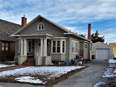
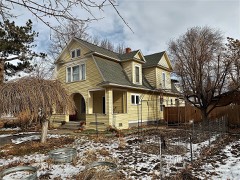
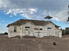
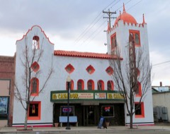
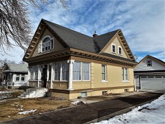
40 National Register listings published here.
Sources: the National Register database, National Park Service
51 topographic sheets cover 41 settlements here, and 40 properties are on the National Register of Historic Places.
40 National Register listings published here.
Sources: the National Register database, National Park Service
Every property in this county listed on the National Register of Historic Places, with the year it was listed and the federal nomination document.
Every wildfire the federal occurrence database records inside this county: 447 of them, burning about 323,526 acres. 163 started naturally and 9 were recorded as arson. Each settlement page carries the fires within five miles of it.
| Reported cause | Fires |
|---|---|
| Natural | 163 |
| Missing data/not specified/undetermined | 77 |
| Equipment and vehicle use | 69 |
| Power generation/transmission/distribution | 37 |
| Debris and open burning | 33 |
| Recreation and ceremony | 22 |
| Fireworks | 20 |
| Arson/incendiarism | 9 |
| Firearms and explosives use | 8 |
| Smoking | 5 |
| Misuse of fire by a minor | 2 |
| Railroad operations and maintenance | 1 |
| Other causes | 1 |
The five largest, by the area the report gives. None of them was recorded as arson.
| Date | Cause | Size | Reported by | Name on the report |
|---|---|---|---|---|
| 7 July 2012 | Natural | 210,874 acres | Twin Falls District | KINYON ROAD |
| 30 July 1995 | Natural | 15,234 acres | Boise District | BLUE GULCH |
| 20 August 2010 | Equipment and vehicle use | 13,745 acres | Idaho Falls District | MULE CREEK |
| 29 September 2008 | Missing data/not specified/undetermined | 6,773 acres | Idaho Falls District | SHOSHONE BASIN |
| 3 June 2012 | Equipment and vehicle use | 6,425 acres | Twin Falls District | BALANCED ROAD |
| 22 June 2005 | Natural | 5,849 acres | Twin Falls District | MAGIC |
| 29 July 1994 | Natural | 4,670 acres | Sawtooth National Forest | COTTONWOOD |
| 2 August 1996 | Natural | 4,000 acres | Boise District | ANTELOPE |
Every settlement page carries the fires within five miles of it - see the settlement index below.
The NOAA Storm Events Database holds 148 reports for this county, causing no deaths, 1 injury and about $3,877,530 in recorded property damage. Each settlement page carries the reports that name it.
| Kind of event | Reports |
|---|---|
| Thunderstorm Wind | 63 |
| Hail | 48 |
| Tornado | 12 |
| Heavy Rain | 9 |
| Flash Flood | 8 |
| Funnel Cloud | 5 |
| Flood | 2 |
| Wildfire | 1 |
The most serious of them, by death, then injury, then recorded damage. The accounts are quoted exactly as the forecast office filed them.
| When | Event | Place named | Harm | What the report says |
|---|---|---|---|---|
| December 2025 | Thunderstorm Wind | Curry | 1 hurt | Media and Idaho Department of Transportation reporting one semi flipped on route 93 near Filer, Idaho. The flip occurred on a north-south bound section of the highway, and crosswinds from the west-northwest hit the side of the semi, flipping it and injuring the driver. |
| February 2017 | Flood | (Twf)Twin Falls Arpt | $2,500,000 | Rainfall coupled with rapid melting of low elevation snowpack on top of frozen and saturated soil led to widespread flooding. Many county roads and large sections of agricultural land were flooded. County Road 1100 East was washed out at the Deep Creek crossing and many other roads were closed and severely damaged. Snow and ice filled canals caused water to overflow canal banks and contribute to the flooding. |
| May 1994 | Thunderstorm Wind | not stated | $500,000 | Thunderstorms, moving east to west around an upper level low pressure system, caused damage across a significant portion of south-central and southeast Idaho. Winds gusted to 61 mph at the Pocatello Airport. Winds at the Twin Falls Airport blew at 69 mph with gusts to 92 mph. The air traffic control tower at the Twin Falls Airport was evacuated for nearly ten minutes. Two unofficial reports of tornadoes were received: one near Castleford, 20 miles west of Twin Falls, and another at Kimberly, five miles southeast of Twin Falls. Upon investigation by National Weather Service personnel, these events were determined to be straight-line winds. The winds did a significant amount of damage. A roof was blown off of a house in Castleford. A "stoutly built" shed, with supporting poles anchored in concrete, was knocked over and blown into a nearby house. Several wheel-line irrigation systems were damaged. Numerous downed electrical wires caused power outages in Twin Falls, as well as in several smaller communities around Twin Falls. Many trees were blown over, a number of them onto houses and cars. One large pine tree flattened the rear portion of a nearly new 1994 Jeep Cherokee. A hangar at the Bulh Airport, 18 miles west of Twin Falls, was blown apart. |
| March 1993 | Thunderstorm Wind | Kimberly | $500,000 | The Twin Falls County Sheriff's office reported strong winds associated with a thunderstorm 5 miles south of Kimberly, Idaho. Kimberly is in south central Idaho 5 miles southeast of Twin Falls. The most costly damage was done to two center- pivot irrigation systems. Other damage included roofing torn free from buildings, around 20 trees uprooted, a windmill blown over, and a car damaged by a small falling light pole. Also, a pickup RV camper was rolled over. A farmer reported a missing calf. The wind was strong enough to pick up a 300-pound door and carry it across a street. |
| July 1998 | Thunderstorm Wind | Filer | $200,000 | no account filed |
| May 1993 | Thunderstorm Wind | not stated | $50,000 | At Hansen, 15 miles southeast of Twin Falls, the roof of a residential garage was torn free by a strong wind gust. Part of the roof fell on a car, breaking a window. |
| July 1996 | Thunderstorm Wind | Twin Falls | $50,000 | no account filed |
| July 1998 | Thunderstorm Wind | Filer | $25,000 | A strong thunderstorm produced wind gusts which peeled the roof off of a business in Filer. |
| September 1985 | Tornado (F1) | not stated | $25,000 | no account filed |
| July 1996 | Thunderstorm Wind | Filer | $15,000 | no account filed |
| March 1993 | Thunderstorm Wind | Countywide | $5,000 | A thunderstorm in south central Idaho produced three-quarter inch hail and strong winds. Tin roofing was blown off a few buildings, and several trees were blown down. |
| May 1996 | Heavy Rain | Filer | $5,000 | no account filed |
| June 1986 | Tornado (F1) | not stated | $2,500 | no account filed |
| June 1957 | Tornado (F1) | not stated | $30 | no account filed |
| May 2025 | Thunderstorm Wind | Filer | - | A large branch fell from a willow tree nearly missing a home. Winds were estimated to be 65 MPH based off of the large canopy and size of the branch broken. |
| May 2025 | Thunderstorm Wind | Hollister | - | Mesonet station TGFI1 Trail Gulch measured a wind gust of 58MPH. |
| May 2025 | Thunderstorm Wind | Twin Falls | - | Twin Falls airport ASOS measured a wind gust of 61MPH as a thunderstorm passed over. |
| December 2025 | Thunderstorm Wind | Hollister | - | A member of the public posted multiple pictures of damage in the town of Hollister. Construction debris strewn across streets, brick walls toppled, trees uprooted, and damage to cars and property. Based on size of debris wind was likely 65 miles per hour. |
| December 2025 | Thunderstorm Wind | (Twf)Twin Falls Arpt | - | At approximately 7 AM, two children who were waiting for the bus near 3400 N and 3100 E just to the southeast of Twin Falls were critically injured as a strong thunderstorm wind gust uprooted and toppled trees. 65 mph gust is estimated based on pictures of the trees downed. |
| December 2025 | Thunderstorm Wind | (Twf)Twin Falls Arpt | - | The Magic Valley Regional Airport's ASOS reported a 68 mph wind gust as a line of showers and embedded thunderstorms move through. |
| May 2023 | Hail | Amsterdam | - | A trained spotter reported lots of lightning and large hail near Kimberly, ID. |
| May 2023 | Hail | Hollister | - | A trained spotter reported one inch hail near Amsterdam, ID. |
| May 2023 | Hail | Hollister | - | A trained spotter reported hail that was measured at 1.25 inches. |
| May 2023 | Thunderstorm Wind | Amsterdam | - | A trained spotter measured severe outflow wind gusts. |
| May 2023 | Funnel Cloud | Curry | - | A photo submitted on social media from a trained spotter showed a funnel cloud just northeast of his location. |
| June 2021 | Thunderstorm Wind | (Twf)Twin Falls Arpt | - | The ASOS at Twin Falls reported a 59 MPH thunderstorm wind gust. |
| August 2021 | Thunderstorm Wind | Cedar | - | Several residents described a sudden wind storm occurring with little, if any, rain and lasting about 5 to 10 minutes between approximately 7:20 pm and 7:30 pm. A resident described two bursts of wind about 3 minutes apart. Most of the damage was observed on the north side of town... north of Highway 30 between Buhl and the Snake River along E 1500 E road. The damage consisted of numerous large diameter trees (both hardwood and soft wood), which were uprooted and blown down toward the northeast. Some of the falling trees damaged trailers, cars, roofs and fences when they fell. One travel trailer was totally destroyed by a falling tree. Another travel trailer was blown over and rolled by the wind. Part of the metal roof on a garage was peeled off. A hen house was reported to be blown off the foundation. Damage to power lines was also reported with about 1000 residents losing power on Monday night. The observed damage and eye witness reports were consistent with downburst winds of 70 to 80 mph, generally blowing from the southwest toward the northeast which accelerated down slope towards the Snake River. No injuries were reported and no significant damage to residential structures was observed. |
| October 2019 | Thunderstorm Wind | Mc Millan | - | A trained spotter reported large trees and power lines down in the Magic Valley around the Twin Falls area. |
| October 2019 | Thunderstorm Wind | Twin Falls | - | A wind gust of 59 MPH was recorded at the Perrine Bridge in Twin Falls. |
| October 2019 | Thunderstorm Wind | Twin Falls | - | A wind gust of 64 MPH was recorded at the Twin Falls ASOS in Kimberly. |
| September 2019 | Thunderstorm Wind | Buhl | - | A trained spotter reported large trees branches down near Buhl. |
| September 2019 | Hail | Berger | - | The NWS received a call from a citizen reporting 1.25 inch hail. |
| September 2019 | Hail | Berger | - | A trained spotter reported one inch hail near Twin Falls. |
| September 2019 | Hail | (Twf)Twin Falls Arpt | - | A trained spotter reported one inch hail near Twin Falls. |
| September 2019 | Hail | Hansen | - | A picture of large hailstones in the Kimberly and Hanson areas was posted on Twitter. |
| May 2019 | Tornado (EF0) | Kimberly | - | A video was posted on Facebook. Downed trees were reported at a farm. |
| May 2018 | Hail | Murtaugh | - | Social Media reported half dollar sized hail around the Murtaugh area. |
| June 2017 | Thunderstorm Wind | Rogerson | - | Social and local media reported trees and power lines down around Buhl and Filer. |
| July 2017 | Thunderstorm Wind | Rogerson | - | The local newspaper and a trained spotter reported large pine trees down and a large section of a motel roof was peeled off. |
| September 2016 | Funnel Cloud | Murtaugh | - | Social media reported and posted a photo of a funnel cloud near Murtaugh, Idaho around 4:00 PM MDT. Strong, gusty winds were also reported around the Twin Falls area. |
| May 2015 | Hail | Kimberly | - | A trained spotter reported a severe thunderstorm with 1 inch hail and very heavy rain. |
| June 2015 | Hail | Rogerson | - | A trained spotter reported hail starting as 1 inch then decreasing to half inch hail. |
| July 2014 | Hail | Rock Creek | - | A Storm Chaser reported 1 inch hail. |
| March 2014 | Funnel Cloud | (Twf)Twin Falls Arpt | - | A funnel cloud was photographed by a deputy sheriff. |
| August 2014 | Heavy Rain | Twin Falls | - | Most streets around the city were flooded many residents reported significant flood damage including flooded basements. Standing water covered roofs of cars in some areas. Flooding and damage to roadways was reported over much of the county. |
| August 2014 | Flash Flood | Rock Creek | - | The Idaho Ranger2 remote automated weather station reported a gust of 69 MPH. |
| August 2014 | Thunderstorm Wind | Rock Creek | - | Trail Gulch raws. |
| August 2014 | Flash Flood | Rock Creek | - | A flash flood on McMullen Creek washed out roads near the intersection of E 2900 N and N 3500 E. |
| August 2014 | Hail | Twin Falls | - | A large amount of quarter sized hail combined with heavy rain producing minor street flooding in Twin Falls. |
| August 2014 | Hail | Castleford | - | Large hail up to 1.75 inches was reported near Twin Falls, Castleford and Buhl. |
| July 2013 | Thunderstorm Wind | Twin Falls | - | A wind gust of 60 MPH was reported at the Twin Falls ASOS. |
| August 2013 | Thunderstorm Wind | Twin Falls | - | Idaho Power reported at least 8 power poles blown down and numerous power outages. |
| September 2013 | Thunderstorm Wind | Filer | - | A post on Facebook reported a roof was ripped off of a barn and irrigation pivots were tunrned over. |
| September 2013 | Hail | Filer | - | One inch hail and heavy rain with street flooding was reported. |
| September 2013 | Flash Flood | Filer | - | Street flooding was reported in Filer. |
| September 2012 | Hail | Hansen | - | Photo received by KMVT in Twin Falls indicated that at least half- dollar size hail occurred at 330 PM in the Rock Creek area near Hansen. |
| August 2012 | Thunderstorm Wind | Twin Falls | - | KMVT television station reported numerous power outages and wind damage in Twin Falls, Idaho. |
| October 2012 | Thunderstorm Wind | Twin Falls | - | The broadcast news media (KMVT) reported up to 11,000 costomers without power throughout the Magic Valley after the storm. |
| October 2012 | Thunderstorm Wind | (Twf)Twin Falls Arpt | - | Wide spread trees down along 3700 N road between Buhl and Kimberly. Two new commodity buidlings recieved damage. |
| October 2012 | Thunderstorm Wind | (Twf)Twin Falls Arpt | - | A peak wind gust of 71 mph was measured by the Twin Falls ASOS. |
The Survey's mineral resources record lists 111 workings inside this county. 15 still produce and 96 are closed or unrecorded. Each settlement page carries the workings within five miles of it.
| Commodity | Workings |
|---|---|
| Sand and Gravel, Construction | 69 |
| Geothermal | 18 |
| Gold | 7 |
| Pumice | 6 |
| Chromium, Iron | 4 |
| Iron, Chromium | 3 |
| Volcanic Materials | 3 |
| Diatomite | 2 |
| Clay | 2 |
| Perlite | 1 |
| Stone | 1 |
| Uranium | 1 |
| Calcium | 1 |
| Sand and Gravel, Construction, Clay | 1 |
The least common of them first, because a county's hundredth gravel pit says nothing its first ten did not.
| Where | Site | Commodity | Status | Recorded |
|---|---|---|---|---|
| Banbury | Diatomite, Sand and Gravel, Construction, Clay | Prospect | ||
| Lucky Lolo Uranium Prospect | Uranium | Prospect | ||
| Ora Jones Farm Pumicite Deposit | Geothermal, Pumice, Perlite | Prospect | Pumice | |
| Quarry | Stone, Dimension | Past Producer | ||
| State Pit Tf 56 | Stone, Crushed/Broken | Producer | ||
| State Pit Tf 79 | Stone | Producer | ||
| Twin Falls Lime Production | Calcium | Producer | ||
| Hagerman Valley Clay Pit | Clay | Past Producer | ||
| Ray Banbury Diatomite Deposit | Diatomite | Occurrence | Sedimentary | |
| Unnamed Location | Clay | Occurrence | ||
| Pumicite Deposit | Volcanic Materials | Occurrence | ||
| Pumicite Deposit | Volcanic Materials | Occurrence | ||
| Pumicite Deposit | Volcanic Materials | Occurrence | ||
| Snake River Placer Deposits | Gold, Iron, Chromium | Past Producer | ||
| Snake River Placer Deposits | Gold, Iron, Chromium | Past Producer | ||
| Snake River Placers | Gold, Iron, Chromium | Past Producer | 1862 | |
| Snake River Placer Deposits | Gold, Chromium, Iron | Past Producer | ||
| Snake River Placer Deposits | Gold, Chromium, Iron | Past Producer | ||
| Snake River Placers | Gold, Chromium, Iron | Past Producer | 1862 | |
| Snake River Placers | Gold, Chromium, Iron | Past Producer | 1862 | |
| Unnamed Location | Pumice | Prospect | ||
| Unnamed Location | Pumice | Prospect | ||
| Unnamed Location | Pumice | Prospect | ||
| Unnamed Location | Pumice | Occurrence | ||
| Unnamed Location | Pumice | Prospect | ||
| Geothermal Location | Geothermal | Occurrence | ||
| Geothermal Location | Geothermal | Occurrence | ||
| Geothermal Location | Geothermal | Occurrence | ||
| Geothermal Location | Geothermal | Occurrence | ||
| Geothermal Location | Geothermal | Occurrence | ||
| Geothermal Location | Geothermal | Occurrence | ||
| Geothermal Location | Geothermal | Occurrence | ||
| Geothermal Location | Geothermal | Occurrence | ||
| Geothermal Location | Geothermal | Occurrence | ||
| Geothermal Location | Geothermal | Occurrence | ||
| Geothermal Location | Geothermal | Occurrence | ||
| Goat Springs | Geothermal | Occurrence | ||
| Miracle Hot Spring | Geothermal | Occurrence | ||
| Nat-Poo-Paw Warm Spring | Geothermal | Occurrence | ||
| Ora Jones Thermal Well | Geothermal | Prospect | ||
| Unnamed Hot Springs | Geothermal | Occurrence | ||
| Unnamed Hot Springs | Geothermal | Occurrence | ||
| Blue Gulch Pit | Sand and Gravel, Construction | Producer | ||
| Borrow Pit | Sand and Gravel, Construction | Past Producer | ||
| Borrow Pit | Sand and Gravel, Construction | Past Producer | ||
| Colonial Concrete Plant | Sand and Gravel, Construction | Past Producer | ||
| Colonial Concrete Snake River Dredg | Sand and Gravel, Construction | Past Producer | ||
| Gravel Pit | Sand and Gravel, Construction | Past Producer | ||
| Gravel Pit | Sand and Gravel, Construction | Past Producer | ||
| Gravel Pit | Sand and Gravel, Construction | Past Producer | ||
| Gravel Pit | Sand and Gravel, Construction | Past Producer | ||
| Gravel Pit | Sand and Gravel, Construction | Past Producer | ||
| Gravel Pit | Sand and Gravel, Construction | Past Producer | ||
| Gravel Pit | Sand and Gravel, Construction | Past Producer | ||
| Gravel Pit | Sand and Gravel, Construction | Past Producer | ||
| Gravel Pit | Sand and Gravel, Construction | Producer | ||
| Gravel Pit | Sand and Gravel, Construction | Producer | ||
| Gravel Pit | Sand and Gravel, Construction | Past Producer | ||
| Gravel Pit | Sand and Gravel, Construction | Past Producer | ||
| Gravel Pit | Sand and Gravel, Construction | Past Producer | ||
| Gravel Pit | Sand and Gravel, Construction | Past Producer | ||
| Gravel Pit | Sand and Gravel, Construction | Past Producer | ||
| Gravel Pit | Sand and Gravel, Construction | Past Producer | ||
| Gravel Pit | Sand and Gravel, Construction | Past Producer | ||
| Gravel Pit | Sand and Gravel, Construction | Past Producer | ||
| Gravel Pit | Sand and Gravel, Construction | Past Producer | ||
| Gravel Pit | Sand and Gravel, Construction | Past Producer | ||
| Gravel Pit | Sand and Gravel, Construction | Past Producer | ||
| Gravel Pit | Sand and Gravel, Construction | Past Producer | ||
| Gravel Pit | Sand and Gravel, Construction | Past Producer | ||
| Gravel Pit | Sand and Gravel, Construction | Past Producer | ||
| Gravel Pit | Sand and Gravel, Construction | Past Producer | ||
| Gravel Pit | Sand and Gravel, Construction | Past Producer | ||
| Gravel Pit | Sand and Gravel, Construction | Past Producer | ||
| Gravel Pit | Sand and Gravel, Construction | Producer | ||
| Gravel Pit | Sand and Gravel, Construction | Past Producer | ||
| Gravel Pit | Sand and Gravel, Construction | Past Producer | ||
| Gravel Pit | Sand and Gravel, Construction | Producer | ||
| Gravel Pit | Sand and Gravel, Construction | Past Producer | ||
| Gravel Pit | Sand and Gravel, Construction | Past Producer | ||
| Gravel Pit | Sand and Gravel, Construction | Past Producer | ||
| Gravel Pit | Sand and Gravel, Construction | Past Producer | ||
| Gravel Pit | Sand and Gravel, Construction | Past Producer | ||
| Gravel Pit | Sand and Gravel, Construction | Past Producer | ||
| Gravel Pit | Sand and Gravel, Construction | Past Producer | ||
| Gravel Pit | Sand and Gravel, Construction | Past Producer | ||
| Gravel Pit | Sand and Gravel, Construction | Past Producer | ||
| Gravel Pit | Sand and Gravel, Construction | Past Producer | ||
| Gravel Pit | Sand and Gravel, Construction | Past Producer | ||
| Gravel Pit | Sand and Gravel, Construction | Past Producer | ||
| Gravel Pit | Sand and Gravel, Construction | Past Producer | ||
| Gravel Pit | Sand and Gravel, Construction | Past Producer | ||
| Gravel Pit | Sand and Gravel, Construction | Past Producer | ||
| Gravel Pit | Sand and Gravel, Construction | Past Producer | ||
| Gravel Pit | Sand and Gravel, Construction | Past Producer | ||
| Gravel Pit | Sand and Gravel, Construction | Past Producer | ||
| Gravel Pit | Sand and Gravel, Construction | Past Producer | ||
| Gravel Pit | Sand and Gravel, Construction | Past Producer | ||
| Gravel Pit | Sand and Gravel, Construction | Past Producer | ||
| Gravel Pit | Sand and Gravel, Construction | Past Producer | ||
| Gravel Pit | Sand and Gravel, Construction | Past Producer | ||
| Hansen Pit | Sand and Gravel, Construction | Past Producer | ||
| Hoop Pit | Sand and Gravel, Construction | Producer | ||
| Mcmullen Creek Pit | Sand and Gravel, Construction | Producer | ||
| Northwest Crane Crushing Plant | Sand and Gravel, Construction | Producer | ||
| Rtp Mix Plant | Sand and Gravel, Construction | Past Producer | ||
| Rtp Thousand Springs Pit | Sand and Gravel, Construction | Past Producer | ||
| State Pit T.F. 70 | Sand and Gravel, Construction | Producer | ||
| T F 58 Ring Pit | Sand and Gravel, Construction | Producer | ||
| Twin Falls Screening Plant | Sand and Gravel, Construction | Producer | ||
| Wynn Pit | Sand and Gravel, Construction | Producer |
Named settlements recorded in the Geographic Names Information System, each with the topographic sheets covering it. Villages, hamlets and abandoned places alike. Each is shown with the nearest named watercourse or landform and the survey quadrangle it falls on.
Buhl census division · 83316 · Thousand Springs quadrangle
16 sheets, 1949 to 1959
No longer a settlement
West Salmon Falls census division · Near John Boyd Flat · Cedar Creek Reservoir quadrangle
7 sheets, 1955 to 1992
Buhl census division · 83316 · Thousand Springs quadrangle
16 sheets, 1949 to 1959
No longer a settlement
West Salmon Falls census division · 83302 · On House Creek · Cedar Creek Reservoir quadrangle
7 sheets, 1955 to 1992
Murtaugh census division · 83334 · Eden quadrangle
8 sheets, 1955 to 1964
No longer a settlement
West Salmon Falls census division · 83302 · On Player Creek · Browns Bench South quadrangle
7 sheets, 1955 to 1992
West Salmon Falls census division · Cedar Creek Reservoir quadrangle
7 sheets, 1955 to 1992
West Salmon Falls census division · 83302 · On Browns Creek · Browns Bench South quadrangle
7 sheets, 1955 to 1992
West Salmon Falls census division · 83302 · Cedar Creek Reservoir quadrangle
7 sheets, 1955 to 1992
West Salmon Falls census division · 83302 · Near Indian Jim Canyon · Cedar Creek Reservoir quadrangle
7 sheets, 1955 to 1992
West Salmon Falls census division · 83302 · On House Creek · Cedar Creek Reservoir quadrangle
7 sheets, 1955 to 1992
Murtaugh census division · 83344 · On Dry Creek · Murtaugh quadrangle
8 sheets, 1955 to 1992
West Salmon Falls census division · 83302 · Near Player Butte · Browns Bench South quadrangle
7 sheets, 1955 to 1992
Hollister census division · 83334 · Near Cedar Hill · Stricker Butte quadrangle
9 sheets, 1955 to 1992
West Salmon Falls census division · 83302 · Browns Bench North quadrangle
7 sheets, 1955 to 1992
West Salmon Falls census division · 83321 · Browns Bench North quadrangle
7 sheets, 1955 to 1992
West Salmon Falls census division · 83302 · Browns Bench North quadrangle
7 sheets, 1955 to 1992
The vanished settlements of Twin Falls County: the places named above that are no longer on the map.