 Block
From the record
One of 40 National Register listings published here for Twin Falls County · listed in 1982 · category: Building.
Sources: the case file at the National Archives · the National Register database, National Park Service
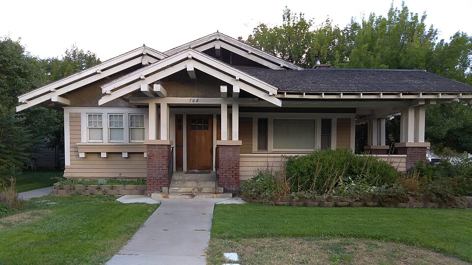
Listed on the National Register of Historic Places in 1982.
One of 40 National Register listings published here for Twin Falls County · listed in 1982 · category: Building.
Sources: the case file at the National Archives · the National Register database, National Park Service
Regional context, not property-specific evidence. The federal wildfire occurrence database lists 123 fires within 5 miles of Robert McCollum House between 1992 and 2020, burning about 915 acres in total. 5 started naturally. 10 were recorded as arson. Distance is straight-line from the map coordinates, so a fire counted here may appear on a neighbouring settlement's page as well.
| Reported cause | Fires |
|---|---|
| Missing data/not specified/undetermined | 32 |
| Fireworks | 27 |
| Equipment and vehicle use | 24 |
| Arson/incendiarism | 10 |
| Debris and open burning | 9 |
| Firearms and explosives use | 7 |
| Natural | 5 |
| Smoking | 3 |
| Recreation and ceremony | 3 |
| Power generation/transmission/distribution | 2 |
| Misuse of fire by a minor | 1 |
The most recent of them, most recent first, with the day each was reported and the service that recorded it.
| Date | Cause | Size | Reported by | Name on the report |
|---|---|---|---|---|
| 9 September 2012 | Fireworks | 58 acres | Twin Falls District | GOLF COURSE |
| 8 September 2001 | Equipment and vehicle use | 4.0 acres | Twin Falls District | LASTDEVIL |
| 5 September 1997 | Natural | 1.0 acres | Twin Falls District | SHOFALLSN |
| 28 September 2008 | Equipment and vehicle use | 1.5 acres | Twin Falls District | DEVILS CORRAL 4 |
| 27 September 2012 | Missing data/not specified/undetermined | 2.5 acres | Twin Falls District | FIELD |
| 22 September 2000 | Equipment and vehicle use | under an acre | Twin Falls District | 84JUNCTION |
| 21 September 2013 | Arson/incendiarism | under an acre | Idaho Falls District | HIDDEN LAKE |
| 2 September 2013 | Equipment and vehicle use | under an acre | Twin Falls District | DEVILS CORRAL 2 |
Regional context, not property-specific evidence. The federal mineral resources record lists 19 workings within 5 miles of Robert McCollum House: 8 past producers, 7 unknowns, 3 producers, 1 occurrence. 3 still produce. What was taken out: Sand and Gravel, Construction, Gold, Chromium, Iron, Calcium. Distance is straight-line from the map coordinates, so a quarry counted here may appear on a neighbouring settlement's page as well.
| Where | Site | Commodity | Status | Recorded |
|---|---|---|---|---|
| Twin Falls Lime Production | Calcium | Producer | ||
| Unnamed Location | Geothermal | Occurrence | ||
| Snake River Placer Deposits | Gold, Chromium, Iron | Past Producer | ||
| Snake River Placers | Gold, Chromium, Iron | Past Producer | 1862 | |
| Colonial Concrete Plant | Sand and Gravel, Construction | Past Producer | ||
| Colonial Concrete Snake River Dredg | Sand and Gravel, Construction | Past Producer | ||
| Gravel Pit | Sand and Gravel, Construction | Unknown | ||
| Gravel Pit | Sand and Gravel, Construction | Unknown | ||
| Gravel Pit | Sand and Gravel, Construction | Past Producer | ||
| Gravel Pit | Sand and Gravel, Construction | Unknown |
Regional context, not property-specific evidence. The National Weather Service names Twin Falls, the town this property stands in, in 25 storm reports between 1993 and 2025: 10 thunderstorm wind, 8 hail, 2 tornado, 2 heavy rain. No death or injury is recorded in these reports. Each account below is quoted exactly as the forecast office filed it, from the NOAA Storm Events Database, and each date opens the federal record of that event.
| When | Event | Place named | Harm | What the report says |
|---|---|---|---|---|
| July 1996 | Thunderstorm Wind | Twin Falls | $50,000 | no account filed |
| May 2025 | Thunderstorm Wind | Twin Falls | - | Twin Falls airport ASOS measured a wind gust of 61MPH as a thunderstorm passed over. |
| October 2019 | Thunderstorm Wind | Twin Falls | - | A wind gust of 59 MPH was recorded at the Perrine Bridge in Twin Falls. |
| October 2019 | Thunderstorm Wind | Twin Falls | - | A wind gust of 64 MPH was recorded at the Twin Falls ASOS in Kimberly. |
| August 2014 | Heavy Rain | Twin Falls | - | Most streets around the city were flooded many residents reported significant flood damage including flooded basements. Standing water covered roofs of cars in some areas. Flooding and damage to roadways was reported over much of the county. |
| August 2014 | Hail | Twin Falls | - | A large amount of quarter sized hail combined with heavy rain producing minor street flooding in Twin Falls. |
| July 2013 | Thunderstorm Wind | Twin Falls | - | A wind gust of 60 MPH was reported at the Twin Falls ASOS. |
| August 2013 | Thunderstorm Wind | Twin Falls | - | Idaho Power reported at least 8 power poles blown down and numerous power outages. |
| August 2012 | Thunderstorm Wind | Twin Falls | - | KMVT television station reported numerous power outages and wind damage in Twin Falls, Idaho. |
| October 2012 | Thunderstorm Wind | Twin Falls | - | The broadcast news media (KMVT) reported up to 11,000 costomers without power throughout the Magic Valley after the storm. |
| December 2011 | Thunderstorm Wind | Twin Falls | - | The Twin Falls ASOS at Kimberly reported a wind gust of 68 MPH and the Idaho Department of Transportation automated observation system on the Hansen Bridge reported a gust of 67 MPH as a line of thunderstorms passed through the Twin Falls area. |
| March 2011 | Tornado (EF0) | Twin Falls | - | Local law enforcement officials and the public reported a brief touchdown of a tornado near Filer. A trained spotter in Hollister reported a measured wind gust of 61 MPH and a 30 by 40 foot metal building was blown over near Filer. |
| August 2010 | Flash Flood | Twin Falls | - | Trained spotters reported heavy rain and street flooding in downtown Twin Falls. |
| July 2009 | Hail | Twin Falls | - | A trained spotter reported three quarter inch hail with heavy rain. |
| June 2009 | Hail | Twin Falls | - | A trained spotter reported 5 minutes of nickel and dime sized hail. |
| March 1993 | Tornado (F0) | Twin Falls | - | This tornado was reported by a Twin Falls County Sheriff. No duration, dimensions, or damage were reported. |
| March 1993 | Hail | Twin Falls | - | A thunderstorm in south central Idaho produced three-quarter inch hail and strong winds. Tin roofing was blown off a few buildings, and several trees were blown down. |
| July 2006 | Hail | Twin Falls | - | no account filed |
| June 2005 | Hail | Twin Falls | - | no account filed |
| August 2000 | Thunderstorm Wind | Twin Falls | - | no account filed |
| August 1998 | Hail | Twin Falls | - | no account filed |
| June 1998 | Hail | Twin Falls | - | no account filed |
| June 1997 | Funnel Cloud | Twin Falls | - | no account filed |
| June 1996 | Flood | Twin Falls | - | no account filed |
| July 1996 | Heavy Rain | Twin Falls | - | no account filed |
No historic map-sheet match is published for this property yet. That does not mean no map exists. This record needs a coordinate-quality review before it can be joined to a sheet boundary. Browse the county's mapped places while that work is pending.
Other National Register properties close enough to walk or drive between, ordered by distance from this one. Both positions come from the same geocoding pass that matched these properties to their map sheets.
| Photograph | Property | Distance | Listed |
|---|---|---|---|
| Walter Priebe House | under 500 feet | 1993 | |
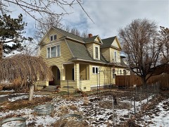 | D. H. Peck House | 0.1 miles | 1993 |
 | Twin Falls City Park Historic District | 0.2 miles | 1978 |
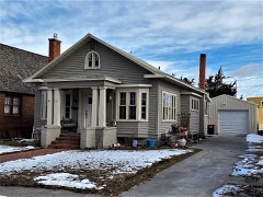 | Burton Morse House | 0.2 miles | 1993 |
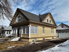 | C. Harvey Smith House | 0.2 miles | 1978 |
| Lincoln Street Electric Streetlights | 0.3 miles | 1992 |
| National Archives record | The nomination case file for reference 82000386 in Record Group 79. |
| Twin Falls County | All 40 listed properties in this county. |