 Block
From the record
31 National Register listings published here.
Sources: the National Register database, National Park Service
60 topographic sheets cover 16 settlements here, and 31 properties are on the National Register of Historic Places.
31 National Register listings published here.
Sources: the National Register database, National Park Service
Every property in this county listed on the National Register of Historic Places, with the year it was listed and the federal nomination document.
| Photograph | Property | Type | Listed | Reference |
|---|---|---|---|---|
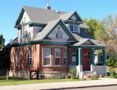 | Anderson-Elwell House | building | 1982 | 82000373 |
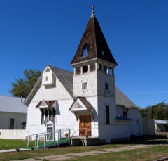 | Baptist Church | building | 1977 | 77000470 |
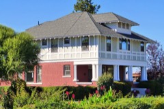 | Butterfield Livestock Company House | building | 1982 | 82000374 |
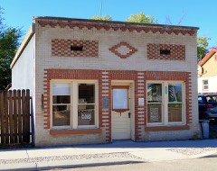 | Cambridge News Office | building | 1989 | 89002128 |
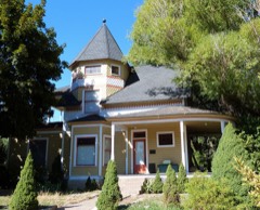 | Col. C. F. Drake House | building | 1978 | 78001104 |
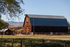 | Edwards-Gillette Barn | building | 2002 | 02000013 |
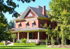 | James M. Fisher House | building | 1986 | 86002146 |
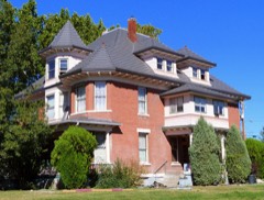 | Thomas C. Galloway House | building | 1978 | 78001105 |
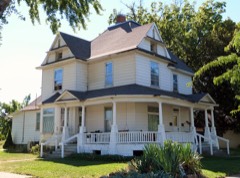 | Bernard Haas House | building | 1978 | 78001106 |
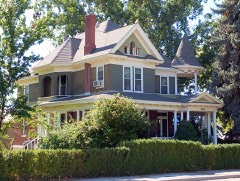 | Herman Haas House | building | 1982 | 82000375 |
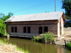 | Institute Canal Company Pump House | building | 2017 | 100000958 |
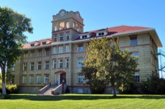 | Intermountain Institute | district | 1979 | 79000811 |
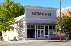 | Jewell Building | building | 1990 | 89002263 |
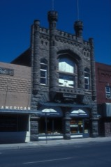 | Knights of Pythias Lodge Hall | building | 1976 | 76000683 |
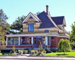 | Kurtz-Van Sicklin House | building | 1982 | 82000376 |
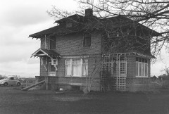 | Archie Larsen House | building | 1982 | 82000377 |
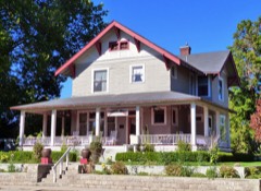 | G. V. Nesbit House | building | 1982 | 82000378 |
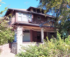 | Dr. J. R. Numbers House | building | 1982 | 82000379 |
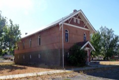 | Salubria Lodge No. 31 | building | 1990 | 90000368 |
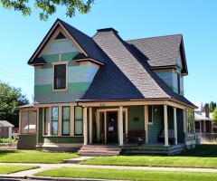 | Morris Sommer House | building | 1982 | 82000380 |
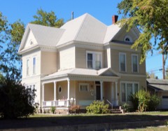 | Mary Elizabeth Sommercamp House | building | 1982 | 82000381 |
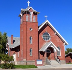 | St. Agnes Catholic Church | building | 1978 | 78001107 |
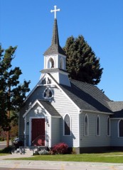 | St. Luke's Episcopal Church | building | 1978 | 78001108 |
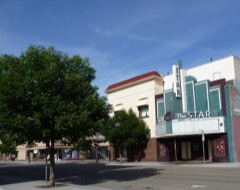 | Star Theater | building | 1999 | 99001413 |
| Sunnyside School | building | 2025 | 100011321 | |
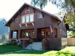 | B. S. Varian House | building | 1982 | 82000382 |
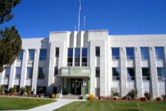 | Washington County Courthouse | building | 1987 | 87001602 |
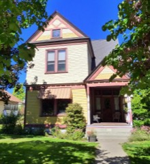 | Benjamin Watlington House | building | 1991 | 91000458 |
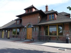 | Weiser Oregon Short Line Railroad Depot | building | 2007 | 07000006 |
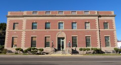 | Weiser Post Office | building | 1982 | 82000383 |
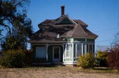 | Wilson House | building | 2004 | 03001369 |
Every wildfire the federal occurrence database records inside this county: 350 of them, burning about 263,761 acres. 200 started naturally and 6 were recorded as arson. Each settlement page carries the fires within five miles of it.
| Reported cause | Fires |
|---|---|
| Natural | 200 |
| Recreation and ceremony | 52 |
| Missing data/not specified/undetermined | 35 |
| Equipment and vehicle use | 25 |
| Railroad operations and maintenance | 9 |
| Debris and open burning | 7 |
| Arson/incendiarism | 6 |
| Fireworks | 6 |
| Power generation/transmission/distribution | 6 |
| Smoking | 3 |
| Misuse of fire by a minor | 1 |
The five largest, by the area the report gives. None of them was recorded as arson.
| Date | Cause | Size | Reported by | Name on the report |
|---|---|---|---|---|
| 7 September 2020 | Recreation and ceremony | 96,614 acres | Payette National Forest | WOODHEAD |
| 28 July 2005 | Natural | 25,280 acres | Payette National Forest | SNAKE ONE |
| 6 July 2007 | Natural | 23,760 acres | Payette National Forest | WARM SPRINGS |
| 29 August 2013 | Natural | 20,395 acres | Payette National Forest | RAFT |
| 25 July 2018 | Natural | 17,600 acres | Payette National Forest | KEITHLY |
| 21 August 2006 | Natural | 10,610 acres | Boise District | FRENCHIE |
| 28 June 1992 | Natural | 9,507 acres | Boise District | PRESLEY |
| 29 August 2013 | Natural | 9,062 acres | Payette National Forest | HELLS CANYON |
Every settlement page carries the fires within five miles of it - see the settlement index below.
The NOAA Storm Events Database holds 54 reports for this county, causing no deaths, 3 injuries and about $2,247,000 in recorded property damage. Each settlement page carries the reports that name it.
| Kind of event | Reports |
|---|---|
| Thunderstorm Wind | 22 |
| Hail | 10 |
| Flood | 10 |
| Flash Flood | 4 |
| Heavy Rain | 4 |
| Tornado | 3 |
| Debris Flow | 1 |
The most serious of them, by death, then injury, then recorded damage. The accounts are quoted exactly as the forecast office filed them.
| When | Event | Place named | Harm | What the report says |
|---|---|---|---|---|
| July 1999 | Thunderstorm Wind | Weiser | 3 hurt | Thunderstorm downburst winds of up to 80 mph damaged several homes and businesses in downtown Weiser. Numerous trees were downed on homes, with 2 people sustaining broken bones and a third sustaining a minor shoulder injury. The roofs of several businesses were damaged or blown off. The damaged area was two miles wide and 5 miles in length. |
| February 2017 | Flood | Weiser | $1,000,000 | An ice jam released and caused flooding downstream along the Weiser River near the town of Weiser. Some homes near the river were flooded and widespread flooding of agricultural land occurred. A few residents living near the river were evacuated from their homes and one resident had to be rescued via helicopter. Flood waters inundated a portion of U.S. Highway 95 just south of Weiser. |
| June 2010 | Flood | Cambridge | $1,000,000 | Washington County Emergency Manager reported flooding along the Weiser River from Cambridge to Weiser. |
| June 2010 | Flash Flood | Cambridge | $140,000 | Washington County Emergency Manager reported Rush Creek was flooding on roads just east of Cambridge and flooding on Advent Gulch Road northwest of Cambridge. |
| May 1996 | Tornado (F1) | Weiser | $50,000 | no account filed |
| June 2002 | Thunderstorm Wind | Weiser | $30,000 | On the evening of June 27th, thunderstorm winds toppled numerous trees and caused structural damage to several outbuildings and to six houses in Weiser, Idaho. A National Weather Service storm survey estimated wind speeds between 60 and 90 mph. |
| July 1990 | Tornado (F1) | not stated | $25,000 | no account filed |
| March 2017 | Flood | Cambridge | $2,000 | Flooding occurred along the Weiser River from Cambridge to Weiser and surrounding fields and roads. |
| March 2023 | Heavy Rain | Rebecca | - | The mesonet station DW9477 near Minden, ID measured 1.24 inches of rain. |
| March 2023 | Heavy Rain | Cobb | - | The Mesonet station at DEAI1 near Catfish, ID reported 0.61 inches of heavy rain. |
| August 2023 | Thunderstorm Wind | Weiser | - | Spotter reported thunderstorm wind gusts resulting in 3 large pine trees knocked down, small branches breaking, and one large branch breaking. |
| June 2023 | Heavy Rain | Cobb | - | The mesonet station, DEAI1, near Catfish, ID measured 0.66 inches of heavy rain. |
| June 2023 | Heavy Rain | Rebecca | - | The mesonet station, DW9477, near Minden, ID measured 0.48 inches of heavy rain. |
| June 2021 | Thunderstorm Wind | Cobb | - | The Mesonet station at Catfish RAWS reported a thunderstorm wind gust of 62 MPH. |
| April 2019 | Flood | Cambridge | - | The Washington County emergency manager reported moderate flooding near the U.S. Highway 95 bridge in Weiser. The flooding caused extensive damage and the closure of the highway for 4 days. |
| March 2017 | Flood | Feltham | - | Flooding occurred along the Snake River around the Weiser, Idaho area and surrounding fields and roads. |
| April 2017 | Flood | Weiser | - | Flooding continued from the previous month of March along the Snake River in southern Washington County near Weiser. |
| May 2014 | Thunderstorm Wind | Weiser | - | A trained spotter reported trees down around the Weiser area due to thunderstorm outflow winds. |
| March 2014 | Flood | Cambridge | - | Moderate flooding on the Weiser River due to heavy rain and snowmelt occurred around the Cambridge area affecting many of the county roads. |
| March 2014 | Flood | Rebecca | - | Moderate flooding on the Weiser River due to heavy rain and snowmelt occurred around the Weiser area affecting many of the county roads and the south and east part of the town. |
| June 2012 | Hail | Cambridge | - | Local media reported 1.00 inch hail in and around Cambridge. |
| April 2012 | Thunderstorm Wind | Weiser | - | Wind damage including large tree limbs and power lines down was reported by a county official. |
| June 2011 | Flash Flood | Heath | - | Local law enforcement reported flash flooding with mudslides along State Road 71 between Cambridge and Oxbow Dam and on U.S Highway 95 between Weiser and Cambridge. |
| March 2011 | Flood | Weiser | - | Moderate flooding occured on the Weiser River around Weiser, Idaho with flooding of houses and buildings. The flooding also closed U.S Highway 95 and county roads around the area. The river crested at 12.1 feet which is about 2.5 feet above flood stage. |
| June 2010 | Thunderstorm Wind | Weiser | - | Washington County Emergency Manager reported large trees down on power lines on Cove Road west of Weiser and an out building was leveled just south of Weiser. |
| June 2009 | Flash Flood | Weiser | - | Law enforcement reported flash flooding on a creek west of Weiser, Idaho. Water flowing across Olds Ferry Road prompted county officials to close the route. |
| July 2003 | Hail | Weiser | - | Near Weiser High School. |
| September 2001 | Tornado (F0) | Weiser | - | A tornado touched down briefly and moved east, crossing US Highway 95 about 7 miles north of Weiser. A barn, shed and mobile home received some damage before the tornado lifted. |
| June 1999 | Flood | Weiser | - | During the afternoon of June first a series of showers and thunderstorms moved over the Weiser area dumping an estimated 2 to 3 inches of rain. Street flooding caused minor damage to a number of homes and businesses. |
| April 1995 | Thunderstorm Wind | Weiser | - | ,,,,,,,,Blowing Dust |
| June 1995 | Thunderstorm Wind | Weiser | - | Winds gusted to 60 miles per hour in Weiser. This thunderstorm also produced pea-size hail. |
| May 2005 | Hail | Midvale | - | no account filed |
| May 2005 | Thunderstorm Wind | Weiser | - | no account filed |
| July 2002 | Thunderstorm Wind | Weiser | - | no account filed |
| September 1998 | Thunderstorm Wind | Weiser | - | no account filed |
| June 1998 | Flash Flood | Weiser | - | no account filed |
| July 1997 | Debris Flow | Midvale | - | no account filed |
| July 1997 | Thunderstorm Wind | Weiser | - | no account filed |
| April 1995 | Hail | Weiser | - | no account filed |
| April 1995 | Hail | Jackson | - | no account filed |
| July 1995 | Thunderstorm Wind | Sturgell Mtn | - | no account filed |
| July 1992 | Hail | not stated | - | no account filed |
| July 1992 | Hail | not stated | - | no account filed |
| August 1990 | Thunderstorm Wind | not stated | - | no account filed |
| June 1987 | Thunderstorm Wind | not stated | - | no account filed |
| April 1987 | Thunderstorm Wind | not stated | - | no account filed |
| December 1987 | Thunderstorm Wind | not stated | - | no account filed |
| July 1981 | Thunderstorm Wind | not stated | - | no account filed |
| July 1981 | Thunderstorm Wind | not stated | - | no account filed |
| July 1975 | Thunderstorm Wind | not stated | - | no account filed |
| May 1969 | Hail | not stated | - | no account filed |
| July 1967 | Hail | not stated | - | no account filed |
| June 1966 | Hail | not stated | - | no account filed |
| July 1956 | Thunderstorm Wind | not stated | - | no account filed |
The Survey's mineral resources record lists 170 workings inside this county. 9 still produce and 161 are closed or unrecorded. Each settlement page carries the workings within five miles of it.
| Commodity | Workings |
|---|---|
| Copper | 30 |
| Geothermal | 26 |
| Silver | 17 |
| Gold | 14 |
| Sand and Gravel, Construction | 13 |
| Mercury | 10 |
| Diatomite | 10 |
| Clay | 9 |
| Iron | 8 |
| Manganese | 7 |
| Gypsum-Anhydrite | 6 |
| Lead | 5 |
| Copper, Silver | 4 |
| Aggregate, Light Weight | 4 |
The least common of them first, because a county's hundredth gravel pit says nothing its first ten did not.
| Where | Site | Commodity | Status | Recorded |
|---|---|---|---|---|
| Abundance Mine | Iron, Gold, Silver, Copper | Past Producer | 1895, 1918 | |
| Black Hawk Mine | Copper, Silver, Zinc, Lead, Gold | Past Producer | Chalcopyrite, Galena, Sphalerite, Tetrahedrite, Wurtzite | |
| Black Jack Prospect | Zinc, Silver, Copper | Occurrence | Chalcopyrite, Sphalerite | |
| Boone Mine | Silver, Zinc, Copper, Lead, Gold | Past Producer | Chalcopyrite, Galena, Sphalerite, Tetrahedrite | |
| Cuddy Mine | Iron, Silver, Gold, Copper | Past Producer | Vein | |
| Cuddy Mtn. District | Copper, Lead, Silver, Gold | Producer | DISSEMINATED, LENS, REPLACEMENT | |
| Eagan Mine | Copper, Silver, Antimony, Lead, Zinc | Past Producer | 1895 | |
| Edna May Prospect | Copper, Lead | Past Producer | Chalcopyrite, Galena | |
| Enterprise Mine | Copper, Zinc, Gold, Silver, Lead | Past Producer | 1895 | |
| Gold Peak | Silver, Lead, Copper, Zinc | Past Producer | ||
| Grade Creek Prospect | Copper, Zinc, Silver, Lead | Prospect | Chalcopyrite, Chrysocolla, Galena, Malachite | |
| Hercules Group Prospect | Copper, Silver, Gold, Lead, Zinc | Occurrence | Vein | |
| IXL Mine | Molybdenum, Copper, Silver, Lead, Zinc | Producer | 1921 | |
| Jerry No. 1 Mine | Stone, Crushed/Broken | Producer | ||
| Kismet Prospect | Copper, Molybdenum, Lead, Zinc, Gold, Silver | Prospect | 1964 | |
| Lead Zone Mine | Lead, Silver, Zinc, Gold, Copper | Past Producer | Anglesite, Galena | |
| Liberty Mine | Copper, Lead, Zinc, Silver | Past Producer | Chalcopyrite, Galena, Sphalerite, Tetrahedrite | |
| Mineral District | Silver, Copper, Lead, Gold | Producer | REPLACEMENT, VEIN, CONTACT METAMORPHIC | |
| Mineral District | Silver, Copper, Lead, Gold, Zinc | Past Producer | 1870, 1880 | |
| Modock Mine | Gold, Stone, Crushed/Broken | Past Producer | 1911 | |
| Monroe Creek Tuff Deposit | Clay, Fullers Earth | Occurrence | 1911 | |
| Mortimer Prospect | Copper, Gold, Iron | Prospect | 1897 | |
| Railroad Mine | Copper, Bismuth, Gold, Silver | Past Producer | Contact Metasomatic | |
| Scrivens Lead Prospect | Lead, Zinc | Occurrence | ||
| Shale Bed Prospect | Stone, Crushed/Broken, Clay | Occurrence | 1919 | |
| Silver Bell | Copper, Silver, Zinc, Lead | Past Producer | 1875, 1887 | |
| Silver King | Silver, Copper, Lead, Zinc | Occurrence | ||
| Silver Still Mine | Silver, Antimony, Tin, Zinc, Lead, Gold, Copper | Producer | 1870, 1923 | |
| Thor Property | Zinc, Lead, Silver | Occurrence | Vein | |
| Thorn Spring Prospect | Copper, Zinc, Molybdenum | Occurrence | Chalcopyrite, Malachite, Sphalerite | |
| Turley Property | Mica | Occurrence | ||
| Weiser Silica Prospect | Clay, Feldspar, Silica | Occurrence | ||
| Azurite Prospect | Silver, Zinc, Copper | Prospect | Vein | |
| Belmont Mine | Silver, Lead, Zinc | Past Producer | 1885 | |
| Blue Dog | Gold, Silver | Prospect | Volcanogenic Massive Sulfide | |
| Climax Prospect | Silver, Copper | Occurrence | Contact Metasomatic | |
| Condor Mine | Gold, Zinc, Copper, Silver | Past Producer | 1875 | |
| Dennett Creek Prospect | Copper, Silver, Zinc | Prospect | Chalcopyrite, Sphalerite | |
| Four V Prospect | Copper, Gold, Silver | Prospect | Chalcopyrite, Malachite | |
| Held | Copper, Gold, Silver | Occurrence | ||
| Keystone Property | Lead, Silver, Zinc | Past Producer | 1950 | |
| King Prospect | Zinc, Copper, Silver | Occurrence | Chalcopyrite, Sphalerite, Tetrahedrite | |
| Mariah Mine | Copper, Gold, Silver, Lead, Zinc | Past Producer | Vein | |
| Montana Prospect | Copper, Iron | Occurrence | 1897 | |
| Standard Specularite Prospect | Copper, Iron | Prospect | 1897 | |
| Tate Prospect | Silver, Zinc, Copper | Occurrence | Chalcopyrite, Sphalerite | |
| Unknown | Copper, Molybdenum | Prospect | ||
| Unknown | Gold, Molybdenum | Prospect | ||
| Bristol Northwest Silica | Silica | Producer | ||
| Silica Prospect | Silica | Occurrence | ||
| Thorson Silica Deposit | Silica | Past Producer | ||
| Campbell Magnetite Deposit Prospect | Iron, Copper, Silver | Past Producer | 1897 | |
| Mc Curkle - Shane Mine | Copper, Silver | Past Producer | 1898 | |
| Moonshine | Aggregate, Light Weight | Past Producer | ||
| Unknown | Aggregate, Light Weight | Past Producer | ||
| Unknown | Aggregate, Light Weight | Past Producer | ||
| Unknown | Aggregate, Light Weight | Past Producer | ||
| Houlahan Prospect | Lead, Silver | Prospect | Replacement | |
| Unknown Willie Creek | Lead | Prospect | ||
| Gypsum Deposit | Gypsum-Anhydrite | Occurrence | Sedimentary | |
| Gypsum Mine | Gypsum-Anhydrite | Past Producer | Sedimentary | |
| Handy Mine | Gypsum-Anhydrite | Producer | 1910 | |
| Silver Still Gypsum | Gypsum-Anhydrite | Past Producer | ||
| Unnamed Location | Gypsum-Anhydrite | Occurrence | ||
| Unnamed Location | Gypsum-Anhydrite | Unknown | ||
| Brownlee Manganese Prospect | Manganese | Occurrence | 1953 | |
| Dukes Creek | Manganese | Prospect | ||
| J. G. Hill Prospect | Manganese | Occurrence | Vein | |
| Reilly Manganese Deposits Prospect | Manganese | Occurrence | ||
| Sheep Creek Manganese Property | Manganese | Occurrence | ||
| Sturgill Bar Placer | Manganese, Iron | Past Producer | Gold | |
| Sturgill Creek Mine | Manganese | Past Producer | Pyrolusite | |
| Iron Prospect | Iron, Copper | Prospect | Chalcopyrite, Magnetite, Pyrite | |
| Metheny Prospect | Copper, Iron | Occurrence | Replacement | |
| Montana | Copper, Iron | Prospect | ||
| Morrow Property | Iron | Occurrence | ||
| Clay Bed Occurrence | Clay | Occurrence | 1919 | |
| Clay Occurrence | Clay | Occurrence | 1919 | |
| Clay Occurrence | Clay | Occurrence | 1919, 1921 | |
| Clay Occurrence | Clay | Past Producer | ||
| Unnamed Location | Clay | Occurrence | ||
| Unnamed Location | Clay | Occurrence | ||
| Unnamed Location | Clay | Occurrence | ||
| Unnamed Location | Clay | Occurrence | ||
| Almaden Mine | Gold, Mercury | Past Producer | 1936, 1939 | |
| Barnet Zufeldt Prospect | Mercury | Occurrence | Cinnabar | |
| Consolidated Property | Mercury | Prospect | Cinnabar | |
| Diatomite Mine | Diatomite | Past Producer | Sedimentary | |
| Diatomite Mine | Diatomite | Occurrence | ||
| Diatomite Occurrence | Diatomite | Occurrence | Sedimentary | |
| Diatomite Occurrence | Diatomite | Occurrence | Sedimentary | |
| Diatomite Occurrence | Diatomite | Occurrence | Sedimentary | |
| Diatomite Occurrence | Diatomite | Occurrence | Sedimentary | |
| Diatomite Occurrence | Diatomite | Occurrence | ||
| Diatomite Occurrence | Diatomite | Prospect | ||
| Diatomite Occurrence | Diatomite | Occurrence | ||
| Edgemont Group Prospect | Mercury | Occurrence | ||
| Ellis Ranch Diatomite Prospect | Diatomite | Prospect | ||
| Helen Zucker Prospect | Mercury | Prospect | 1942 | |
| John Coats Prospect | Mercury | Prospect | 1941 | |
| March | Mercury | Occurrence | Float | |
| Taylor Cinnabar | Mercury | Past Producer | Cinnabar | |
| Unnamed Mine | Mercury | Occurrence | ||
| Virginia L. Claims | Mercury | Past Producer | 1941 | |
| Borrow Pit | Sand and Gravel, Construction | Past Producer | ||
| Gravel Pit | Sand and Gravel, Construction | Past Producer | ||
| Gravel Pit | Sand and Gravel, Construction | Past Producer | ||
| Gravel Pit | Sand and Gravel, Construction | Past Producer | ||
| Gravel Pit | Sand and Gravel, Construction | Past Producer | ||
| Gravel Pit | Sand and Gravel, Construction | Past Producer | ||
| Midvale Sand and Gravel | Sand and Gravel, Construction | Producer | ||
| Sand & Gravel Pit #050 | Sand and Gravel, Construction | Past Producer | ||
| Sand Pit | Sand and Gravel, Construction | Past Producer | ||
| Sand Pit | Sand and Gravel, Construction | Past Producer | ||
| Sand Pit | Sand and Gravel, Construction | Past Producer | ||
| Unknown | Sand and Gravel, Construction | Past Producer | ||
| Weiser Crushing Plant | Sand and Gravel, Construction | Producer | ||
| Behme | Gold | Prospect | ||
| Freeze Prospect | Gold | Occurrence | Gold | |
| Gold Prospect | Gold | Occurrence | Gold | |
| Indian Head | Gold | Prospect | ||
| Lost Cabin | Gold | Prospect | ||
| Montezuma | Gold, Silver | Prospect | ||
| Olds Perry | Gold | Occurrence | ||
| Thirsty Mtn-Haystack Mtn | Gold | Prospect | ||
| Unknown | Gold | Occurrence | ||
| Unknown | Gold | Unknown | ||
| Unknown | Gold, Copper | Prospect | ||
| Blue Rock | Copper, Silver | Prospect | ||
| Garnet | Copper, Silver | Prospect | ||
| Little Gem | Copper, Silver | Prospect | ||
| Lone Star | Copper, Silver | Prospect | ||
| Riley Prospect | Silver | Prospect | ||
| Yellow Bride | Copper, Silver | Prospect | ||
| Zeus Group | Copper, Silver | Prospect | ||
| Geothermal Location | Geothermal | Occurrence | ||
| Geothermal Location | Geothermal | Occurrence | ||
| Geothermal Location | Geothermal | Occurrence | ||
| Geothermal Location | Geothermal | Occurrence | ||
| Geothermal Location | Geothermal | Occurrence | ||
| Geothermal Location | Geothermal | Occurrence | ||
| Geothermal Location | Geothermal | Occurrence | ||
| Geothermal Location | Geothermal | Occurrence | ||
| Geothermal Location | Geothermal | Occurrence | ||
| Geothermal Location | Geothermal | Occurrence | ||
| Geothermal Location | Geothermal | Occurrence | ||
| Geothermal Location | Geothermal | Occurrence | ||
| Geothermal Location | Geothermal | Occurrence | ||
| Geothermal Location | Geothermal | Occurrence | ||
| Geothermal Location | Geothermal | Occurrence | ||
| Geothermal Location | Geothermal | Occurrence | ||
| Geothermal Location | Geothermal | Occurrence | ||
| Geothermal Location | Geothermal | Occurrence | ||
| Geothermal Location | Geothermal | Occurrence | ||
| Geothermal Location | Geothermal | Occurrence | ||
| Geothermal Location | Geothermal | Occurrence | ||
| Geothermal Location | Geothermal | Occurrence | ||
| Geothermal Location | Geothermal | Occurrence | ||
| Geothermal Spring | Geothermal | Occurrence | ||
| J Wiggins | Geothermal | Occurrence | ||
| Thermal Spring | Geothermal | Occurrence | ||
| Donoho | Copper | Prospect | ||
| East Brownlee Creek | Copper | Occurrence | Vein | |
| East Fork of Mann Creek Prospect | Copper | Occurrence | ||
| Gabbro Prospect | Copper | Occurrence | Chalcopyrite | |
| Goodrich Creek Canyon Prospect | Copper | Occurrence | Chalcopyrite, Malachite | |
| Rush Creek Copper Occurrence | Copper | Occurrence | Chalcopyrite, Malachite | |
| Skarn Prospect | Copper | Occurrence | Chalcopyrite, Malachite | |
| Unknown | Copper | Prospect | ||
| Unknown | Copper | Prospect |
Named settlements recorded in the Geographic Names Information System, each with the topographic sheets covering it. Villages, hamlets and abandoned places alike. Each is shown with the nearest named watercourse or landform and the survey quadrangle it falls on.
Midvale census division · 83645 · On Sheep Creek · Midvale Hill quadrangle
15 sheets, 1897 to 1987
Cambridge census division · 83610 · On Rush Creek · Cambridge quadrangle
11 sheets, 1955 to 1986
Midvale census division · 83672 · On Thousand Springs Creek · Mann Creek SE quadrangle
15 sheets, 1897 to 1987
Midvale census division · 83645 · On Middle Creek · Granger Butte quadrangle
14 sheets, 1894 to 1980
No longer a settlement
Weiser census division · 83672 · Near Cherry Gulch · Weiser South quadrangle
16 sheets, 1897 to 1998
Weiser census division · 83672 · On Warm Springs Creek · Porters Flat quadrangle
12 sheets, 1952 to 1980
Cambridge census division · 83610 · On Camp Creek · Brownlee Dam quadrangle
12 sheets, 1955 to 1987
Cambridge census division · 83610 · Near Cuddy Mountain · Cuddy Mountain quadrangle
13 sheets, 1955 to 2004
No longer a settlement
Weiser census division · 83672 · Near West Weiser Flat · Porters Flat quadrangle
12 sheets, 1952 to 1980
Midvale census division · 83645 · On Beaver Creek · Midvale quadrangle
15 sheets, 1897 to 1986
Weiser census division · 83672 · On North Fork Dennett Creek · Monroe Butte quadrangle
14 sheets, 1915 to 2004
Weiser census division · 83672 · On Mann Creek · Weiser Cove quadrangle
15 sheets, 1897 to 1998
Cambridge census division · 83610 · On Rush Creek · Cambridge quadrangle
11 sheets, 1955 to 1986
Weiser census division · 83672 · On Monroe Creek · Weiser North quadrangle
16 sheets, 1897 to 1987
The vanished settlements of Washington County: the places named above that are no longer on the map.