 Block
American Falls, Idaho
12 topographic sheets cover this place, the earliest surveyed in 1934 and the latest in 1984. It stands in the American Falls census division. It lies in ZIP code area 83211. The Survey maps it on the American Falls quadrangle. 4,568 people lived here at the 2020 count. It stands 4,406 feet above sea level.
Research this city
On record in American Falls
Buildings and businesses the archive holds for this place. Each opens its own page, with the source record it came from.
On the National Register 12 records
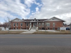 Bethany Deaconess Hospitallisted 1995
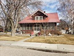 William Davie Houselisted 2008
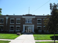 Power County Courthouselisted 1987
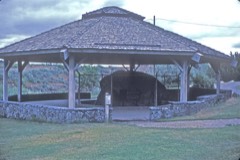 Register Rocklisted 1978
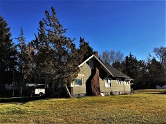 Walter Sparks Houselisted 2007
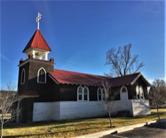 St. John's Episcopal Churchlisted 2007
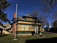 Richard and Winnie Warwas Houselisted 2006
- American Falls East Shore Power Plantslisted 1976
- American Falls Reservoir Flooded Townsitelisted 2002
- Oneida Milling and Elevator Company Grain Elevatorlisted 1993
- Oregon Trail Historic Districtlisted 1973
- Oregon Trail Historic District (Boundary Increase)listed 1974
Population over time
2 figuresAmerican Falls grew from 4,457 to 4,568 between 2010 and 2020. These are the recorded population figures Wikidata holds for this place, reached through the Geographic Names Information System number this page is keyed on rather than by name, so they belong to this place and not to another of the same name. Most are census counts, but not all are: an early figure may be a founding or settlement estimate, and an estimate published within five years of a census is left out. The change column is computed, and is left blank where more than 20 years separate a figure from the one before it, because a gap that long is not a change between two counts.
| Year | People | Change |
|---|---|---|
| 2010 | 4,457 | |
| 2020 | 4,568 | +111 (+2%) |
Topographic sheets covering this place
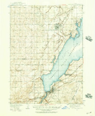
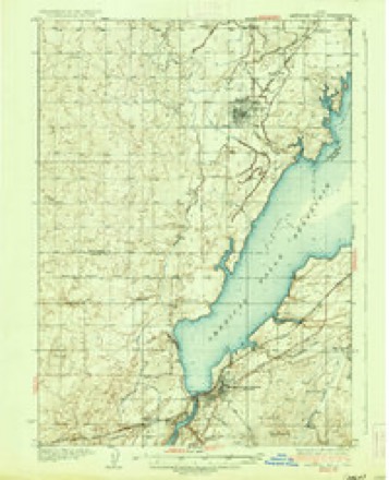
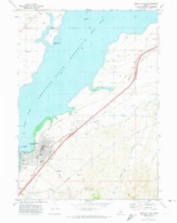
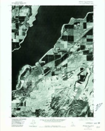
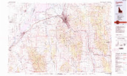
7 surveys from 12 printed sheetsMatched by testing this settlement's coordinate against the published boundary of every sheet in the United States Geological Survey's historical collection. Each opens the scanned sheet at the Survey.
- 1934 USGS American Falls quadrangle1:62500
- 1936 USGS American Falls quadrangle1:62500
- 1954 USGS Pocatello quadrangle1:250000, 4 printings
- 1958 USGS Pocatello quadrangle1:250000, 2 printings
- 1971 USGS American Falls quadrangle1:24000
- 1976 USGS American Falls quadrangle1:24000
- 1984 USGS Pocatello quadrangle1:100000, 2 printings
Fires near this place
8 since 1996Regional context, not property-specific evidence. The federal wildfire occurrence database lists 8 fires within 5 miles of American Falls between 1996 and 2020, burning about 536 acres in total. 1 started naturally. None was recorded as arson. Distance is straight-line from the map coordinates, so a fire counted here may appear on a neighbouring settlement's page as well.
| Reported cause | Fires |
|---|---|
| Missing data/not specified/undetermined | 5 |
| Natural | 1 |
| Power generation/transmission/distribution | 1 |
| Equipment and vehicle use | 1 |
The most recent of them, most recent first, with the day each was reported and the service that recorded it.
| Date | Cause | Size | Reported by | Name on the report |
|---|---|---|---|---|
| 1 September 1996 | Power generation/transmission/distribution | 85 acres | Idaho Falls District | SUNBEAM |
| 9 August 1998 | Natural | 294 acres | Idaho Falls District | INDIAN |
| 8 August 2001 | Missing data/not specified/undetermined | under an acre | Idaho Falls District | NEELY |
| 4 August 2020 | Missing data/not specified/undetermined | 5.0 acres | Power County | POWER COUNTY ASSIST 1 |
| 17 August 2018 | Missing data/not specified/undetermined | 80 acres | Idaho Falls District | POWER COUNTY ASSIST 4 |
| 23 July 2018 | Missing data/not specified/undetermined | 1.8 acres | Idaho Falls District | POWER COUNTY ASSIST 3 |
| 15 July 2018 | Missing data/not specified/undetermined | 47 acres | Idaho Falls District | POWER COUNTY ASSIST 2 |
| 23 June 2000 | Equipment and vehicle use | 23 acres | Twin Falls District | MARY |
Settlements close enough to share some of these fires:
Mines and quarries near this place
3 within 5 milesRegional context, not property-specific evidence. The federal mineral resources record lists 3 workings within 5 miles of American Falls: 1 past producer, 1 occurrence, 1 unknown. None of them still produces. What was taken out: Gold, Geothermal, Barium-Barite, Mercury. Distance is straight-line from the map coordinates, so a quarry counted here may appear on a neighbouring settlement's page as well.
| Where | Site | Commodity | Status | Recorded |
|---|---|---|---|---|
| Barite Prospect | Barium-Barite, Mercury | Unknown | ||
| Big Bend | Gold | Past Producer | ||
| Geothermal Location 8S-31E-17 | Geothermal | Occurrence |
Storms near this place
49 since 1996Regional context, not property-specific evidence. The National Weather Service names American Falls in 49 storm reports between 1996 and 2025: 27 thunderstorm wind, 7 flash flood, 5 funnel cloud, 4 tornado. No death or injury is recorded in these reports. Each account below is quoted exactly as the forecast office filed it, from the NOAA Storm Events Database, and each date opens the federal record of that event.
| When | Event | Place named | Harm | What the report says |
|---|---|---|---|---|
| February 2000 | Tornado (F0) | American Falls | $375,000 | A large metal farm building was damaged 6W of Pocatello airport: siding pushed in and roof partially removed. Nearby, a cinder block and a steel framed potato storage buildings collapsed. A large grain silo sustained severe damage. A recreation fee building destroyed and several large trees downed at Willow Bay county park. Throughout the tornado's path, irrigations center pivots flipped and wheel line systems twisted. |
| March 2006 | Thunderstorm Wind | American Falls | $75,000 | no account filed |
| March 2006 | Thunderstorm Wind | American Falls | $70,000 | no account filed |
| October 2019 | Thunderstorm Wind | American Falls | $25,000 | About 30 large hardwood trees either uprooted or snapped due to a likely microburst. One tree caused moderate damage to a RV, while another destroyed a pickup truck parked nearby. Another tree fell onto a baseball field fence. An open ended trailer rolled one turn on it's side significantly damaging it. A nearby heavy metal picnic table was flipped and shingle damage noted on a marina facilities building. |
| December 2025 | Thunderstorm Wind | American Falls | $15,000 | A semi was blown over on interstate 86 near exit 44. |
| August 2023 | Flash Flood | American Falls | $15,000 | Over 2 inches of rain fell in a 3 hour period in American Falls resulting in flash flooding. Pocatello Avenue flooded with water coming halfway up tires. The construction site at American Falls High School flooded with sandbags required. Multiple houses flooded as storm drains could not catch up with the heavy rainfall. |
| September 2012 | Thunderstorm Wind | American Falls | $10,000 | Idaho Power lost three 60 foot towers near East Road in American Falls. |
| May 2005 | Thunderstorm Wind | American Falls | $6,000 | no account filed |
| December 2025 | Thunderstorm Wind | American Falls | $5,000 | Multiple trees and power lines downed on Pleasant Valley Rd and South Pleasant Valley Rd. |
| August 2013 | Flash Flood | American Falls | $5,000 | Over one inch of rain fell in less than an hour with 1.31 inches total. Houses on the southwest side of town had basement flooding with flooding in the downtown construction area. |
| December 2025 | Thunderstorm Wind | American Falls | $4,000 | Wires downed and power outages in American Falls. |
| May 2024 | Thunderstorm Wind | American Falls | $4,000 | Trees downed in west of American Falls. |
| May 2015 | Thunderstorm Wind | American Falls | $3,000 | Large tree uprooted and downed due to thunderstorm winds near American Falls. Created 6 to 8 foot deep crater and landed on a home. |
| June 2015 | Thunderstorm Wind | American Falls | $2,000 | Idaho State Journal reported several large tree limbs down as well as power lines and road signs west of American Falls. |
| March 2011 | Thunderstorm Wind | American Falls | $2,000 | Extensive damage and warning level winds occurred with the passage of a cold front the evening of March 10th. A roof was blown off a building in American Falls into power lines with power outages in the city for up to an hour. Wind speeds of 78 mph were measured in American Falls. The winds also downed some power lines. |
| August 2007 | Thunderstorm Wind | American Falls | $2,000 | Several trees downed to the east of American Falls with power outages. |
| June 2024 | Thunderstorm Wind | American Falls | $1,000 | Large tree several feet in diameter uprooted and down on top of a house along Van Buren St. |
| June 2024 | Thunderstorm Wind | American Falls | $1,000 | A large tree uprooted and downed in a yard. |
| June 2024 | Thunderstorm Wind | American Falls | $1,000 | Tree snapped off in the area of Fort Hall Ave and Madison St. |
| June 2024 | Flash Flood | American Falls | $1,000 | Several commercial and residential streets under water. One residential street experienced significant damage and erosion. |
| August 2014 | Flash Flood | American Falls | $1,000 | Flash flooding reported in American Falls with standing water on roadways and a basement flooded at one residence. |
| May 2014 | Tornado (EF0) | American Falls | $1,000 | A tornado was spotted about 10 miles west-northwest of American Falls around 640 PM MDT and it moved slightly north-northwest until around 7 pm MDT. It was located 1.2 mile north-northwest of the intersection of North Pleasant Valley Road and County Line Road at 641 pm MDT. A damage survey showed damage to a residence on North Pleasant Valley Road between Schritter and County Line Roads. Multiple trees were uprooted or had branches torn off. Shingles were torn off the hours and a shed door was damaged and blown off its hinges. There were also isolated reports of irrigation line damage as the tornado moved through mostly open fields. No other damage was found. |
| April 2002 | Thunderstorm Wind | American Falls | $1,000 | no account filed |
| August 2024 | Thunderstorm Wind | American Falls | $500 | Large tree limb fell on fence in American Falls. |
| June 2024 | Flash Flood | American Falls | $300 | Flash flooding occurred across roads and fields in the areas of Bragg Rd and Neibur Rd with several inches of water in a garage. |
| June 2024 | Flash Flood | American Falls | $100 | Intersection of Fort Hall Ave and Harrison St flooded. |
| June 2024 | Flash Flood | American Falls | $100 | Water reported across the interstate 86 eastbound exit ramp at exit 40. |
| August 2025 | Thunderstorm Wind | American Falls | - | A 58 mph wind gust recorded at mesonet station 2977 D5 Arbon Valley. |
| May 2024 | Thunderstorm Wind | American Falls | - | Idaho Power reported 100 customers lost power west of Aberdeen. |
| June 2024 | Hail | American Falls | - | One inch hail in American Falls. |
| June 2024 | Thunderstorm Wind | American Falls | - | A 60 mph wind gust estimated and 2 inches of rain on Sunset Lane. |
| May 2023 | Funnel Cloud | American Falls | - | Photograph of funnel cloud. |
| May 2023 | Funnel Cloud | American Falls | - | Funnel cloud photograph received west of American Falls. |
| May 2023 | Funnel Cloud | American Falls | - | Funnel cloud photographed west of American Falls. |
| February 2019 | Flood | American Falls | - | Warming temperatures caused snow melt and Main Street in American Falls was submerged in water. |
| May 2018 | Thunderstorm Wind | American Falls | - | The Crystal RAWS measured an 89 mph wind gust. |
| April 2016 | Funnel Cloud | American Falls | - | Multiple photographs were received of a funnel cloud west of American Falls between 1 pm and 1:30 pm MDT on April 11th. |
| August 2011 | Hail | American Falls | - | A spotter reported 1 inch hail 4 miles east northeast of American Falls. |
| July 2008 | Hail | American Falls | - | Three quarter inch hail west of American Falls. |
| June 2004 | Thunderstorm Wind | American Falls | - | Estimated wind gusts, blew pickup truck into another vehicle. |
| June 2004 | Thunderstorm Wind | American Falls | - | Irrigation pipe blown from storage rack. |
| April 2003 | Tornado (F0) | American Falls | - | Tornado occurred in open fields near Indian Springs. No damage occurred. |
| July 2000 | Thunderstorm Wind | American Falls | - | Winds to 60 mph toppled several trees of 6-8 inches in diameter, broke tree limbs and flattened crops. |
| September 1997 | Funnel Cloud | American Falls | - | County sheriff observed funnel cloud near Bannock Peak. |
| August 2003 | Thunderstorm Wind | American Falls | - | no account filed |
| April 2003 | Hail | American Falls | - | no account filed |
| June 1996 | Tornado (F0) | American Falls | - | no account filed |
| June 1996 | Thunderstorm Wind | American Falls | - | no account filed |
| September 1996 | Wildfire | American Falls | - | no account filed |
Nearest settlements
The eight closest, with where each one stands in the county. Distances are straight-line, computed from the Geographic Names Information System coordinates.
Elsewhere
Matched on this settlement's Geographic Names Information System number rather than its name, so it cannot be a different place of the same name in another state.
| Wikipedia article on American Falls | An encyclopaedic summary. Its text is share-alike, so it is linked here rather than copied. |
| Wikidata item Q385233 | The structured record the population and elevation above come from. Public domain (CC0). |
Provenance
This settlement is recorded in the Geographic Names Information System as feature 396035. The sheet list is computed by point-in-boundary test against the United States Geological Survey's historical topographic inventory. Both are works of the United States government and carry no copyright under 17 U.S.C. 105.
Wildfire. Short, Karen C. 2022. Spatial wildfire occurrence data for the United States, 1992-2020 [FPA_FOD_20221014]. 6th Edition. Fort Collins, CO: Forest Service Research Data Archive. https://doi.org/10.2737/RDS-2013-0009.6 Collected with United States Government funding and usable without additional permissions or fees.
Mines and quarries. USGS Mineral Resources Data System (MRDS) https://mrdata.usgs.gov/mrds/ A work of the United States government, no copyright under 17 U.S.C. 105.
Storms. NOAA National Centers for Environmental Information, Storm Events Database https://www.ncei.noaa.gov/stormevents/ A work of the United States government, no copyright under 17 U.S.C. 105. Narratives are quoted verbatim from the National Weather Service report and are not edited or summarised.