 Block
Barber, Idaho
14 topographic sheets cover this place, the earliest surveyed in 1892 and the latest in 1981. It stands in the Boise Hills census division. It lies in ZIP code area 83716. It lies near Maynard Gulch. The Survey maps it on the Lucky Peak quadrangle.
On record in Barber
Buildings and businesses the archive holds for this place. Each opens its own page, with the source record it came from.
On the National Register within a mile 1 record
The National Register names another town for these. They stand within one mile of this settlement's coordinate.
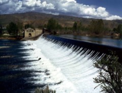 Barber Dam and Lumber Milllisted 1978 · 0.5 miles away
Topographic sheets covering this place
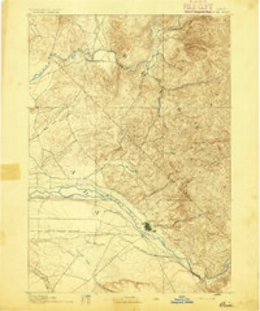
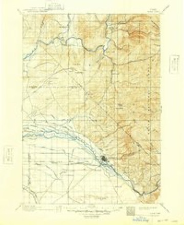
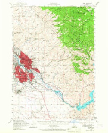
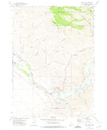
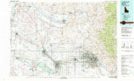
8 surveys from 14 printed sheetsMatched by testing this settlement's coordinate against the published boundary of every sheet in the United States Geological Survey's historical collection. Each opens the scanned sheet at the Survey.
- 1892 USGS Boise quadrangle1:125000
- 1897 USGS Boise quadrangle1:125000, 4 printings
- 1954 USGS Boise quadrangle1:62500, 2 printings
- 1955 USGS Boise quadrangle1:250000
- 1958 USGS Boise quadrangle1:250000, 2 printings
- 1962 USGS Boise quadrangle1:250000
- 1972 USGS Lucky Peak quadrangle1:24000
- 1981 USGS Boise quadrangle1:100000, 2 printings
Fires near this place
128 since 1992Regional context, not property-specific evidence. The federal wildfire occurrence database lists 128 fires within 5 miles of Barber between 1992 and 2020, burning about 26,480 acres in total. 16 started naturally. 12 were recorded as arson. Distance is straight-line from the map coordinates, so a fire counted here may appear on a neighbouring settlement's page as well.
| Reported cause | Fires |
|---|---|
| Missing data/not specified/undetermined | 43 |
| Equipment and vehicle use | 23 |
| Natural | 16 |
| Arson/incendiarism | 12 |
| Recreation and ceremony | 10 |
| Power generation/transmission/distribution | 9 |
| Fireworks | 8 |
| Firearms and explosives use | 3 |
| Misuse of fire by a minor | 2 |
| Debris and open burning | 2 |
The most recent of them, most recent first, with the day each was reported and the service that recorded it.
| Date | Cause | Size | Reported by | Name on the report |
|---|---|---|---|---|
| 9 September 1999 | Recreation and ceremony | 126 acres | Boise District | SANDY POIN |
| 6 September 2012 | Power generation/transmission/distribution | under an acre | Boise District | MM14 HWY21 |
| 3 September 2018 | Missing data/not specified/undetermined | under an acre | Boise District | MM14 HWY21 |
| 29 September 2001 | Equipment and vehicle use | 437 acres | Boise District | HUMPNBUMP |
| 28 September 2011 | Recreation and ceremony | under an acre | Boise District | COTTONWOOD |
| 24 September 2018 | Missing data/not specified/undetermined | under an acre | Boise District | MM10 HWY21 |
| 24 September 2000 | Equipment and vehicle use | 2,551 acres | Boise District | HILLTOP |
| 22 September 2013 | Missing data/not specified/undetermined | under an acre | Boise District | ELEYE |
Settlements close enough to share some of these fires:
Mines and quarries near this place
10 of 47 shownRegional context, not property-specific evidence. The federal mineral resources record lists 47 workings within 5 miles of Barber: 33 past producers, 5 producers, 5 occurrences, 4 prospects. 5 still produce. What was taken out: Gold, Sand and Gravel, Construction, Silver, Copper, Lead, Silver. Distance is straight-line from the map coordinates, so a quarry counted here may appear on a neighbouring settlement's page as well.
| Where | Site | Commodity | Status | Recorded |
|---|---|---|---|---|
| Adelmann Group | Gold, Silver, Zinc | Past Producer | Vein | |
| Black Hornet Mine | Gold, Lead, Silver, Zinc | Past Producer | Vein | |
| Old Boise Stone Company Quarry | Stone, Dimension | Past Producer | Sandstone | |
| Picket Pin Mine | Gold, Lead, Zinc | Past Producer | Vein | |
| Pullman Brick Co. Mine | Clay | Producer | Surface | |
| Quarry | Stone, Crushed/Broken | Past Producer | ||
| Shaw Mining District | Gold, Osmium, Iridium | Prospect | STREAM PLACER | |
| Viola Mine | Gold, Lead, Zinc | Past Producer | Vein | |
| Diatomite Occurrence | Diatomite | Occurrence | Sedimentary | |
| Golden Star Group | Gold, Copper, Lead, Silver | Past Producer |
Storms near this place
12 since 2008Regional context, not property-specific evidence. The National Weather Service names Barber in 12 storm reports between 2008 and 2025: 6 flood, 3 debris flow, 1 thunderstorm wind, 1 heavy rain. No death or injury is recorded in these reports. Each account below is quoted exactly as the forecast office filed it, from the NOAA Storm Events Database, and each date opens the federal record of that event.
| When | Event | Place named | Harm | What the report says |
|---|---|---|---|---|
| May 2017 | Flood | Barber | $2,000,000 | The Boise River remained in flood during the entire month of May due to planned release from Lucky Peak dam. Regulated flows were above flood stage for 101 days resulting in extensive damage to the Greenbelt and Nature Trail paths. Extensive flood fight efforts continued in the Eagle Island area to prevent a pit capture. Widespread flooding continued on Eagle Island in the Riviera Estates area where several homes were surrounded by water and low lying roads were inundated. Large portions of Ann Morrison Park, Barber Park, and Marianne Williams Park were impacted by flood waters. Some residential streets continued to be impacted by flood waters, especially in the Garden City Warehouse District and on Eagle Island. A pit capture occurred just downstream of Eagle Island causing a major shift in the river channel. Streets in the Stonebriar development just downstream of the Highway 16 bridge were inundated by water. Severe bank erosion and large trees washed into the river caused problems in the river channel and at some bridge crossings. |
| April 2017 | Flood | Barber | $1,000,000 | Planned releases from Lucky Peak Reservoir for flood control ranged from 7800 CFS to 8900 CFS during the month of April. The prolonged flood flows continued to cause extensive damage to the Greenbelt and Nature Trail paths. Flood waters inundated portions of Eagle Island, particularly along Artesian Road and Hatchery Road. Numerous homes in Riviera Estates were surrounded by water. Flood fight efforts continued to focus in the Eagle Island area with extensive sandbagging taking place. Additional flood fight efforts to mitigate a pit capture continued along the Eagle Island south channel of the river. Flood diversion tubes and muscle wall barriers were used to limit river encroachment on the sandpit. Large sections of Ann Morrison Park, Marianne Williams Park, and Barber Park were flooded. Some residential streets adjacent to the river had water on them, especially in the Garden City Warehouse District. |
| March 2017 | Flood | Barber | $1,000,000 | The Army Corps of Engineers and Bureau of Reclamation increased regulated flows from Lucky Peak Reservoir putting the Boise River in flood for the remainder of the month of March. Flooding was expected to continue through late spring. Flood flows for the extended period caused significant damage to much of the Greenbelt and Nature Trail paths along the river. Flood fight efforts were focused in the Eagle Island area where severe bank erosion occurred and a pit capture threat existed. A HESCO barrier wall and extensive sandbagging occurred in the area to mitigate a pit capture. |
| August 2025 | Debris Flow | Barber | - | On the east side of the Valley Fire burn scar, heavy rainfall with a peak rain rate of 7 inches per hour caused a slurry of mud, ash, and debris to flow down eastern Highland Valley Rd, depositing nearly a foot of debris on the road with running water estimated at 12 inches high. The road would have been impassable while water was running, and the debris flow ran down the length of the valley. No impacts along Hwy 21. |
| August 2025 | Debris Flow | Barber | - | Heavy rainfall rates on the recent Valley Fire burn scar created a debris flow that ran down the entire length of Highland Valley, half of which flowed into the Boise River and the other half into a canal. The slurry heavily impacted a community along Warm Springs, running water/slurry could have been anywhere from 3 to 8 ft in height, swept a truck into a fence, only being caught by other debris. Lawns were covered in debris and a white picket fence would have been submerged in the flow. This came from a storm with a peak rain rate of 7 inches per hour that remained over Lucky Peak for an extended period of time. |
| August 2025 | Debris Flow | Barber | - | Following the debris flow that impacted the community at the bottom of Highland Valley, the half of the flow that entered the canal followed the canal into another community near Barber. The flow was so high it crested a canal culvert and began flowing down streets of the suburban community. Multiple inches of silt were built up in the neighborhood, with debris at every turn along the way. Triggering a fast response clean up to reopen the neighborhood. |
| August 2025 | Flash Flood | Barber | - | A training thunderstorm persisted near Arrowrock Dam for about 45 minutes with rain rates between 3 and 6 inches per hour. Rocky cliff faces and steep valleys allowed water to accumulate, though soil/brush retention absorbed most of the rain. While Arrowrock Road was still drivable afterwards, there was evidence of significant water erosion, with multiple spots estimated to have at least 6 inches of running water. The road would have been undrivable during the event. |
| November 2022 | Heavy Rain | Barber | - | A rainfall total of 0.74 inches was measured by CoCoRaHS station ID-AD-21. |
| May 2012 | Flood | Barber | - | Regulated flows on the Boise River increased above flood flow (7,000 cfs) on April 28, and were reduced below flood flow on May 15. Flood impacts were minor. Lowland flooding occurred along the river from Boise downstream through Caldwell to Parma. Sections of the greenbelt path were flooded along with some pasture and fields near the river. Floodwaters inundated a section of Boise River Road between Highway 95 and Notus. Several large trees were up-rooted and became snagged on bridges. |
| May 2011 | Flood | Barber | - | The Boise River experienced minor flooding due to a planned release from Lucky Peak Dam. the river crested at 10.03 feet around 300 PM MDT. |
| June 2008 | Thunderstorm Wind | Barber | - | Boise Lucky Peak RAWS reported thunderstorm wind gusts of 65 and 67 MPH from around 630 PM to 800 PM while many reports of downed trees and power outages were received from the Boise metro area during the same time period. An off duty NWS meteorologist also reported an estimated wind gust of 60 MPH 3 miles north of Meridian at 635 PM. |
| March 2017 | Flood | Barber | - | no account filed |
Nearest settlements
The eight closest, with where each one stands in the county. Distances are straight-line, computed from the Geographic Names Information System coordinates.
| Map | Place | Distance | Sheets |
|---|---|---|---|
| South Boise (historical) | 2.9 miles | 19 | |
| Vernon | 3.0 miles | 19 | |
| Hillcrest | 3.7 miles | 19 | |
| Boise | 5.8 miles | 19 | |
| Boise Hills Village | 6.2 miles | 18 | |
| Blacks Creek | 6.2 miles | 16 | |
| Highlands | 7.0 miles | 18 | |
| Garden City | 7.7 miles | 19 |
Provenance
This settlement is recorded in the Geographic Names Information System as feature 397406. The sheet list is computed by point-in-boundary test against the United States Geological Survey's historical topographic inventory. Both are works of the United States government and carry no copyright under 17 U.S.C. 105.
Wildfire. Short, Karen C. 2022. Spatial wildfire occurrence data for the United States, 1992-2020 [FPA_FOD_20221014]. 6th Edition. Fort Collins, CO: Forest Service Research Data Archive. https://doi.org/10.2737/RDS-2013-0009.6 Collected with United States Government funding and usable without additional permissions or fees.
Mines and quarries. USGS Mineral Resources Data System (MRDS) https://mrdata.usgs.gov/mrds/ A work of the United States government, no copyright under 17 U.S.C. 105.
Storms. NOAA National Centers for Environmental Information, Storm Events Database https://www.ncei.noaa.gov/stormevents/ A work of the United States government, no copyright under 17 U.S.C. 105. Narratives are quoted verbatim from the National Weather Service report and are not edited or summarised.