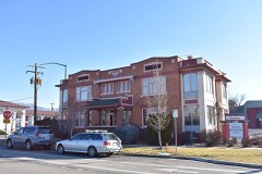
Block
From the record
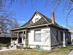
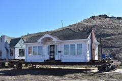
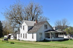
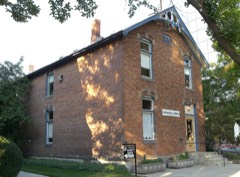
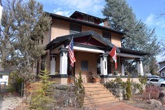
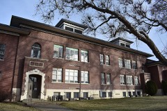
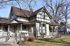
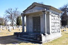
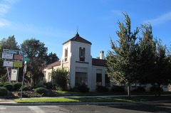
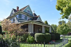
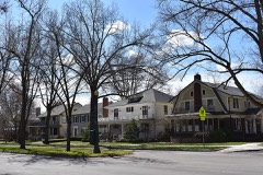
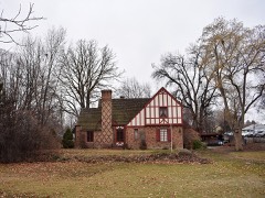
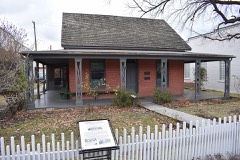
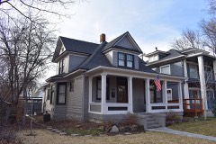
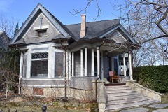
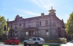
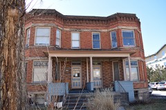
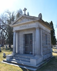
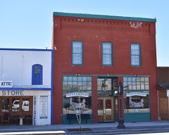
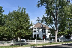
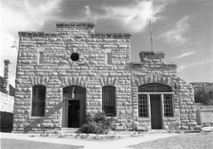
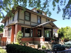
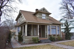
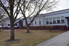
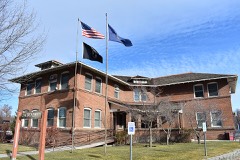
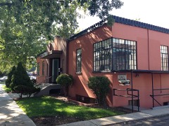
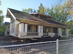
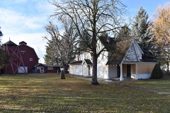
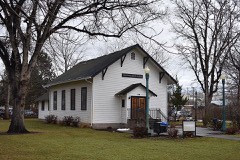
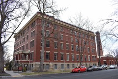
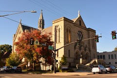
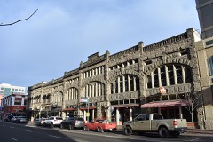
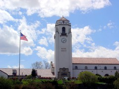
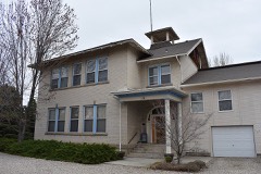
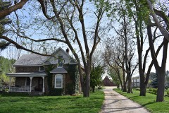
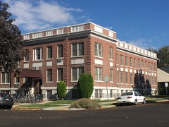
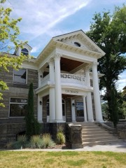
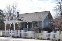
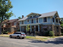
167 National Register listings published here, 1 of them a National Historic Landmark.
Sources: the National Register database, National Park Service
97 topographic sheets cover 30 settlements here, and 167 properties are on the National Register of Historic Places.
167 National Register listings published here, 1 of them a National Historic Landmark.
Sources: the National Register database, National Park Service
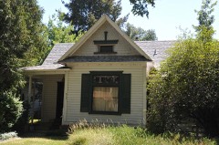
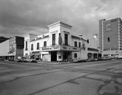
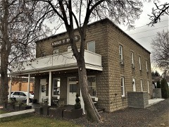
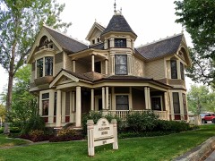
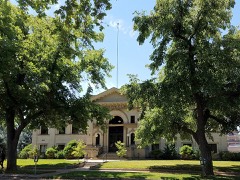
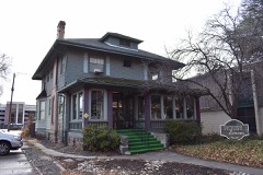
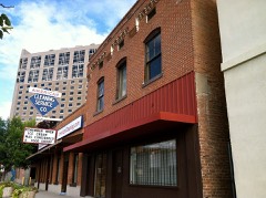
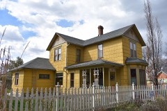
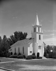
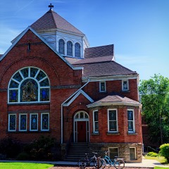
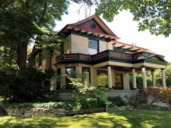
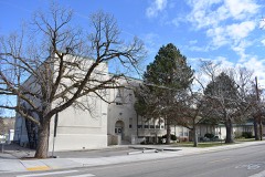
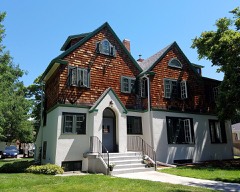
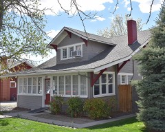
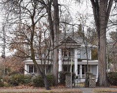
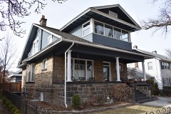
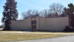
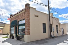
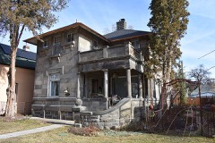
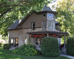
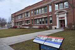
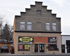
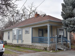
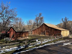
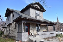
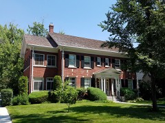
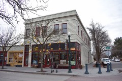
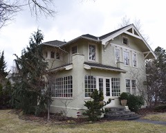
Every property in this county listed on the National Register of Historic Places, with the year it was listed and the federal nomination document.
Every wildfire the federal occurrence database records inside this county: 2,601 of them, burning about 238,076 acres. 222 started naturally and 34 were recorded as arson. Each settlement page carries the fires within five miles of it.
| Reported cause | Fires |
|---|---|
| Equipment and vehicle use | 994 |
| Firearms and explosives use | 964 |
| Natural | 222 |
| Missing data/not specified/undetermined | 195 |
| Power generation/transmission/distribution | 47 |
| Recreation and ceremony | 42 |
| Fireworks | 34 |
| Arson/incendiarism | 34 |
| Debris and open burning | 28 |
| Railroad operations and maintenance | 26 |
| Smoking | 7 |
| Other causes | 4 |
| Misuse of fire by a minor | 4 |
The five largest, by the area the report gives. None of them was recorded as arson.
| Date | Cause | Size | Reported by | Name on the report |
|---|---|---|---|---|
| 30 July 1996 | Natural | 18,165 acres | Boise District | COYOTEBT. |
| 26 August 1996 | Equipment and vehicle use | 15,263 acres | Boise National Forest | EIGHTH STREET |
| 22 August 1996 | Natural | 13,091 acres | Boise District | OTA 21 |
| 28 July 1995 | Natural | 11,622 acres | Boise District | POINT |
| 15 August 2011 | Natural | 10,527 acres | Boise District | UNION |
| 1 October 1997 | Debris and open burning | 9,207 acres | Boise District | HIGHWAY55 |
| 23 August 2005 | Firearms and explosives use | 8,347 acres | Boise District | SOUTHBLACK |
| 16 August 1996 | Natural | 8,200 acres | Boise District | OTA 18 |
Every settlement page carries the fires within five miles of it - see the settlement index below.
The NOAA Storm Events Database holds 214 reports for this county, causing no deaths, 77 injuries and about $5,683,060 in recorded property damage. Each settlement page carries the reports that name it.
| Kind of event | Reports |
|---|---|
| Thunderstorm Wind | 109 |
| Hail | 41 |
| Heavy Rain | 17 |
| Tornado | 13 |
| Flood | 13 |
| Flash Flood | 10 |
| Funnel Cloud | 4 |
| Lightning | 3 |
| Debris Flow | 3 |
| Wildfire | 1 |
The most serious of them, by death, then injury, then recorded damage. The accounts are quoted exactly as the forecast office filed them.
| When | Event | Place named | Harm | What the report says |
|---|---|---|---|---|
| August 2010 | Thunderstorm Wind | (Boi)Gowen Fld Boise | 70 hurt | The BOI ASOS measured a wind gust of 68 MPH and several reports were received for wind damage including downed trees and power lines. Minor injuries were reported from the Western Idaho Fair as a result of temporary structures collapsing. |
| July 2002 | Thunderstorm Wind | Meridian | 4 hurt | no account filed |
| October 2019 | Thunderstorm Wind | Kuna | 2 hurt | The public in Kuna reported several large trees, power lines and fences down, and car damage. The Boise Fire Department reported a lightning strike on a house 2 miles east of Boise. Two injuries were reported including two dogs that died in the fire. |
| July 1995 | Hail | Black Creek | 1 hurt, $5,000 | no account filed |
| May 2017 | Flood | Barber | $2,000,000 | The Boise River remained in flood during the entire month of May due to planned release from Lucky Peak dam. Regulated flows were above flood stage for 101 days resulting in extensive damage to the Greenbelt and Nature Trail paths. Extensive flood fight efforts continued in the Eagle Island area to prevent a pit capture. Widespread flooding continued on Eagle Island in the Riviera Estates area where several homes were surrounded by water and low lying roads were inundated. Large portions of Ann Morrison Park, Barber Park, and Marianne Williams Park were impacted by flood waters. Some residential streets continued to be impacted by flood waters, especially in the Garden City Warehouse District and on Eagle Island. A pit capture occurred just downstream of Eagle Island causing a major shift in the river channel. Streets in the Stonebriar development just downstream of the Highway 16 bridge were inundated by water. Severe bank erosion and large trees washed into the river caused problems in the river channel and at some bridge crossings. |
| June 2023 | Flash Flood | Boise | $1,000,000 | Thunderstorms produced heavy rain across portions of the Lower Treasure Valley, including the city of Boise. Social media, weather spotter, and emergency manager reports indicated localized flooding. |
| April 2017 | Flood | Barber | $1,000,000 | Planned releases from Lucky Peak Reservoir for flood control ranged from 7800 CFS to 8900 CFS during the month of April. The prolonged flood flows continued to cause extensive damage to the Greenbelt and Nature Trail paths. Flood waters inundated portions of Eagle Island, particularly along Artesian Road and Hatchery Road. Numerous homes in Riviera Estates were surrounded by water. Flood fight efforts continued to focus in the Eagle Island area with extensive sandbagging taking place. Additional flood fight efforts to mitigate a pit capture continued along the Eagle Island south channel of the river. Flood diversion tubes and muscle wall barriers were used to limit river encroachment on the sandpit. Large sections of Ann Morrison Park, Marianne Williams Park, and Barber Park were flooded. Some residential streets adjacent to the river had water on them, especially in the Garden City Warehouse District. |
| March 2017 | Flood | Barber | $1,000,000 | The Army Corps of Engineers and Bureau of Reclamation increased regulated flows from Lucky Peak Reservoir putting the Boise River in flood for the remainder of the month of March. Flooding was expected to continue through late spring. Flood flows for the extended period caused significant damage to much of the Greenbelt and Nature Trail paths along the river. Flood fight efforts were focused in the Eagle Island area where severe bank erosion occurred and a pit capture threat existed. A HESCO barrier wall and extensive sandbagging occurred in the area to mitigate a pit capture. |
| April 1995 | Thunderstorm Wind | Star | $500,000 | no account filed |
| September 1997 | Flash Flood | Boise | $60,000 | During the evening of September 11, a flash flood occurred in the foothills of the Boise Mountains. The foothills had received significant rainfall all day long. Between 500 pm and 600 pm MST a heavy shower dumped 4 tenths of an inch of rain in 9 minutes on the foothills triggering flash flooding into the north end of Boise. The wall of mud and debris was estimated at 15 feet high as it breached six flood control dams and washed over a golf course. While most of the damage consisted of mud and debris on local roadways, the golf course sustained damage and 12 houses were slightly damaged at the foundations. No injuries were reported. As of publishing , damages to roads in the city and clean up costs were estimated at at least 60,000 dollars. |
| October 1984 | Tornado (F1) | not stated | $25,000 | no account filed |
| March 1984 | Tornado (F1) | not stated | $25,000 | no account filed |
| September 1998 | Thunderstorm Wind | Boise | $20,000 | no account filed |
| July 2015 | Flash Flood | Boise | $10,000 | Heavy rain from slow moving thunderstorms caused flash flooding in the Boise metro area. Over an inch of rain fell in less than an hour across portions of Boise. Flash flooding was reported in the downtown area and in the north and northwest parts of the city. |
| June 2010 | Thunderstorm Wind | (Boi)Gowen Fld Boise | $10,000 | The BOI ASOS measured a wind gust of 59 MPH and NWS employees reported downed trees and fences in Southeast Boise along Surprise Valley Way. Ada County Emergency Manager reported power lines down in Southwest Boise and trees and traffic lights down in Garden City. |
| September 1998 | Lightning | Boise | $10,000 | no account filed |
| September 1998 | Thunderstorm Wind | Boise | $8,000 | no account filed |
| January 1999 | Thunderstorm Wind | (Boi)Gowen Fld Boise | $5,000 | During the morning of January 16th a line of strong rain showers and ice pellet showers produced severe wind gusts near Boise. A spotter reported the roof of a small barn was blown off and a tree was uprooted. A second spotter reported a small outbuilding was blown 50 yards and power lines were downed. |
| April 1995 | Thunderstorm Wind | Boise | $5,000 | no account filed |
| July 1956 | Tornado (F1) | not stated | $30 | no account filed |
| August 1956 | Tornado (F0) | not stated | $30 | no account filed |
| August 2025 | Debris Flow | Barber | - | On the east side of the Valley Fire burn scar, heavy rainfall with a peak rain rate of 7 inches per hour caused a slurry of mud, ash, and debris to flow down eastern Highland Valley Rd, depositing nearly a foot of debris on the road with running water estimated at 12 inches high. The road would have been impassable while water was running, and the debris flow ran down the length of the valley. No impacts along Hwy 21. |
| August 2025 | Debris Flow | Barber | - | Heavy rainfall rates on the recent Valley Fire burn scar created a debris flow that ran down the entire length of Highland Valley, half of which flowed into the Boise River and the other half into a canal. The slurry heavily impacted a community along Warm Springs, running water/slurry could have been anywhere from 3 to 8 ft in height, swept a truck into a fence, only being caught by other debris. Lawns were covered in debris and a white picket fence would have been submerged in the flow. This came from a storm with a peak rain rate of 7 inches per hour that remained over Lucky Peak for an extended period of time. |
| August 2025 | Debris Flow | Barber | - | Following the debris flow that impacted the community at the bottom of Highland Valley, the half of the flow that entered the canal followed the canal into another community near Barber. The flow was so high it crested a canal culvert and began flowing down streets of the suburban community. Multiple inches of silt were built up in the neighborhood, with debris at every turn along the way. Triggering a fast response clean up to reopen the neighborhood. |
| August 2025 | Flash Flood | Barber | - | A training thunderstorm persisted near Arrowrock Dam for about 45 minutes with rain rates between 3 and 6 inches per hour. Rocky cliff faces and steep valleys allowed water to accumulate, though soil/brush retention absorbed most of the rain. While Arrowrock Road was still drivable afterwards, there was evidence of significant water erosion, with multiple spots estimated to have at least 6 inches of running water. The road would have been undrivable during the event. |
| July 2025 | Thunderstorm Wind | Orchard | - | Mesonet station IDARNG2_RG14 measured a wind gust of 63 mph as a thunderstorm outflow passed. This outflow continued into Elmore county. No damages were reported. |
| December 2025 | Thunderstorm Wind | Orchard | - | The Idaho Transportation Department's Valley Interchange weather station south of Hazelton reported a 66 mph gust as a line of showers and embedded thunderstorms move through. |
| January 2024 | Thunderstorm Wind | Beatty | - | A member of the public reported their portable shed was lifted and damaged siding on their house from the outflow wind gust from a thunderstorm near Kuna, ID. |
| May 2024 | Thunderstorm Wind | Boise | - | A strong outflow boundary from a thunderstorm damaged several power lines around the Boise metropolitan area and Garden Valley. Around 2,000-3,000 people were estimated to be without power in both of those regions due to wind damage. |
| May 2024 | Heavy Rain | (Boi)Gowen Fld Boise | - | The mesonet station, LLAI1, at the Boise WFO measured 0.72 inches of rain. |
| April 2024 | Hail | Sonna | - | An NWS Employee measured 0.75 inch hail from this storm. |
| April 2024 | Hail | Boise Strawberry Gle | - | A member of the public measured 1.0 inch hail from this storm. |
| July 2024 | Thunderstorm Wind | Boise Hills Vlg | - | The Crestline Trail RAWS measured this wind gust. |
| April 2024 | Hail | Bradley Arpt | - | A member of the public measured 1.0 inch hail from this storm. |
| September 2024 | Thunderstorm Wind | Boise Terminal Arpt | - | The ASOS station at the Boise airport reported a high wind gust from a thunderstorm outflow boundary. |
| September 2024 | Thunderstorm Wind | Boise | - | A large spruce tree was knocked down at Morris Hill Cemetery. |
| September 2024 | Thunderstorm Wind | Boise Hills Vlg | - | The public reported a large spruce tree down. |
| September 2024 | Thunderstorm Wind | Boise | - | The public reported a large spruce tree was knocked down along with old juniper trees. Idaho Power reported that this caused 2000 customers to be without power in the Boise North End. |
| June 2023 | Thunderstorm Wind | Boise Hills Vlg | - | There were numerous reports of tree damage with large branches down on social media. |
| June 2023 | Thunderstorm Wind | Boise | - | A tree fell on Park Center Boulevard and Highland Street, which blocked several lanes. |
| June 2023 | Thunderstorm Wind | Boise Hills Vlg | - | The mesonet station, TT289, on Crestline Trail measured 50 knots of wind. |
| June 2023 | Thunderstorm Wind | Boise | - | An NWS employee measured a wind gust of 50 knots in downtown Boise. |
| June 2023 | Thunderstorm Wind | Boise | - | An NWS employee reported 50 knots of wind in southeast Boise. |
| June 2023 | Thunderstorm Wind | Boise Hills Vlg | - | The mesonet station, TT289, on Crestline Trail, measured 50 knots of wind. |
| May 2023 | Thunderstorm Wind | Boise | - | A couple of large trees were knocked down near Quinn's Pond on the Boise Greenbelt. |
| May 2023 | Thunderstorm Wind | Boise Hills Vlg | - | The mesonet station TT289 up on Crestline Trail measured a severe gust. |
| March 2023 | Heavy Rain | (Boi)Gowen Fld Boise | - | The mesonet station LLAI1 at the Boise Weather Forecast Office RAWS measured 1.13 inches of rain. |
| March 2023 | Heavy Rain | Boise Hills Vlg | - | The mesonet station 1452D 2 miles east of Boise measured 1.10 inches of rain. |
| March 2023 | Heavy Rain | Boise | - | The mesonet station GW0891 in Boise measured 1.09 inches of rain. |
| March 2023 | Heavy Rain | Boise Hills Vlg | - | The mesonet station TT289 at Crestline Trail in the Boise foothills measured 1.08 inches of heavy rain. |
| May 2023 | Thunderstorm Wind | Eagle | - | Several trees on a residential property were knocked down from thunderstorm outflow. |
| May 2023 | Thunderstorm Wind | Bradley Arpt | - | A fence was knocked down in the Boise Bench at a residential property. |
| May 2023 | Thunderstorm Wind | Ustick | - | A large tree branch was knocked down in a residential property in the West Bench neighborhood. |
| May 2023 | Thunderstorm Wind | Meridian | - | A few rotten trees were knocked down south of Meridian. |
| May 2023 | Thunderstorm Wind | Boise Jct | - | A large tree was knocked down on the Boise Bench. |
| March 2023 | Heavy Rain | Olson City | - | The mesonet station BOII 1.7 miles southeast of Boise measured 1.15 inches of heavy rain. |
| May 2023 | Tornado (EF0) | Star | - | Several photos of a land spout near Highway 16 and Broken Arrow Lane. |
| March 2023 | Heavy Rain | Boise | - | The mesonet station at BSUI1 measured 1.32 inches of heavy rain. |
| August 2023 | Heavy Rain | (Boi)Gowen Fld Boise | - | The ASOS at the Boise airport measured 0.73 inches of rain. The mesonet station GW0891 one mile south of Boise measured 0.81 inches of rain. |
| August 2023 | Heavy Rain | (Boi)Gowen Fld Boise | - | The mesonet station LLAI1 at Boise measured 2.42 inches of heavy rain. |
The Survey's mineral resources record lists 161 workings inside this county. 17 still produce and 144 are closed or unrecorded. Each settlement page carries the workings within five miles of it.
| Commodity | Workings |
|---|---|
| Sand and Gravel, Construction | 107 |
| Gold | 35 |
| Diatomite | 5 |
| Silver | 4 |
| Zinc | 3 |
| Copper, Lead, Silver | 2 |
| Stone, Dimension | 2 |
| Perlite | 2 |
| Zinc, Lead | 2 |
| Geothermal | 2 |
| Clay | 1 |
| Gold, Lead | 1 |
| Lead, Silver, Zinc | 1 |
| Beryllium | 1 |
The least common of them first, because a county's hundredth gravel pit says nothing its first ten did not.
| Where | Site | Commodity | Status | Recorded |
|---|---|---|---|---|
| Adelmann Group | Gold, Silver, Zinc | Past Producer | Vein | |
| Black Hornet Mine | Gold, Lead, Silver, Zinc | Past Producer | Vein | |
| Gold Dollar Mineral Claims | Manganese | Occurrence | ||
| Picket Pin Mine | Gold, Lead, Zinc | Past Producer | Vein | |
| Pullman Brick Co. Mine | Clay | Producer | Surface | |
| Quarry | Stone, Crushed/Broken | Past Producer | ||
| Shaw Mining District | Gold, Osmium, Iridium | Prospect | STREAM PLACER | |
| Stanley Prospect | Beryllium, Garnet, Mica, Silica | Prospect | Beryl | |
| Unnamed Location | Pumice | Past Producer | ||
| Viola Mine | Gold, Lead, Zinc | Past Producer | Vein | |
| Wild Cat | Copper, Gold, Silver, Lead, Zinc | Past Producer | ||
| Blizzard | Gold, Zinc, Lead | Unknown | ||
| Geothermal Location | Geothermal | Occurrence | ||
| Geothermal Location | Geothermal | Occurrence | ||
| Golden Star Group | Gold, Copper, Lead, Silver | Past Producer | ||
| Old Boise Stone Company Quarry | Stone, Dimension | Past Producer | Sandstone | |
| Perlite Deposit | Perlite | Occurrence | ||
| Rip Rap Pit-Gowen Field | Stone, Dimension | Unknown | ||
| Tornado Mine | Zinc, Lead | Prospect | Vein | |
| Twentieth Century Mine | Gold, Copper, Lead, Silver | Past Producer | Vein | |
| Unnamed Location | Perlite | Past Producer | ||
| Paymaster Mine | Gold, Zinc | Past Producer | Vein | |
| Rising Sun Mine | Gold, Silver, Zinc | Past Producer | Vein | |
| Keltic Gold Mine | Gold, Silver | Past Producer | Vein | |
| Last Hope Mine | Gold, Silver | Past Producer | Vein | |
| Morning Star Mine | Gold, Silver | Past Producer | Vein | |
| Diatomite Occurrence | Diatomite | Past Producer | Sedimentary | |
| Diatomite Occurrence | Diatomite | Occurrence | Sedimentary | |
| Diatomite Occurrence | Diatomite | Occurrence | Sedimentary | |
| Rocky Canyon | Diatomite | Occurrence | ||
| Unnamed Location | Diatomite | Occurrence | ||
| Badger | Gold | Prospect | ||
| Big Giant Mine | Gold | Past Producer | Vein | |
| Black Hornet District | Gold | Producer | QUARTZ VEINS | |
| Daisy | Gold | Prospect | ||
| Dry Creek Placers | Gold | Unknown | ||
| Elevator | Gold | Prospect | ||
| Equitable Group | Gold | Prospect | ||
| First Chance | Gold | Prospect | ||
| Five Mile Creek-Shaw Mountain Belt | Gold | Past Producer | ||
| Free Gold | Gold | Prospect | ||
| Gold Placer | Gold | Past Producer | Placer | |
| Golden Eagle | Gold | Occurrence | ||
| Hattie | Gold | Prospect | ||
| June | Gold | Occurrence | ||
| Last Chance Mine | Gold | Past Producer | Vein | |
| Lubkin Mine | Gold | Past Producer | Vein | |
| North Star Mine | Gold | Past Producer | Vein | |
| Northwest Big Foot Bar Placer | Gold | Unknown | ||
| Queen | Gold | Past Producer | ||
| Scorpion | Gold | Past Producer | ||
| Snake River Placer | Gold | Unknown | ||
| Snake River Placers | Gold | Past Producer | Placer | |
| Unnamed Location | Gold | Unknown | ||
| Ada Pit | Sand and Gravel, Construction | Producer | ||
| Ada Sand and Gravel Pit No 2 | Sand and Gravel, Construction | Past Producer | ||
| Aspen Pit | Sand and Gravel, Construction | Past Producer | ||
| Beacon Street Pit | Sand and Gravel, Construction | Producer | ||
| Black Cat Pit | Sand and Gravel, Construction | Past Producer | ||
| Black Cat Pit | Sand and Gravel, Construction | Producer | ||
| Boise Monroc Pit and Plant | Sand and Gravel, Construction | Producer | ||
| Boise Rip Pit and Plant | Sand and Gravel, Construction | Producer | ||
| Busy B Pit and Plant | Sand and Gravel, Construction | Unknown | ||
| Chausee-Swan Gravel Company | Sand and Gravel, Construction | Past Producer | ||
| Cole Road Pit | Sand and Gravel, Construction | Unknown | ||
| Consolidated Pit | Sand and Gravel, Construction | Producer | ||
| Dalrymple Pit | Sand and Gravel, Construction | Producer | ||
| Eagle Island Pit | Sand and Gravel, Construction | Producer | ||
| Eagle Pit | Sand and Gravel, Construction | Past Producer | ||
| Faulkner & Sons Gravel Pit | Sand and Gravel, Construction | Producer | ||
| Galey Pit | Sand and Gravel, Construction | Past Producer | ||
| Gravel Pit | Sand and Gravel, Construction | Past Producer | ||
| Gravel Pit | Sand and Gravel, Construction | Past Producer | ||
| Gravel Pit | Sand and Gravel, Construction | Past Producer | ||
| Gravel Pit | Sand and Gravel, Construction | Past Producer | ||
| Gravel Pit | Sand and Gravel, Construction | Past Producer | ||
| Gravel Pit | Sand and Gravel, Construction | Past Producer | ||
| Gravel Pit | Sand and Gravel, Construction | Past Producer | ||
| Gravel Pit | Sand and Gravel, Construction | Past Producer | ||
| Gravel Pit | Sand and Gravel, Construction | Past Producer | ||
| Gravel Pit | Sand and Gravel, Construction | Past Producer | ||
| Gravel Pit | Sand and Gravel, Construction | Past Producer | ||
| Gravel Pit | Sand and Gravel, Construction | Past Producer | ||
| Gravel Pit | Sand and Gravel, Construction | Past Producer | ||
| Gravel Pit | Sand and Gravel, Construction | Past Producer | ||
| Gravel Pit | Sand and Gravel, Construction | Past Producer | ||
| Gravel Pit | Sand and Gravel, Construction | Past Producer | ||
| Gravel Pit | Sand and Gravel, Construction | Past Producer | ||
| Gravel Pit | Sand and Gravel, Construction | Past Producer | ||
| Gravel Pit | Sand and Gravel, Construction | Past Producer | ||
| Gravel Pit | Sand and Gravel, Construction | Past Producer | ||
| Gravel Pit | Sand and Gravel, Construction | Past Producer | ||
| Gravel Pit | Sand and Gravel, Construction | Past Producer | ||
| Gravel Pit | Sand and Gravel, Construction | Past Producer | ||
| Gravel Pit | Sand and Gravel, Construction | Past Producer | ||
| Gravel Pit | Sand and Gravel, Construction | Past Producer | ||
| Gravel Pit | Sand and Gravel, Construction | Past Producer | ||
| Gravel Pit | Sand and Gravel, Construction | Past Producer | ||
| Gravel Pit | Sand and Gravel, Construction | Past Producer | ||
| Gravel Pit | Sand and Gravel, Construction | Past Producer | ||
| Gravel Pit | Sand and Gravel, Construction | Past Producer | ||
| Gravel Pit | Sand and Gravel, Construction | Past Producer | ||
| Gravel Pit | Sand and Gravel, Construction | Past Producer | ||
| Gravel Pit | Sand and Gravel, Construction | Past Producer | ||
| Gravel Pit | Sand and Gravel, Construction | Past Producer | ||
| Gravel Pit | Sand and Gravel, Construction | Past Producer | ||
| Gravel Pit | Sand and Gravel, Construction | Past Producer | ||
| Gravel Pit | Sand and Gravel, Construction | Past Producer | ||
| Gravel Pit | Sand and Gravel, Construction | Past Producer | ||
| Gravel Pit | Sand and Gravel, Construction | Past Producer | ||
| Gravel Pit | Sand and Gravel, Construction | Past Producer | ||
| Gravel Pit | Sand and Gravel, Construction | Past Producer | ||
| Gravel Pit | Sand and Gravel, Construction | Past Producer | ||
| Gravel Pit | Sand and Gravel, Construction | Past Producer | ||
| Gravel Pit | Sand and Gravel, Construction | Past Producer | ||
| Gravel Pit | Sand and Gravel, Construction | Past Producer | ||
| Gravel Pit | Sand and Gravel, Construction | Past Producer | ||
| Gravel Pit | Sand and Gravel, Construction | Past Producer | ||
| Gravel Pit | Sand and Gravel, Construction | Past Producer | ||
| Gravel Pit | Sand and Gravel, Construction | Past Producer | ||
| Gravel Pit | Sand and Gravel, Construction | Past Producer | ||
| Gravel Pit | Sand and Gravel, Construction | Unknown | ||
| Gravel Pit | Sand and Gravel, Construction | Past Producer | ||
| Gravel Pit | Sand and Gravel, Construction | Past Producer | ||
| Gravel Pit | Sand and Gravel, Construction | Past Producer | ||
| Gravel Pit | Sand and Gravel, Construction | Past Producer | ||
| Gravel Pit | Sand and Gravel, Construction | Past Producer | ||
| Gravel Pit | Sand and Gravel, Construction | Past Producer | ||
| Gravel Pit | Sand and Gravel, Construction | Past Producer | ||
| Gravel Pit | Sand and Gravel, Construction | Past Producer | ||
| Hendricks Pit and Plant | Sand and Gravel, Construction | Producer | ||
| Idaho Concrete Pipe Co. | Sand and Gravel, Construction | Producer | ||
| Joplin Pit | Sand and Gravel, Construction | Past Producer | ||
| Kuna Pit | Sand and Gravel, Construction | Unknown | ||
| Macgregor Triangle Pit | Sand and Gravel, Construction | Producer | ||
| Madison Pit | Sand and Gravel, Construction | Past Producer | ||
| Madison-Meyers-Whitehead | Sand and Gravel, Construction | Past Producer | ||
| Marcum Pit & Plant | Sand and Gravel, Construction | Producer | ||
| Masterpiece Pit | Sand and Gravel, Construction | Past Producer | ||
| Masterpiece Pit | Sand and Gravel, Construction | Past Producer | ||
| McCartan's Pit | Sand and Gravel, Construction | Past Producer | ||
| Meridian Pit | Sand and Gravel, Construction | Past Producer | ||
| No. 3 Pit | Sand and Gravel, Construction | Past Producer | ||
| Number Two & Plant | Sand and Gravel, Construction | Past Producer | ||
| Pleasant Valley Pit | Sand and Gravel, Construction | Unknown | ||
| Ready To Pour | Sand and Gravel, Construction | Producer | ||
| Rumple Pit | Sand and Gravel, Construction | Past Producer | ||
| Sand Pit | Sand and Gravel, Construction | Past Producer | ||
| Swanfalls Pit | Sand and Gravel, Construction | Unknown | ||
| Ten Mile Pit | Sand and Gravel, Construction | Unknown | ||
| White Pit | Sand and Gravel, Construction | Unknown | ||
| Whitehed Pit | Sand and Gravel, Construction | Producer |
Named settlements recorded in the Geographic Names Information System, each with the topographic sheets covering it. Villages, hamlets and abandoned places alike. Each is shown with the nearest named watercourse or landform and the survey quadrangle it falls on.
Boise Hills census division · 83714 · Near Spring Valley · Pearl quadrangle
15 sheets, 1892 to 1985
Boise Hills census division · 83716 · Near Maynard Gulch · Lucky Peak quadrangle
14 sheets, 1892 to 1981
Orchard census division · 83716 · Indian Creek Reservoir quadrangle
15 sheets, 1892 to 1992
No longer a settlement
Orchard census division · 83716 · On Blacks Creek · Owyhee quadrangle
16 sheets, 1892 to 1992
Boise City census division · 83702 · On Freestone Creek · Boise South quadrangle
19 sheets, 1892 to 1981
Boise City census division · 83702 · Near Hulls Gulch · Boise North quadrangle
18 sheets, 1892 to 1981
Boise City census division · 83703 · Near Polecat Gulch · Boise North quadrangle
18 sheets, 1892 to 1981
Boise City census division · 83714 · Near Boise Valley · Boise South quadrangle
19 sheets, 1892 to 1981
Boise City census division · 83702 · Near Hulls Gulch · Boise North quadrangle
18 sheets, 1892 to 1981
Boise City census division · 83642 · On South Slough · Meridian quadrangle
15 sheets, 1892 to 1981
Orchard census division · 83716 · Mayfield quadrangle
18 sheets, 1892 to 1990
No longer a settlement
Orchard census division · 83716 · On Bowns Creek · Orchard quadrangle
16 sheets, 1892 to 1992
Orchard census division · 83716 · On Sheep Creek · Mayfield quadrangle
18 sheets, 1892 to 1990
Boise City census division · 83642 · Near Purdam Gulch · Meridian quadrangle
15 sheets, 1892 to 1981
Boise City census division · 83706 · Boise South quadrangle
19 sheets, 1892 to 1981
No longer a settlement
Boise City census division · 83712 · Near Table Rock · Boise South quadrangle
19 sheets, 1892 to 1981
The vanished settlements of Ada County: the places named above that are no longer on the map.