 Block
Burley, Idaho
9 topographic sheets cover this place, the earliest surveyed in 1954 and the latest in 1993. It stands in the Burley census division. It lies in ZIP code area 83318. It lies near Hog Island. The Survey maps it on the Burley quadrangle. 11,704 people lived here at the 2020 count. It stands 4,163 feet above sea level.
Research this city
On record in Burley
Buildings and businesses the archive holds for this place. Each opens its own page, with the source record it came from.
On the National Register 2 records
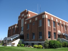 Cassia County Courthouselisted 1987
- Granite Passlisted 1972
Population over time
2 figuresBurley grew from 10,345 to 11,704 between 2010 and 2020. These are the recorded population figures Wikidata holds for this place, reached through the Geographic Names Information System number this page is keyed on rather than by name, so they belong to this place and not to another of the same name. Most are census counts, but not all are: an early figure may be a founding or settlement estimate, and an estimate published within five years of a census is left out. The change column is computed, and is left blank where more than 20 years separate a figure from the one before it, because a gap that long is not a change between two counts.
| Year | People | Change |
|---|---|---|
| 2010 | 10,345 | |
| 2020 | 11,704 | +1,359 (+13%) |
Topographic sheets covering this place
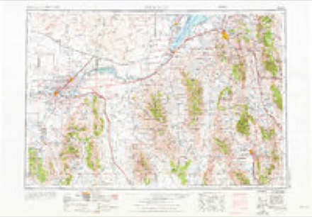
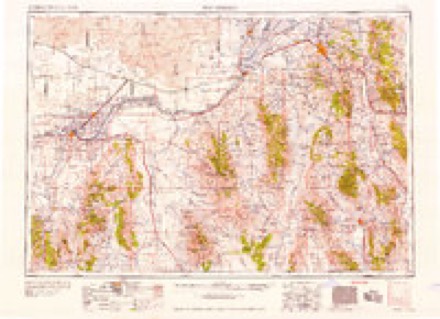
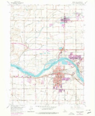
4 surveys from 9 printed sheetsMatched by testing this settlement's coordinate against the published boundary of every sheet in the United States Geological Survey's historical collection. Each opens the scanned sheet at the Survey.
- 1954 USGS Pocatello quadrangle1:250000, 4 printings
- 1958 USGS Pocatello quadrangle1:250000, 2 printings
- 1964 USGS Burley SE quadrangle1:24000, 2 printings
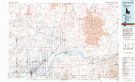
- 1993 USGS Lake Walcott quadrangle1:100000
Fires near this place
2 since 2002Regional context, not property-specific evidence. The federal wildfire occurrence database lists 2 fires within 5 miles of Burley between 2002 and 2011, burning about 10,422 acres in total. 1 started naturally. None was recorded as arson. Distance is straight-line from the map coordinates, so a fire counted here may appear on a neighbouring settlement's page as well.
| Reported cause | Fires |
|---|---|
| Natural | 1 |
| Missing data/not specified/undetermined | 1 |
The most recent of them, most recent first, with the day each was reported and the service that recorded it.
| Date | Cause | Size | Reported by | Name on the report |
|---|---|---|---|---|
| 4 August 2002 | Natural | 10,422 acres | Idaho Falls District | HORSEBUTTE |
| 9 July 2011 | Missing data/not specified/undetermined | under an acre | Idaho Falls District | RURAL ASSIST 1 |
Settlements close enough to share some of these fires:
Mines and quarries near this place
10 of 17 shownRegional context, not property-specific evidence. The federal mineral resources record lists 17 workings within 5 miles of Burley: 9 producers, 6 past producers, 1 unknown, 1 occurrence. 9 still produce. What was taken out: Sand and Gravel, Construction, Clay, Gold, Brick Clay. Distance is straight-line from the map coordinates, so a quarry counted here may appear on a neighbouring settlement's page as well.
| Where | Site | Commodity | Status | Recorded |
|---|---|---|---|---|
| Burley Clay Mine | Brick Clay | Producer | Unconsolidated Sediments | |
| Clay Deposit | Clay | Occurrence | ||
| Emerson Clay Pit | Clay | Producer | ||
| Goose Creek Placer Deposits | Gold | Past Producer | ||
| Snake River Placers | Gold | Past Producer | Placer | |
| Gordon Paving | Sand and Gravel, Construction | Past Producer | ||
| Gravel Pit | Sand and Gravel, Construction | Unknown | ||
| Gravel Pit | Sand and Gravel, Construction | Producer | ||
| Gravel Pit | Sand and Gravel, Construction | Producer | ||
| Gravel Pit - Idaho Dept of Highways | Sand and Gravel, Construction | Producer |
Storms near this place
46 since 1996Regional context, not property-specific evidence. The National Weather Service names Burley in 46 storm reports between 1996 and 2024: 15 hail, 15 thunderstorm wind, 3 flash flood, 3 heavy rain. The reports record 1 death and 1 injury. Each account below is quoted exactly as the forecast office filed it, from the NOAA Storm Events Database, and each date opens the federal record of that event.
| When | Event | Place named | Harm | What the report says |
|---|---|---|---|---|
| July 1996 | Lightning | Burley | 1 killed, 1 hurt | no account filed |
| February 2017 | Flood | Burley | $5,240,000 | A warmup in temperatures caused extensive snow melt to lower elevations of Cassia County with devastating flooding throughout the rural county. Flooding began in earnest on the 5th. Interstate 86 was closed for a 36 mile stretch in the county with flooding over the Raft River bridges. A foot and a half of water was over the interstate and it was closed from the 6th until the 9th. The interstate began to flood on the 5th. Cassia County was declared a state disaster area. Dozens of homes were severely damaged by flood waters. Many private wells and septic systems flooded contaminating many homes. Several back roads had to be closed and many suffered tremendous damage. |
| March 2017 | Flood | Burley | $175,000 | Sheet flooding continued in March throughout Cassia although effects were not nearly as strong as February. Property and road damage continued to add up and many fields in the Oakley area remained under water for much of the month. |
| May 2009 | Thunderstorm Wind | Burley | $30,000 | Several trees were downed in Burley by a microburst wind with several trees on houses and extensive shingle damage reported. Light fixtures were shattered on several homes. |
| March 2011 | Thunderstorm Wind | Burley | $10,000 | Extensive damage and warning level winds occurred with the passage of a cold front the evening of March 10th. Two trees were downed into a house in Burley. Several trees down at Burley parks and golf course. |
| May 2005 | Lightning | Burley | $10,000 | Lightning in Burley struck an electrical light system at Overland and 14th Street causing damage. |
| June 1998 | Tornado (F0) | Burley | $4,000 | Evergreen Nursery greenhouse roofs removed and plants damaged. |
| July 2013 | Thunderstorm Wind | Burley | $2,000 | An 8 foot by 10 foot shed blown down by thunderstorm winds in Burley. |
| September 2007 | Thunderstorm Wind | Burley | $2,000 | Thunderstorm winds damaged the roof of an industrial building at the corner of Albion Avenue and 13th Street in Burley. |
| May 2024 | Thunderstorm Wind | Burley | $1,000 | Reports of tree damage, power outages with Idaho Power reporting 1,100 customers without power in Burley. |
| August 2021 | Thunderstorm Wind | Burley | $1,000 | Multiple power outages affecting over 500 customers near Milner, Hobson, and Hynes. |
| May 2024 | Thunderstorm Wind | Burley | - | A 59 mph wind gust measured 4 miles south of Burley at station DVI01498. |
| May 2023 | Flash Flood | Burley | - | Extensive street flooding reported in Burley. |
| July 2020 | Thunderstorm Wind | Burley | - | Two trees were downed at a Burley area golf course. |
| May 2020 | Thunderstorm Wind | Burley | - | A 57 mph wind gust at Moburg Canyon. |
| October 2019 | Thunderstorm Wind | Burley | - | A large tree snapped off 7 feet above the ground in Burley. |
| May 2018 | Hail | Burley | - | Multiple reports of quarter sized hail in Burley. |
| May 2018 | Hail | Burley | - | An inch and a quarter size hail reported 6 miles south of Murtaugh. |
| January 2017 | Flood | Burley | - | Extensive flooding reported in the City of Malta, particularly for areas west of Highway 81 where water entered many homes. At least knee deep water was reported running down city streets on Tuesday night, January 10th. Water entered many homes in the city to the west of Highway 81.||A few people have been displaced from homes as a result of home flooding. Many county roads closed throughout Cassia County as a result of flooding. 1 to 2 feet of water on Highway 30 from Burley to the county line. Many basements have received water throughout the county. Birch Creek flowing onto city streets in Oakley. Many streets in Oakley under water. Canals are at bankfull. Canal engineers working to contain flow. |
| December 2011 | Thunderstorm Wind | Burley | - | Spotter recorded a 75 mph wind gust with a thunderstorm along a strong cold front. |
| April 2009 | Tornado (EF0) | Burley | - | An F0 tornado was reported 3 miles southwest of Burley. The tornado caused no damage and was on the ground for 5 minutes. |
| August 2007 | Hail | Burley | - | A weather spotter reported 1 inch hail near Burley. |
| June 2004 | Tornado (F0) | Burley | - | Spotter reported tornado 15 miles north of Hazelton. No reports of damage. |
| August 2002 | Wildfire | Burley | - | Horse Butte wildfire burned more than 12,000 acres in mountains southeast of Burley. No damage to property. |
| August 1997 | Heavy Rain | Burley | - | Heavy rain at the Fairgounds in Burley collapsed tents and flooded the parking lot with up to three feet of water with some vehicles partially flooded. Elsewhere in Burley extensive street flooded occurred with water over curbs. Water ponded to 2 to 4 feet in some parking lots. |
| August 1997 | Hail | Burley | - | Dime-size hail near 215S 650E accumulated 1 to 2 inches with drifts up to 5 inches. |
| August 1997 | Hail | Burley | - | Hail up to golfball-size near 300S 603E caused total loss of the wheat crop and extensive damage to potatoes, sugarbeets and corn. All leafy foliage was stripped with only only potato vines remaining. Hail remained in some shady areas until the next morning. |
| August 1997 | Hail | Burley | - | Quarter-size hail at 300S 705E accumulated to about 2 inches with severe damage to crops in area. |
| August 1997 | Hail | Burley | - | Nickel-size hail accumulated to about 2 inches. 1.5 inches of rain measured by spotter at 400S 800E. |
| August 1997 | Hail | Burley | - | Hail along the hillside at the bottom of the Albion highway grade pulverized gardens and plants, stripped paint from side of homes/buildings, chipped small pieces of brick along the side of one home, and broke yard lights. |
| August 1997 | Hail | Burley | - | Pea to nickel-size hail at Burley Fairgrounds. Hail covered the ground. |
| May 2023 | Hail | Burley | - | no account filed |
| May 2023 | Hail | Burley | - | no account filed |
| July 2009 | Thunderstorm Wind | Burley | - | no account filed |
| March 2006 | Thunderstorm Wind | Burley | - | no account filed |
| June 2006 | Hail | Burley | - | no account filed |
| June 2006 | Thunderstorm Wind | Burley | - | no account filed |
| January 2004 | Thunderstorm Wind | Burley | - | no account filed |
| June 2004 | Hail | Burley | - | no account filed |
| August 2003 | Flash Flood | Burley | - | no account filed |
| July 2001 | Hail | Burley | - | no account filed |
| July 2001 | Hail | Burley | - | no account filed |
| September 1998 | Funnel Cloud | Burley | - | no account filed |
| May 1996 | Flash Flood | Burley | - | no account filed |
| June 1996 | Heavy Rain | Burley | - | no account filed |
| July 1996 | Heavy Rain | Burley | - | no account filed |
Nearest settlements
The eight closest, with where each one stands in the county. Distances are straight-line, computed from the Geographic Names Information System coordinates.
| Map | Place | Distance | Sheets |
|---|---|---|---|
| Ruby | 2.7 miles | 9 | |
| Unity | 2.9 miles | 10 | |
| Beetville | 3.8 miles | 9 | |
| Pella | 4.8 miles | 9 | |
| Springdale | 5.6 miles | 10 | |
| Hobson | 7.0 miles | 9 | |
| View | 7.7 miles | 11 | |
| North Kenyon | 8.0 miles | 9 |
Elsewhere
Matched on this settlement's Geographic Names Information System number rather than its name, so it cannot be a different place of the same name in another state.
| Wikipedia article on Burley | An encyclopaedic summary. Its text is share-alike, so it is linked here rather than copied. |
| Wikidata item Q844028 | The structured record the population and elevation above come from. Public domain (CC0). |
Provenance
This settlement is recorded in the Geographic Names Information System as feature 399811. The sheet list is computed by point-in-boundary test against the United States Geological Survey's historical topographic inventory. Both are works of the United States government and carry no copyright under 17 U.S.C. 105.
Wildfire. Short, Karen C. 2022. Spatial wildfire occurrence data for the United States, 1992-2020 [FPA_FOD_20221014]. 6th Edition. Fort Collins, CO: Forest Service Research Data Archive. https://doi.org/10.2737/RDS-2013-0009.6 Collected with United States Government funding and usable without additional permissions or fees.
Mines and quarries. USGS Mineral Resources Data System (MRDS) https://mrdata.usgs.gov/mrds/ A work of the United States government, no copyright under 17 U.S.C. 105.
Storms. NOAA National Centers for Environmental Information, Storm Events Database https://www.ncei.noaa.gov/stormevents/ A work of the United States government, no copyright under 17 U.S.C. 105. Narratives are quoted verbatim from the National Weather Service report and are not edited or summarised.