 Block
Nampa, Idaho
14 topographic sheets cover this place, the earliest surveyed in 1898 and the latest in 1981. It stands in the Nampa census division. It lies in ZIP code area 83686. It stands on 12th Ave Drain. The Survey maps it on the Nampa quadrangle. 100,200 people lived here at the 2020 count. It stands 2,516 feet above sea level.
Research this city
On record in Nampa
Buildings and businesses the archive holds for this place. Each opens its own page, with the source record it came from.
On the National Register 12 of 19 shown
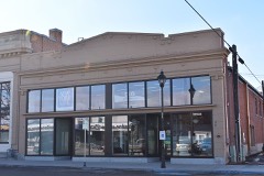 E. H. Dewey Storeslisted 1982
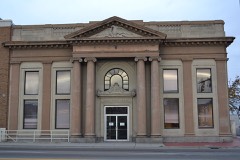 Farmers and Merchants Banklisted 1976
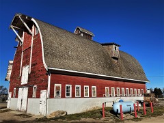 Horse Barnlisted 1978
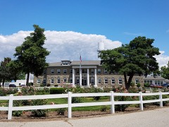 Idaho State Sanitarium Administration Buildinglisted 1982
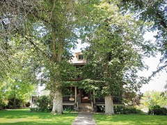 Lockman, Jacob P. Houselisted 2005
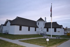 Nampa American Legion Chateaulisted 1982
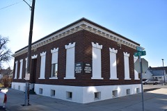 Nampa and Meridian Irrigation District Officelisted 1982
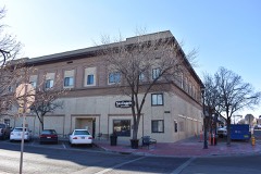 Nampa Department Storelisted 1982
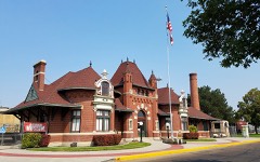 Nampa Depotlisted 1972
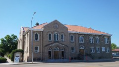 Nampa First Methodist Episcopal Churchlisted 1982
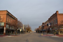 Nampa Historic Districtlisted 1983
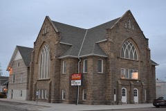 Nampa Presbyterian Churchlisted 1982
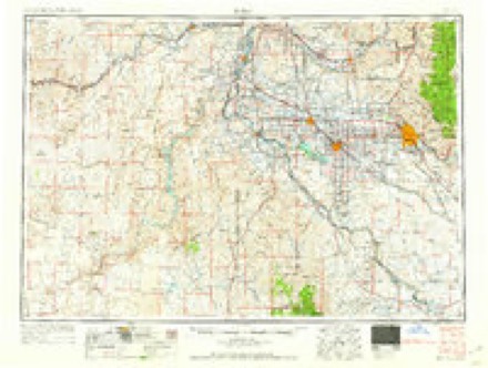
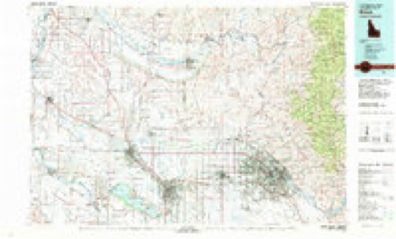
Topographic sheets covering this place
6 surveys from 14 printed sheetsMatched by testing this settlement's coordinate against the published boundary of every sheet in the United States Geological Survey's historical collection. Each opens the scanned sheet at the Survey.
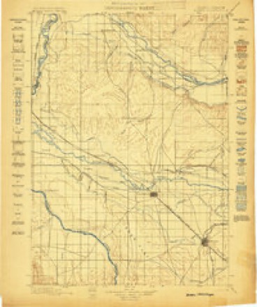
- 1898 USGS Nampa quadrangle1:125000, 4 printings
- 1955 USGS Boise quadrangle1:250000
- 1958 USGS Boise quadrangle1:250000, 2 printings
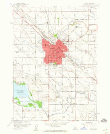
- 1958 USGS Nampa quadrangle1:24000, 4 printings
- 1962 USGS Boise quadrangle1:250000
- 1981 USGS Boise quadrangle1:100000, 2 printings
Fires near this place
40 since 1992Regional context, not property-specific evidence. The federal wildfire occurrence database lists 40 fires within 5 miles of Nampa between 1992 and 2020, burning about 277 acres in total. 2 started naturally. 19 were recorded as arson. Distance is straight-line from the map coordinates, so a fire counted here may appear on a neighbouring settlement's page as well.
| Reported cause | Fires |
|---|---|
| Arson/incendiarism | 19 |
| Missing data/not specified/undetermined | 13 |
| Fireworks | 3 |
| Natural | 2 |
| Debris and open burning | 2 |
| Recreation and ceremony | 1 |
The most recent of them, most recent first, with the day each was reported and the service that recorded it.
| Date | Cause | Size | Reported by | Name on the report |
|---|---|---|---|---|
| 8 September 1995 | Arson/incendiarism | 3.1 acres | Deer Flat National Wildlife Refuge | GOTTS |
| 28 September 2003 | Arson/incendiarism | 6.0 acres | Deer Flat National Wildlife Refuge | QUAIL 1 |
| 23 September 2005 | Arson/incendiarism | under an acre | Deer Flat National Wildlife Refuge | MARLBORO4 |
| 16 September 2005 | Arson/incendiarism | under an acre | Deer Flat National Wildlife Refuge | MARLBORO3 |
| 13 September 1995 | Arson/incendiarism | 16 acres | Deer Flat National Wildlife Refuge | POINT |
| 8 August 2005 | Missing data/not specified/undetermined | 1.0 acres | Deer Flat National Wildlife Refuge | GOTTS 4 |
| 8 August 2005 | Missing data/not specified/undetermined | 1.0 acres | Deer Flat National Wildlife Refuge | GOTTS 3 |
| 30 August 2005 | Missing data/not specified/undetermined | under an acre | Deer Flat National Wildlife Refuge | MARLBORO2 |
Settlements close enough to share some of these fires:
Mines and quarries near this place
10 of 20 shownRegional context, not property-specific evidence. The federal mineral resources record lists 20 workings within 5 miles of Nampa: 11 unknowns, 7 producers, 2 past producers. 7 still produce. What was taken out: Sand and Gravel, Construction. Distance is straight-line from the map coordinates, so a quarry counted here may appear on a neighbouring settlement's page as well.
| Where | Site | Commodity | Status | Recorded |
|---|---|---|---|---|
| A and A Redimix Gravel Pit | Sand and Gravel, Construction | Unknown | ||
| Bowman Sand and Gravel Co. | Sand and Gravel, Construction | Producer | ||
| Bryon C Rambo Crushing, Co Inc | Sand and Gravel, Construction | Producer | ||
| Dell Gravel Pit | Sand and Gravel, Construction | Past Producer | ||
| Gravel Pit | Sand and Gravel, Construction | Unknown | ||
| Gravel Pit | Sand and Gravel, Construction | Unknown | ||
| Gravel Pit | Sand and Gravel, Construction | Unknown | ||
| Gravel Pit | Sand and Gravel, Construction | Unknown | ||
| Gravel Pit | Sand and Gravel, Construction | Unknown | ||
| Gravel Pit | Sand and Gravel, Construction | Unknown |
Storms near this place
17 since 2000Regional context, not property-specific evidence. The National Weather Service names Nampa in 17 storm reports between 2000 and 2022: 8 thunderstorm wind, 5 hail, 2 tornado, 1 flash flood. The reports record 4 injuries. Each account below is quoted exactly as the forecast office filed it, from the NOAA Storm Events Database, and each date opens the federal record of that event.
| When | Event | Place named | Harm | What the report says |
|---|---|---|---|---|
| July 2002 | Thunderstorm Wind | Nampa | 4 hurt | no account filed |
| June 2022 | Heavy Rain | Nampa | - | The Mesonet station, FW5367, in Nampa measured 1.08 inches of total rainfall. |
| September 2013 | Flash Flood | Nampa | - | A National Weather Service employee reported flash flooding in Nampa and a trained spotter reported an inch and a half of rainfall in 30 minutes south of Nampa. |
| March 2013 | Thunderstorm Wind | Nampa | - | A retired NWS employee reported roof shingles blown off homes in the area. |
| July 2011 | Thunderstorm Wind | Nampa | - | Several reports of downed trees and fences and damage to homes were received from local media. |
| April 2011 | Thunderstorm Wind | Nampa | - | A coop observer in Nampa reported a fence blown over and a 6 inch diameter tree uprooted. |
| August 2009 | Hail | Nampa | - | A trained spotter in Nampa, Idaho reported three quarter inch hail. |
| July 2007 | Hail | Nampa | - | Quarter Sized Hail Reported. |
| April 2007 | Hail | Nampa | - | Retired USAF weather forecaster reported nickel size hail. |
| July 2007 | Hail | Nampa | - | Penny and Nickel Sized Hail Reported. |
| July 2003 | Thunderstorm Wind | Nampa | - | A gust of 54 knots was also reported from this site. |
| April 2002 | Thunderstorm Wind | Nampa | - | A severe thunderstorm wind gust of 54 knots destroyed a carport 10 miles South of Nampa in Canyon County. |
| December 2000 | Tornado (F0) | Nampa | - | A strong frontal system moved through southeast Oregon and southwest Idaho during the late evening/early morning hours of December 14th and 15th. A weak tornado formed on the leading edge of the gust front and touched down in a largely rural area of Nampa. A National Weather Service storm survey found evidence that suggested the tornado touched down intermittently over a period of approximately 3 minutes and traveled approximately one mile through a rural area scattered with a few subdivisions. At it's widest, path width was estimated at 30 yards. The tornado was witnessed by a naval officer who described the tornado as a well defined rope-like funnel which was occasionally lighted by exploding transformers and power line arching at the base of the funnel. Damage along the path was confined to shingle damage to a number of homes, a power pole snapped off at it's base and a 3 foot diameter tree uprooted. No injuries occurred with this tornado and damage estimates were not available. |
| April 2003 | Tornado (F0) | Nampa | - | no account filed |
| April 2003 | Hail | Nampa | - | no account filed |
| July 2002 | Thunderstorm Wind | Nampa | - | no account filed |
| May 2000 | Thunderstorm Wind | Nampa | - | no account filed |
Nearest settlements
The eight closest, with where each one stands in the county. Distances are straight-line, computed from the Geographic Names Information System coordinates.
| Map | Place | Distance | Sheets |
|---|---|---|---|
| Kings Corner | 2.2 miles | 14 | |
| Deal | 2.6 miles | 14 | |
| Swartz Corner | 2.8 miles | 14 | |
| Tiegs Corner | 3.2 miles | 14 | |
| Karcher Junction | 3.8 miles | 14 | |
| Fischer | 5.5 miles | 14 | |
| Bowmont | 6.0 miles | 15 | |
| Moss | 6.0 miles | 14 |
Elsewhere
Matched on this settlement's Geographic Names Information System number rather than its name, so it cannot be a different place of the same name in another state.
| Wikipedia article on Nampa | An encyclopaedic summary. Its text is share-alike, so it is linked here rather than copied. |
| Wikidata item Q622633 | The structured record the population and elevation above come from. Public domain (CC0). |
Provenance
This settlement is recorded in the Geographic Names Information System as feature 396943. The sheet list is computed by point-in-boundary test against the United States Geological Survey's historical topographic inventory. Both are works of the United States government and carry no copyright under 17 U.S.C. 105.
Wildfire. Short, Karen C. 2022. Spatial wildfire occurrence data for the United States, 1992-2020 [FPA_FOD_20221014]. 6th Edition. Fort Collins, CO: Forest Service Research Data Archive. https://doi.org/10.2737/RDS-2013-0009.6 Collected with United States Government funding and usable without additional permissions or fees.
Mines and quarries. USGS Mineral Resources Data System (MRDS) https://mrdata.usgs.gov/mrds/ A work of the United States government, no copyright under 17 U.S.C. 105.
Storms. NOAA National Centers for Environmental Information, Storm Events Database https://www.ncei.noaa.gov/stormevents/ A work of the United States government, no copyright under 17 U.S.C. 105. Narratives are quoted verbatim from the National Weather Service report and are not edited or summarised.