Block
From the record
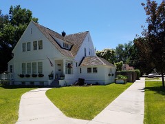
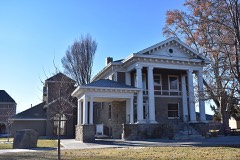
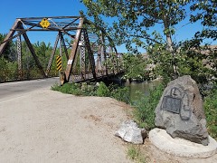
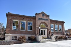
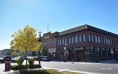
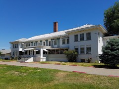
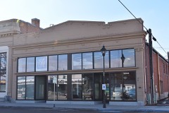
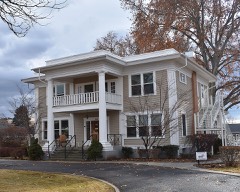
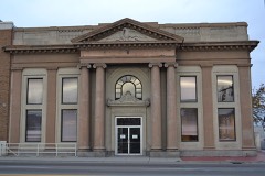
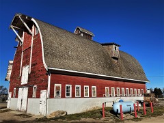
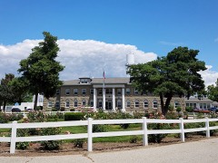
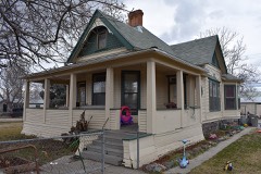
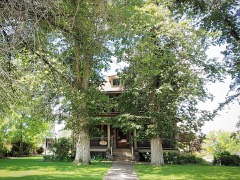
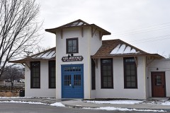
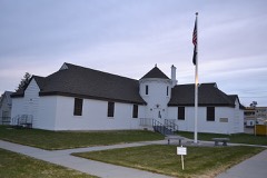
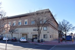
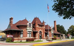
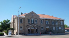
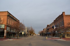
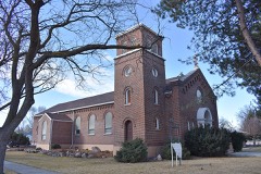
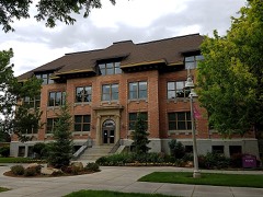
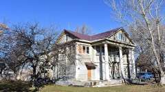
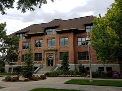
44 National Register listings published here.
Sources: the county history on the Internet Archive · the National Register database, National Park Service
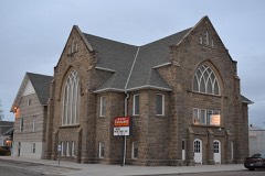
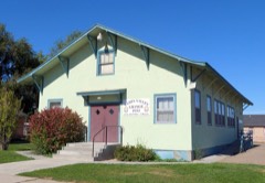
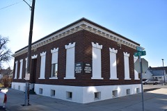
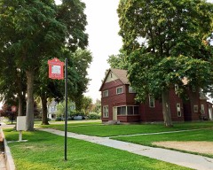
59 topographic sheets cover 39 settlements here, and 44 properties are on the National Register of Historic Places.
44 National Register listings published here.
Sources: the county history on the Internet Archive · the National Register database, National Park Service
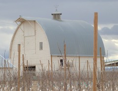
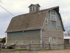
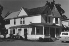
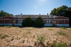
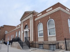
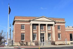
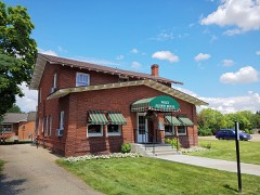
Every property in this county listed on the National Register of Historic Places, with the year it was listed and the federal nomination document.
Every wildfire the federal occurrence database records inside this county: 125 of them, burning about 12,794 acres. 6 started naturally and 26 were recorded as arson. Each settlement page carries the fires within five miles of it.
| Reported cause | Fires |
|---|---|
| Missing data/not specified/undetermined | 49 |
| Arson/incendiarism | 26 |
| Fireworks | 14 |
| Debris and open burning | 11 |
| Equipment and vehicle use | 8 |
| Natural | 6 |
| Recreation and ceremony | 4 |
| Firearms and explosives use | 3 |
| Power generation/transmission/distribution | 2 |
| Smoking | 1 |
| Other causes | 1 |
The five largest, by the area the report gives. Two of them were set deliberately.
| Date | Cause | Size | Reported by | Name on the report |
|---|---|---|---|---|
| 19 July 2011 | Arson/incendiarism | 2,890 acres | Boise District | GOODY |
| 4 September 1995 | Natural | 2,221 acres | Boise District | D LINE |
| 12 June 2014 | Missing data/not specified/undetermined | 1,206 acres | Boise District | CELEBRATION |
| 29 May 1992 | Missing data/not specified/undetermined | 1,120 acres | Boise District | DAUTRICH |
| 6 June 2016 | Natural | 1,093 acres | Boise District | MAP ROCK |
| 2 July 2005 | Fireworks | 968 acres | Boise District | GOTCHCANYO |
| 22 August 1995 | Arson/incendiarism | 353 acres | Boise District | CELEBRATE |
| 16 June 1997 | Missing data/not specified/undetermined | 341 acres | Boise District | PICKLE BTT |
Every settlement page carries the fires within five miles of it - see the settlement index below.
The NOAA Storm Events Database holds 121 reports for this county, causing 2 deaths, 15 injuries and about $2,122,500 in recorded property damage. Each settlement page carries the reports that name it.
| Kind of event | Reports |
|---|---|
| Thunderstorm Wind | 68 |
| Hail | 27 |
| Flood | 7 |
| Tornado | 6 |
| Lightning | 3 |
| Funnel Cloud | 3 |
| Heavy Rain | 3 |
| Wildfire | 2 |
| Flash Flood | 2 |
The most serious of them, by death, then injury, then recorded damage. The accounts are quoted exactly as the forecast office filed them.
| When | Event | Place named | Harm | What the report says |
|---|---|---|---|---|
| July 2002 | Lightning | Caldwell | 1 killed, 2 hurt | One man was killed instantly when struck by lightning while moving an aluminum irrigation pipe on an alfalfa farm near Sunnyslope. A second man, standing about four feet away, received serious burns to the head and shoulder. |
| June 1997 | Lightning | Melba | 1 killed | A farm worker was struck and killed by lightning while working on an irrigation pipe in a farm field during a thunderstorm. |
| June 1987 | Hail | not stated | 5 hurt | no account filed |
| July 2002 | Thunderstorm Wind | Nampa | 4 hurt | no account filed |
| October 2019 | Thunderstorm Wind | Caldwell | 2 hurt | The public in Caldwell reported several large trees and power lines down. |
| June 2001 | Wildfire | Caldwell | 1 hurt | no account filed |
| July 1989 | Thunderstorm Wind | not stated | 1 hurt | no account filed |
| May 2017 | Flood | Middleton | $750,000 | The Boise River remained in flood during the entire month of May due to planned release from Lucky Peak dam. Regulated flows were above flood stage for 101 days resulting in extensive bank erosion and flooding of lowlands along the river. |
| April 2017 | Flood | Stoddard | $500,000 | Planned releases from Lucky Peak Reservoir for flood control ranged from 7800 CFS to 8900 CFS during the month of April. The prolonged flood flows caused extensive damage along the river banks and widespread flooding of lowlands. |
| March 2017 | Flood | Stoddard | $250,000 | The Army Corps of Engineers and Bureau of Reclamation increased regulated flows from Lucky Peak Reservoir putting the Boise River in flood for the remainder of the month of March. Flooding was expected to continue through late spring. The extended period of flood flows caused severe bank erosion and lowland flooding. |
| August 1996 | Thunderstorm Wind | Se Nampa | $250,000 | no account filed |
| April 2003 | Thunderstorm Wind | Middleton | $100,000 | no account filed |
| May 2005 | Flash Flood | Caldwell | $50,000 | no account filed |
| May 1996 | Tornado (F1) | Parma | $50,000 | no account filed |
| June 1999 | Thunderstorm Wind | Melba | $40,000 | no account filed |
| June 1996 | Thunderstorm Wind | Wilder | $30,000 | no account filed |
| June 1996 | Thunderstorm Wind | Middleton | $30,000 | no account filed |
| April 1991 | Tornado (F0) | not stated | $25,000 | no account filed |
| June 1996 | Thunderstorm Wind | Caldwell | $20,000 | no account filed |
| May 1996 | Lightning | Caldwell | $15,000 | no account filed |
| February 1995 | Thunderstorm Wind | not stated | $5,000 | Thunderstorms associated with a cold front produce strong winds which knock over TV antennas and power poles. |
| May 1996 | Thunderstorm Wind | Parma | $5,000 | no account filed |
| July 1990 | Tornado (F0) | not stated | $2,500 | no account filed |
| May 2024 | Heavy Rain | Middleton | - | The 24 hour rainfall total was 0.73 inches at station ID CY 34. |
| May 2023 | Thunderstorm Wind | Huston | - | Two boats capsized from thunderstorm outflow wind and subsequent waves on Lake Lowell. One person had to be rescued. |
| May 2023 | Thunderstorm Wind | Moss | - | A portion of a metal roof was ripped off of an aircraft hangar. |
| May 2023 | Heavy Rain | Notus | - | Heavy rain reported within a few hours. |
| June 2023 | Flood | Wilder | - | Minor flooding was reported on Highway US-95 from Mile Post 0-35. |
| June 2022 | Flood | Stoddard | - | This was a public report form the Meteorological Phenomenon Identification Near the Ground. |
| June 2022 | Hail | Melba | - | A member of the public submitted a photo on social media. |
| June 2022 | Flood | Stoddard | - | A public report indicated that cropland, a yard, and a basement was flooded due to nearby rivers and creeks overflowing from heavy rain. |
| August 2022 | Hail | Parma Arpt | - | A member of the public submitted a photo of this on social media. |
| August 2022 | Hail | Parma Arpt | - | This photo was submitted on social media and the time was estimated from radar. |
| June 2022 | Heavy Rain | Nampa | - | The Mesonet station, FW5367, in Nampa measured 1.08 inches of total rainfall. |
| June 2021 | Thunderstorm Wind | Notus | - | Blue Spruce tree 50 feet tall uprooted in thunderstorm outflow. |
| May 2020 | Thunderstorm Wind | Caldwell | - | Damage was widespread across the valley including downed trees of various sizes. |
| May 2018 | Hail | Moss | - | Trained spotters south of Caldwell reported lime and half dollar sized hail. |
| June 2017 | Thunderstorm Wind | Parma | - | A retired National Weather Service employee reported very strong winds gusts and damage associated with nearby thunderstorms. Numerous reports of downed trees and power lines were received through social media. |
| May 2017 | Thunderstorm Wind | Parma | - | Social media reported a 60 foot tall Blue Spruce tree was uprooted near Parma. |
| July 2017 | Thunderstorm Wind | Wilder | - | A trained spotter just west of Wilder reported large tree branches down due to thunderstorm outflow winds. |
| June 2015 | Thunderstorm Wind | Wilder | - | A trained spotter reported 4 inch tree branches down on numerous trees from thunderstorm gusts. Lightning struck a fence post causing the post to catch on fire. |
| September 2013 | Flash Flood | Nampa | - | A National Weather Service employee reported flash flooding in Nampa and a trained spotter reported an inch and a half of rainfall in 30 minutes south of Nampa. |
| March 2013 | Thunderstorm Wind | Nampa | - | A retired NWS employee reported roof shingles blown off homes in the area. |
| May 2012 | Flood | Stoddard | - | Regulated flows on the Boise River increased above flood flow (7,000 cfs) on April 28, and were reduced below flood flow on May 15. Flood impacts were minor. Lowland flooding occurred along the river from Boise downstream through Caldwell to Parma. Sections of the greenbelt path were flooded along with some pasture and fields near the river. Floodwaters inundated a section of Boise River Road between Highway 95 and Notus. Several large trees were up-rooted and became snagged on bridges. |
| April 2012 | Hail | Caldwell | - | A National Weather Service employee reported one inch size hail and damage to vehicles. |
| July 2011 | Thunderstorm Wind | Nampa | - | Several reports of downed trees and fences and damage to homes were received from local media. |
| April 2011 | Thunderstorm Wind | Nampa | - | A coop observer in Nampa reported a fence blown over and a 6 inch diameter tree uprooted. |
| August 2009 | Thunderstorm Wind | Greenleaf | - | A measured gust of 51 MPH was reported, but tree and shingle damage, and extensive blowing dust point to a likely wind in excess of 58 MPH from the storm. |
| August 2009 | Hail | Nampa | - | A trained spotter in Nampa, Idaho reported three quarter inch hail. |
| July 2007 | Hail | Nampa | - | Quarter Sized Hail Reported. |
| August 2007 | Thunderstorm Wind | Bowmont | - | A trained spotter reported wind gusts to 60 MPH with trees blown down and heavy rain. |
| April 2007 | Hail | Nampa | - | Retired USAF weather forecaster reported nickel size hail. |
| July 2007 | Hail | Nampa | - | Penny and Nickel Sized Hail Reported. |
| May 2006 | Hail | Huston | - | Sunnyslope Market |
| August 2006 | Thunderstorm Wind | Parma | - | Wind Gust measured by home weather station at 68 M.P.H |
| July 2003 | Thunderstorm Wind | Nampa | - | A gust of 54 knots was also reported from this site. |
| August 2003 | Thunderstorm Wind | Caldwell | - | High winds blew down trees and damaged power lines which knocked out power to over 8000 homesas well as traffic signals, tying up traffic in Canyon County during the afternoon and evening. Heavy rain also caused street flooding in Nampa and Caldwell. |
| April 2002 | Thunderstorm Wind | Nampa | - | A severe thunderstorm wind gust of 54 knots destroyed a carport 10 miles South of Nampa in Canyon County. |
| June 2002 | Thunderstorm Wind | Parma | - | An area of thunderstorms intensified as it moved northward from northwest Owyhee County into Canyon County. A utility pole was blown down in Parma, taking down power lines. |
| July 2002 | Thunderstorm Wind | Notus | - | A line of thunderstorms swept across Owyhee, Washington, Payette and Canyon counties. Several limbs were broken off trees and sheet metal was blown from a roof under construction. |
The Survey's mineral resources record lists 81 workings inside this county. 21 still produce and 60 are closed or unrecorded. Each settlement page carries the workings within five miles of it.
| Commodity | Workings |
|---|---|
| Sand and Gravel, Construction | 60 |
| Volcanic Materials | 9 |
| Geothermal | 6 |
| Gold | 3 |
| Clay | 2 |
| Gypsum-Anhydrite | 1 |
| Gold, Stone, Crushed/Broken, Silver | 1 |
The least common of them first, because a county's hundredth gravel pit says nothing its first ten did not.
| Where | Site | Commodity | Status | Recorded |
|---|---|---|---|---|
| Cimota Enterprises, Inc Gravel Pit | Gypsum-Anhydrite, Gold, Stone, Crushed/Broken, Silver | Past Producer | ||
| Clay Deposit | Clay | Occurrence | ||
| Clay Industrial | Clay | Unknown | ||
| Snake River Placers | Gold | Past Producer | Placer | |
| Snake River Placers | Gold | Past Producer | Placer | |
| Snake River Placers | Gold | Past Producer | Placer | |
| Geothermal Location | Geothermal | Occurrence | ||
| Geothermal Location | Geothermal | Occurrence | ||
| Geothermal Location | Geothermal | Occurrence | ||
| Geothermal Location | Geothermal | Occurrence | ||
| Geothermal Location | Geothermal | Occurrence | ||
| Geothermal Location | Geothermal | Occurrence | ||
| Cinder Deposit | Volcanic Materials | Prospect | ||
| Cinder Deposit | Volcanic Materials | Prospect | ||
| Cinder Deposit | Volcanic Materials | Occurrence | ||
| Cinder Deposit | Volcanic Materials | Prospect | Cinders | |
| Cinder Deposit | Volcanic Materials | Occurrence | ||
| Cinder Deposit | Volcanic Materials | Occurrence | ||
| Cinder Pit | Volcanic Materials | Unknown | ||
| Cinder Pit | Volcanic Materials | Unknown | ||
| Leland Freiberghaus Cinder Pit | Volcanic Materials | Producer | Surface | |
| A and A Redimix Gravel Pit | Sand and Gravel, Construction | Unknown | ||
| Allen Pit | Sand and Gravel, Construction | Past Producer | ||
| Baker Sand and Gravel | Sand and Gravel, Construction | Producer | ||
| Black Cat Pit | Sand and Gravel, Construction | Producer | ||
| Bowman Sand and Gravel Co. | Sand and Gravel, Construction | Producer | ||
| Bryon C Rambo Crushing, Co Inc | Sand and Gravel, Construction | Producer | ||
| Caldwell Pit & Plant | Sand and Gravel, Construction | Producer | ||
| Cinder Pit | Sand and Gravel, Construction | Unknown | ||
| Cinder Pit | Sand and Gravel, Construction | Prospect | ||
| Dell Gravel Pit | Sand and Gravel, Construction | Past Producer | ||
| Gravel Pit | Sand and Gravel, Construction | Unknown | ||
| Gravel Pit | Sand and Gravel, Construction | Unknown | ||
| Gravel Pit | Sand and Gravel, Construction | Unknown | ||
| Gravel Pit | Sand and Gravel, Construction | Past Producer | ||
| Gravel Pit | Sand and Gravel, Construction | Producer | ||
| Gravel Pit | Sand and Gravel, Construction | Unknown | ||
| Gravel Pit | Sand and Gravel, Construction | Past Producer | ||
| Gravel Pit | Sand and Gravel, Construction | Producer | ||
| Gravel Pit | Sand and Gravel, Construction | Unknown | ||
| Gravel Pit | Sand and Gravel, Construction | Unknown | ||
| Gravel Pit | Sand and Gravel, Construction | Unknown | ||
| Gravel Pit | Sand and Gravel, Construction | Unknown | ||
| Gravel Pit | Sand and Gravel, Construction | Producer | ||
| Gravel Pit | Sand and Gravel, Construction | Unknown | ||
| Gravel Pit | Sand and Gravel, Construction | Unknown | ||
| Gravel Pit | Sand and Gravel, Construction | Unknown | ||
| Gravel Pit | Sand and Gravel, Construction | Past Producer | ||
| Gravel Pit | Sand and Gravel, Construction | Producer | ||
| Gravel Pit | Sand and Gravel, Construction | Unknown | ||
| Gravel Pit | Sand and Gravel, Construction | Unknown | ||
| Gravel Pit | Sand and Gravel, Construction | Unknown | ||
| Gravel Pit | Sand and Gravel, Construction | Unknown | ||
| Gravel Pit | Sand and Gravel, Construction | Unknown | ||
| Gravel Pit | Sand and Gravel, Construction | Unknown | ||
| Gravel Pit | Sand and Gravel, Construction | Unknown | ||
| Gravel Pit | Sand and Gravel, Construction | Occurrence | ||
| Gravel Pit | Sand and Gravel, Construction | Unknown | ||
| Gravel Pit | Sand and Gravel, Construction | Unknown | ||
| Gravel Pit | Sand and Gravel, Construction | Unknown | ||
| Gravel Pit | Sand and Gravel, Construction | Unknown | ||
| Gravel Pit | Sand and Gravel, Construction | Unknown | ||
| Gravel Pit | Sand and Gravel, Construction | Unknown | ||
| Gravel Pit | Sand and Gravel, Construction | Unknown | ||
| Gravel Pit | Sand and Gravel, Construction | Past Producer | ||
| Gravel Pit | Sand and Gravel, Construction | Unknown | ||
| Hennis Pit | Sand and Gravel, Construction | Unknown | ||
| Henry Pit | Sand and Gravel, Construction | Unknown | ||
| Ida State Mine 103 | Sand and Gravel, Construction | Producer | ||
| Idaho Concrete Co | Sand and Gravel, Construction | Producer | ||
| Karcher Pit | Sand and Gravel, Construction | Past Producer | ||
| Nampa Pit and Plant | Sand and Gravel, Construction | Unknown | ||
| Nelson-Deppe Gravel Pit | Sand and Gravel, Construction | Producer | ||
| Nelson-Deppe,Inc Gravel Pit | Sand and Gravel, Construction | Producer | ||
| Pickles Butte Pit | Sand and Gravel, Construction | Producer | ||
| Raymond Pit | Sand and Gravel, Construction | Producer | ||
| Richard Hill | Sand and Gravel, Construction | Producer | ||
| Sebree Pit | Sand and Gravel, Construction | Producer | ||
| Strang Pit | Sand and Gravel, Construction | Producer | ||
| Strang Sand and Gravel Co. | Sand and Gravel, Construction | Producer | ||
| Valley Pit | Sand and Gravel, Construction | Producer |
The part of each published history that is about one town: 1 chapter, each reproduced complete.
| Town | Chapter | From | Length |
|---|---|---|---|
| Caldwell | Caldwell, "the Magic City" : In the Boise Valley, Idaho. Facts Pertain | Caldwell, "the Magic City" : In the Boise Valley, Idaho. Facts Pertaining to the Magic City and Its Great Tributary Resources; Also Statistics As to Climate, Health, Agriculture, Stock Raising, Mining, Etc. / Presented by Rule & Cole ... (1891) | 14,078 words |
Named settlements recorded in the Geographic Names Information System, each with the topographic sheets covering it. Villages, hamlets and abandoned places alike. Each is shown with the nearest named watercourse or landform and the survey quadrangle it falls on.
Parma census division · 83660 · Near Gold Island · Parma quadrangle
12 sheets, 1898 to 1981
Caldwell census division · 83605 · Caldwell quadrangle
13 sheets, 1898 to 1981
No longer a settlement
Huston census division · 83676 · Near Clarks Island · Marsing quadrangle
13 sheets, 1898 to 1981
Parma census division · 83660 · Near Sand Run Gulch · Owyhee quadrangle
11 sheets, 1906 to 1993
No longer a settlement
Caldwell census division · 83626 · Near Pipe Gulch · Notus quadrangle
13 sheets, 1898 to 1981
Huston census division · 83607 · Near Lower Deer Flat · Marsing quadrangle
13 sheets, 1898 to 1981
Nampa census division · 83686 · On 12th Ave Drain · Nampa quadrangle
14 sheets, 1898 to 1981
Huston census division · 83607 · Near Pickle Butte · Marsing quadrangle
13 sheets, 1898 to 1981
Middleton census division · 83644 · Near McIntyre Hill · Middleton quadrangle
13 sheets, 1898 to 1981
Huston census division · 83607 · Near Liberty Butte · Marsing quadrangle
13 sheets, 1898 to 1981
Nampa census division · 83686 · Near Madden Butte · Nampa quadrangle
14 sheets, 1898 to 1981
Melba census division · 83641 · Near Big Rocky Island · Walters Butte quadrangle
15 sheets, 1892 to 1992
Melba census division · 83641 · Near White Butte · Walters Butte quadrangle
15 sheets, 1892 to 1992
The vanished settlements of Canyon County: the places named above that are no longer on the map.