 Block
From the record
One of 44 National Register listings published here for Canyon County · listed in 2002 · category: Building.
Sources: the case file at the National Archives · the National Register database, National Park Service
Listed on the National Register of Historic Places in 2002.
One of 44 National Register listings published here for Canyon County · listed in 2002 · category: Building.
Sources: the case file at the National Archives · the National Register database, National Park Service
Regional context, not property-specific evidence. The federal wildfire occurrence database lists 7 fires within 5 miles of Caldwell Residential Historic District between 1992 and 2020, burning about 66 acres in total. 1 started naturally. 2 were recorded as arson. Distance is straight-line from the map coordinates, so a fire counted here may appear on a neighbouring settlement's page as well.
| Reported cause | Fires |
|---|---|
| Arson/incendiarism | 2 |
| Missing data/not specified/undetermined | 2 |
| Equipment and vehicle use | 1 |
| Natural | 1 |
| Debris and open burning | 1 |
The most recent of them, most recent first, with the day each was reported and the service that recorded it.
| Date | Cause | Size | Reported by | Name on the report |
|---|---|---|---|---|
| 22 September 2008 | Natural | under an acre | Deer Flat National Wildlife Refuge | ORCHARD |
| 3 August 1994 | Arson/incendiarism | 43 acres | Boise District | SINKER CR. |
| 22 August 1992 | Debris and open burning | 2.0 acres | Deer Flat National Wildlife Refuge | Y66 BLDG |
| 27 July 2001 | Missing data/not specified/undetermined | 5.0 acres | Deer Flat National Wildlife Refuge | ORCHARD |
| 2 July 2019 | Missing data/not specified/undetermined | under an acre | Boise District | MURPH |
| 23 June 2002 | Arson/incendiarism | 2.0 acres | Deer Flat National Wildlife Refuge | TENTHANDO |
| 4 October 2020 | Equipment and vehicle use | 13 acres | Boise District | DUCKY |
Regional context, not property-specific evidence. The federal mineral resources record lists 17 workings within 5 miles of Caldwell Residential Historic District: 7 unknowns, 6 producers, 3 past producers, 1 occurrence. 6 still produce. What was taken out: Sand and Gravel, Construction, Clay. Distance is straight-line from the map coordinates, so a quarry counted here may appear on a neighbouring settlement's page as well.
| Where | Site | Commodity | Status | Recorded |
|---|---|---|---|---|
| Blue Creek Clay Deposit | Clay | Occurrence | ||
| Clay Industrial | Clay | Unknown | ||
| Caldwell Pit & Plant | Sand and Gravel, Construction | Producer | ||
| Gravel Pit | Sand and Gravel, Construction | Unknown | ||
| Gravel Pit | Sand and Gravel, Construction | Past Producer | ||
| Gravel Pit | Sand and Gravel, Construction | Unknown | ||
| Gravel Pit | Sand and Gravel, Construction | Past Producer | ||
| Gravel Pit | Sand and Gravel, Construction | Unknown | ||
| Gravel Pit | Sand and Gravel, Construction | Producer | ||
| Gravel Pit | Sand and Gravel, Construction | Unknown |
Regional context, not property-specific evidence. The National Weather Service names Caldwell, the town this property stands in, in 14 storm reports between 1995 and 2020: 6 thunderstorm wind, 2 lightning, 2 hail, 2 funnel cloud. The reports record 1 death and 5 injuries. Each account below is quoted exactly as the forecast office filed it, from the NOAA Storm Events Database, and each date opens the federal record of that event.
| When | Event | Place named | Harm | What the report says |
|---|---|---|---|---|
| July 2002 | Lightning | Caldwell | 1 killed, 2 hurt | One man was killed instantly when struck by lightning while moving an aluminum irrigation pipe on an alfalfa farm near Sunnyslope. A second man, standing about four feet away, received serious burns to the head and shoulder. |
| October 2019 | Thunderstorm Wind | Caldwell | 2 hurt | The public in Caldwell reported several large trees and power lines down. |
| June 2001 | Wildfire | Caldwell | 1 hurt | no account filed |
| May 2005 | Flash Flood | Caldwell | $50,000 | no account filed |
| June 1996 | Thunderstorm Wind | Caldwell | $20,000 | no account filed |
| May 1996 | Lightning | Caldwell | $15,000 | no account filed |
| May 2020 | Thunderstorm Wind | Caldwell | - | Damage was widespread across the valley including downed trees of various sizes. |
| April 2012 | Hail | Caldwell | - | A National Weather Service employee reported one inch size hail and damage to vehicles. |
| August 2003 | Thunderstorm Wind | Caldwell | - | High winds blew down trees and damaged power lines which knocked out power to over 8000 homesas well as traffic signals, tying up traffic in Canyon County during the afternoon and evening. Heavy rain also caused street flooding in Nampa and Caldwell. |
| April 1998 | Funnel Cloud | Caldwell | - | Funnel clouds were observed over Lake Lowell by numerous weather spotters and a local television station. The funnels did not touch down. Numerous showers were in the area at the time. |
| March 1998 | Funnel Cloud | Caldwell | - | Weather spotters and a local television station reported a small funnel cloud near Caldwell. |
| April 1997 | Hail | Caldwell | - | During the afternoon and evening of April 30 1997 a series of strong and severe thunderstorms moved into Southwest Idaho. 3/4 inch hail was reported just south of Caldwell , Idaho and 1 inch hail was reported in just west of the Boise Airport. |
| April 1995 | Thunderstorm Wind | Caldwell | - | ,,,,,,,,Blowing Dust |
| August 1996 | Thunderstorm Wind | Caldwell | - | no account filed |
No historic map-sheet match is published for this property yet. That does not mean no map exists. This record needs a coordinate-quality review before it can be joined to a sheet boundary. Browse the county's mapped places while that work is pending.
Other National Register properties close enough to walk or drive between, ordered by distance from this one. Both positions come from the same geocoding pass that matched these properties to their map sheets.
| Photograph | Property | Distance | Listed |
|---|---|---|---|
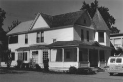 | John C. Rice House | under 500 feet | 1980 |
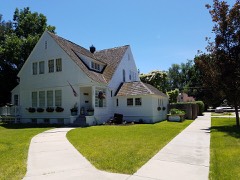 | F. F. Beale House | 0.1 miles | 1993 |
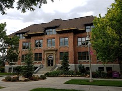 | Sterry Hall | 0.4 miles | 1978 |
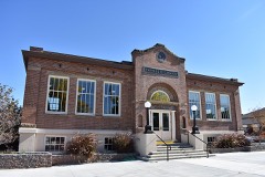 | Caldwell Carnegie Library | 0.4 miles | 1979 |
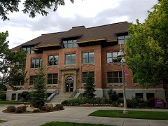 | Carrie Adell Strahorn Memorial Library | 0.4 miles | 1982 |
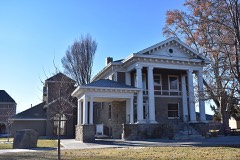 | Blatchley Hall | 0.5 miles | 1978 |
| National Archives record | The nomination case file for reference 02001064 in Record Group 79. |
| Canyon County | All 44 listed properties in this county. |